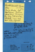
Mine Index Number: 1018
| Company Name:
|
Black Beauty Coal Company
|
| Mine Name:
|
Riola Mine
|
| Start Date:
|
April 12, 1996
|
End Date:
|
June 9, 2006
|
| Type of Mine:
|
Underground
|
| Total acres shown:
|
1,853
|
| Acres after map date:
|
|
General Area of mining acres shown:
|
|
|
|
Shaft, Slope, Drift or Tipple Location(s)
| Type
|
County
|
Township-Range
|
Section
|
Part Section
|
| Main slope
|
Vermilion
|
18N 12W
|
33
|
SE NE NE
|
| Air shaft
|
Vermilion
|
18N 12W
|
28
|
NE SE SE
|
| Air shaft
|
Vermilion
|
18N 12W
|
28
|
SW SE SE
|
Geology
| Herrin
|
251
|
4.5
|
|
5.8-6.8
|
RPP
|
Geological Problems Reported
Faults trending E-W were noted on the source map. Roof falls were relatively
common, and were relatively large (size not given). The roof was generally silty shale and siltstone, with occasional
fine sandstone beds that were 1 foot or more thick. At the base of the slope, shearing created an unstable roof that
was difficult to support with roof bolting. In some instances, most of the movement along the shear was horizontal,
but in other areas nearby and few feet up into the roof, the shearing dipped at various angles and trends, even along
a single shear surface. There were numerous indications of soft sediment flow before complete lithification of the roof
sediments or the coal. In the area at the slope bottom, the 5 foot mechanical bolts were supplemented with 8 to 12
foot resin bolts, often with “bacon strips”, thin metal bands attached to adjacent roof bolts to help support smaller
pieces of roof rock. A clay dike was seen, although clay dikes are rare in the Herrin Coal. Rolls were large (across
multiple entries) and mine plans were altered to leave pillars under them where possible. Pyrite and siderite in lenses
and nodules were found. The lenses were up to 0.2 feet thick and more than 1 foot in diameter. The sulphur content
was generally less than 2%.
Production
| Company
|
Mine Name
|
Date
|
Production (tons)
|
|
|
|
|
|
| Total Production: 8,458,877
|
Production Notes
Coal Report production (if available)
Sources of Data
| Company, 6-424
|
6-9-2006
|
1:6000
|
1:6000
|
Final
|
Annotated Bibliography (Data source - brief description of information)
| Coal Reports - Production, ownership, years of operation, thickness.
|
| Directory of Illinois Coal Mines (Vermilion County) - Mine names, mine index, ownership, years of operation.
|
| Mine notes (Vermilion County) - Mine type, slope location, seam, depth, thickness, geologic problems.
|
| Company map, Coal Section files, 6-424 - Slope & shaft locations, mine outline, mining method, geologic problems.
|
Mine Notes
Mine Images
Photographs


![[[:Riola|Riola]]](https://wikiimage.isgs.illinois.edu/ilmines/vermilion/thumbnails/m1018_6_424b_2006_th.jpg)