Mine Index Number: 1020
| Company Name:
|
Illini Energy Resources
|
| Mine Name:
|
Razorback I Mine
|
| Start Date:
|
1997
|
End Date:
|
2000
|
| Type of Mine:
|
Surface
|
| Total acres shown:
|
48
|
| Acres after map date:
|
|
General Area of mining acres shown:
|
|
|
|
Shaft, Slope, Drift or Tipple Location(s)
| Type
|
County
|
Township-Range
|
Section
|
Part Section
|
| Pit / tipple
|
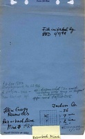
Jackson
|
7S 2W
|
36
|
NE SW
|
Geology
| Herrin
|
60
|
6.8
|
8.0
|
7.5
|
Surface
|
Geological Problems Reported
Production
| Company
|
Mine Name
|
Date
|
Production (tons)
|
Production Notes
Coal Report production (if available)
Sources of Data
| Coal section files, 6-352
|
2-24-2000
|
1:3600
|
1:3600
|
Final
|
Annotated Bibliography (Data source - brief description of information)
| Coal Reports - Production, ownership, years of operation.
|
| Directory of Illinois Coal Mines (Jackson County) - Mine names, mine index, ownership, years of operation.
|
| Mine notes (Jackson County) - Mine type, pit location, seam, depth, thickness.
|
| Coal section files, 6-352 - Mine outline, mining method.
|
Mine Notes
Mine Images
Photographs
![[[:Razorback I|Razorback I]]](https://wikiimage.isgs.illinois.edu/ilmines/jackson/thumbnails/m1020_6_352_1998_th.jpg)