Mine Index Number: 0688
| Company Name:
|
Freeman United Coal Mining Corporation
|
| Mine Name:
|
Orient No. 4 Mine
|
| Start Date:
|
1952
|
End Date:
|
May 1987
|
| Type of Mine:
|
Underground
|
| Total acres shown:
|
6,462
|
| Acres after map date:
|
|
General Area of mining acres shown:
|
|
|
|
Shaft, Slope, Drift or Tipple Location(s)
| Type
|
County
|
Township-Range
|
Section
|
Part Section
|
| Main slope
|
Williamson
|
8S 3E
|
28
|
NW NE SE
|
| Air slope
|
Williamson
|
8S 3E
|
28
|
SW NE SE
|
| Air / man / material slope
|
Williamson
|
8S 3E
|
26
|
1750 FNL, 850 FEL
|
| Air shaft (10 ft - upcast)
|
Williamson
|
8S 3E
|
26
|
SE SE NE
|
| Shaft (14 ft)
|
Williamson
|
8S 4E
|
30
|
1039 FSL, 823 FEL
|
Geology
| Herrin
|
275-300
|
|
|
5.5-7.33
|
RPP, HERThe high-extraction retreat method was more prevalent in the east half of the mine.
|
Geological Problems Reported
The mine intersected some normal or strike-slip faults, some with displacements up to 80 feet, all part of the Cottage Grove Fault System (see ISGS Circular 522, Cottage Grove Fault System). Most of the fault offsets were small, from a few inches to just less than 15 feet, but a few were up to 80 feet. The source map indicated “bad top” near the faulted areas. An oil seep was noted, and water and gas also entered along the fault planes. Many of the western parts of the mine noted water and bad top at the furthest extent of mining. Faults were reported throughout the mine, sometimes requiring a change in the configuration of rooms. Older portions of the mine collected water and were sealed. The gray shale roof displayed slickensides. In some areas of the mine, the roof was black shale. The coal seam contained some pyrite and calcite filled some cleats.
Production
| Company
|
Mine Name
|
Date
|
Production (tons)
|
|
|
|
|
|
| Total Production: 35,675,749
|
Production Notes
Coal Report production (if available)
Sources of Data
| Company, Coal Section files, 6-429
|
5-15-1987
|
1:12000
|
1:12000
|
Final
|
Annotated Bibliography (Data source - brief description of information)
| Coal Reports - Production, ownership, years of operation, thickness.
|
| Directory of Illinois Coal Mines (Williamson County) - Mine names, mine index, ownership, years of operation.
|
| Mine notes (Williamson County) - Mine type, slope and shaft locations, seam, depth, geologic problems.
|
| Company map, Coal Section files, 6-429 - Slope and shaft locations, mine outline, mining method, geologic problems.
|
Mine Notes
Mine Images
![[[:Orient No. 4|Orient No. 4]]](https://wikiimage.isgs.illinois.edu/ilmines/williamson/thumbnails/m0688a_th.jpg) These files may not be true to scale and are not georgistered. These files may not be true to scale and are not georgistered.
|
Map Type:
|
Company
|
| Map ID:
|
6-429
|
| Company:
|
Freeman United Coal Mining Corporation
|
| Mine Name:
|
Orient No. 4
|
| Caption:
|
|
| Map Date:
|
05-15-1987
|
| Map Status:
|
Final
|
| Image Credit:
|
|
| Note:
|
|
| More Info:
|
M0688a
|
| Full Res Download:These files are true to scale and most are georegistered for gis software. These files may be a very large (>1GB) download!
|
https://wikiimage.isgs.illinois.edu/ilmines/williamson/m0688a.zip
|
Photographs
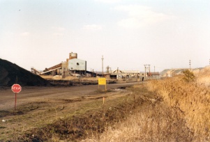
Caption: Preparation Plant at old portal of Orient No. 4 Mine, looking north. Photo by John Nelson
Credit: Illinois State Geological Survey
Date: 03/24/1981
Publication: Mine Notes
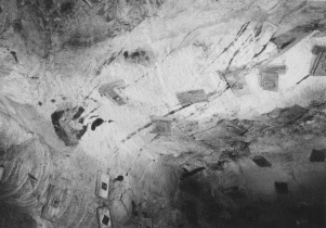
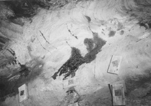
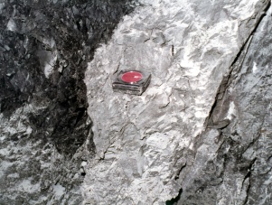
Caption: Oil seep in Piasa Limestone roof, travel-way of 6th North off 2nd SE Mains, about 2300' inby.
Credit: Illinois State Geological Survey
Date: 07/10/1974
Publication: Mine Notes
Caption: Oil seep in Piasa Limestone roof, travel-way of 6th North off 2nd SE Mains, about 2300' inby.
Date: 07/10/1974
Publication: Mine Notes
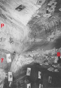
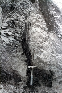
Caption: Normal fault with about 80 feet displacement. Left side down (P) Piasa Limestone (7) No. 7 coal (B) Brereton Limestone on footwall. Located about 2500' into 6th North travel-way off 2nd SE Mains.
Credit: Illinois State Geological Survey
Date: 07/10/1974
Publication: Mine Notes
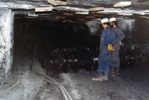
Caption: Curt Lewman (left) and Steve Danner with continuous mining machine. Photo by John Nelson
Credit: Illinois State Geological Survey
Date: 03/24/1981
Publication: Mine Notes
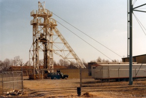
Caption: Headframe at No. 3 Portal, Orient No. 4
Credit: Illinois State Geological Survey
Date: 03/24/1981
Publication: Mine Notes
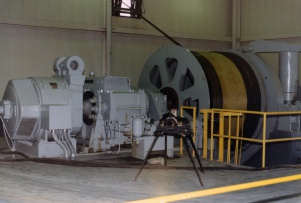
Caption: Hoisting room, Portal No. 3
Credit: Illinois State Geological Survey
Date: 03/24/1981
Publication: Mine Notes
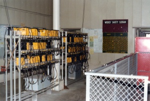
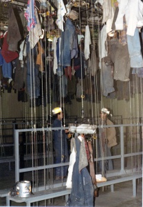
Caption: Lamp room, No. 3 Portal
Credit: Illinois State Geological Survey
Date: 03/24/1981
Caption: Change Room, No. 3 Portal
Credit: Illinois State Geological Survey
Date: 03/24/1981
Publication: Mine Notes
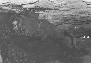
Caption: Continuous miner in action in the 8th Panel West
Credit: Illinois State Geological Survey
Date: 03/24/1981
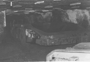
Caption: Shuttle car in action
Credit: Illinois State Geological Survey
Date: 03/24/1981
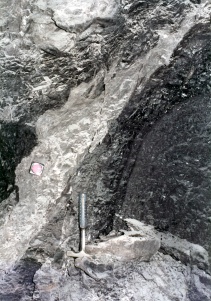
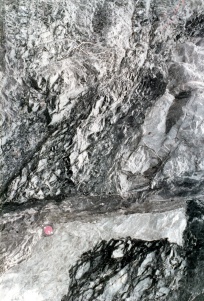
Caption: Series of Photos by Eugene Robertson, showing fault zone in 8th Main East near 1st Main North, Orient No. 4 Mine. This view shows dragged and brecciated rock along normal fault. Tape measure rests on light gray Energy Shale on downthrown block;black Anna Shale overlies Energy shale to the left. Fault plane about 6 inches to right (west) of tape; Herrin coal to the right of fault.
Credit: Illinois State Geological Survey
Date: 06/21/1984
Publication: Mine Notes
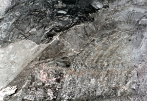
Caption: Series of Photos by Eugene Robertson, showing fault zone in 8th Main East near 1st Main North, Orient No. 4 Mine.
A more complete view of the fault zone, same sight.
Credit: Illinois State Geological Survey
Date: 06/21/1984
Publication: Mine Notes
Caption: Series of Photos by Eugene Robertson, showing fault zone in 8th Main East near 1st Main North, Orient No. 4 Mine.
View above and to right of last (Mn 45 028.jpg). Note variation in width of fault zone; a lenticular slice of relatively unfractured Energy Shale between two grouge-filled planes.
Credit: Illinois State Geological Survey
Date: 06/21/1984
Publication: Mine Notes
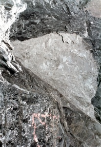
Caption: Series of Photos by Eugene Robertson, showing fault zone in 8th Main East near 1st Main North, Orient No. 4 Mine.
Another slice of Energy Shale along fault zone.
Credit: Illinois State Geological Survey
Date: 06/21/1984
Publication: Mine Notes
Caption: Series of Photos by Eugene Robertson, showing fault zone in 8th Main East near 1st Main North, Orient No. 4 Mine.
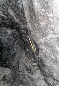
View of fault on north rib of same entry. Energy and Anna Shale on right, downthrown block dragged to nearly vertical position; coal and shale left of fault are dragged and heavily sheared.
Credit: Illinois State Geological Survey
Date: 06/21/1984
Publication: Mine Notes
Caption: Series of Photos by Eugene Robertson, showing fault zone in 8th Main East near 1st Main North, Orient No. 4 Mine.
North rib, view from farther back. Top is to right
Credit: Illinois State Geological Survey
Date: 06/21/1984
Publication: Mine Notes
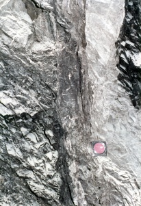
Caption: Series of Photos by Eugene Robertson, showing fault zone in 8th Main East near 1st Main North, Orient No. 4 Mine.
Another view; gouge along fault plane.
Credit: Illinois State Geological Survey
Date: 06/21/1984
Publication: Mine Notes
Caption: Series of Photos by Eugene Robertson, showing fault zone in 8th Main East near 1st Main North, Orient No. 4 Mine.
Same place,Mn 45 033.jpg, rock dust cleared off for a better view.
Credit: Illinois State Geological Survey
Date: 06/21/1984
Publication: Mine Notes

![[[:Orient No. 4|Orient No. 4]]](https://wikiimage.isgs.illinois.edu/ilmines/williamson/thumbnails/m0688a_th.jpg)
