Mine Index Number: 0857
| Company Name:
|
Peabody Coal Company
|
| Mine Name:
|
River King Surface Mine
|
| Start Date:
|
1957
|
End Date:
|
February 1986
|
| Type of Mine:
|
Surface
|
| Total acres shown:
|
1722 (Pit No.s 1, 2, & 4); 1784 (Pit No. 3)
|
| Acres after map date:
|
|
General Area of mining acres shown:
|
|
|
The area shown on the accompanying map, combined with that shown on Mascoutah and New Athens East Quadrangles, is much smaller than expected from the reported production. The area shown for River King Pit No. 6 Mine (mine index 0934) on the Tilden, Baldwin, and New Athens East Quadrangles is much larger than expected for the reported production. If both index numbers are combined for all of the River King Surface mines, the area shown on the quadrangle maps is in line with the reported production. The total area mined was 13,164 acres for a total of 104,187,734 tons.
|
Shaft, Slope, Drift or Tipple Location(s)
| Type
|
County
|
Township-Range
|
Section
|
Part Section
|
| Tipple
|
St. Clair
|
1S 7W
|
15
|
280 FSL, 180 FWL, NE SW
|
| Pit 1 (1957-1965)
|
St. Clair
|
2S 7W
|
33 (Freeburg quadrangle)
|
|
| Pit 2 (1957-1965)
|
St. Clair
|
1S 7W
|
22 (Mascoutah quadrangle)
|
|
| Pit 3 (1965-1986)
|
St. Clair
|
2S 7W
|
26 (New Athens East quadrangle)
|
|
| Pit 4 (1957-1965)
|
St. Clair
|
2S 7W
|
3 (Mascoutah quadrangle)
|
|
Geology
| Herrin
|
58-78 other
|
|
|
6.2-7.0
|
Surface
|
Geological Problems Reported
The upper 6 inches of the Herrin Coal contained flat concretions in one area. Some difficulties encountered in surface mining Pit No. 3 included shooting the hard limestones (Piasa & Brereton) and in drilling the shot holes in the soft sand above the bedrock, which required continuous casing.
Production
| Company
|
Mine Name
|
Date
|
Production (tons)
|
|
|
|
|
|
| Total Production: 77,031,794
|
Production Notes
Coal Report production (if available)
Sources of Data
| Company, 4103.S31 i5.1-62
|
3-14-1969
|
1:12000
|
1:12000
|
Final Final for Pits 1, 2 (Mascoutah quadrangle), and 4. Not final for Pit 3 (New Athens East quadrangle).
|
| Company map
|
3-8-1989
|
1:12000
|
1:12000
|
Final Final for Pit No. 3
|
| USGS topographic map
|
1991
|
1:24000
|
1:24000
|
Secondary source
|
Annotated Bibliography (Data source - brief description of information)
| Coal Reports - Production, ownership, years of operation, seam, depth, thickness, mining method.
|
| Directory of Illinois Coal Mines (St. Clair County) - Mine names, mine index, ownership, years of operation.
|
| Company map, ISGS map library, 4103.S31 i5.1-62 - Mine outline.
|
| Company map, Coal Section files - Mine outline, mining method.
|
| USGS Topographic map, New Athens East 7.5 minute quadrangle, 1991 - East extension of Pit No. 3
|
Mine Notes
Mine Images
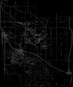
Company: 4103.S31 i5.1-62
Map Date: 3-14-1969
Coal Co.: Peabody Coal Company
Mine Name: River King Surface Mine
Full Res Download
Company: 4103.S31 i5.1-62
Map Date: 3-14-1969
Coal Co.: Peabody Coal Company
Mine Name: River King Surface Mine
Full Res Download
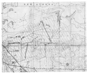
Company: 6-410
Map Date: 3-8-1989
Coal Co.: Peabody Coal Company
Mine Name: River King Surface Mine
Full Res Download
Photographs

