Mine Index Number: 0863
| Company Name:
|
Old Ben Coal Corporation
|
| Mine Name:
|
Old Ben No. 21 Mine
|
| Start Date:
|
1960
|
End Date:
|
October 26, 1991
|
| Type of Mine:
|
Underground
|
| Total acres shown:
|
8,696
|
| Acres after map date:
|
|
General Area of mining acres shown:
|
|
|
|
Shaft, Slope, Drift or Tipple Location(s)
| Type
|
County
|
Township-Range
|
Section
|
Part Section
|
| Main shaft
|
Franklin
|
5S 2E
|
8
|
NE NE NE
|
| Air shaft
|
Franklin
|
5S 2E
|
8
|
NW NE NE
|
| D and E shafts
|
Franklin
|
5S 2E
|
17
|
NW SW NE
|
| F and G shafts
|
Franklin
|
5S 1E
|
14
|
SW NE SE
|
Geology
| Herrin
|
656-660
|
|
|
5.8-8.42
|
HER, LW, RPP,RPThe mine operated in RPP pattern from 1978-1986, and began some longwall panels in 1985 (the only longwall mine in the state at that time). The mine was idled from May to October 1990, and reopened with only the continuous miners working RP method. Plans were underway for longwall expansion in 1991, but the mine was idled instead and never reopened.
|
Geological Problems Reported
Several types of structural features are common here: large, high-angle faults apparently of tectonic origin (Rend Lake Fault System) with 1 to 6 feet of displacement, steep high-angle fractures or slips in coal or roof (tectonic origin), minor slips in roof shale (soft-sediment compaction features), and “X” pattern faults (usually two faults intersecting at the top of the coal). The roof was medium gray shale, finely silty and micaceous, finely laminated, firm, with fine sideritic laminations and nodules. The northwestern corner of the property had split coal, where the blue band thickened from its normal 2 to 3 inches up to 24 inches. (This area is adjacent to the Walshville channel.) At least one large roll was present, plus a series of small rolls. About 12 inches of top coal was left to support the roof throughout the mine.
Production
| Company
|
Mine Name
|
Date
|
Production (tons)
|
|
|
|
|
|
| Total Production: 53,797,836
|
Production Notes
Coal Report production (if available)
Sources of Data
| Company map
|
12-1993
|
1:12000
|
1:12000
|
Final
|
| Company map
|
12-31-1996
|
1:4800
|
1:4800
|
Final
|
Annotated Bibliography (Data source - brief description of information)
| Coal Reports - Production, ownership, years of operation, depth, thickness.
|
| Directory of Illinois Coal Mines (Franklin County) - Mine names, mine index, ownership, years of operation.
|
| Mine notes (Franklin County) - Mine type, shaft location, seam, thickness, geologic problems.
|
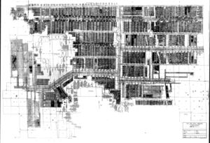
| Company map, ISGS Coal Section files - Mine outline, mining method.
|
| Company map, ISGS Coal Section files (digital) - Shaft locations.
|
Mine Notes
Mine Images
Company: 6-325
Map Date: 12-1993
Coal Co.: Old Ben Coal Corporation
Mine Name: Old Ben No. 21 Mine
Full Res Download
Photographs
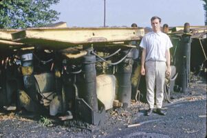
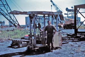
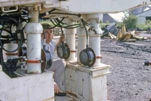
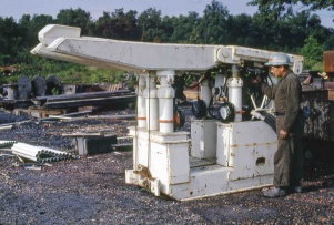
Caption: Old Ben 21
Rheinstahl-Wanheim 4 leg chocks
Credit: Illinois State Geological Survey
Date: 1960's
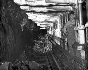
Caption: Old Ben 21
Rheinstahl-Wanheim 6 leg Chocks
Face 3
Credit: Illinois State Geological Survey
Date: 1964
Caption: Old Ben 21
Rheinstahl-Wanheim 6 leg Chocks
Face 3
Credit: Illinois State Geological Survey
Date: 1964
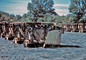
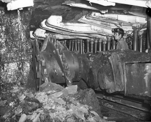
Caption: Old Ben 21
Gullick Chocks
Face 6
Credit: Illinois State Geological Survey
Date: 1969 Jun-1970 Apr
Caption: Old Ben 21
Gullick Chocks
Face 6(3rd-5th N Panel off 1 E.S. Mains)
Credit: Illinois State Geological Survey
Date: 1969 Jun-1970 Apr
Caption: Old Ben 21
Gullick Chocks
Face 6 (3rd-5th N Panel off 1 E.S. Mains)
Credit: Illinois State Geological Survey
Date: 1969 Jun-1970 Apr
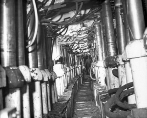
Caption: Old Ben 21
Joy-Gullick 600 ton Chocks
Face 6
Credit: Illinois State Geological Survey
Date: 1969 Jun-1970 Apr
Caption: Old Ben 21
Joy-Gullick 600 ton Chocks
Face 6
Credit: Illinois State Geological Survey
Date: 1969 Jun-1970 Apr

