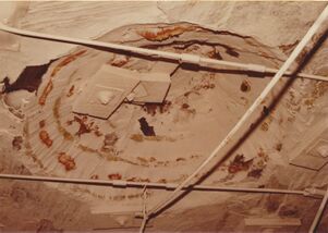
Mine Index Number: 0886
| Company Name:
|
MaRyan Mining, LLC
|
| Mine Name:
|
Shay No. 1 Mine
|
| Start Date:
|
1970
|
End Date:
|
2020
|
| Type of Mine:
|
Underground
|
| Total acres shown:
|
16,695
|
| Acres after map date:
|
|
General Area of mining acres shown:
|
|
|
|
Shaft, Slope, Drift or Tipple Location(s)
| Type
|
County
|
Township-Range
|
Section
|
Part Section
|
| Slope
|
Macoupin
|
9N 7W
|
22
|
SE NW SW
|
| Air shaft
|
Macoupin
|
9N 7W
|
22
|
SW NE SW
|
| Air shaft
|
Macoupin
|
9N 7W
|
24
|
SW SE SE
|
| Air shaft
|
Macoupin
|
9N 7W
|
15
|
SE SE SW
|
| Air shaft
|
Macoupin
|
9N 7W
|
3
|
NW SE SE
|
| Air shaft
|
Macoupin
|
9N 7W
|
3
|
NW SE SE
|
Geology
| Herrin
|
300-330
|
|
|
6.67-7.25
|
RPP, LWBeginning in 1994, this mine only mined with the longwall method, until it closed in 2007. When the mine reopened in 2009, mining resumed using the room and pillar panel method only.
|
Geological Problems Reported
geologic problems not reported for active mines
Production
| Company
|
Mine Name
|
Date
|
Production (tons)
|
|
|
|
|
|
| Total Production: 105,284,652
|
Production Notes
Coal Report production (if available)
Sources of Data
| Company, 6-436d
|
1-1-2004
|
1:12000
|
1:12000
|
Not final
|
| Company, 6-436Q
|
3-10-2020
|
1:12000
|
1:12000
|
Not final The company listed this mine as idle in 2020, and the Coal Reports have not shown any production after 2020. The outline shown on this map mine can likely be considered final, unless the mine comes out of idle status in the future.
|
Annotated Bibliography (Data source - brief description of information)
| Coal Reports - Production, ownership, years of operation.
|
| Directory of Illinois Coal Mines (Macoupin County) - Mine names, mine index, ownership, years of operation.
|
| Company map, Coal Section files, 6-436d- Slope and shaft locations.
|
| Company map, Coal Section files, 6-436Q - Mine outline, mining method.
|
Mine Notes
Mine Images
![[[:Shay No. 1|Shay No. 1]]](https://wikiimage.isgs.illinois.edu/ilmines/macoupin/thumbnails/6-436Q-m0886_shay_2020_th.jpg) These files may not be true to scale and are not georgistered. These files may not be true to scale and are not georgistered.
|
Map Type:
|
Company
|
| Map ID:
|
6-436Q
|
| Company:
|
MaRyan Mining, LLC
|
| Mine Name:
|
Shay No. 1
|
| Caption:
|
Yearly Map of Underground workings for 2019 and 2020
|
| Map Date:
|
03/10/2020
|
| Map Status:
|
Not Final
|
| Image Credit:
|
|
| Note:
|
Map should be near final.
|
| More Info:
|
M0886 2020
|
| Full Res Download:These files are true to scale and most are georegistered for gis software. These files may be a very large (>1GB) download!
|
https://wikiimage.isgs.illinois.edu/ilmines/macoupin/6-436Q-m0886 shay 2020.zip
|
![[[:Monterey No. 1|Monterey No. 1]]](https://go.illinois.edu/ILMImages/macoupin/thumbnails/m0886_6-436d_th.jpg) These files may not be true to scale and are not georgistered. These files may not be true to scale and are not georgistered.
|
Map Type:
|
Company
|
| Map ID:
|
6-436d
|
| Company:
|
Monterey Coal Company
|
| Mine Name:
|
Monterey No. 1
|
| Caption:
|
|
| Map Date:
|
01-12-2004
|
| Map Status:
|
Not Final
|
| Image Credit:
|
|
| Note:
|
|
| More Info:
|
M0886 2004
|
| Full Res Download:These files are true to scale and most are georegistered for gis software. These files may be a very large (>1GB) download!
|
https://go.illinois.edu/ILMImages/macoupin/m0886 6-436d.zip
|
![[[:Shay No. 1|Shay No. 1]]](https://wikiimage.isgs.illinois.edu/ilmines/macoupin/thumbnails/2018_shay_6-436O_th.jpg) These files may not be true to scale and are not georgistered. These files may not be true to scale and are not georgistered.
|
Map Type:
|
Company
|
| Map ID:
|
6-436O
|
| Company:
|
MaRyan Mining, LLC
|
| Mine Name:
|
Shay No. 1
|
| Caption:
|
|
| Map Date:
|
03/06/2018
|
| Map Status:
|
Not Final
|
| Image Credit:
|
|
| Note:
|
Not georegistered
|
| More Info:
|
M0886 2018
|
| Full Res Download:These files are true to scale and most are georegistered for gis software. These files may be a very large (>1GB) download!
|
https://wikiimage.isgs.illinois.edu/ilmines/macoupin/2018 shay 6-436O.tif
|
Photographs
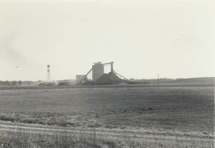
Caption: View looking southward at preparation plant of Monterey Coal Company's Mine No. 1
Date: 1979
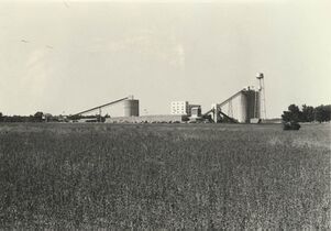
Caption: Monterey #1, Macoupin Co. 1979
Date: 1979
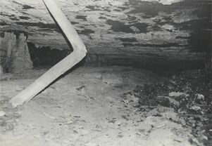
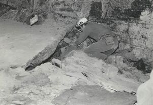
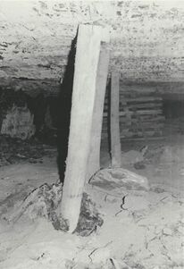
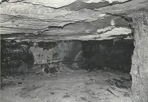
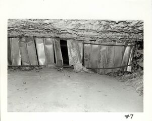
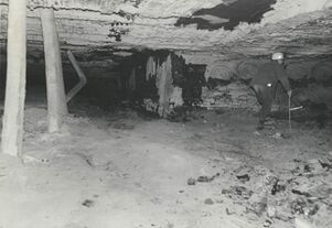
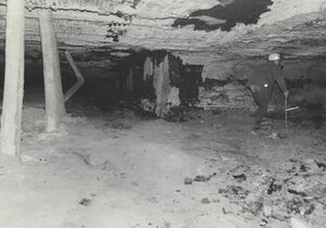
Caption: Floor heaving: 7' vertical opening was closed to only a few feet. Wooden posts which were set when the squeeze first started broke.
Date: 07/11/1972
Caption: Floor heaving: 7' vertical opening was closed to only a few feet.
Date: 07/11/1972
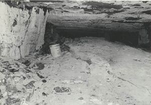
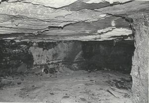
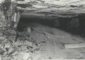
Caption: As the floor heaves particularly near the center of the rooms, irregular cracks start to develop thus dividing the floor into separate plates thereby allowing differential movement of these plates.
Date: 07/11/1972
Caption: Floor heaving: 7' vertical opening was closed to only a few feet. Wooden posts which were set when the squeeze first started broke or were pused into the underclay whiched heaved and broke around them.
Date: 07/11/1972
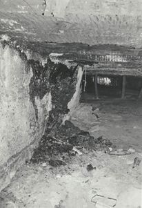
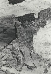
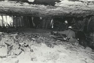
Caption: The heaving puts unusual stresses on the coal pillars which leads to their ultimate failure.
Date: 07/11/1972
Caption: The heaving puts unusual stresses on the coal pillars which leads to their ultimate failure.
Date: 07/11/1972
Date: 07/11/1972
Library No.: Mn act macoupin 14
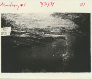
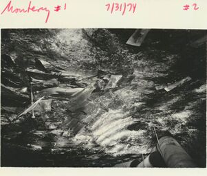
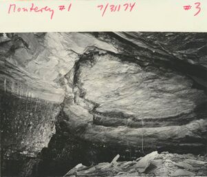
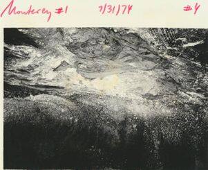
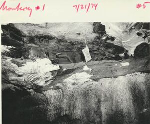
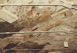
Caption: Anna Shale, slip and bedding.
Date: 07/31/1974
Caption: Anna Shale, slip and bedding.
Date: 07/31/1974
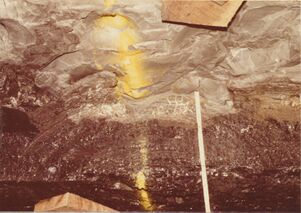
Caption: Roof fall, where Energy Shale above coal (many plants in shale) above Energy Shale very thin Anna Shale and "pot" of Brereton Limestone.
Date: 07/31/1974
Caption: "Crossbedding of coal laminae in gray shale, fall along slip"
Date: 07/31/1974
Caption: Energy Shale pinching out towards the south, rather thin (2 ft) Anna Shale above and thin Brereton Limestone; fall along slip.
Date: 07/31/1974
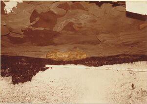
Caption: Septarian concretions in gray silty mudstone above the Herrin Coal
Date: 07/29/1984
Caption: Pyritic concretion at coal-shale boundary.
Date: 07/29/1984
Caption: One of many flat-lying fossil logs in the immediate roof.
Date: 07/29/1984
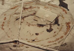
Caption: Fossil tree stump, or "kettlebottom" in immediate roof.
Date: 07/29/1984
Caption: "Kettlebottom", Monterey No. 1 Mine, in Energy Shale.
Date: 07/29/1984

![[[:Shay No. 1|Shay No. 1]]](https://wikiimage.isgs.illinois.edu/ilmines/macoupin/thumbnails/6-436Q-m0886_shay_2020_th.jpg)
![[[:Monterey No. 1|Monterey No. 1]]](https://go.illinois.edu/ILMImages/macoupin/thumbnails/m0886_6-436d_th.jpg)
![[[:Shay No. 1|Shay No. 1]]](https://wikiimage.isgs.illinois.edu/ilmines/macoupin/thumbnails/6-436P-m0886_shay_1_2019_th.jpg)
![[[:Shay No. 1|Shay No. 1]]](https://wikiimage.isgs.illinois.edu/ilmines/macoupin/thumbnails/2018_shay_6-436O_th.jpg)
