Mine Index Number: 3694
| Company Name:
|
Consolidated Coal Company of St. Louis
|
| Mine Name:
|
Ellsworth No. 4 Mine
|
| Start Date:
|
1872
|
End Date:
|
1898
|
| Type of Mine:
|
Underground
|
| Total acres shown:
|
228
|
| Acres after map date:
|
|
General Area of mining acres shown:
|
|
|
|
Shaft, Slope, Drift or Tipple Location(s)
| Type
|
County
|
Township-Range
|
Section
|
Part Section
|
| Main shaft
|
Vermilion
|
19N 11W
|
19
|
NW NE NE
|
| Air shaft Connected underground to Ellsworth No. 2 Mine (mine index 3688)
|
Vermilion
|
19N 11W
|
18
|
SW SE SE
|
| Pump shaft
|
Vermilion
|
19N 11W
|
18
|
NW SE SW
|
| Pump shaft
|
Vermilion
|
19N 11W
|
18
|
SE NW SE
|
Geology
| Danville
|
70-85
|
|
|
5.5-6.0
|
MRP
|
| Seelyville The shaft was sunk 310 feet to the Seelyville Coal, but that seam was thin and was abandoned in the first year of operation.
|
310
|
|
|
3.67
|
|
Geological Problems Reported
The mine was abandoned due to a large amount of water and sediment in the mine, the result of an excessively wet spring. No source map for this mining has been found. Since much less than an acre was mined, the maps that accompany this directory do not include a map of the Seelyville coal.
Production
| Company
|
Mine Name
|
Date
|
Production (tons)
|
|
|
|
|
|
| Total Production: 1,406,482
|
Production Notes
Coal Report production (if available)
Sources of Data
| Microfilm, document 352903
|
1888
|
1:6000
|
1:6000
|
Not final The mined area shown on the accompanying map is the approximate size expected for the production reported. This suggests that the mine outline is complete.
|
| Microfilm, document 352943
|
5-7-1903
|
1:1200
|
1:2069
|
Incomplete The mined area shown on the accompanying map is the approximate size expected for the production reported. This suggests that the mine outline is complete.
|
Annotated Bibliography (Data source - brief description of information)
| Coal Reports - Production, ownership, years of operation, seam, depth, thickness, geologic problems.
|
| Directory of Illinois Coal Mines (Vermilion County) - Mine names, mine index, ownership, years of operation.
|
| Mine notes (Vermilion County) - Mine type, shaft location.
|
| Microfilm map, document 352903, reel 03141, frame 40 - Shaft locations, mine outline.
|
| Microfilm map, document 352943, reel 03141, frame 84 - Mining method.
|
| History of Vermilion County, Illinois, by Lottie E. Jones, 1911 - Years of operation.
|
Mine Notes
Mine Images
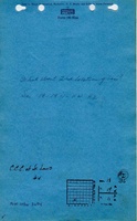
Microfilm: 352903
Map Date: 1888
Coal Co.: Consolidated Coal Company of St. Lous
Mine Name: Ellsworth No. 4 Mine
Full Res Download
Photographs