File:M3409.jpg: Difference between revisions
Alan.Myers (talk | contribs) No edit summary |
Alan.Myers (talk | contribs) m (Text replacement - "http://isgs.illinois.edu/ilmines_wiki/images/hires/" to "https://wikiimage.isgs.illinois.edu/ilmines/") |
||
| Line 9: | Line 9: | ||
|Map Status=Secondary source | |Map Status=Secondary source | ||
|Map ID=225 d | |Map ID=225 d | ||
|Map hires= | |Map hires=https://wikiimage.isgs.illinois.edu/ilmines/st_clair/m3409_geo.zip | ||
|county1=St. Clair | |county1=St. Clair | ||
|quad1=French Village | |quad1=French Village | ||
}} | }} | ||
Latest revision as of 08:42, April 22, 2020
CLICK HERE TO DOWNLOAD THE HIGH RESOLUTION IMAGE. FILE SIZE MAY BE LARGE(Note:this file is usually better quality than "original file" linked above)
| Mine Index(s): | 3409 |
| Mine Company: | Erhstein and Pruessing |
| Mine Name | Erhstein and Pruessing Mine |
| Map Date | after 1945 |
| Map Scale | 1:24000 |
| Map Type microfilm/company/wpa/quade | Coal Section Files |
| Map Status final,not final, secondary | Secondary source |
| ID Number | 225 d |
| Used For | |
| Notes | |
| Image Credit | |
| Hi-Res Download | Click to download |
File history
Click on a date/time to view the file as it appeared at that time.
| Date/Time | Thumbnail | Dimensions | User | Comment | |
|---|---|---|---|---|---|
| current | 09:07, October 23, 2019 | 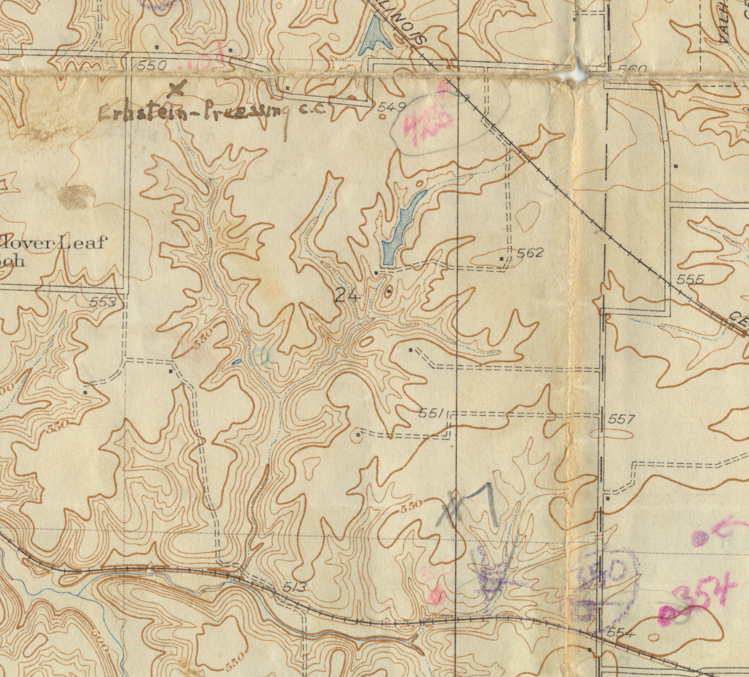 | 2,511 × 2,269 (983 KB) | Cheri (talk | contribs) |
You cannot overwrite this file.
File usage
The following page uses this file: