WPA: Difference between revisions
From ILMINES WIKI
Alan.Myers (talk | contribs) No edit summary |
Alan.Myers (talk | contribs) m (Text replacement - "Category:WPA2" to "Category:WPA") |
||
| (15 intermediate revisions by the same user not shown) | |||
| Line 1: | Line 1: | ||
__NOTOC__ | |||
Works | These maps were constructed as part of the nationwide Works Projects Administration (WPA), generally between 1934 and 1937 with some later updates or revisions. | ||
==Disclaimer== | ==Disclaimer== | ||
'''Maps for some locations might have multiple versions/seams, please inspected these areas closely for differences.''' | '''Maps for some locations might have multiple versions/seams, please inspected these areas closely for differences.''' | ||
Notes and corrections made by ISGS staff. | '''Notes and corrections were made by ISGS staff.''' | ||
These maps are reproductions from microfilm, they may be of poor quality with text difficult to read. | '''These maps are reproductions from microfilm, they may be of poor quality with text difficult to read.''' | ||
== | ==Maps== | ||
Use the search box below to filter the list below, by county name or Township-Range (use T##N/S-R##E/W format i.e. '''T4N-R4W''')<br> | |||
The export tab just exports the queried list not the actual images, click the image or link (on the left) to download. | |||
{{#ask: [[Category:WPA]] | {{#ask: [[Category:WPA]] | ||
|?Map ID | |?Map ID | ||
|?County_name | |?County_name | ||
|?TR=Township-Range | |?TR=Township-Range | ||
|? | |?Filename = Image Download | ||
|format=table | |format=table | ||
|limit=500 | |limit=500 | ||
Latest revision as of 12:30, August 13, 2020
These maps were constructed as part of the nationwide Works Projects Administration (WPA), generally between 1934 and 1937 with some later updates or revisions.
Disclaimer
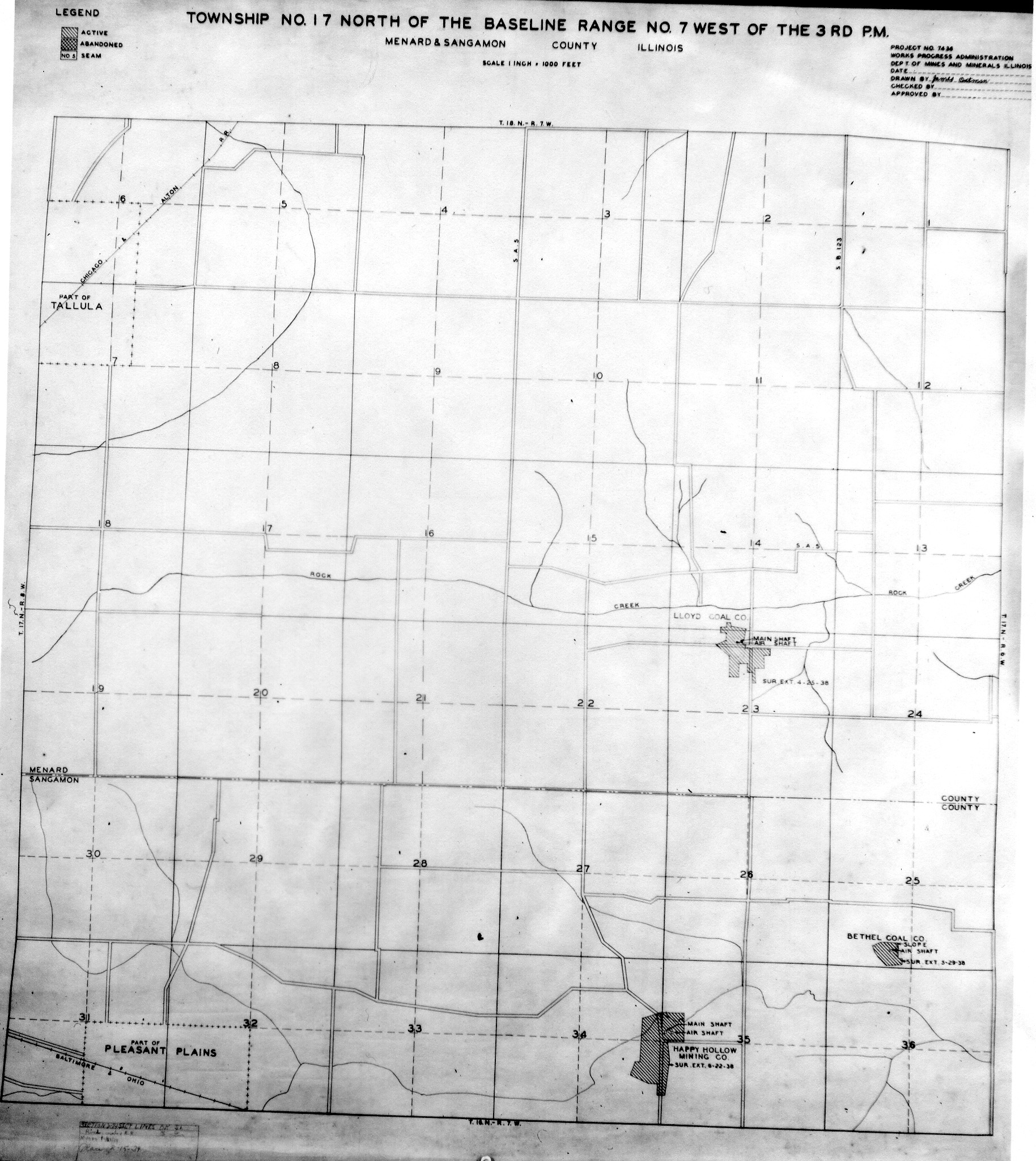
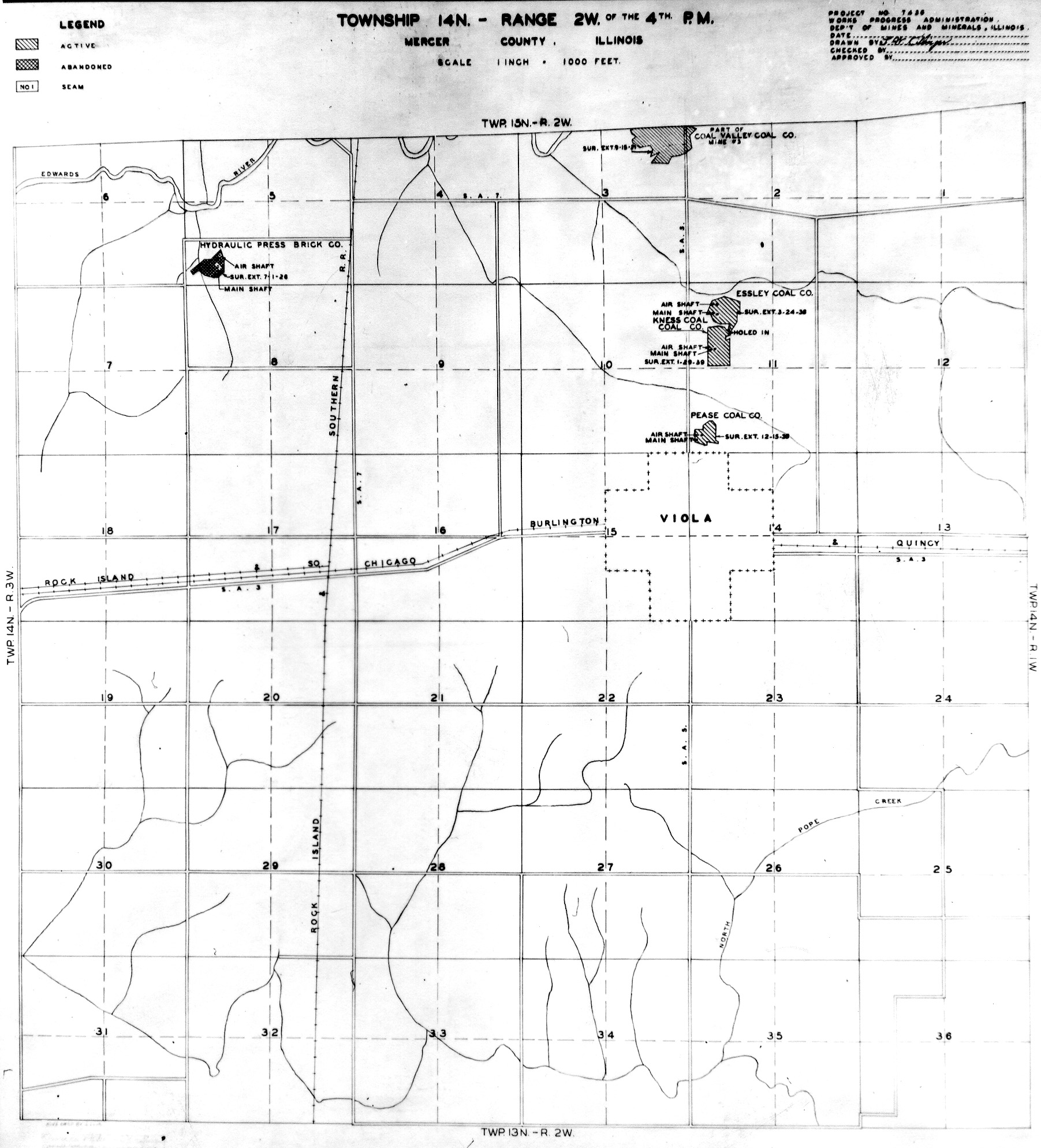
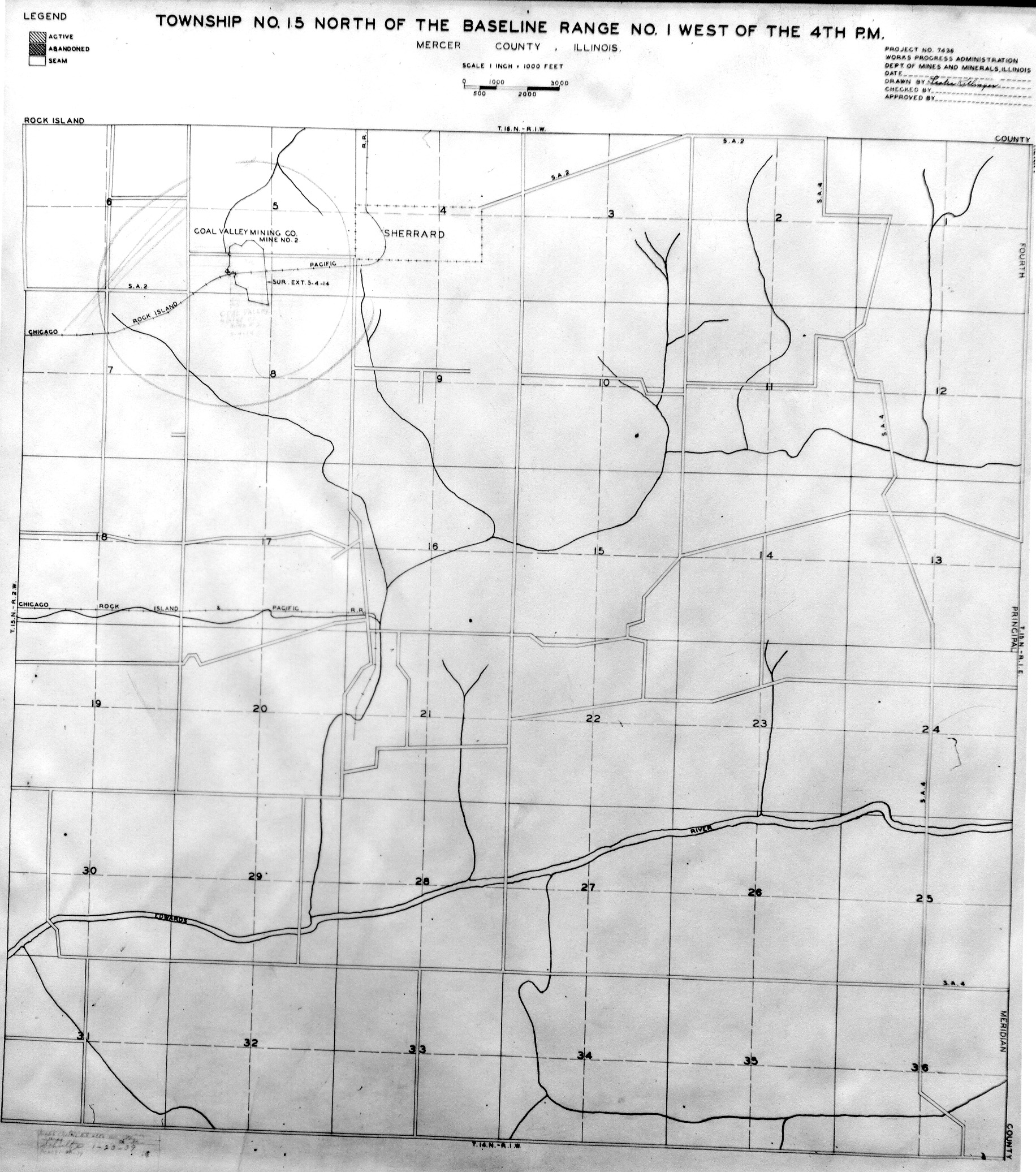
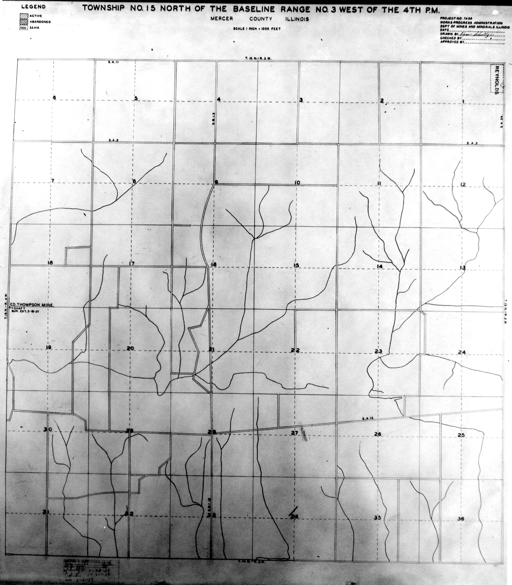
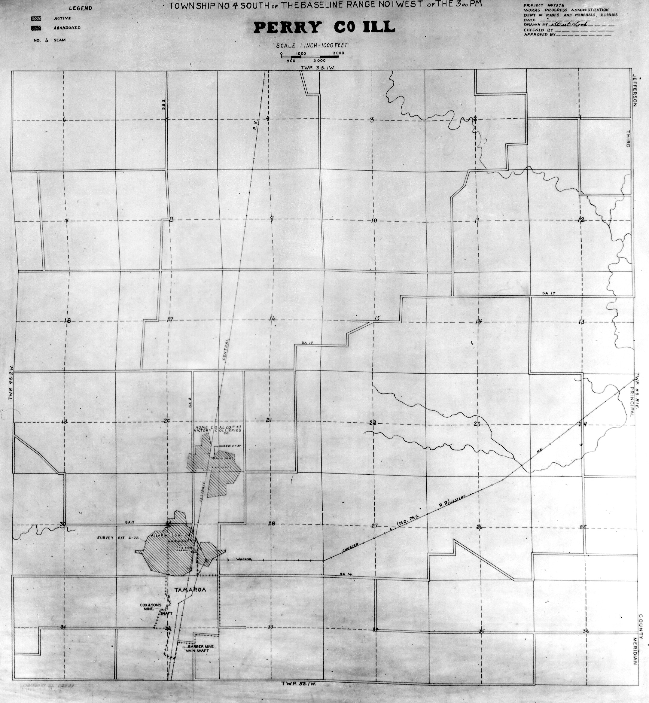
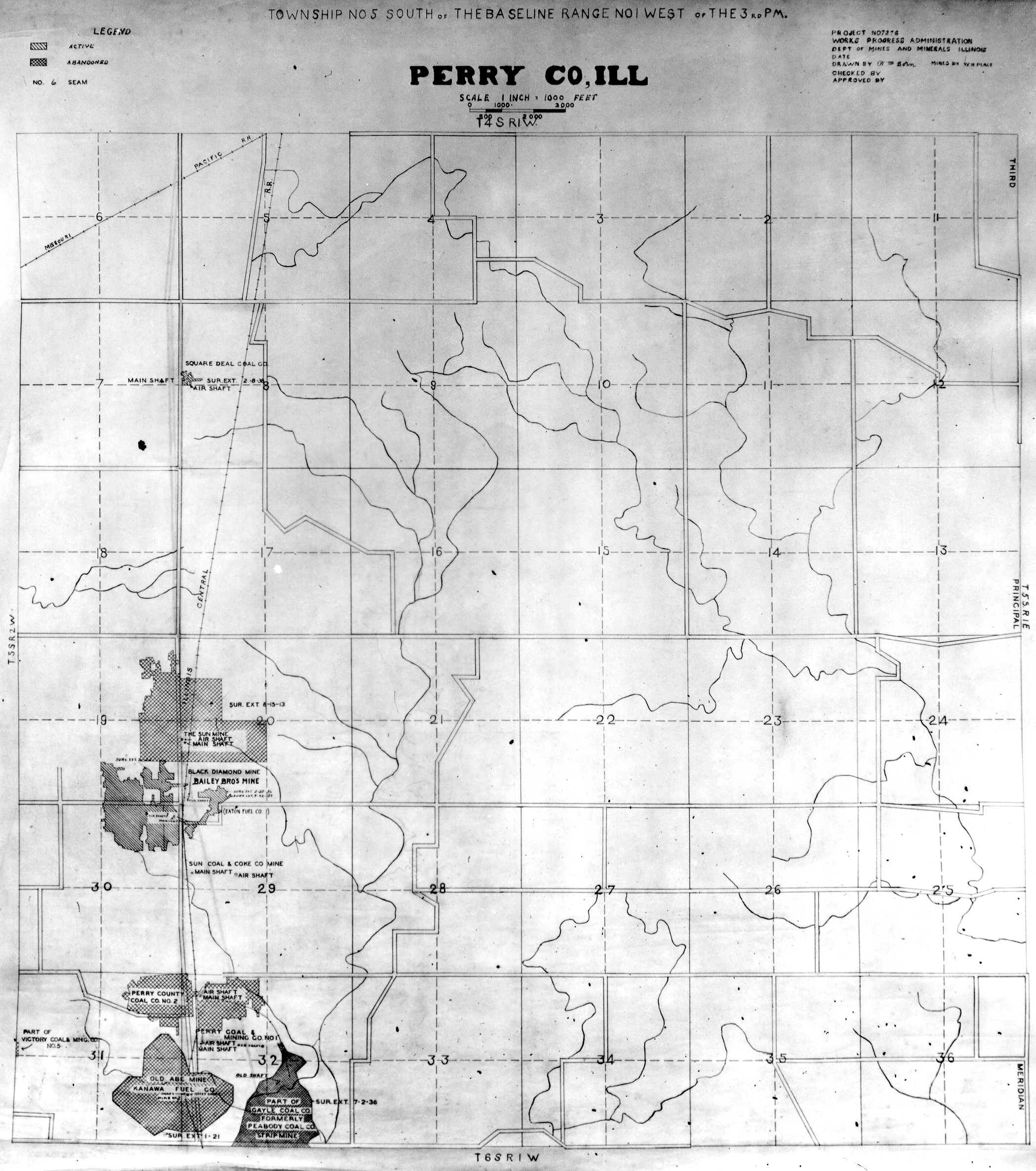
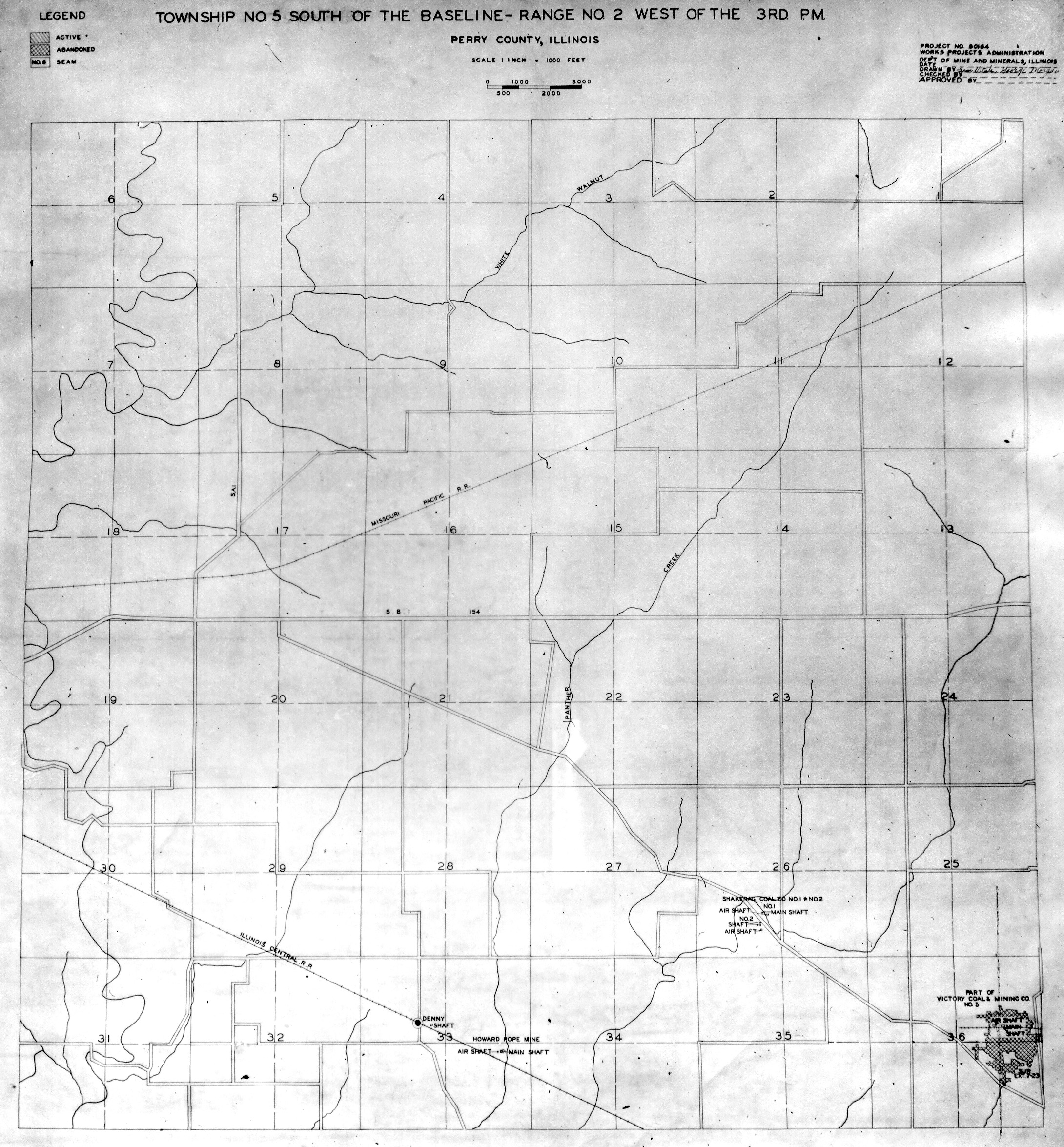
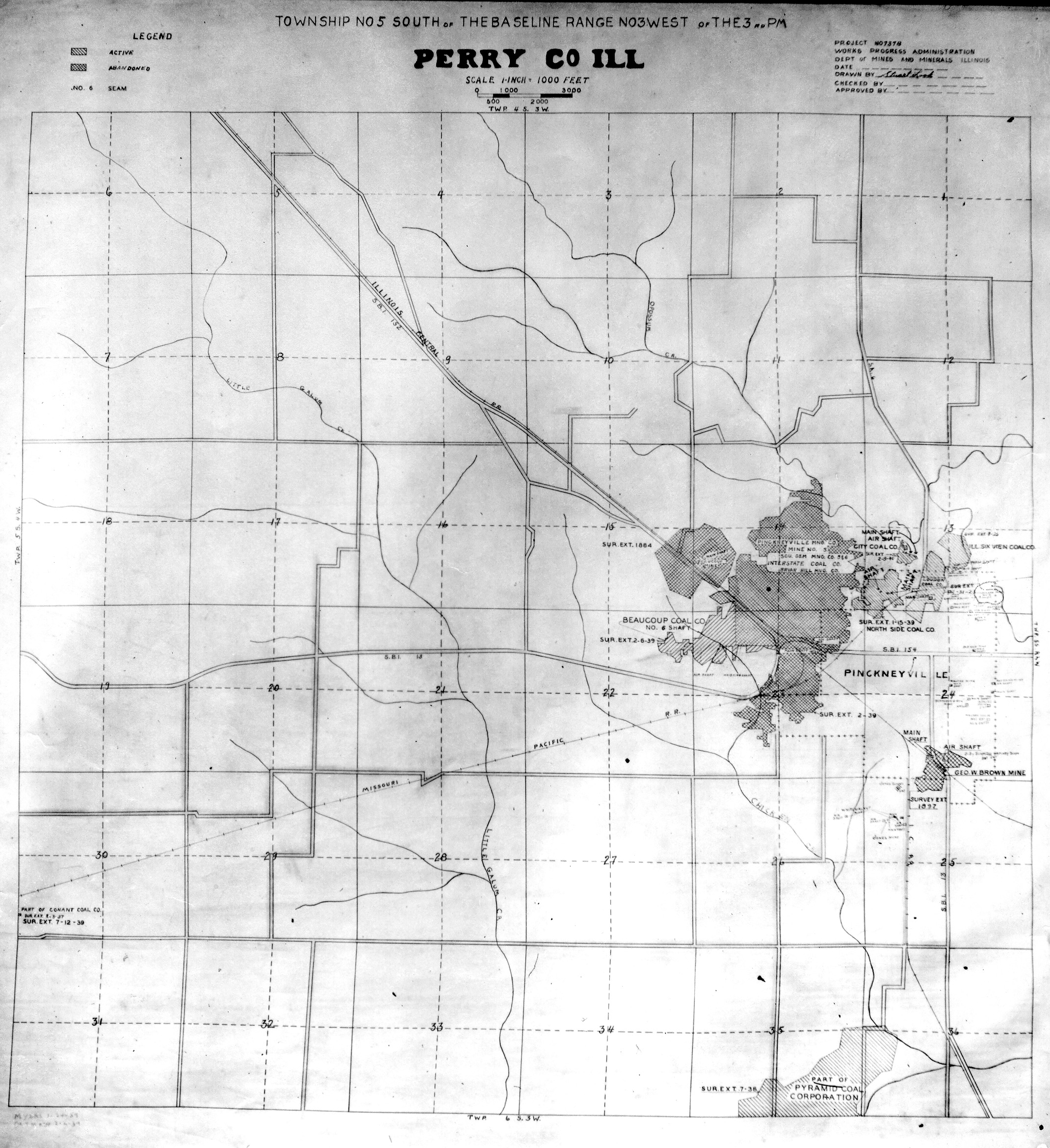
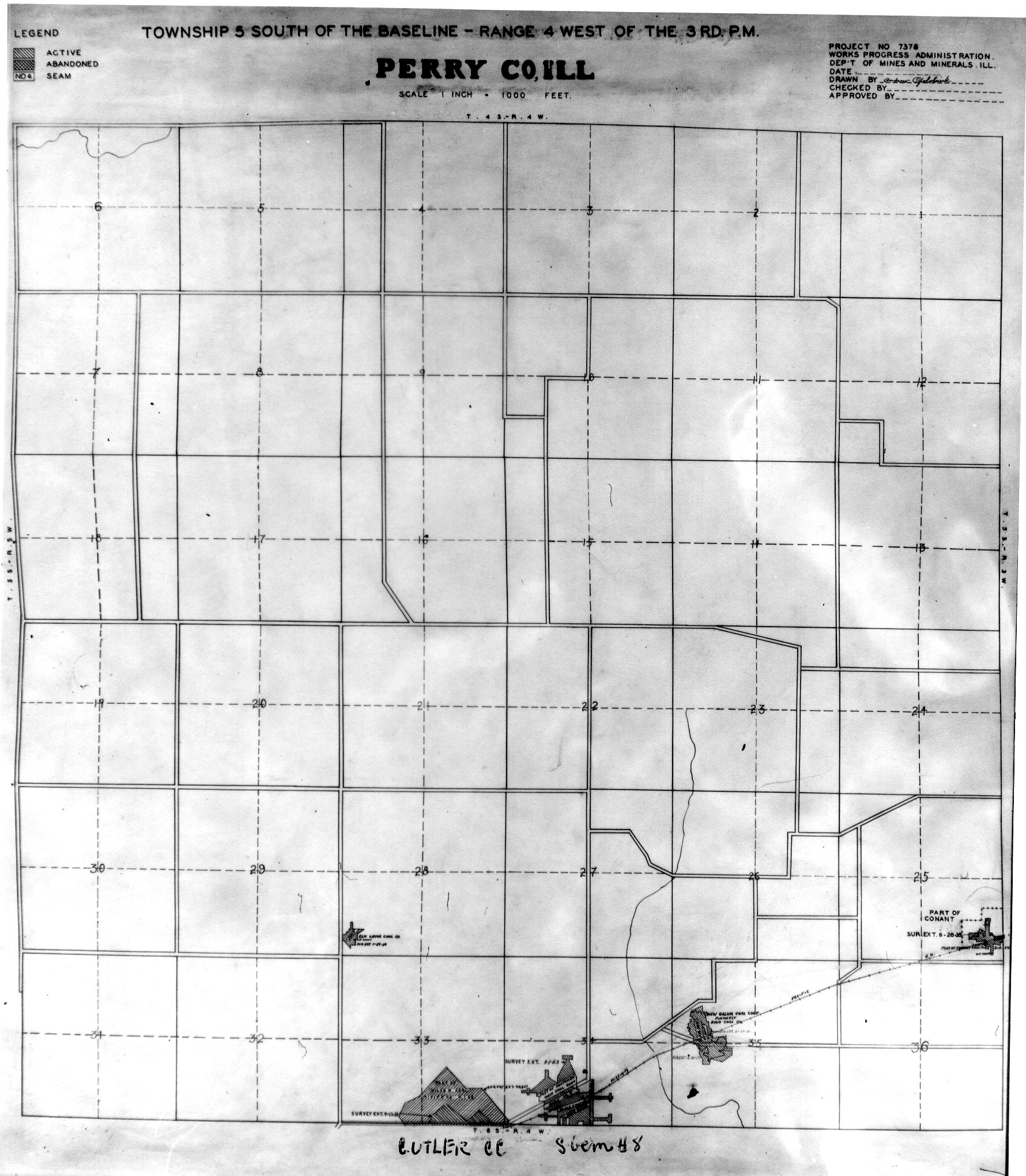
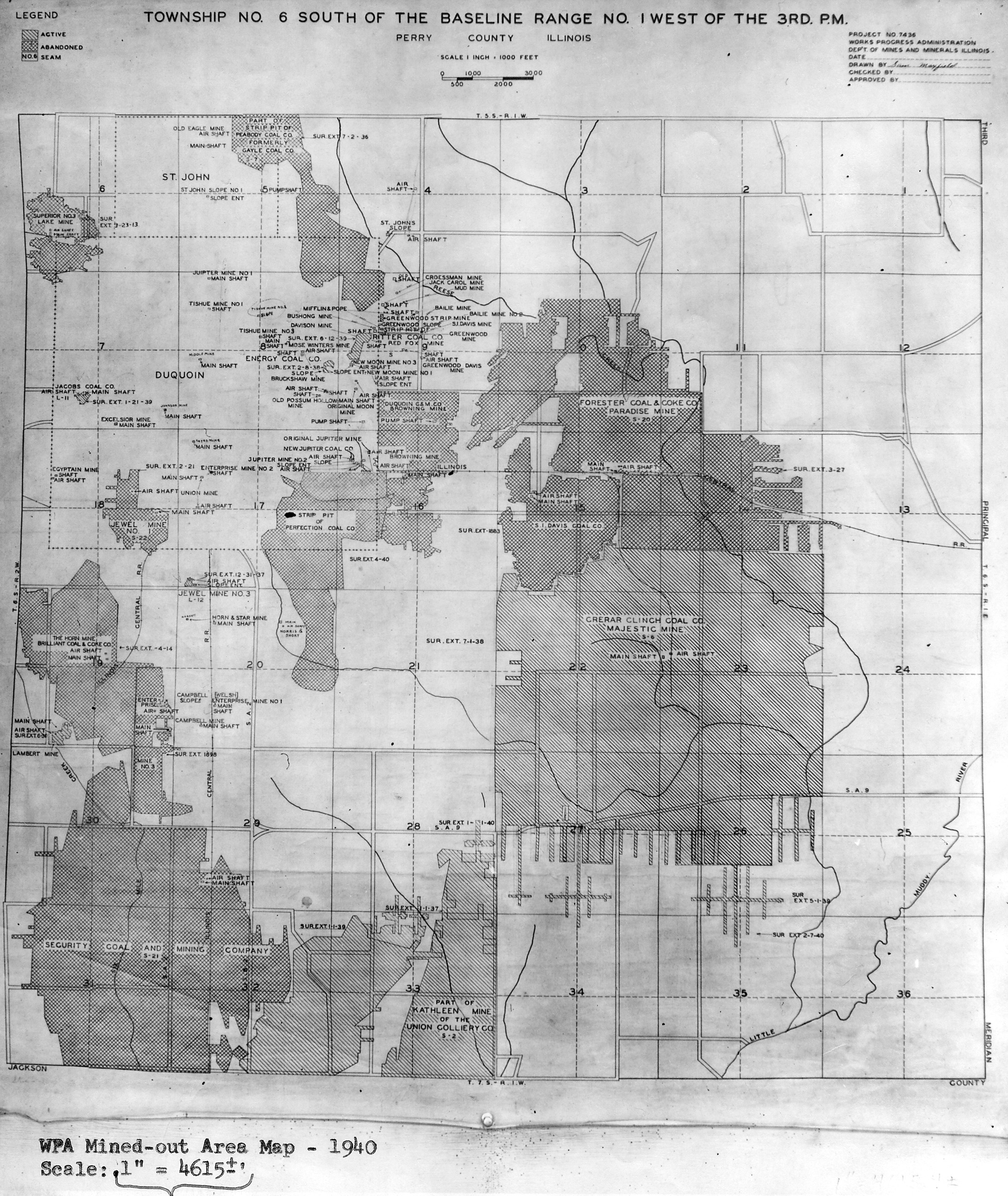
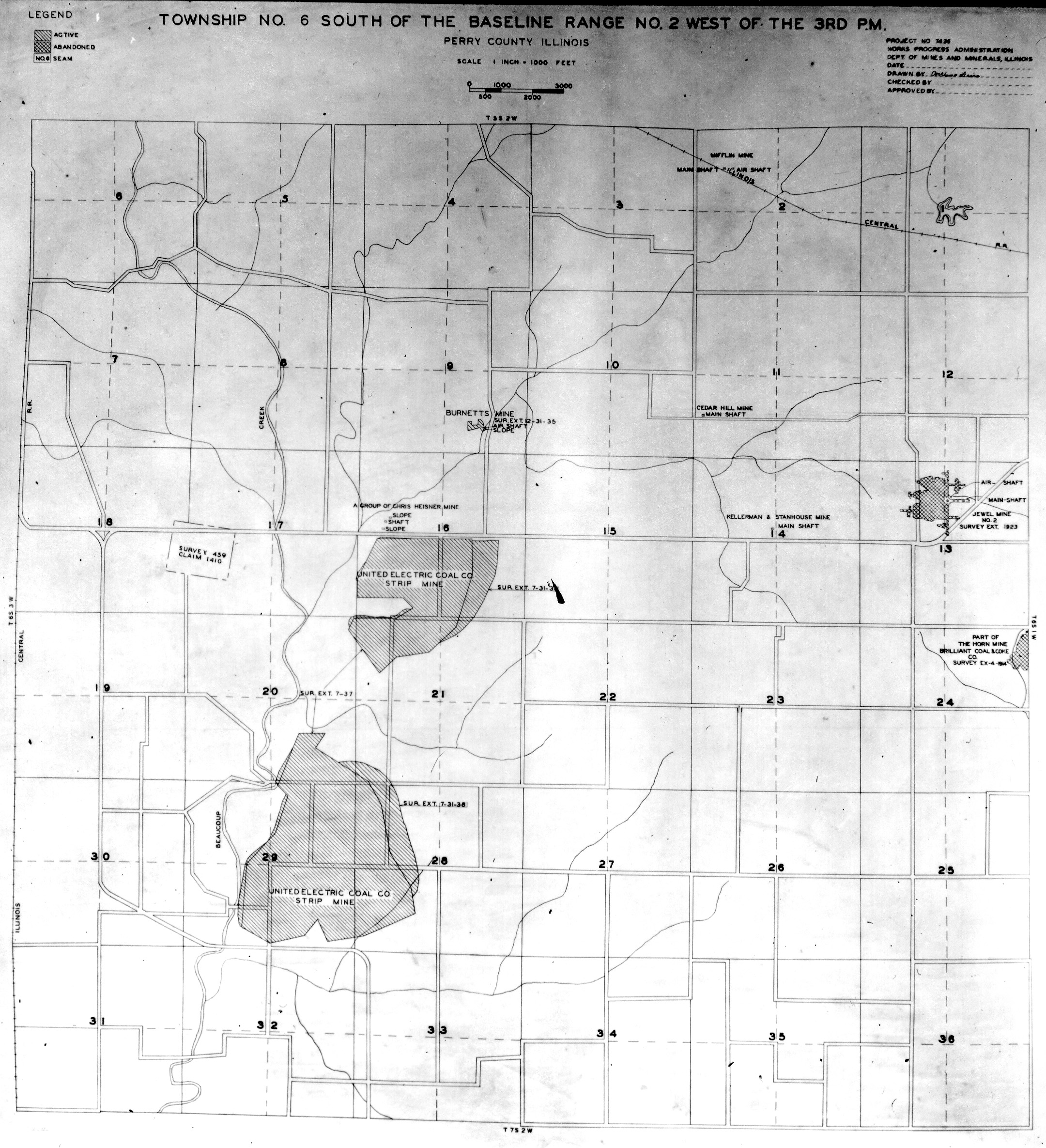
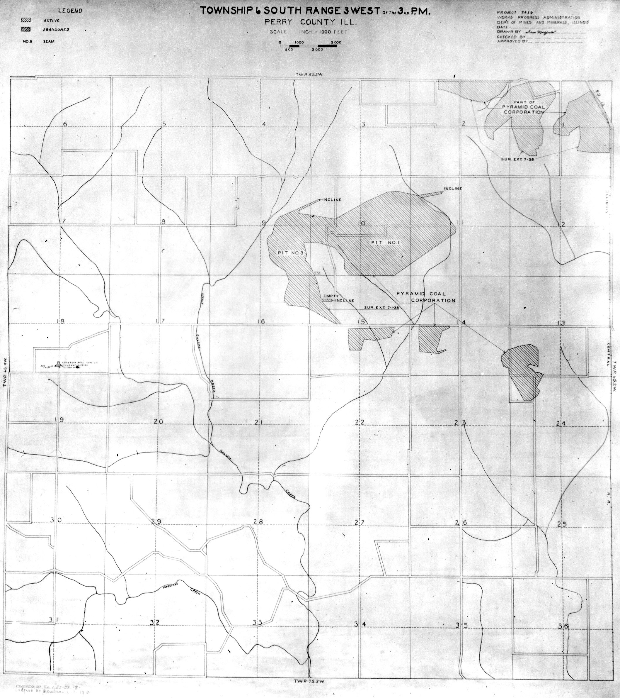
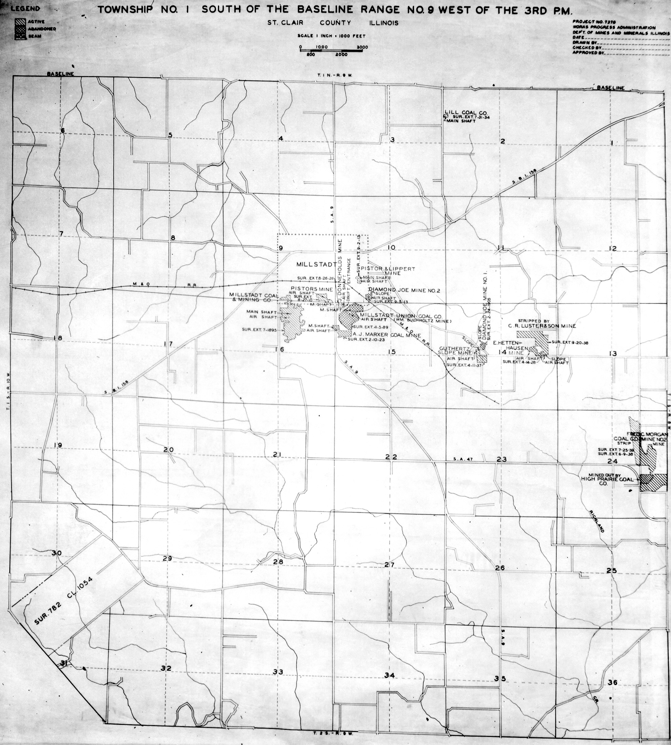
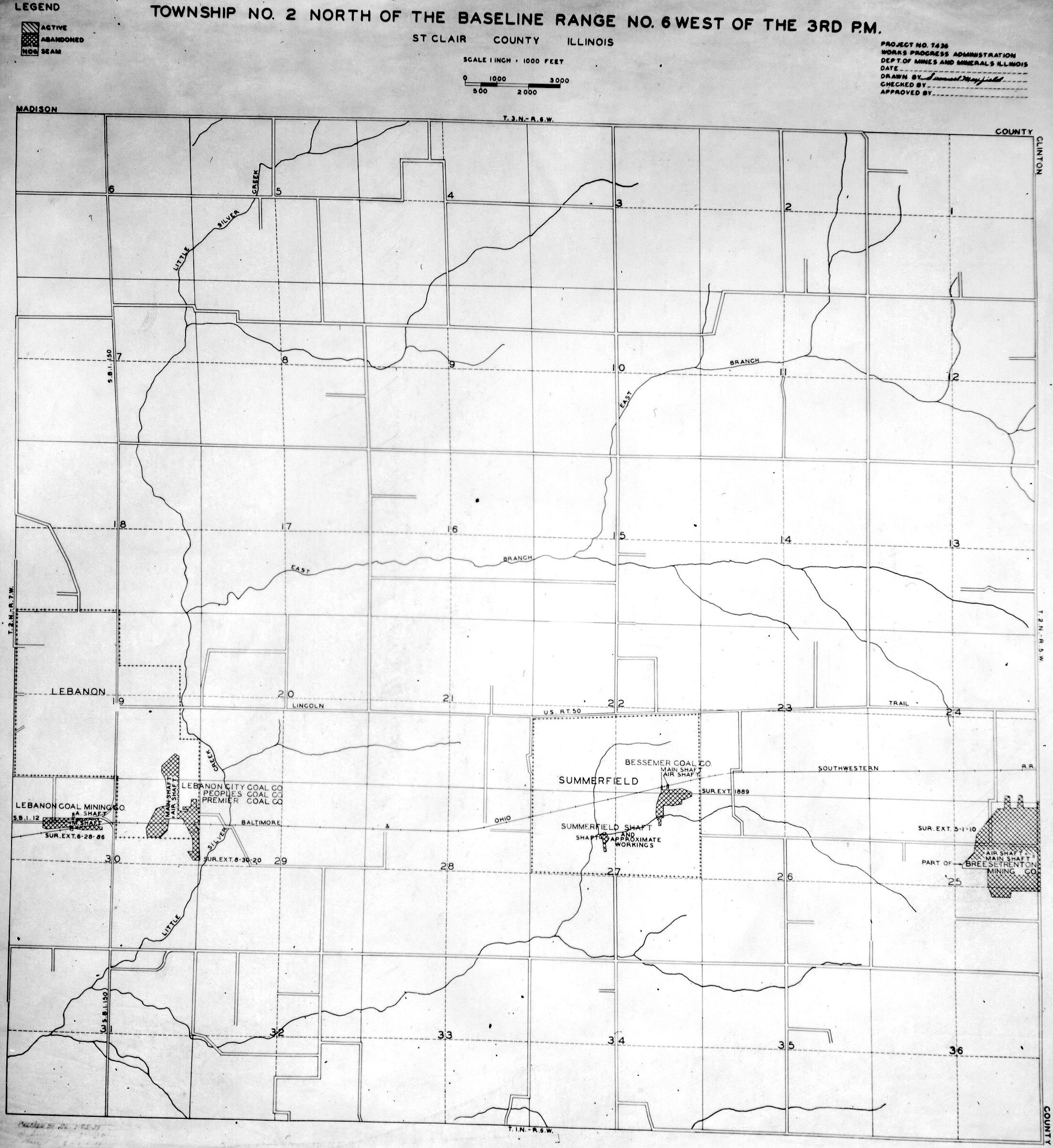
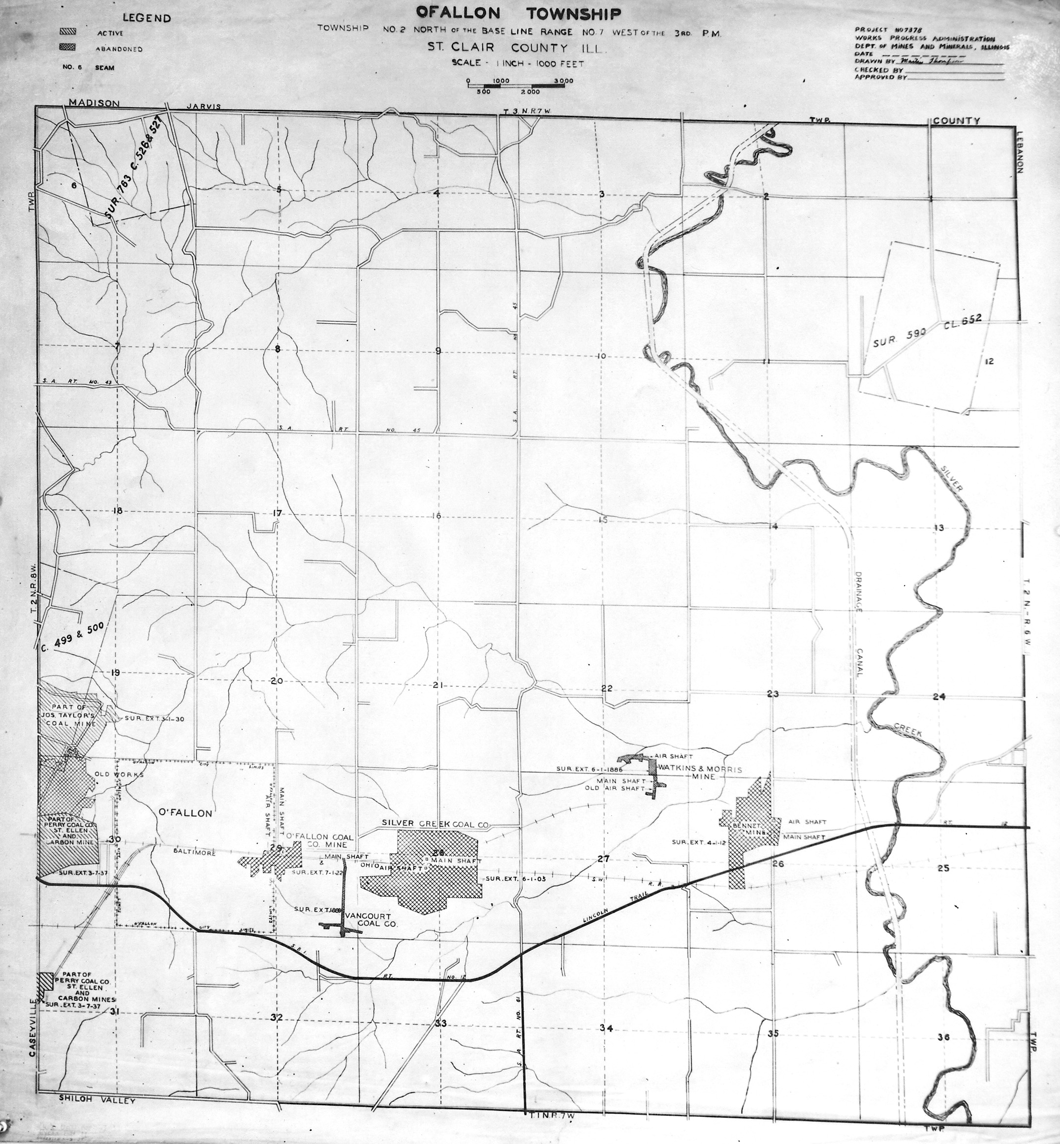
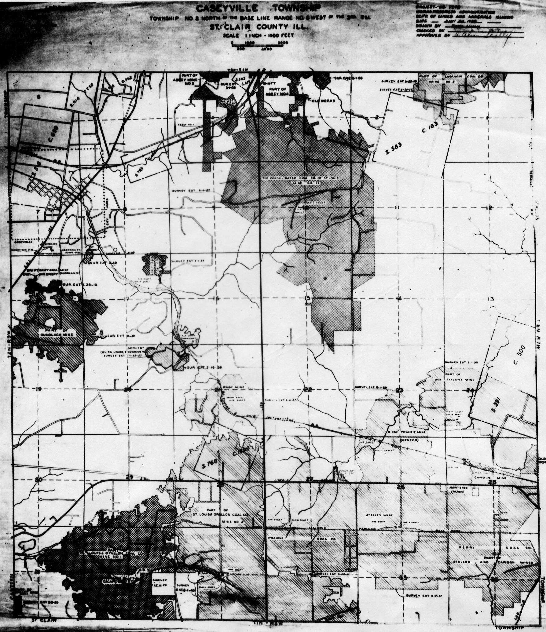
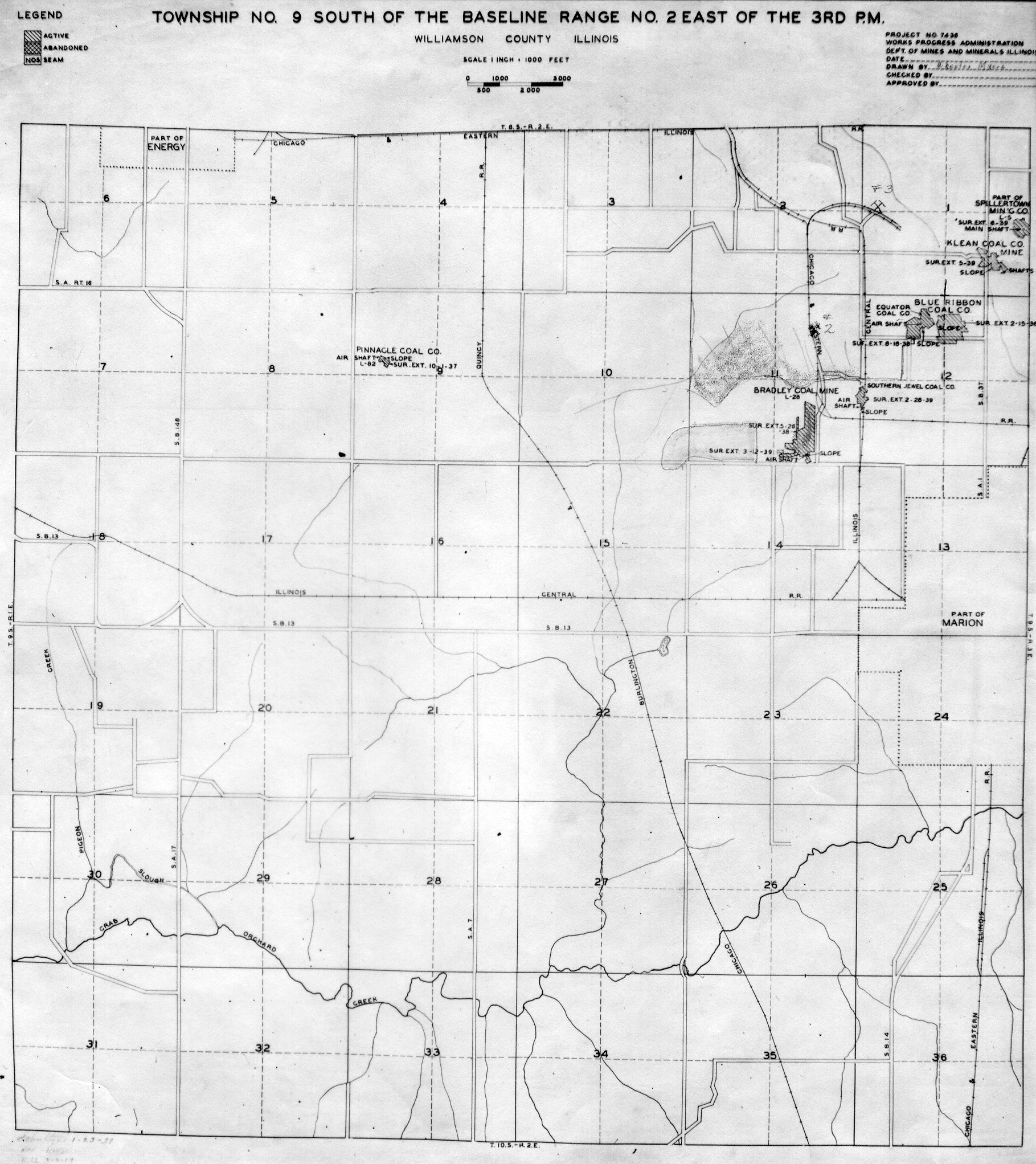
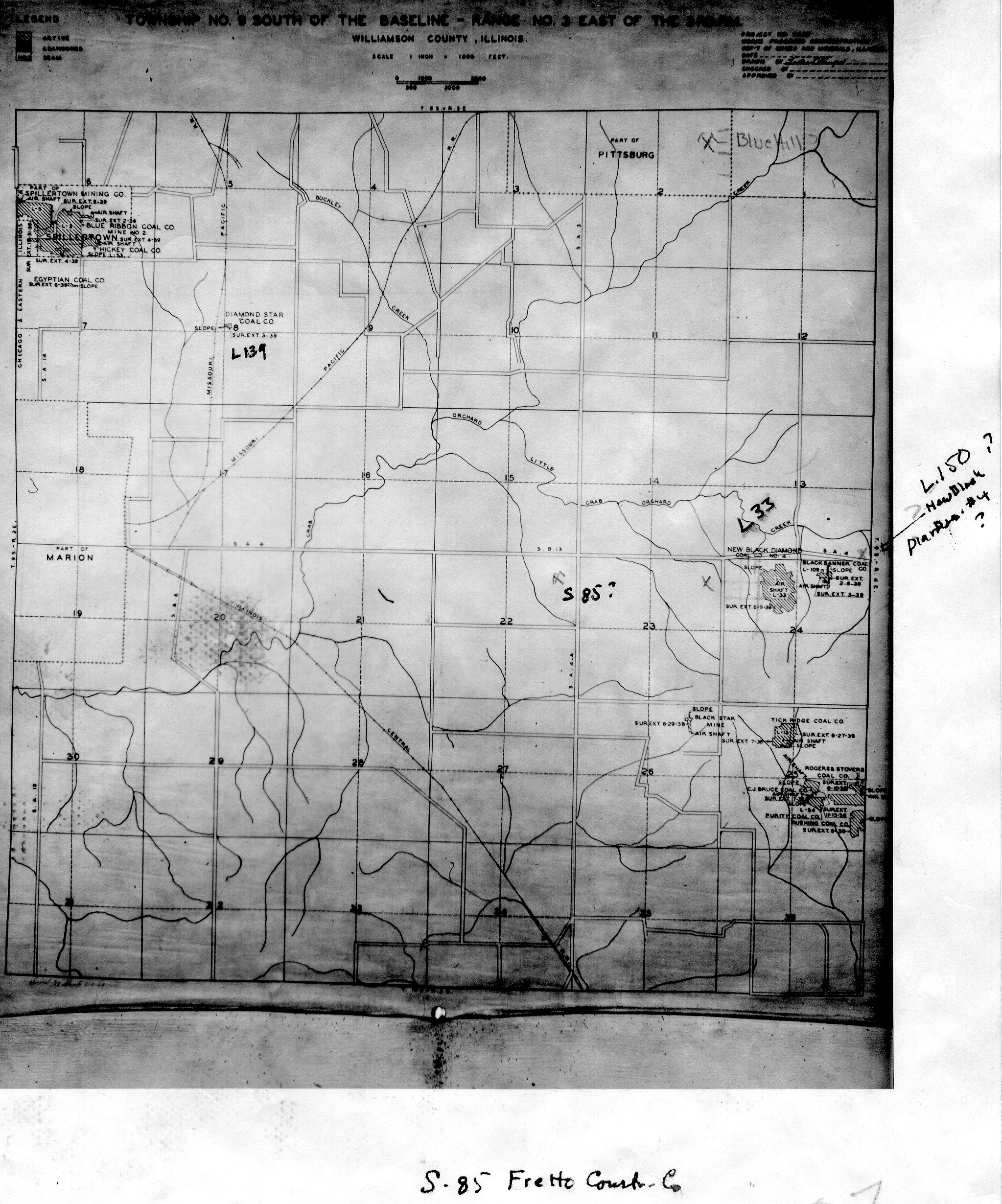
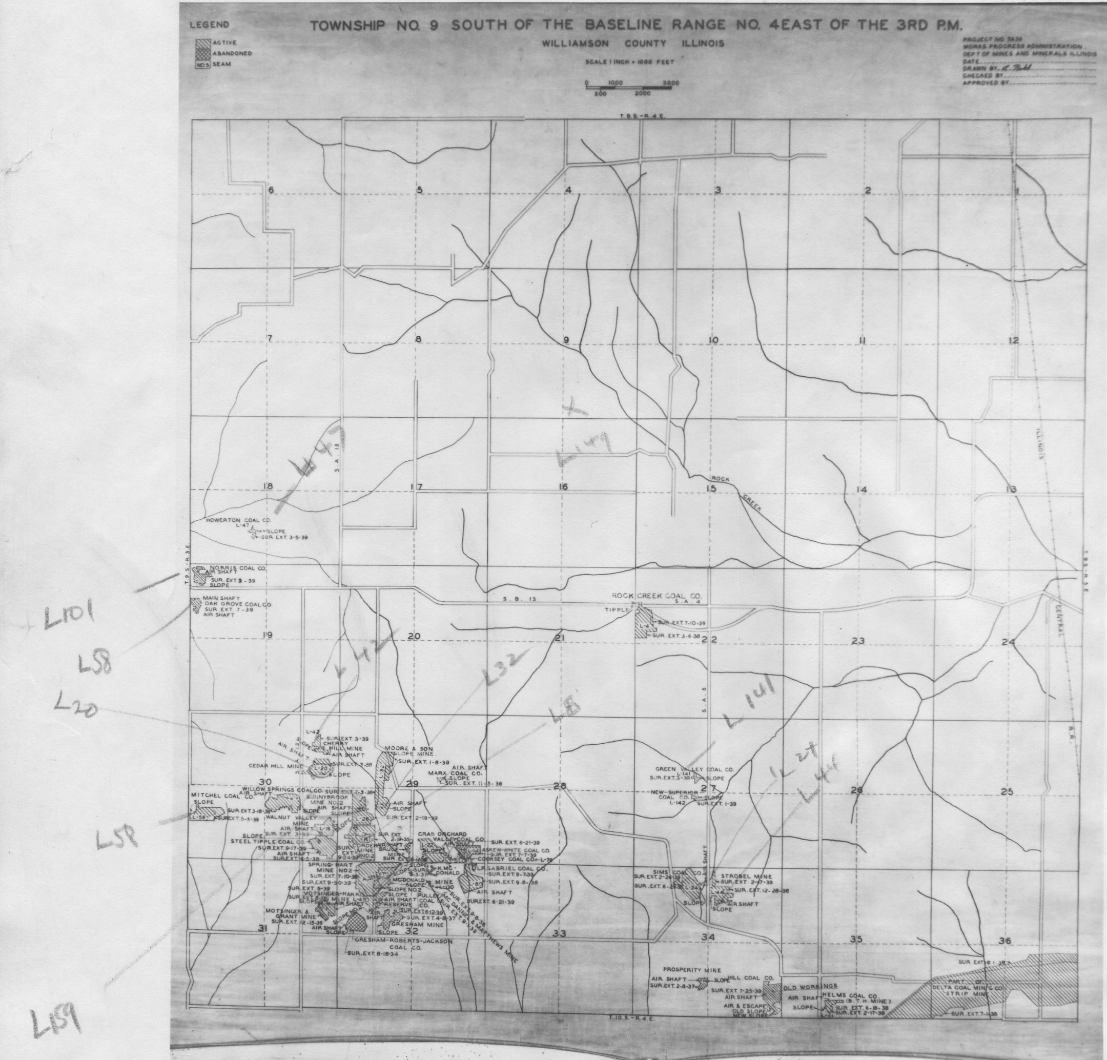
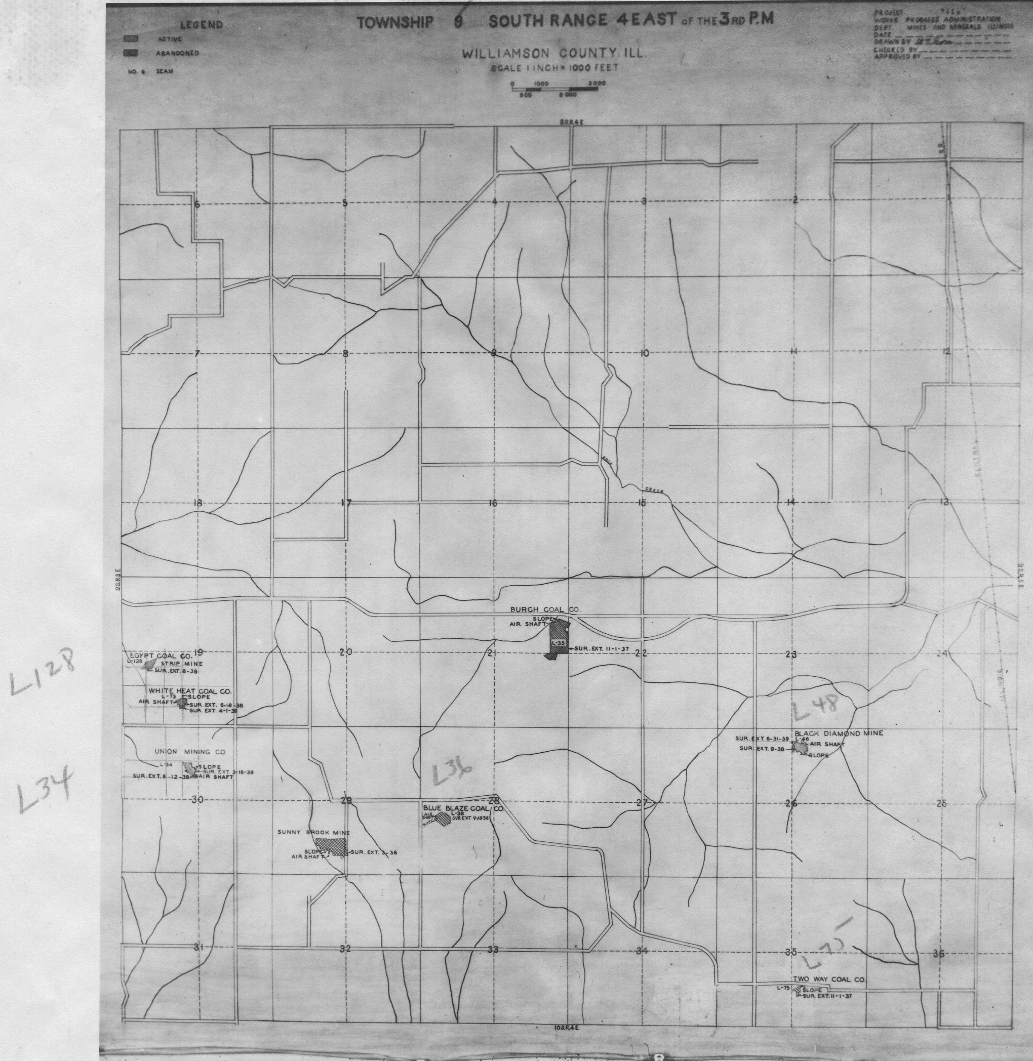
Maps for some locations might have multiple versions/seams, please inspected these areas closely for differences.
Notes and corrections were made by ISGS staff.
These maps are reproductions from microfilm, they may be of poor quality with text difficult to read.
Maps
Use the search box below to filter the list below, by county name or Township-Range (use T##N/S-R##E/W format i.e. T4N-R4W)
The export tab just exports the queried list not the actual images, click the image or link (on the left) to download.
| Map ID | County name | Township-Range | Image Download | |
|---|---|---|---|---|
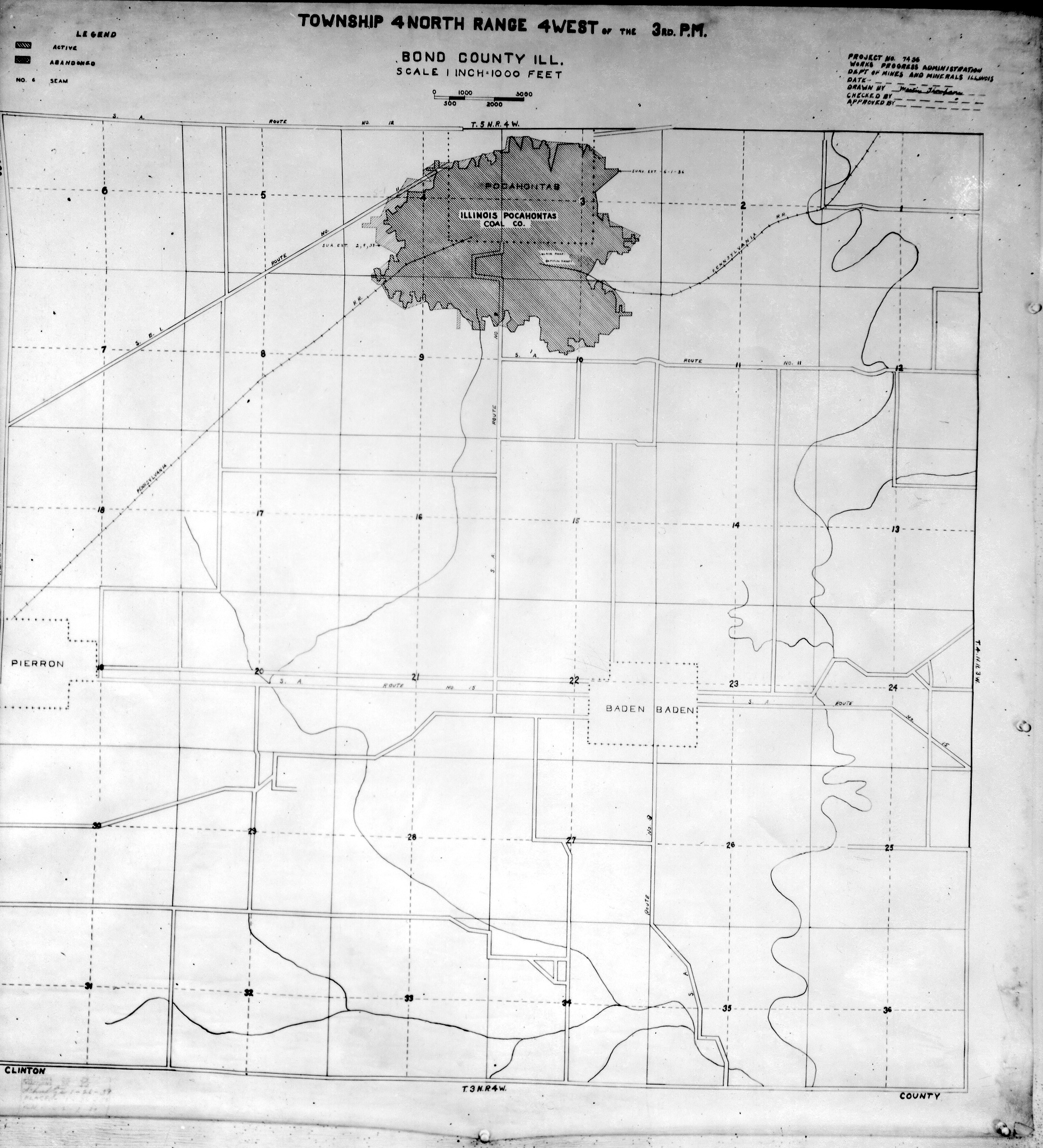
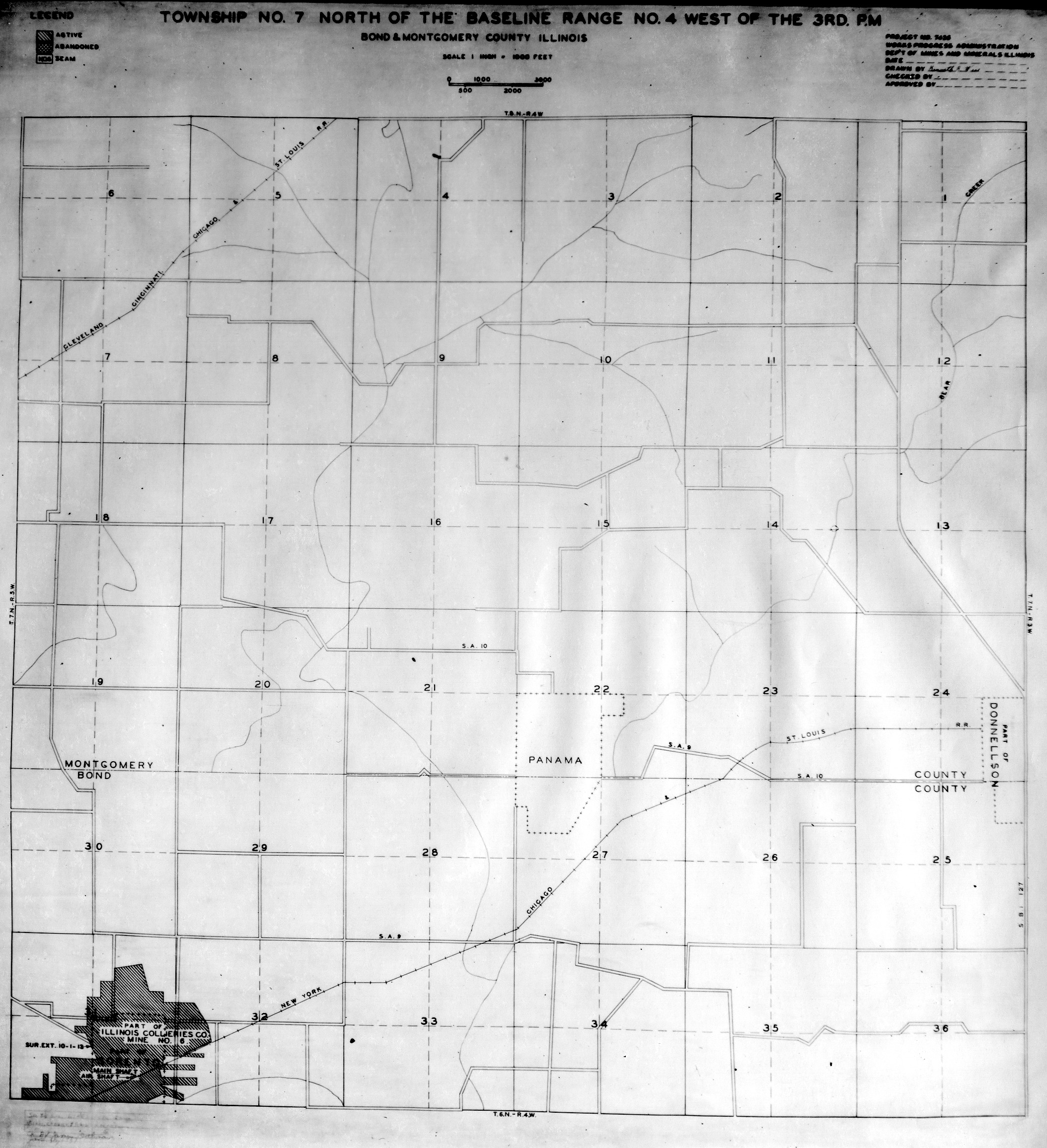
 | Bond, T4N-R4W | Bond | T4N-R4W | WPA BOND T4NR4W.jpg |
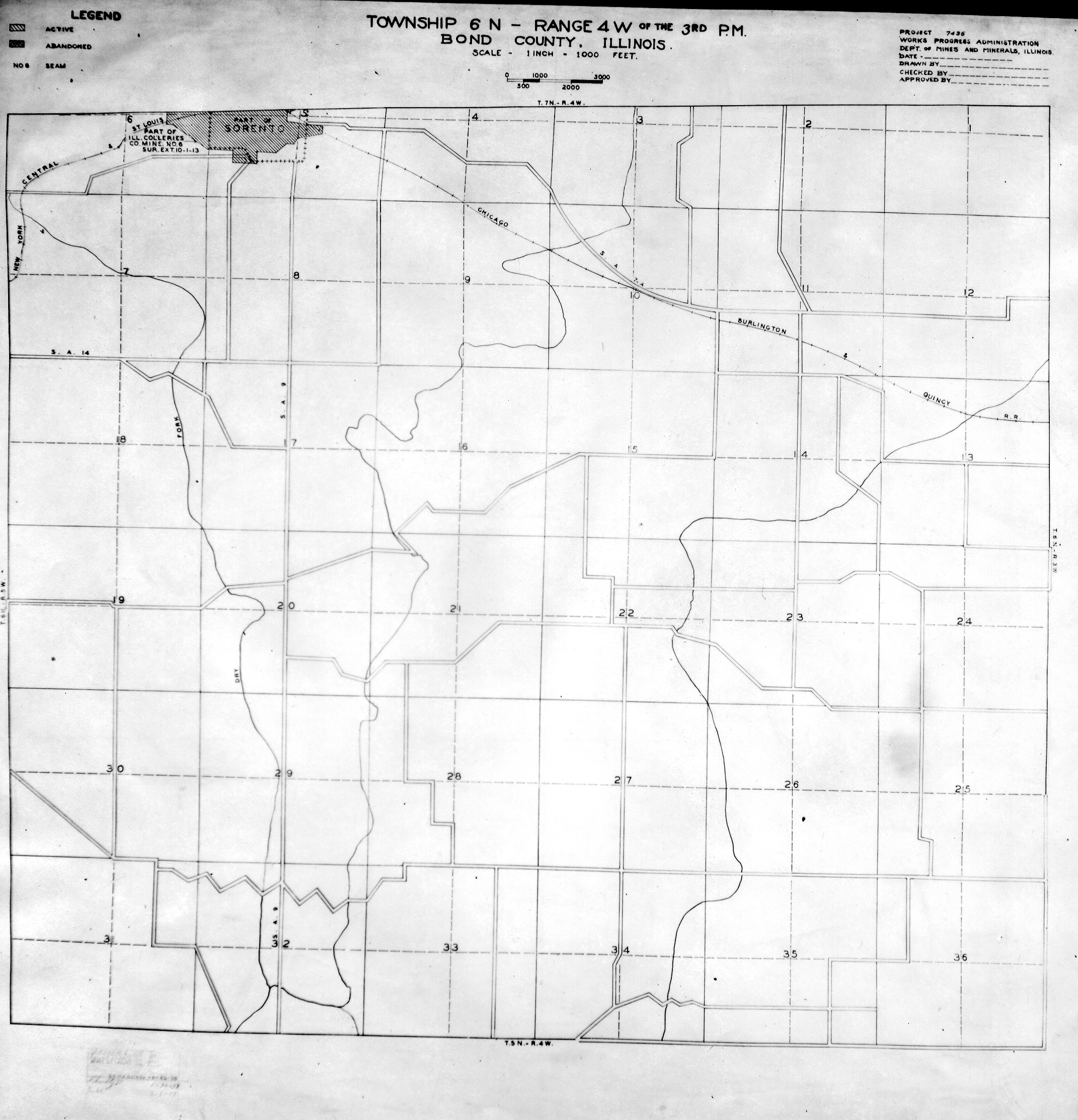
 | Bond, T6N-R4W | Bond | T6N-R4W | WPA BOND T6NR4W.jpg |
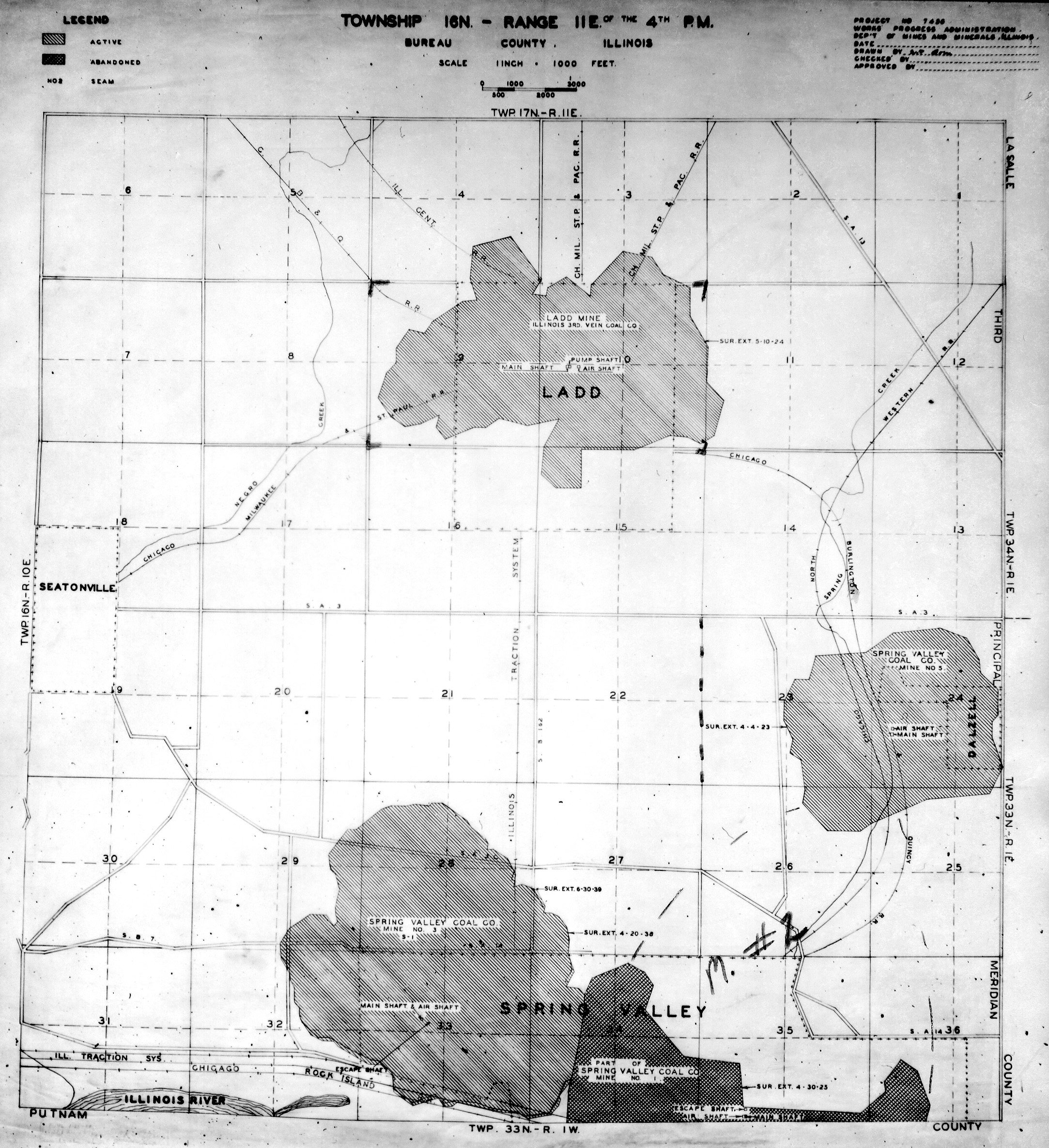
 | Bureau, T16N-R11E | Bureau | T16N-R11E | WPA BUREAU 16N11E.jpg |
 | Bureau, T16N-R6E | Bureau | T16N-R6E | WPA BUREAU 16N6E.jpg |
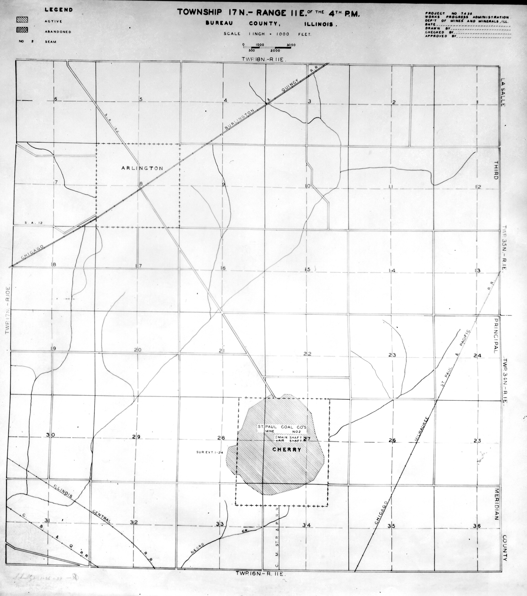
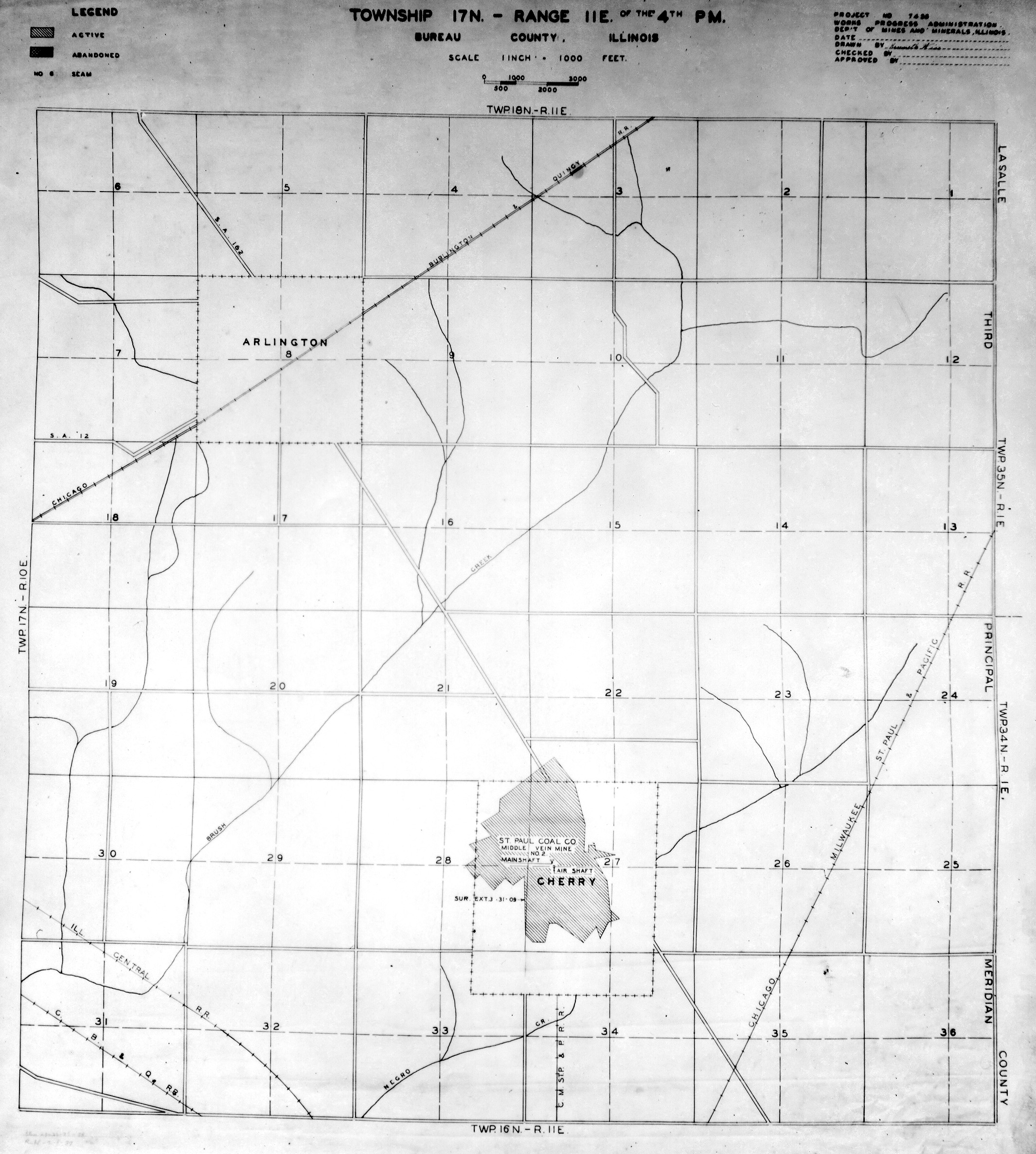
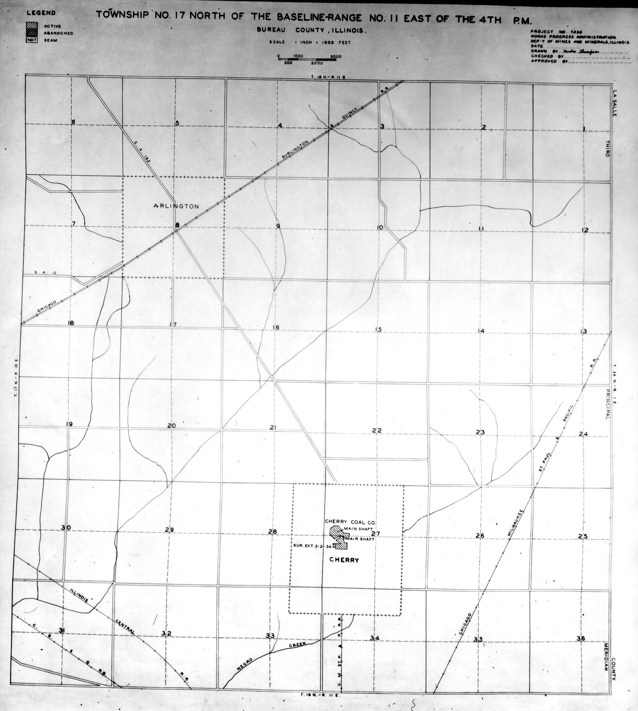
 | Bureau, T17N-R11E No. 1 | Bureau | T17N-R11E | WPA BUREAU 17N11E NO 1.jpg |
 | Bureau, T17N-R11E No. 2 | Bureau | T17N-R11E | WPA BUREAU 17N11E NO 2.jpg |
 | Bureau, T17N-R11E No. 3 | Bureau | T17N-R11E | WPA BUREAU 17N11E NO 3.jpg |
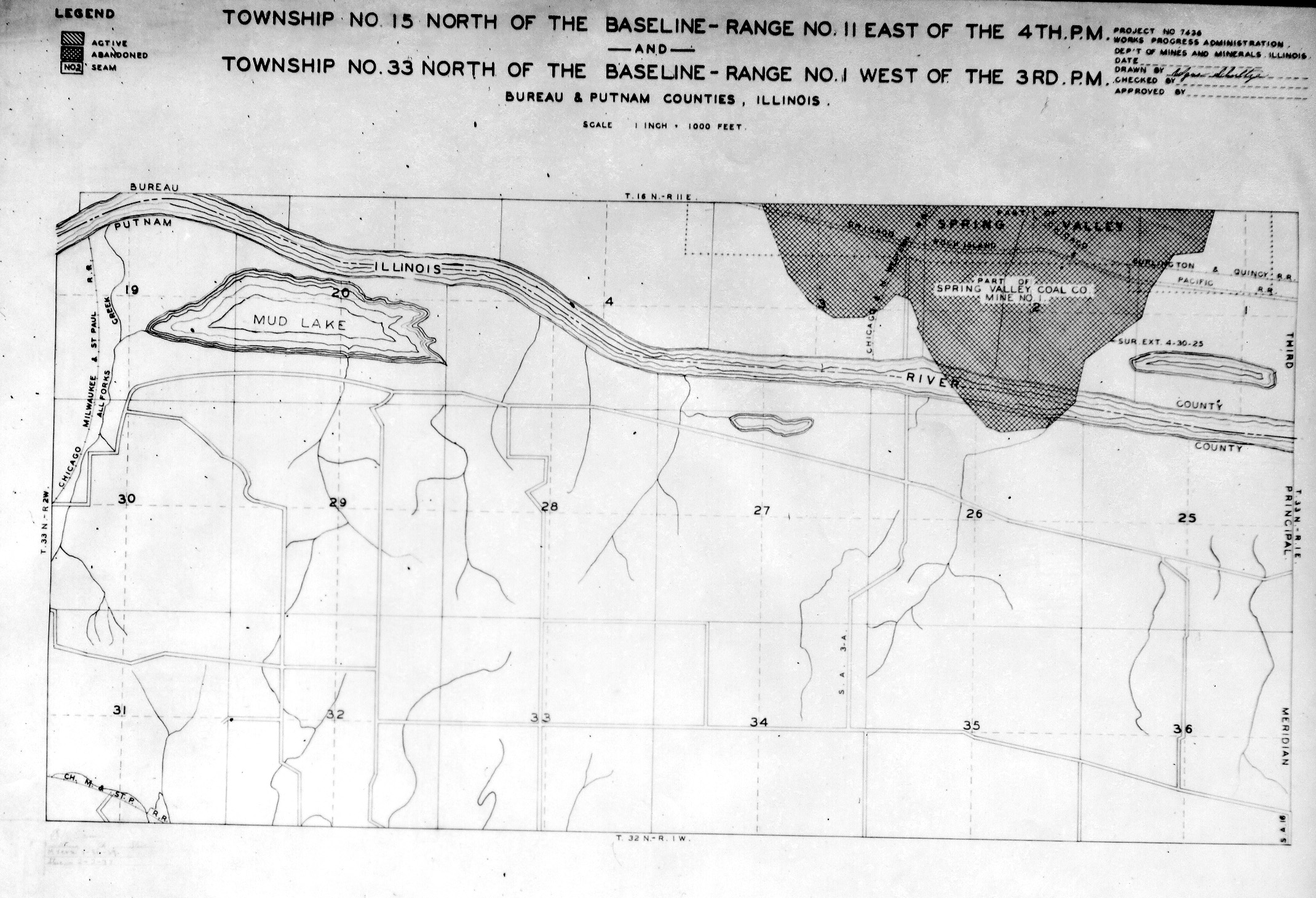
 | Bureau & Putnam, T15N-R11E & T33N-R1W | Bureau Putnam | T15N-R11E T33N-R1W | WPA BUREAU PUTNAM 15N11E-33N1W.jpg |
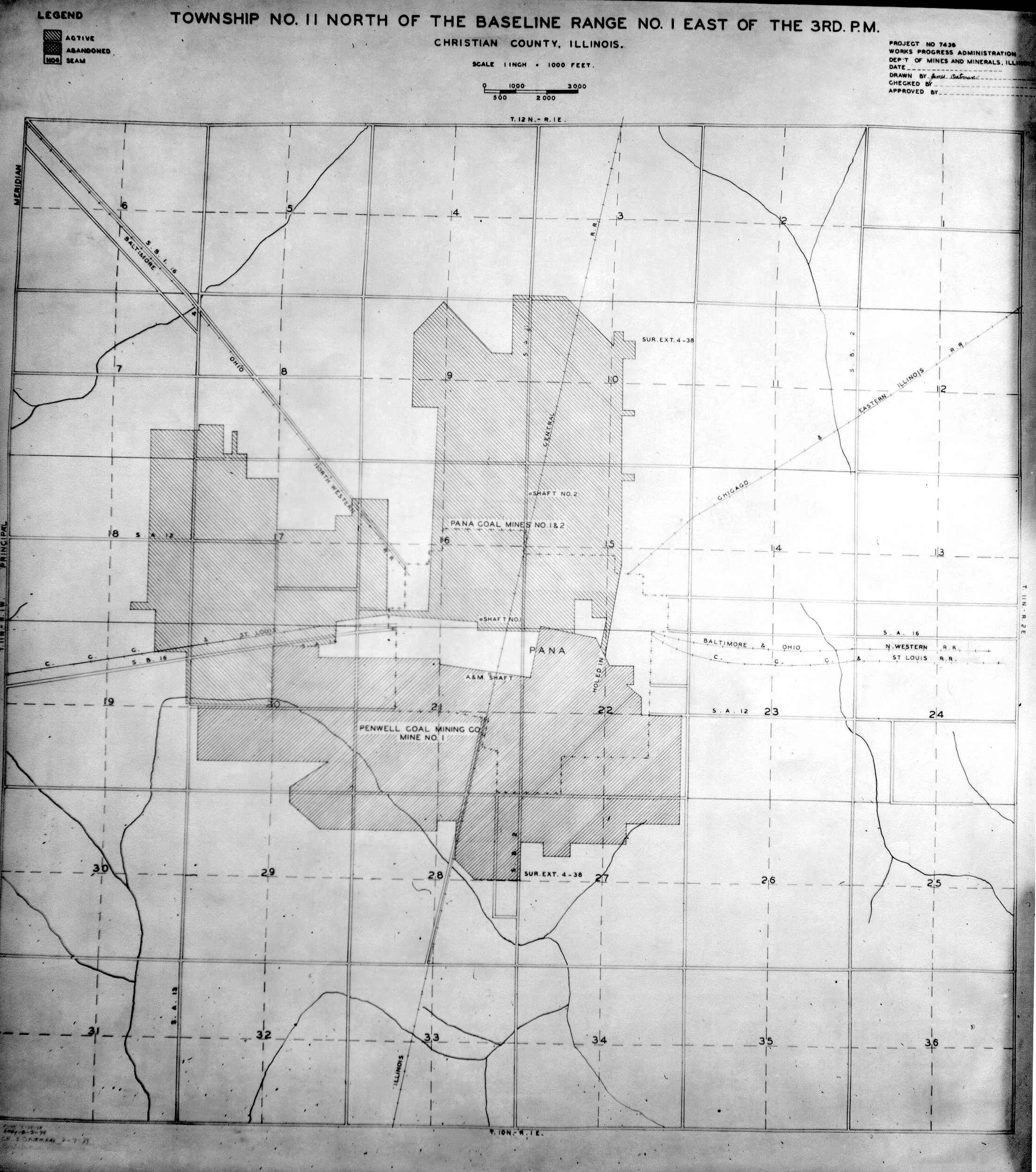
 | Christian, T11N-R1E | Christian | T11N-R1E | WPA CHRISTIAN 11N1E.jpg |
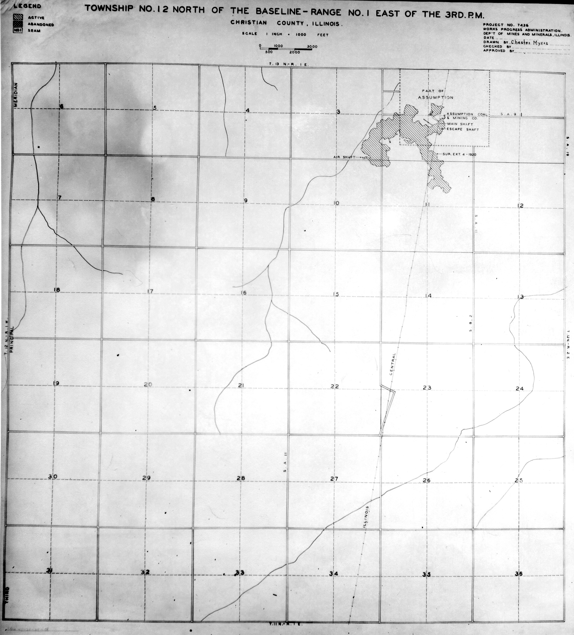
 | Christian, T12N-R1E | Christian | T12N-R1E | WPA CHRISTIAN 12N1E.jpg |
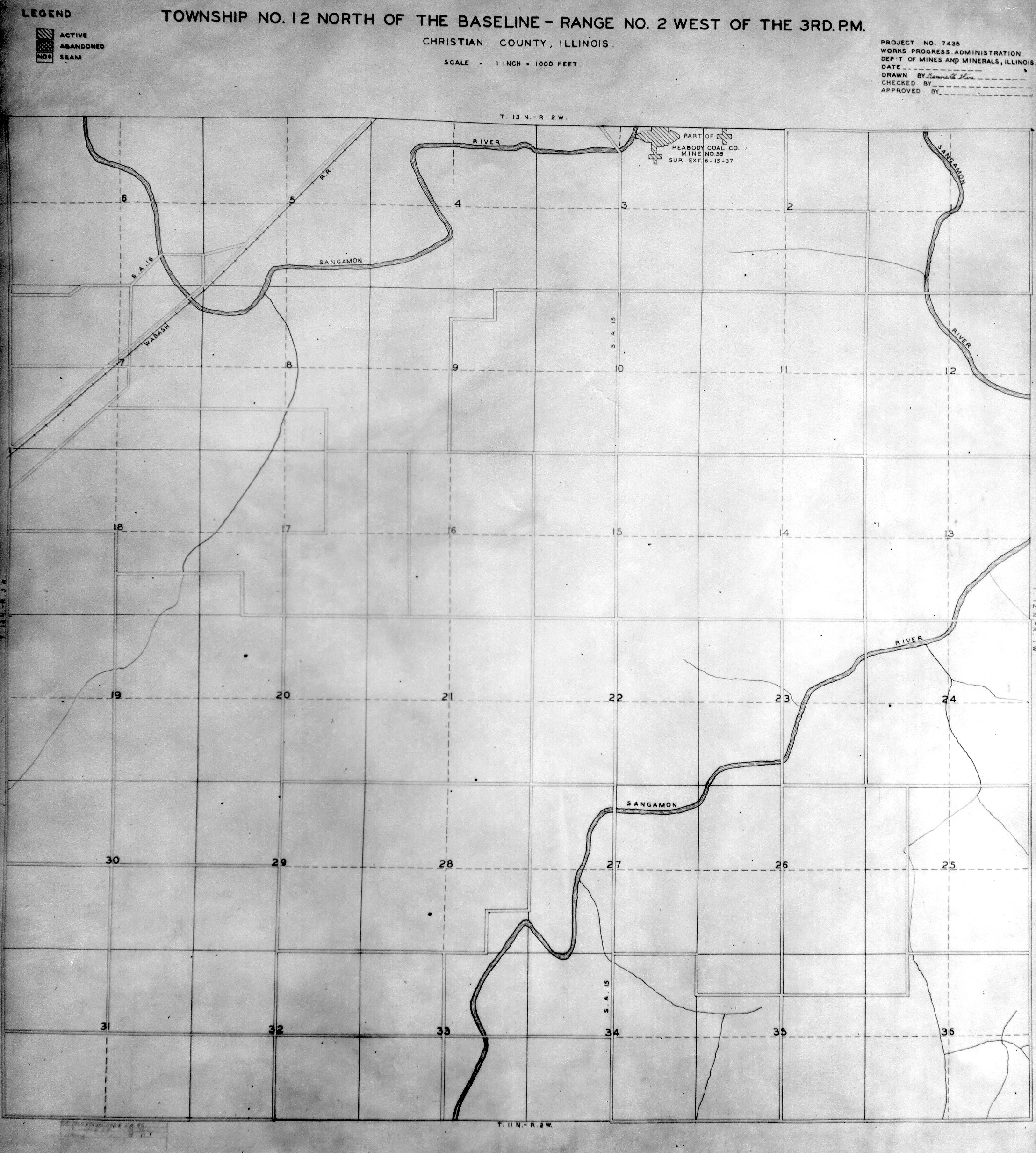
 | Christian, T12N-R2W | Christian | T12N-R2W | WPA CHRISTIAN 12N2W.jpg |
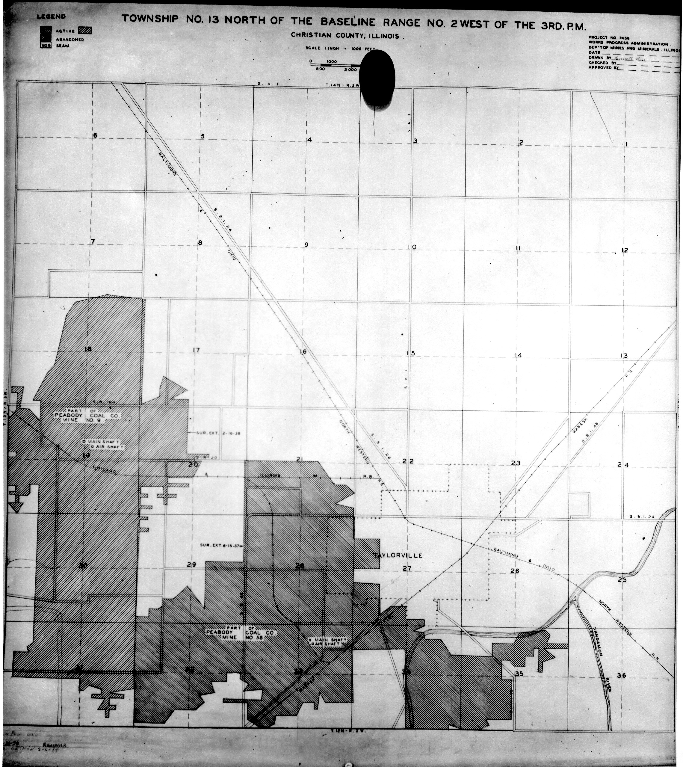
 | Christian, T13N-R2W | Christian | T13N-R2W | WPA CHRISTIAN 13N2W.jpg |
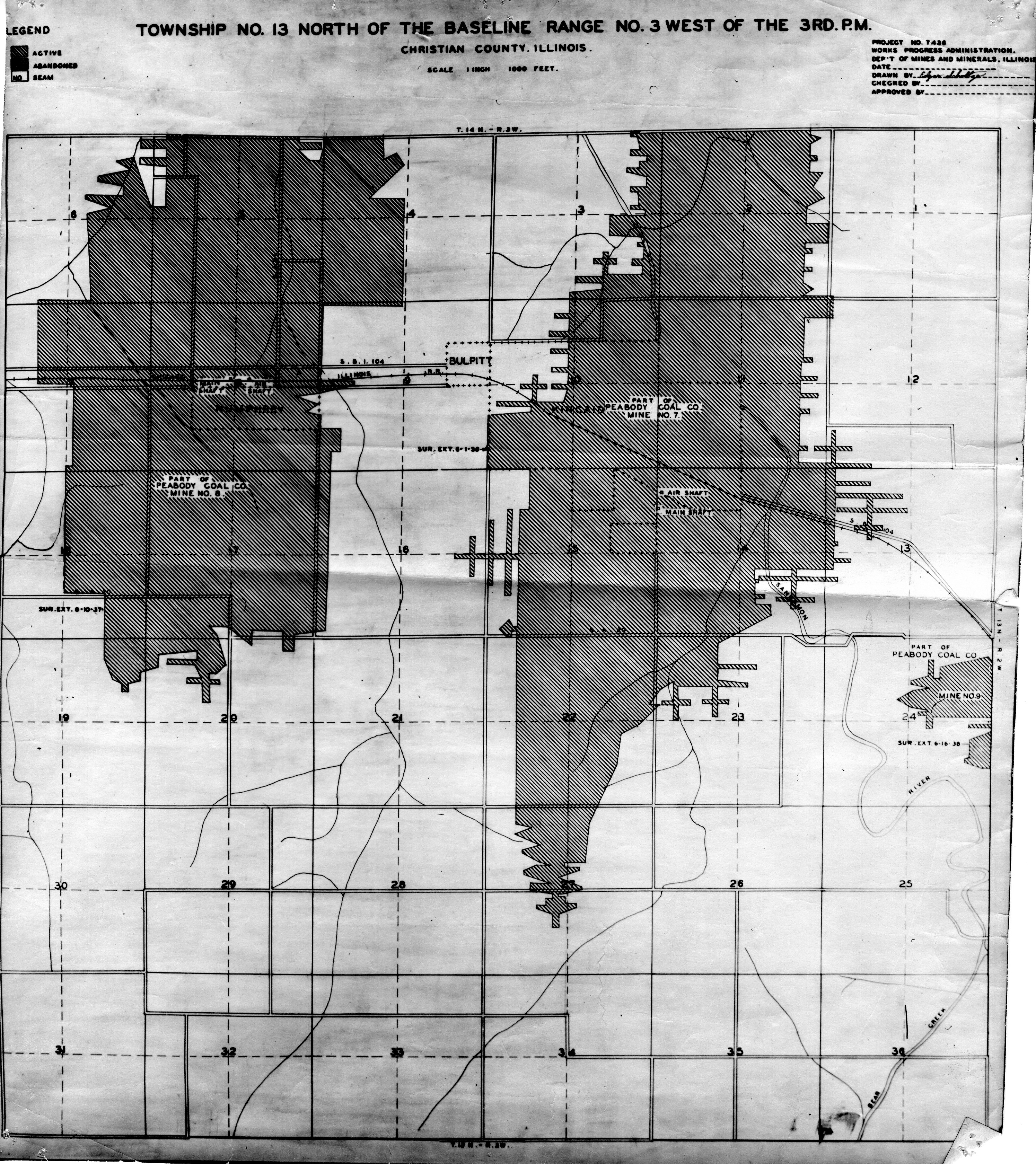
 | Christian, T13N-R3W | Christian | T13N-R3W | WPA CHRISTIAN 13N3W.jpg |
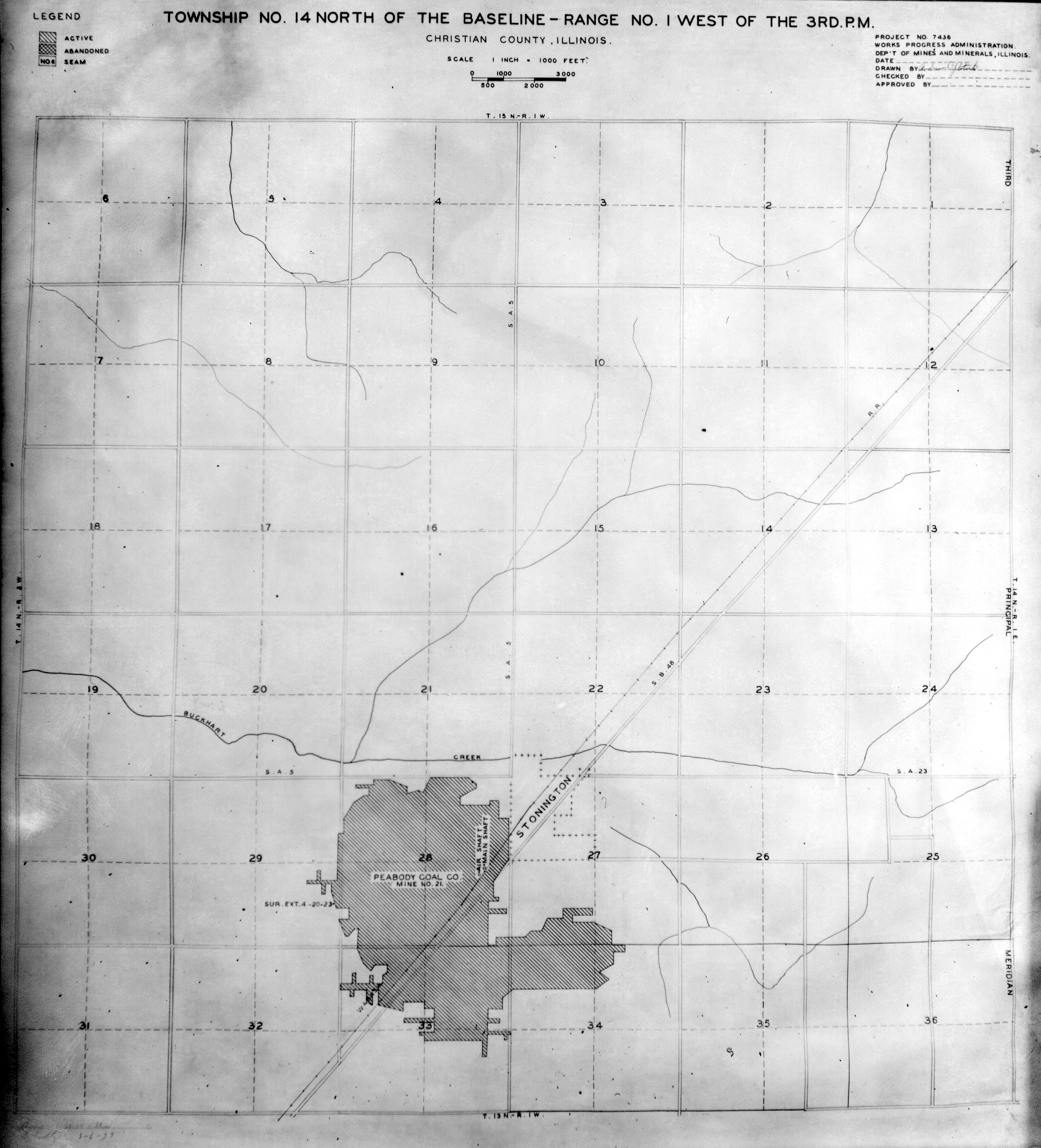
 | Christian, T14N-R1W | Christian | T14N-R1W | WPA CHRISTIAN 14N1W.jpg |
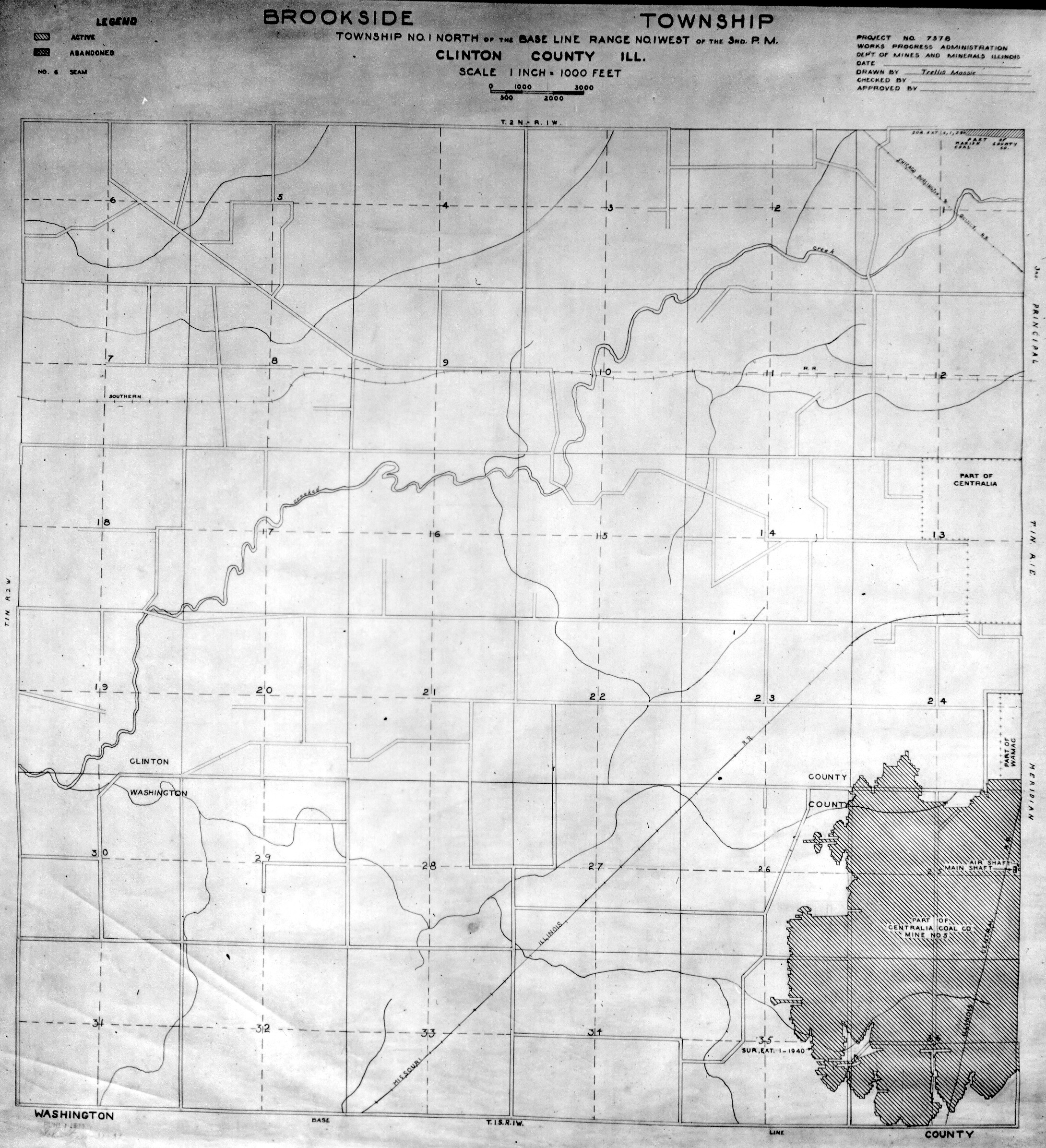
 | Clinton, T1N-R1W | Clinton | T1N-R1W | WPA CLINTON 1N1W.jpg |
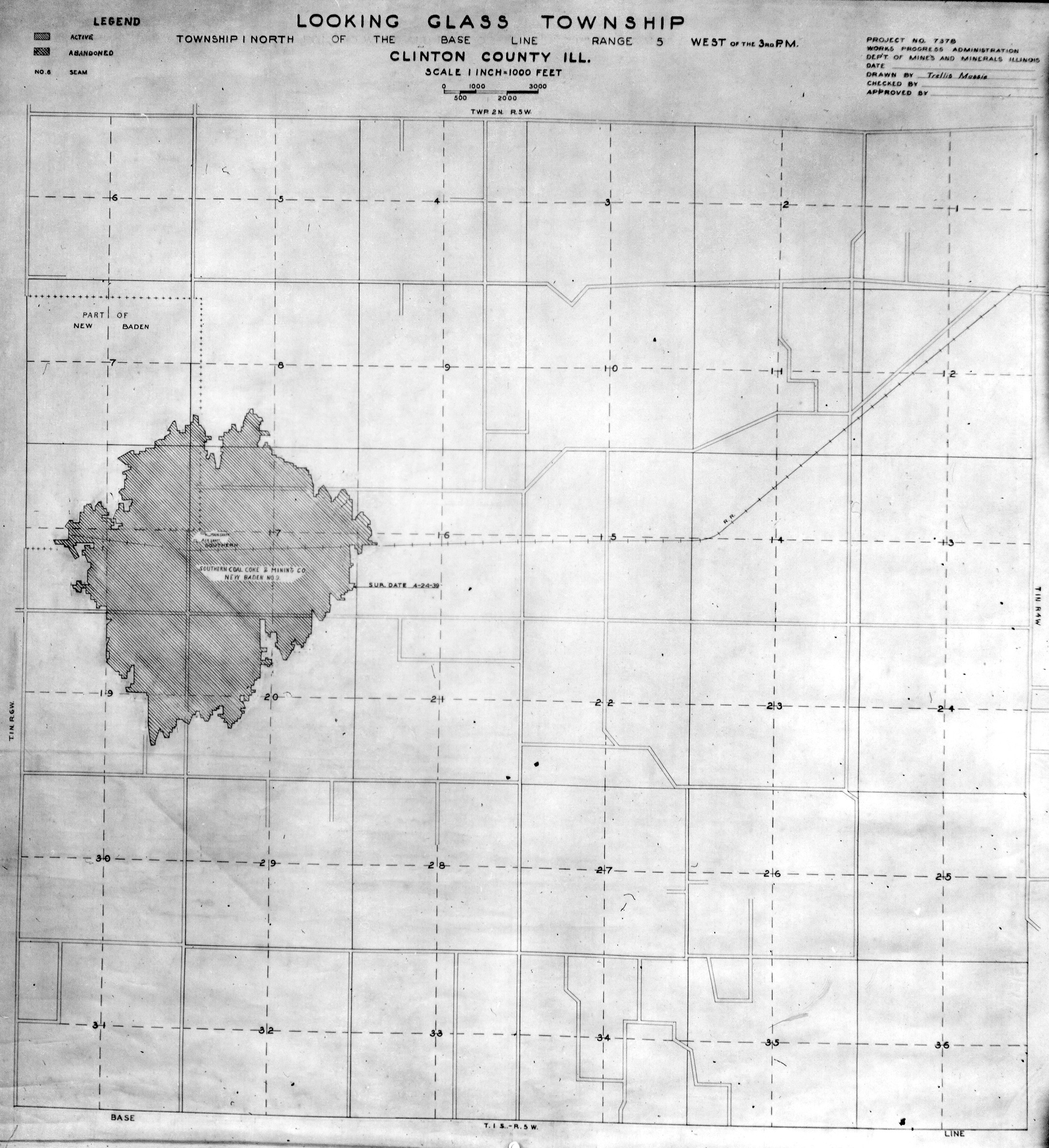
 | Clinton, T1N-R5W | Clinton | T1N-R5W | WPA CLINTON 1N5W.jpg |
 | Christian, T2N-R1W | Clinton | T2N-R1W | WPA CLINTON 2N1W.jpg |
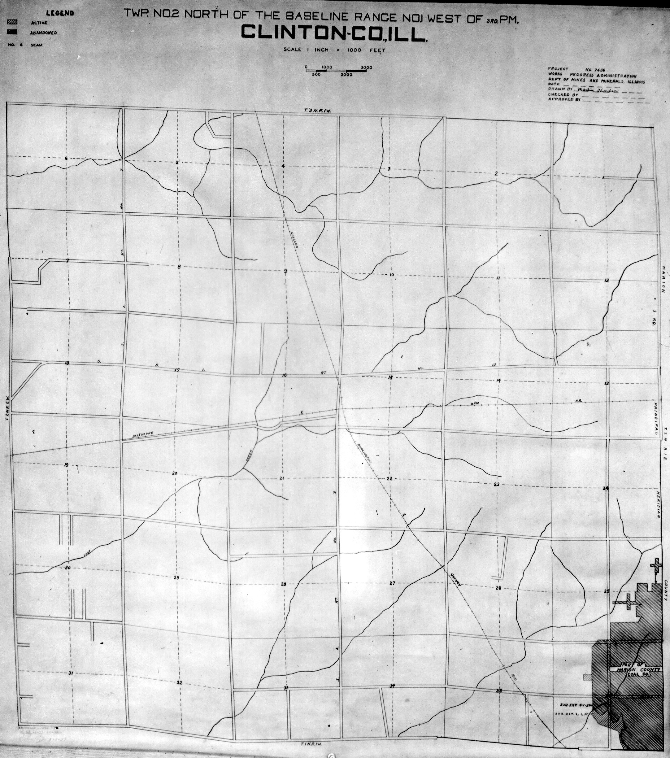
 | Clinton, T2N-R3W | Clinton | T2N-R3W | WPA CLINTON 2N3W.jpg |
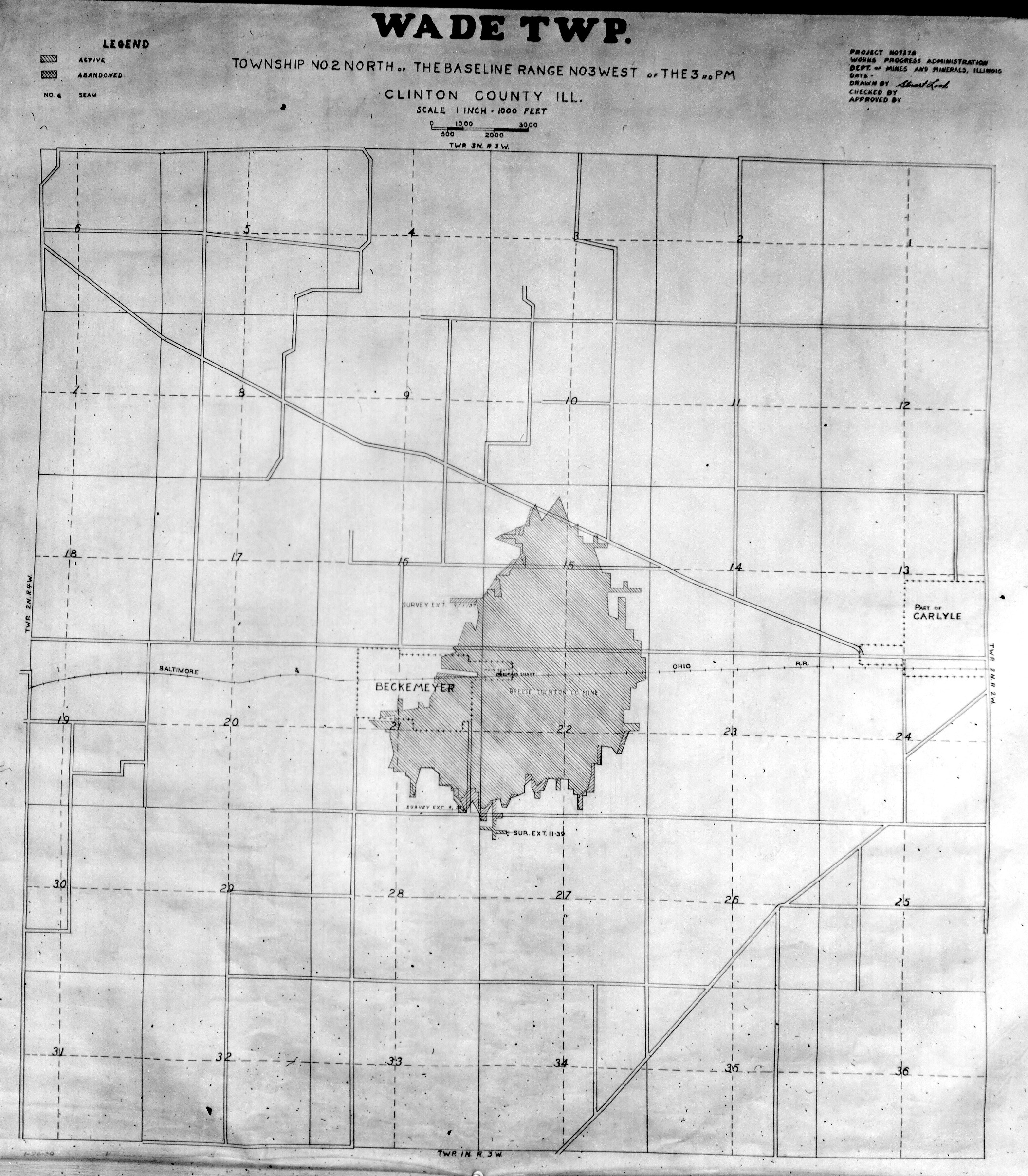
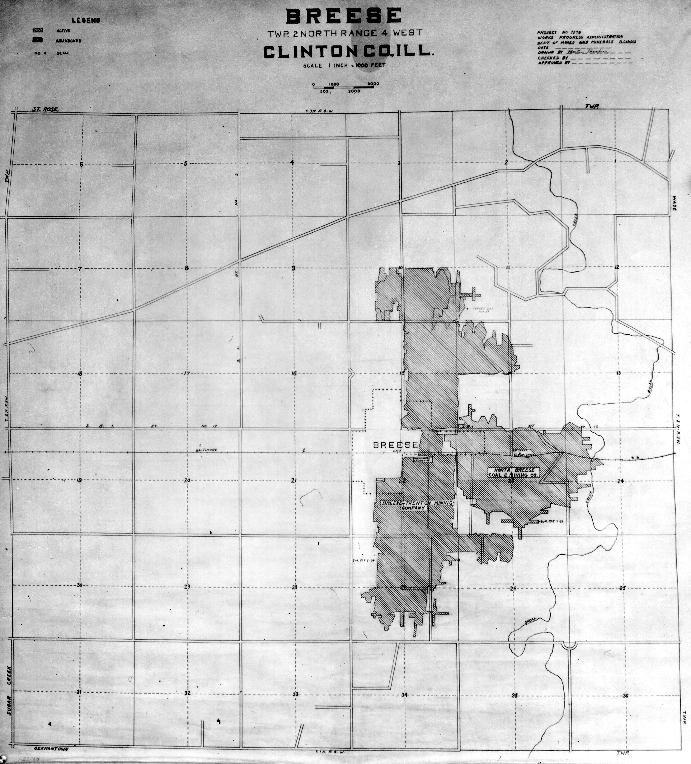
 | Clinton, T2N-R4W | Clinton | T2N-R4W | WPA CLINTON 2N4W.jpg |
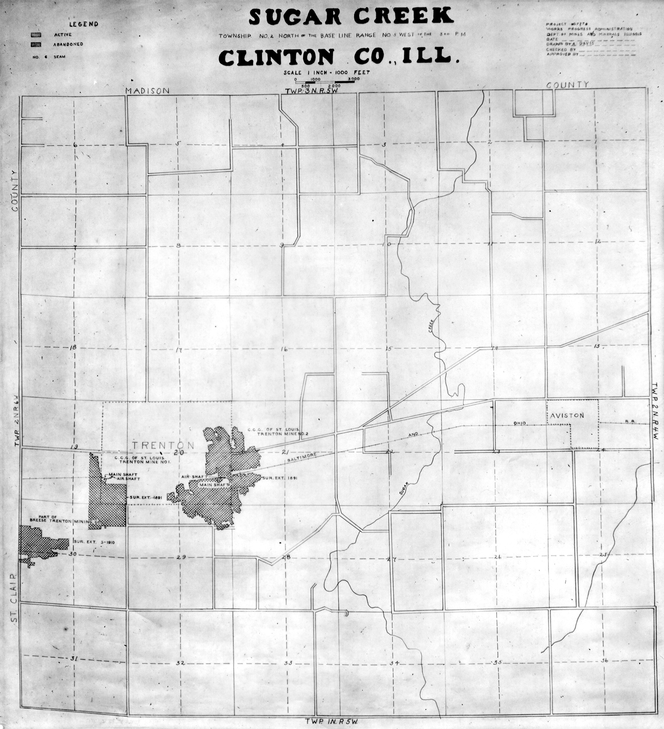
 | Clinton, T2N-R5W | Clinton | T2N-R5W | WPA CLINTON 2N5W.jpg |
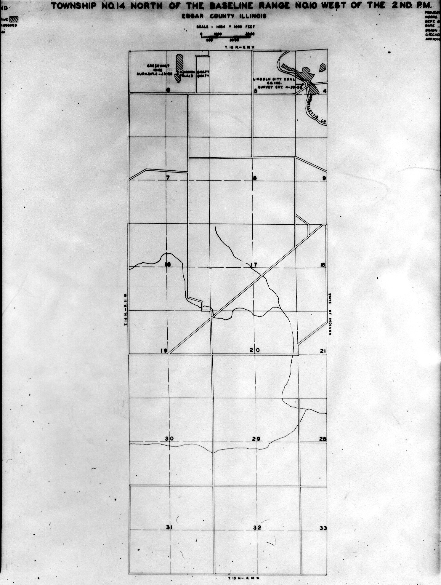
 | Edgar, T14N-R10W | Edgar | T14N-R10W | WPA EDGAR 14N10W.jpg |
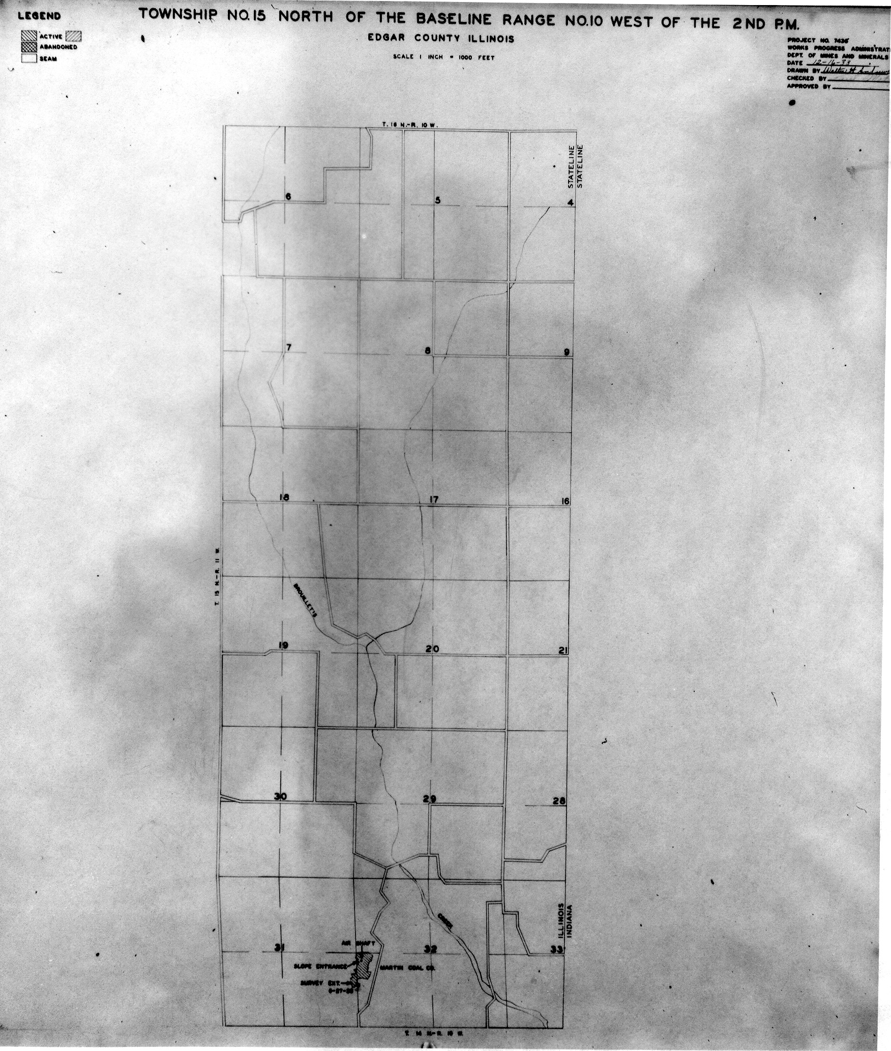
 | Edgar, T15N-R10W | Edgar | T15N-R10W | WPA EDGAR 15N10W.jpg |
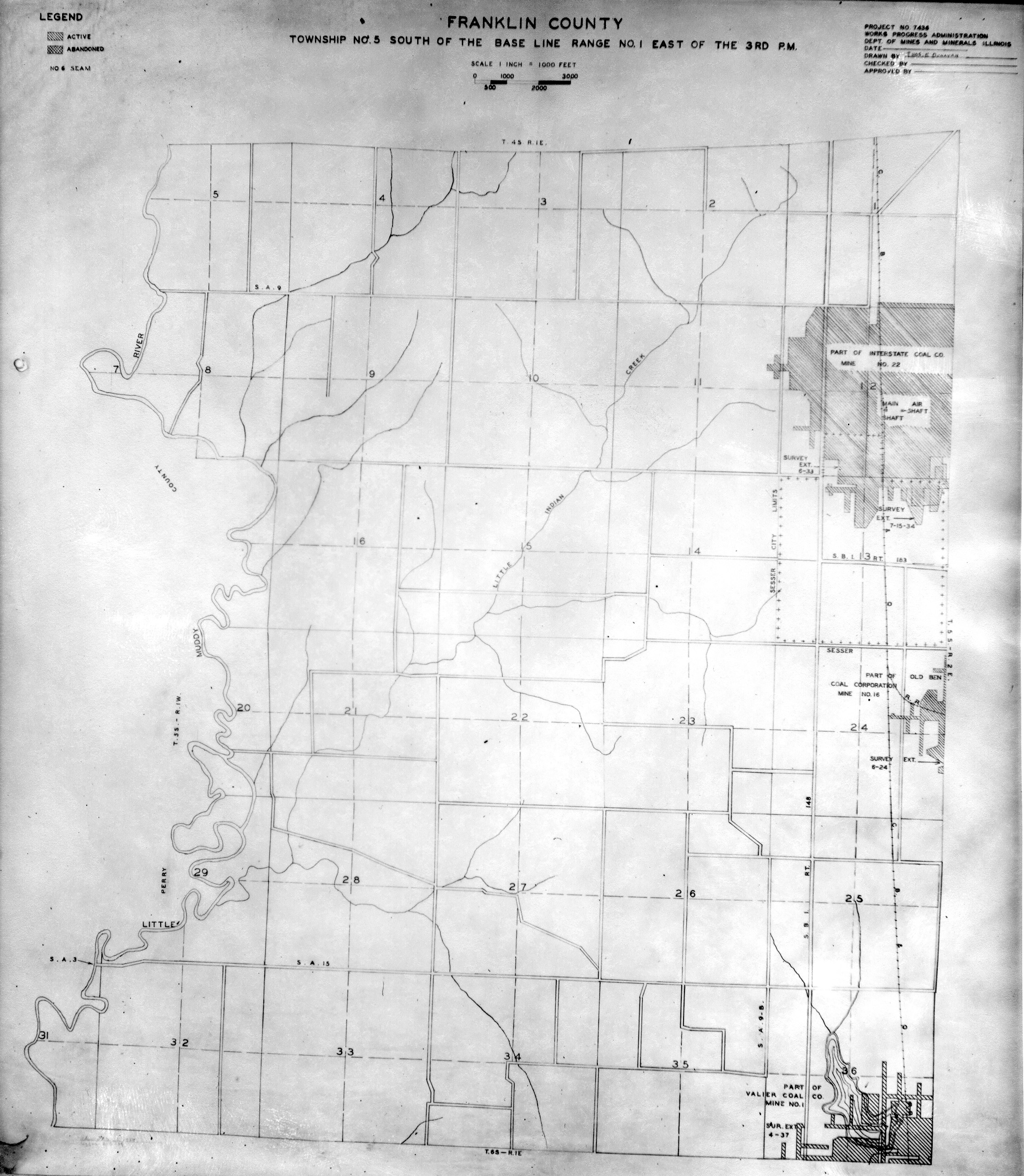
 | Franklin, T5S-R1E | Franklin | T5S-R1E | WPA FRANKLIN 5S1E.jpg |
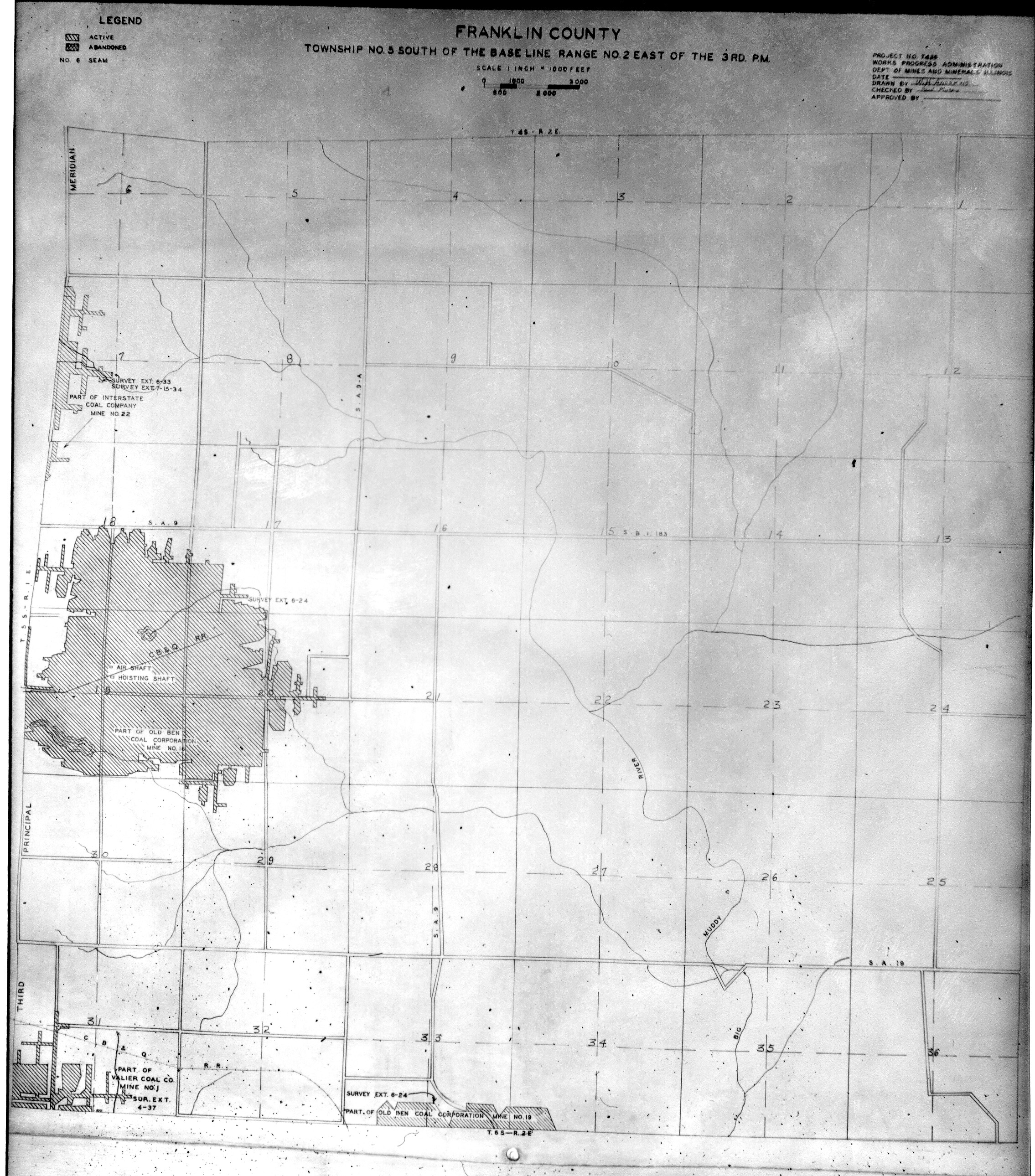
 | Franklin, T5S-R2E | Franklin | T5S-R2E | WPA FRANKLIN 5S2E.jpg |
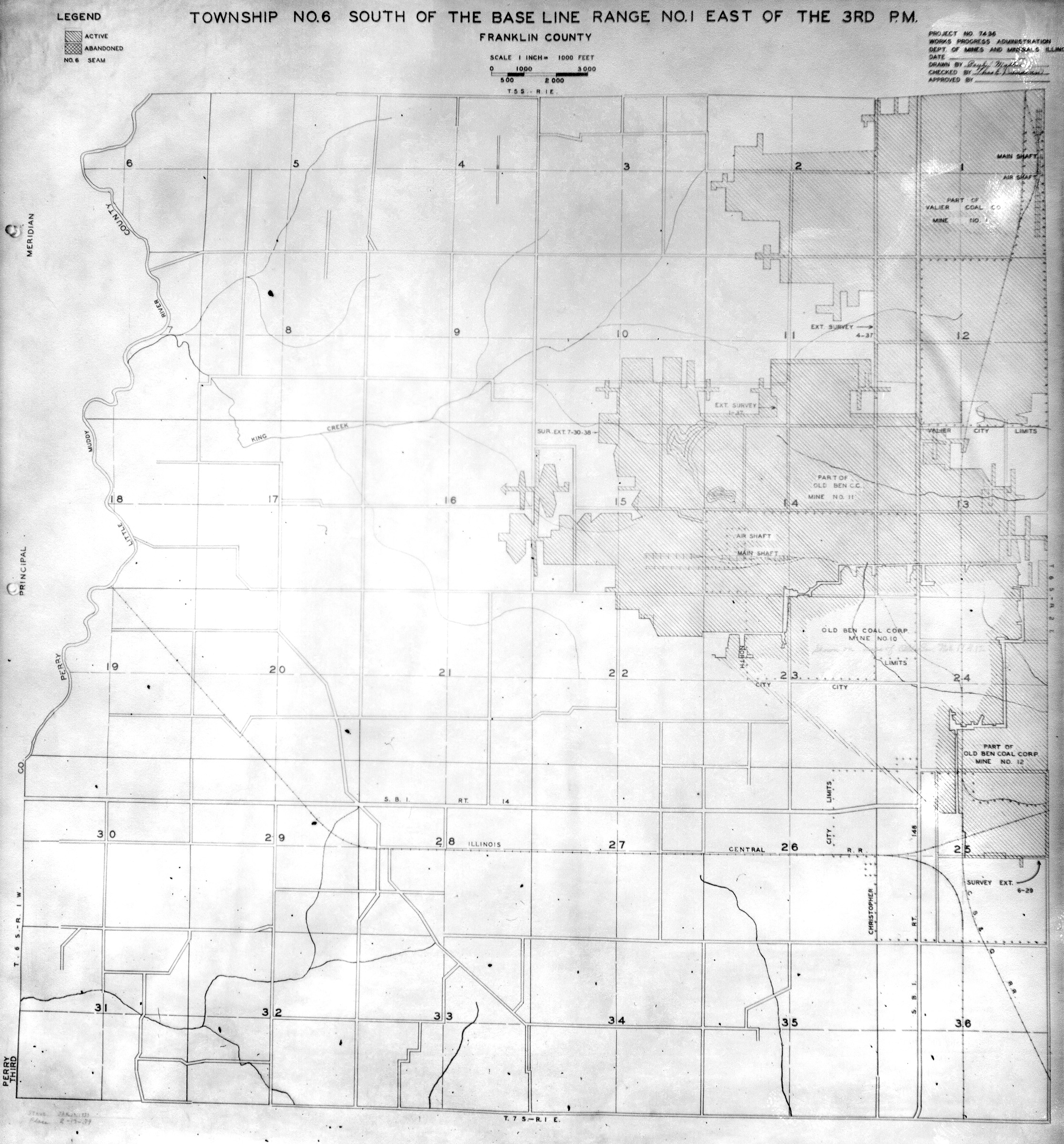
 | Franklin, T6S-R1E | Franklin | T6S-R1E | WPA FRANKLIN 6S1E.jpg |
 | Franklin, T6S-R2E | Franklin | T6S-R2E | WPA FRANKLIN 6S2E.jpg |
 | Franklin, T6S-R3E | Franklin | T6S-R3E | WPA FRANKLIN 6S3E.jpg |
 | Franklin, T7S-R2E | Franklin | T7S-R2E | WPA FRANKLIN 7S2E.jpg |
 | Franklin, T7S-R3E | Franklin | T7S-R3E | WPA FRANKLIN 7S3E.jpg |
 | Fulton, T3N-R3E | Fulton | T3N-R3E | WPA FULTON 3N3E.jpg |
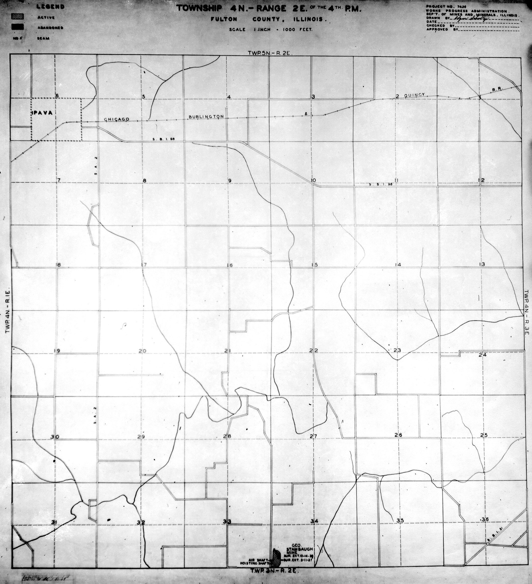
 | Fulton, T4N-R2E | Fulton | T4N-R2E | WPA FULTON 4N2E.jpg |
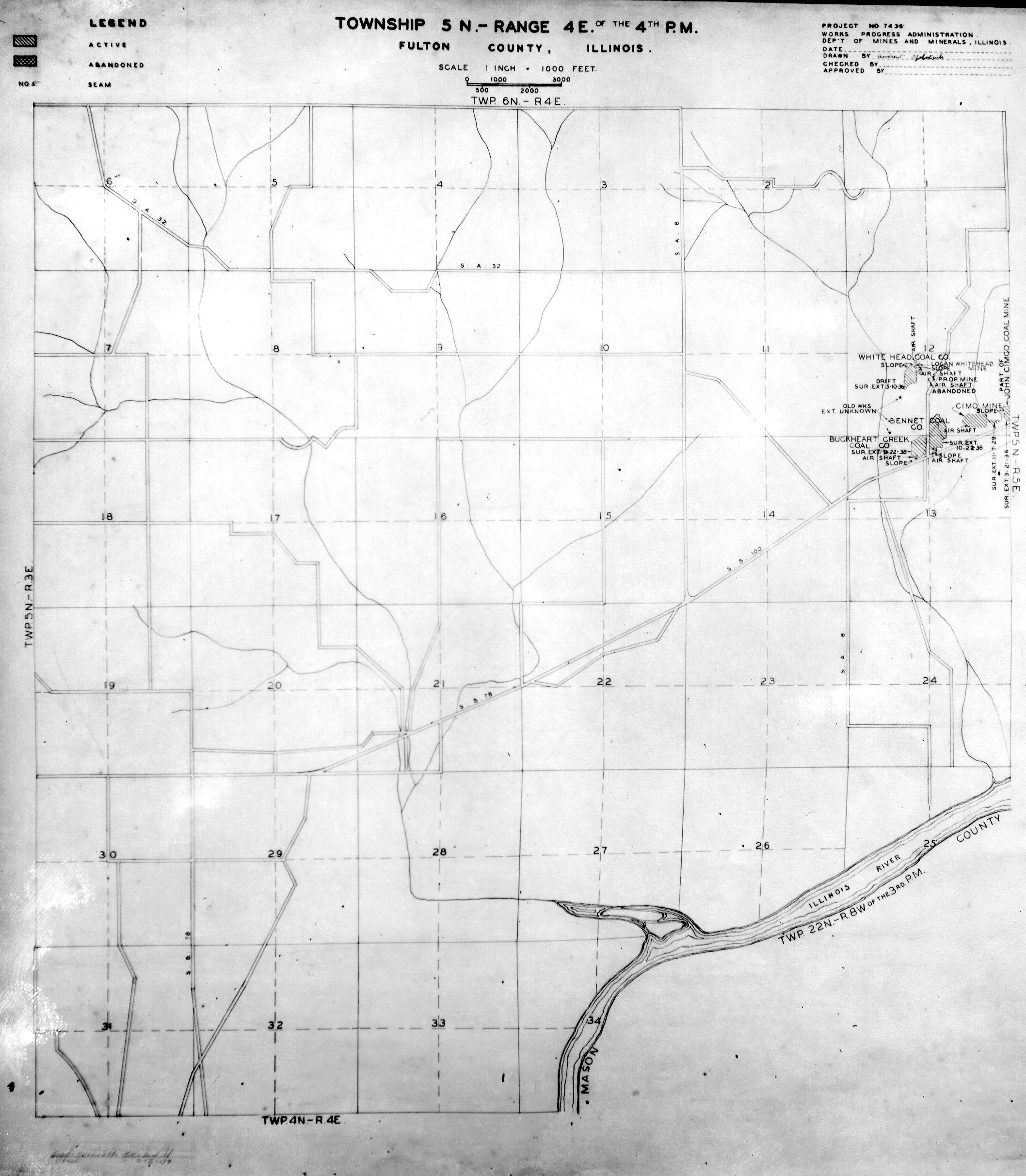
 | Fulton, T5N-R4E | Fulton | T5N-R4E | WPA FULTON 5N4E.jpg |
 | Fulton, T5N-R5E | Fulton | T5N-R5E | WPA FULTON 5N5E.jpg |
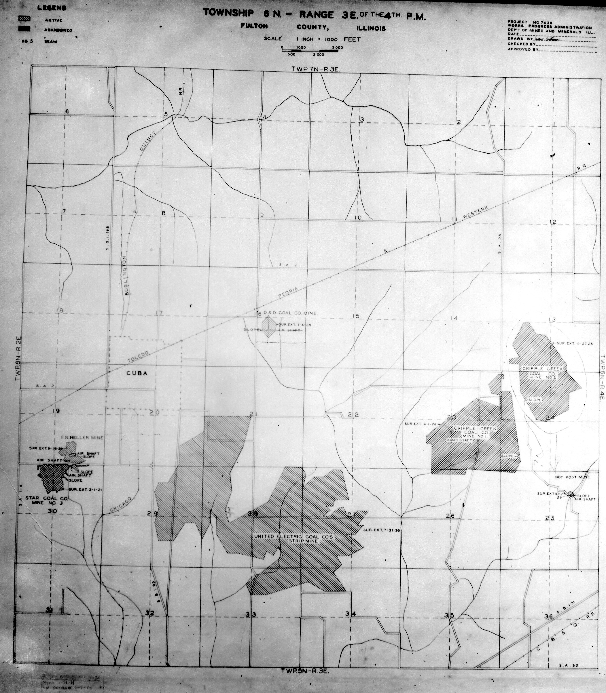
 | Fulton, T6N-R3E | Fulton | T6N-R3E | WPA FULTON 6N3E.jpg |
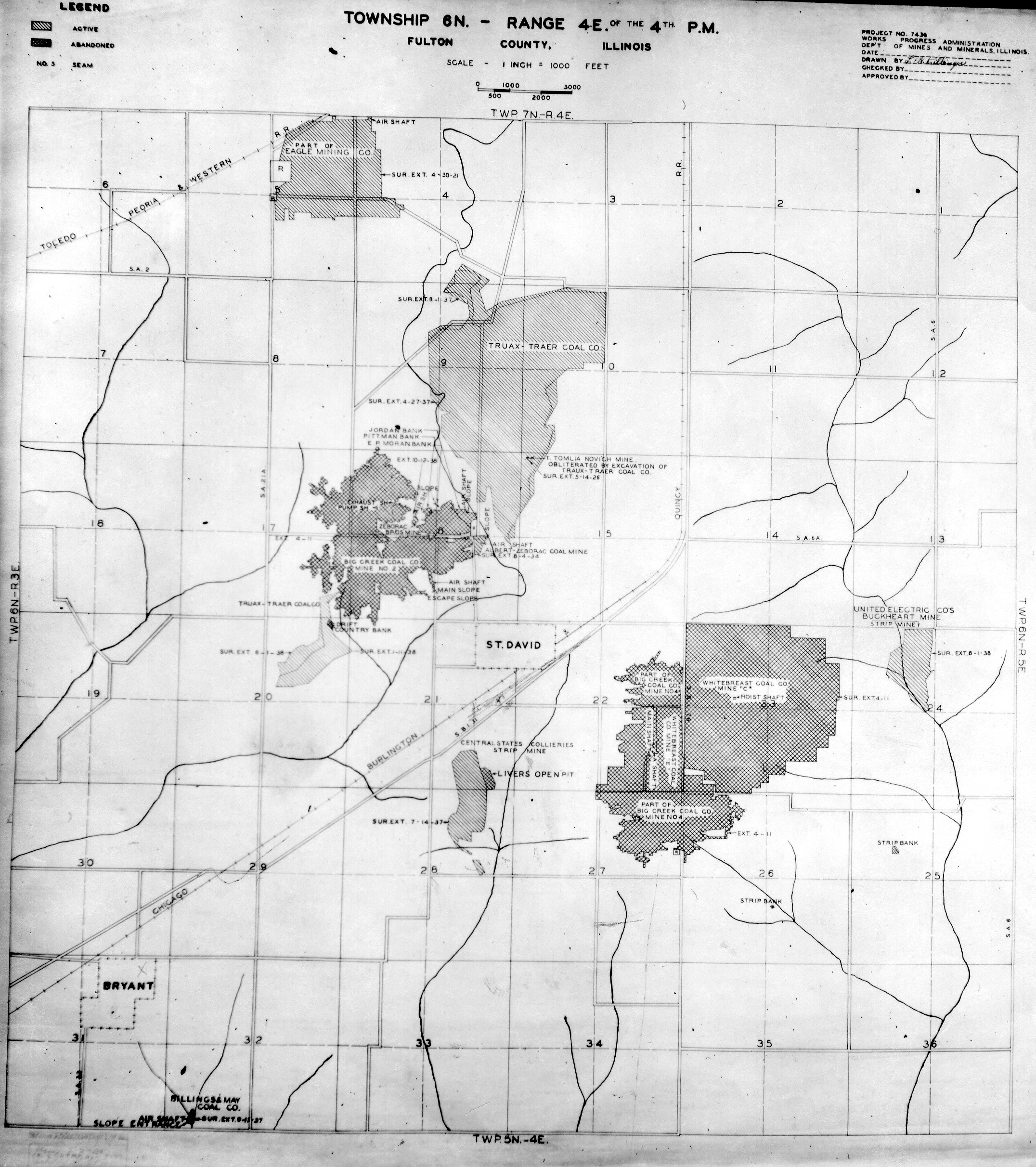
 | Fulton, T6N-R4E | Fulton | T6N-R4E | WPA FULTON 6N4E.jpg |
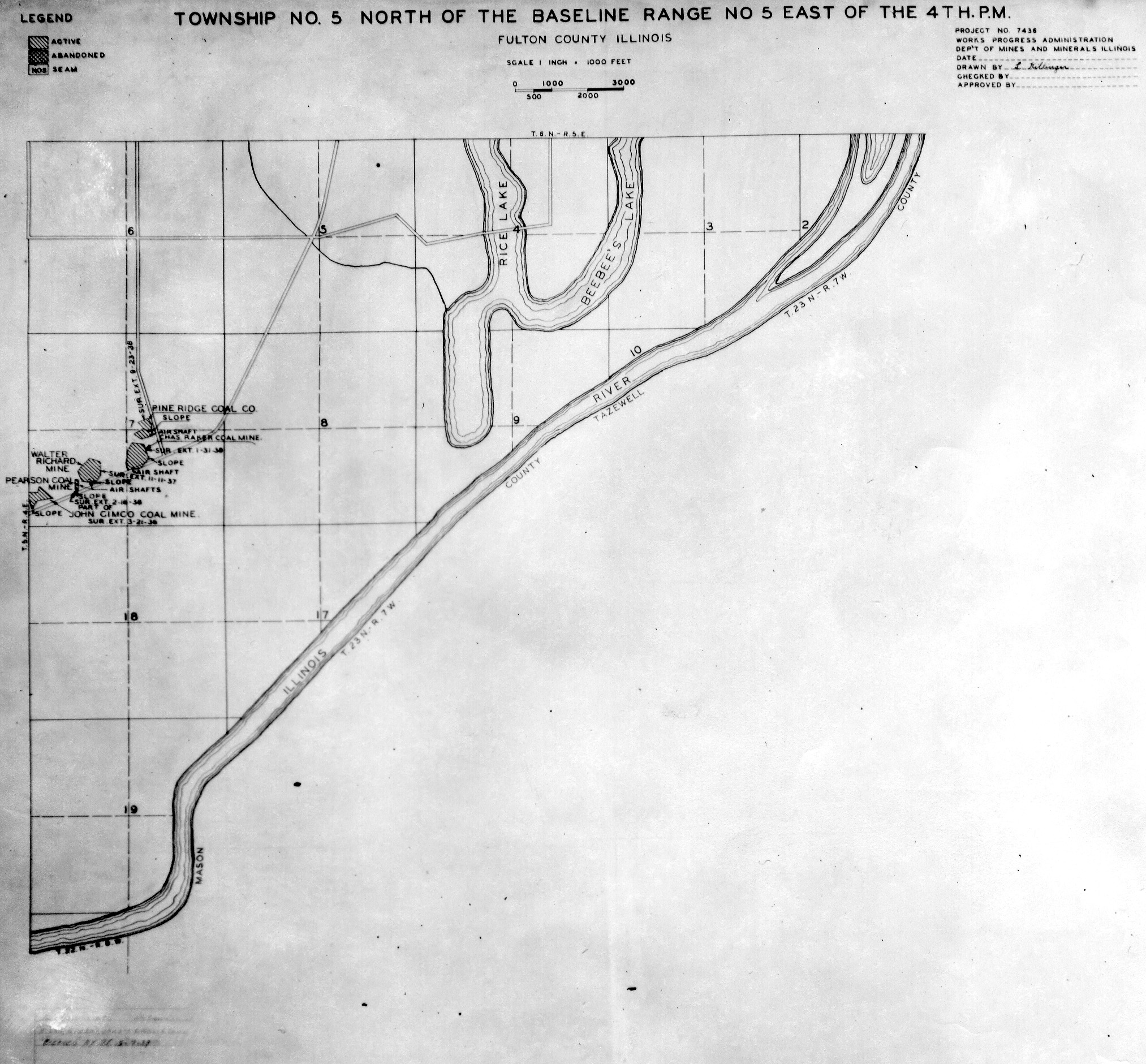
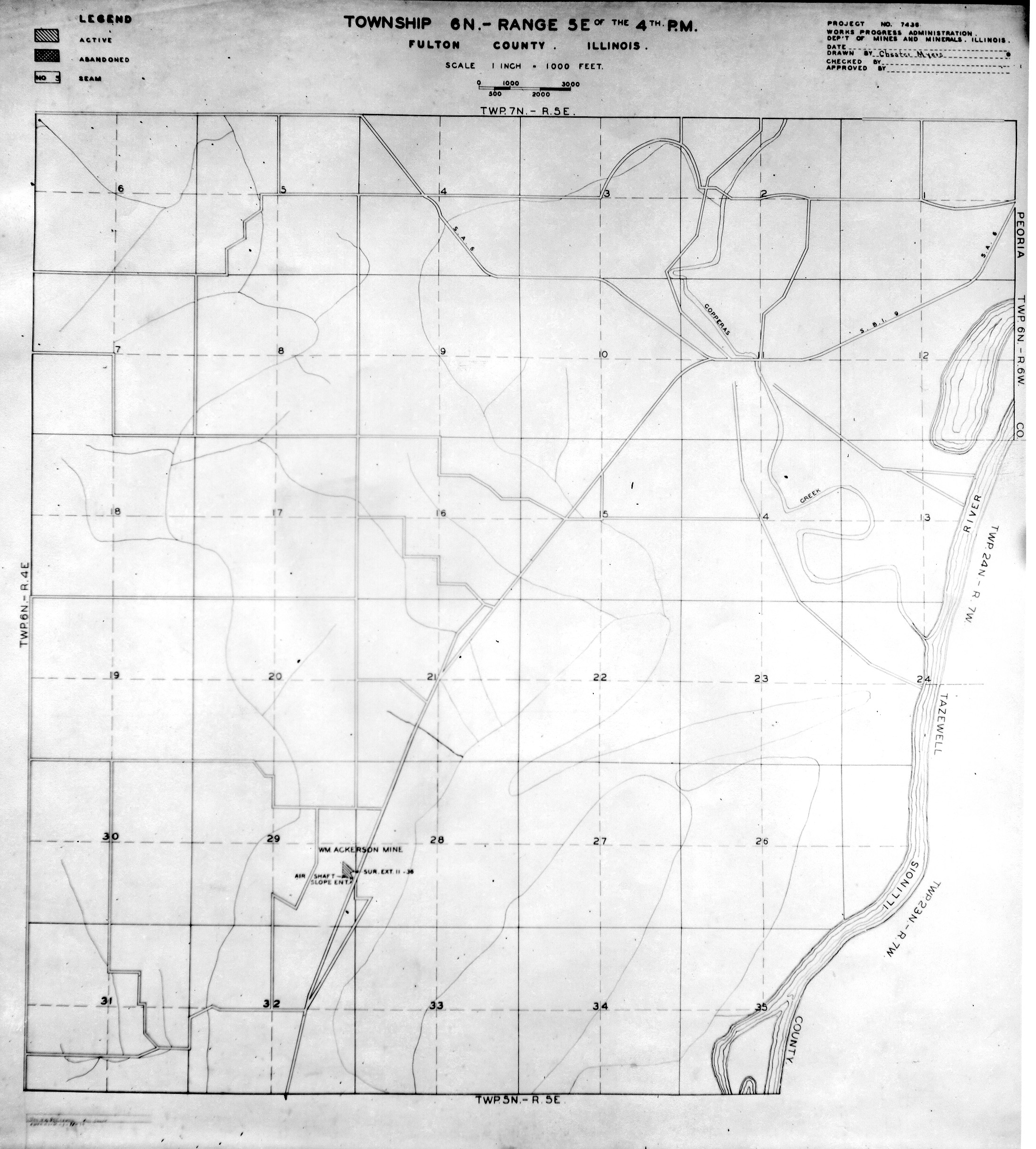
 | Fulton, T6N-R5E | Fulton | T6N-R5E | WPA FULTON 6N5E.jpg |
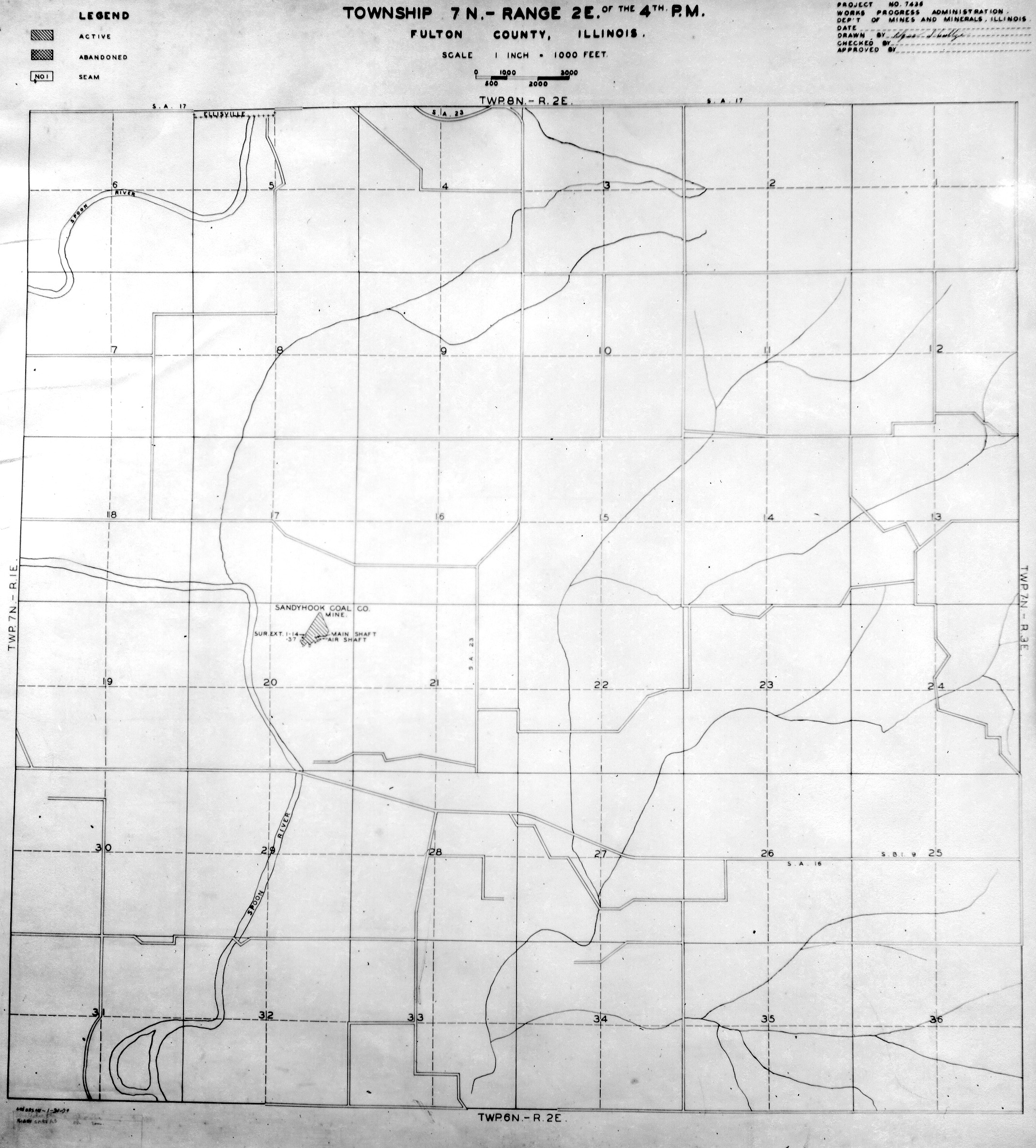
 | Fulton, T7N-R2E | Fulton | T7N-R2E | WPA FULTON 7N2E.jpg |
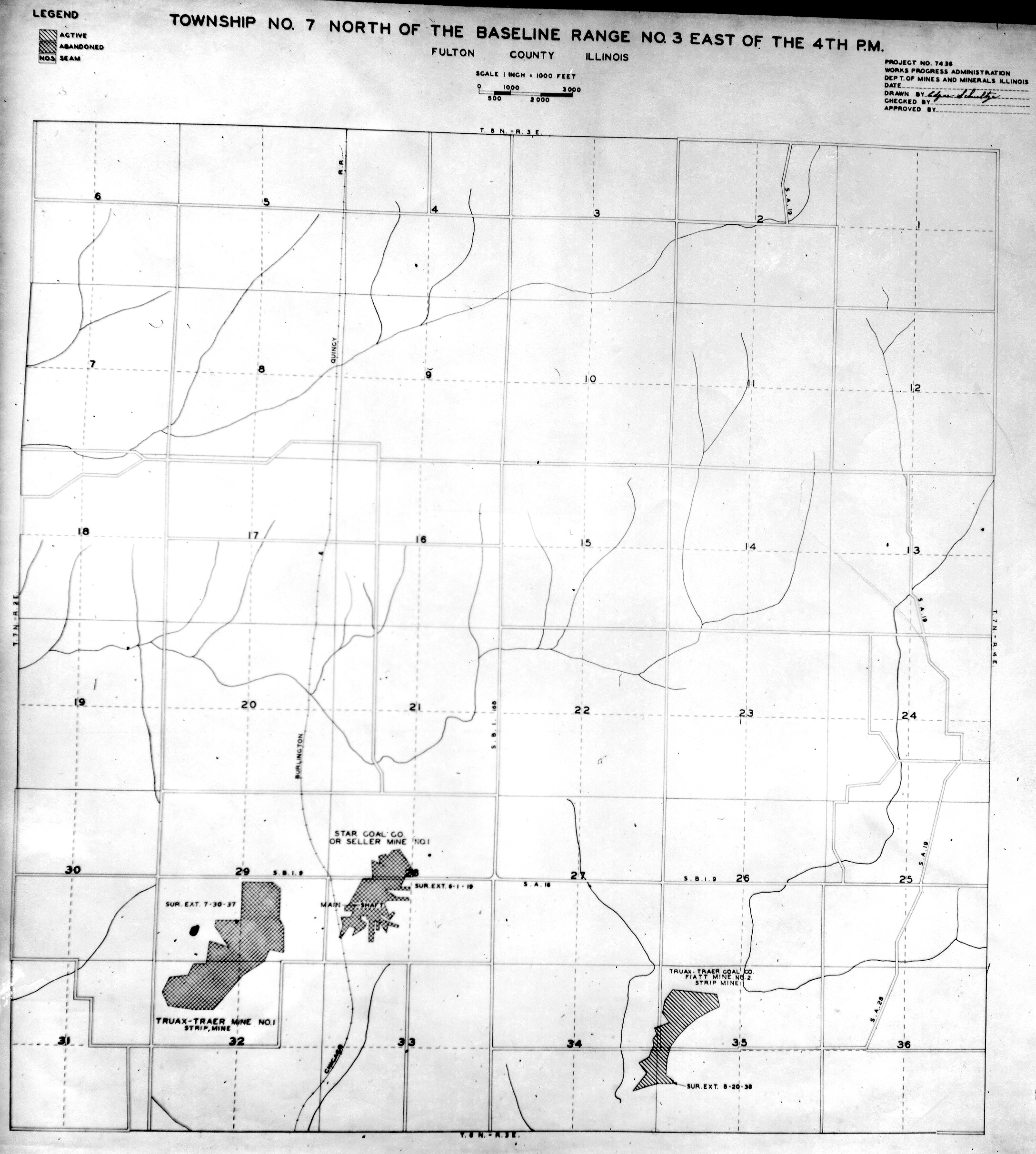
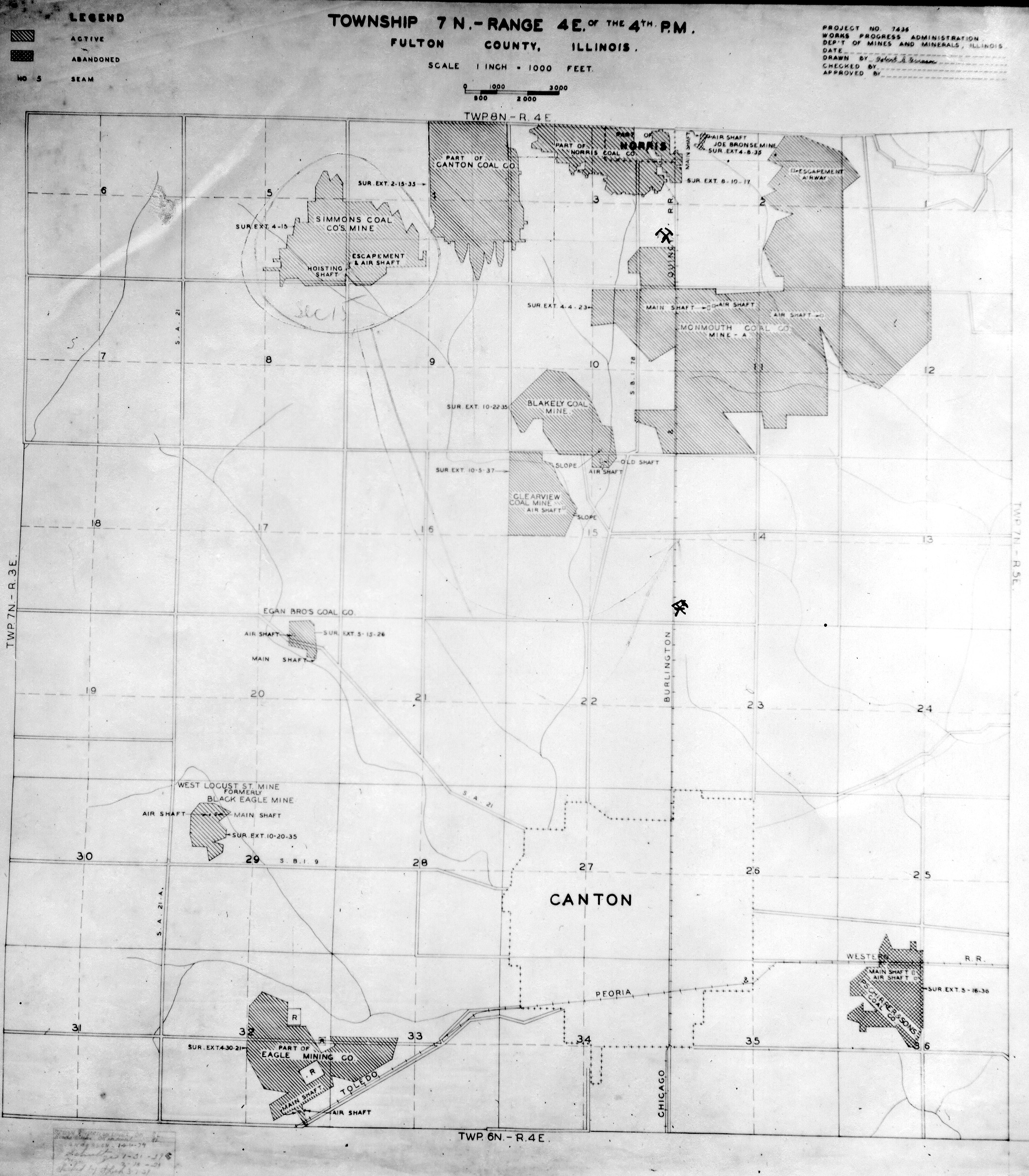
 | Fulton, T7N-R3E | Fulton | T7N-R3E | WPA FULTON 7N3E.jpg |
 | Fulton, T7N-R4E | Fulton | T7N-R4E | WPA FULTON 7N4E.jpg |
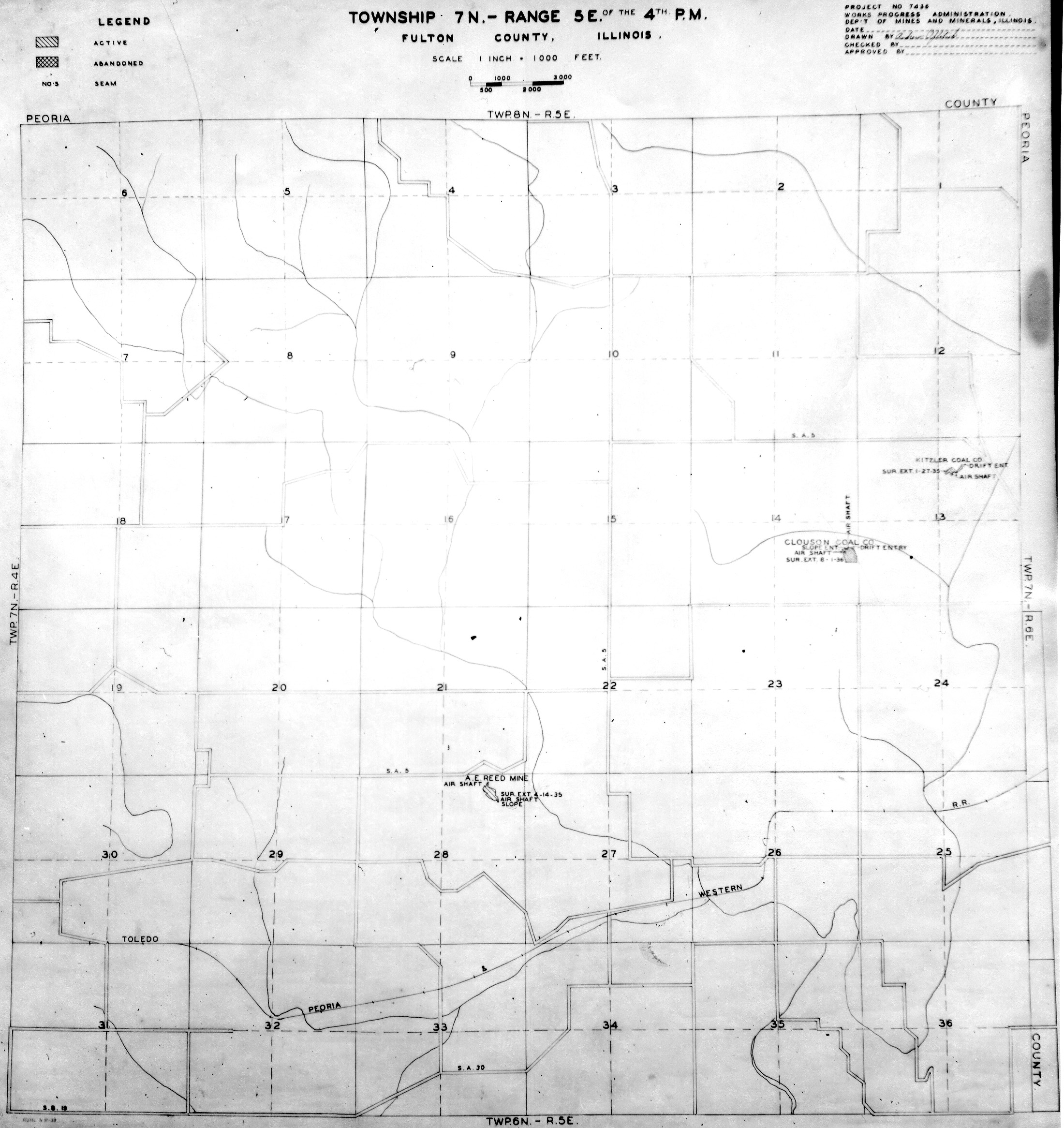
 | Fulton, T7N-R5E | Fulton | T7N-R5E | WPA FULTON 7N5E.jpg |
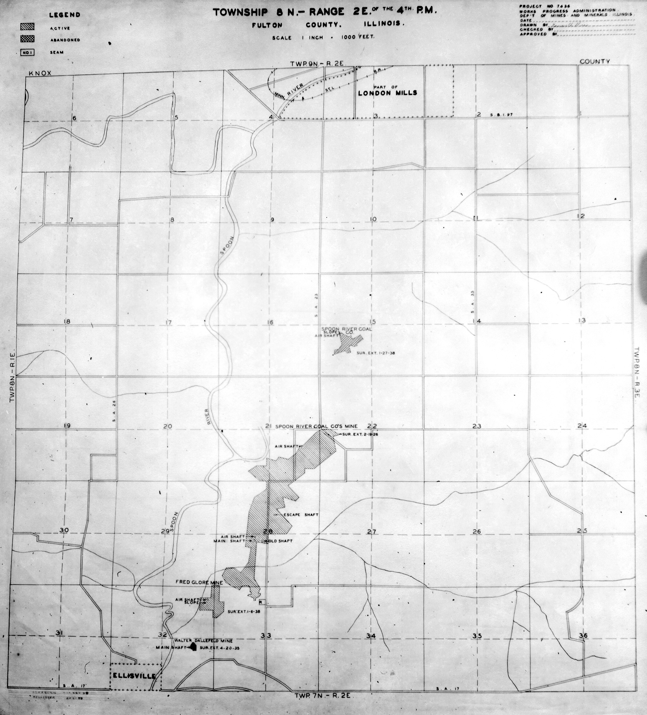
 | Fulton, T8N-R2E | Fulton | T8N-R2E | WPA FULTON 8N2E.jpg |
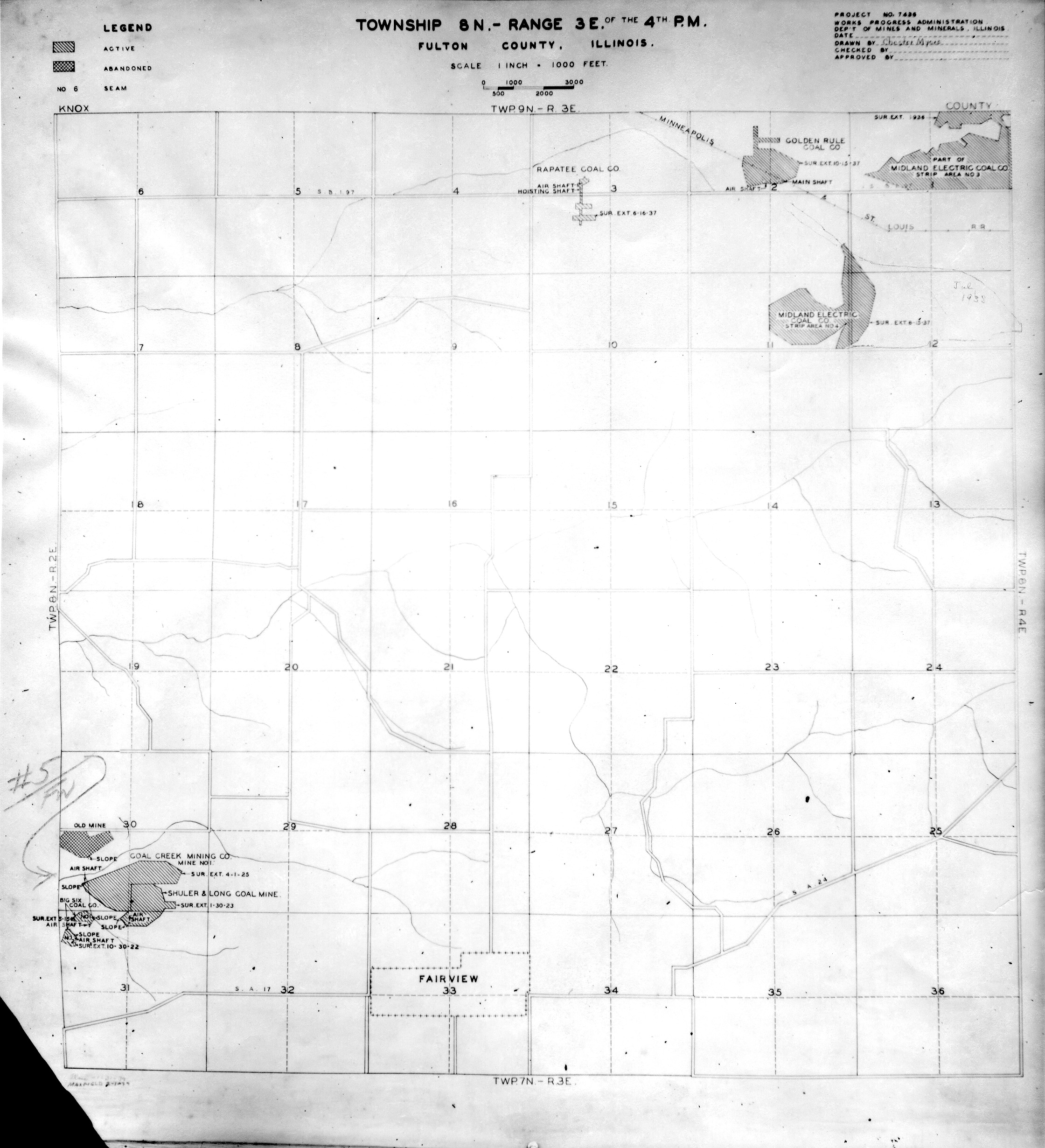
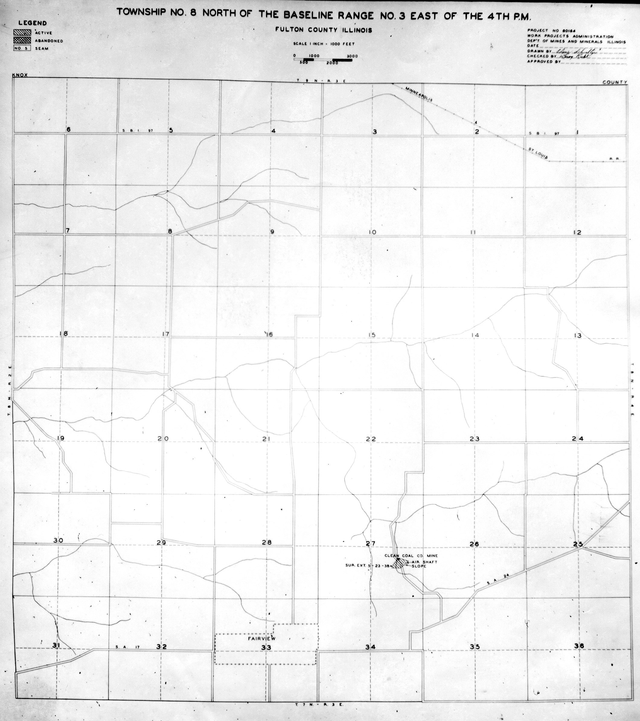
 | Fulton, T8N-R3E No.1 | Fulton | T8N-R3E | WPA FULTON 8N3E NO 1.jpg |
 | Fulton, T8N-R3E No.2 | Fulton | T8N-R3E | WPA FULTON 8N3E NO 2.jpg |
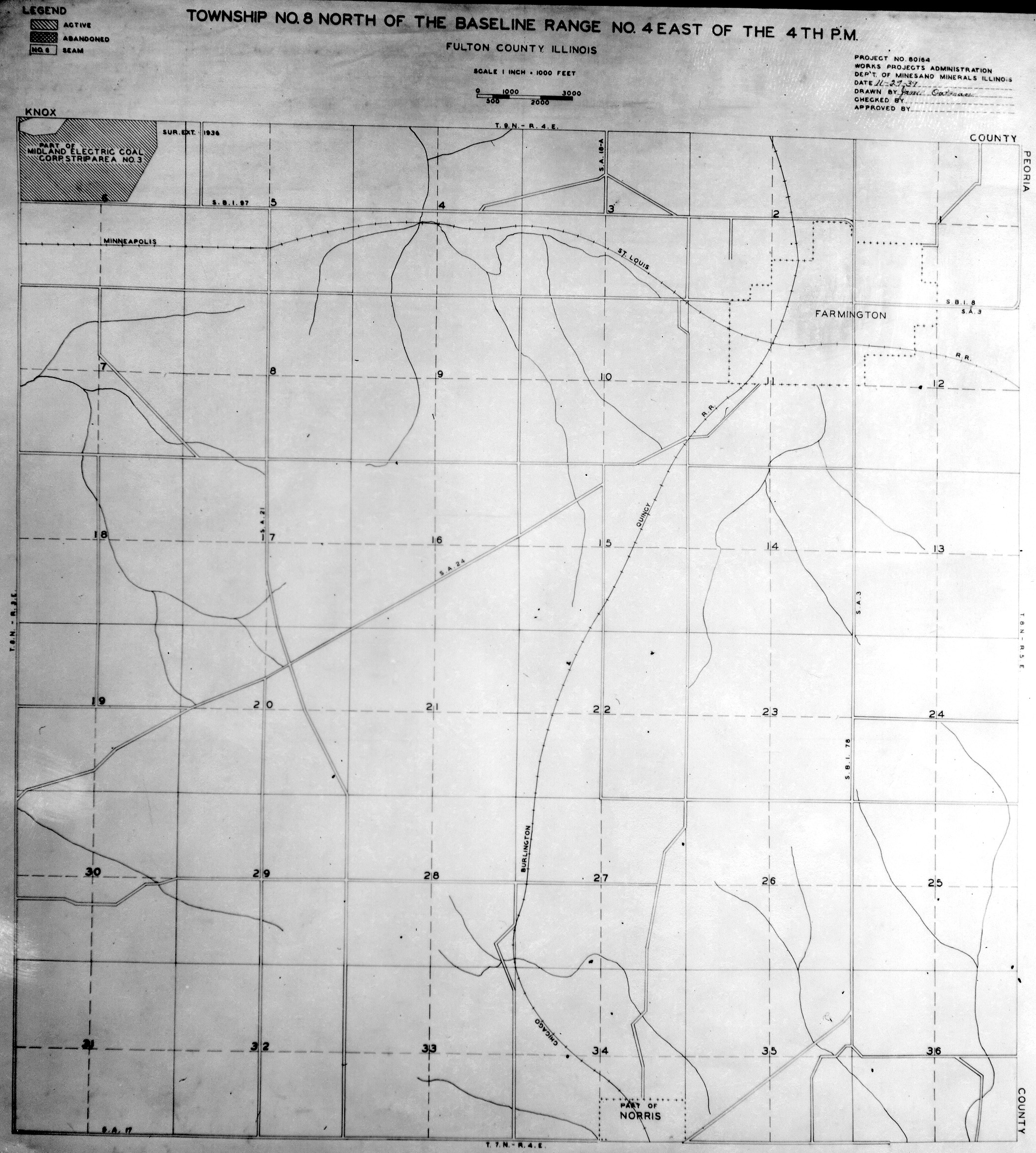
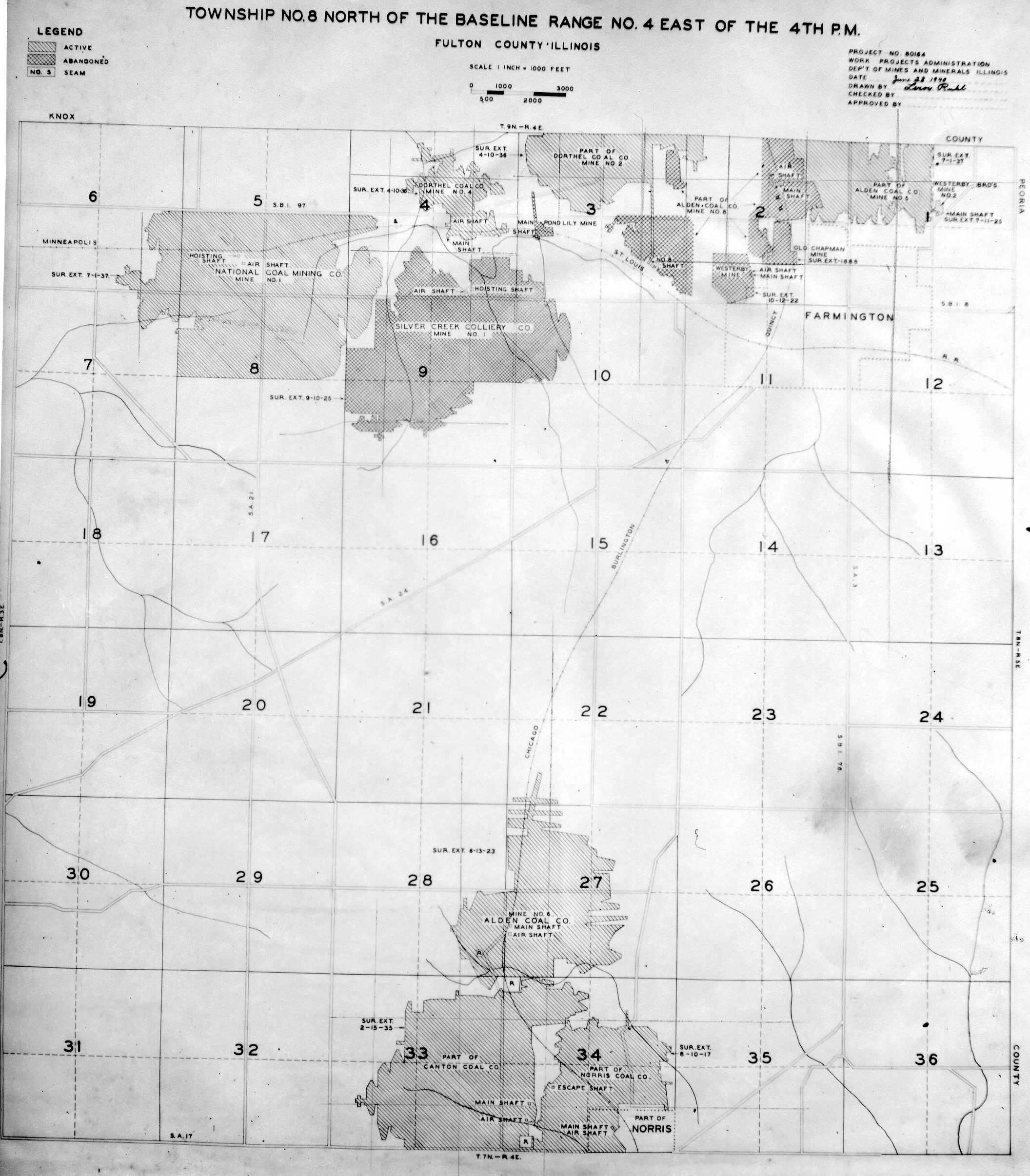
 | Fulton, T8N-R4E No.1 | Fulton | T8N-R4E | WPA FULTON 8N4E NO 1.jpg |
 | Fulton, T8N-R4E No.2 | Fulton | T8N-R4E | WPA FULTON 8N4E NO 2.jpg |
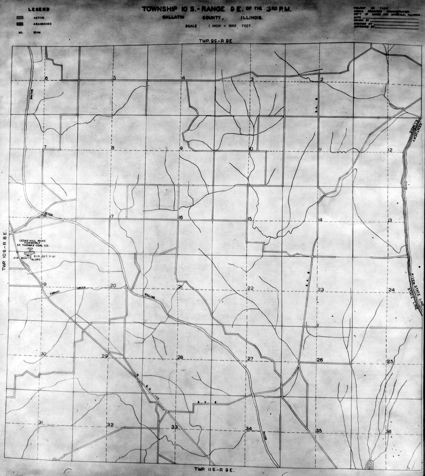
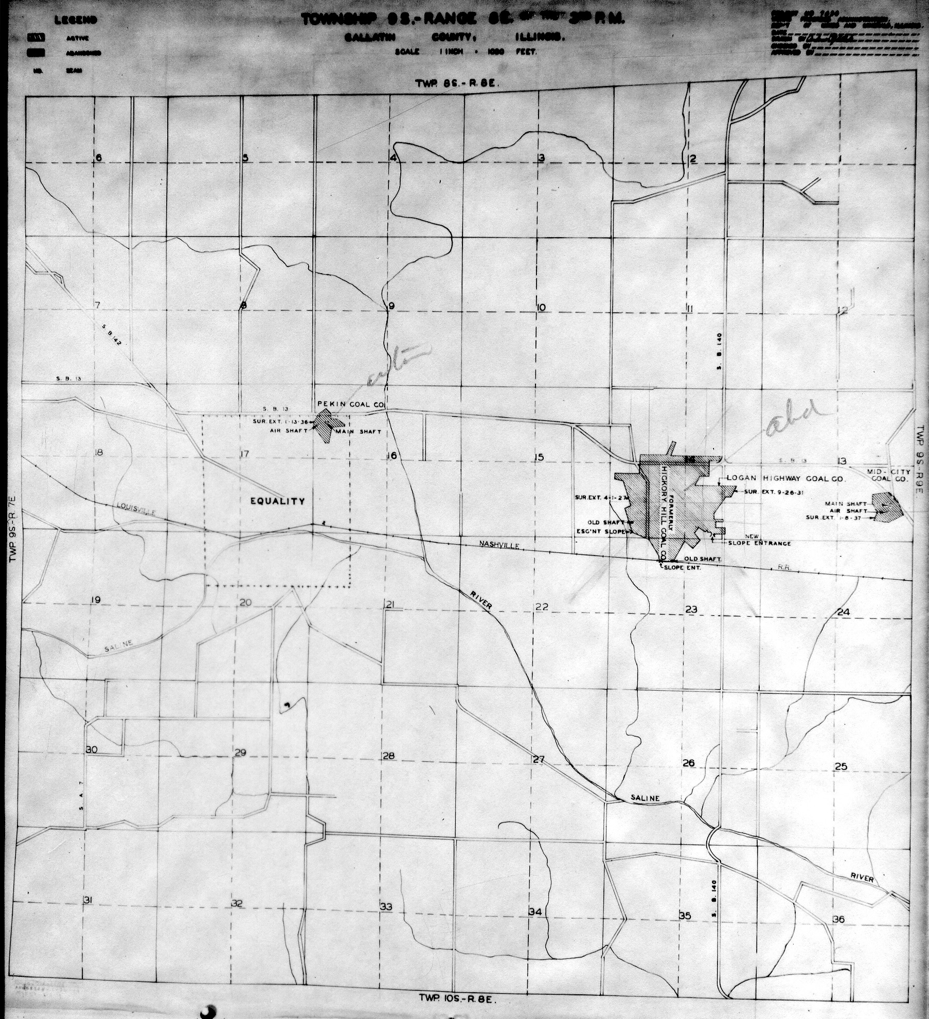
 | Gallatin, T10S-R9E | Gallatin | T10S-R9E | WPA GALLATIN 10S9E.jpg |
 | Gallatin, T9S-R8E | Gallatin | T9S-R8E | WPA GALLATIN 9S8E.jpg |
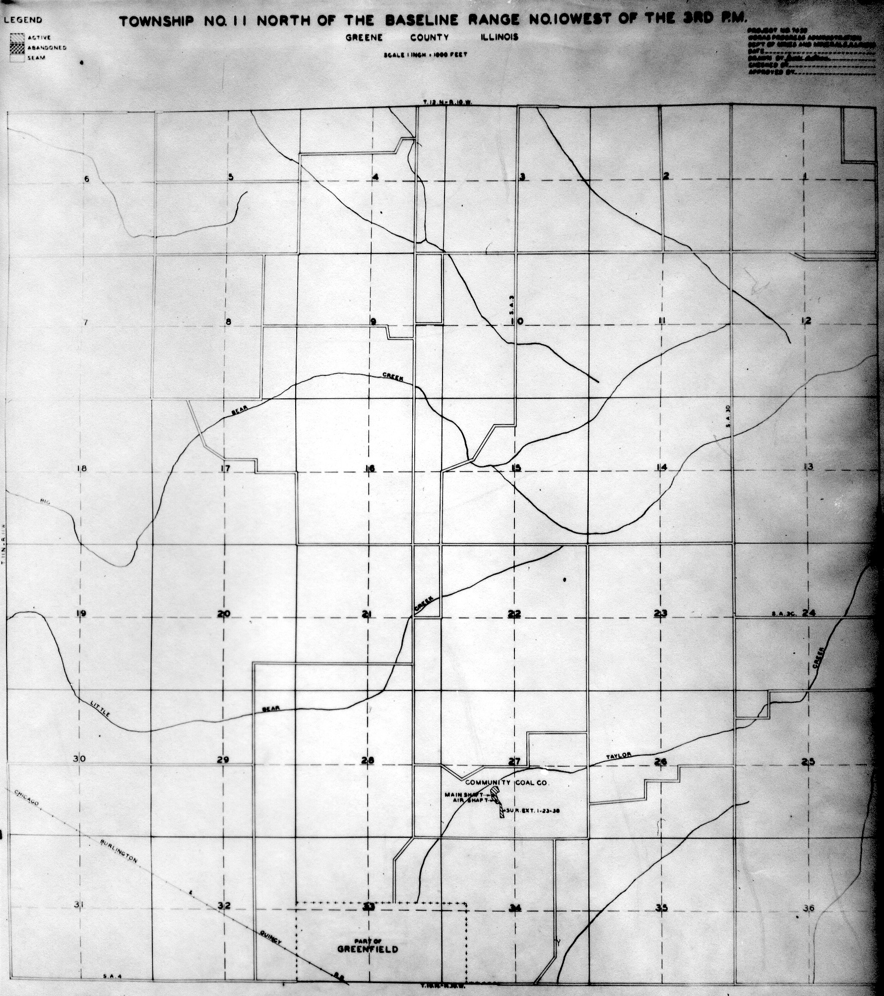
 | Greene, T11N-R10W | Greene | T11N-R10W | WPA GREENE 11N10W.jpg |
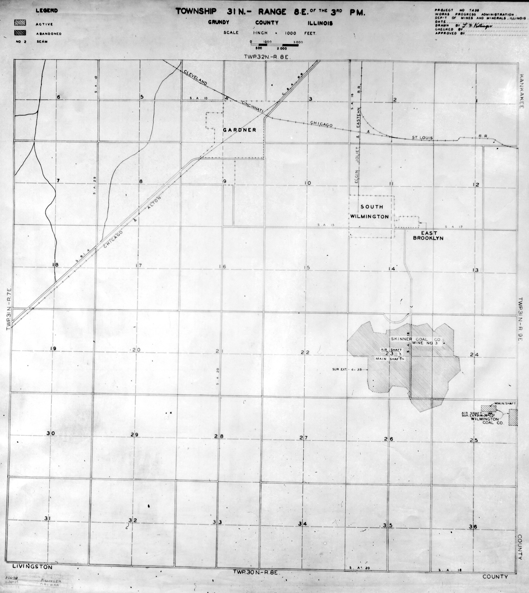
 | Grundy, T31N-R8E | Grundy | T31N-R8E | WPA GRUNDY 31N8E.jpg |
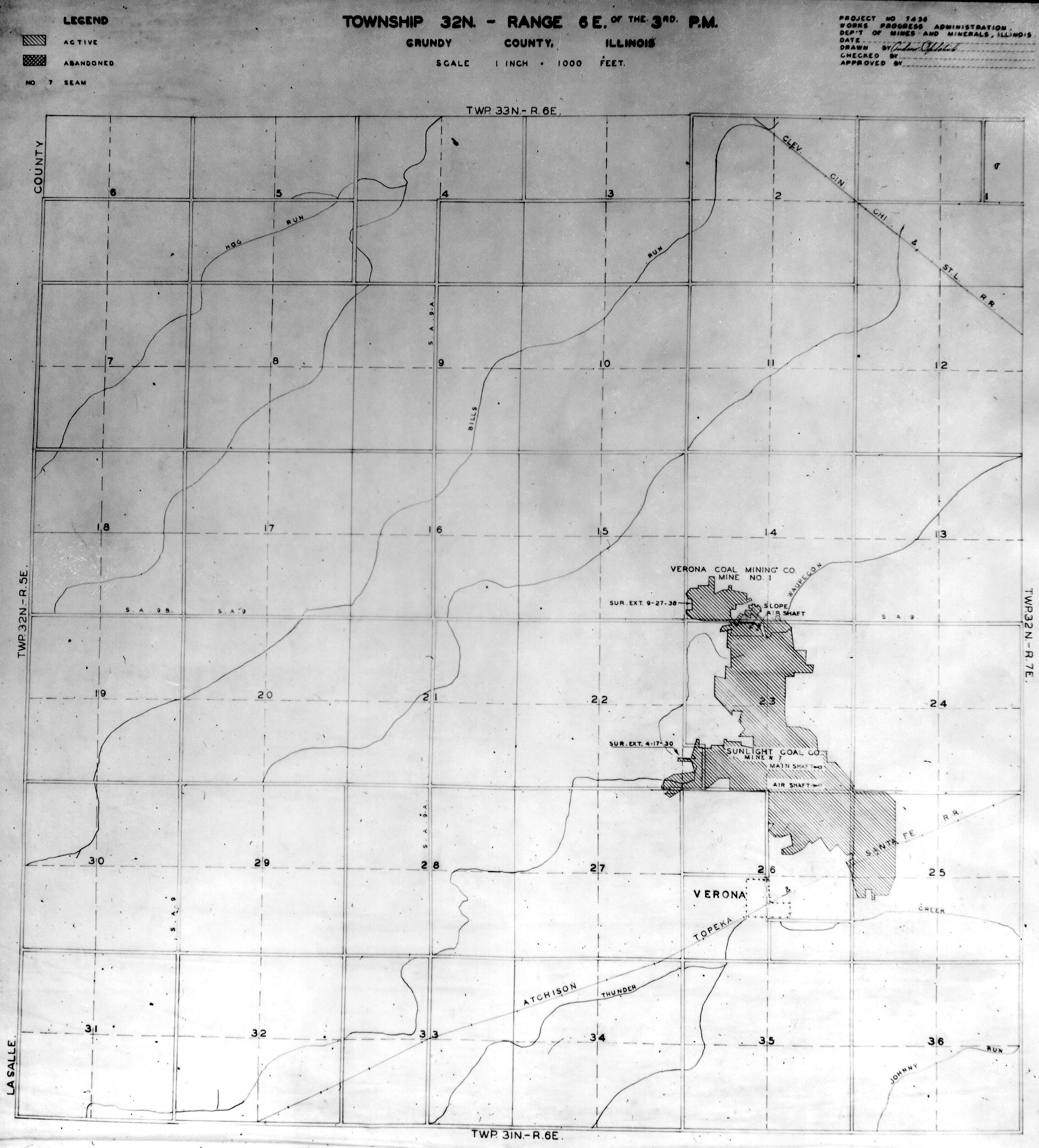
 | Grundy, T32N-R6E | Grundy | T32N-R6E | WPA GRUNDY 32N6E.jpg |
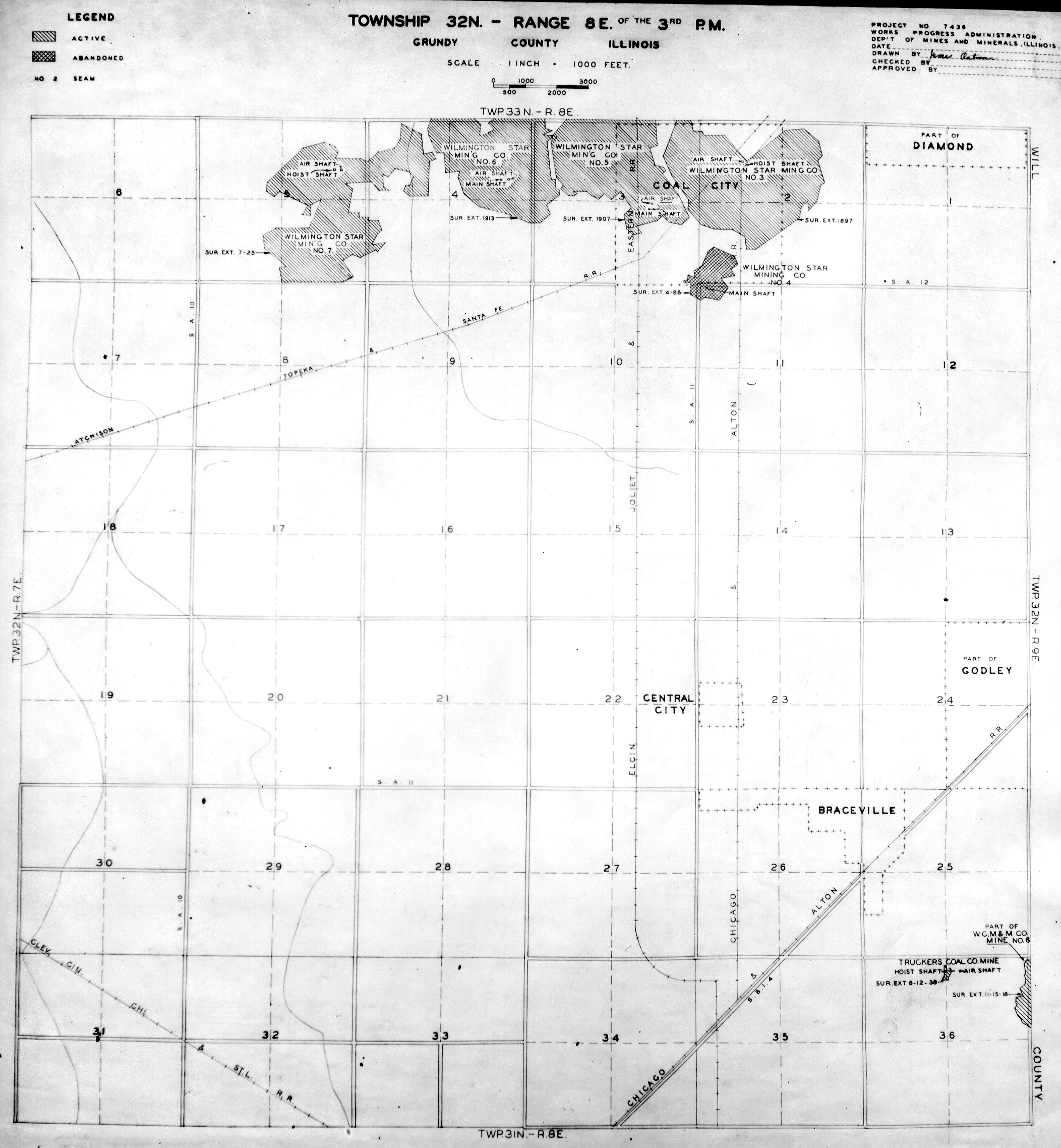
 | Grundy, T32N-R8E | Grundy | T32N-R8E | WPA GRUNDY 32N8E.jpg |
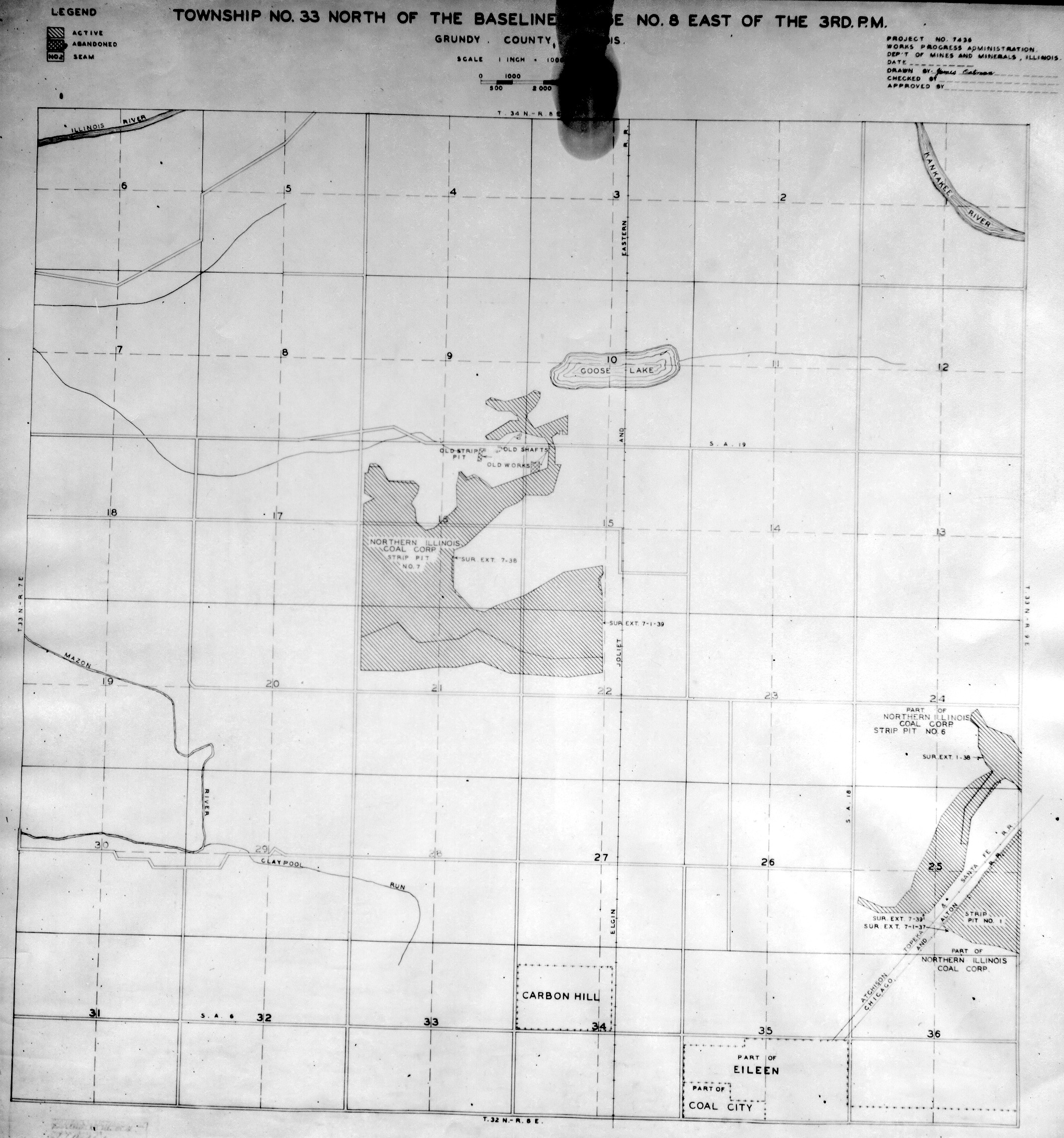
 | Grundy, T33N-R8E | Grundy | T33N-R8E | WPA GRUNDY 33N8E.jpg |
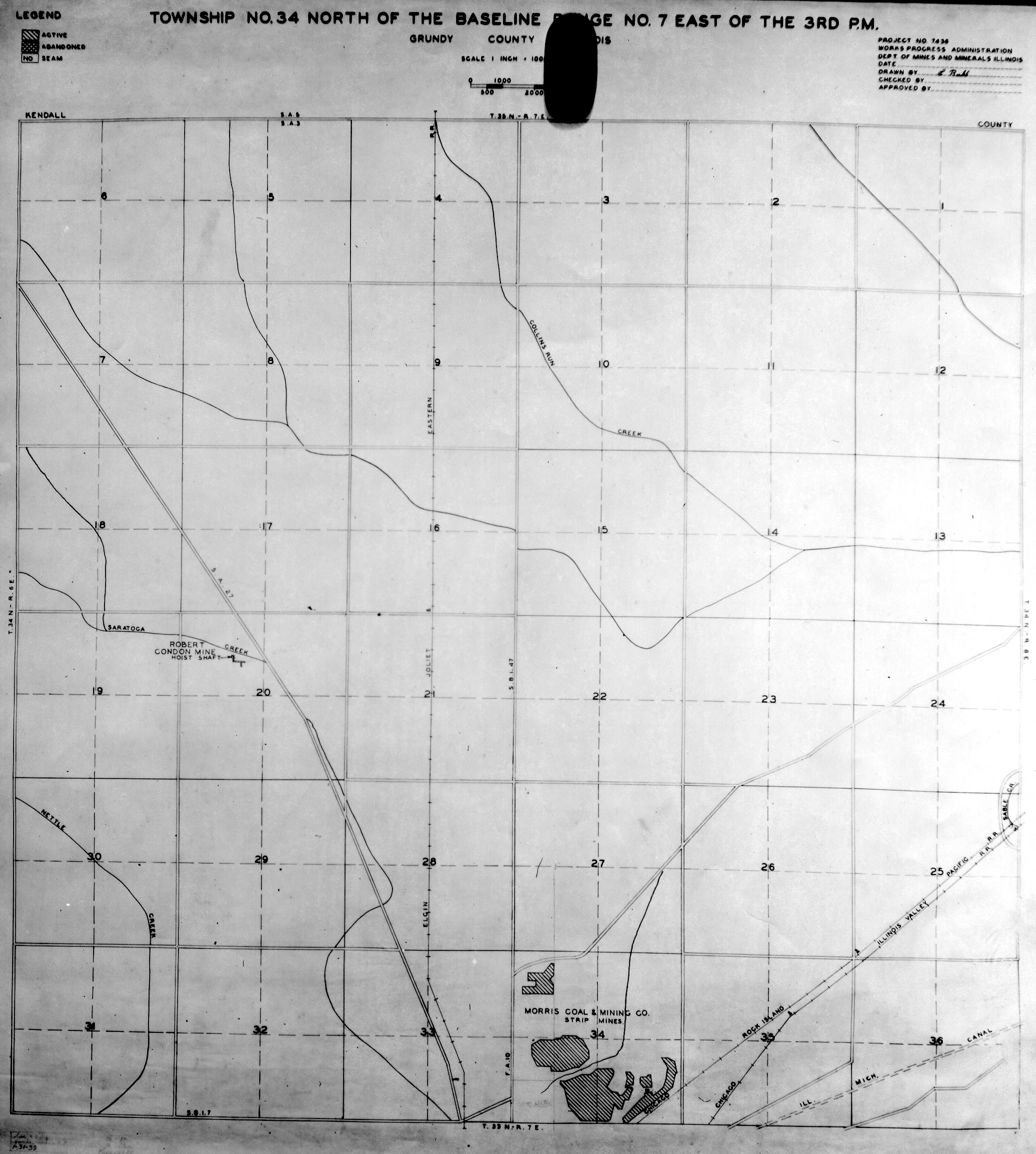
 | Grundy, T34N-R7E | Grundy | T34N-R7E | WPA GRUNDY 34N7E.jpg |
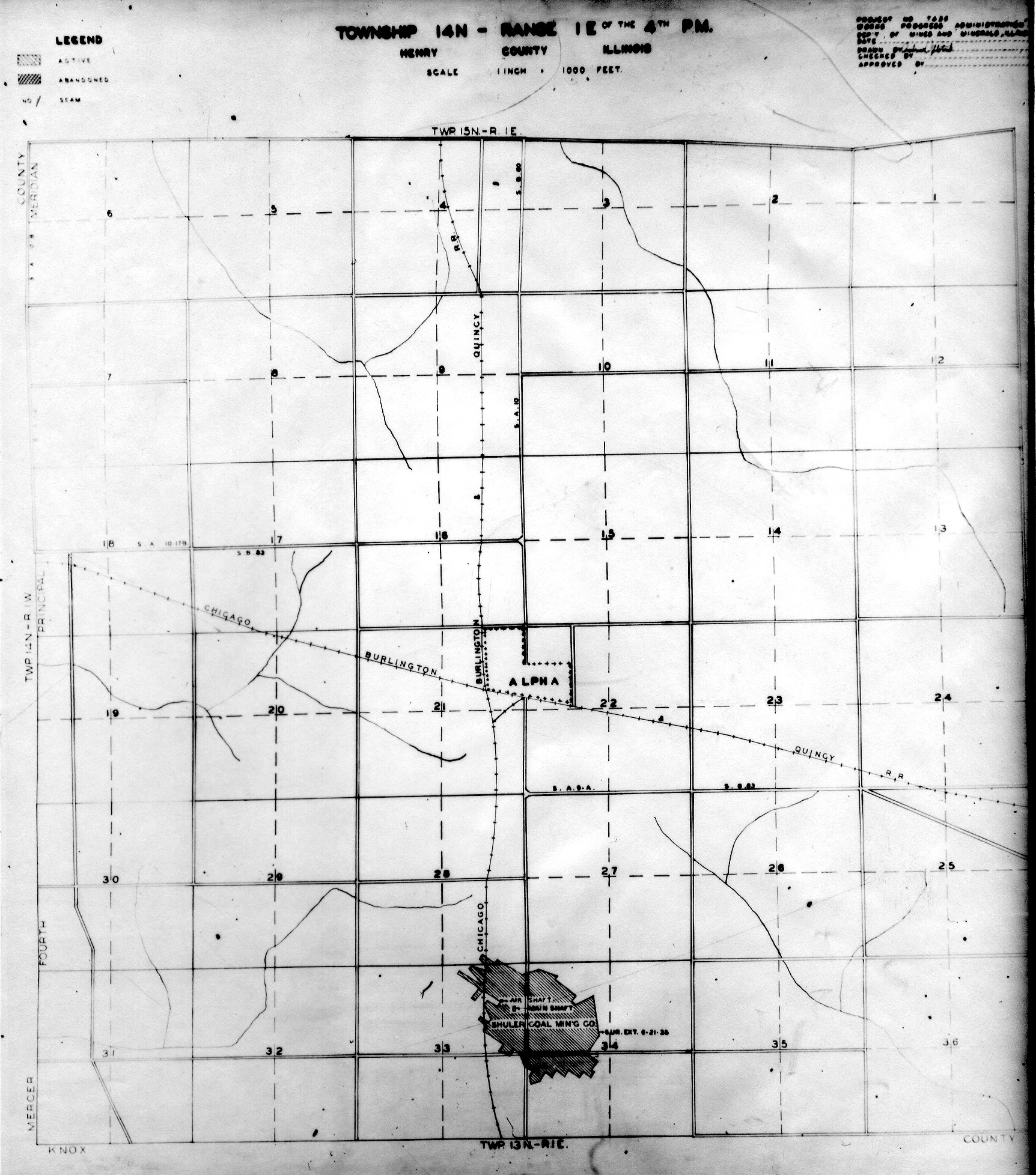
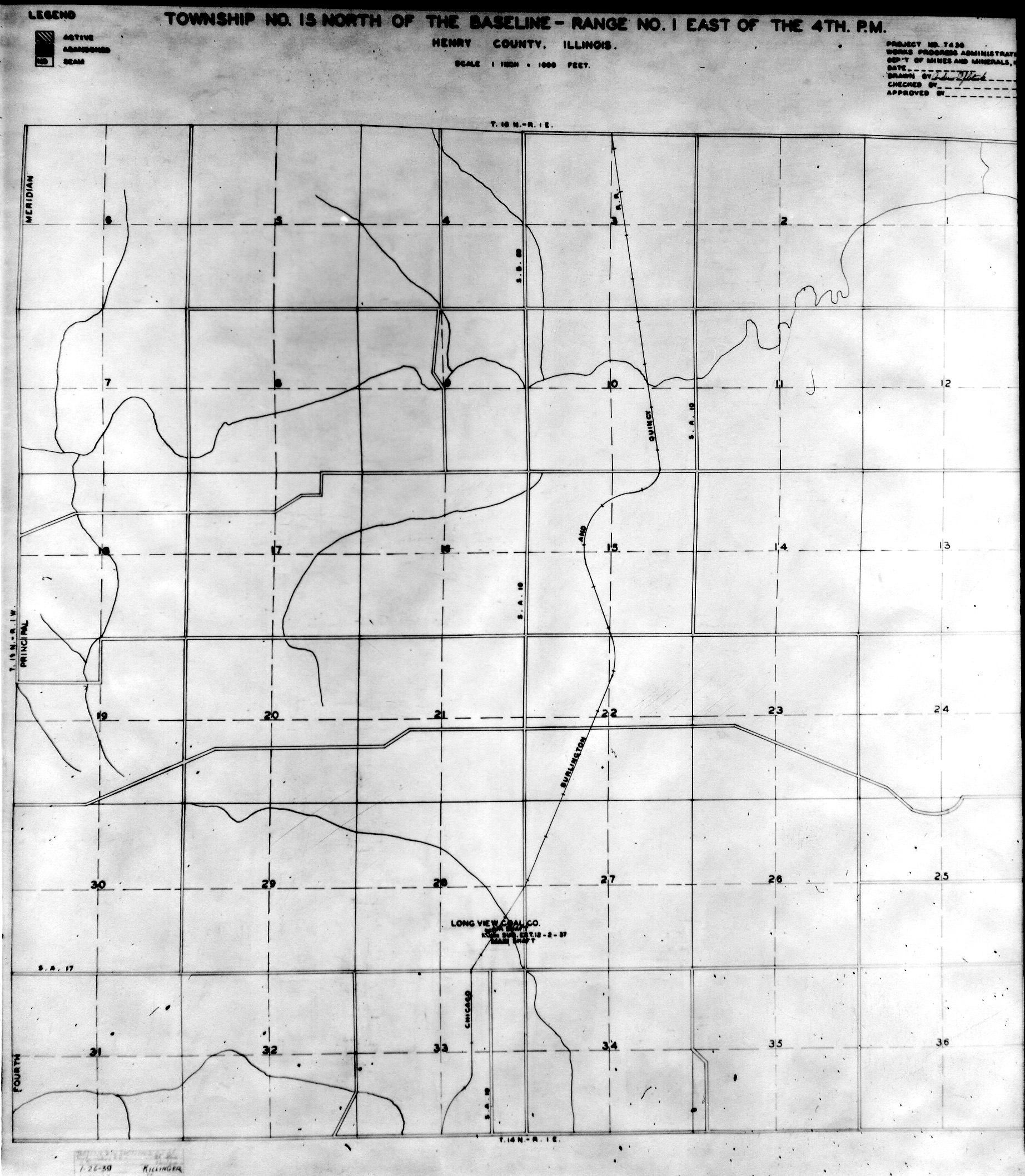
 | Henry, T14N-R1E | Henry | T14N-R1E | WPA HENRY 14N1E.jpg |
 | Henry, T15N-R1E | Henry | T15N-R1E | WPA HENRY 15N1E.jpg |
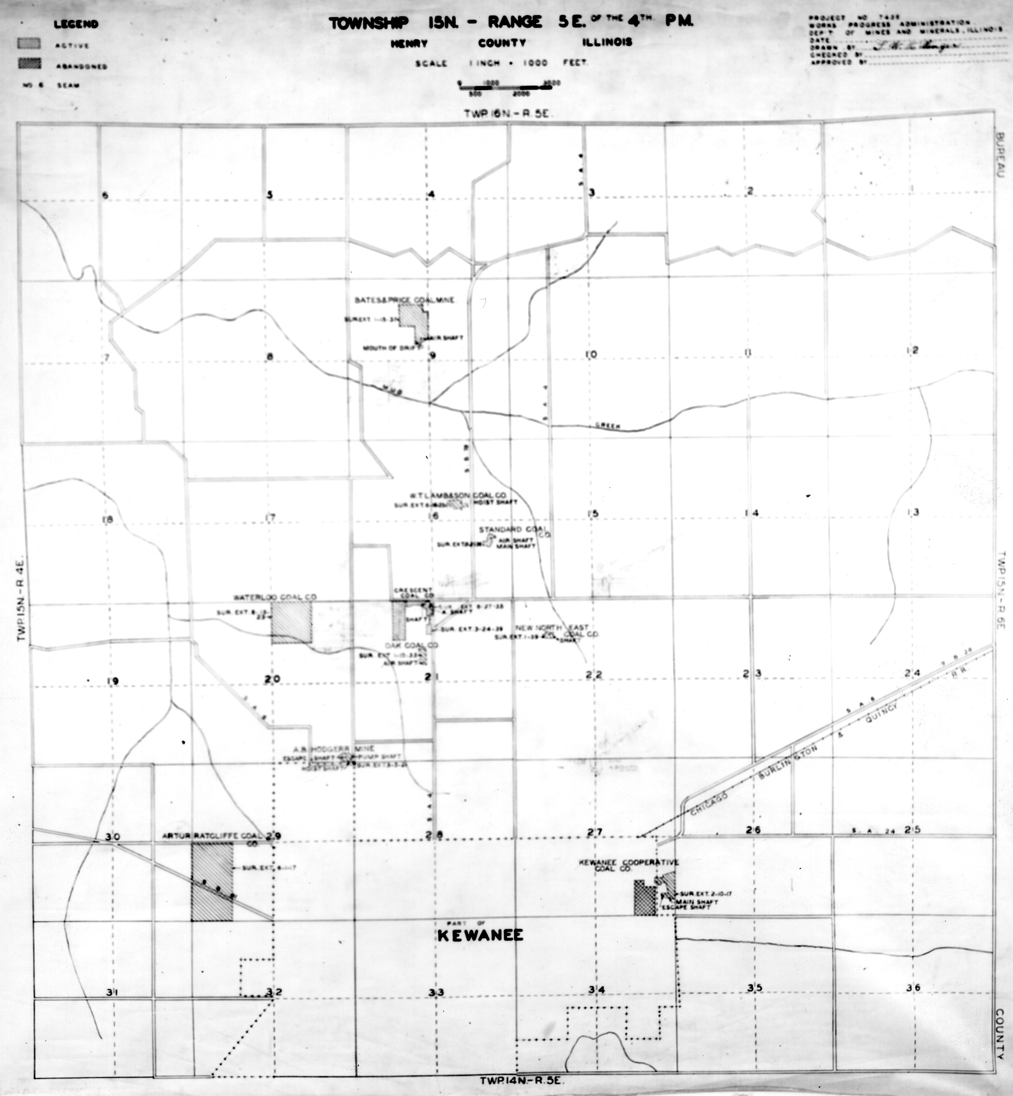
 | Henry, T15N-R5E No. 1 | Henry | T15N-R5E | WPA HENRY 15N5E NO 1.jpg |
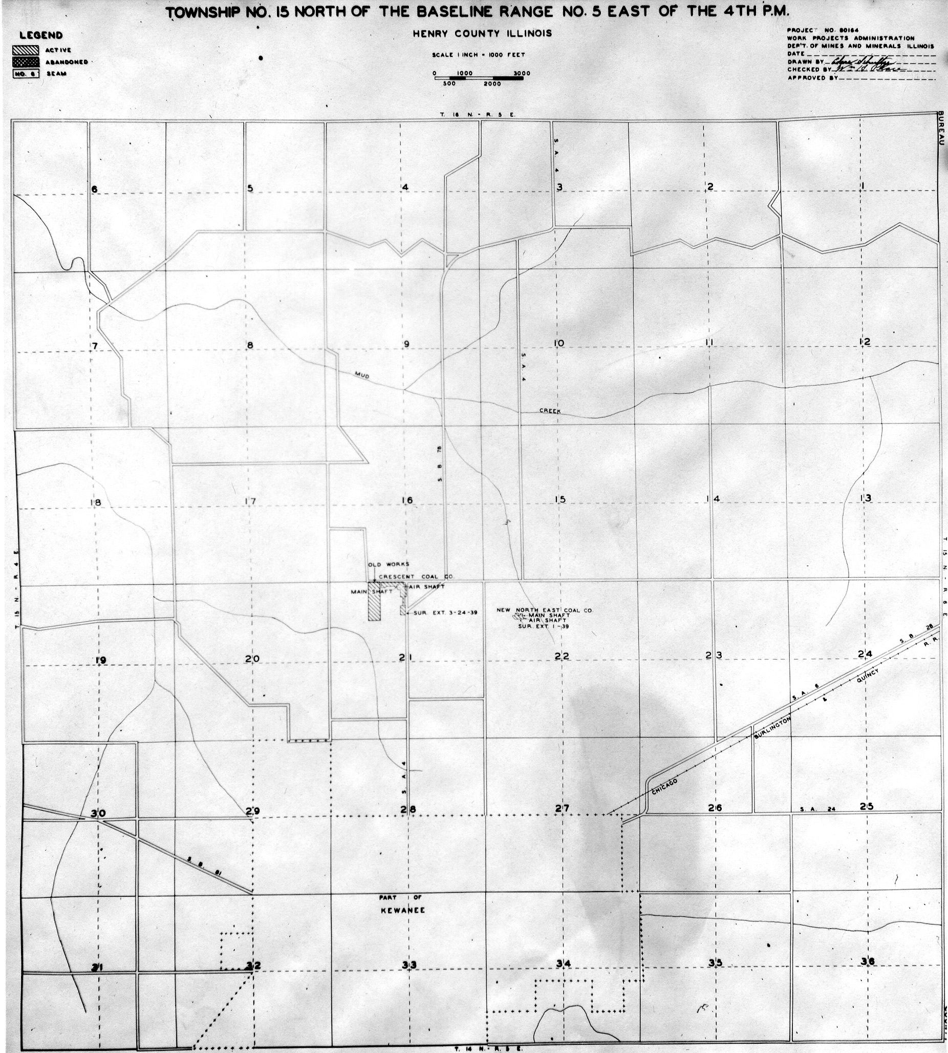
 | Henry, T15N-R5E No. 2 | Henry | T15N-R5E | WPA HENRY 15N5E NO 2.jpg |
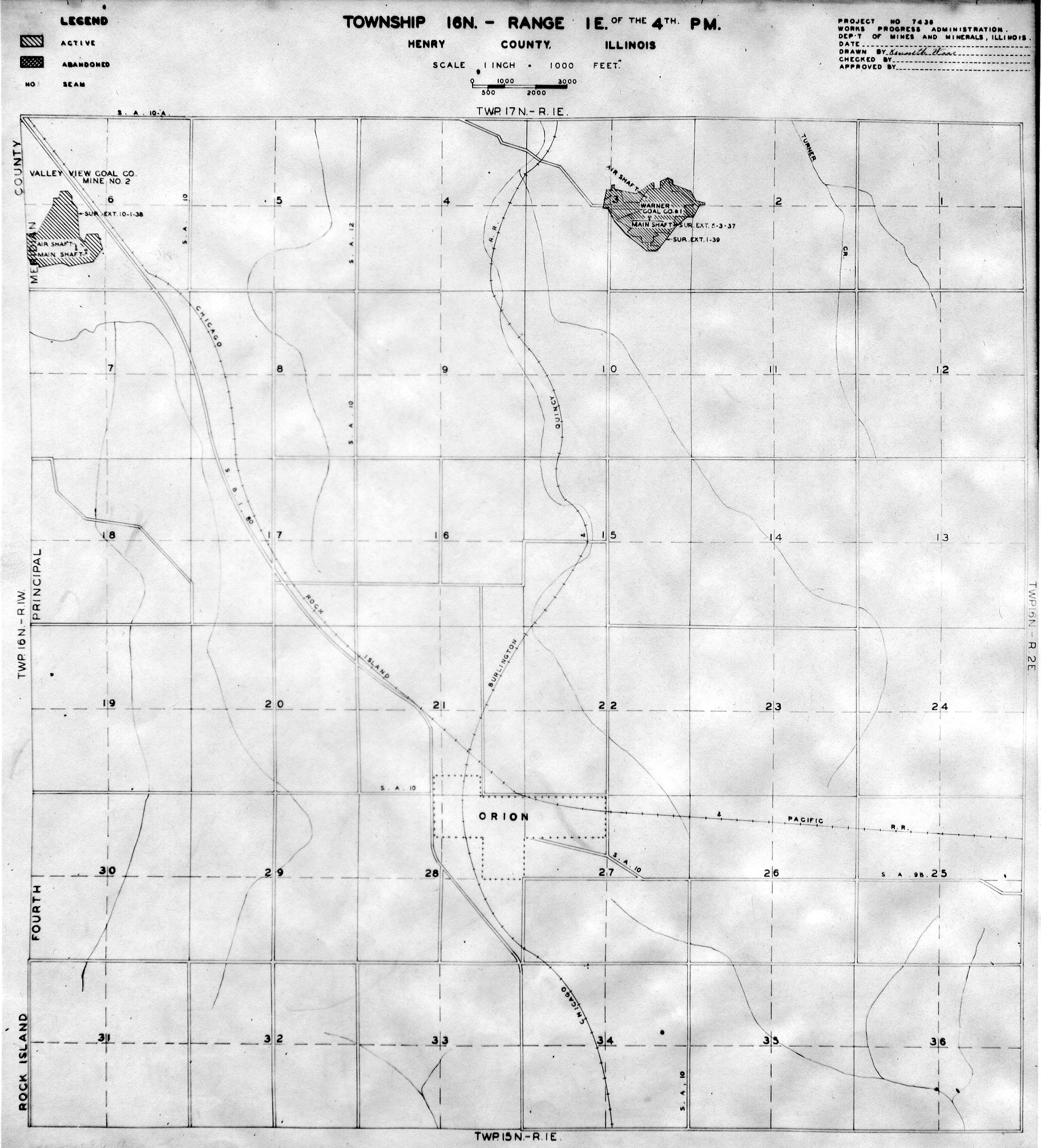
 | Henry, T16N-R1E | Henry | T16N-R1E | WPA HENRY 16N1E.jpg |
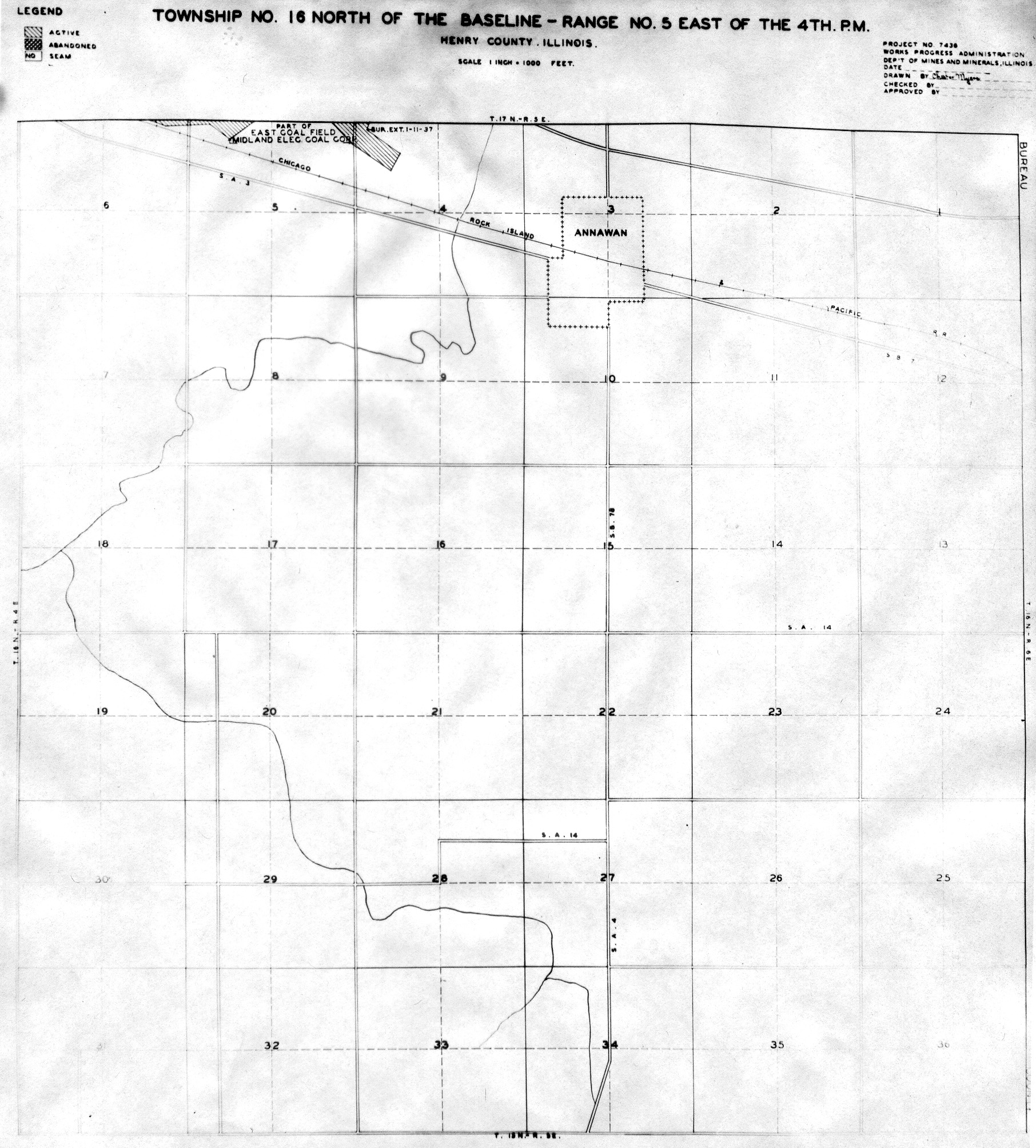
 | Henry, T16N-R5E | Henry | T16N-R5E | WPA HENRY 16N5E.jpg |
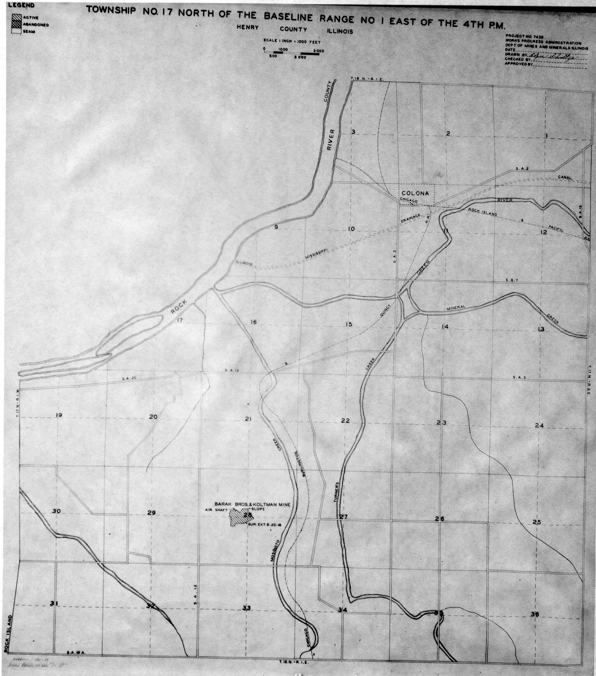
 | Henry, T17N-R1E | Henry | T17N-R1E | WPA HENRY 17N1E.jpg |
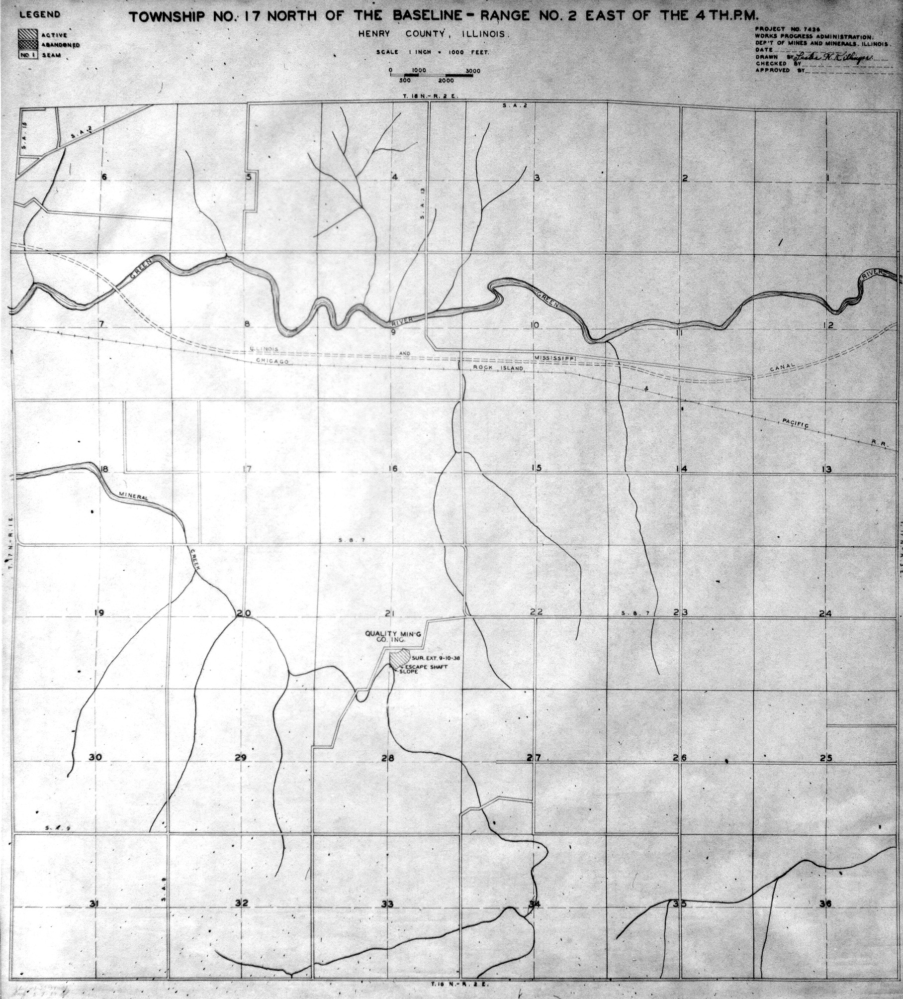
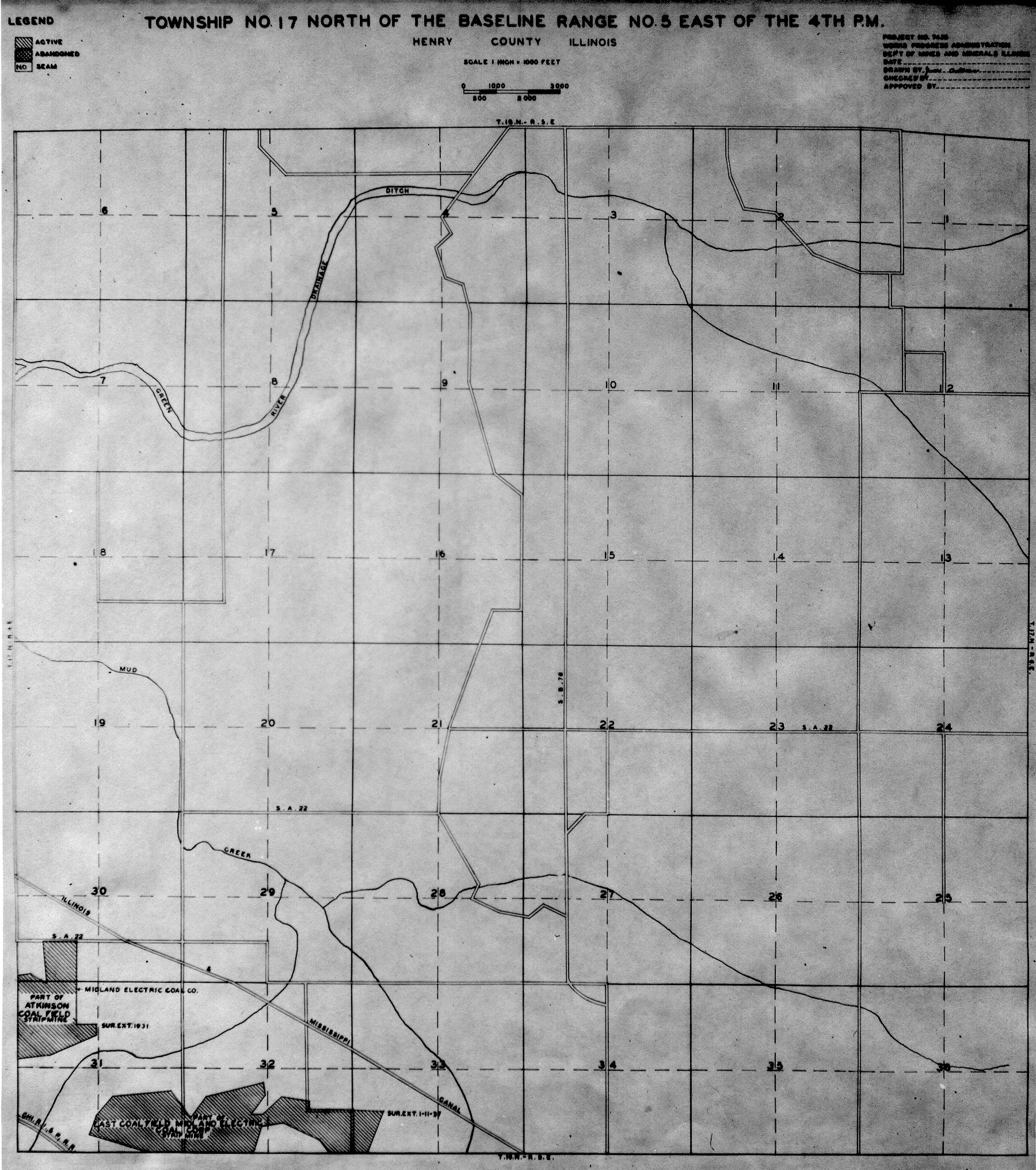
 | Henry, T17N-R2E | Henry | T17N-R2E | WPA HENRY 17N2E.jpg |
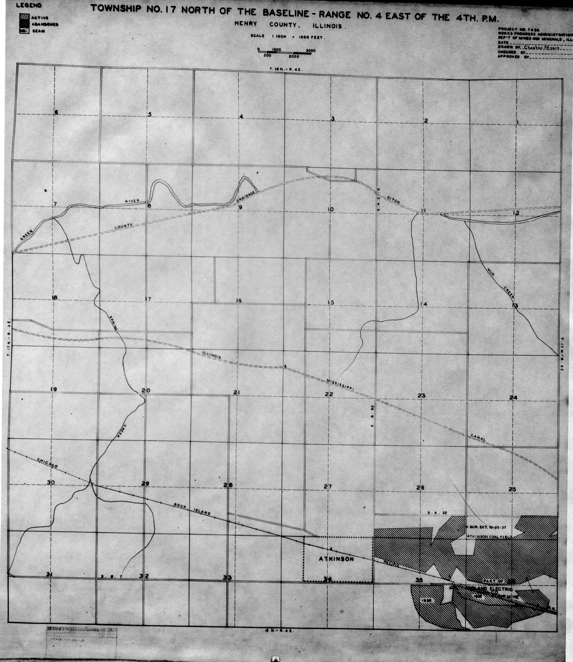
 | Henry, T17N-R4E | Henry | T17N-R4E | WPA HENRY 17N4E.jpg |
 | Henry, T17N-R5E | Henry | T17N-R5E | WPA HENRY 17N5E.jpg |
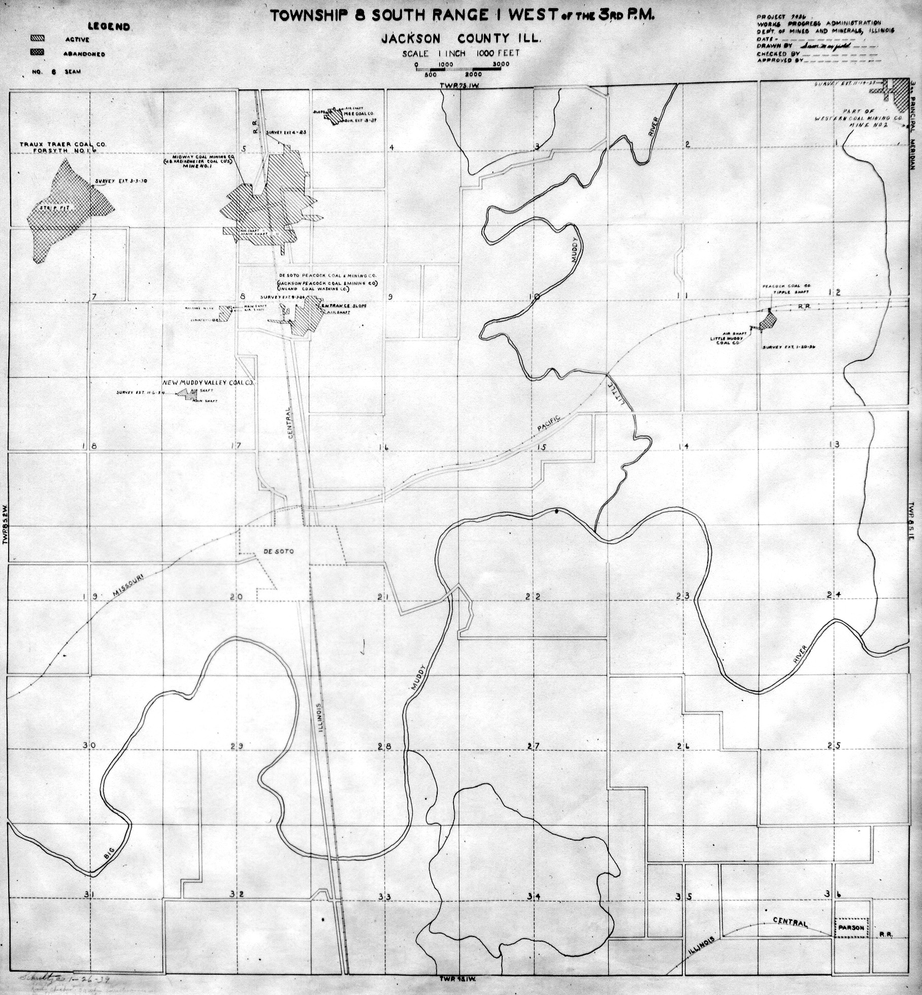
 | Jackson, T7S-R1W | Jackson | T7S-R1W | WPA JACKSON 7S1W.jpg |
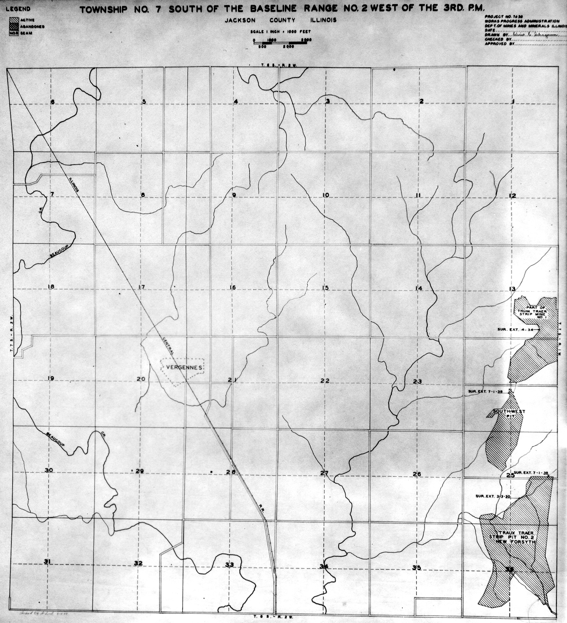
 | Jackson, T7S-R2W | Jackson | T7S-R2W | WPA JACKSON 7S2W.jpg |
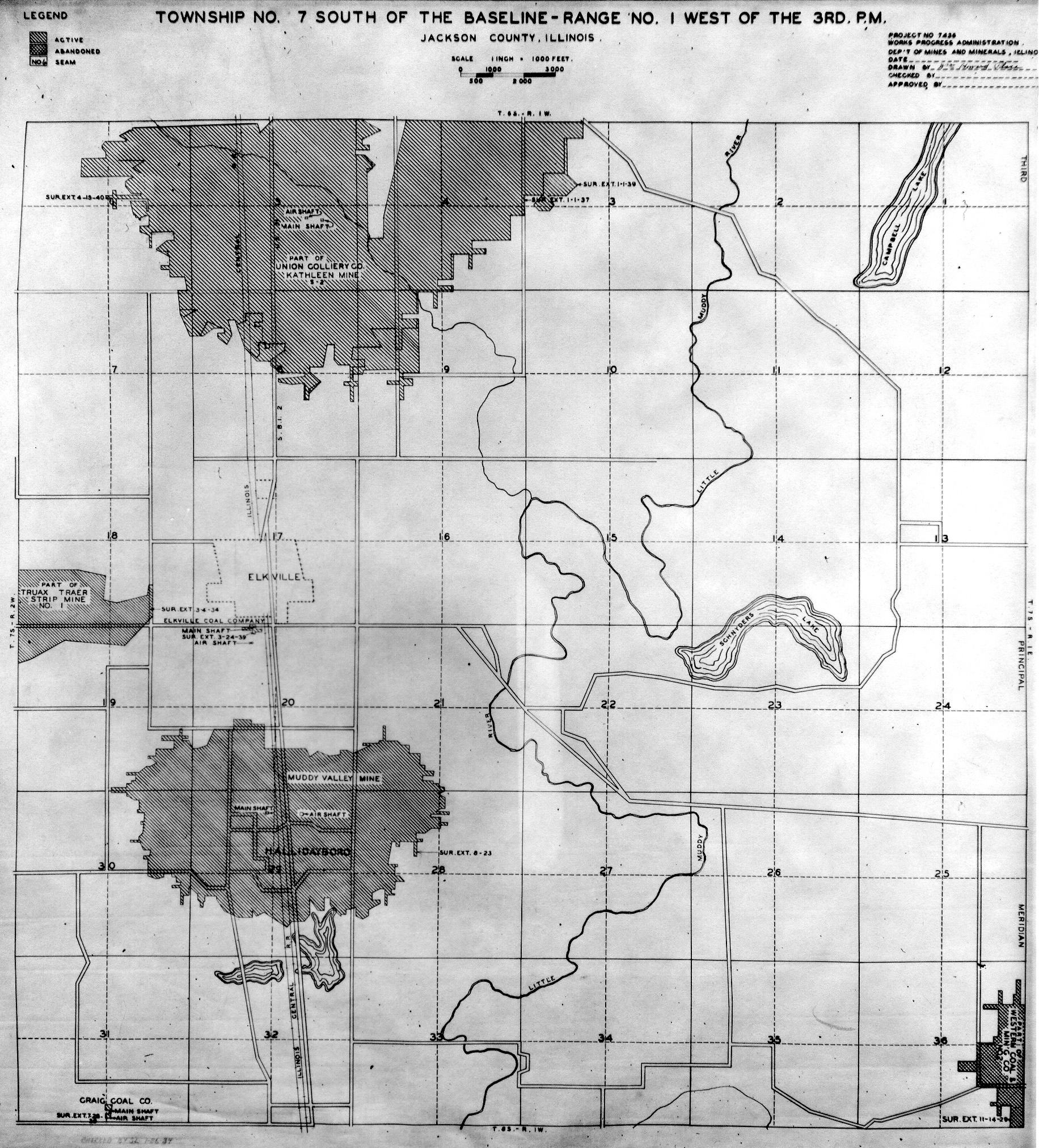
 | Jackson, T7S-R3W | Jackson | T7S-R3W | WPA JACKSON 7S3W.jpg |
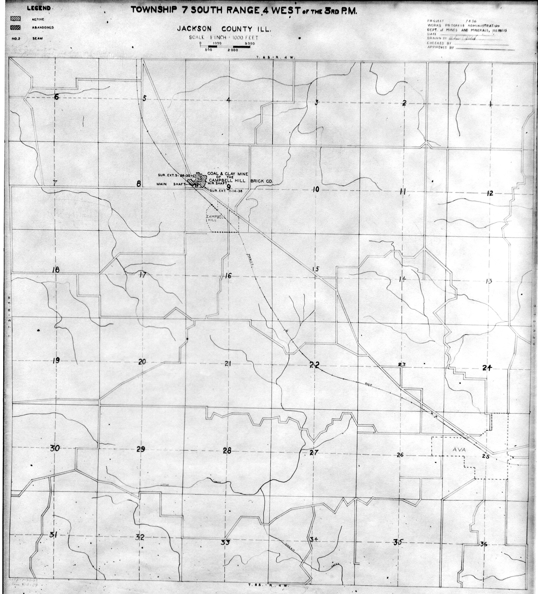
 | Jackson, T7S-R4W | Jackson | T7S-R4W | WPA JACKSON 7S4W.jpg |
 | Jackson, T8S-R1W | Jackson | T8S-R1W | WPA JACKSON 8S1W.jpg |
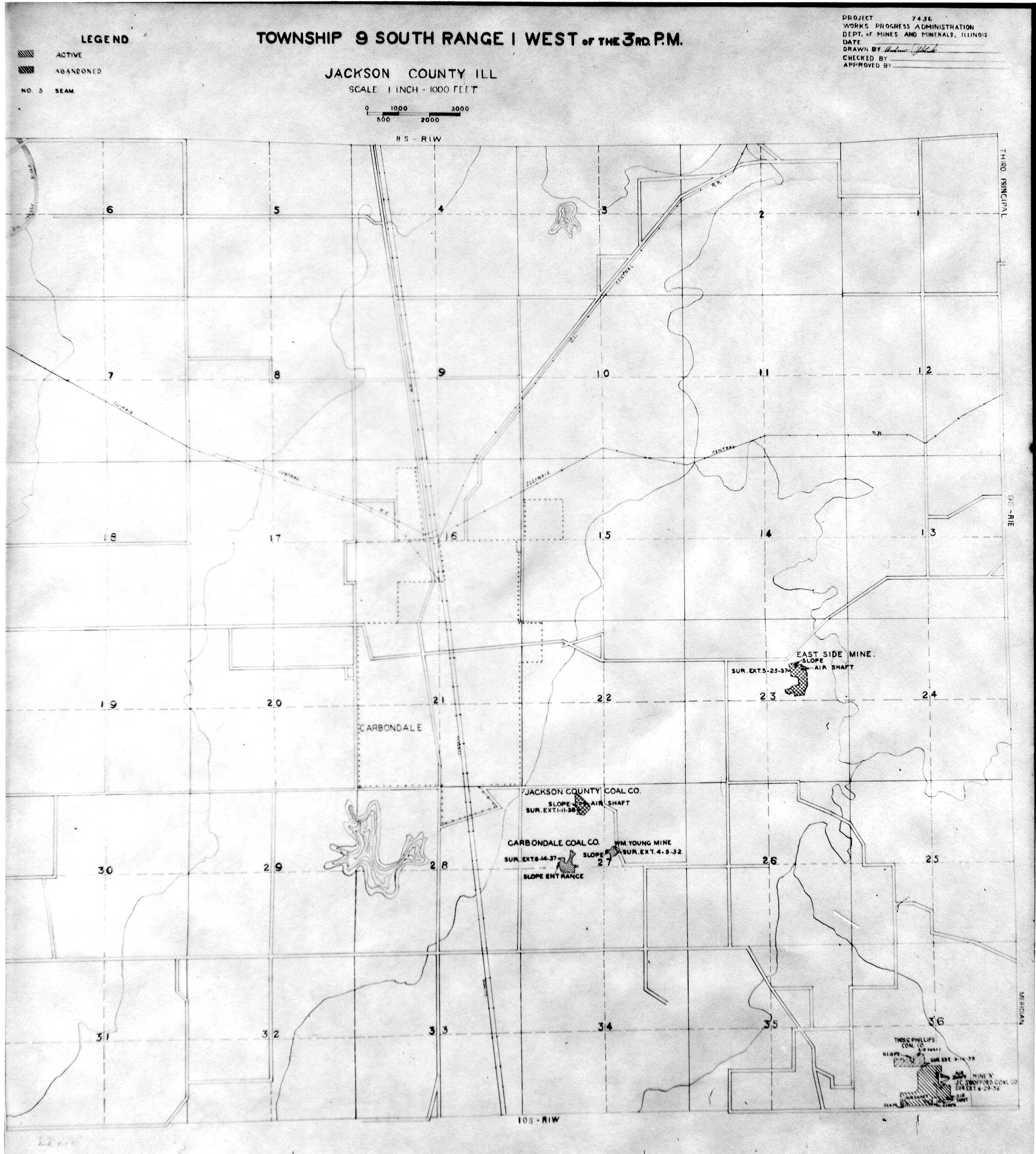
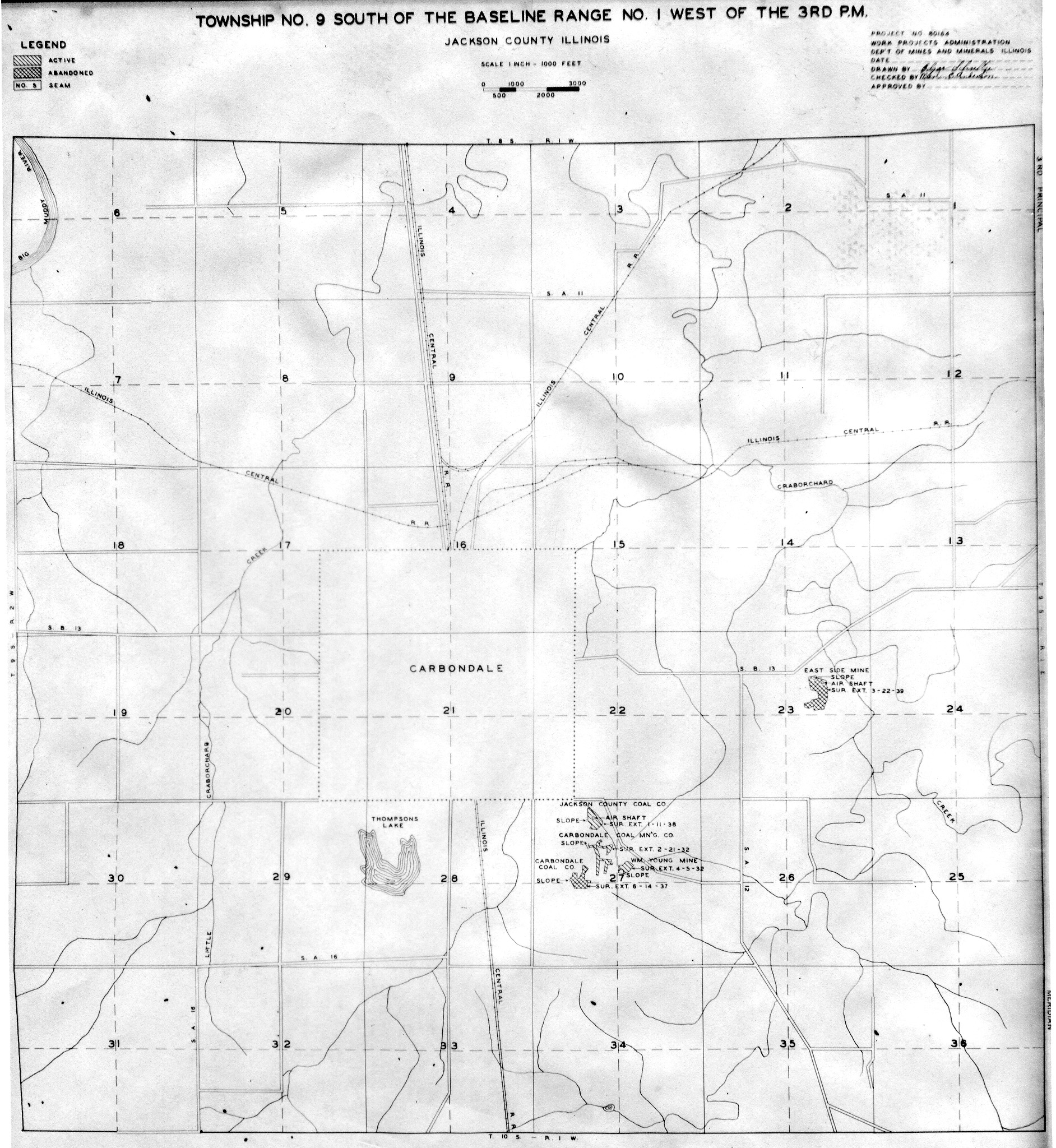
 | Jackson, T9S-R1W No.1 | Jackson | T9S-R1W | WPA JACKSON 9S1W NO 1.jpg |
 | Jackson, T9S-R1W No.2 | Jackson | T9S-R1W | WPA JACKSON 9S1W NO 2.jpg |
 | Jackson, T9S-R1W No.3 | Jackson | T9S-R1W | WPA JACKSON 9S1W NO 3.jpg |
 | Jackson, T9S-R1W No.4 | Jackson | T9S-R1W | WPA JACKSON 9S1W NO 4.jpg |
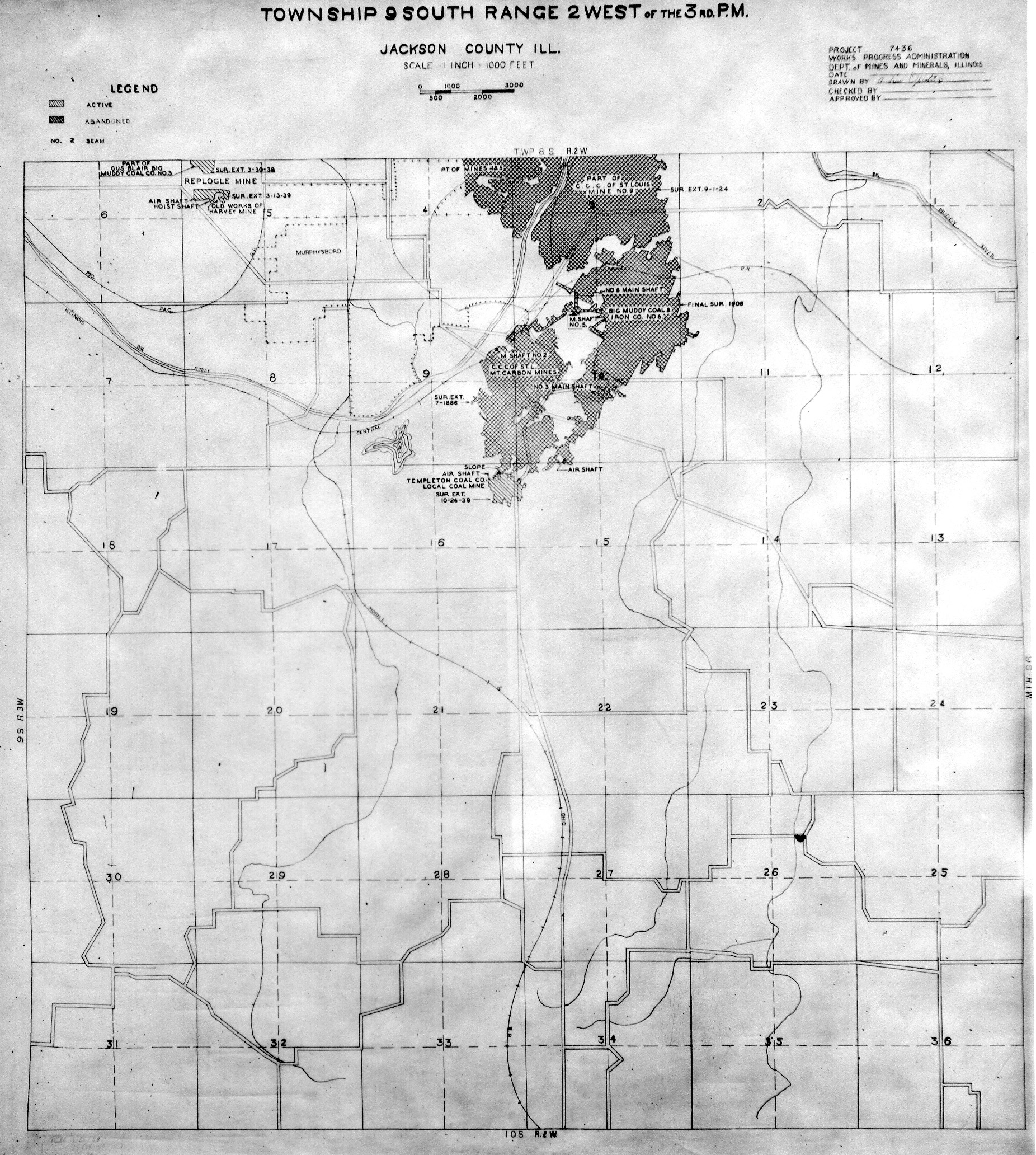
 | Jackson, T9S-R2W | Jackson | T9S-R2W | WPA JACKSON 9S2W.jpg |
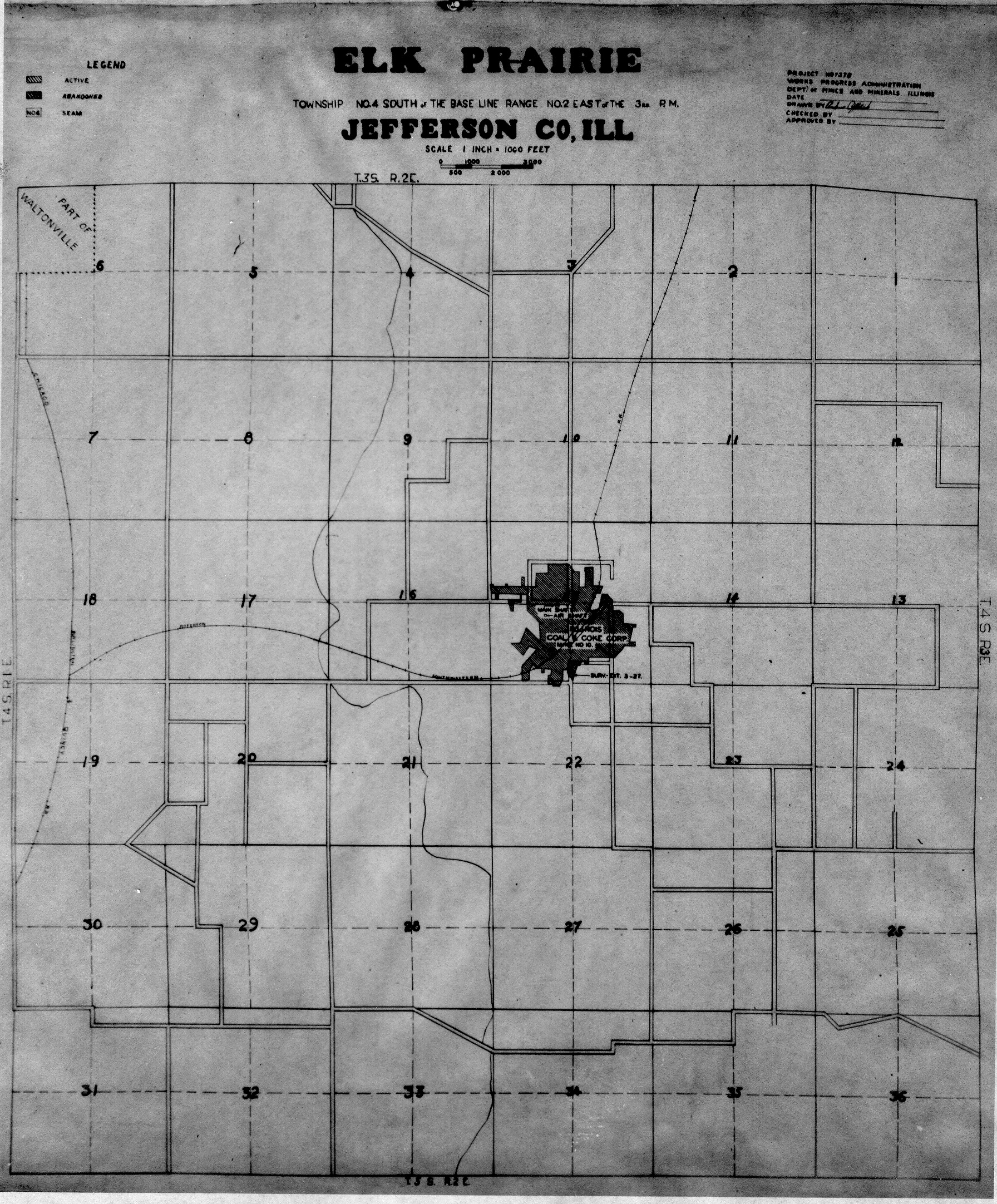
 | Jefferson, T4S-R2E | Jefferson | T4S-R2E | WPA JEFFERSON 4S2E.jpg |
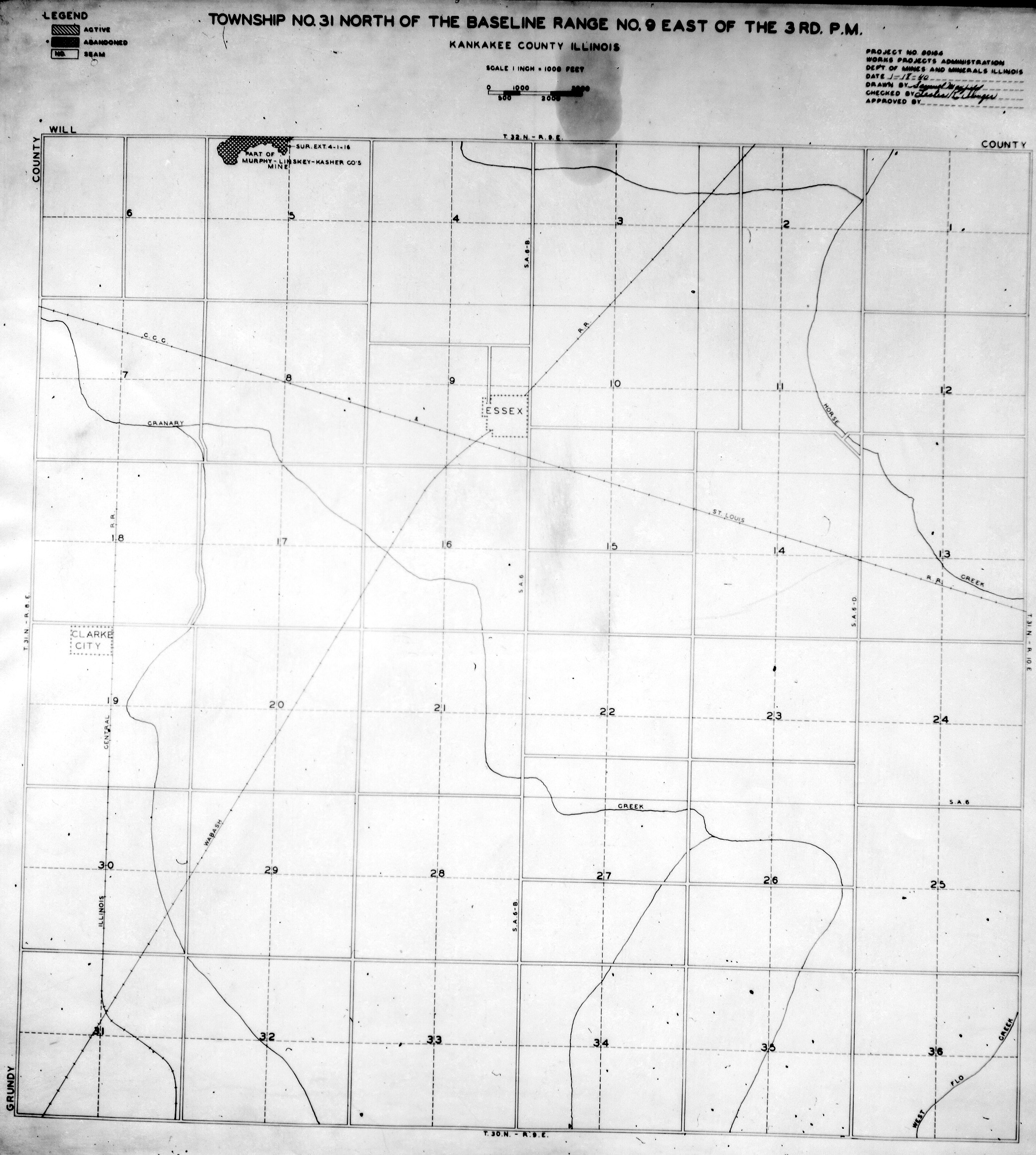
 | Kankakee, T31N-R9E | Kankakee | T31N-R9E | WPA KANKAKEE 31N9E.jpg |
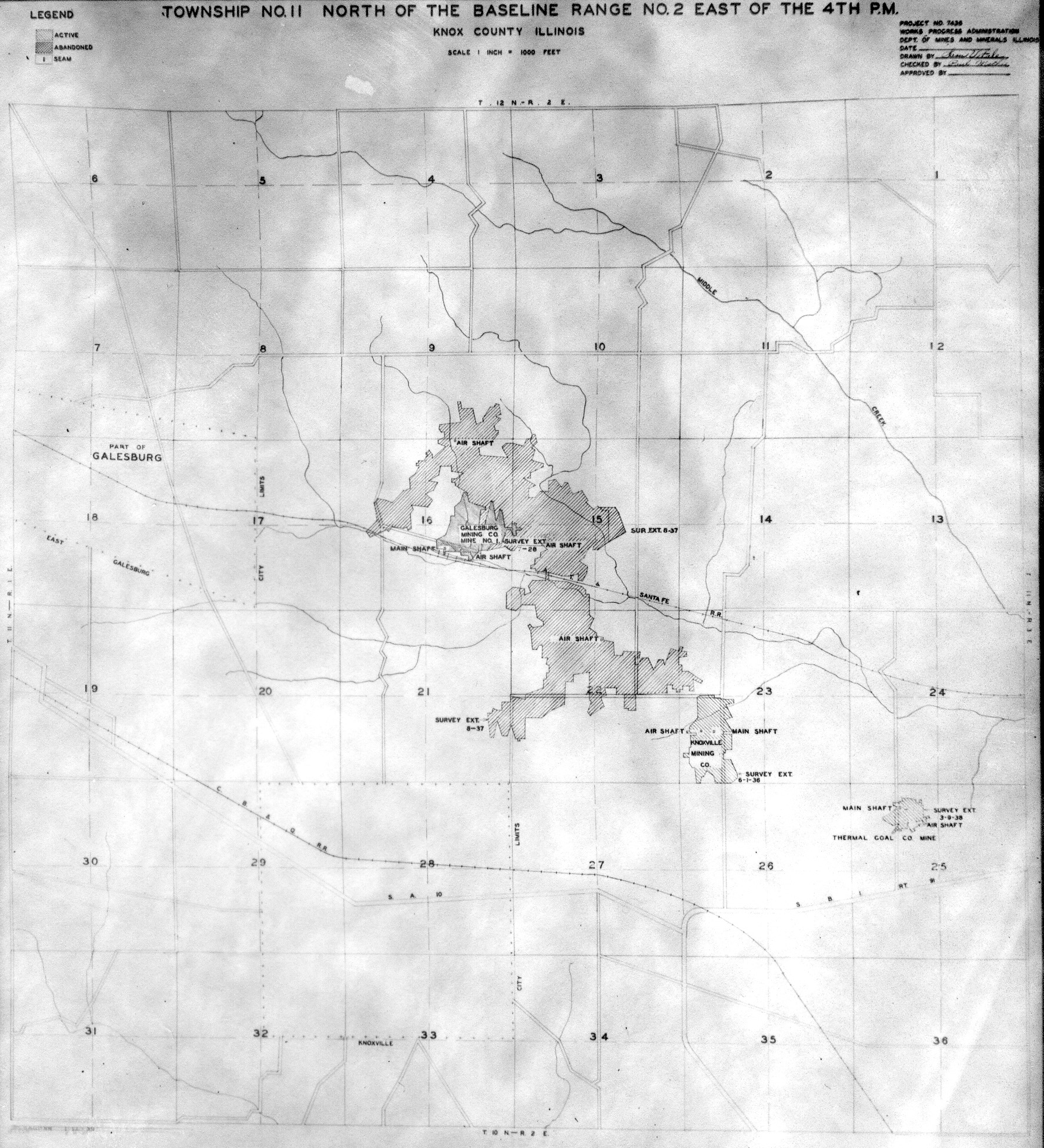
 | Knox, T11N-R2E | Knox | T11N-R2E | WPA KNOX 11N2E.jpg |
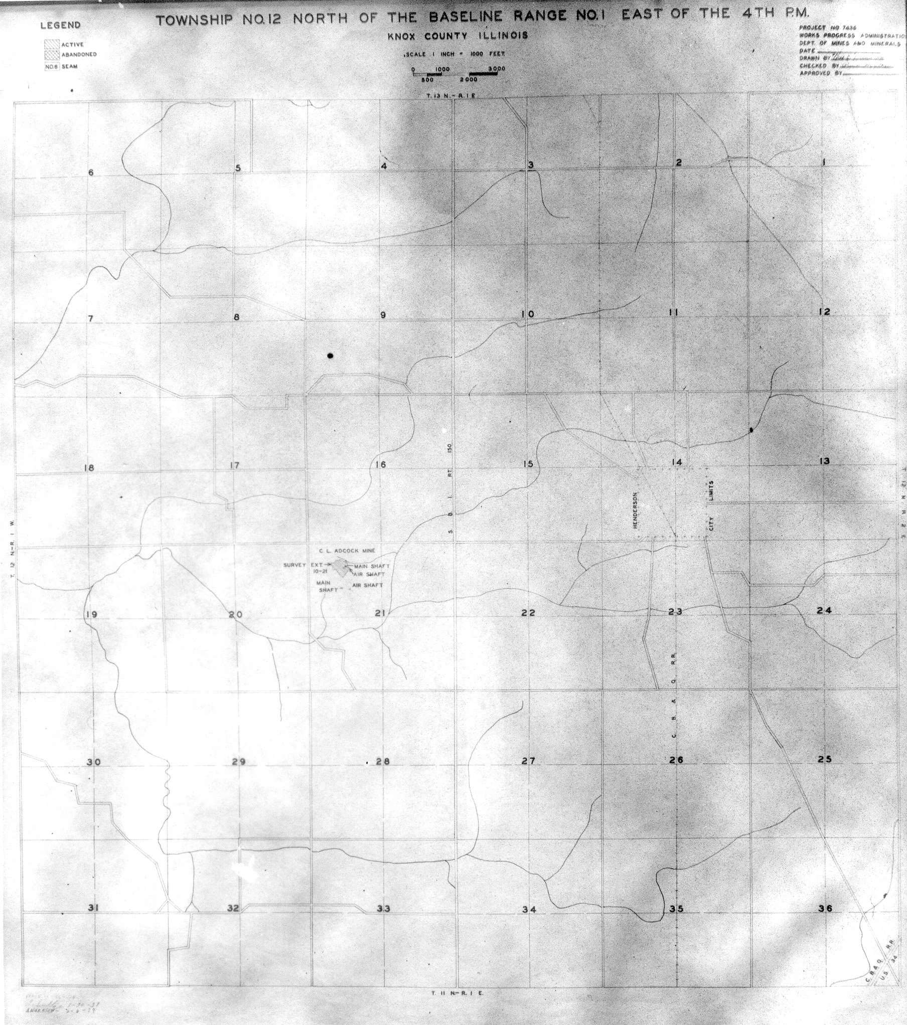
 | Knox, T12N-R1E | Knox | T12N-R1E | WPA KNOX 12N1E.jpg |
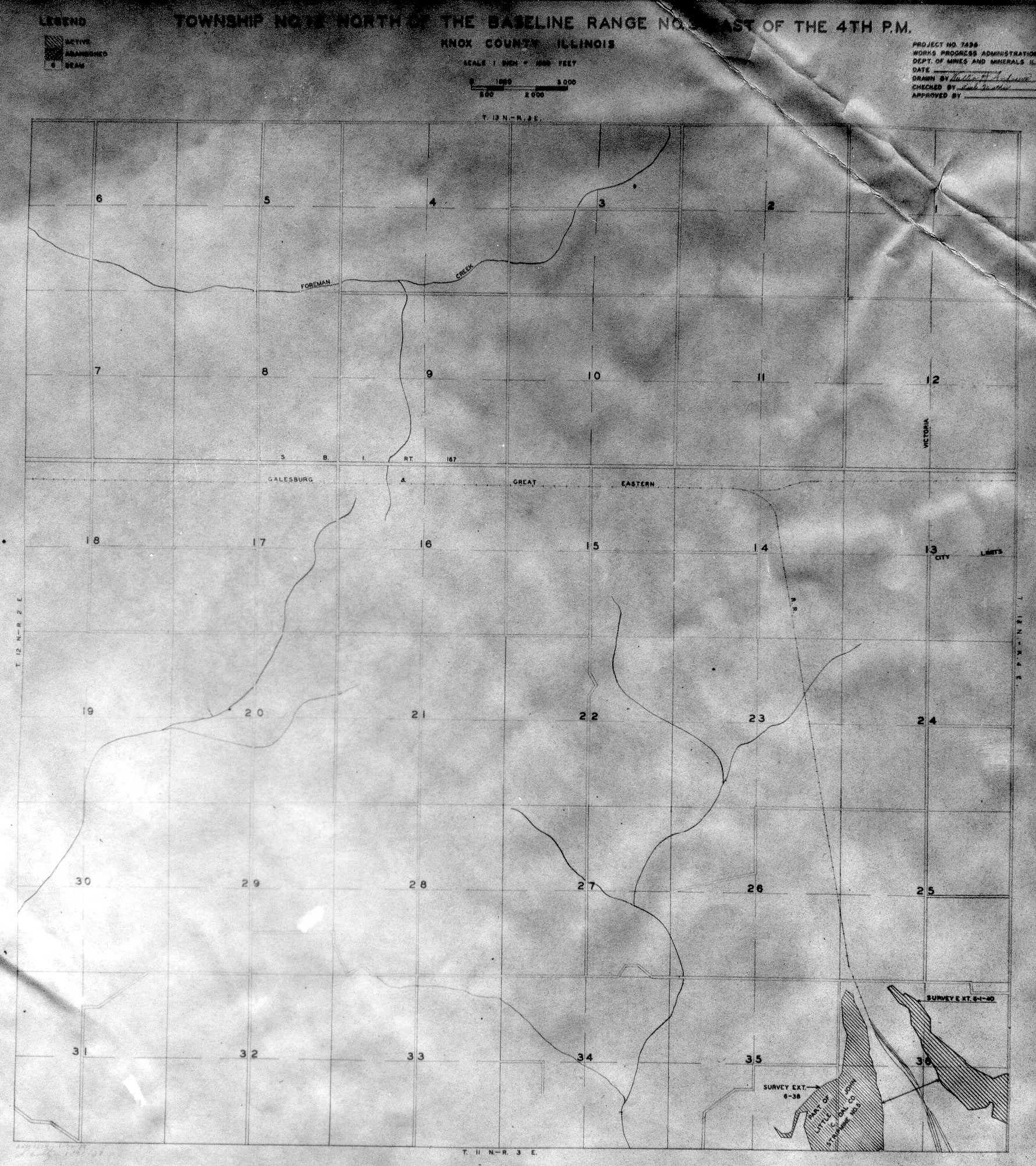
 | Knox, T12N-R3E | Knox | T12N-R3E | WPA KNOX 12N3E.jpg |
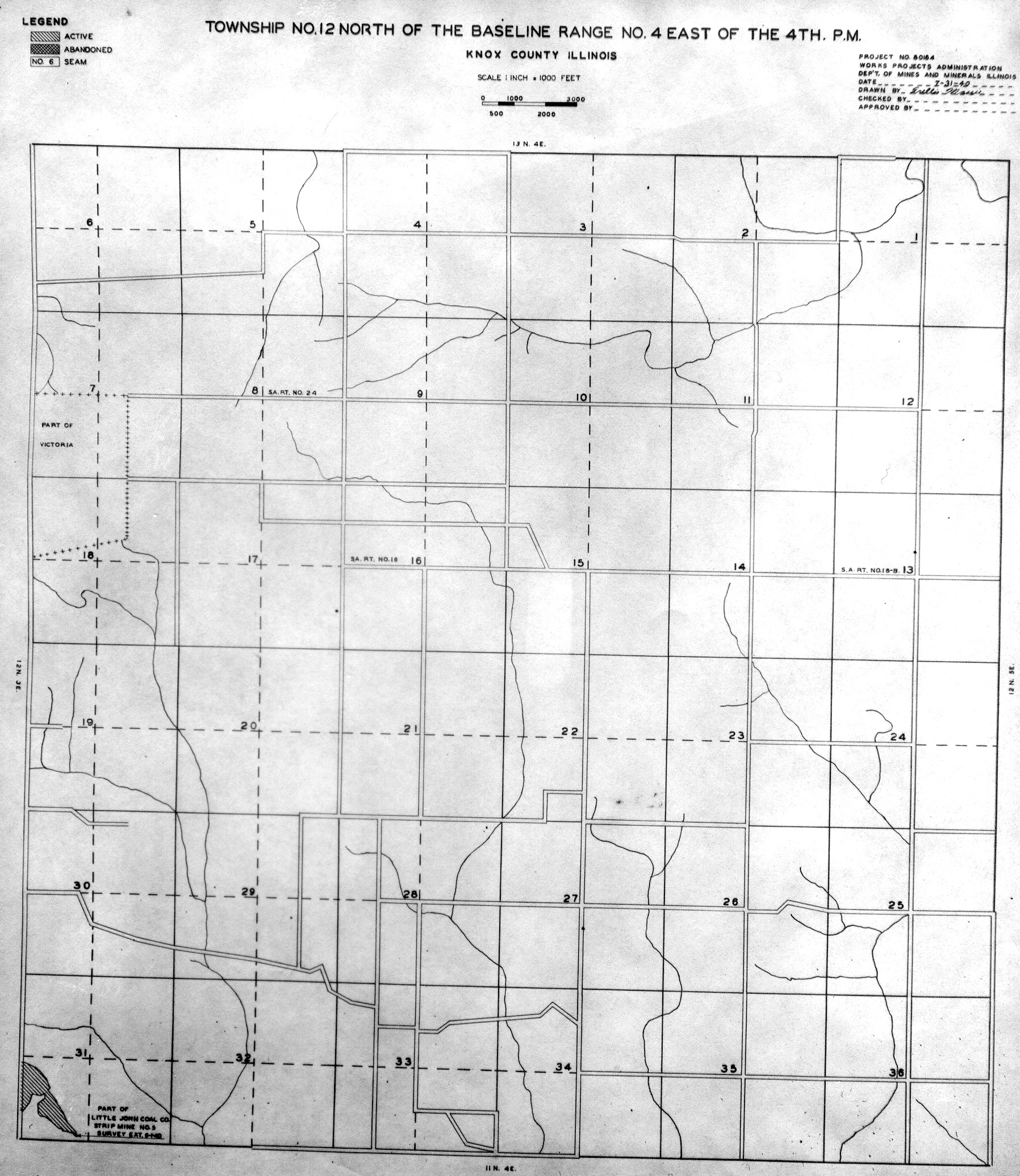
 | Knox, T12N-R4E | Knox | T12N-R4E | WPA KNOX 12N4E.jpg |
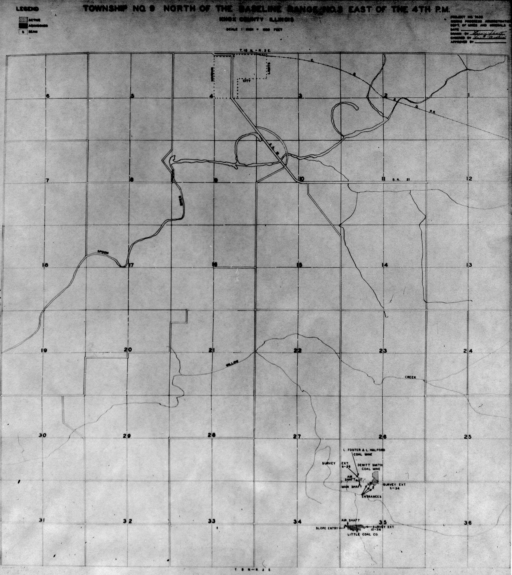
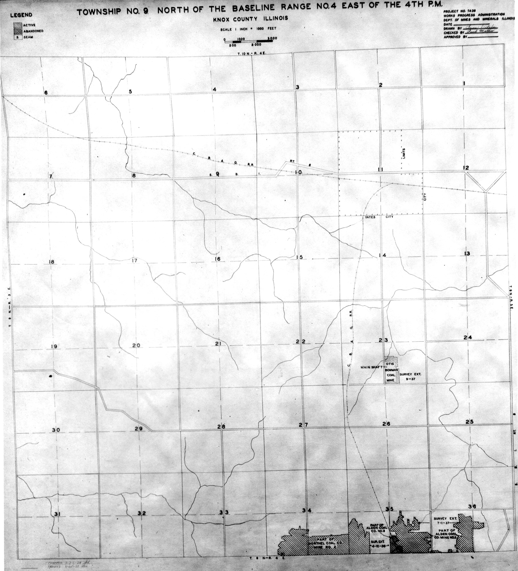
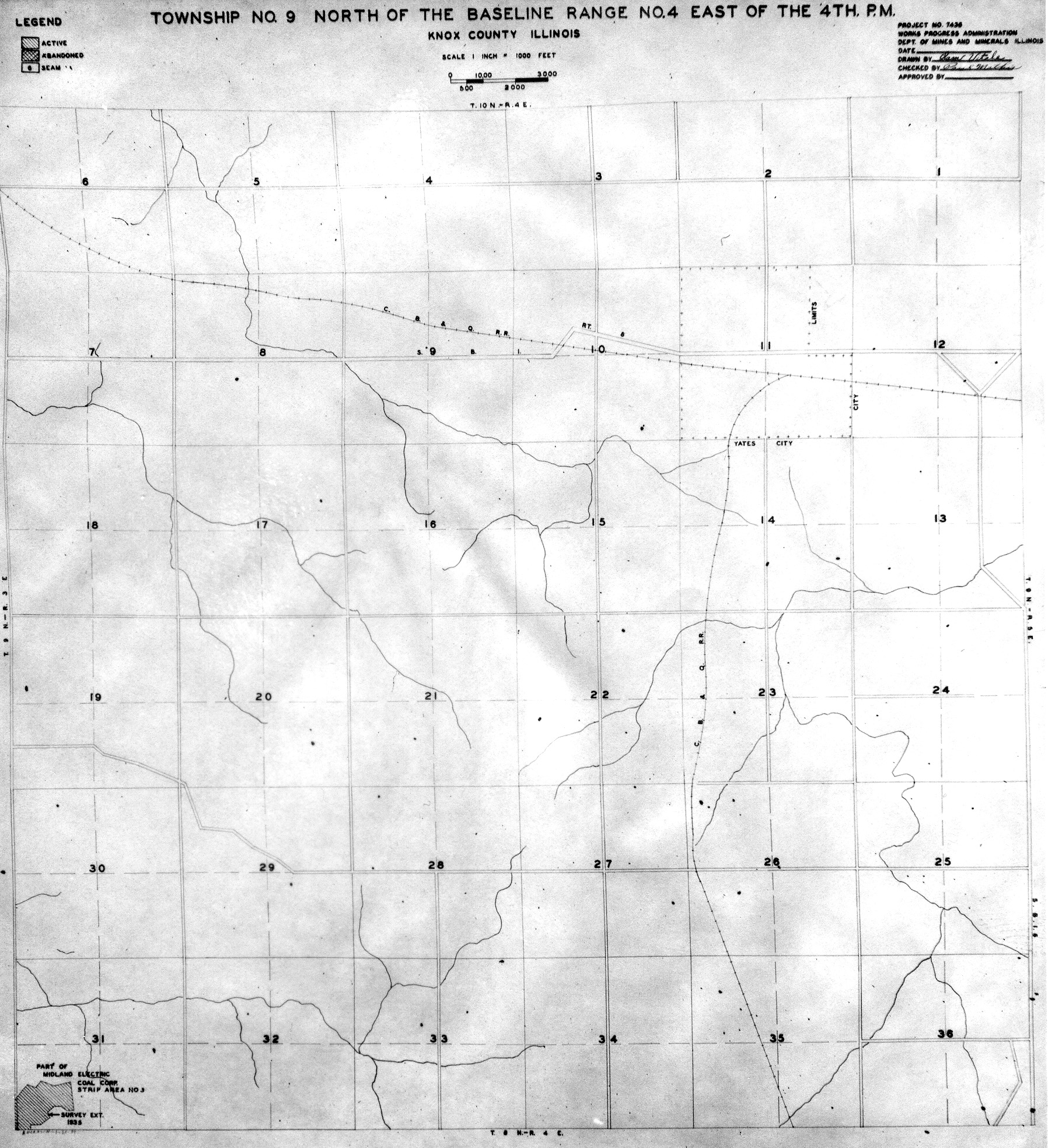
 | Knox, T9S-R3E No.1 | Knox | T9S-R3E | WPA KNOX 9N3E NO 1.jpg |
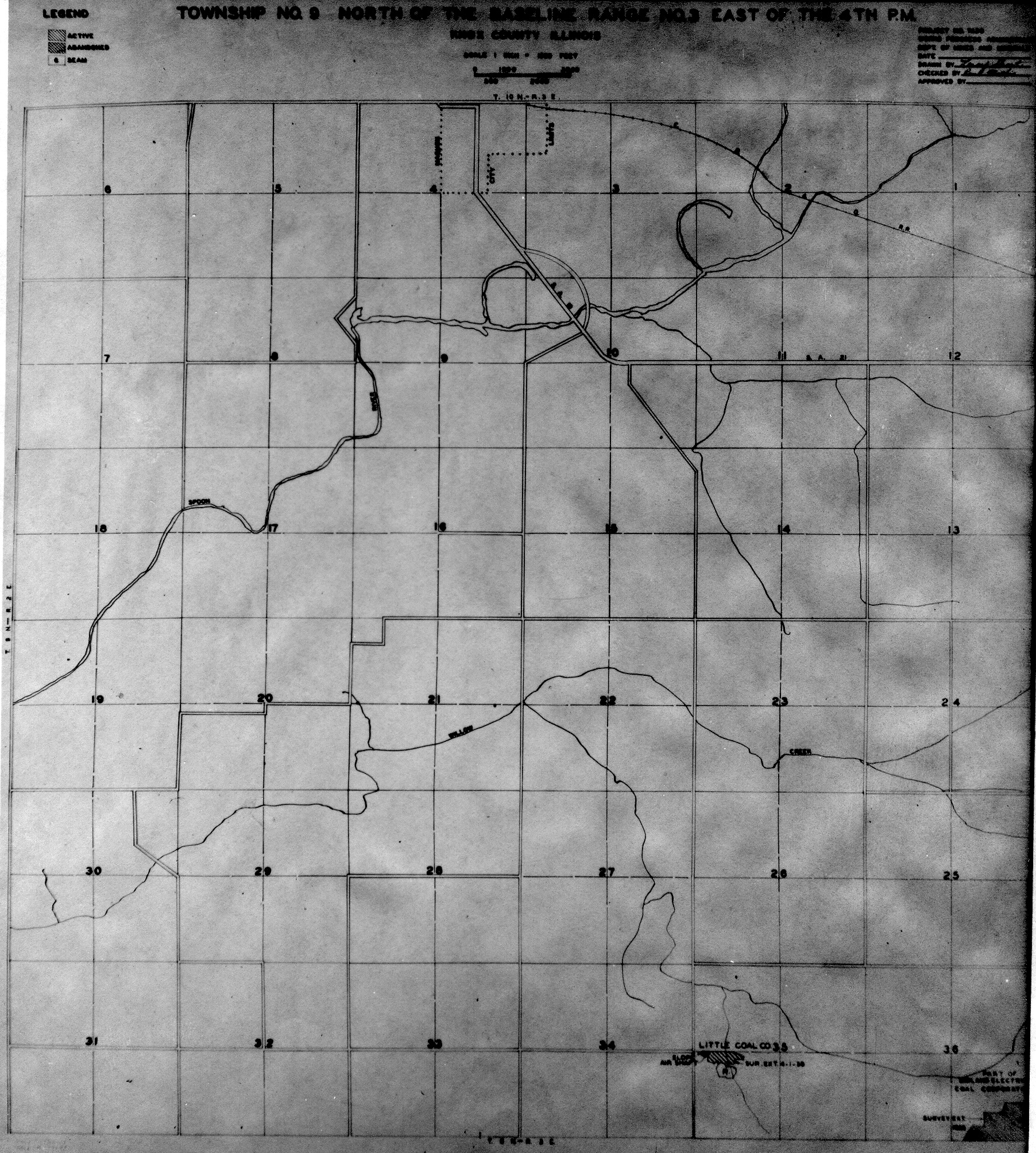
 | Knox, T9S-R3E No.2 | Knox | T9S-R3E | WPA KNOX 9N3E NO 2.jpg |
 | Knox, T9S-R4E No.1 | Knox | T9S-R4E | WPA KNOX 9N4E NO 1.jpg |
 | Knox, T9S-R4E No.2 | Knox | T9S-R4E | WPA KNOX 9N4E NO 2.jpg |
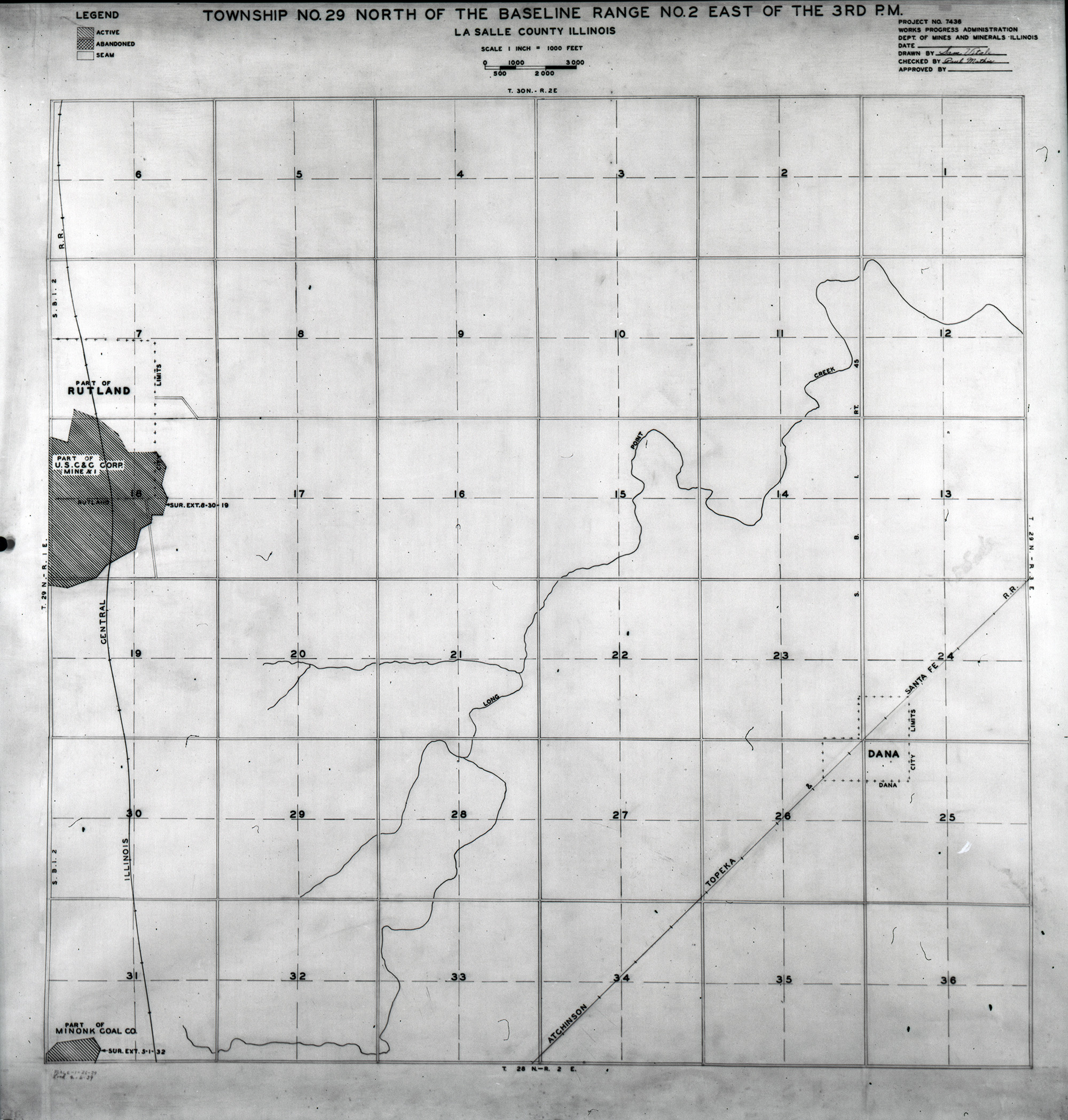
 | LaSalle, T29N-R2E | La Salle | T29N-R2E | WPA LASALLE 29N-2E.jpg |
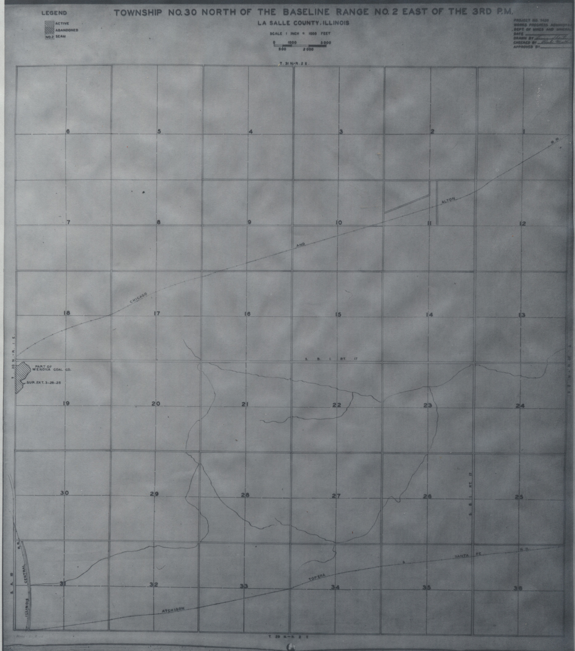
 | LaSalle, T30N-R2E | La Salle | T30N-R2E | WPA LASALLE 30N-2E.jpg |
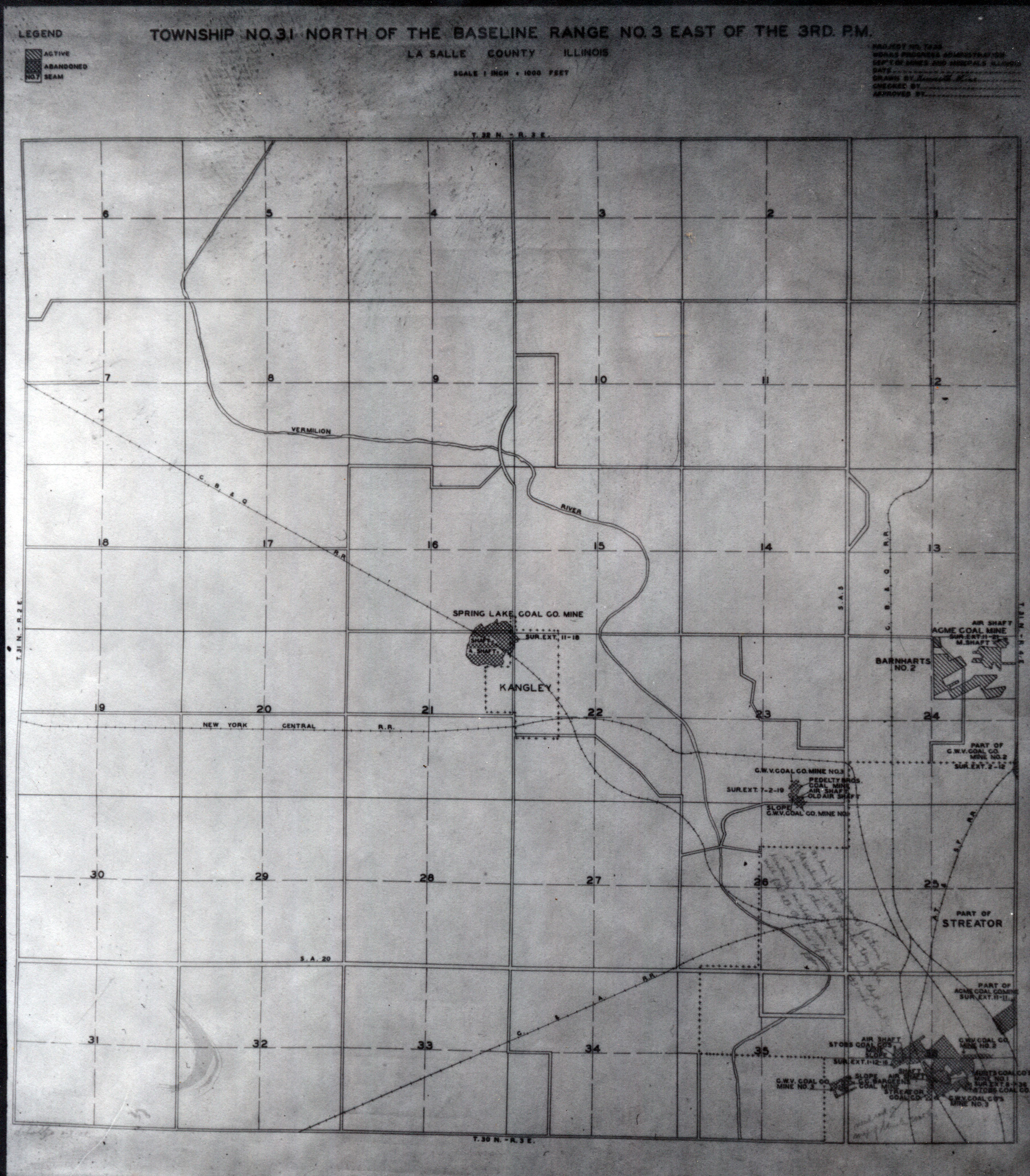
 | LaSalle, T31N-R3E No. 1 | La Salle | T31N-R3E | WPA LASALLE 31N-3E No 1.jpg |
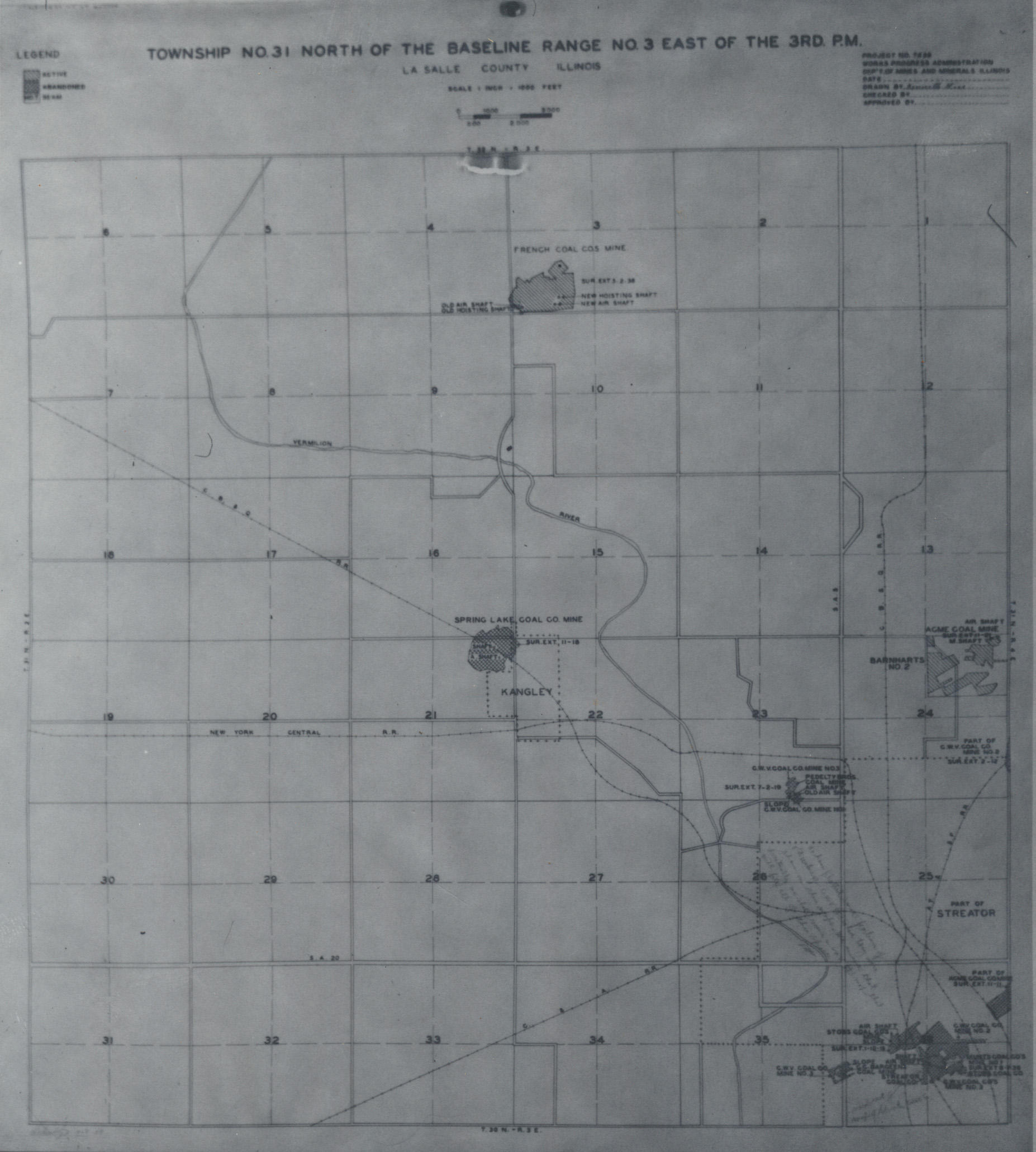
 | LaSalle, T31N-R3E No. 2 | La Salle | T31N-R3E | WPA LASALLE 31N-3E No 2.jpg |
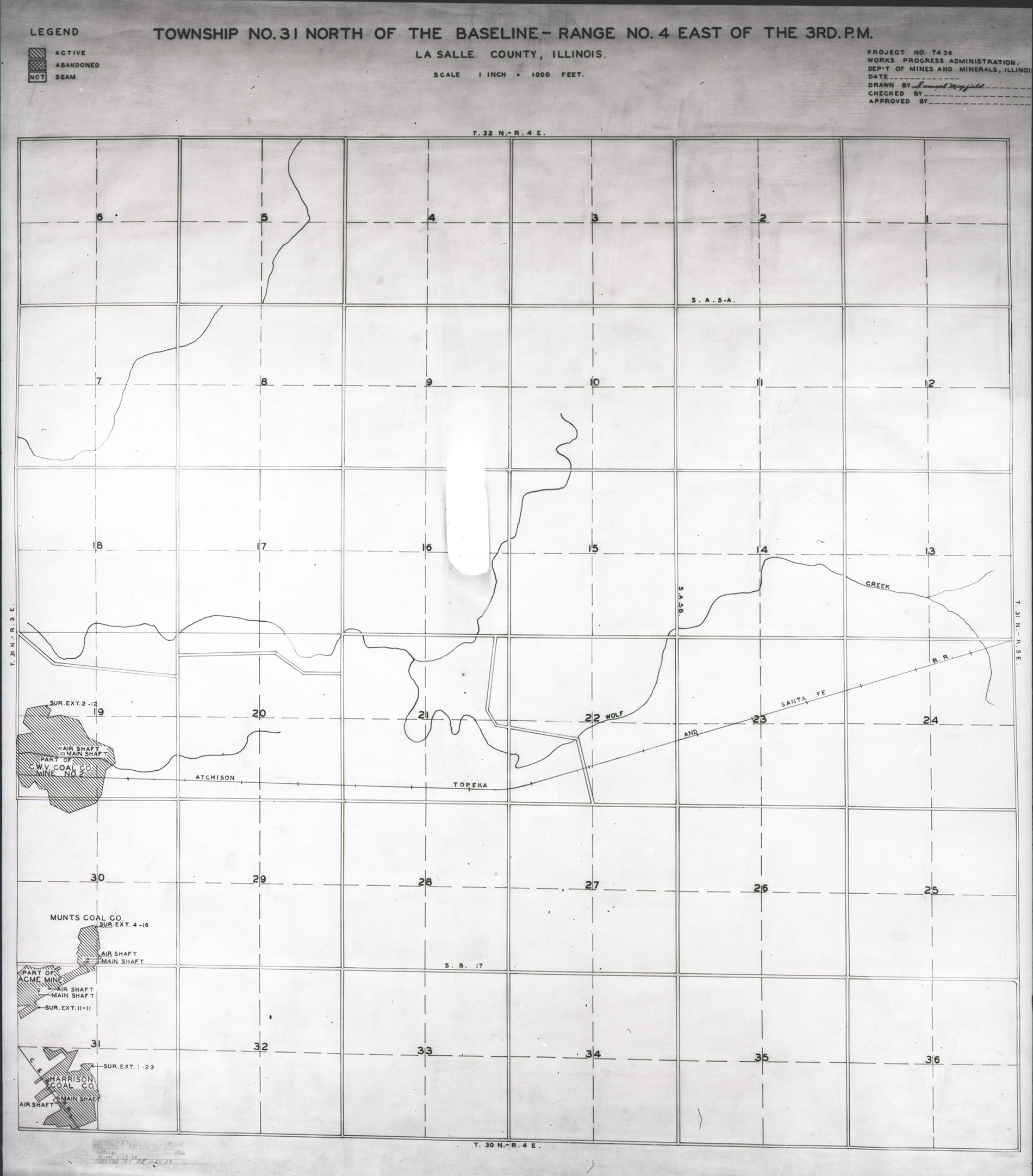
 | LaSalle, T31N-R4E | La Salle | T31N-R4E | WPA LASALLE 31N-4E.jpg |
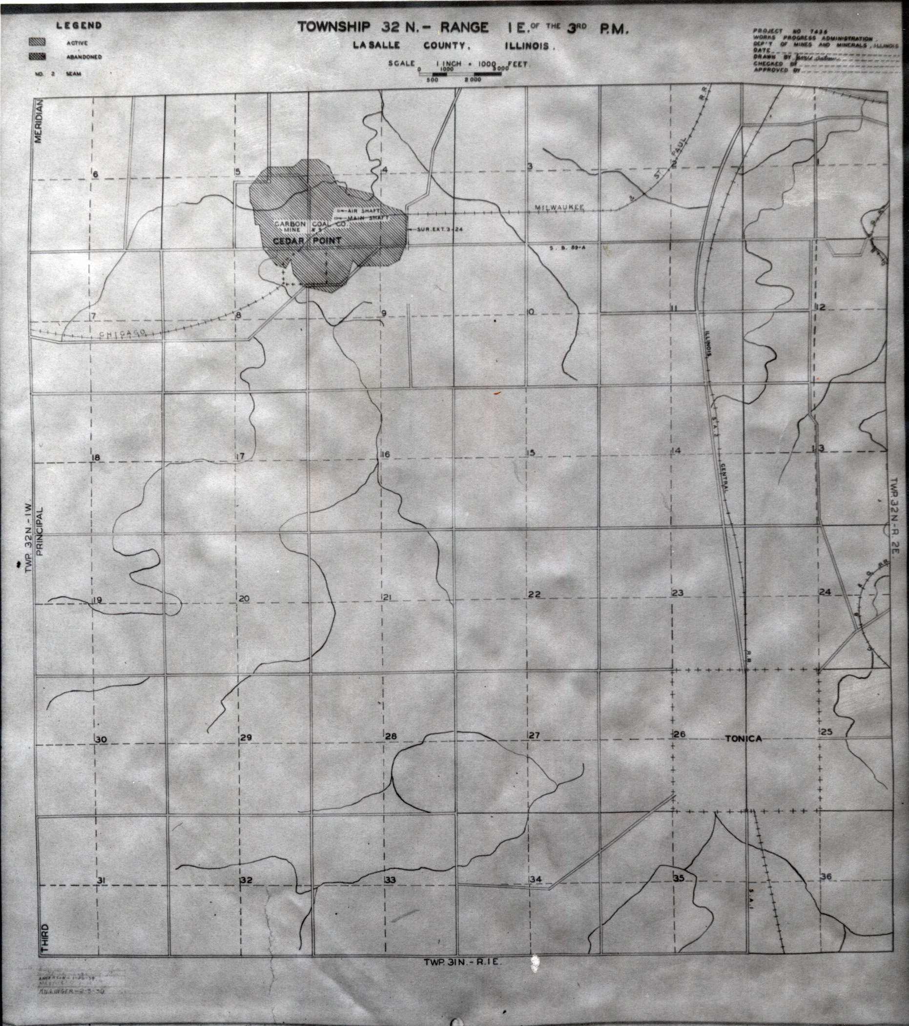
 | LaSalle, T32N-R1E | La Salle | T32N-R1E | WPA LASALLE 32N-1E.jpg |
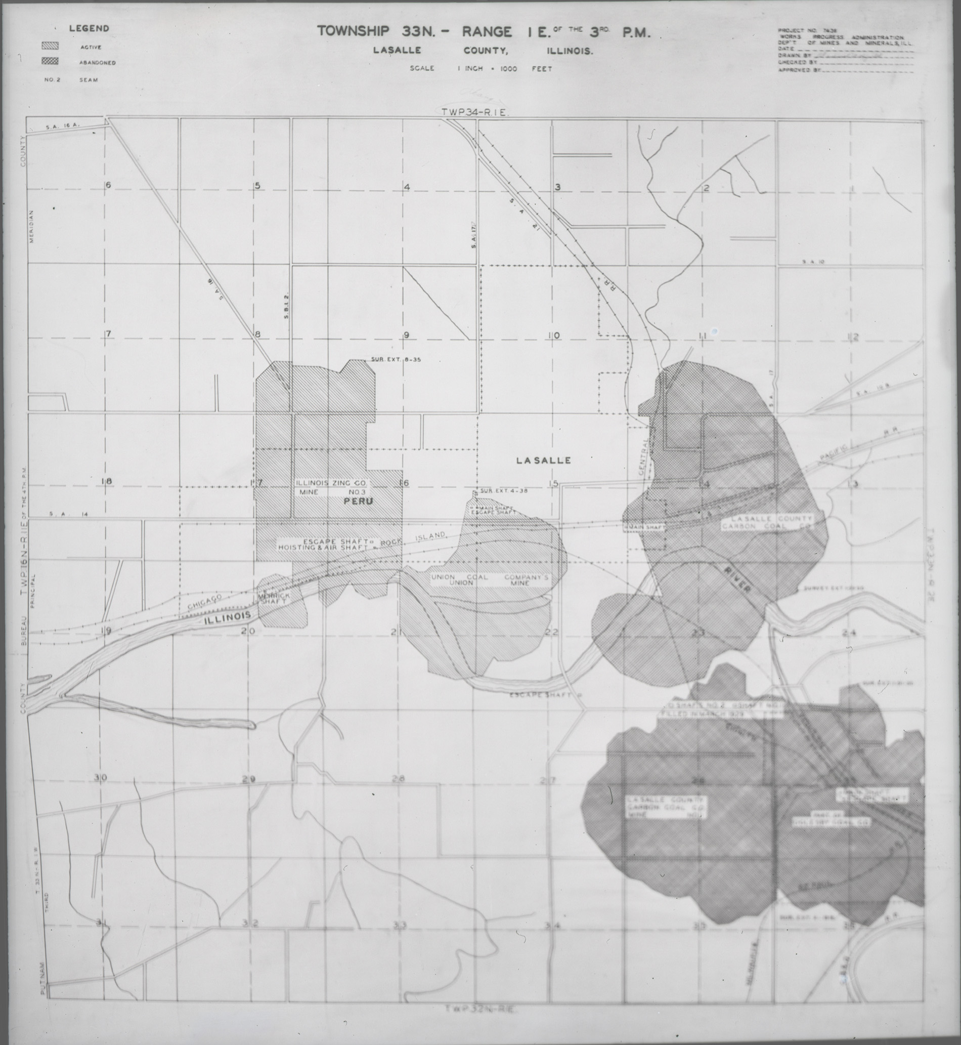
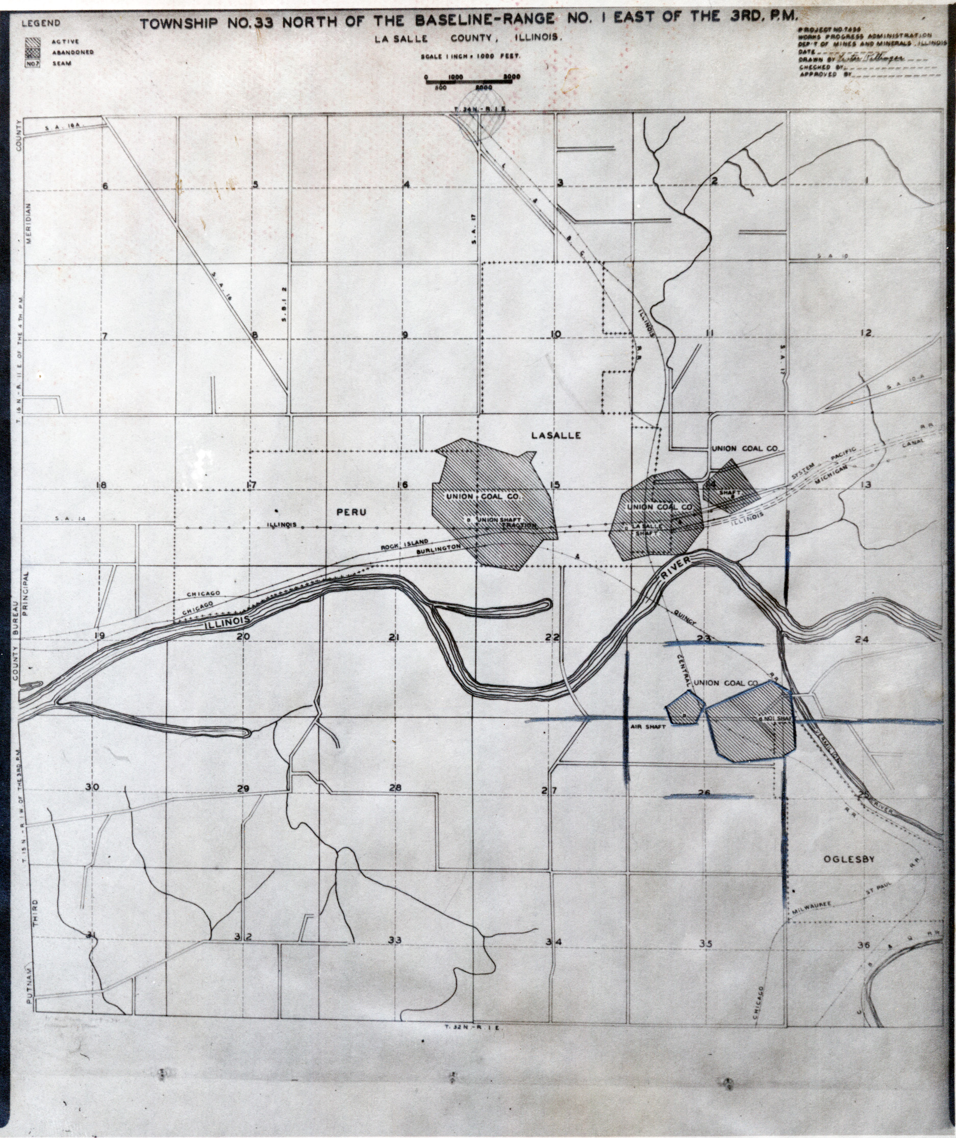
 | LaSalle, T33N-R1E Seam No.2 | La Salle | T33N-R1E | WPA LASALLE 33N-1E SEAM2.jpg |
 | LaSalle, T33N-R1E Seam No.7 | La Salle | T33N-R1E | WPA LASALLE 33N-1E SEAM7.jpg |
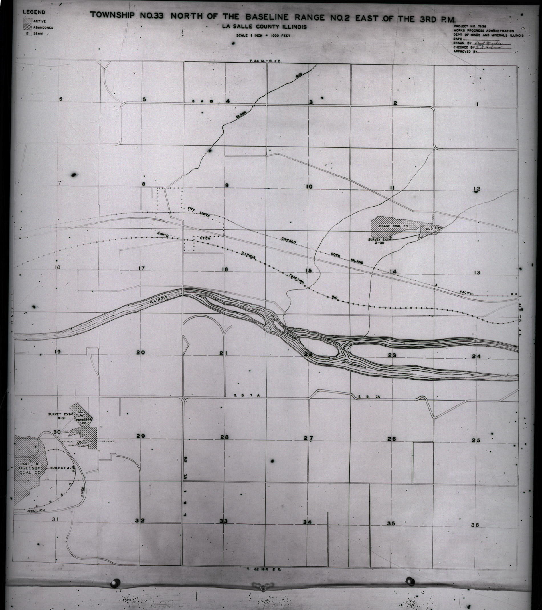
 | LaSalle, T33N-R2E No.1 | La Salle | T33N-R2E | WPA LASALLE 33N-2E no 1.jpg |
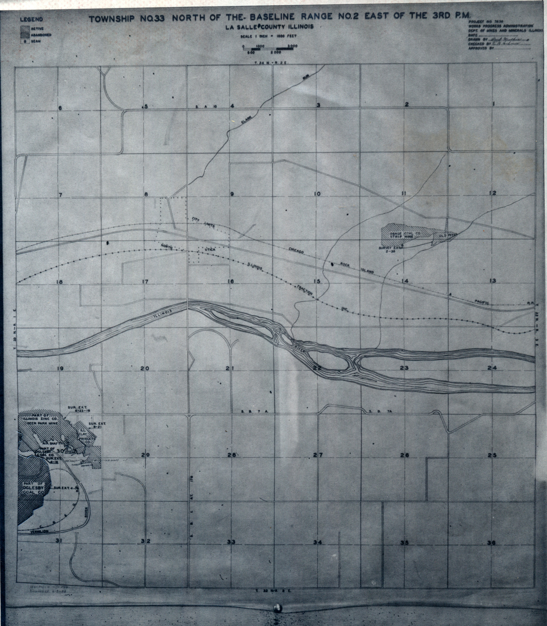
 | LaSalle, T33N-R2E No. 2 | La Salle | T33N-R2E | WPA LASALLE 33N-2E no 2.jpg |
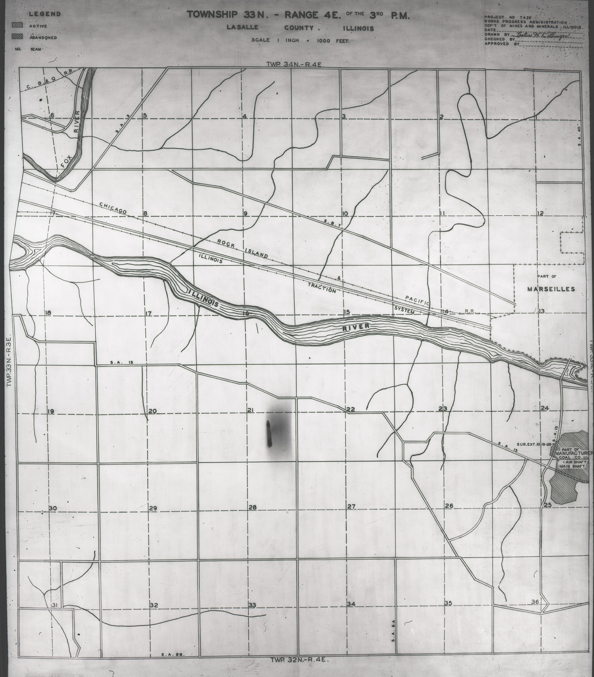
 | LaSalle, T33N-R4E | La Salle | T33N-R4E | WPA LASALLE 33N-4E.jpg |
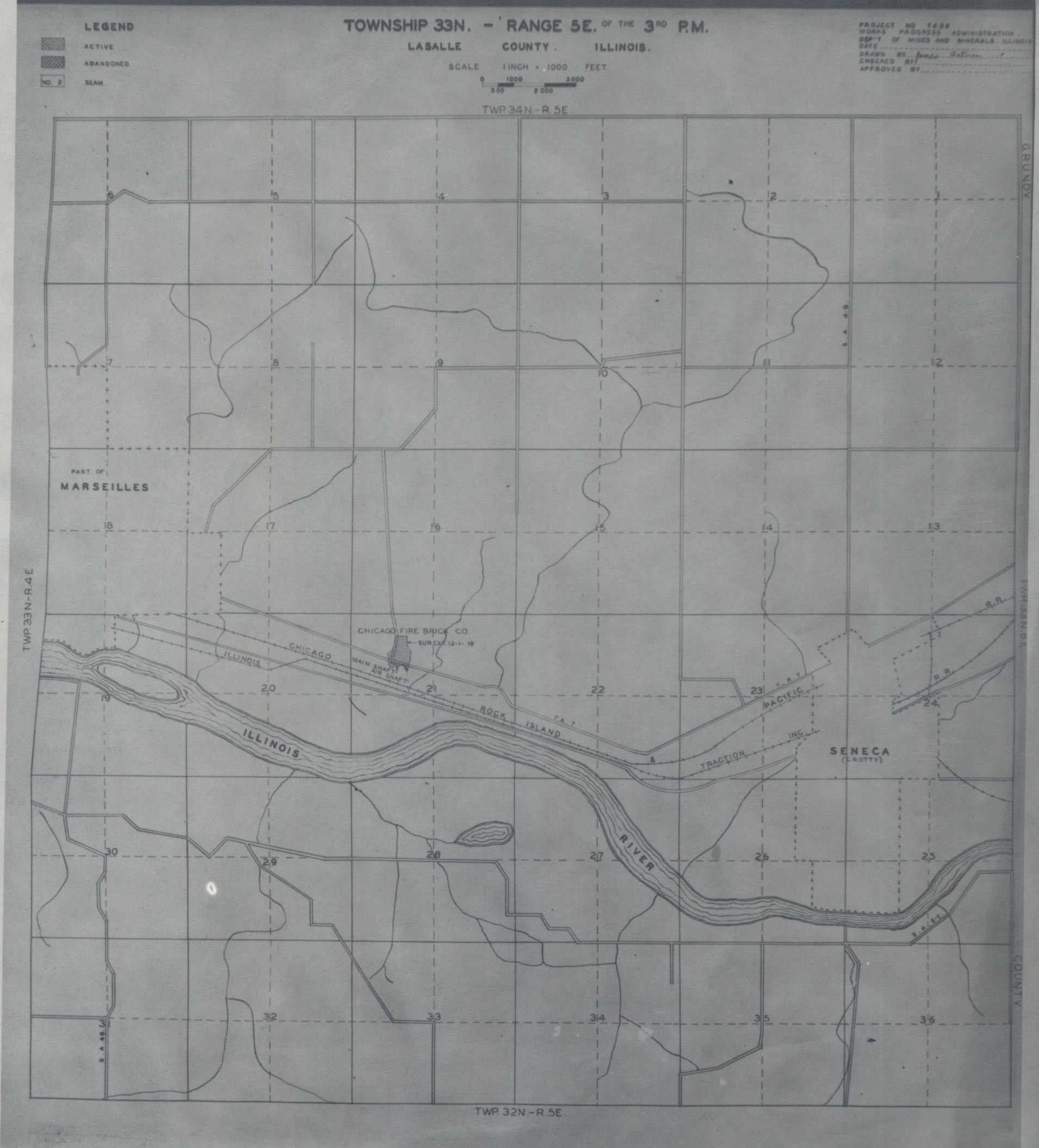
 | LaSalle, T33N-R5E | La Salle | T33N-R5E | WPA LASALLE 33N-5E.jpg |
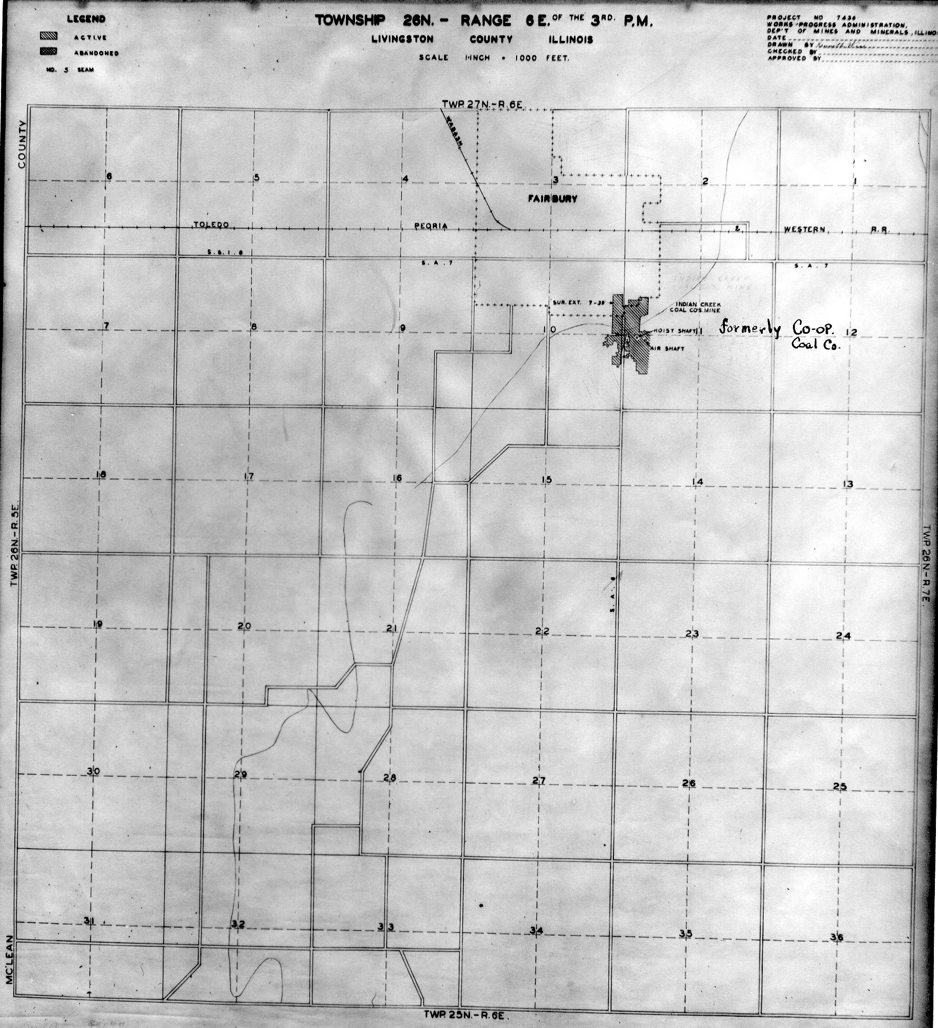
 | Livingston, T26N-R6E | Livingston | T26N-R6E | WPA LIVINGSTON 26N6E NO 1.jpg |
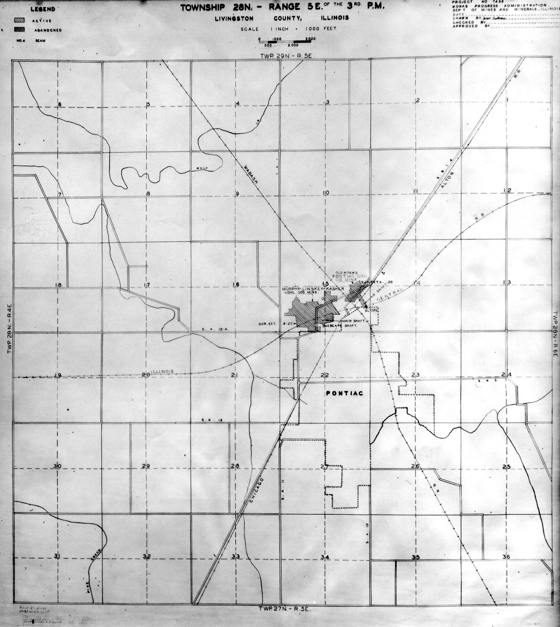
 | Livingston, T28N-R5E | Livingston | T28N-R5E | WPA LIVINGSTON 28N5E.jpg |
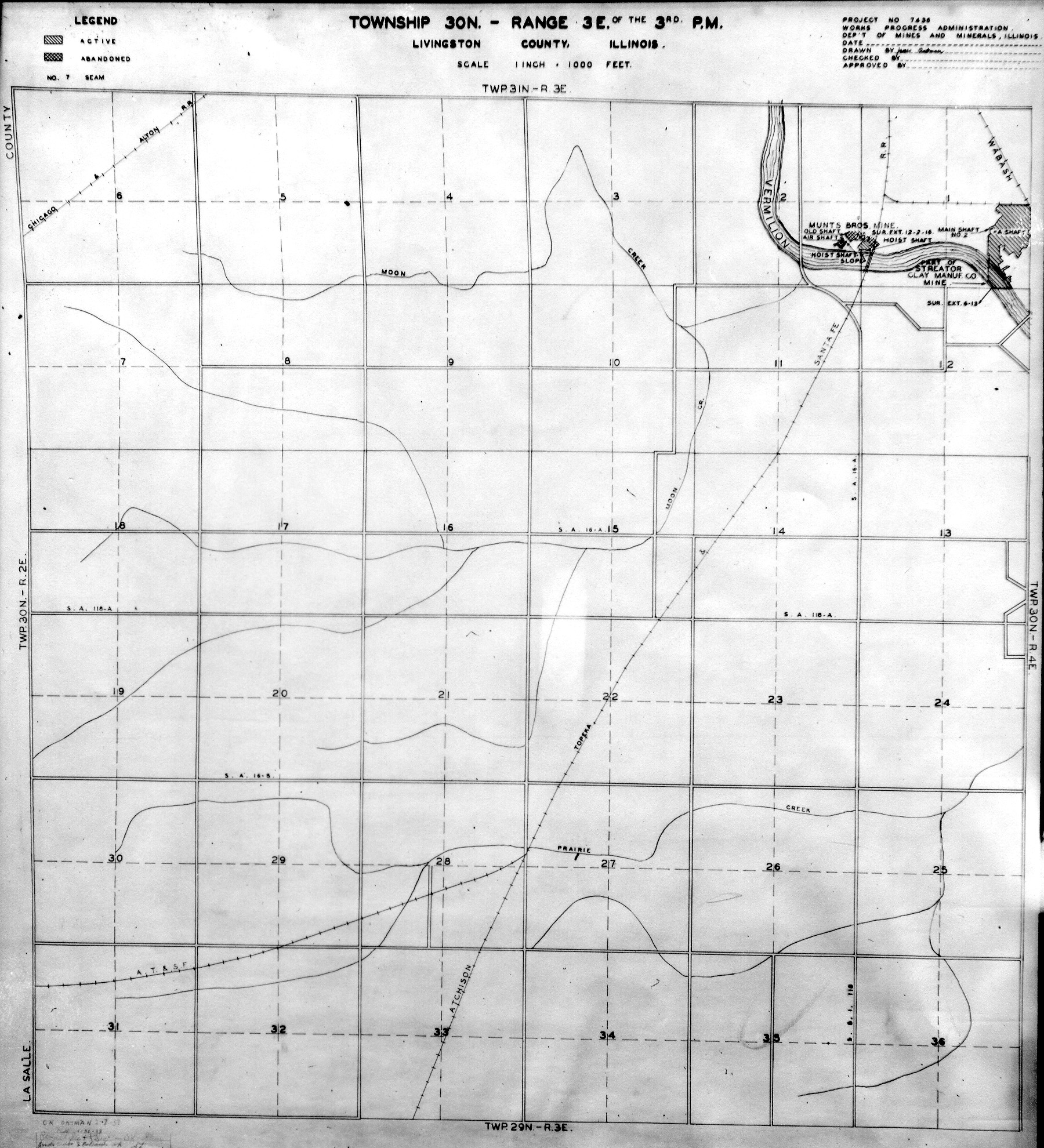
 | Livingston, T30N-R3E | Livingston | T30N-R3E | WPA LIVINGSTON 30N3E.jpg |
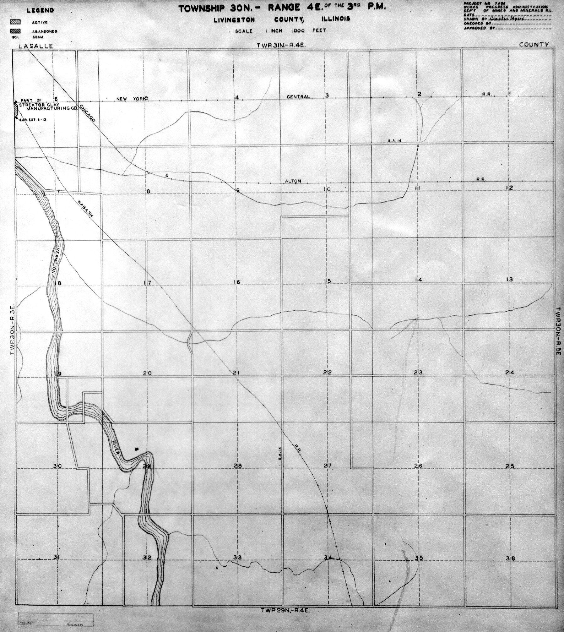
 | Livingston, T30N-R4E | Livingston | T30N-R4E | WPA LIVINGSTON 30N4E.jpg |
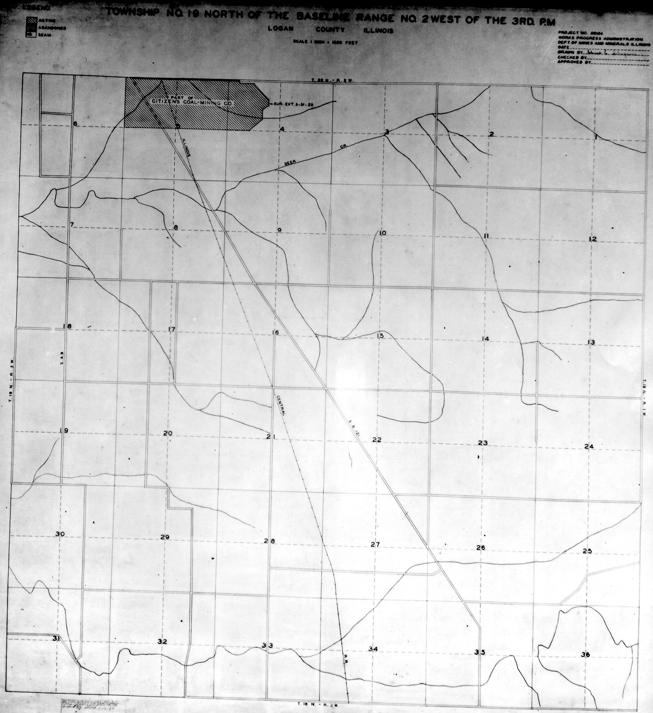
 | Logan, T19N-R2W | Logan | T19N-R2W | WPA LOGAN 19N2W.jpg |
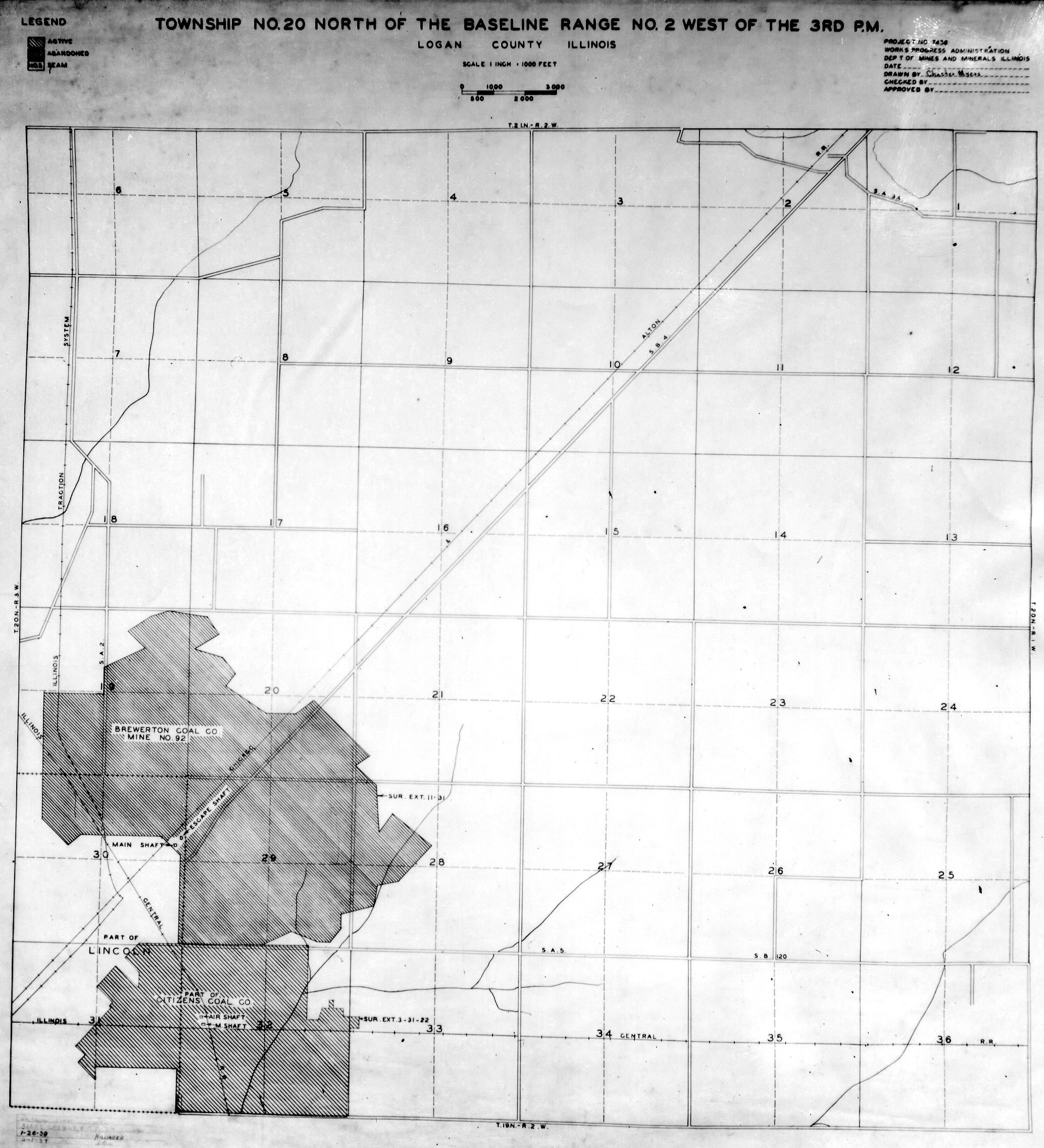
 | Logan, T20N-R2W | Logan | T20N-R2W | WPA LOGAN 20N2W.jpg |
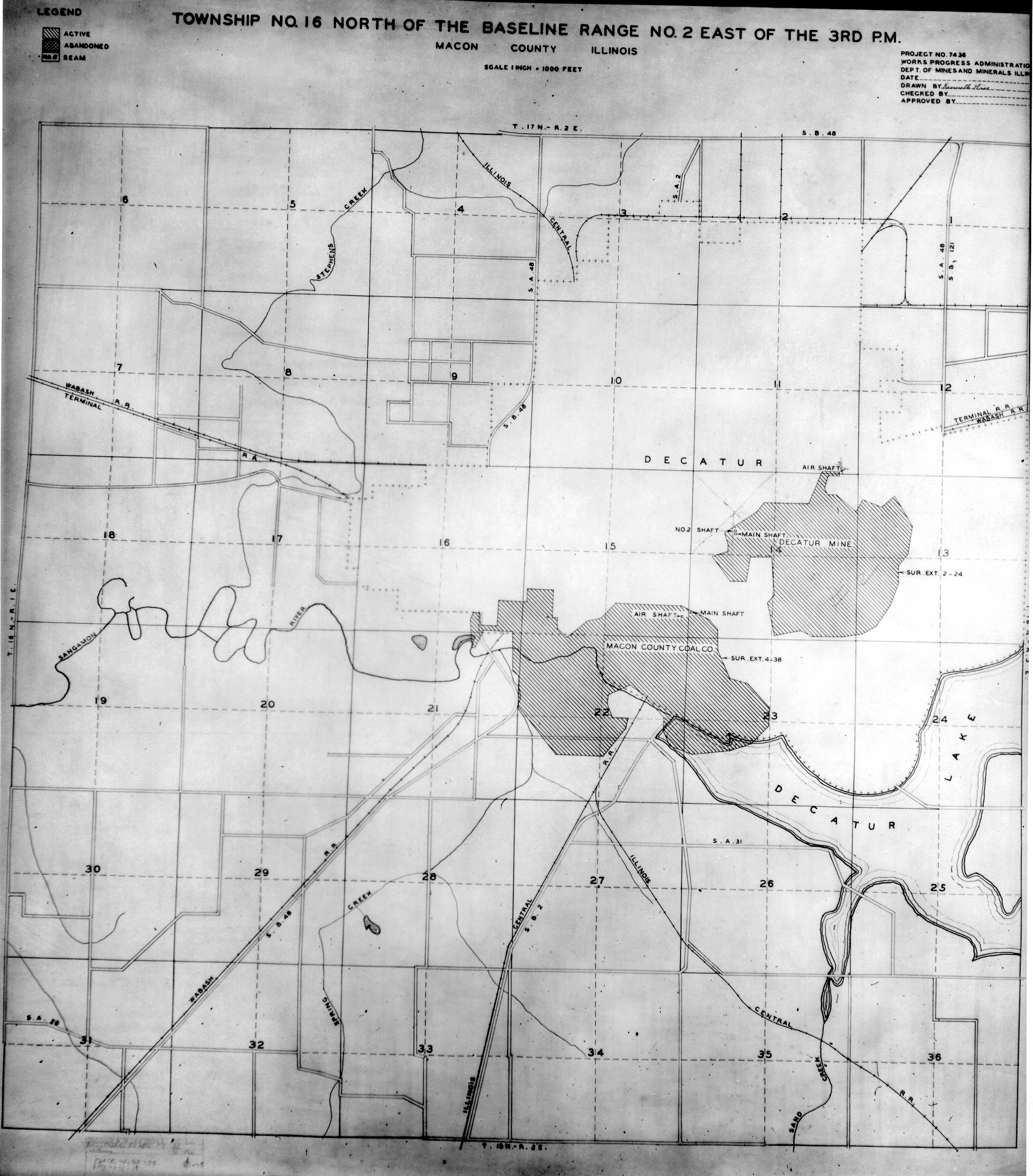
 | Macon, T16N-R2E | Macon | T16N-R2E | WPA MACON 16N2E.jpg |
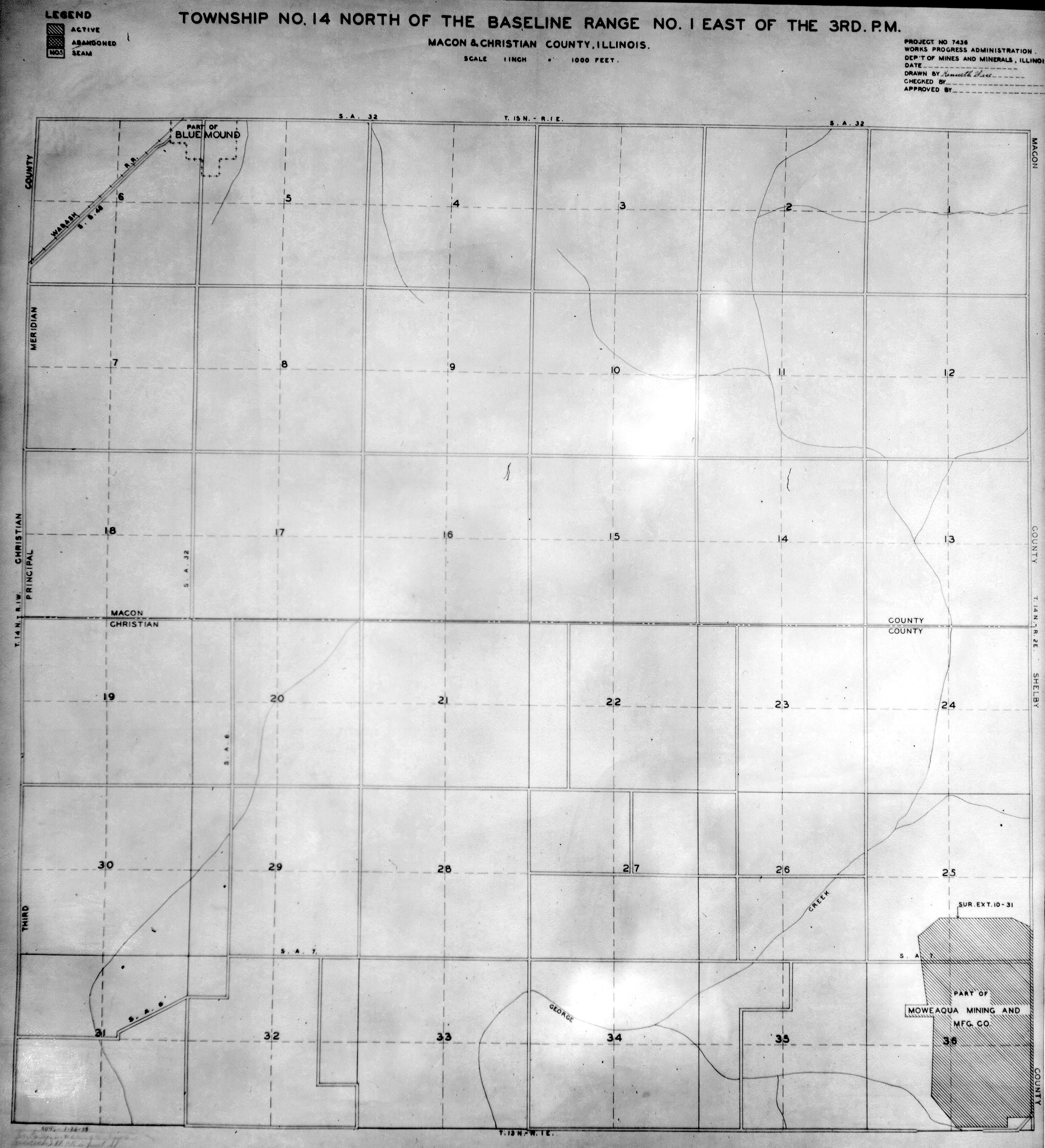
 | Macon & Christian, T14N-R1E | Macon Christian | T14N-R1E | WPA MACON CHRISTIAN 14N1E.jpg |
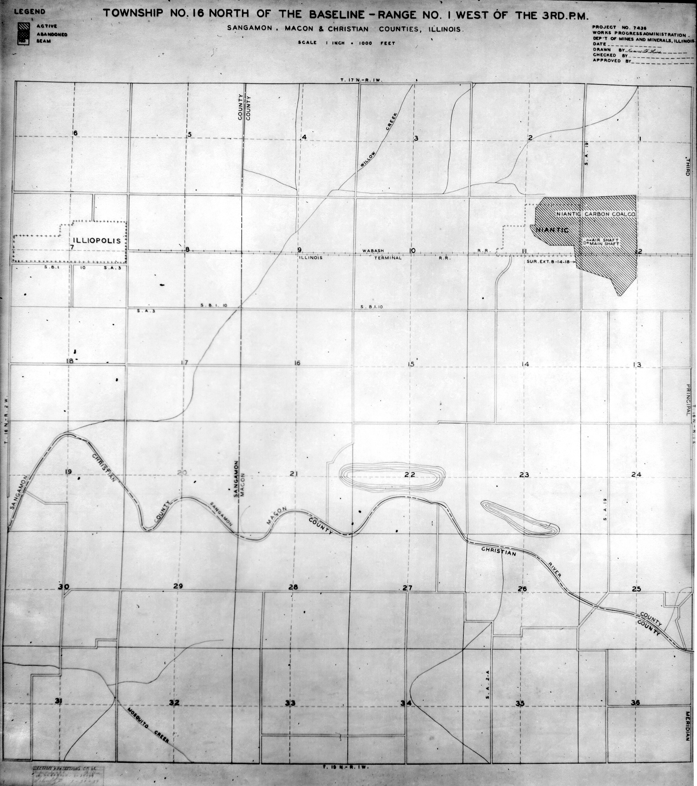
 | Macon, Sangamon & Christian T16N-R1W | Macon Sangamon Christian | T16N-R1W | WPA MACON SANGAMON CHRISTIAN 16N1W.jpg |
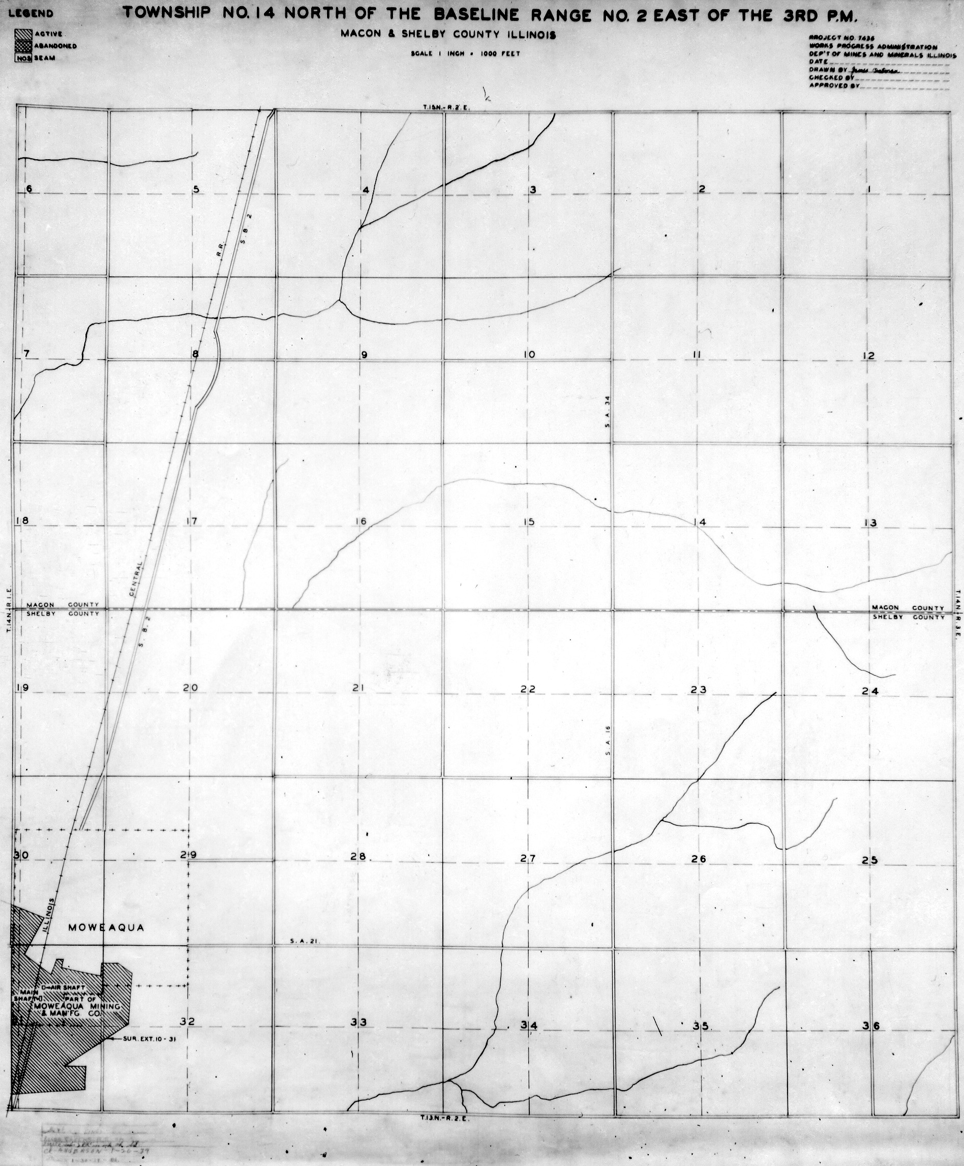
 | Macon & Shelby T14N-R2E | Macon Shelby | T14N-R2E | WPA MACON SHELBY 14N2E.jpg |
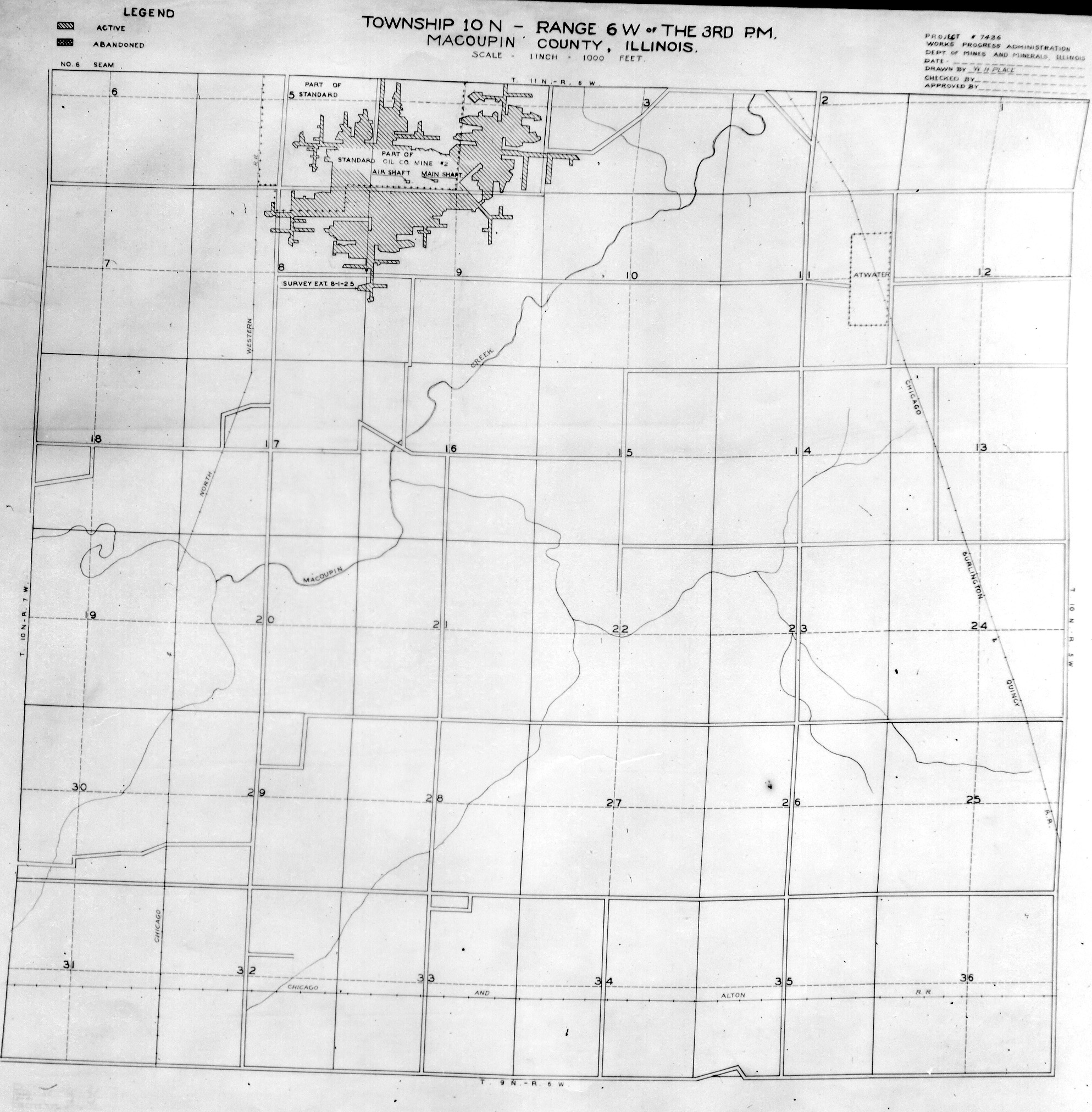
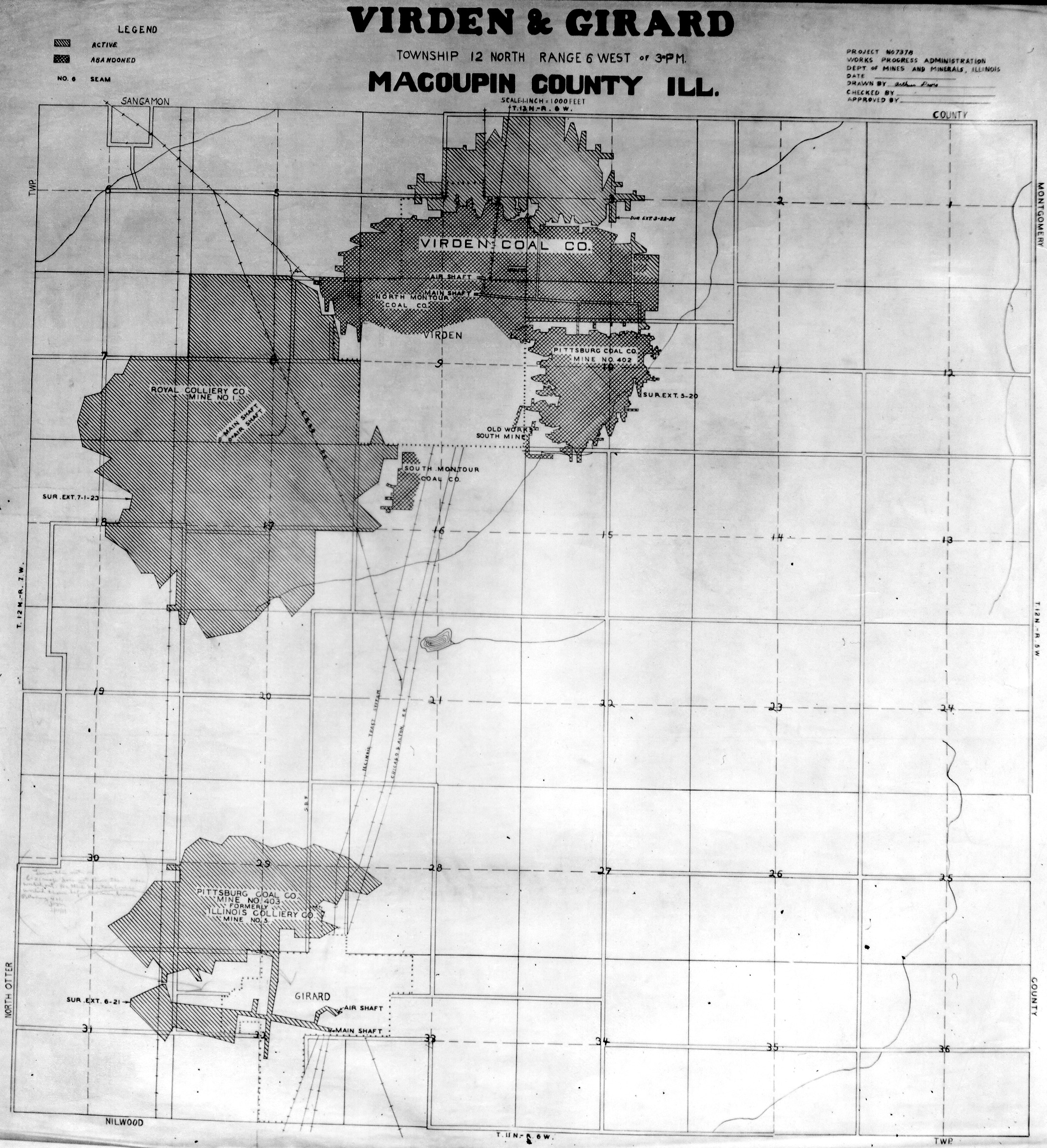
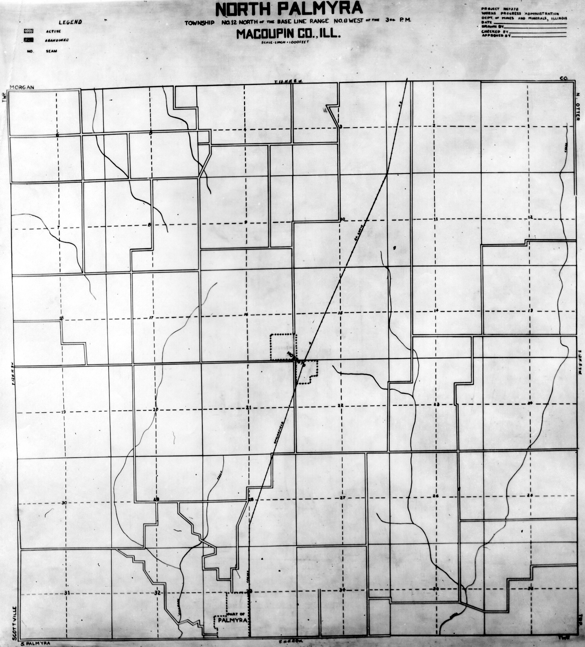
 | Macoupin T10N-R6W | Macoupin | T10N-R6W | WPA MACOUPIN 10N6W.jpg |
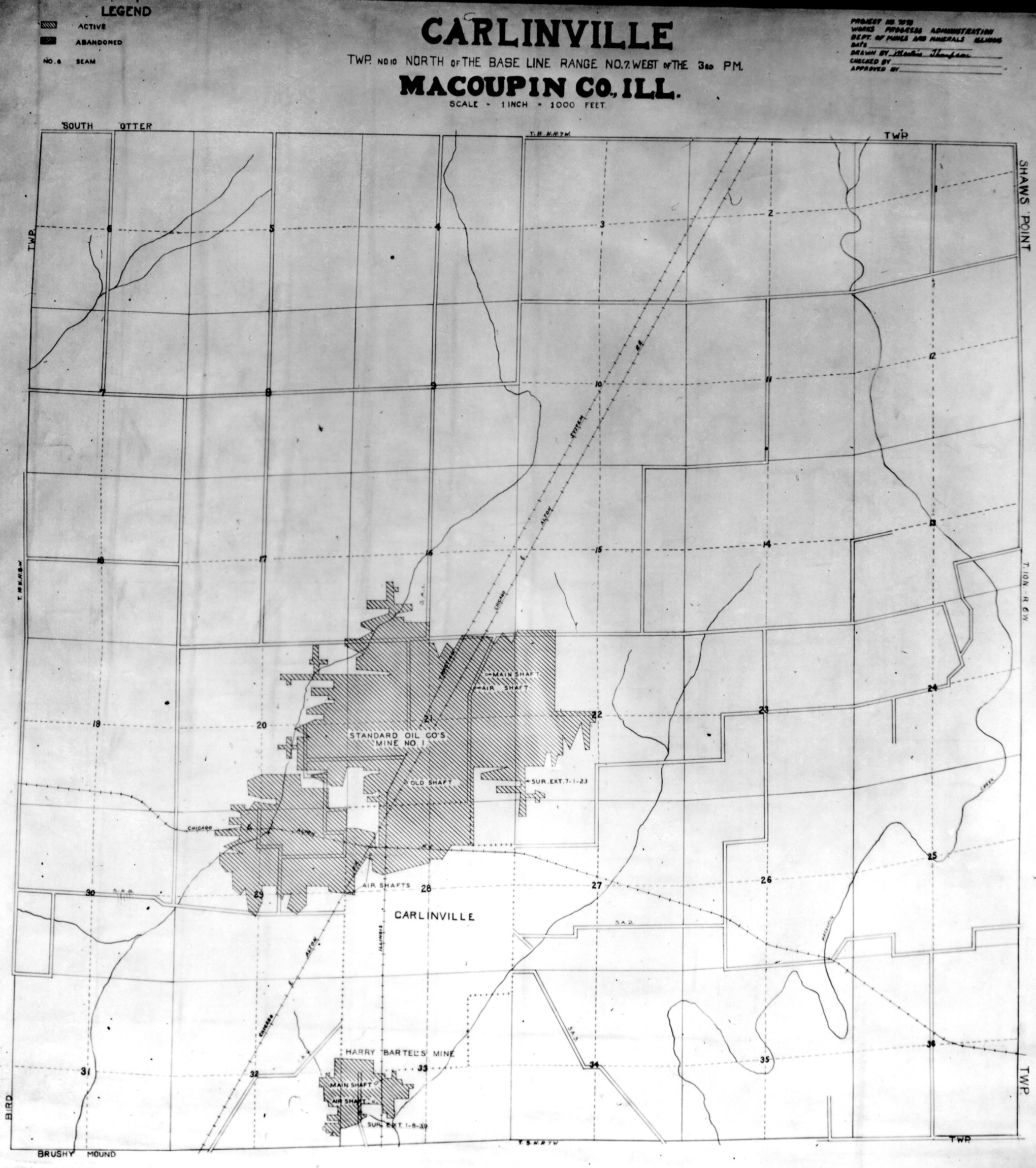
 | Macoupin T10N-R7W | Macoupin | T10N-R7W | WPA MACOUPIN 10N7W.jpg |
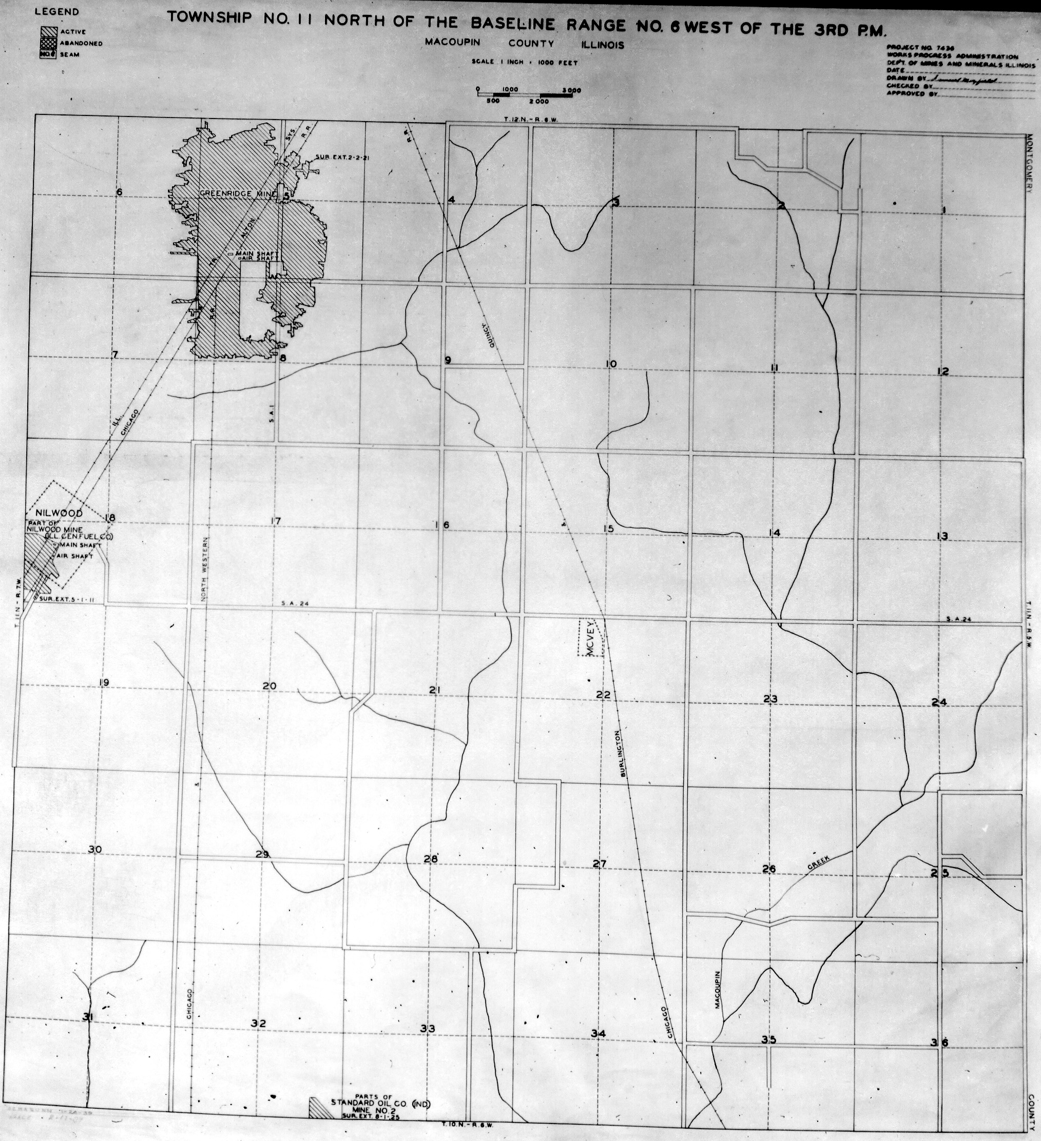
 | Macoupin T11N-R6W | Macoupin | T11N-R6W | WPA MACOUPIN 11N6W.jpg |
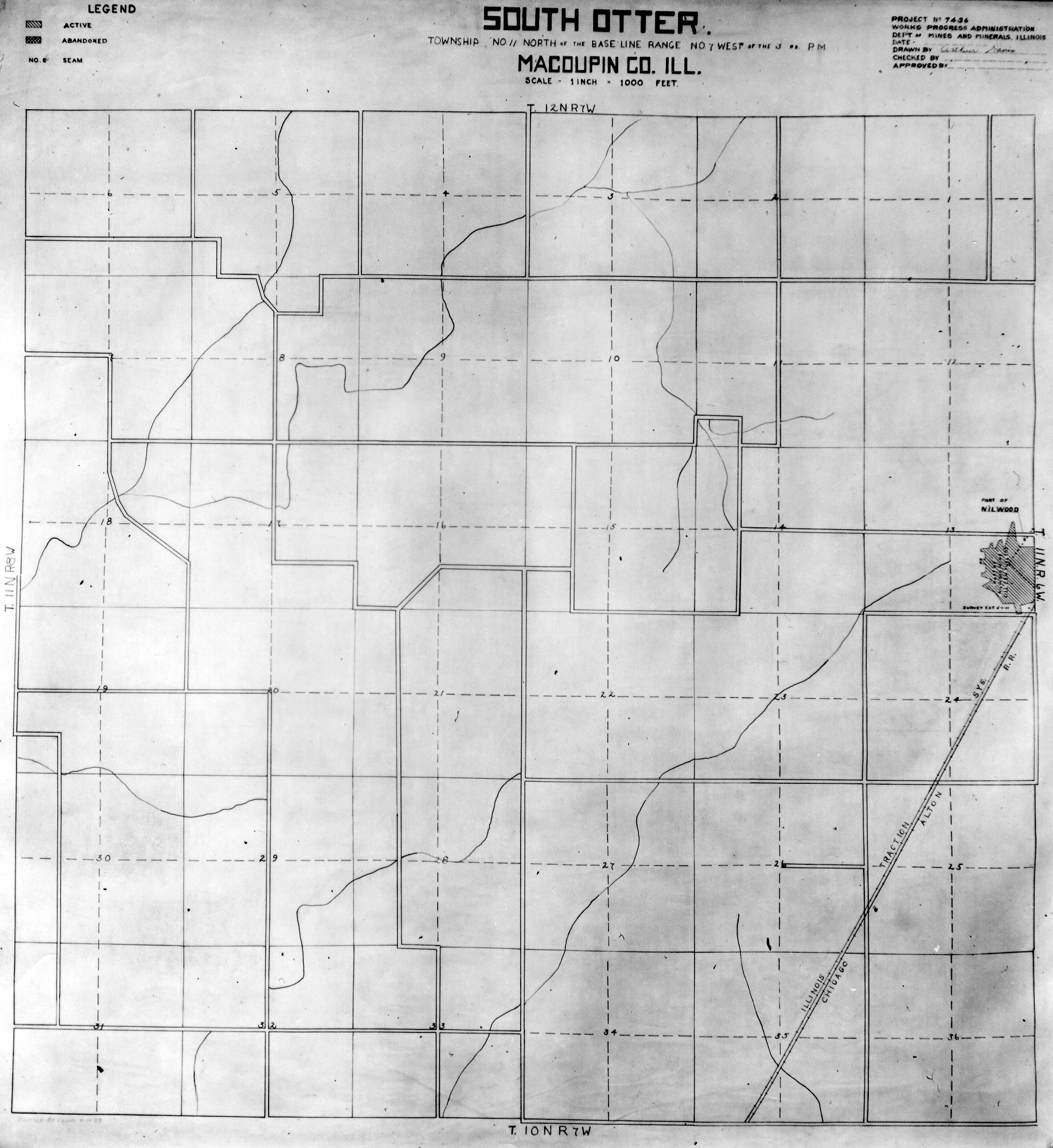
 | Macoupin T11N-R7W | Macoupin | T11N-R7W | WPA MACOUPIN 11N7W.jpg |
 | Macoupin T12N-R6W | Macoupin | T12N-R6W | WPA MACOUPIN 12N6W.jpg |
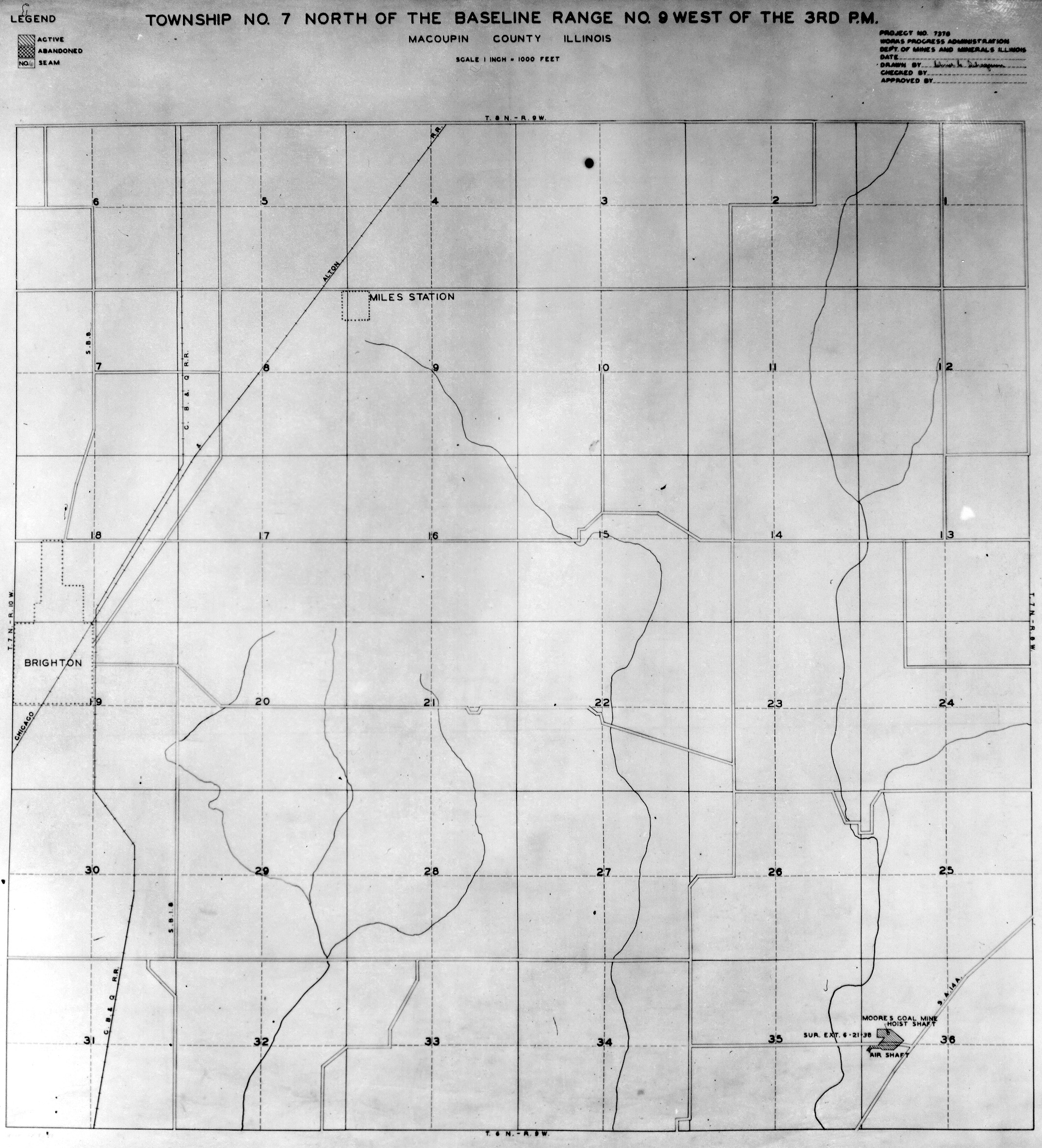
 | Macoupin T12N-R9W | Macoupin | T12N-R9W | WPA MACOUPIN 12N9W.jpg |
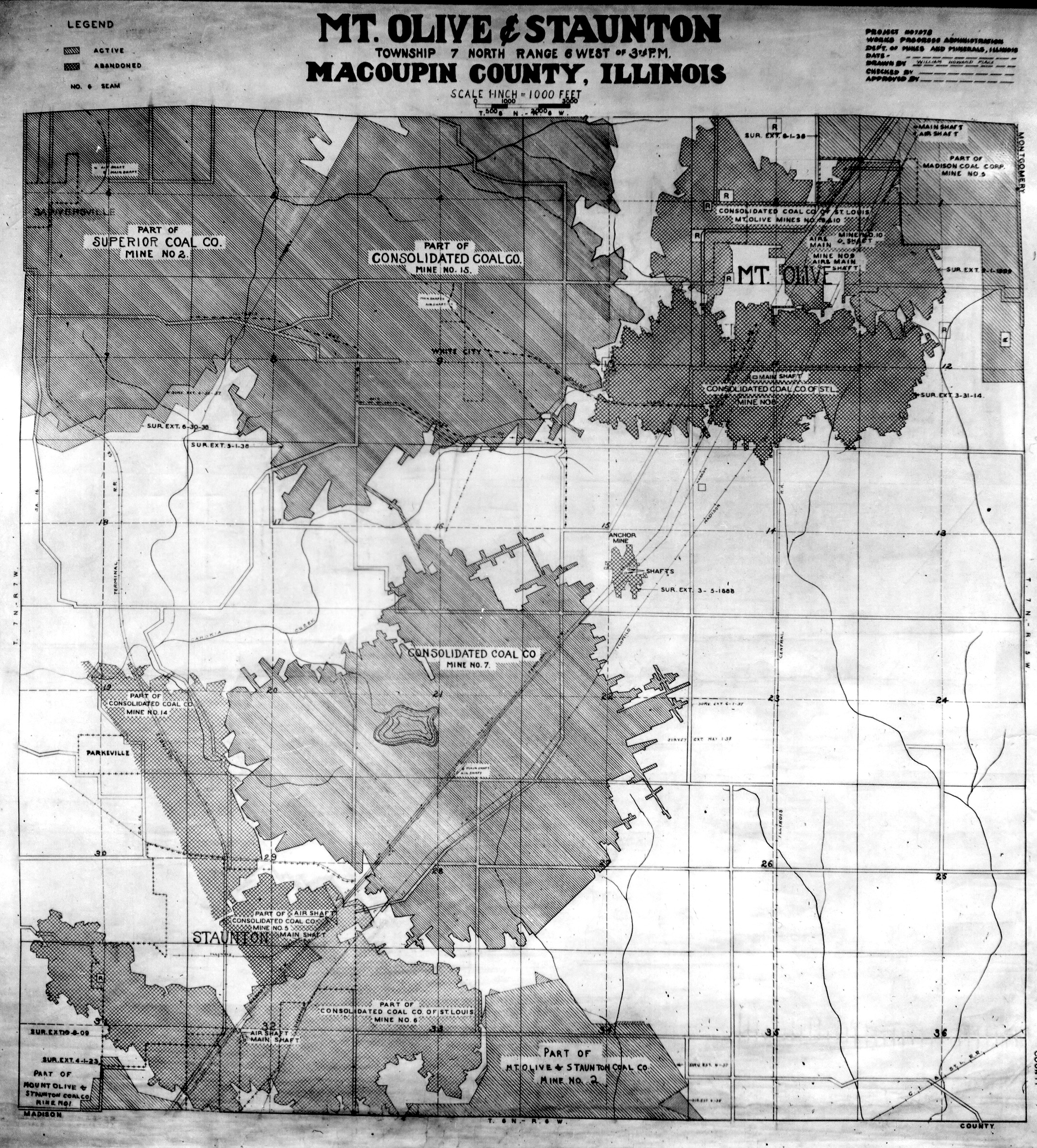
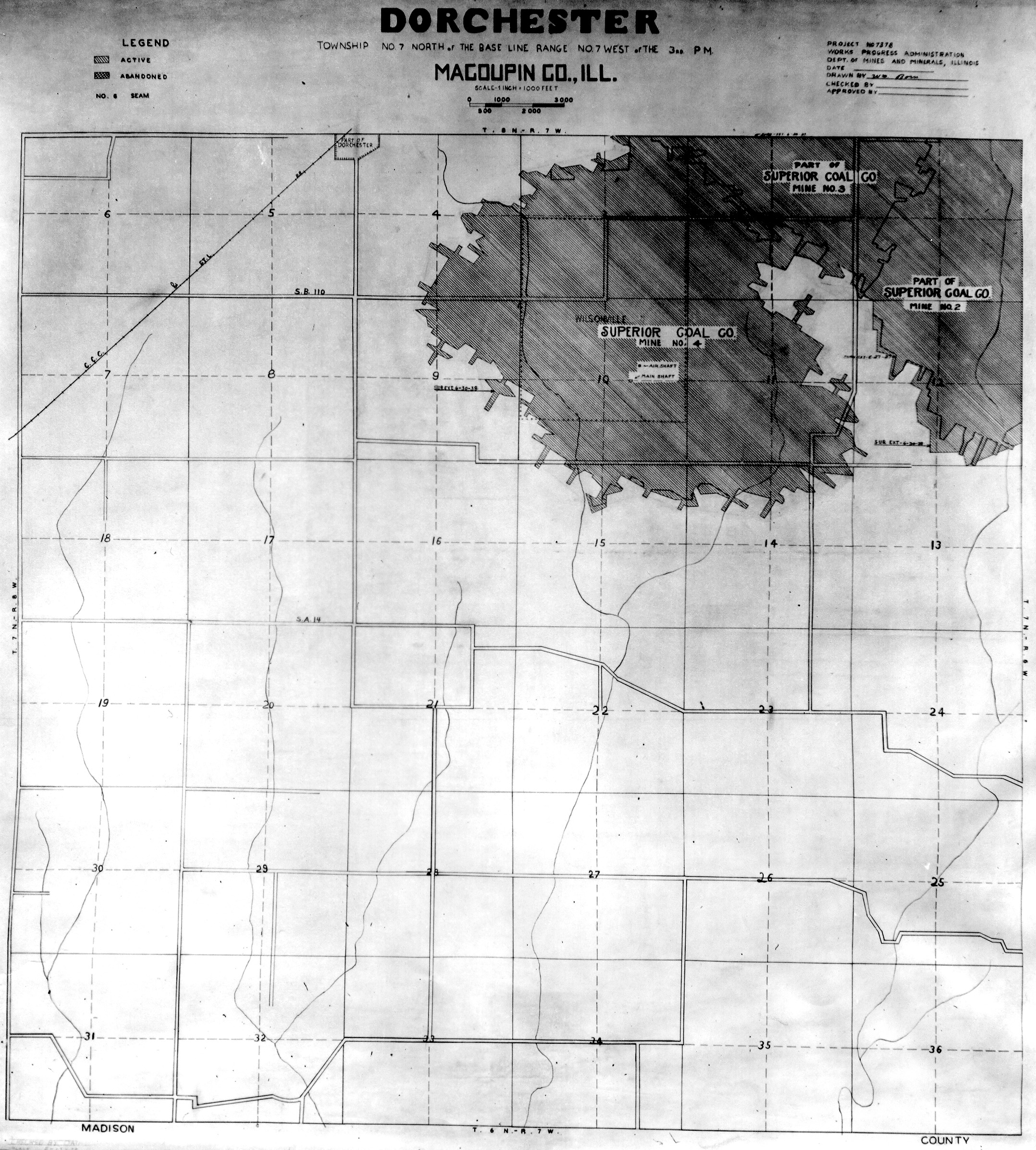
 | Macoupin T7N-R6W | Macoupin | T7N-R6W | WPA MACOUPIN 7N6W.jpg |
 | Macoupin T7N-R7W | Macoupin | T7N-R7W | WPA MACOUPIN 7N7W.jpg |
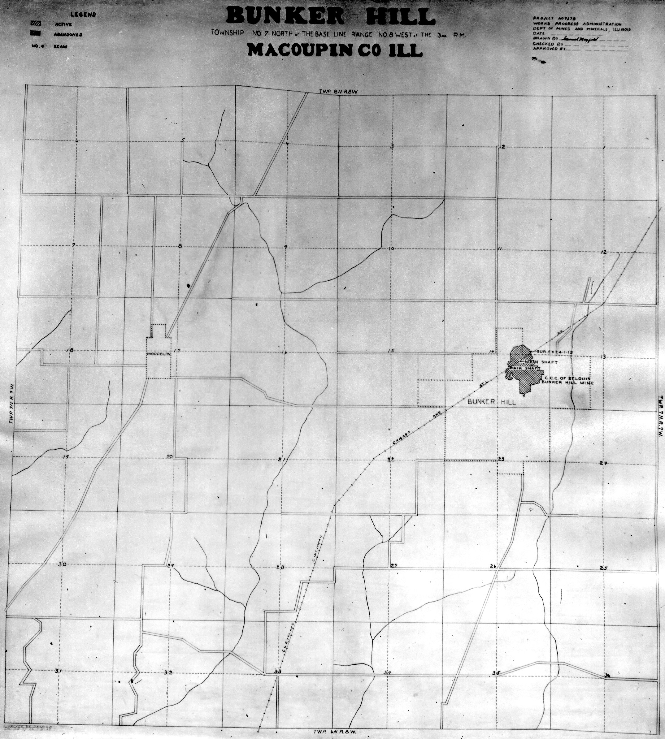
 | Macoupin T7N-R8W No. 1 | Macoupin | T7N-R8W | WPA MACOUPIN 7N8W NO 1.jpg |
 | Macoupin T7N-R8W No. 2 | Macoupin | T7N-R8W | WPA MACOUPIN 7N8W NO 2.jpg |
 | Macoupin T7N-R9W | Macoupin | T7N-R9W | WPA MACOUPIN 7N9W.jpg |
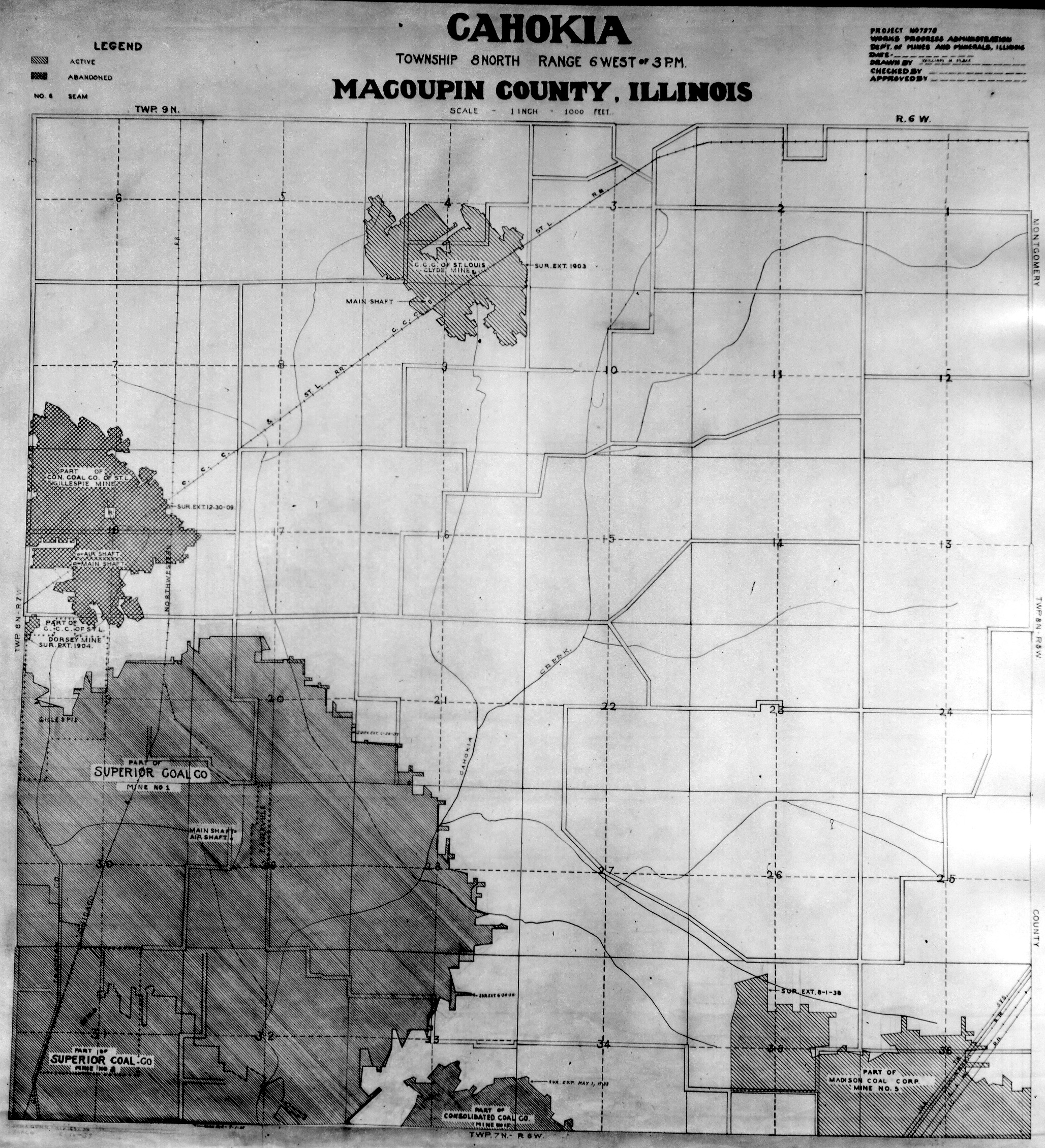
 | Macoupin T8N-R6W | Macoupin | T8N-R6W | WPA MACOUPIN 8N6W.jpg |
 | Macoupin T8N-R7W | Macoupin | T8N-R7W | WPA MACOUPIN 8N7W.jpg |
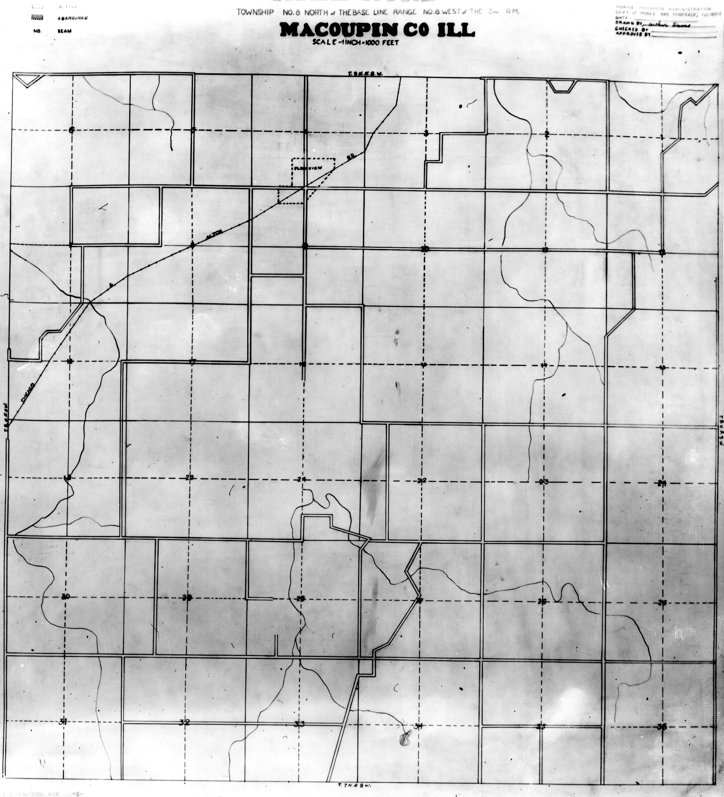
 | Macoupin T8N-R8W | Macoupin | T8N-R8W | WPA MACOUPIN 8N8W.jpg |
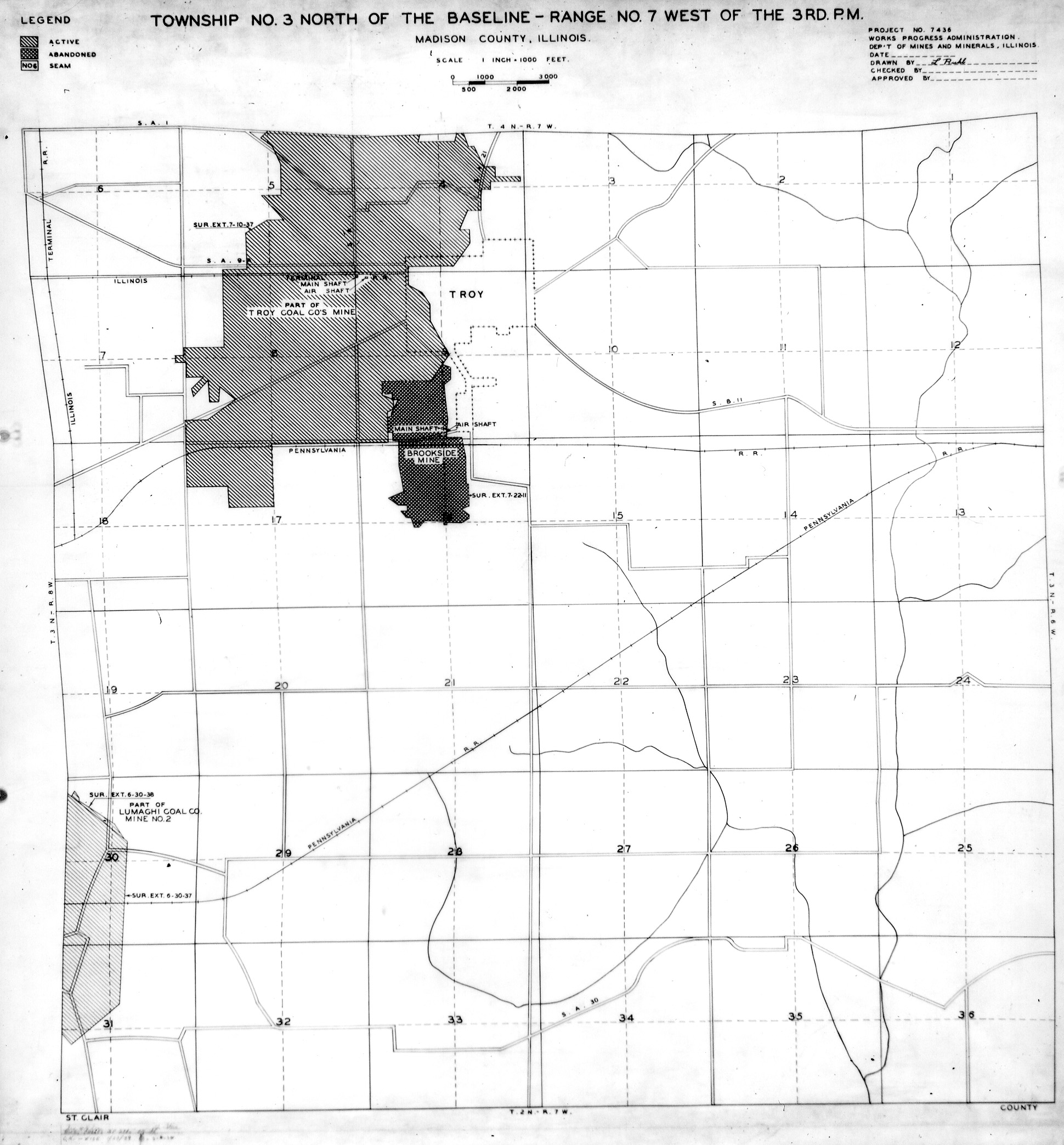
 | Madison, T3N-R7W | Madison | T3N-R7W | WPA MADISON 3N7W.jpg |
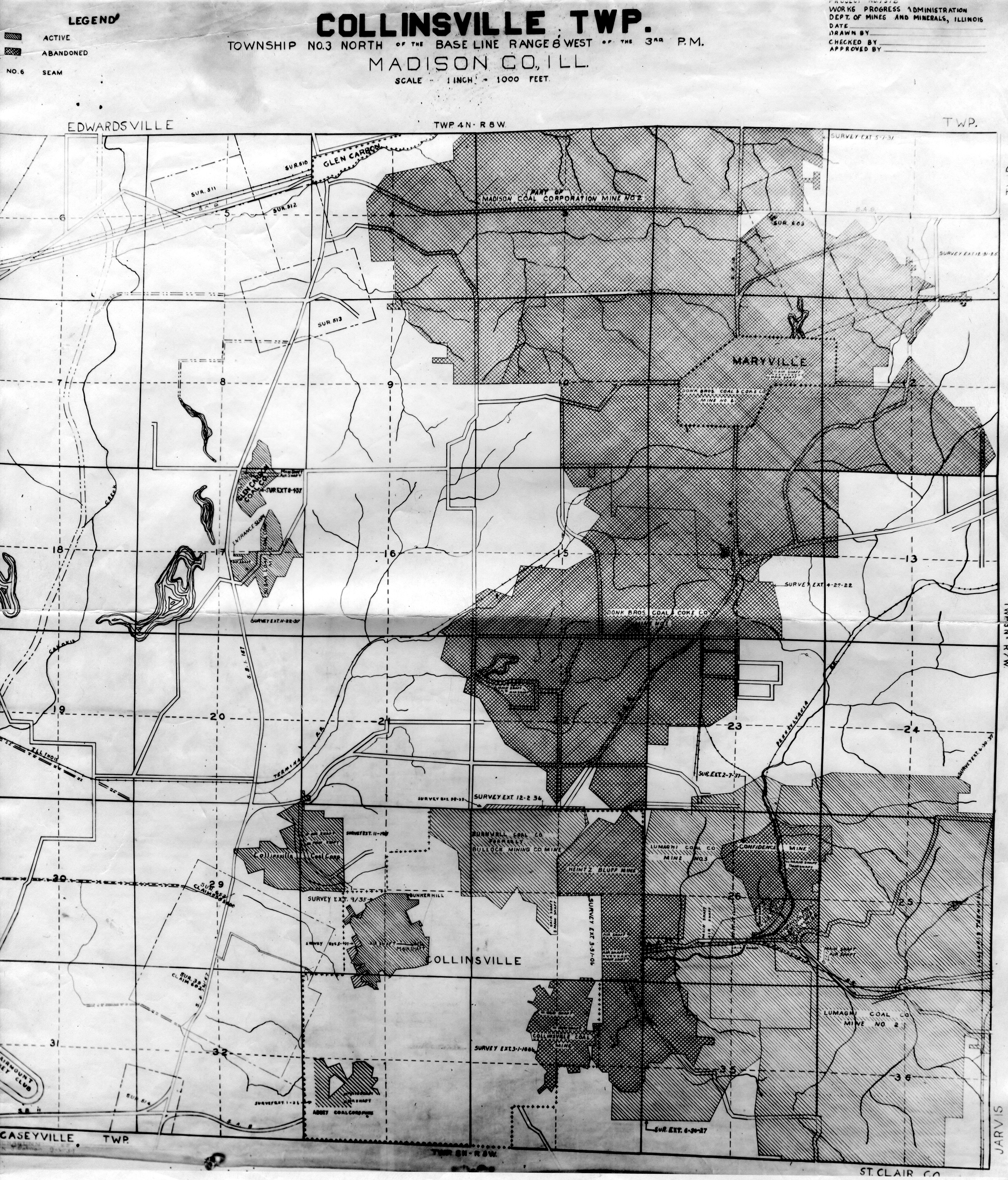
 | Madison, T3N-R8W | Madison | T3N-R8W | WPA MADISON 3N8W.jpg |
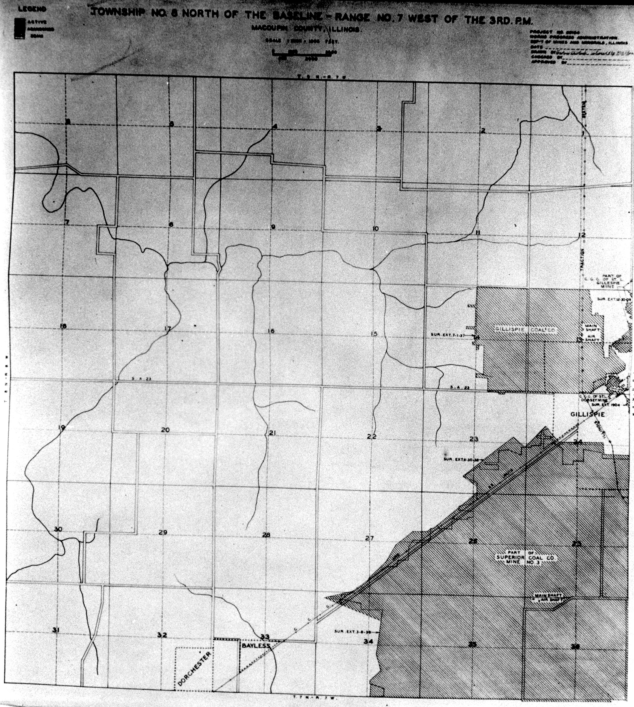
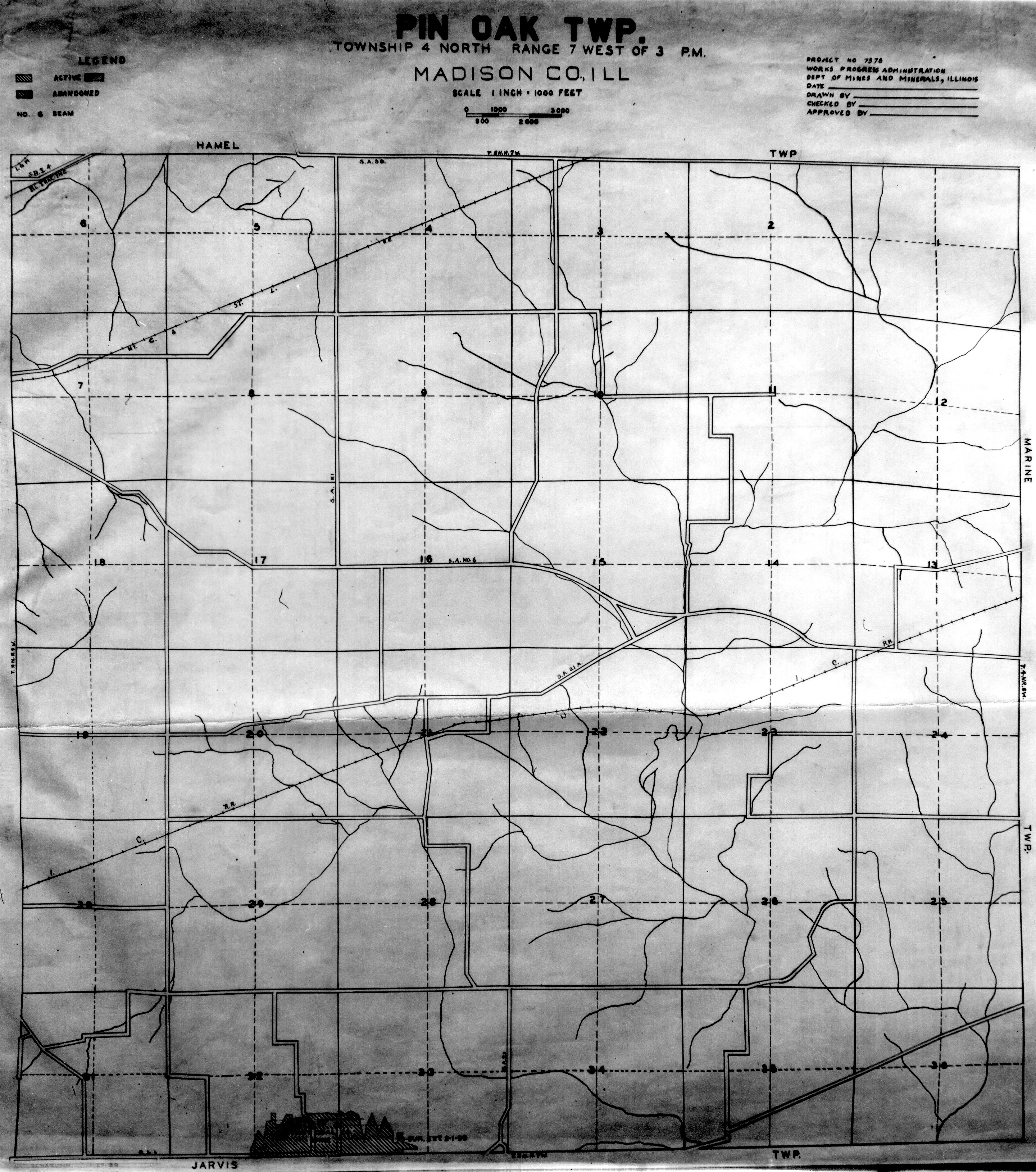
 | Madison, T4N-R7W | Madison | T4N-R7W | WPA MADISON 4N7W.jpg |
 | Madison, T4N-R8W | Madison | T4N-R8W | WPA MADISON 4N8W.jpg |
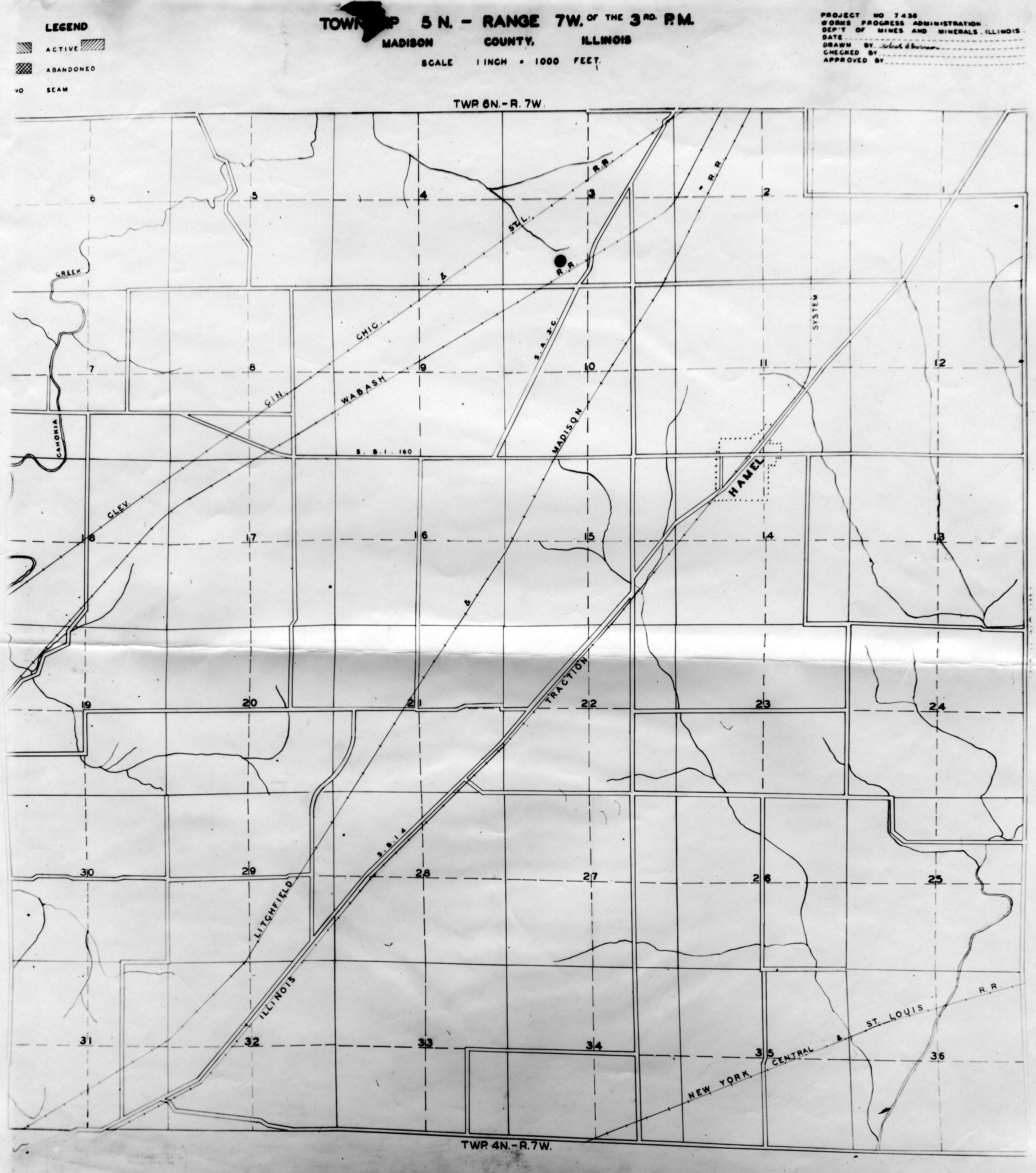
 | Madison, T5N-R7W | Madison | T5N-R7W | WPA MADISON 5N7W.jpg |
 | Madison, T5N-R8W | Madison | T5N-R8W | WPA MADISON 5N8W.jpg |
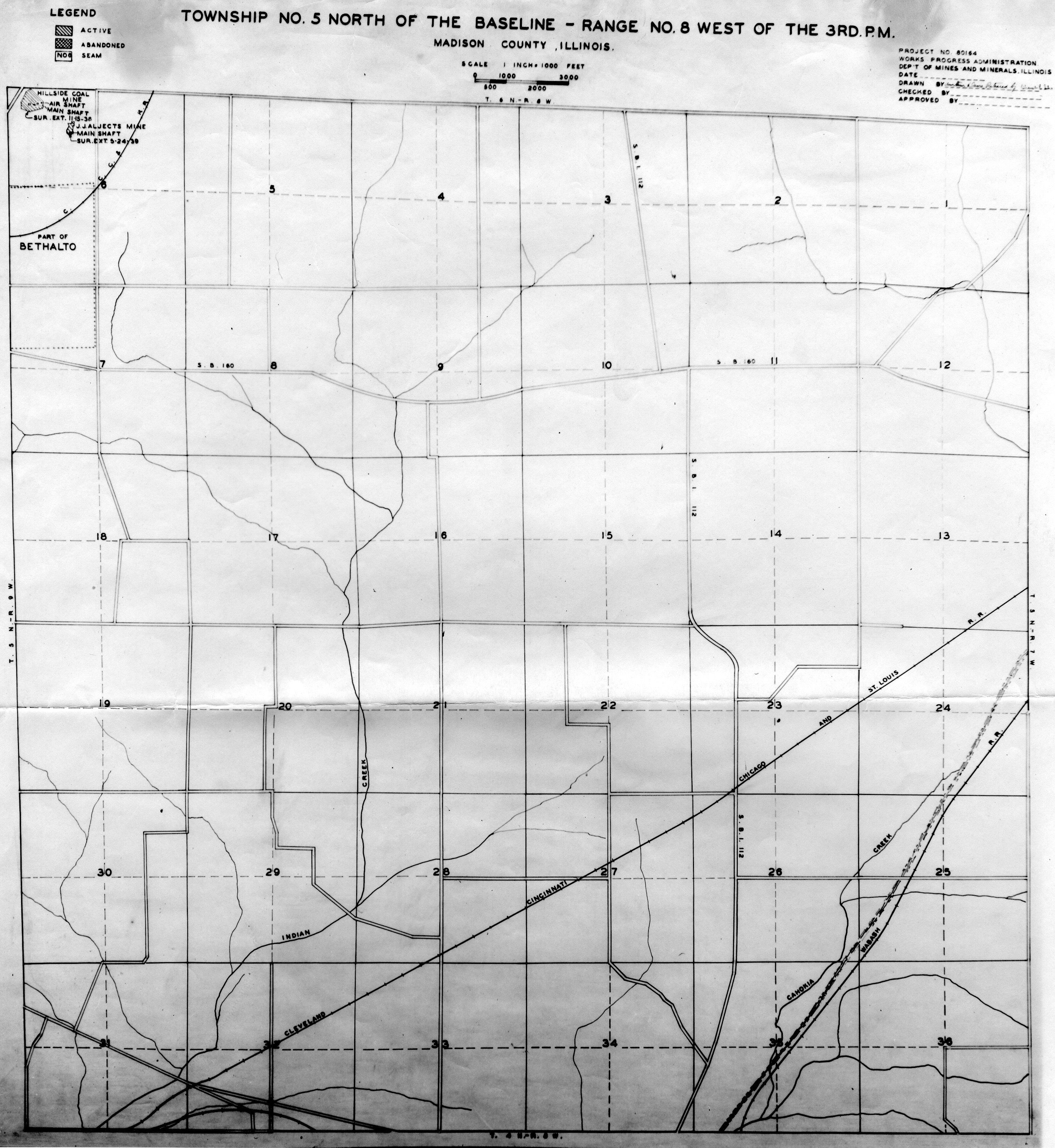
 | Madison, T5N-R9W | Madison | T5N-R9W | WPA MADISON 5N9W.jpg |
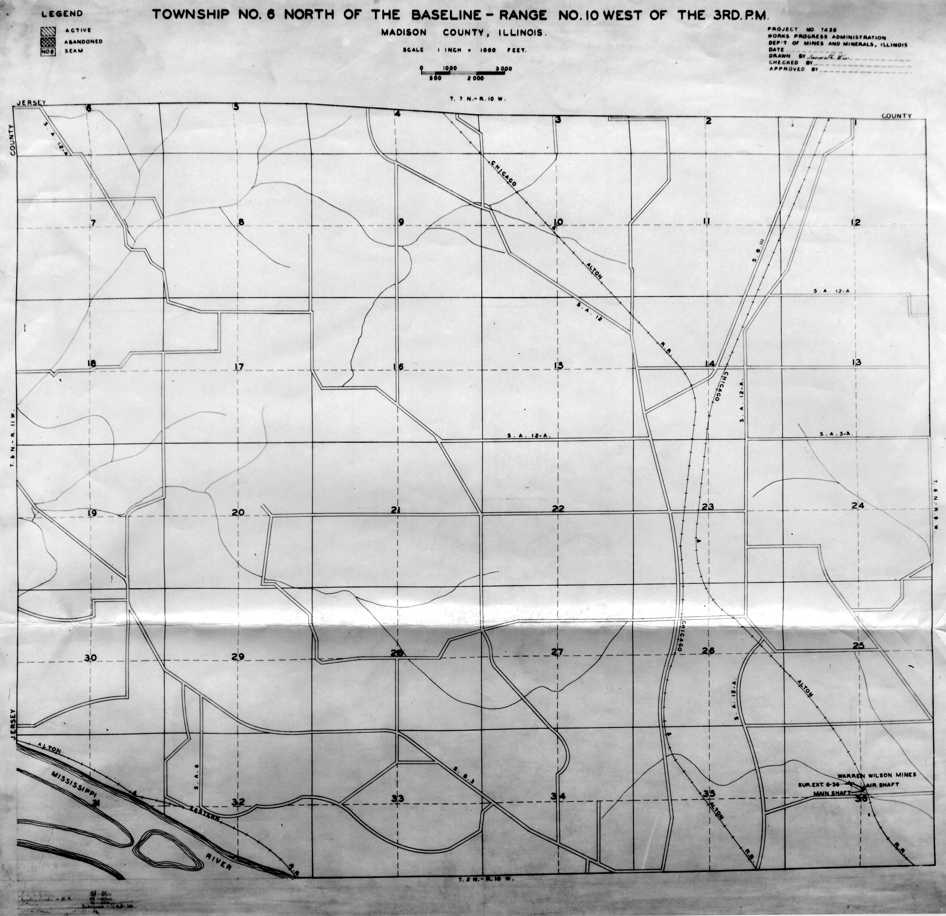
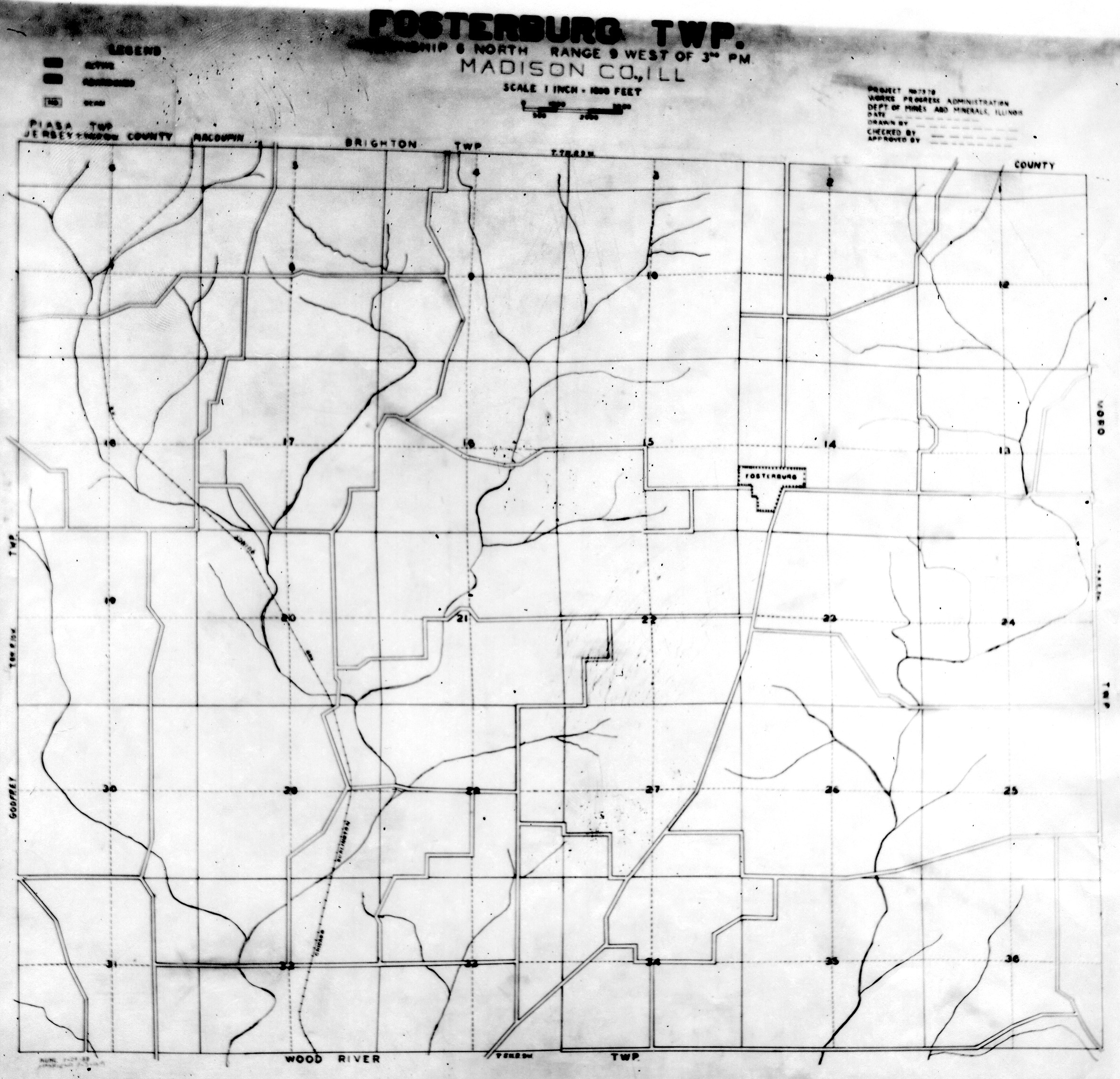
 | Madison, T6N-R10W | Madison | T6N-R10W | WPA MADISON 6N10W.jpg |
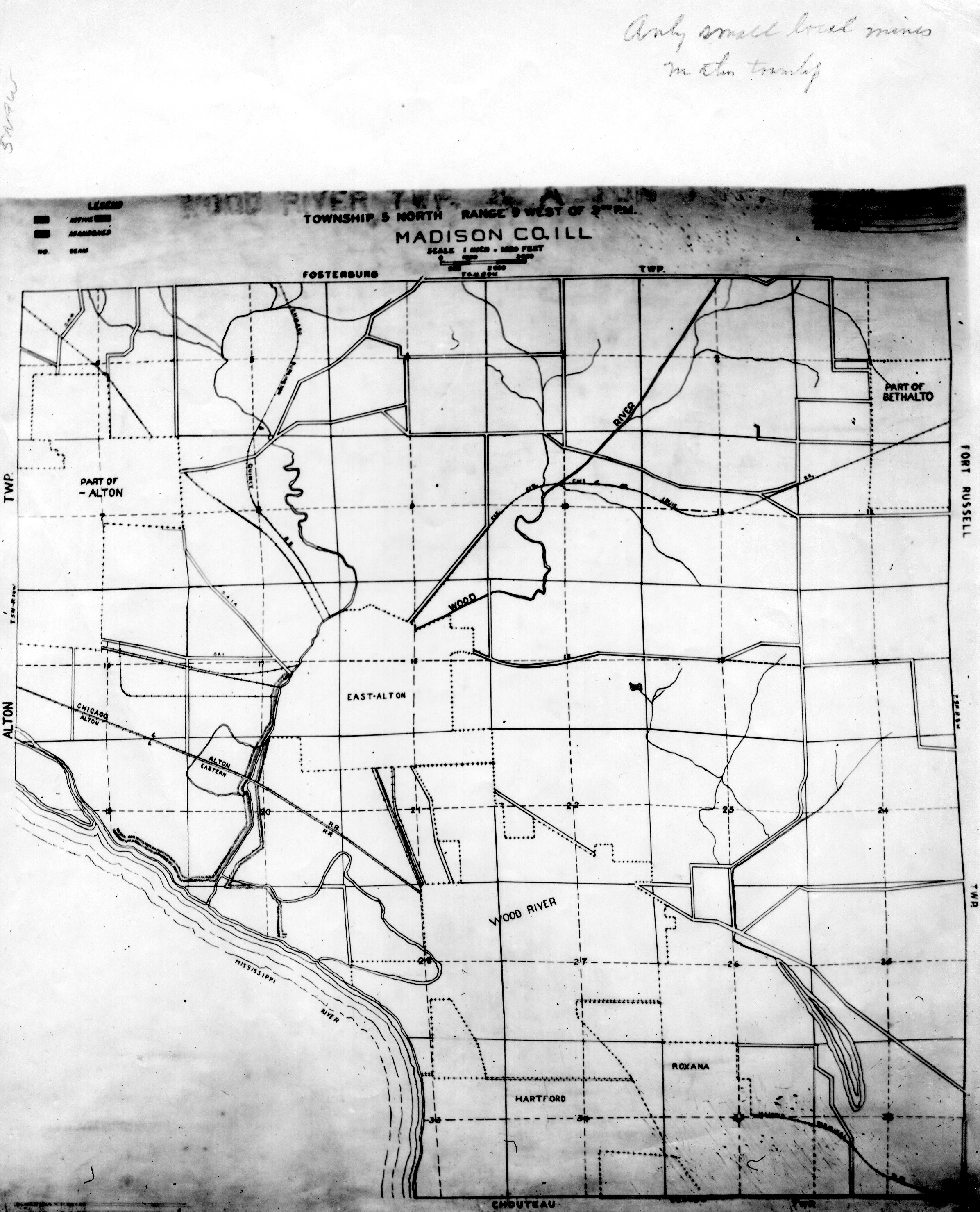
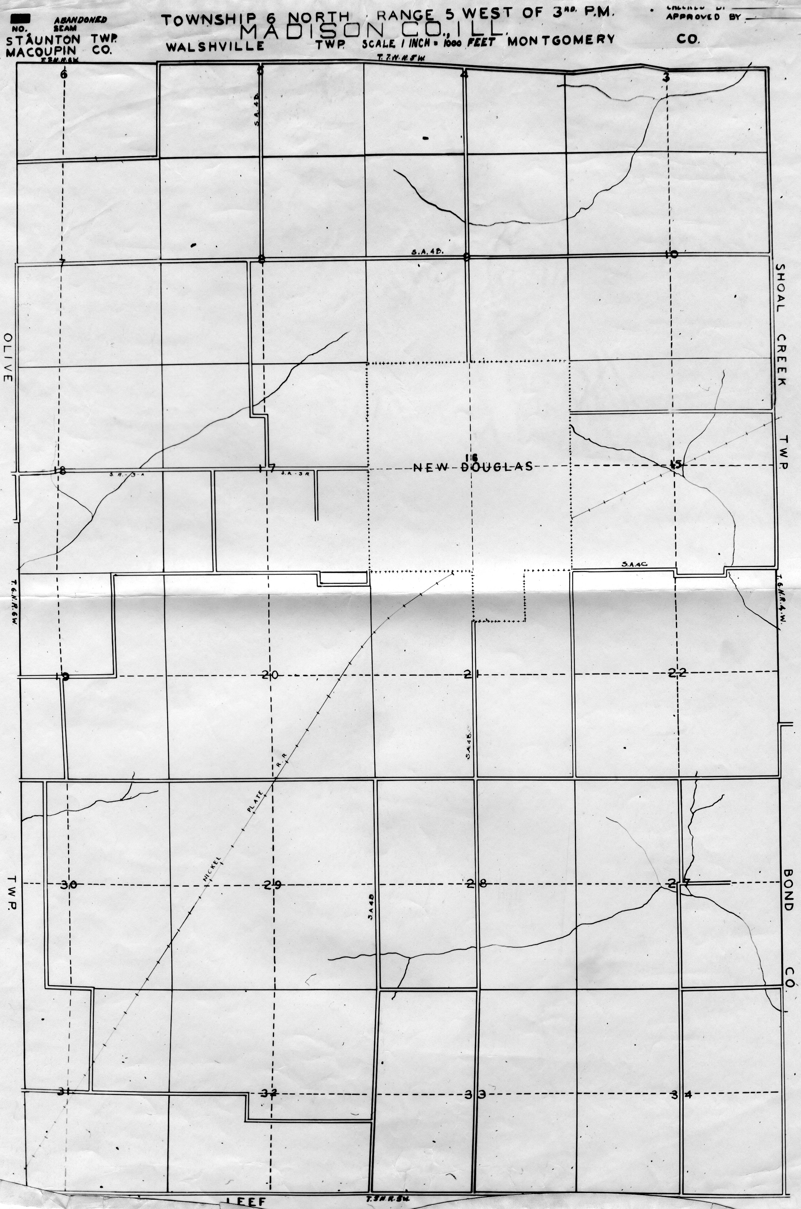
 | Madison, T6N-R5W | Madison | T6N-R5W | WPA MADISON 6N5W.jpg |
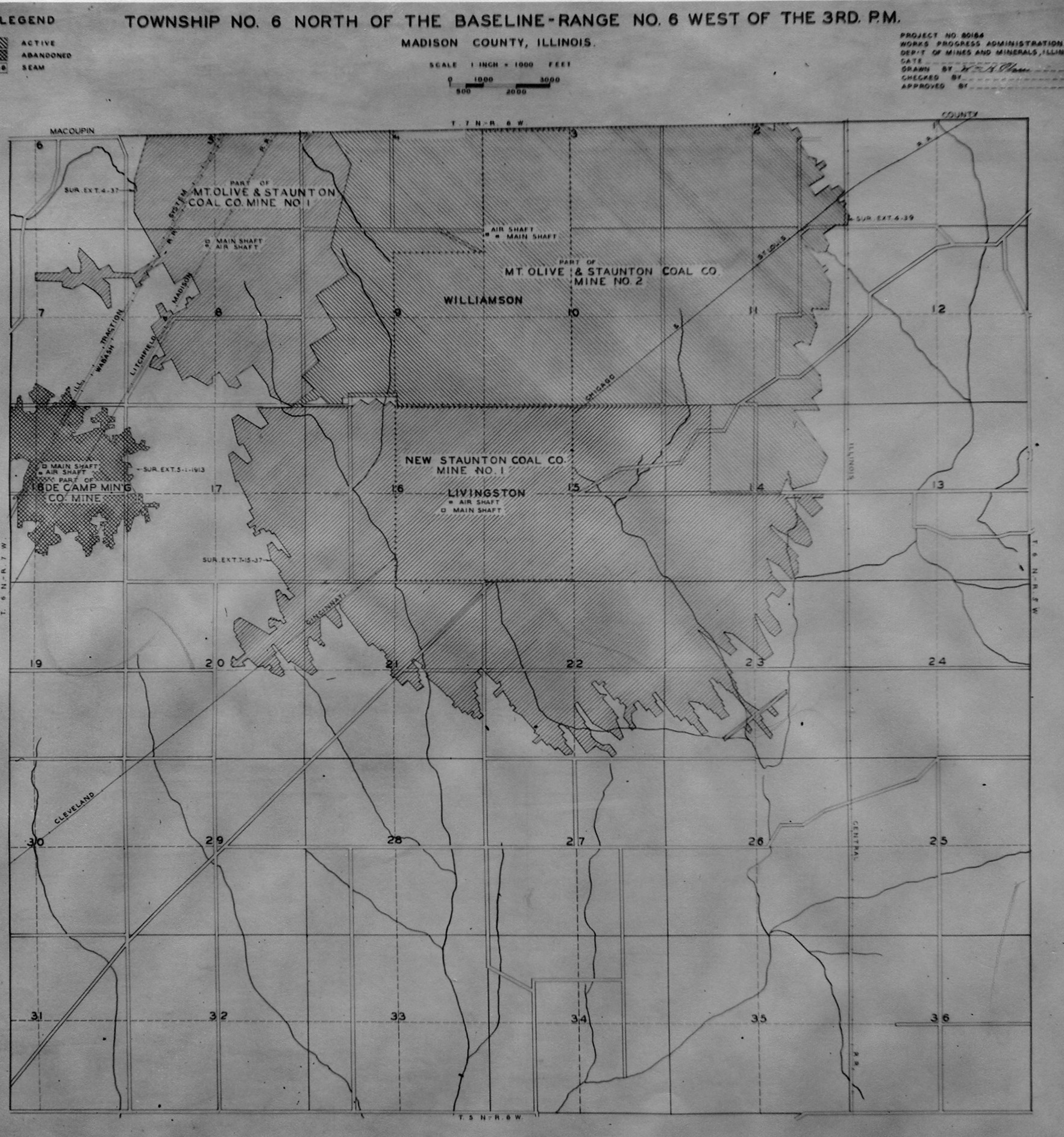
 | Madison, T6N-R6W | Madison | T6N-R6W | WPA MADISON 6N6W.jpg |
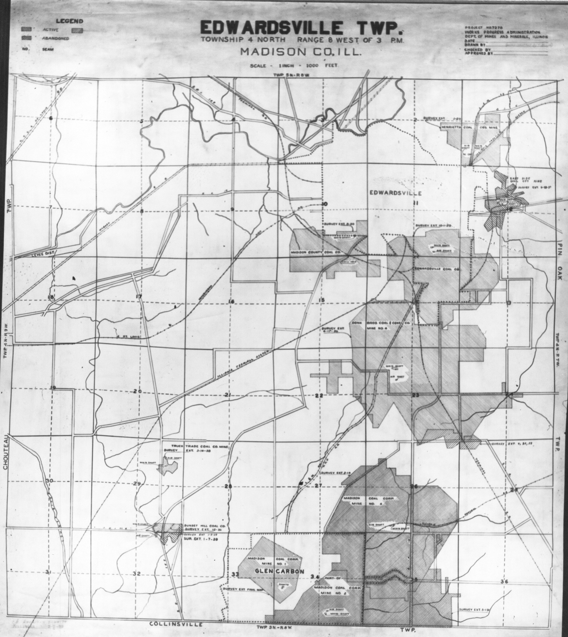
 | Madison, T6N-R7W | Madison | T6N-R7W | WPA MADISON 6N7W.jpg |
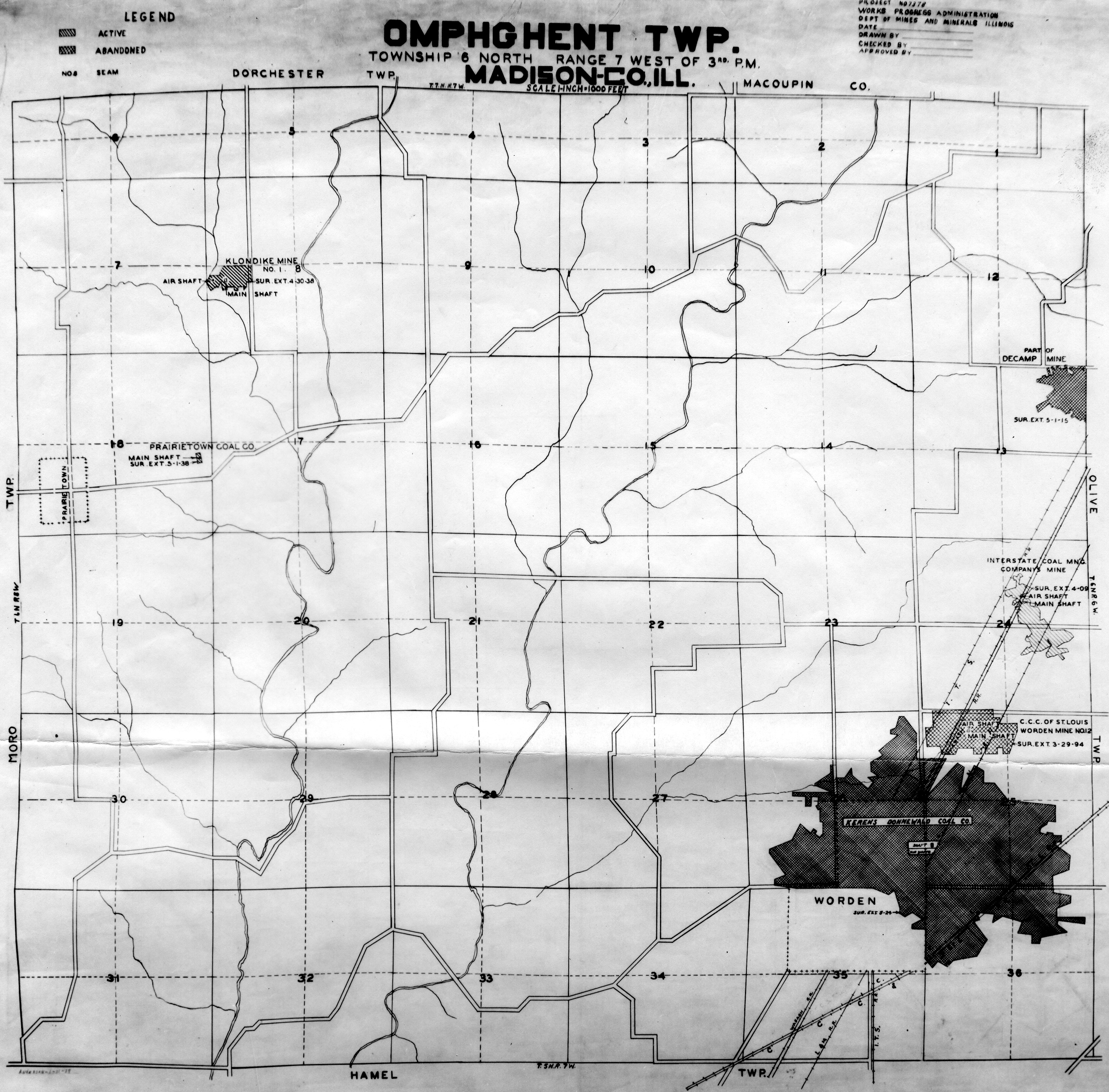
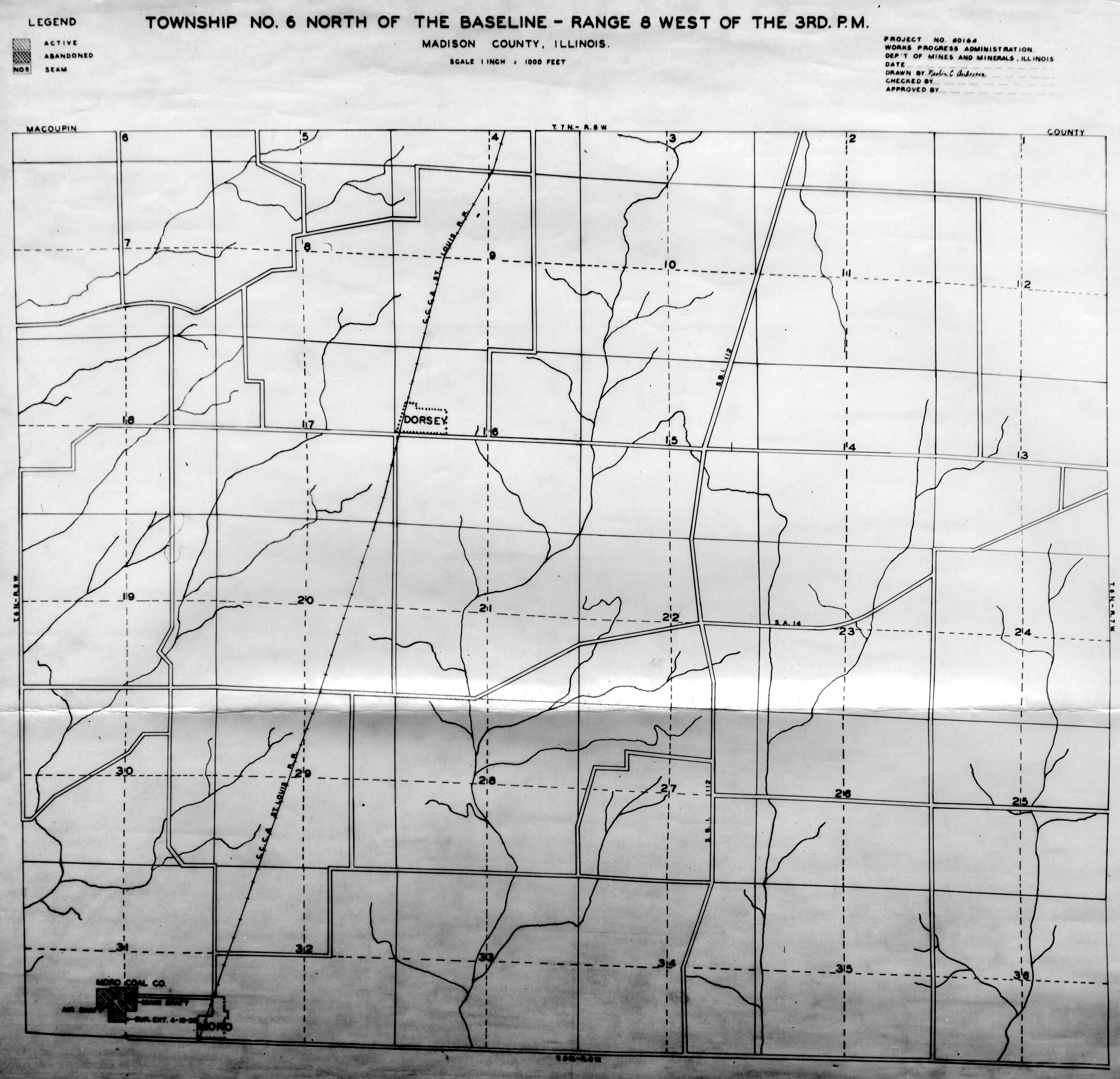
 | Madison, T6N-R8W | Madison | T6N-R8W | WPA MADISON 6N8W.jpg |
 | Madison, T6N-R9W | Madison | T6N-R9W | WPA MADISON 6N9W.jpg |
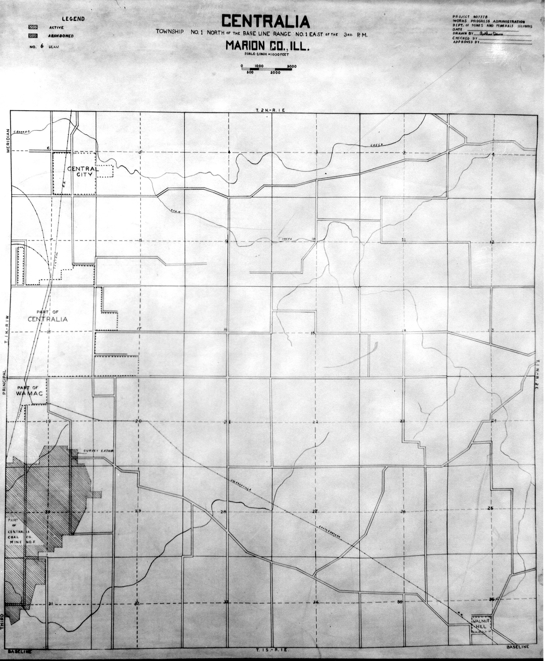
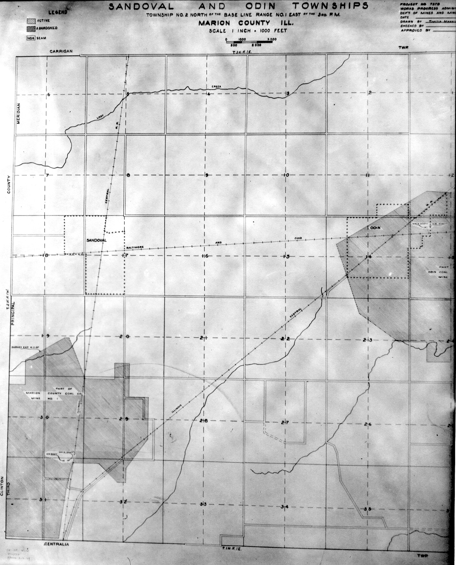
 | Marion, T1N-R1E | Marion | T1N-R1E | WPA MARION 1N1E.jpg |
 | Marion, T2N-R1E | Marion | T2N-R1E | WPA MARION 2N1E.jpg |
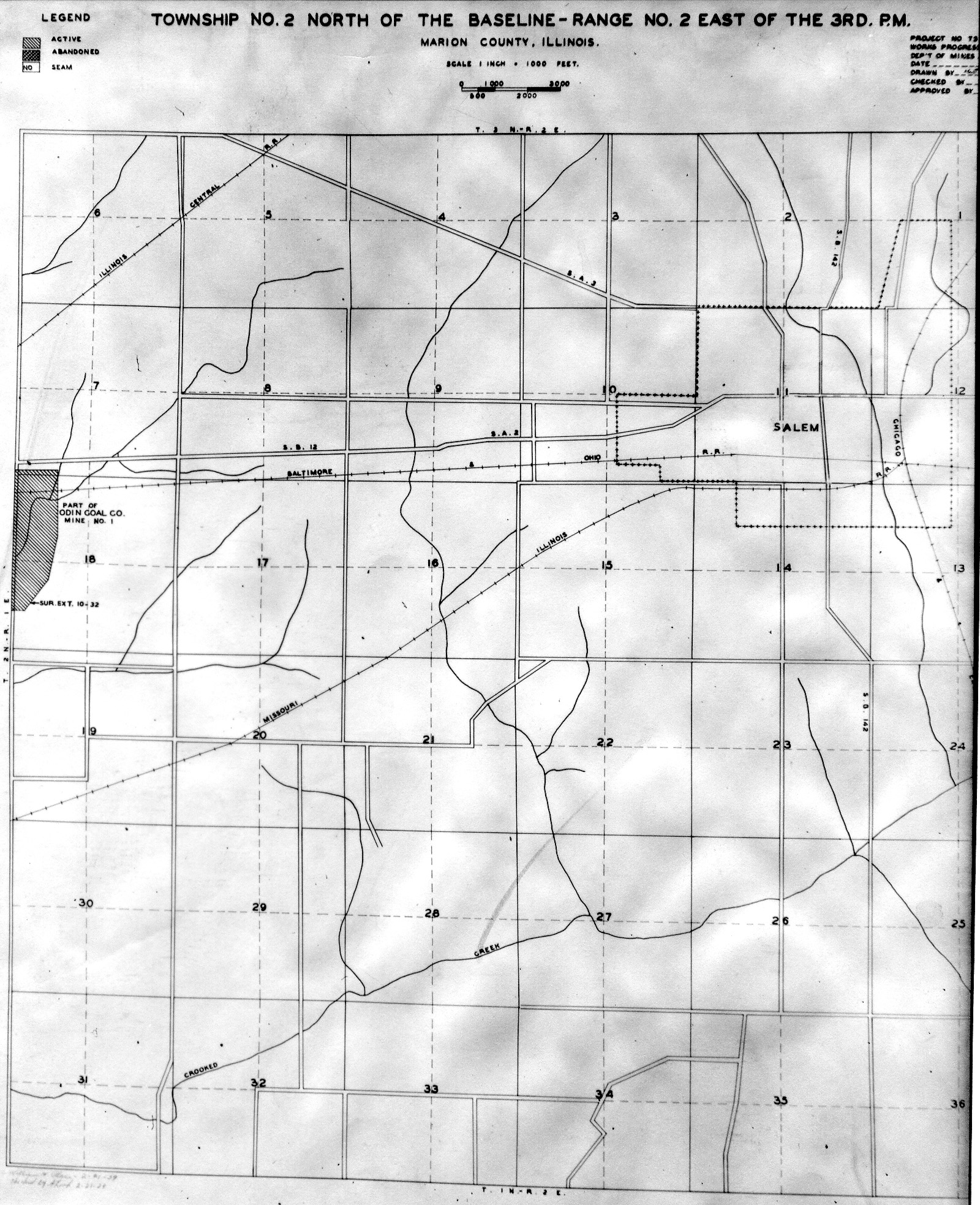
 | Marion, T2N-R2E | Marion | T2N-R2E | WPA MARION 2N2E.jpg |
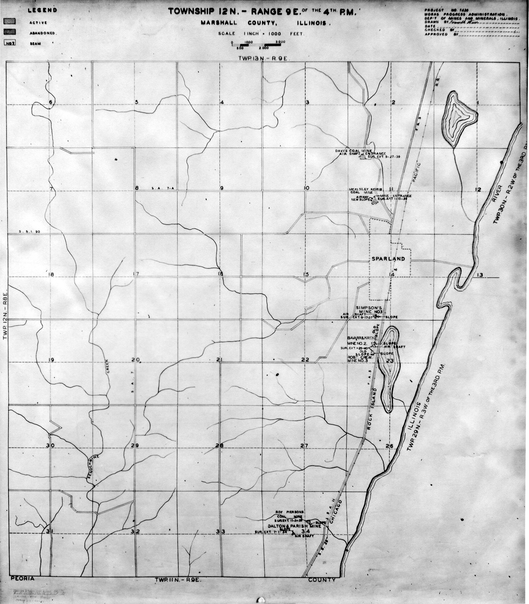
 | Marshall, T12N-R9E | Marshall | T12N-R9E | WPA MARSHALL 12N9E.jpg |
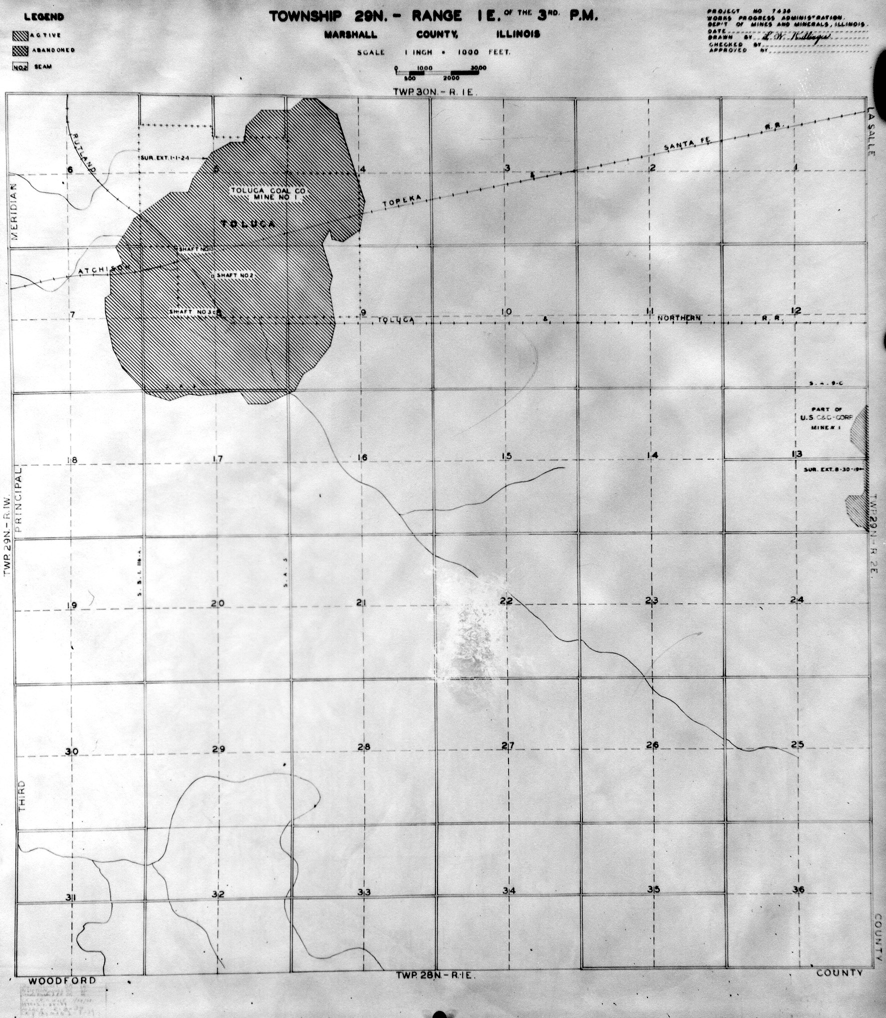
 | Marshall, T29N-R1E | Marshall | T29N-R1E | WPA MARSHALL 29N1E.jpg |
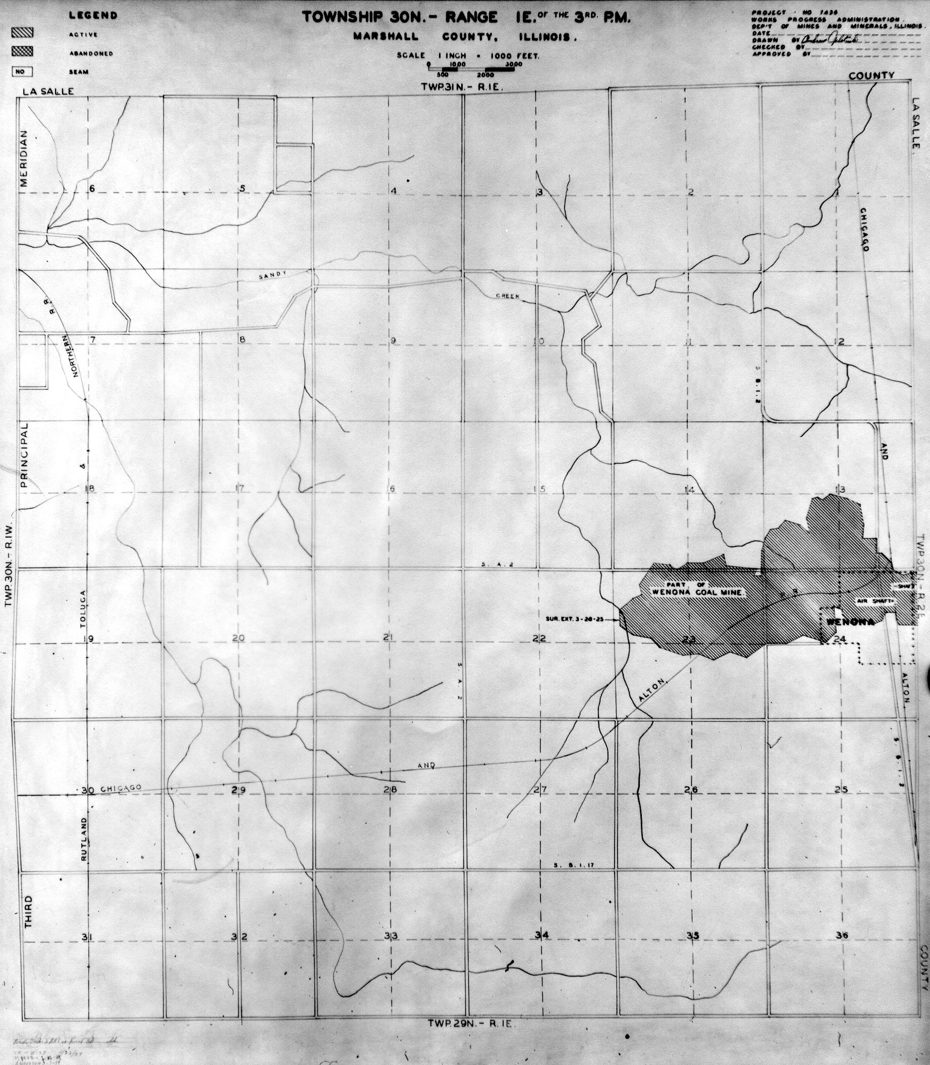
 | Marshall, T30N-R1E | Marshall | T30N-R1E | WPA MARSHALL 30N1E.jpg |
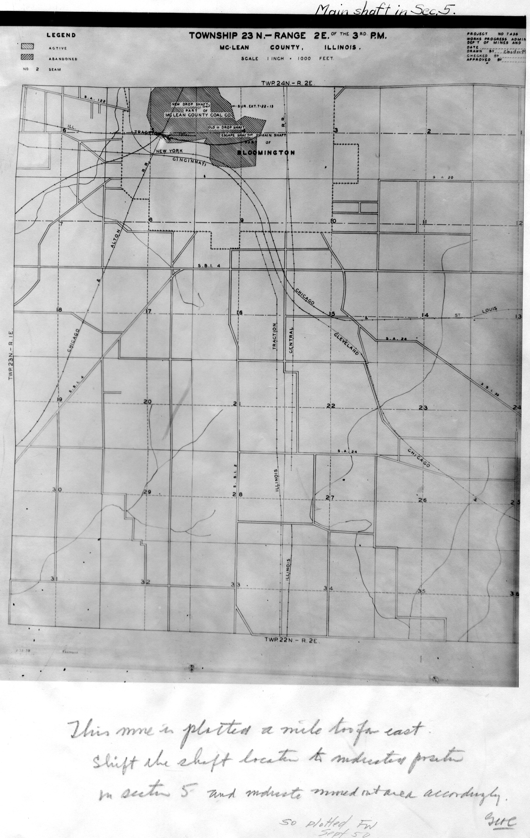
 | McLean, T23N-R2E | McLean | T23N-R2E | WPA MCLEAN 23N2E.jpg |
 | McLean, T24N-R2E | McLean | T24N-R2E | WPA MCLEAN 24N2E.jpg |
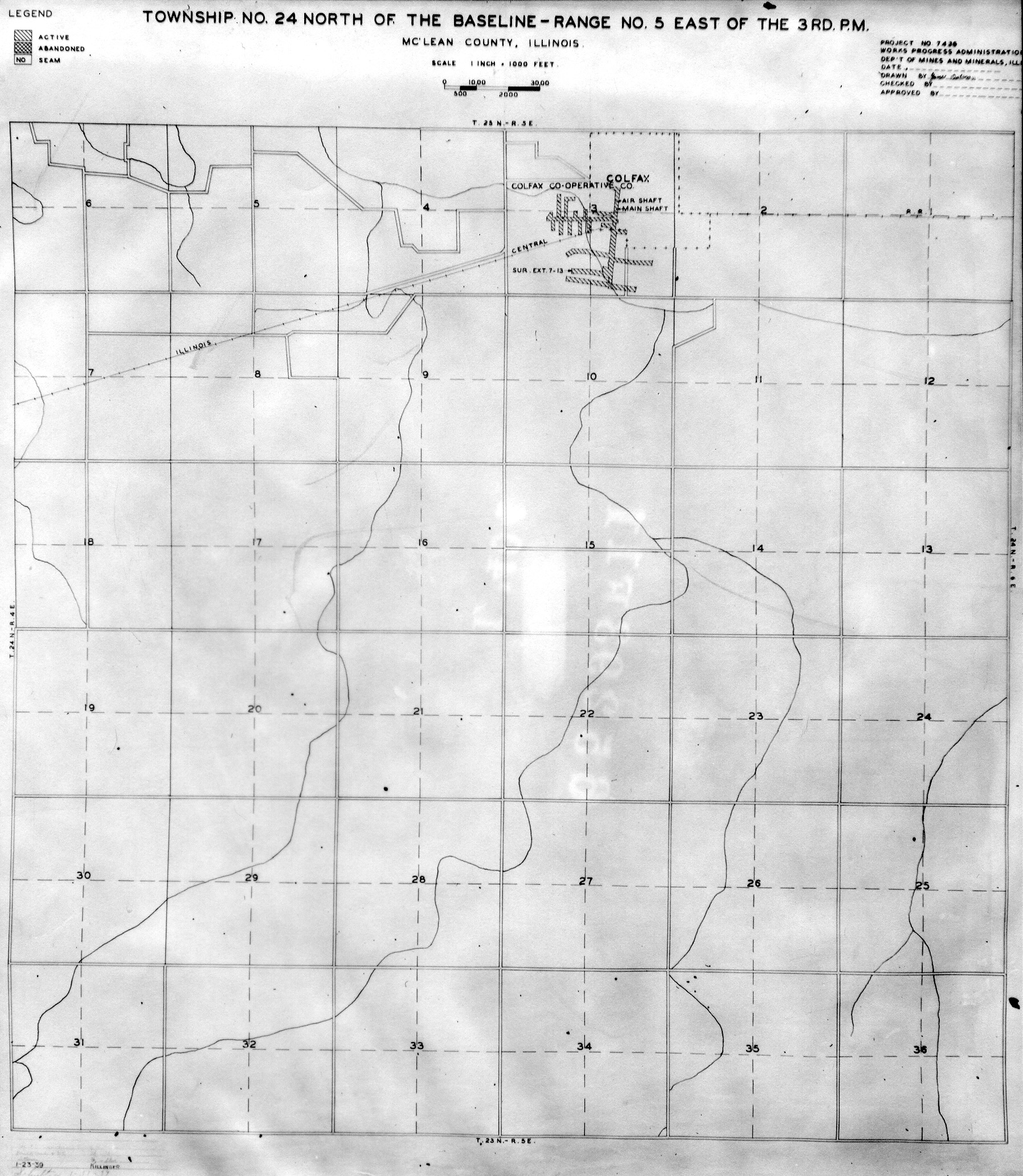
 | McLean, T24N-R5E | McLean | T24N-R5E | WPA MCLEAN 24N5E.jpg |
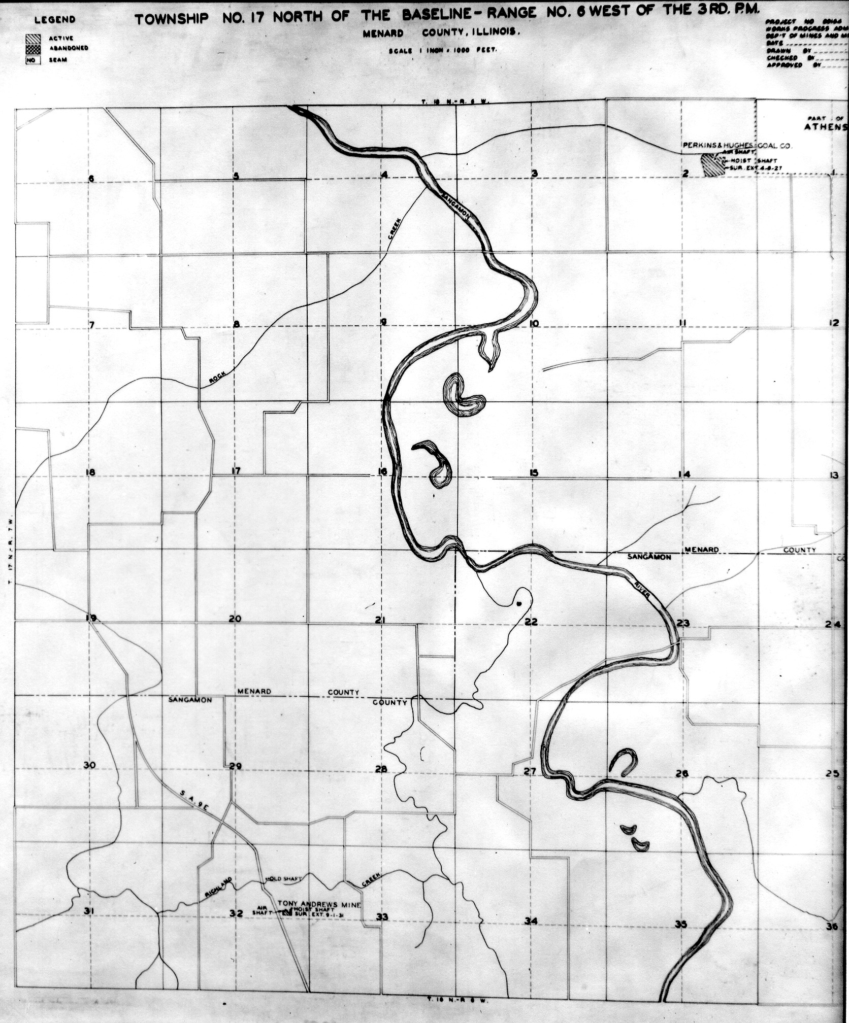
 | Menard, T17N-R6W | Menard | T17N-R6W | WPA MENARD 17N6W.jpg |
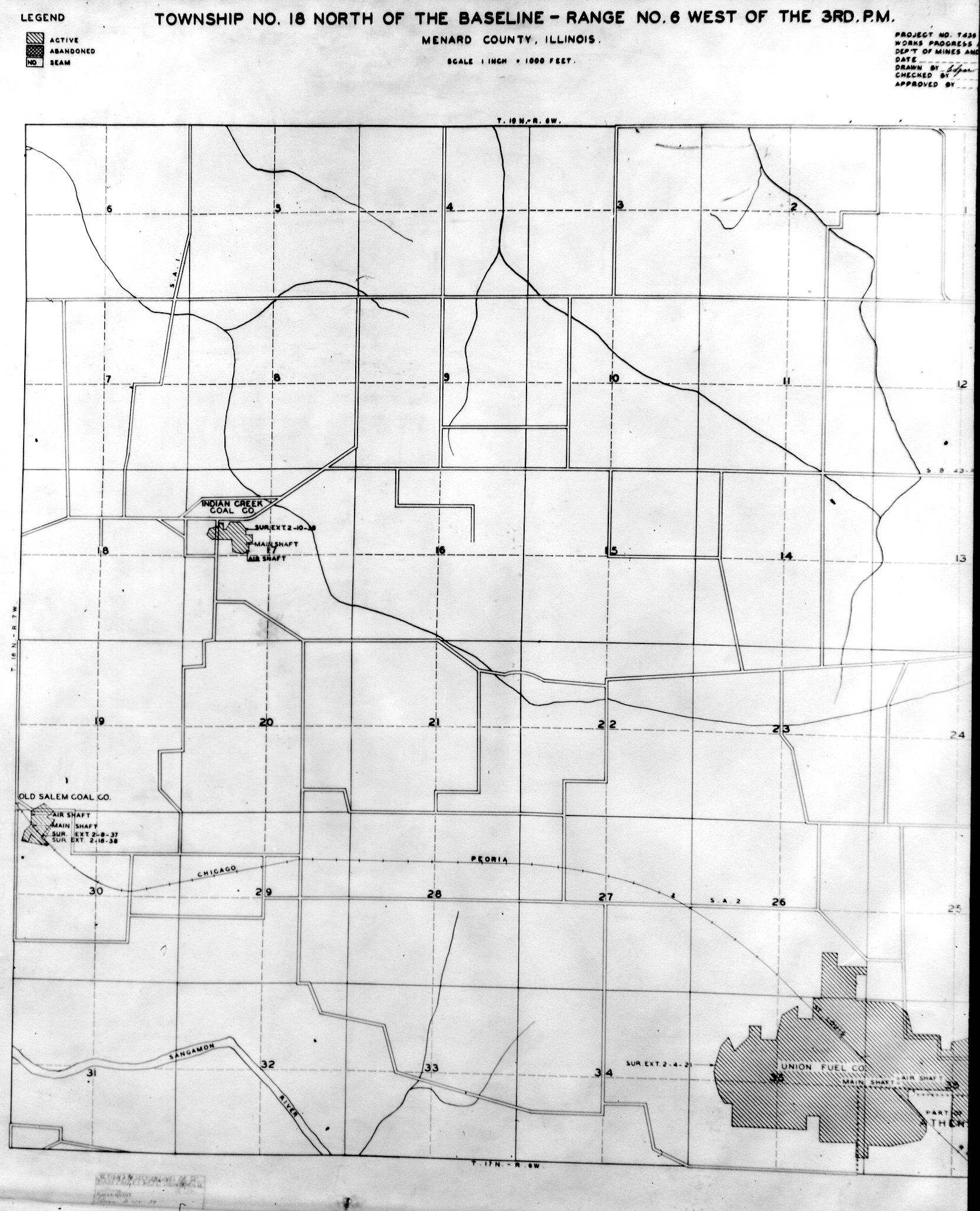
 | Menard, T18N-R6W | Menard | T18N-R6W | WPA MENARD 18N6W.jpg |
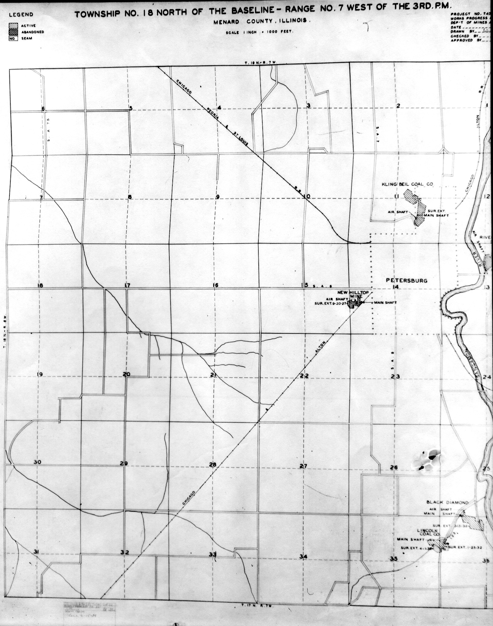
 | Menard, T18N-R7W | Menard | T18N-R7W | WPA MENARD 18N7W.jpg |
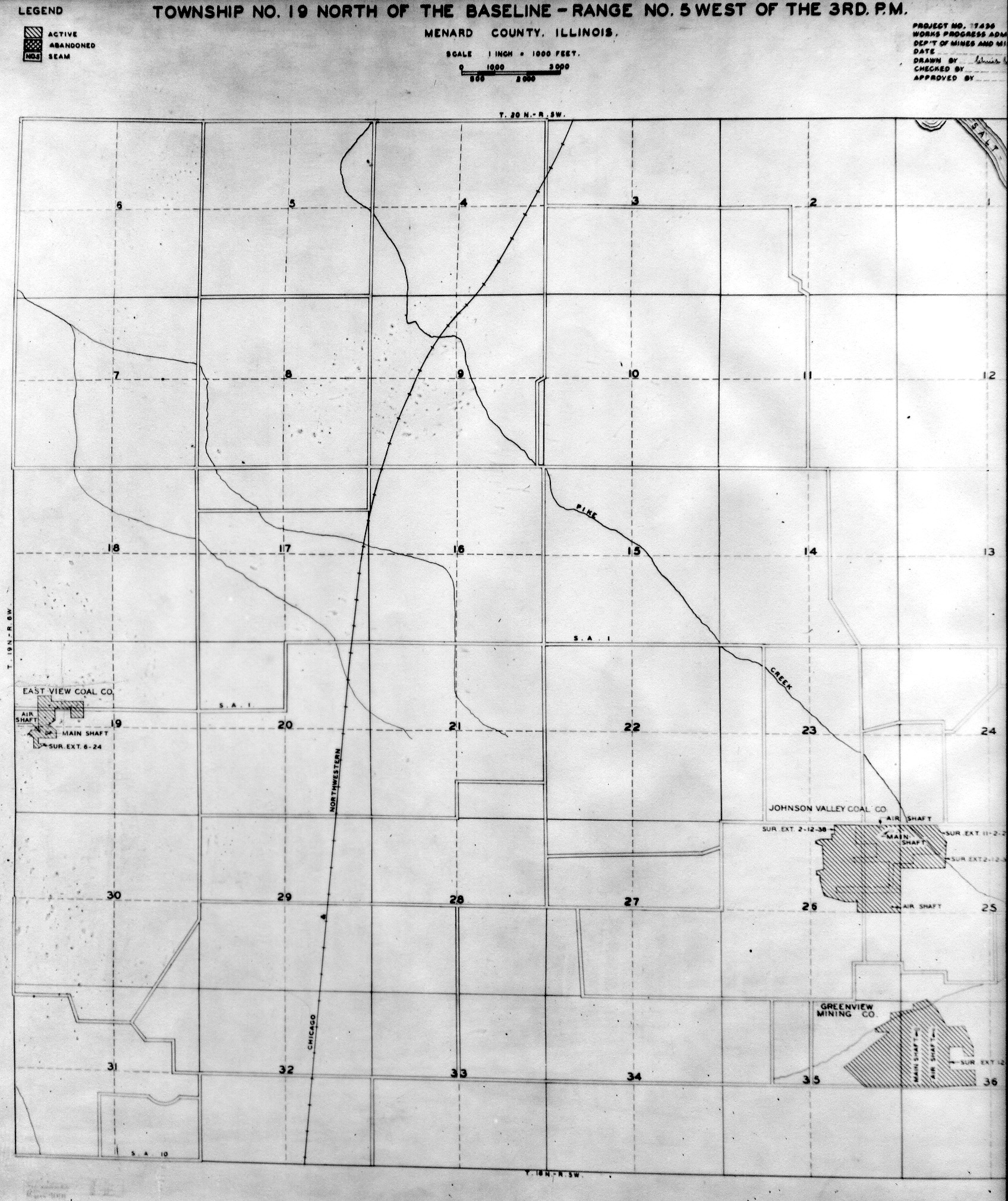
 | Menard, T19N-R5W | Menard | T19N-R5W | WPA MENARD 19N5W.jpg |
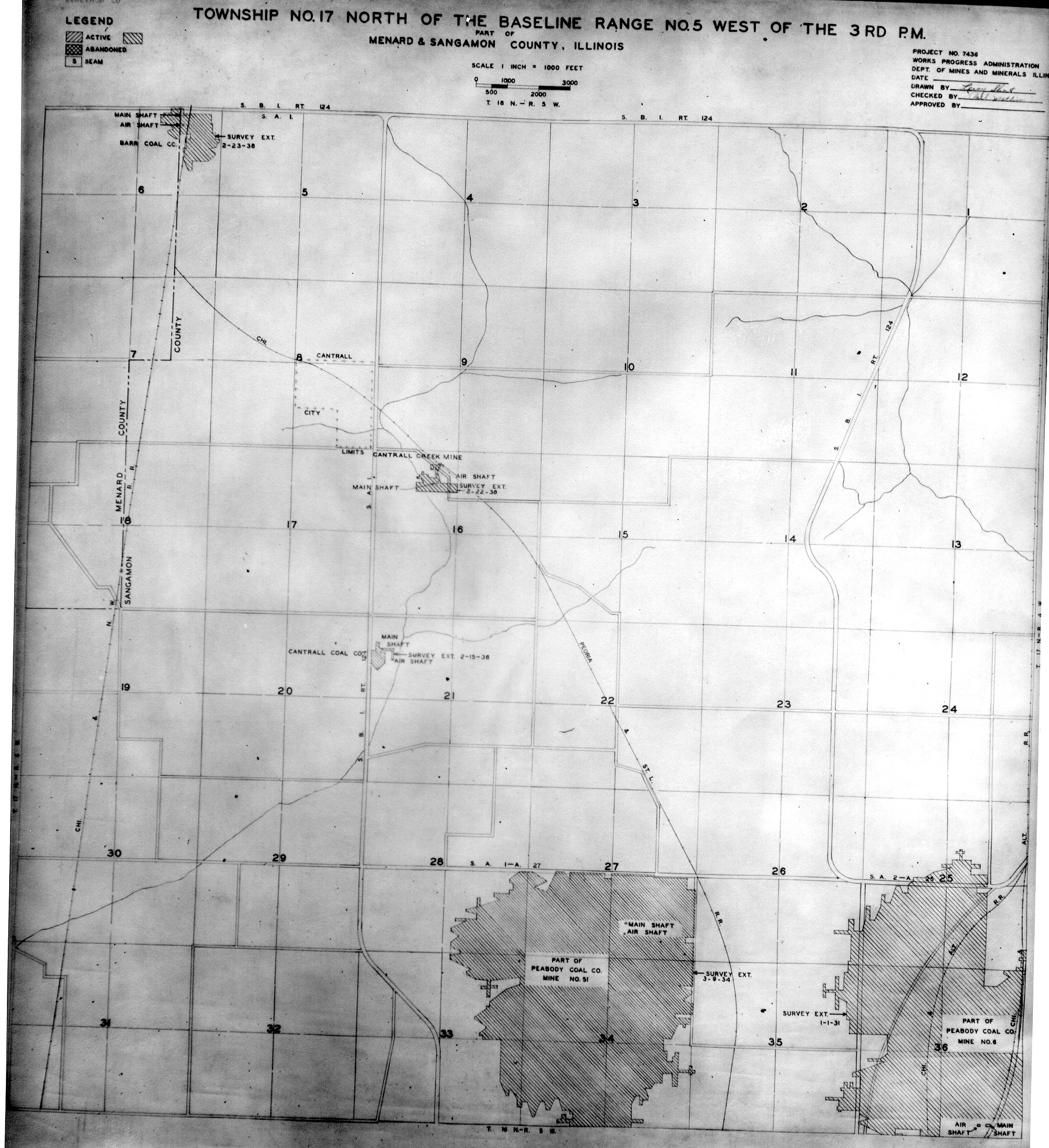
 | Menard & Sangamon, T17N-R5W | Menard Sangamon | T17N-R5W | WPA MENARD SANGAMON 17N5W.jpg |
 | Macon, Sangamon & Christian T17N-R7W | Macon Sangamon Christian | T17N-R7W | WPA MENARD SANGAMON 17N7W.jpg |
 | Mercer, T14N-R2W | Mercer | T14N-R2W | WPA MERCER 14N2W.jpg |
 | Mercer, T15N-R1W | Mercer | T15N-R1W | WPA MERCER 15N1W.jpg |
 | Mercer, T15N-R3W | Mercer | T15N-R3W | WPA MERCER 15N3W.jpg |
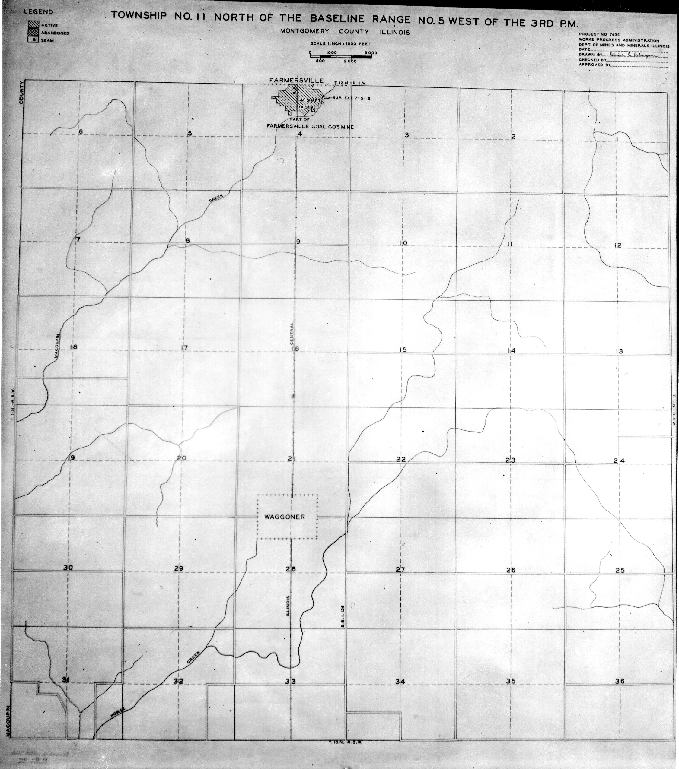
 | Montgomery, T10N-R2W | Montgomery | T10N-R2W | WPA MONTGOMERY 10N2W.jpg |
 | Montgomery, T11N-R5W | Montgomery | T11N-R5W | WPA MONTGOMERY 11N5W.jpg |
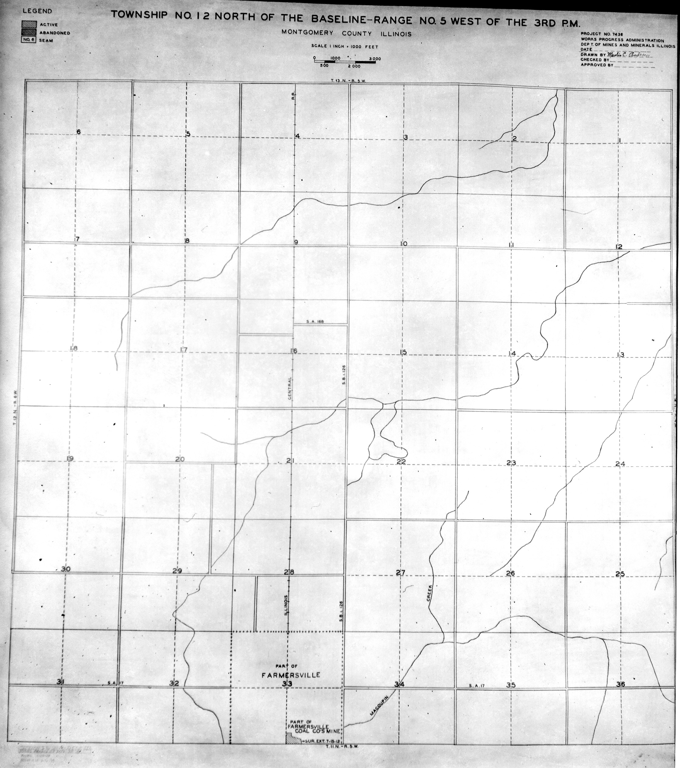
 | Montgomery, T12N-R5W | Montgomery | T12N-R5W | WPA MONTGOMERY 12N5W.jpg |
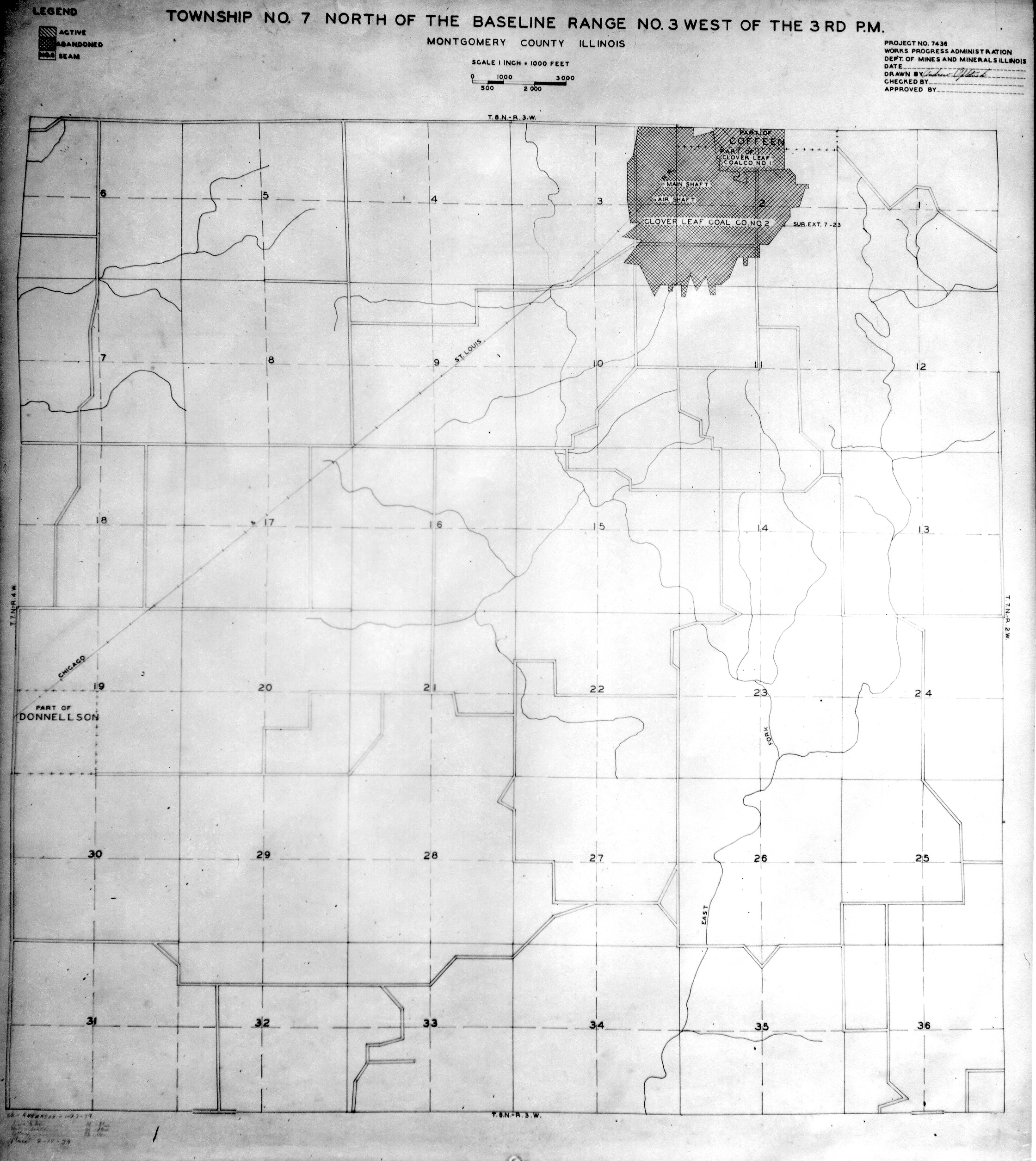
 | Montgomery, T7N-R3W | Montgomery | T7N-R3W | WPA MONTGOMERY 7N3W.jpg |
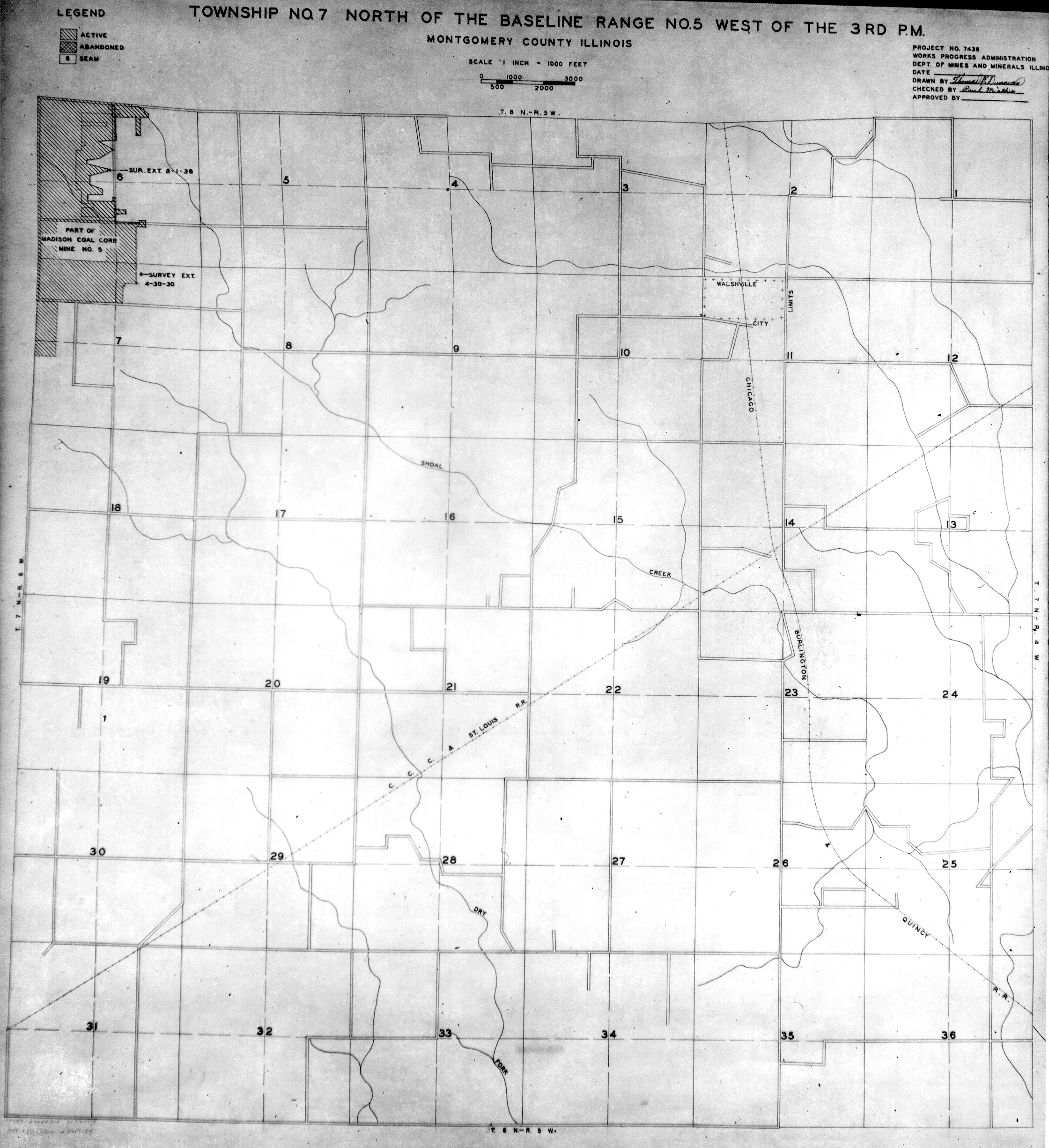
 | Montgomery, T7N-R5W | Montgomery | T7N-R5W | WPA MONTGOMERY 7N5W.jpg |
 | Montgomery, T8N-R3W | Montgomery | T8N-R3W | WPA MONTGOMERY 8N3W.jpg |
 | Montgomery, T8N-R4W | Montgomery | T8N-R4W | WPA MONTGOMERY 8N4W.jpg |
 | Montgomery, T8N-R5W | Montgomery | T8N-R5W | WPA MONTGOMERY 8N5W.jpg |
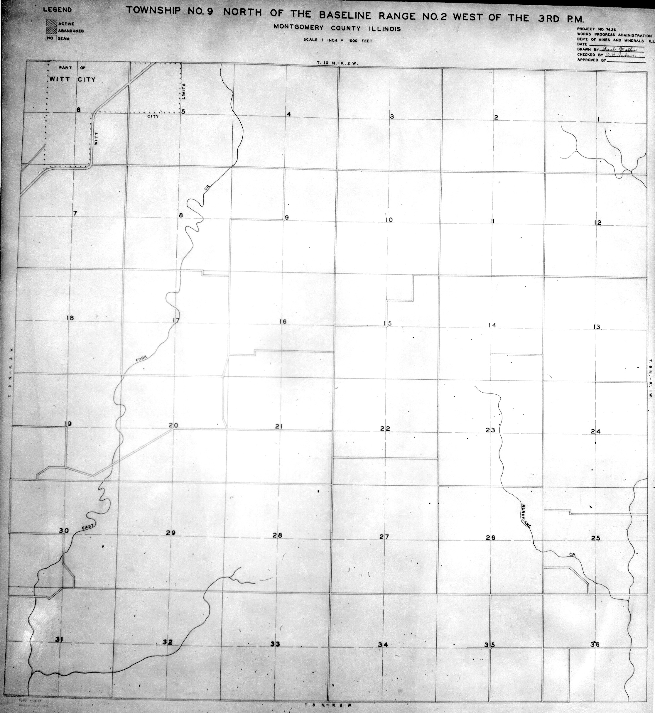
 | Montgomery, T9N-R2W | Montgomery | T9N-R2W | WPA MONTGOMERY 9N2W.jpg |
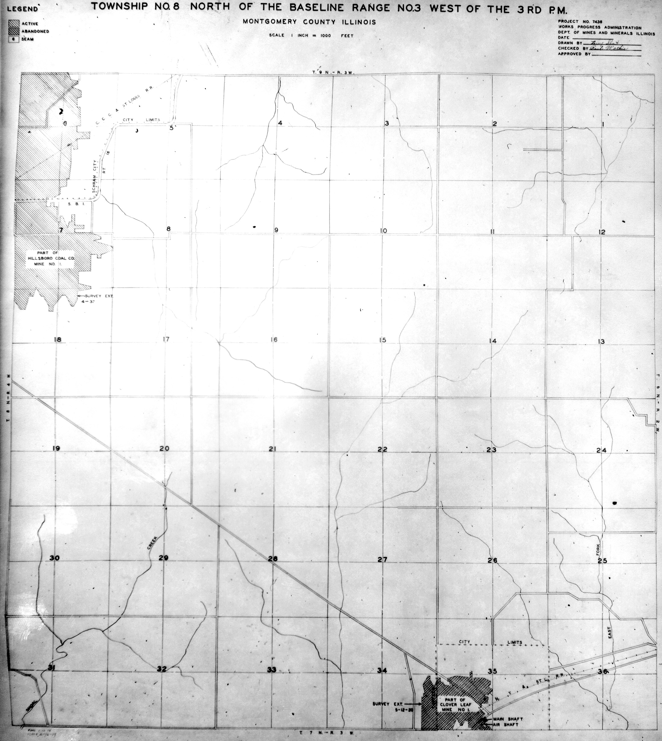
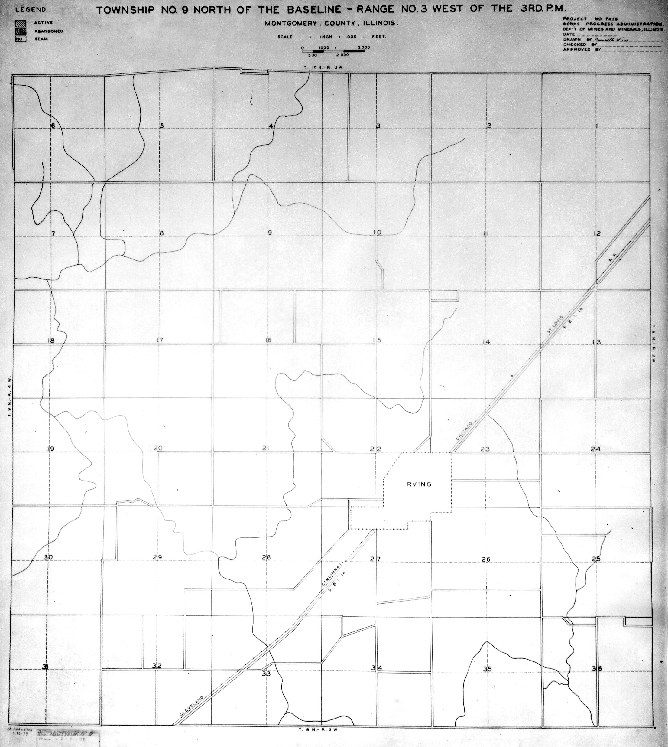
 | Montgomery, T9N-R3W | Montgomery | T9N-R3W | WPA MONTGOMERY 9N3W.jpg |
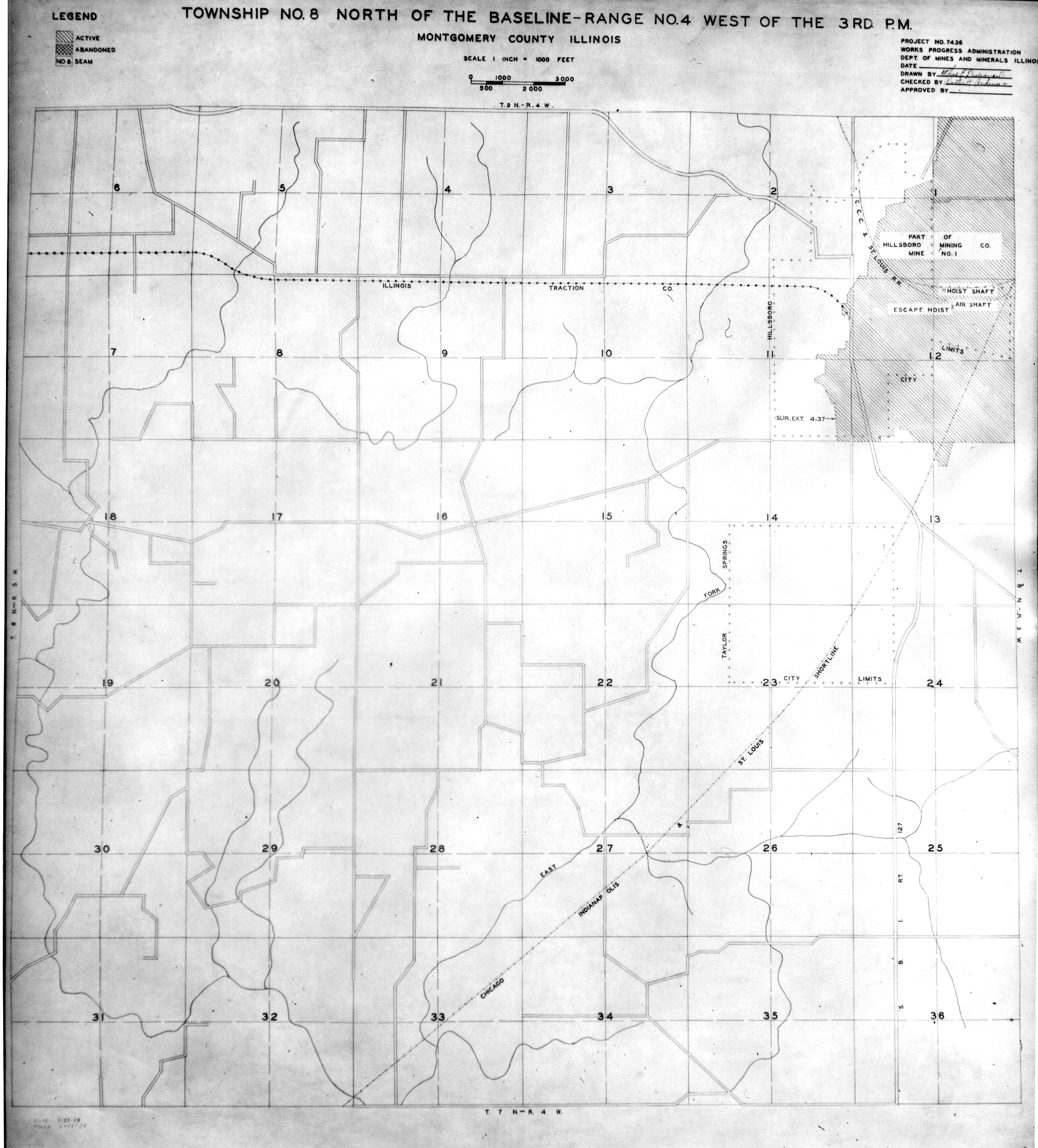
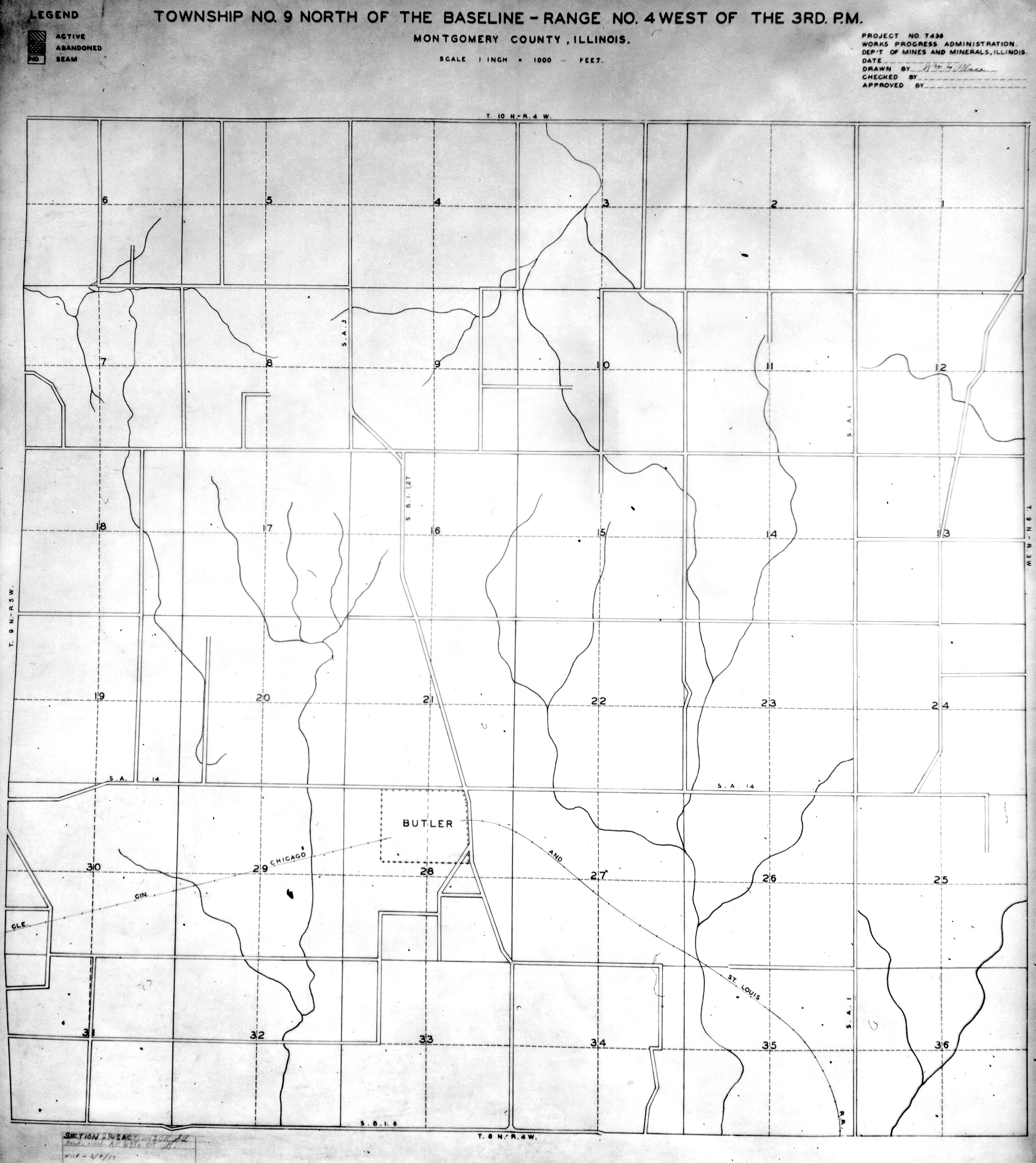
 | Montgomery, T9N-R4W | Montgomery | T9N-R4W | WPA MONTGOMERY 9N4W.jpg |
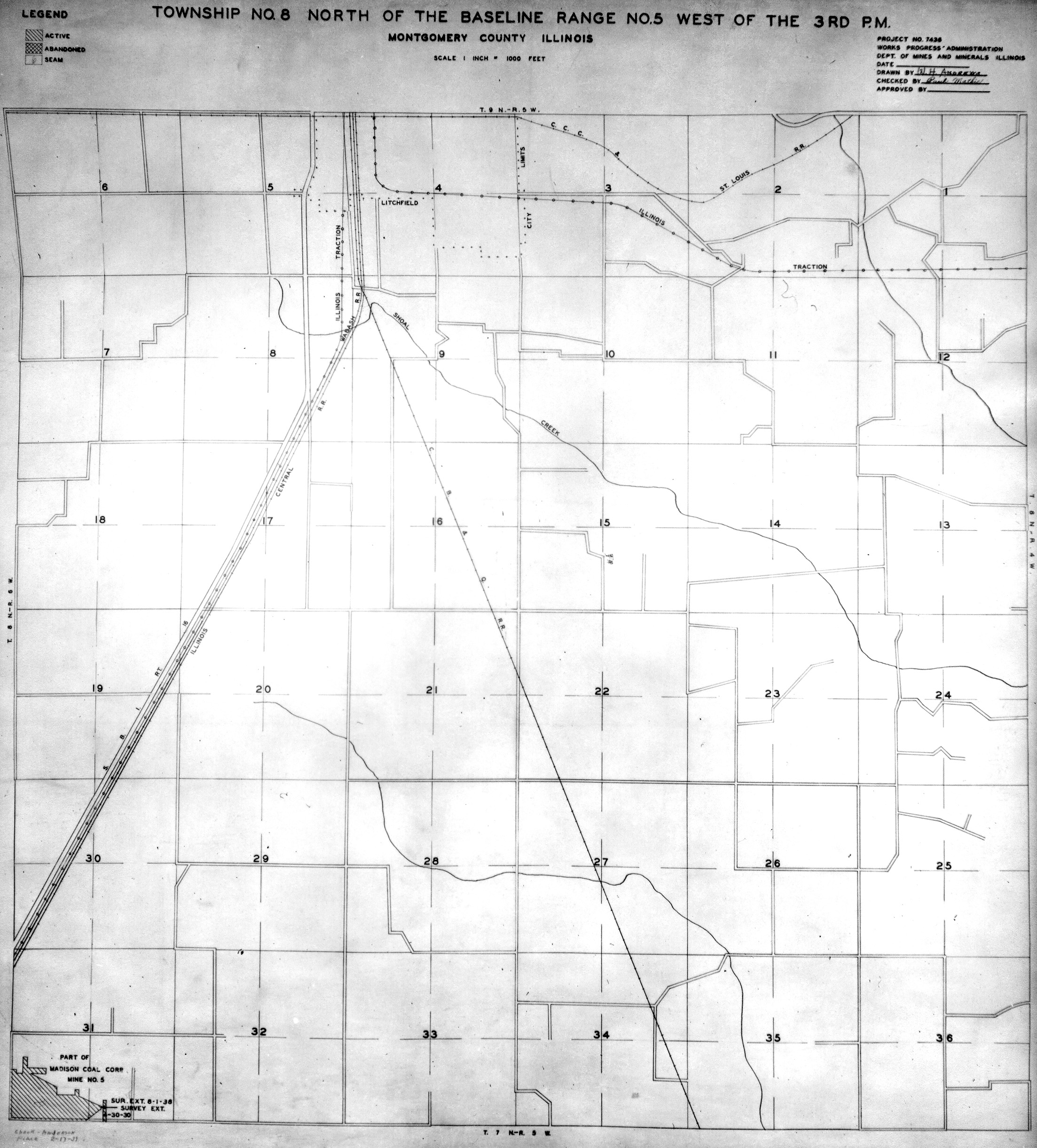
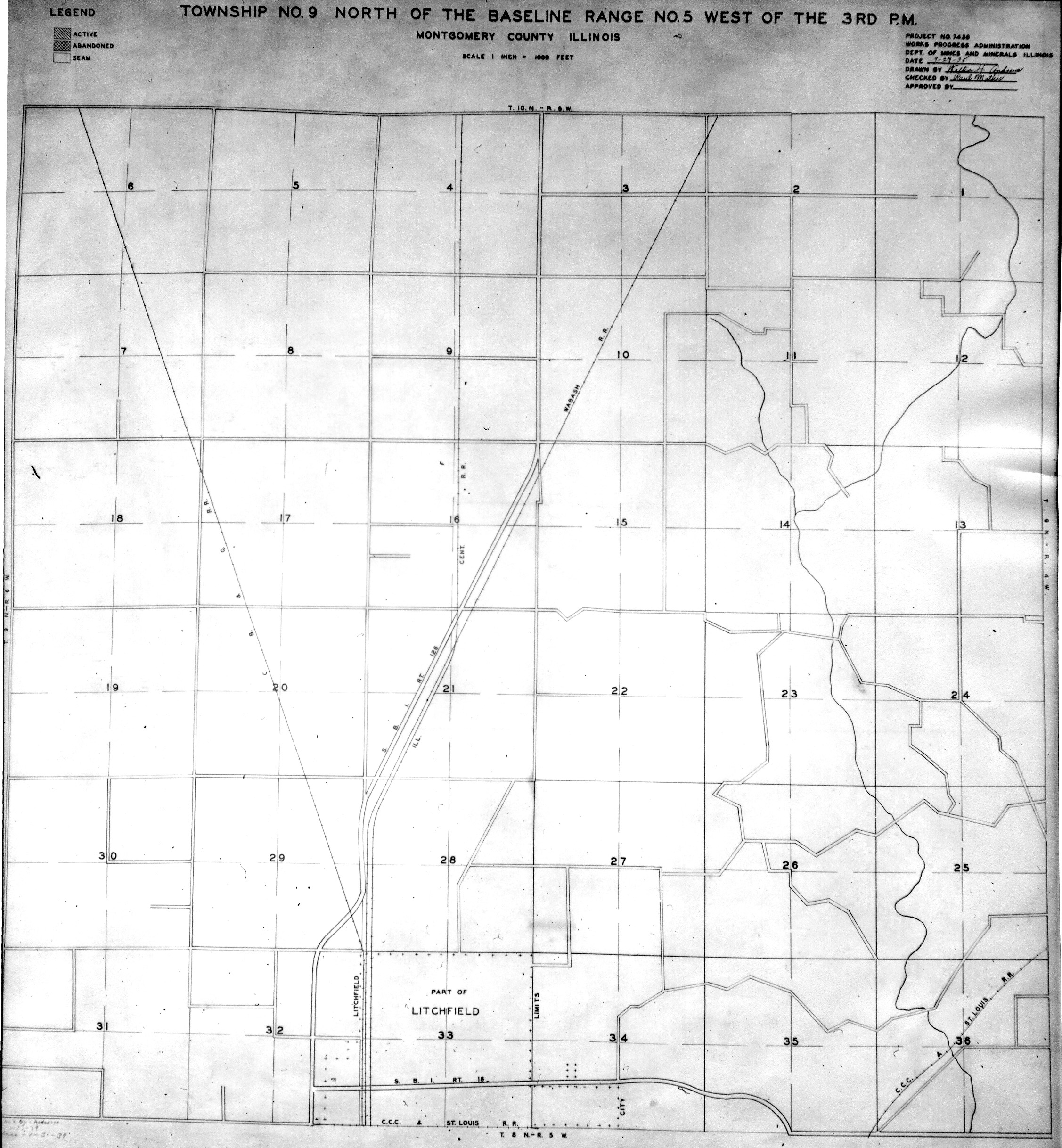
 | Montgomery, T9N-R5W | Montgomery | T9N-R5W | WPA MONTGOMERY 9N5W.jpg |
 | Peoria, T10N-R7E | Peoria | T10N-R7E | WPA PEORIA 10N7E.jpg |
 | Peoria, T11N-R6E | Peoria | T11N-R6E | WPA PEORIA 11N6E.jpg |
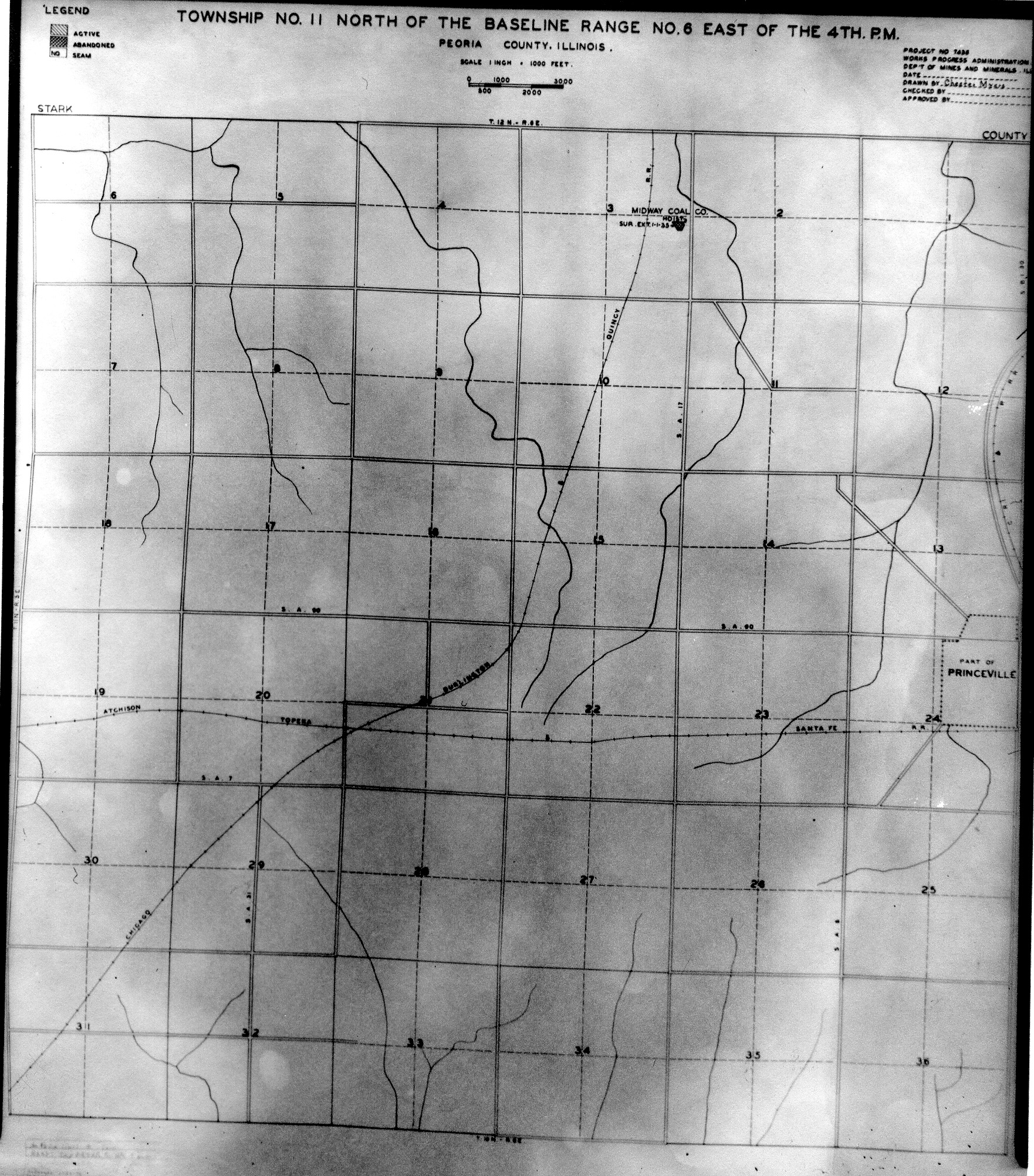
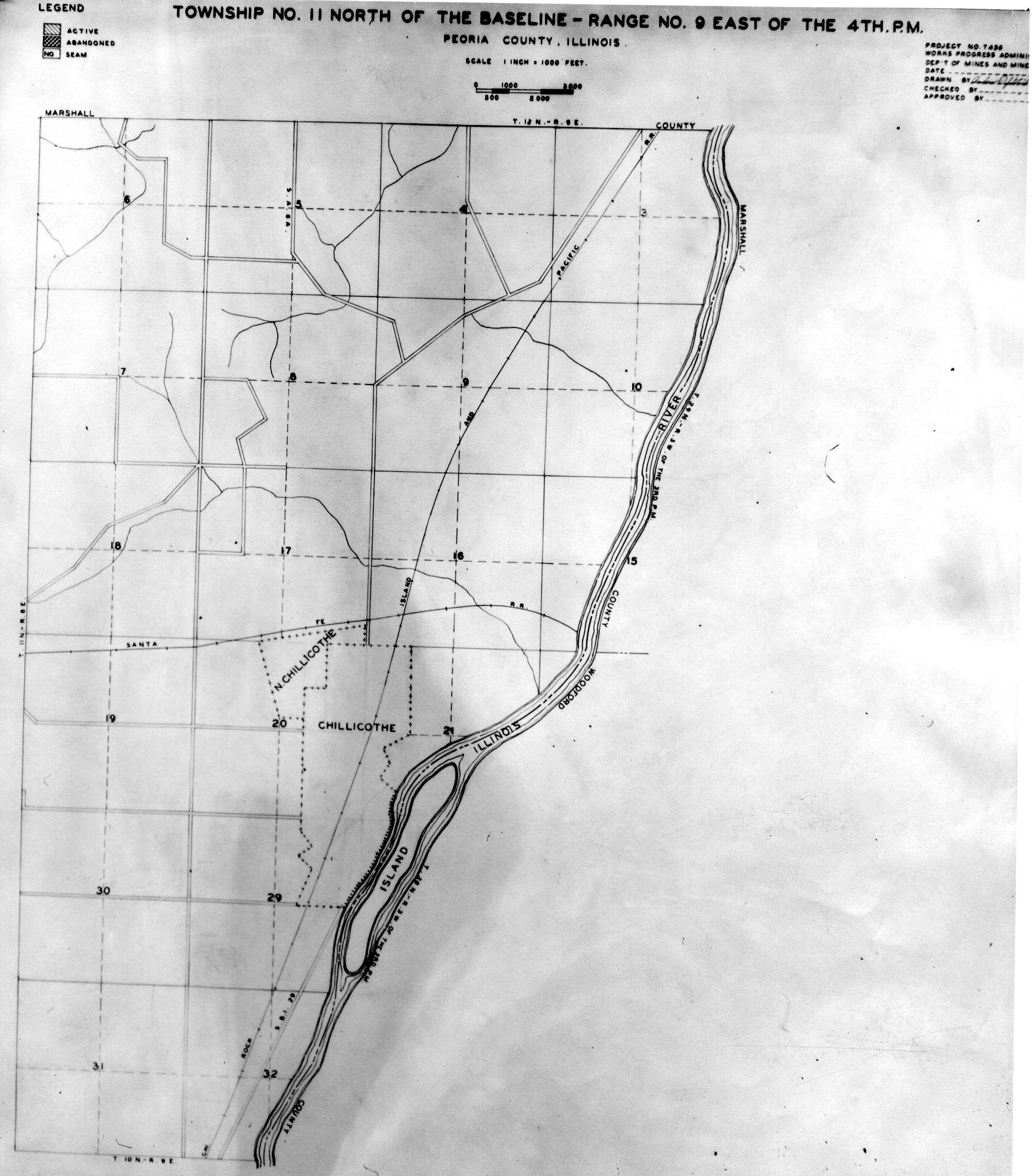
 | Peoria, T11N-R9E | Peoria | T11N-R9E | WPA PEORIA 11N9E.jpg |
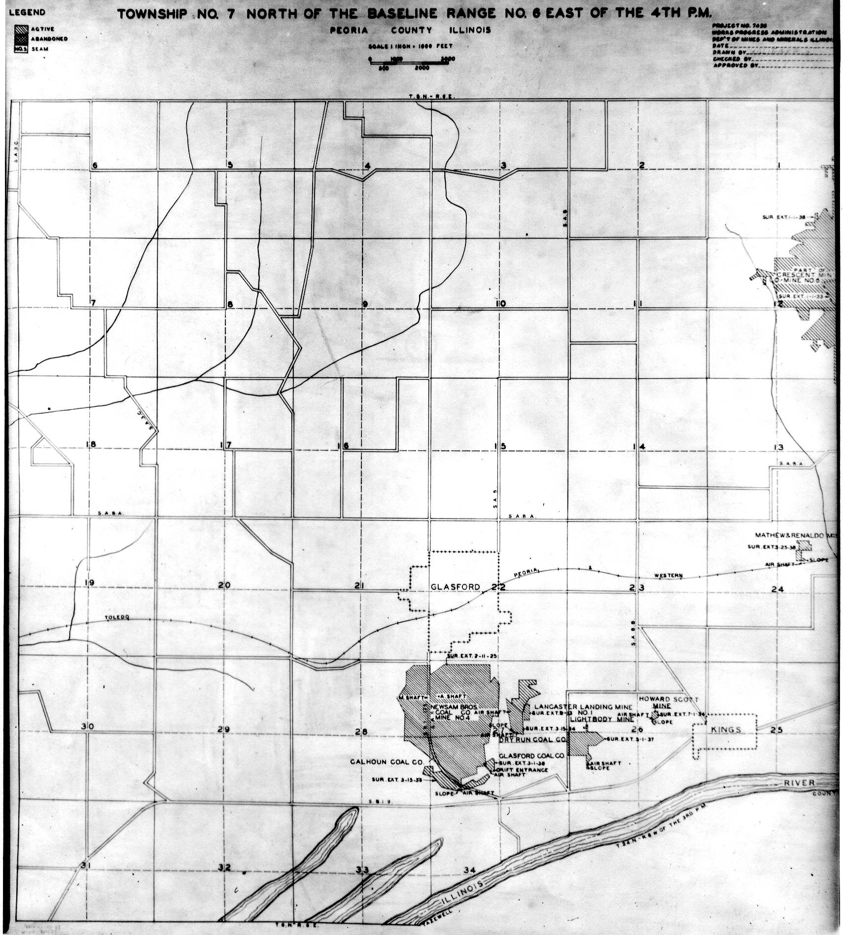
 | Peoria, T7N-R6E No.1 | Peoria | T7N-R6E | WPA PEORIA 7N6E NO 1.jpg |
 | Peoria, T7N-R6E No.2 | Peoria | T7N-R6E | WPA PEORIA 7N6E NO 2.jpg |
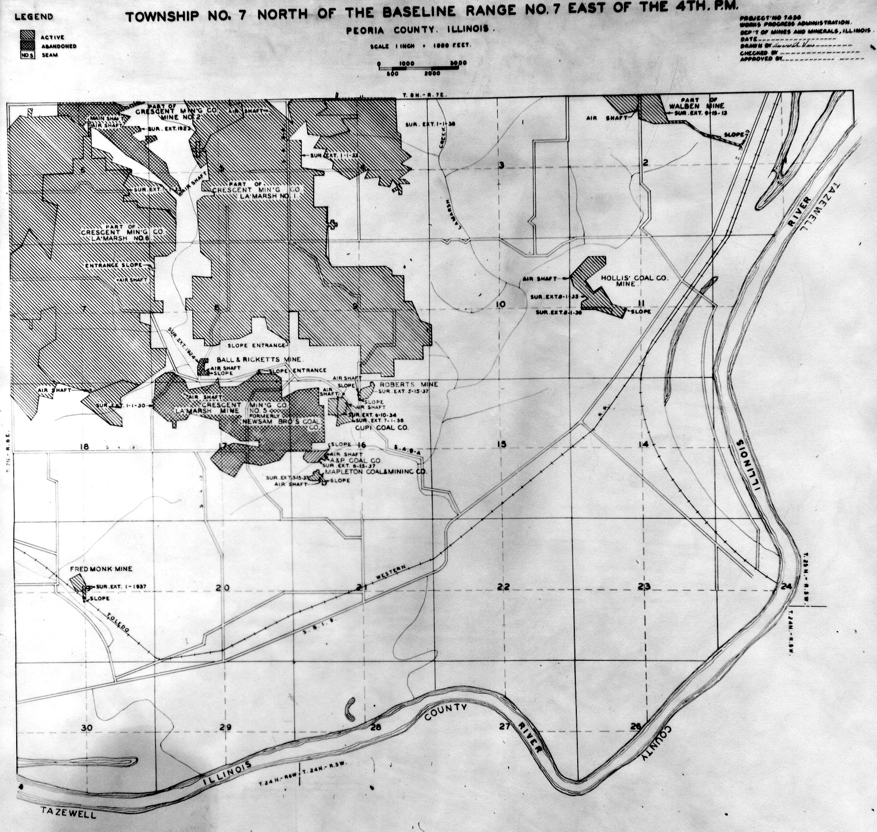
 | Peoria, T7N-R7E | Peoria | T7N-R7E | WPA PEORIA 7N7E.jpg |
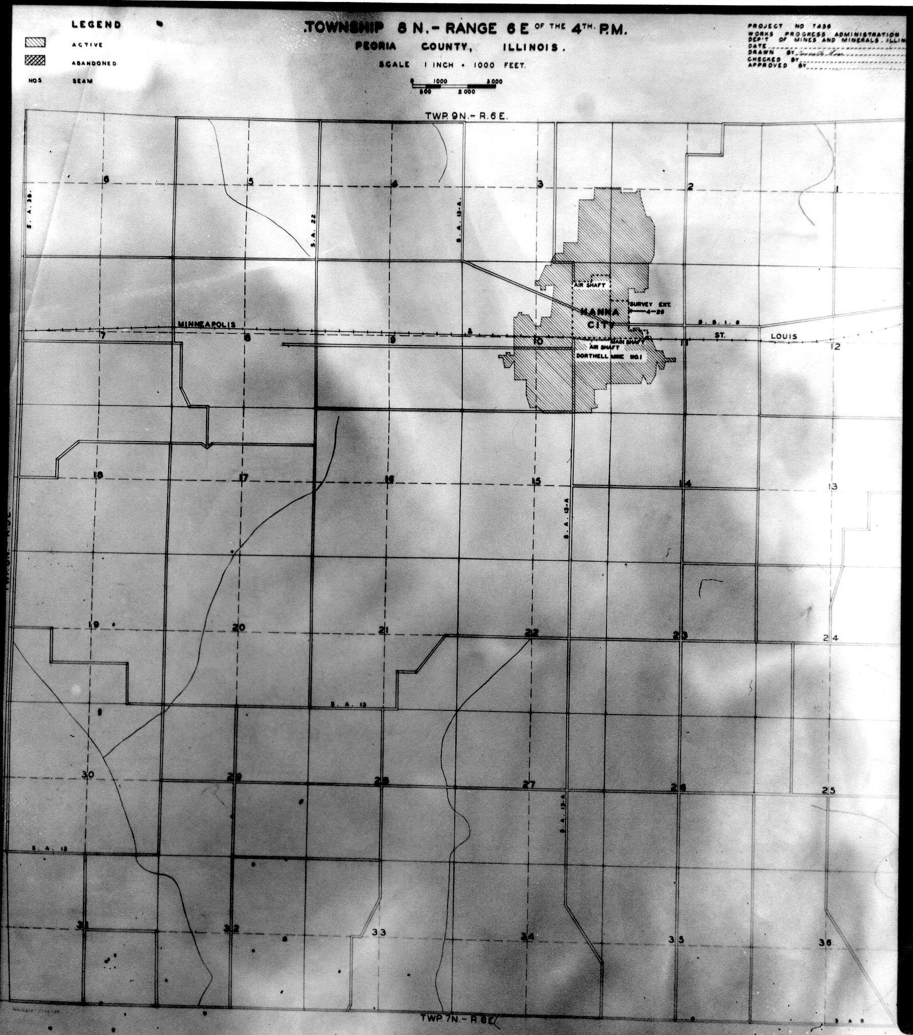
 | Peoria, T8N-R6E | Peoria | T8N-R6E | WPA PEORIA 8N6E.jpg |
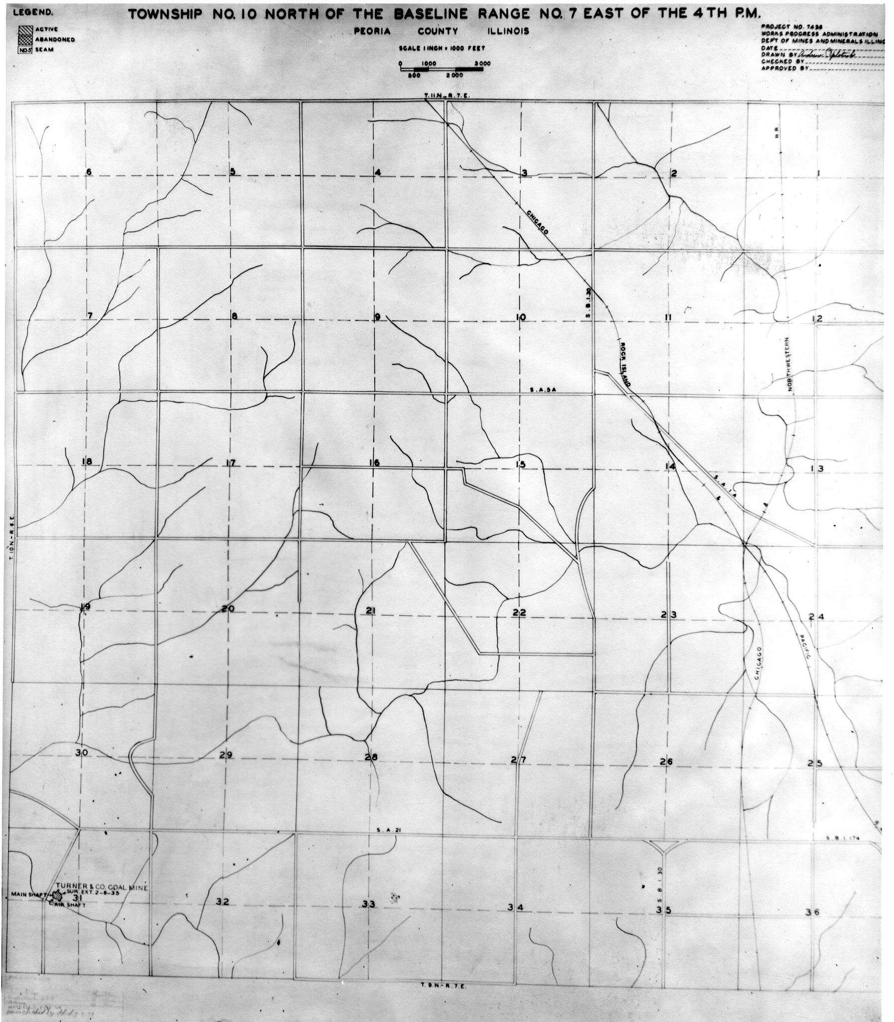
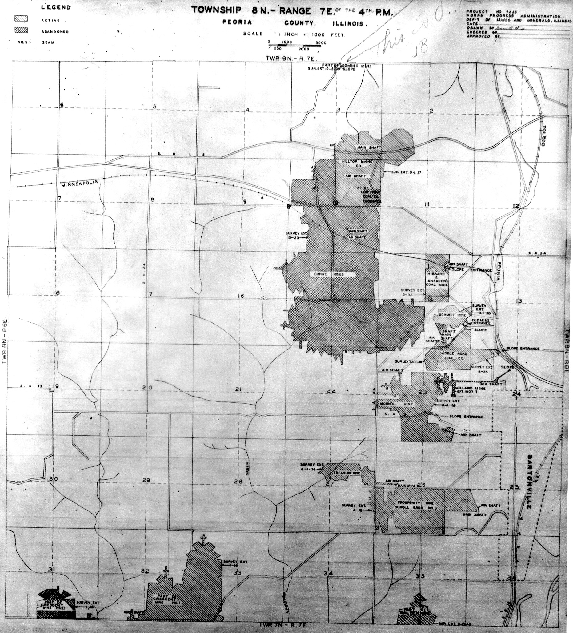
 | Peoria, T8N-R7E | Peoria | T8N-R7E | WPA PEORIA 8N7E.jpg |
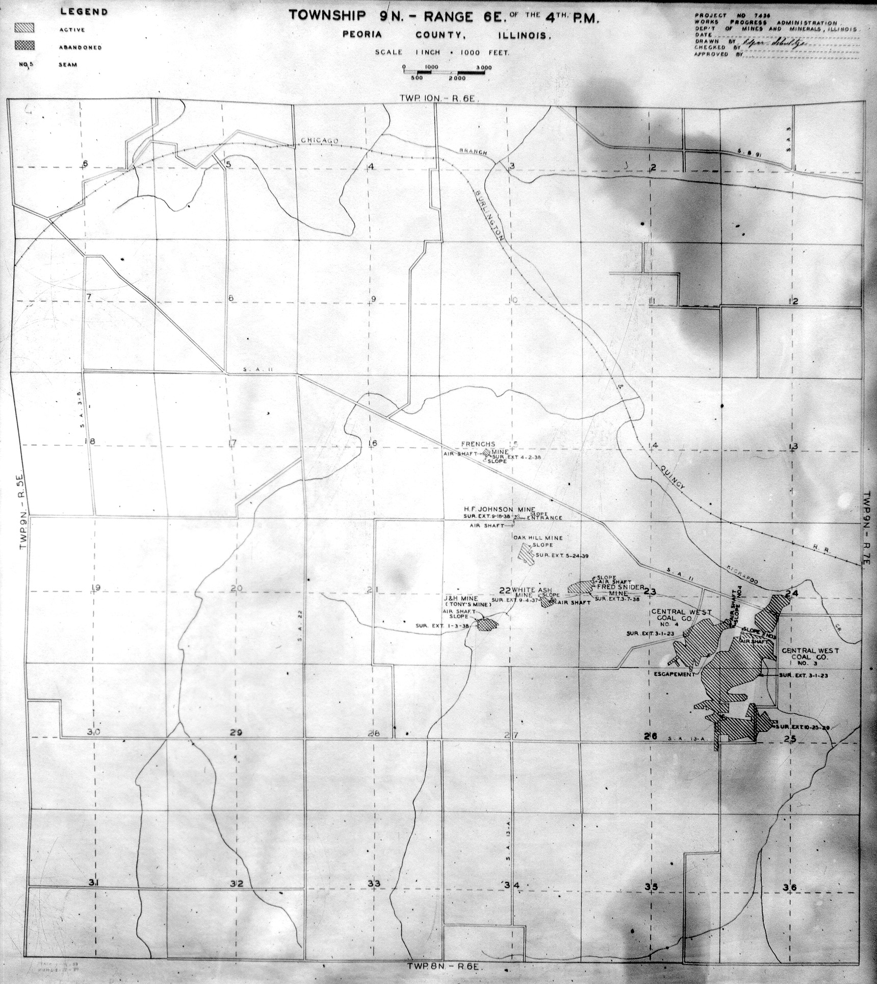
 | Peoria, T9N-R6E | Peoria | T9N-R6E | WPA PEORIA 9N6E.jpg |
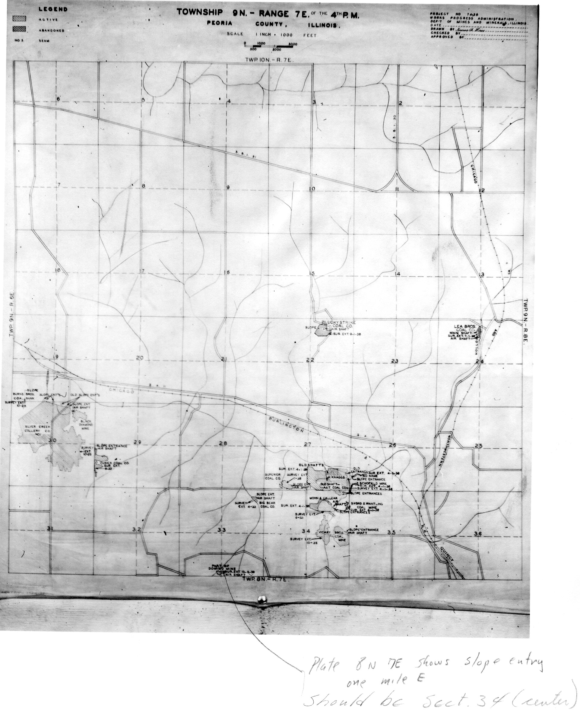
 | Peoria, T9N-R7E | Peoria | T9N-R7E | WPA PEORIA 9N7E.jpg |
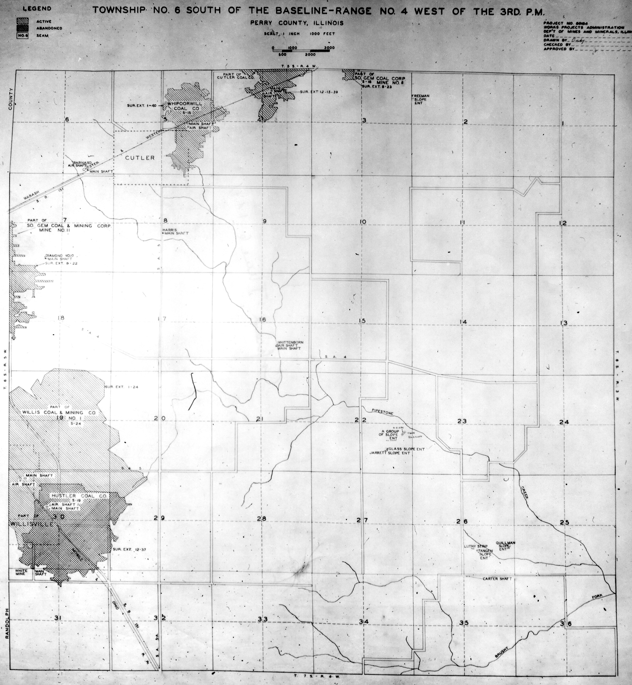
 | Perry, T4S-R1W | Perry | T4S-R1W | WPA PERRY 4S1W.jpg |
 | Perry, T4S-R4W | Perry | T4S-R4W | WPA PERRY 4S4W.jpg |
 | Perry, T5S-R1W | Perry | T5S-R1W | WPA PERRY 5S1W.jpg |
 | Perry, T5S-R2W | Perry | T5S-R2W | WPA PERRY 5S2W.jpg |
 | Perry, T5S-R3W | Perry | T5S-R3W | WPA PERRY 5S3W.jpg |
 | Perry, T5S-R4W | Perry | T5S-R4W | WPA PERRY 5S4W.jpg |
 | Perry, T6S-R1W | Perry | T6S-R1W | WPA PERRY 6S1W.jpg |
 | Perry, T6S-R2W | Perry | T6S-R2W | WPA PERRY 6S2W.jpg |
 | Perry, T6S-R3W | Perry | T6S-R3W | WPA PERRY 6S3W.jpg |
 | Perry, T6S-R4W | Perry | T6S-R4W | WPA PERRY 6S4W.jpg |
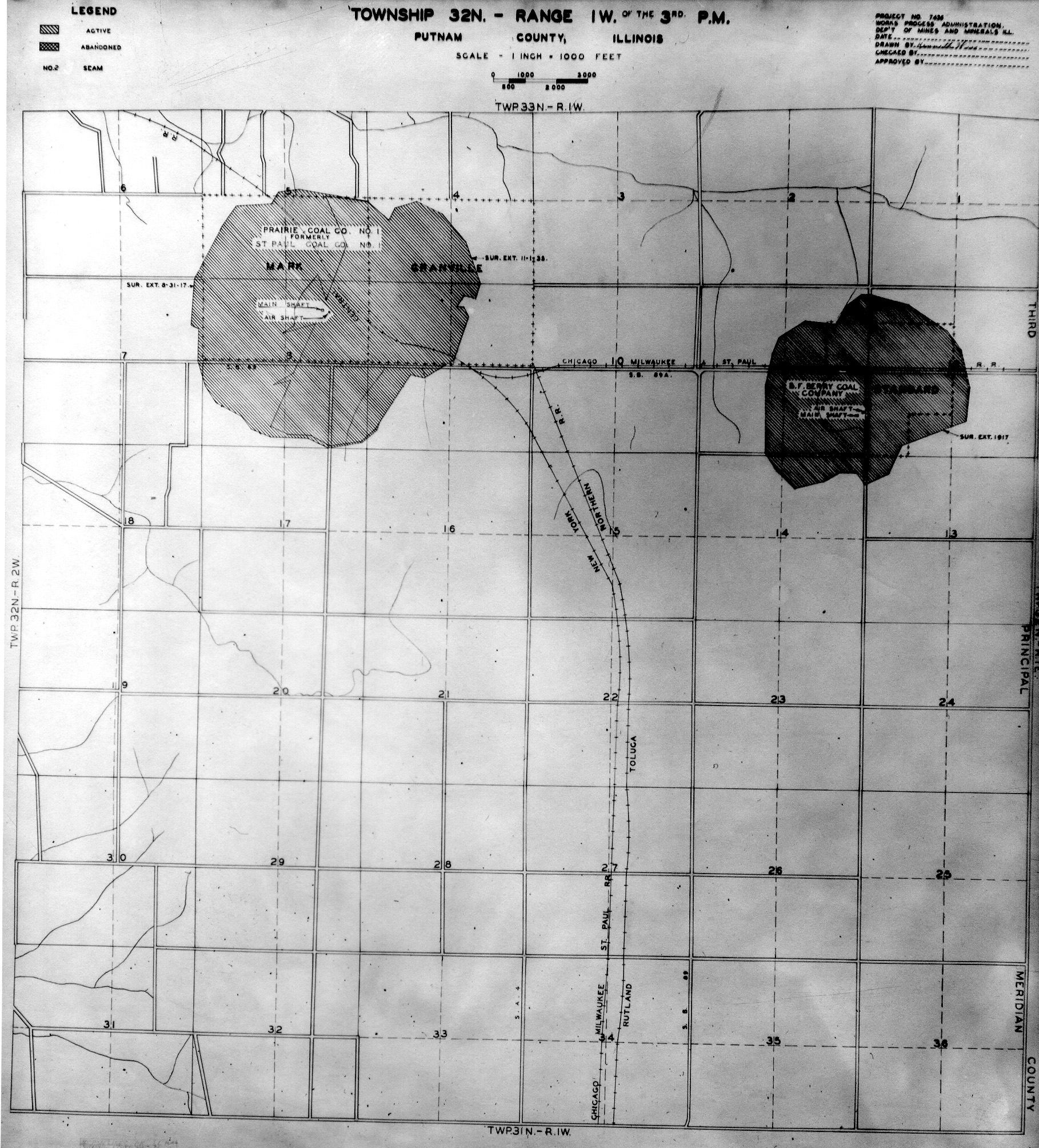
 | Putnam, T32N-R1W | Putnam | T32N-R1W | WPA PUTNAM 32N1W.jpg |
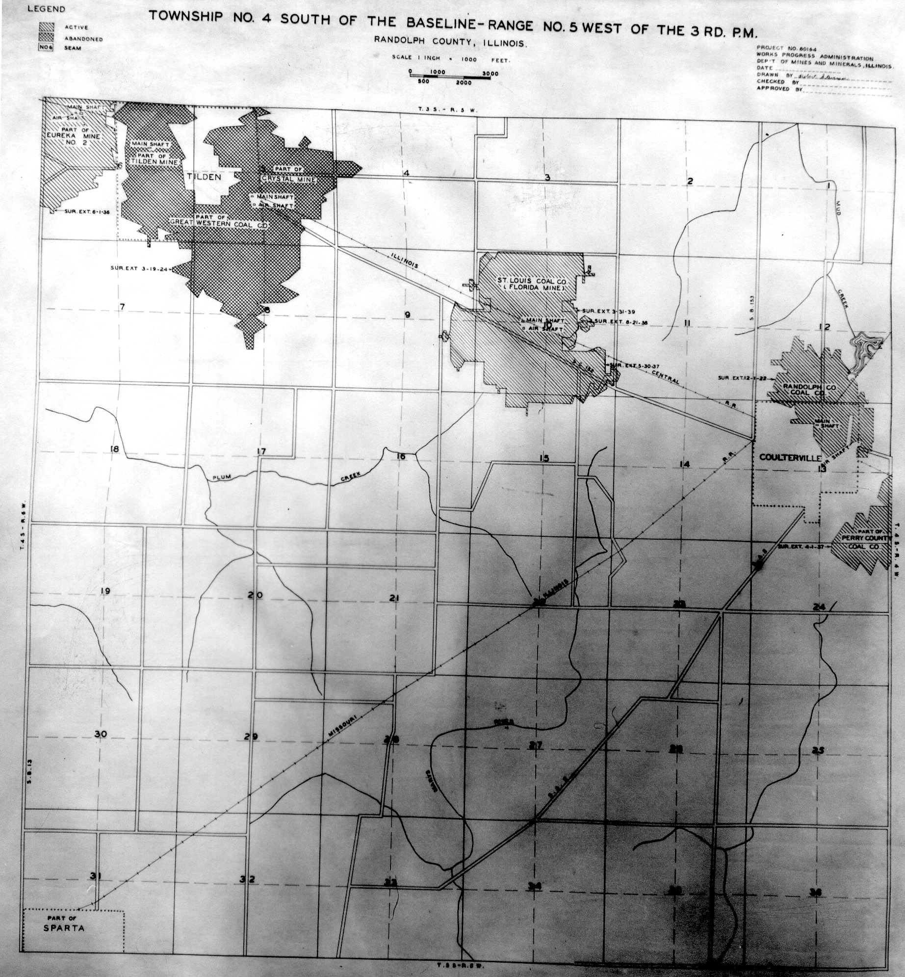
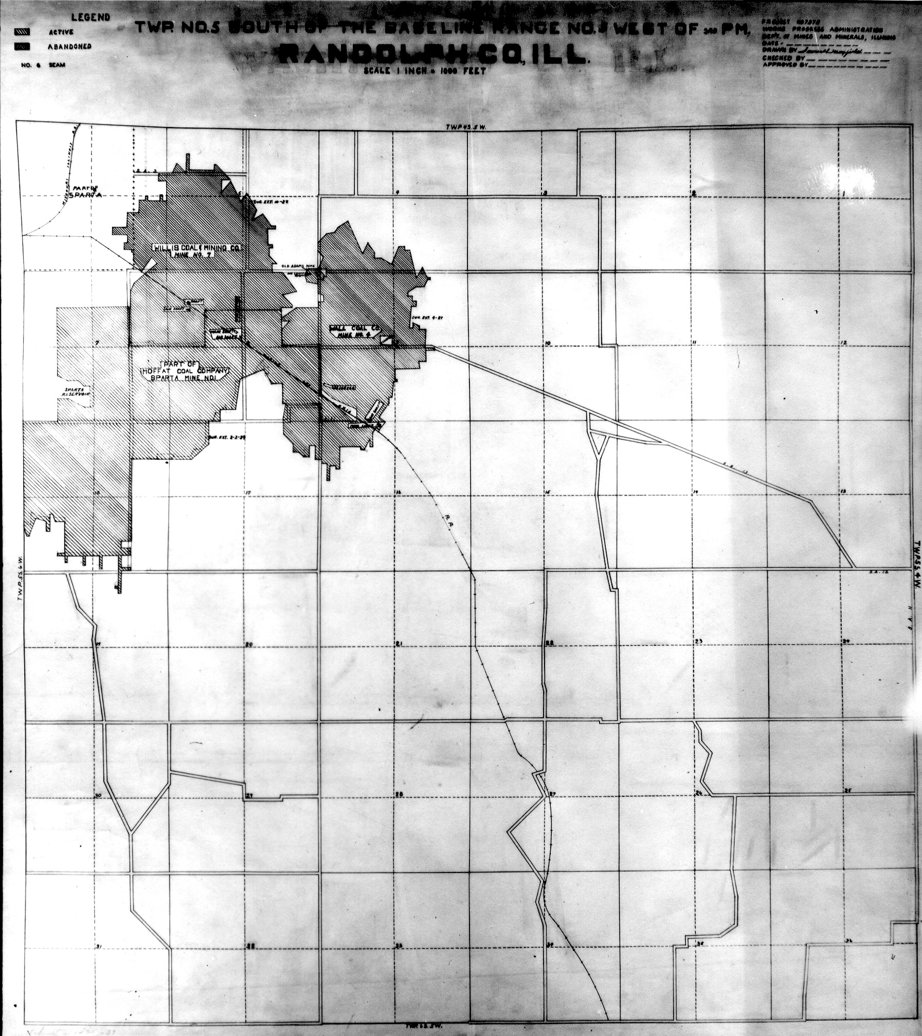
 | Randolph, T4S-R5W | Randolph | T4S-R5W | WPA RANDOLPH 4S5W.jpg |
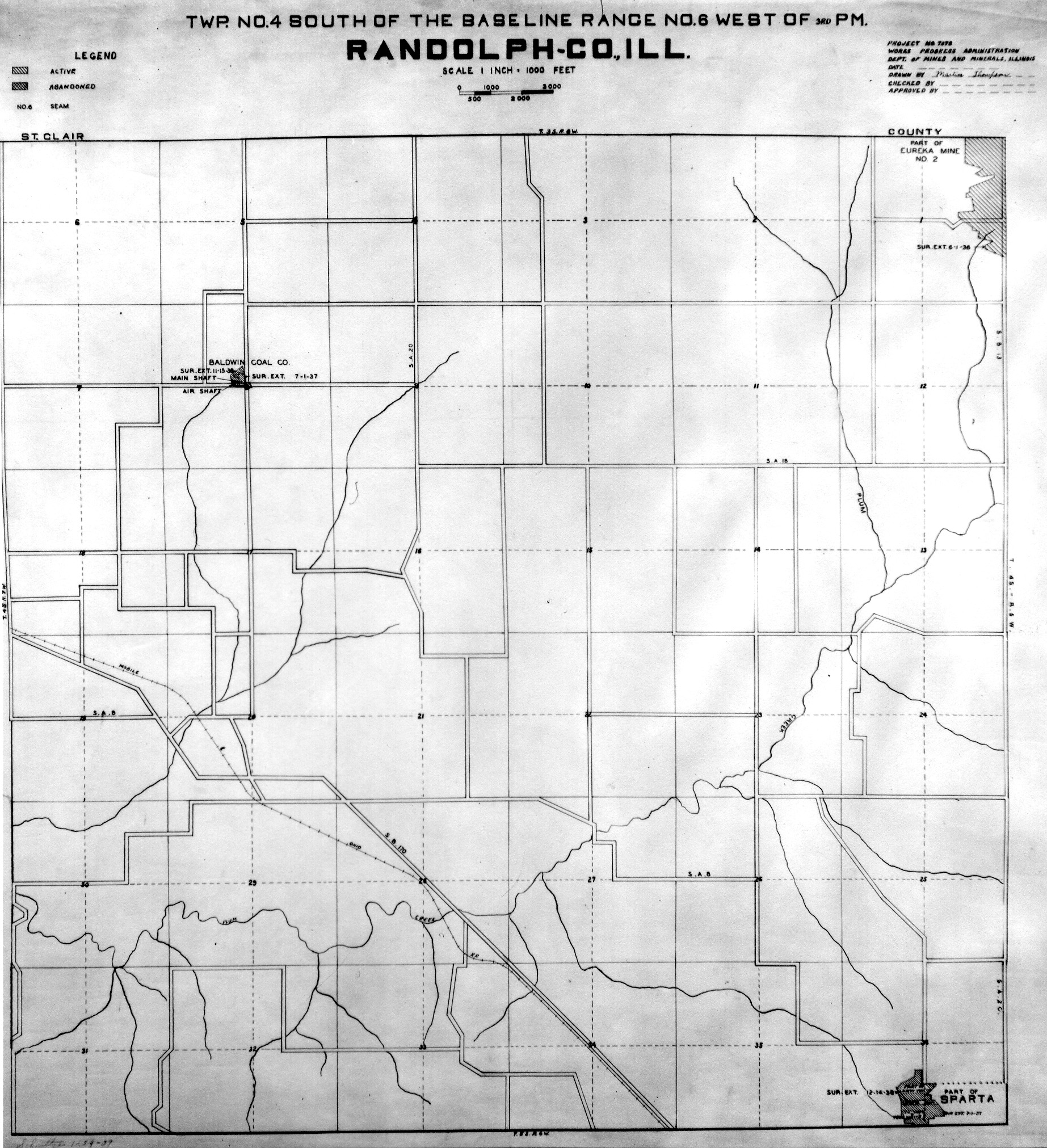
 | Randolph, T4S-R6W | Randolph | T4S-R6W | WPA RANDOLPH 4S6W.jpg |
 | Randolph, T5S-R5W | Randolph | T5S-R5W | WPA RANDOLPH 5S5W.jpg |
 | Randolph, T5S-R6W No.1 | Randolph | T5S-R6W | WPA RANDOLPH 5S6W NO 1.jpg |
 | Randolph, T5S-R6W No.2 | Randolph | T5S-R6W | WPA RANDOLPH 5S6W NO 2.jpg |
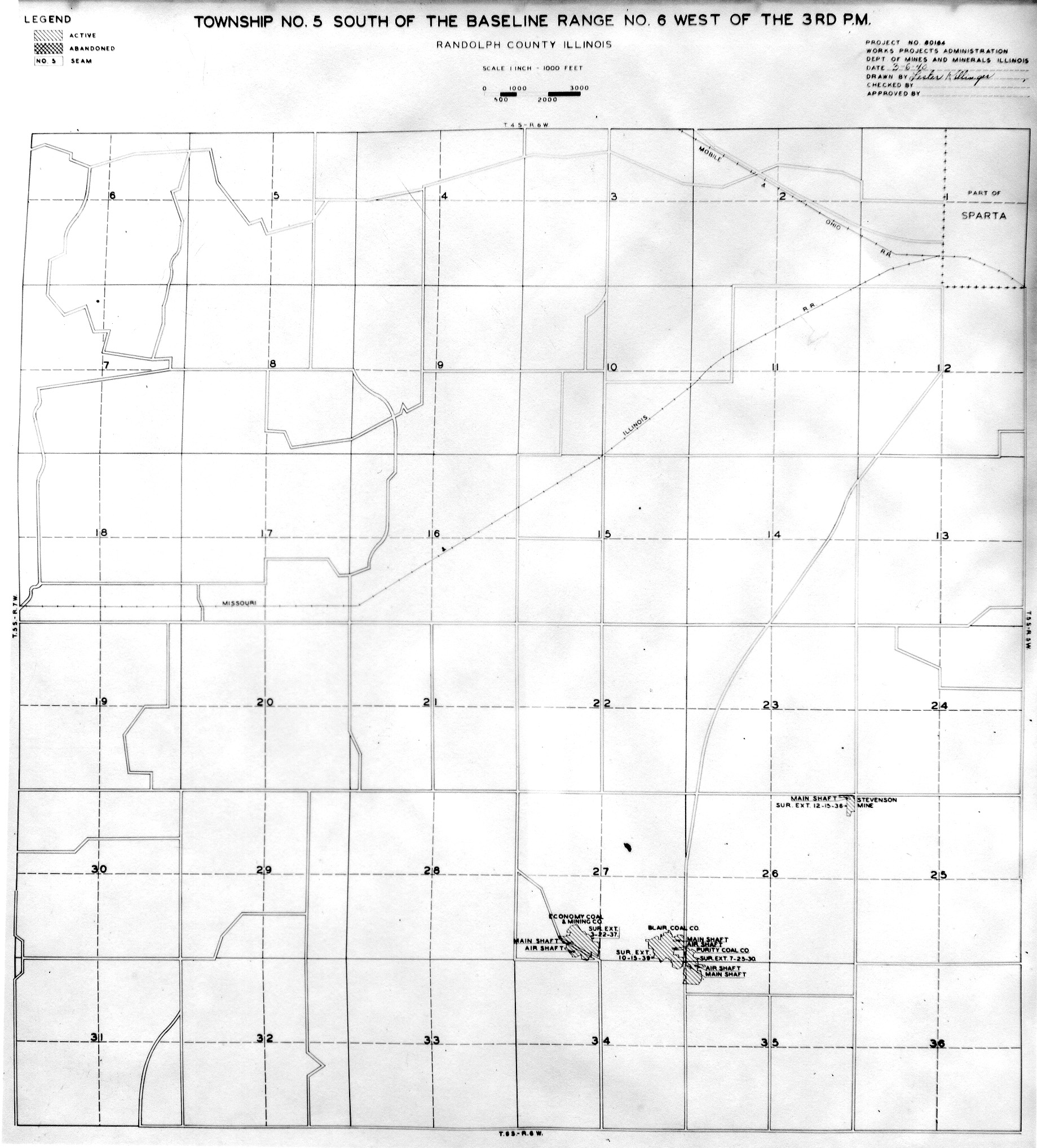
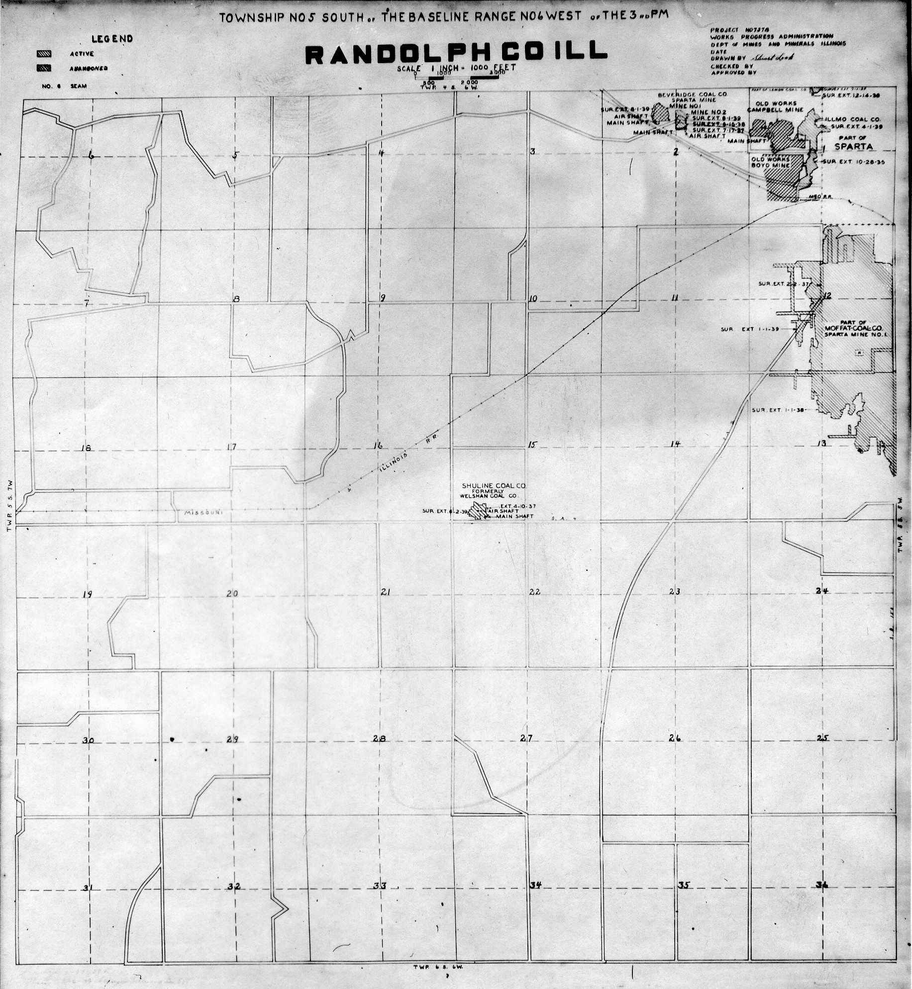
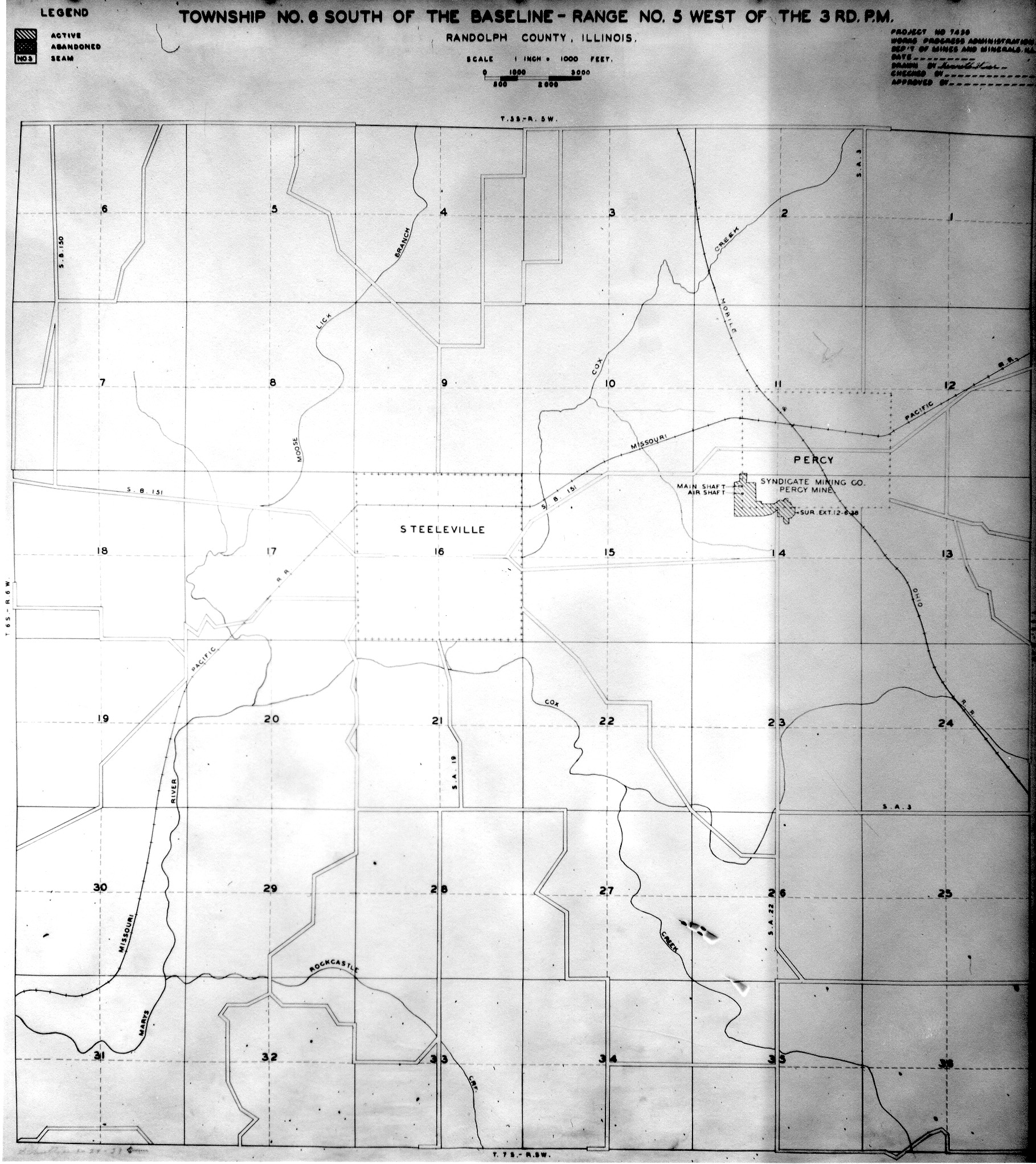
 | Randolph, T6S-R5W No.1 | Randolph | T6S-R5W | WPA RANDOLPH 6S5W NO 1.jpg |
 | Randolph, T6S-R5W No.2 | Randolph | T6S-R5W | WPA RANDOLPH 6S5W NO 2.jpg |
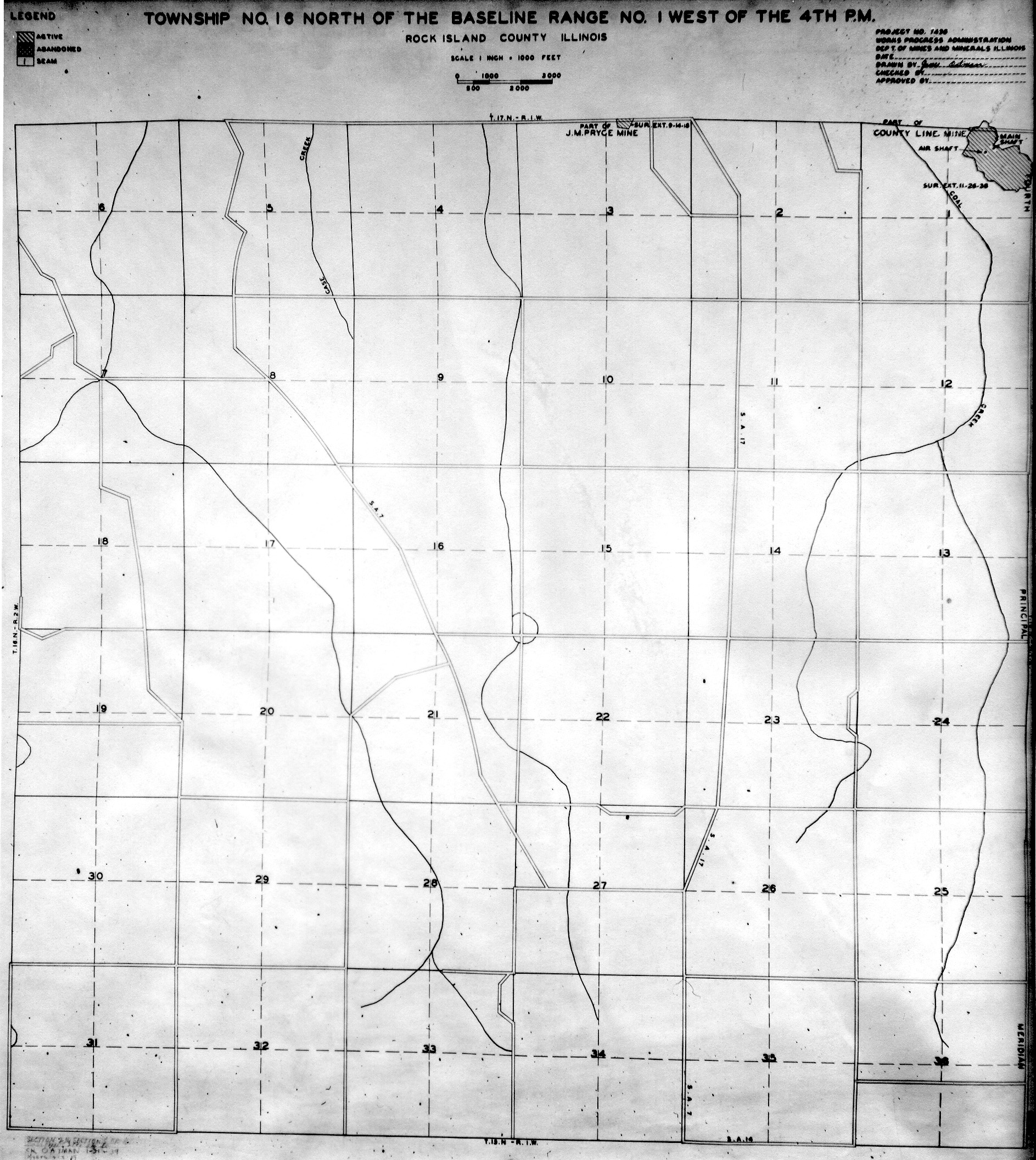
 | Rock Island, T16N-R1W | Rock Island | T16N-R1W | WPA ROCK ISLAND 16N1W.jpg |
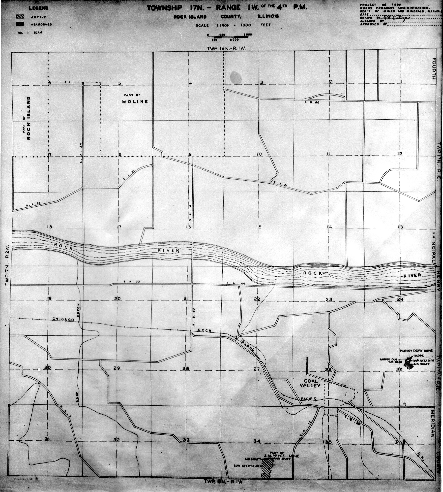
 | Rock Island, T17N-R1W | Rock Island | T17N-R1W | WPA ROCK ISLAND 17N1W.jpg |
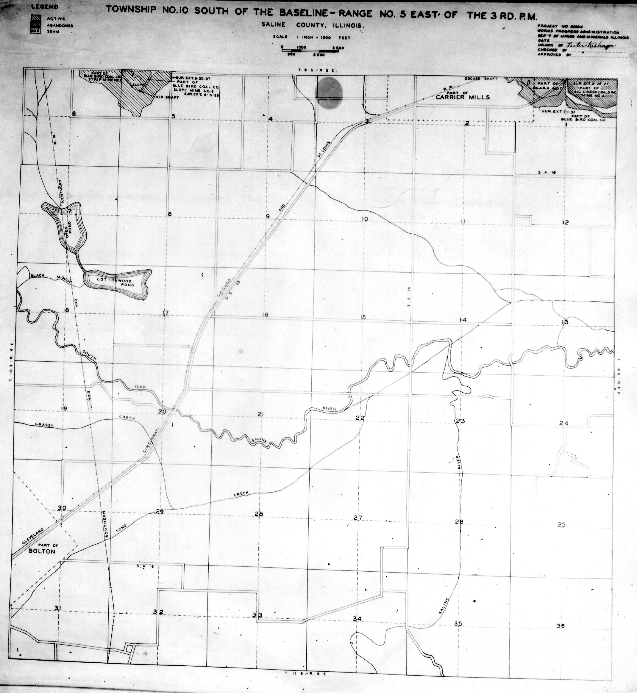
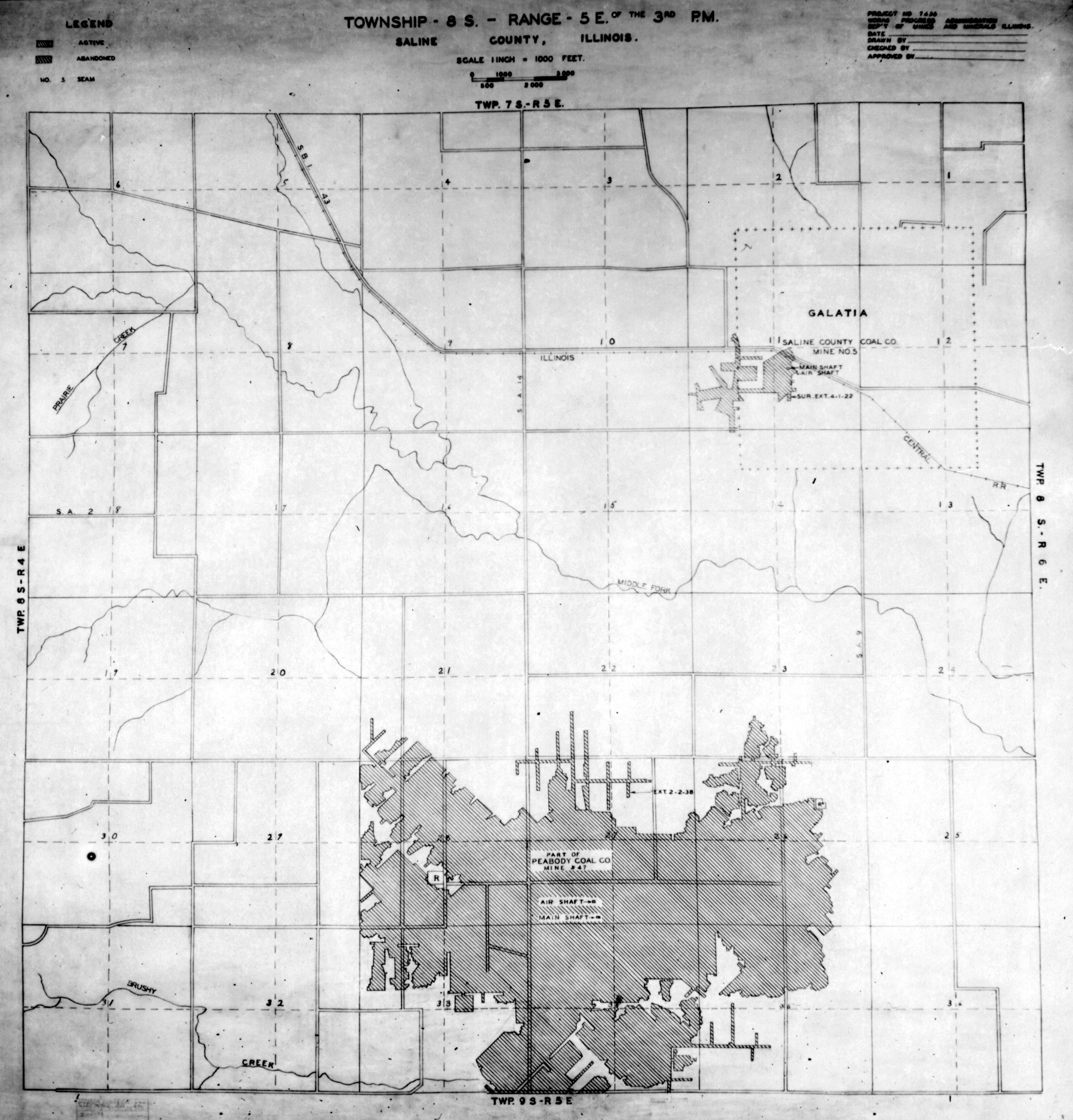
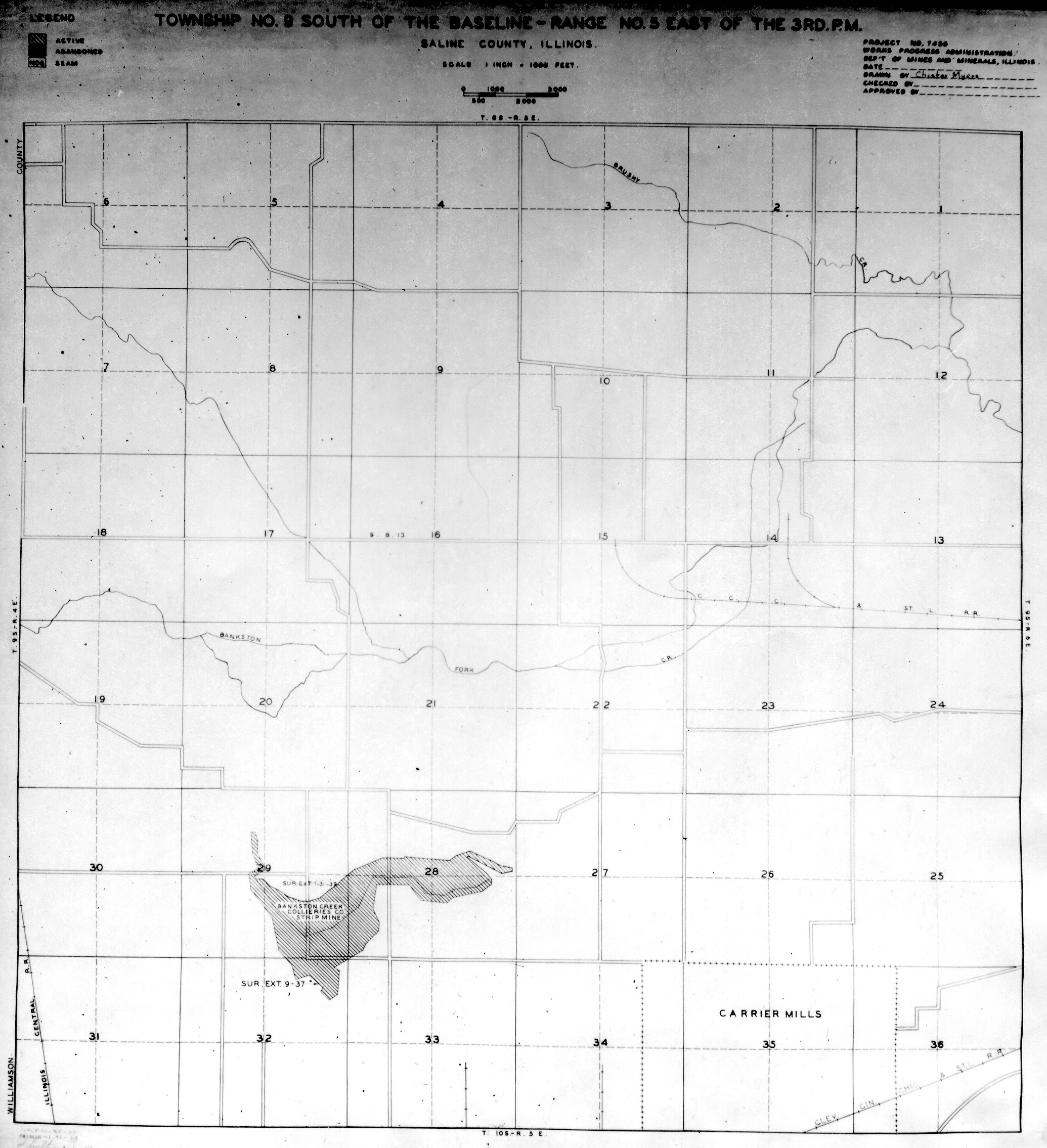
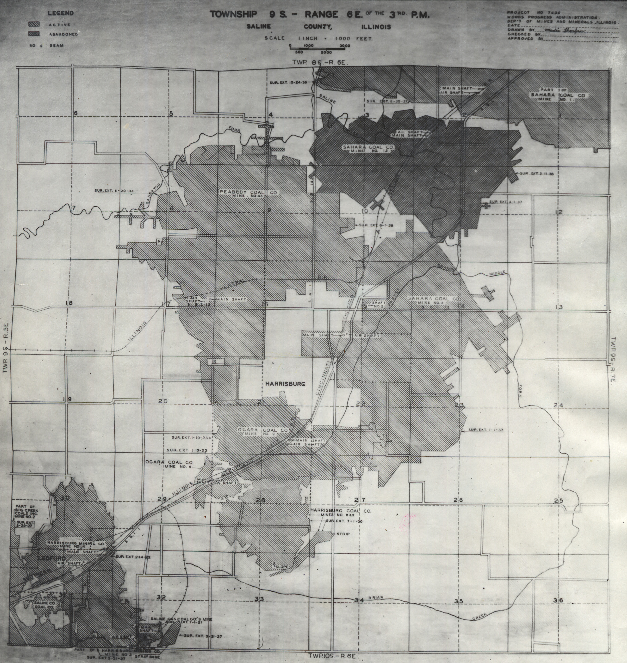
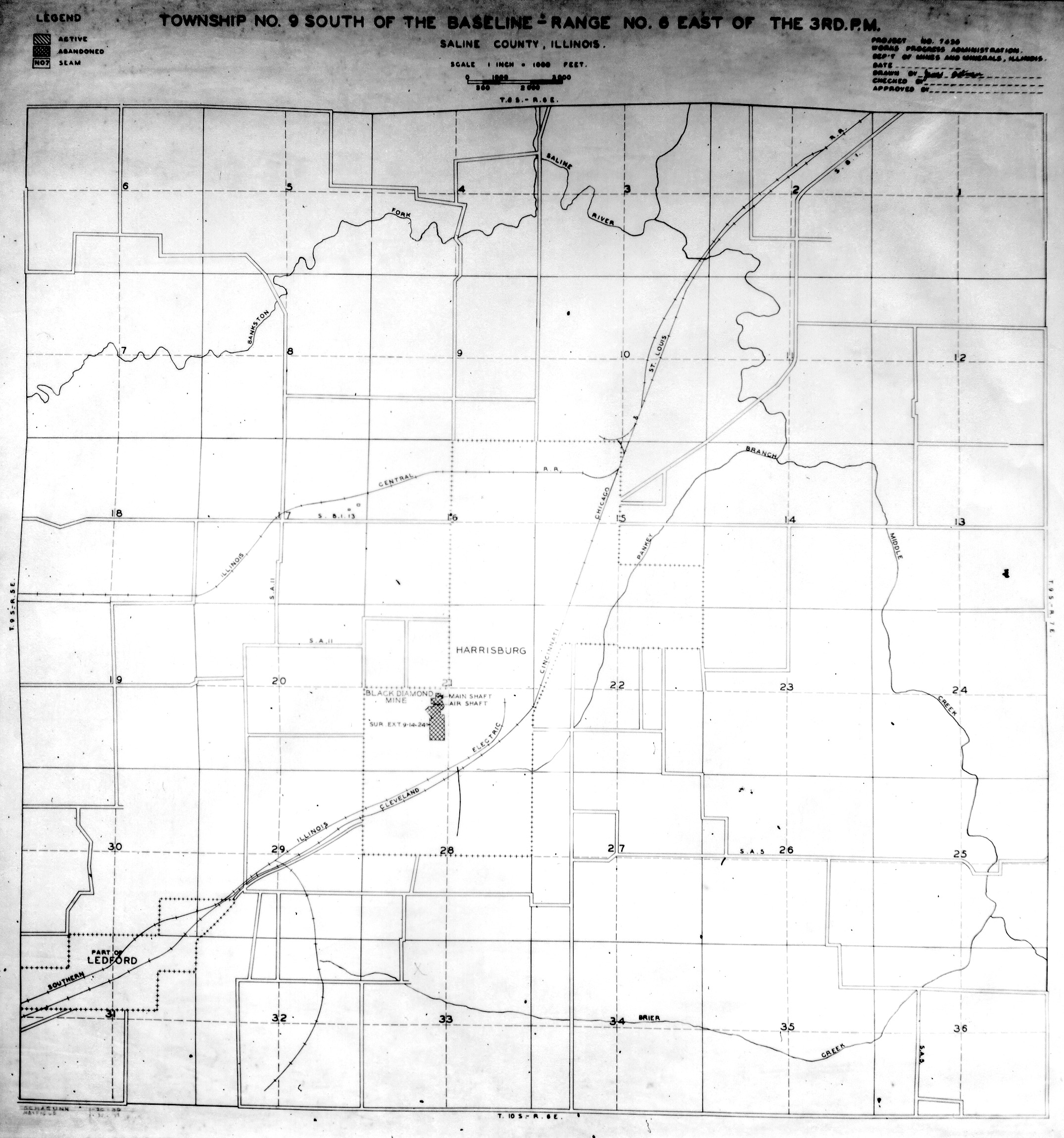
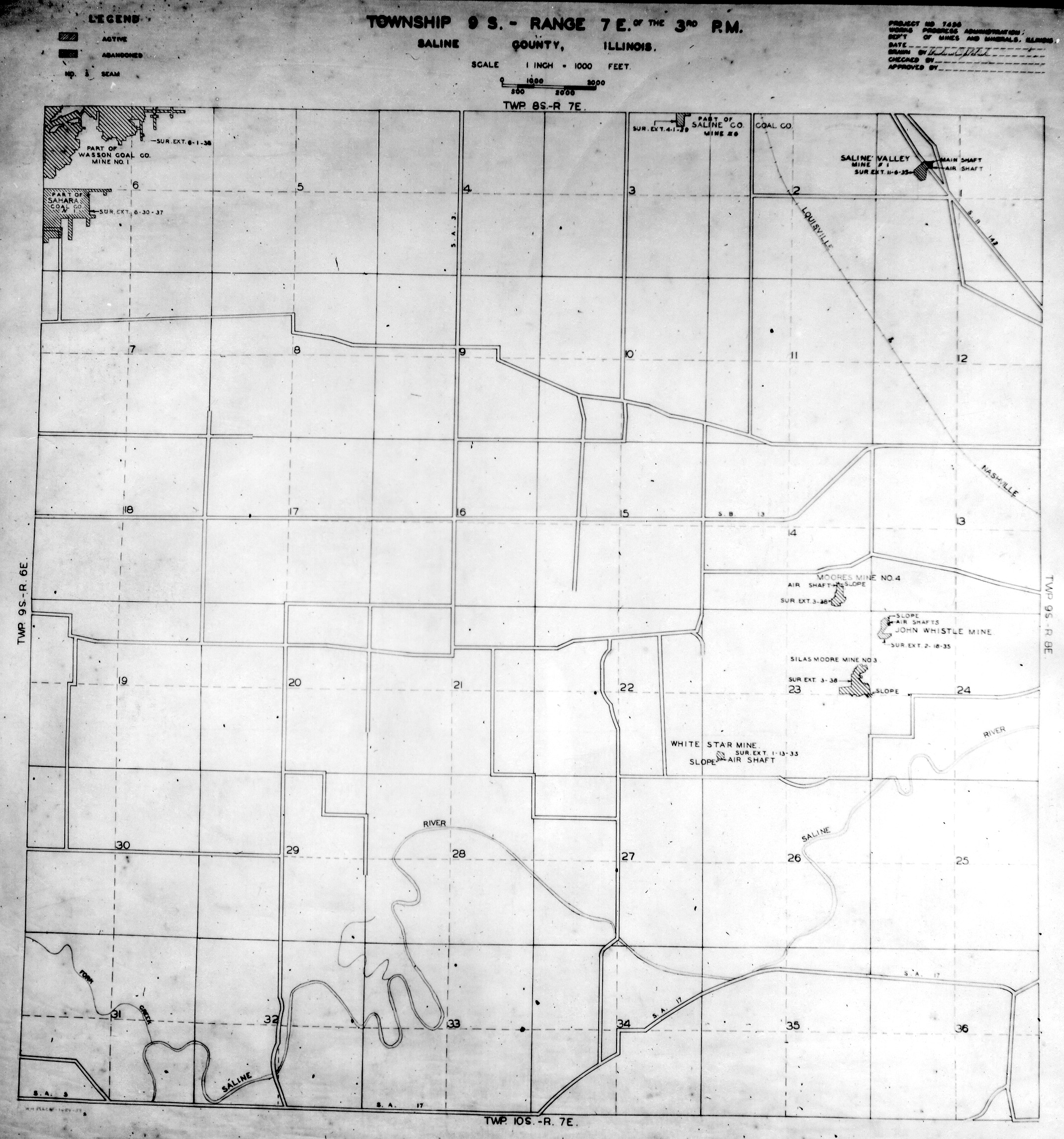
 | Saline, T10S-R5E | Saline | T10S-R5E | WPA SALINE 10S5E.jpg |
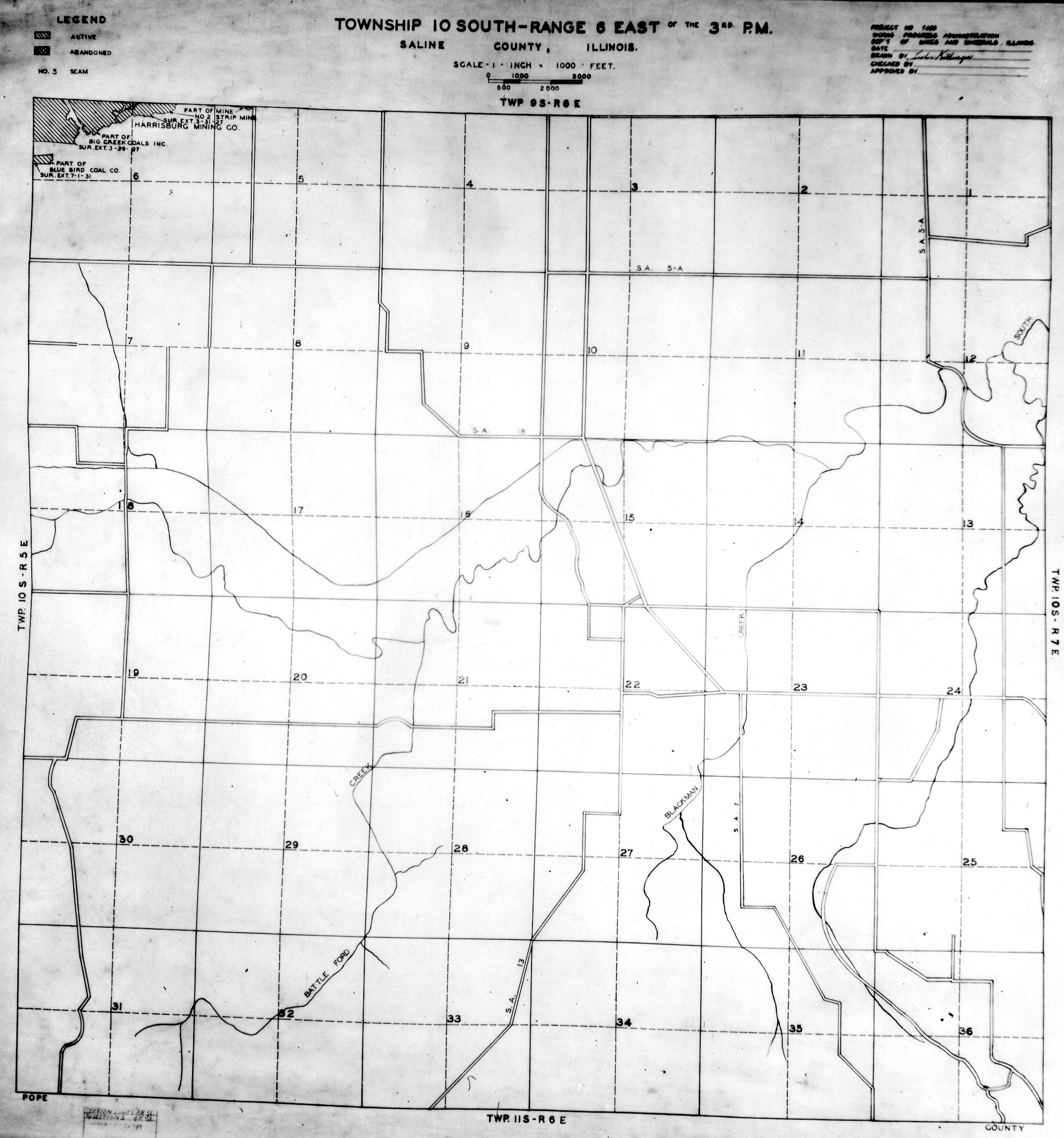
 | Saline, T10S-R6E | Saline | T10S-R6E | WPA SALINE 10S6E.jpg |
 | Saline, T10S-R7E | Saline | T10S-R7E | WPA SALINE 10S7E.jpg |
 | Saline, T8S-R5E | Saline | T8S-R5E | WPA SALINE 8S5E.jpg |
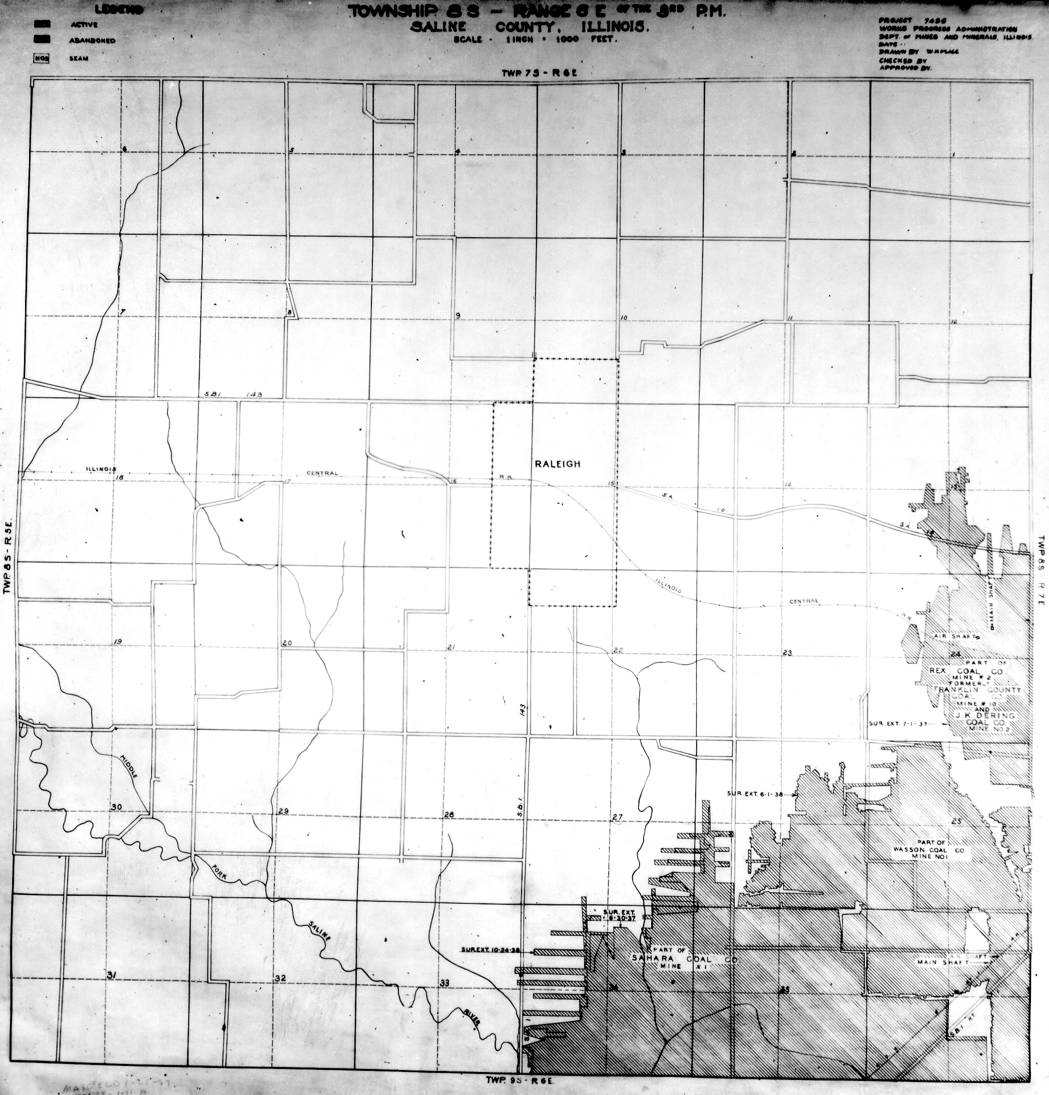
 | Saline, T8S-R6E | Saline | T8S-R6E | WPA SALINE 8S6E.jpg |
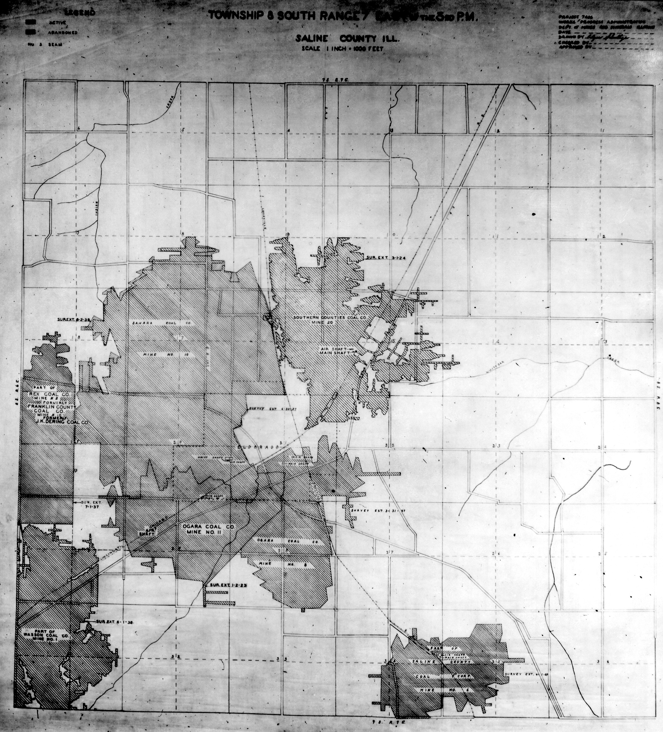
 | Saline, T8S-R7E | Saline | T8S-R7E | WPA SALINE 8S7E.jpg |
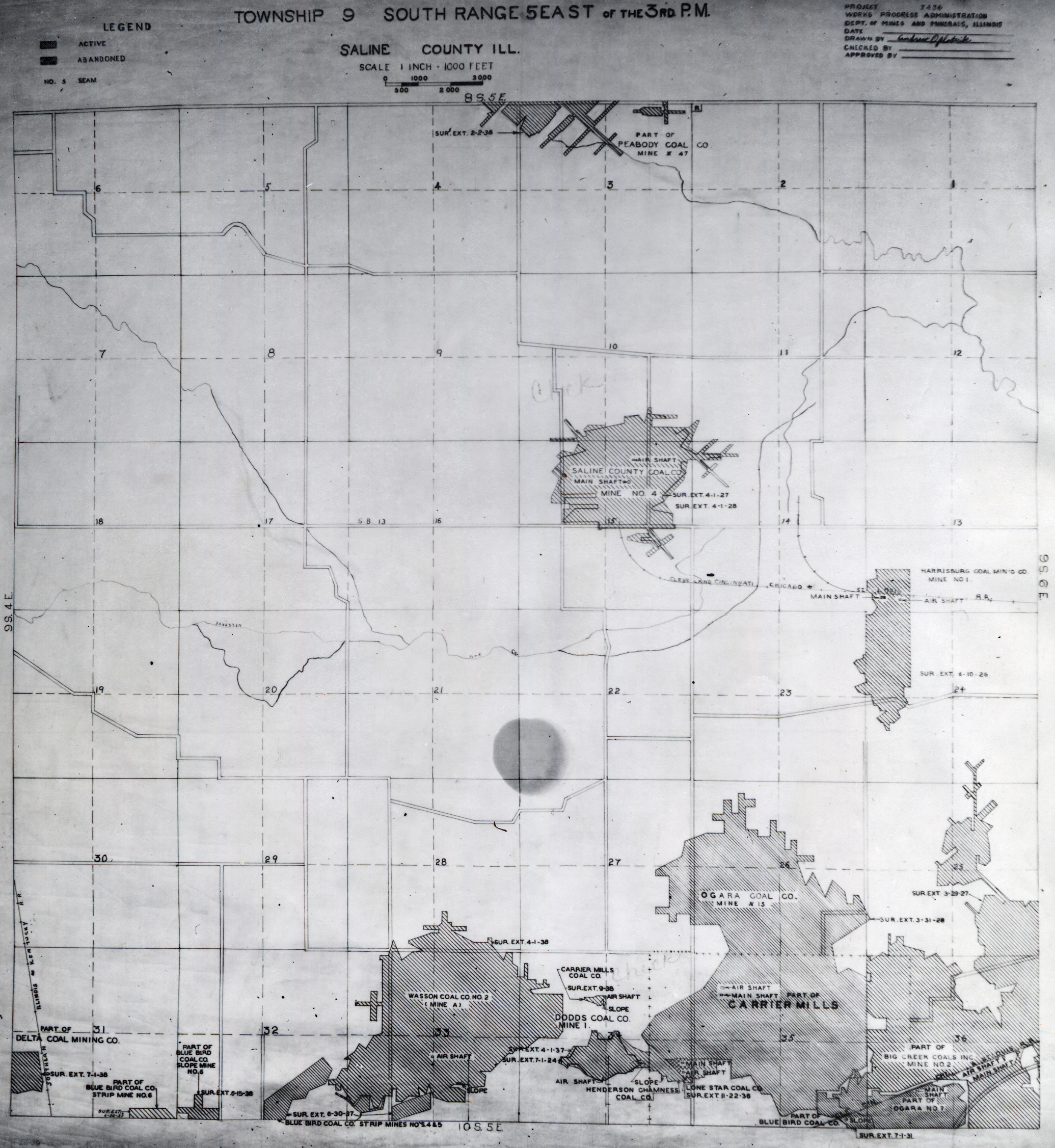
 | Saline, T9S-R5E No.1 | Saline | T9S-R5E | WPA SALINE 9S5E NO 1.jpg |
 | Saline, T9S-R5E No.2 | Saline | T9S-R5E | WPA SALINE 9S5E NO 2.jpg |
 | Saline, T9S-R6E No.1 | Saline | T9S-R6E | WPA SALINE 9S6E NO 1.jpg |
 | Saline, T9S-R6E No.2 | Saline | T9S-R6E | WPA SALINE 9S6E NO 2.jpg |
 | Saline, T9S-R7E | Saline | T9S-R7E | WPA SALINE 9S7E.jpg |
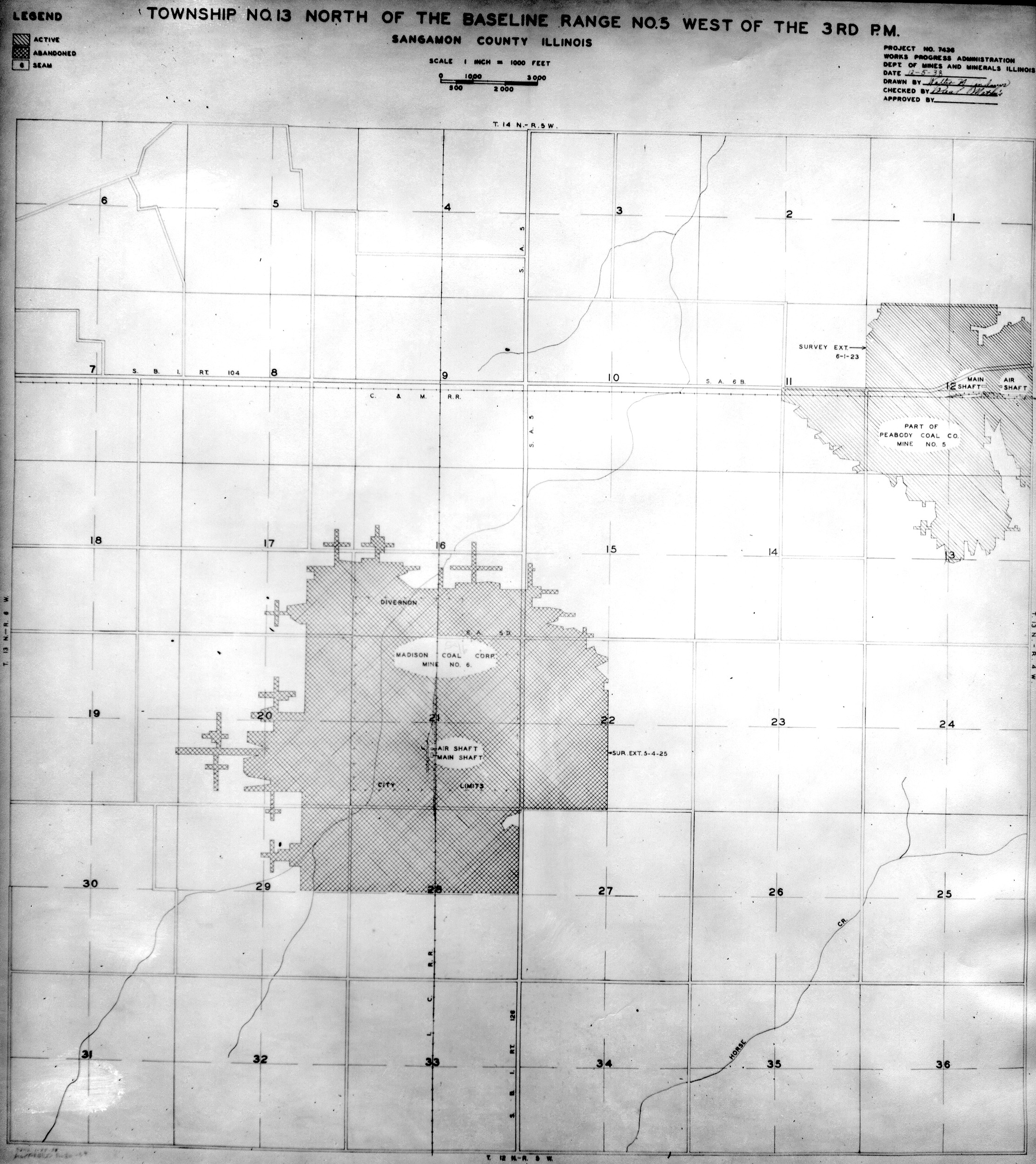
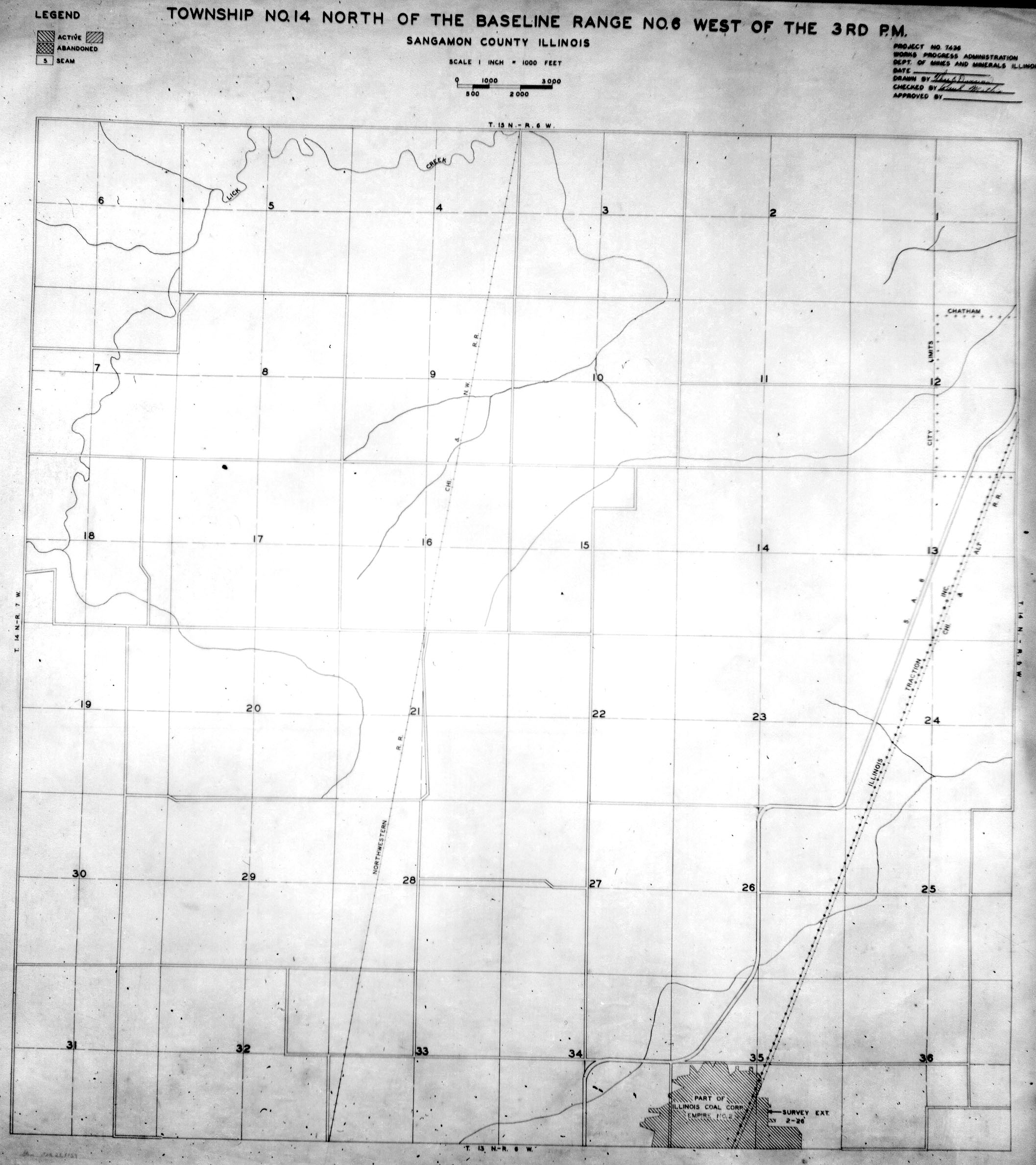
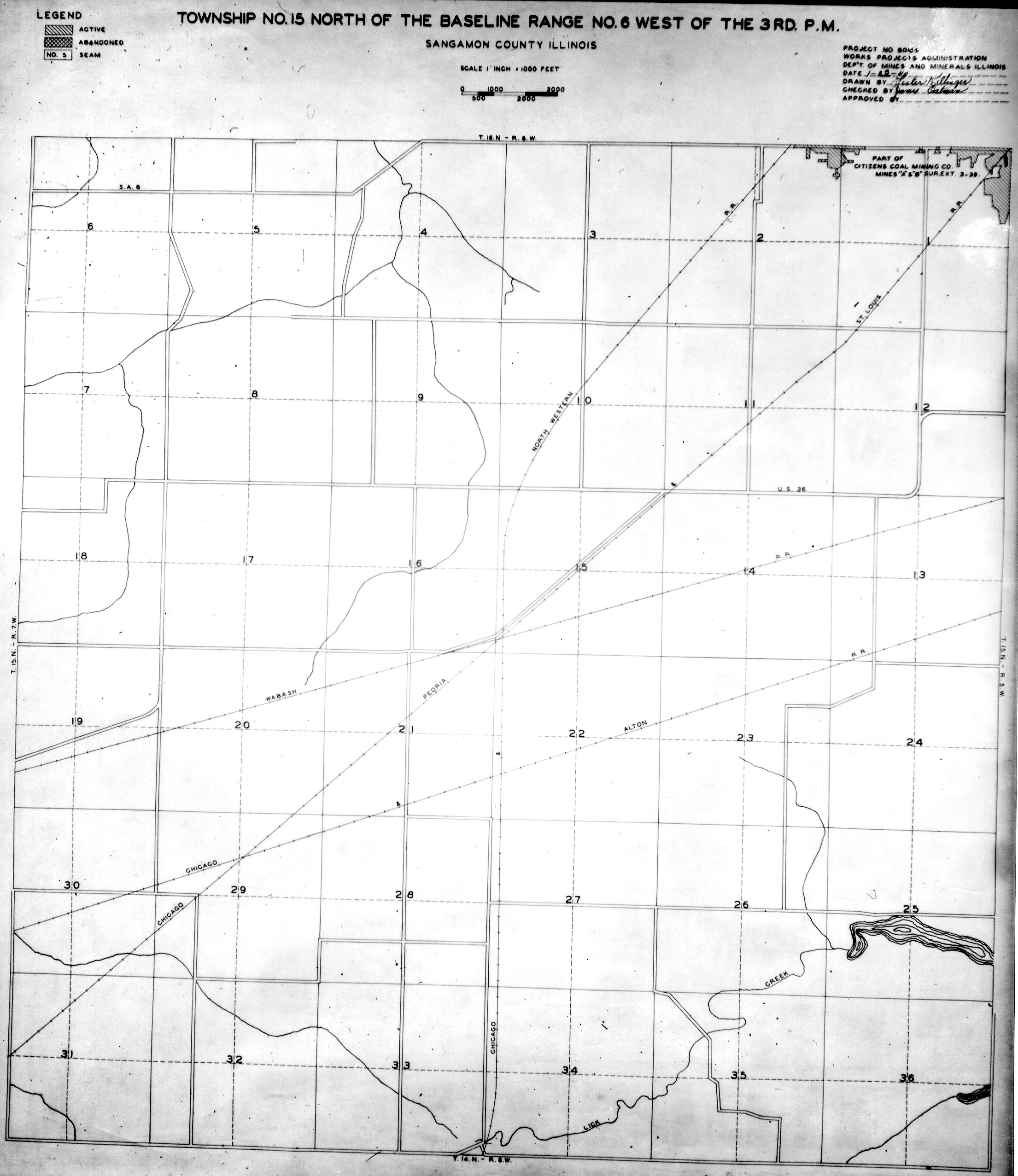
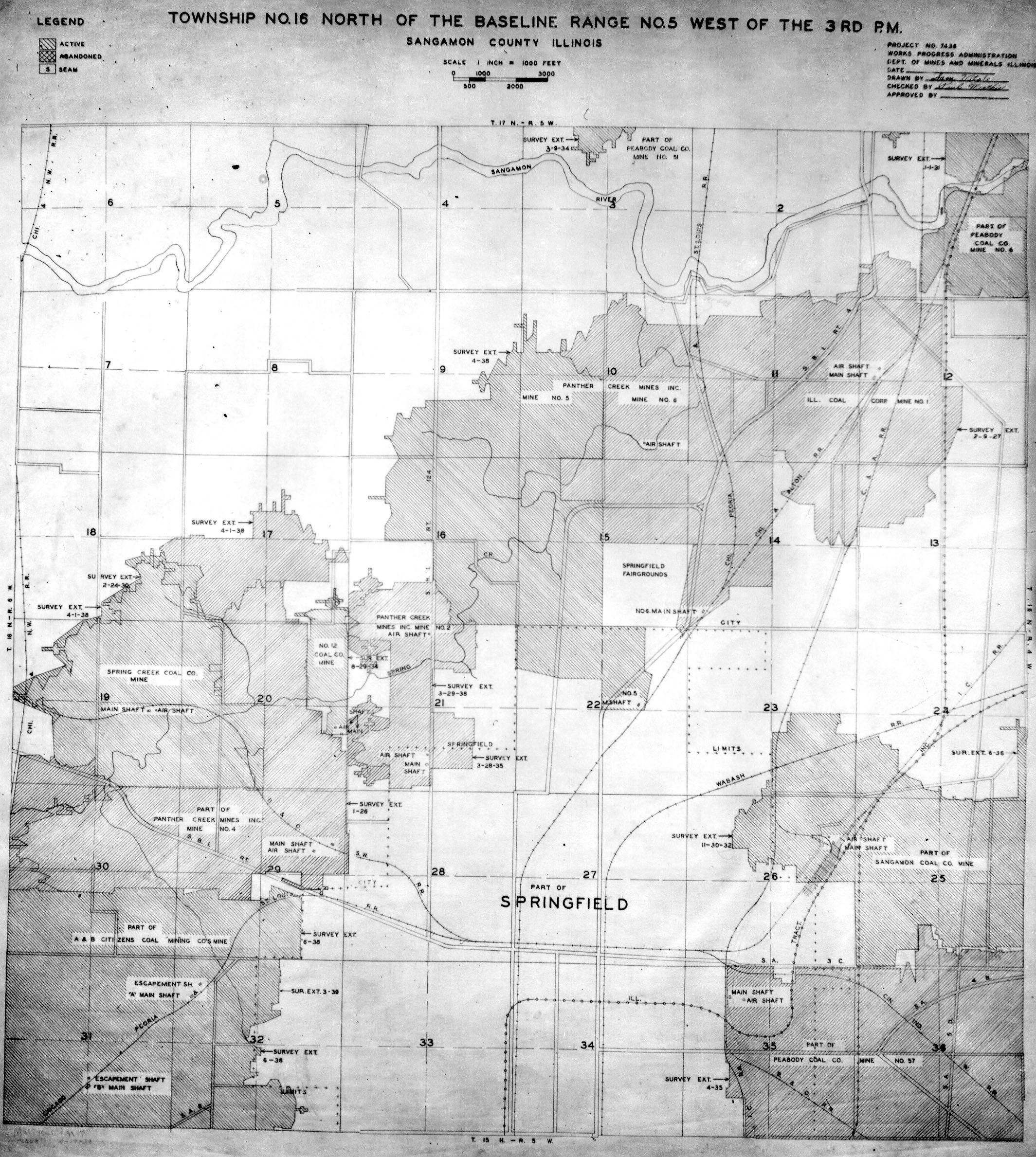
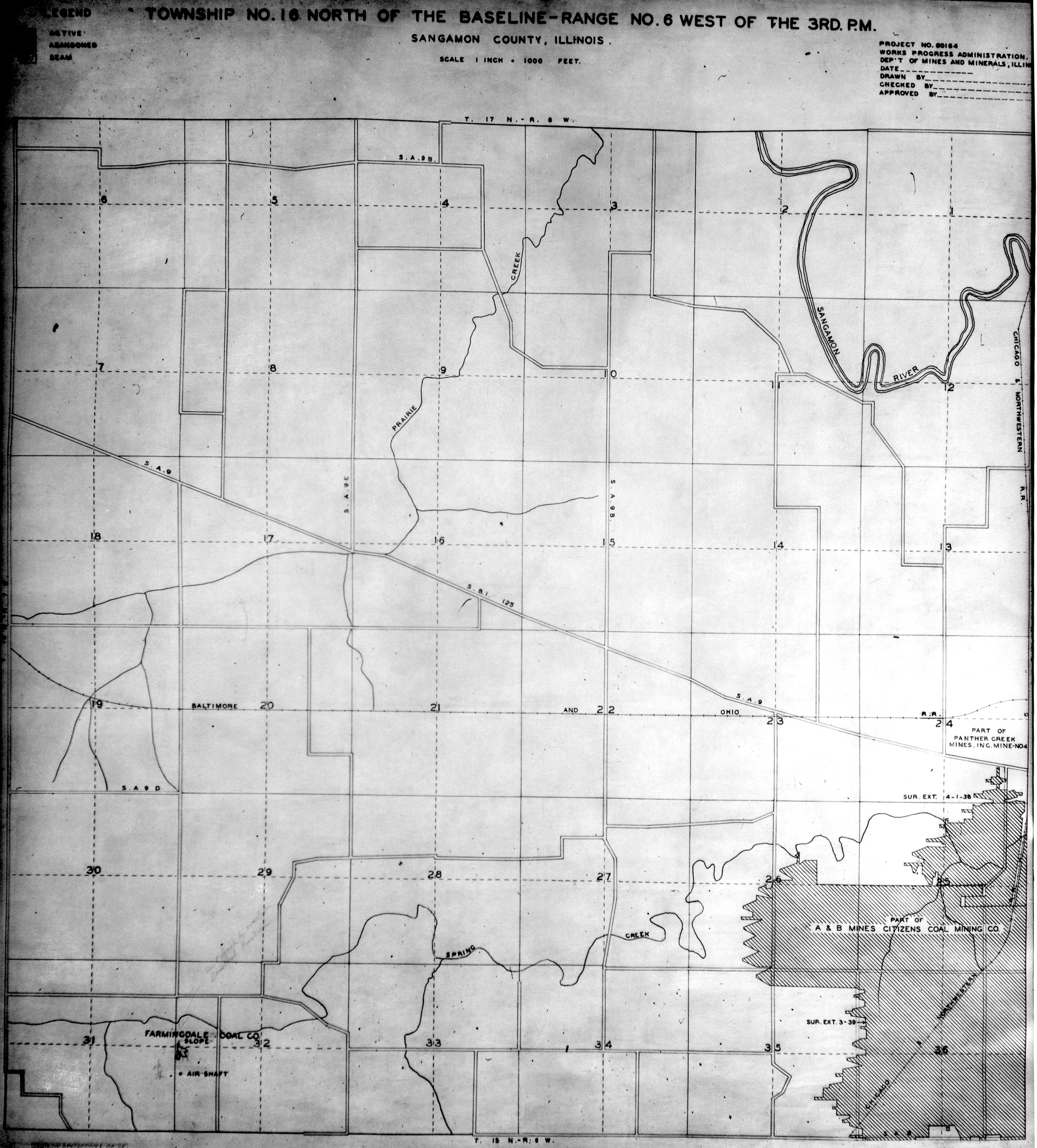
 | Sangamon, T13N-R5W | Sangamon | T13N-R5W | WPA SANGAMON 13N5W.jpg |
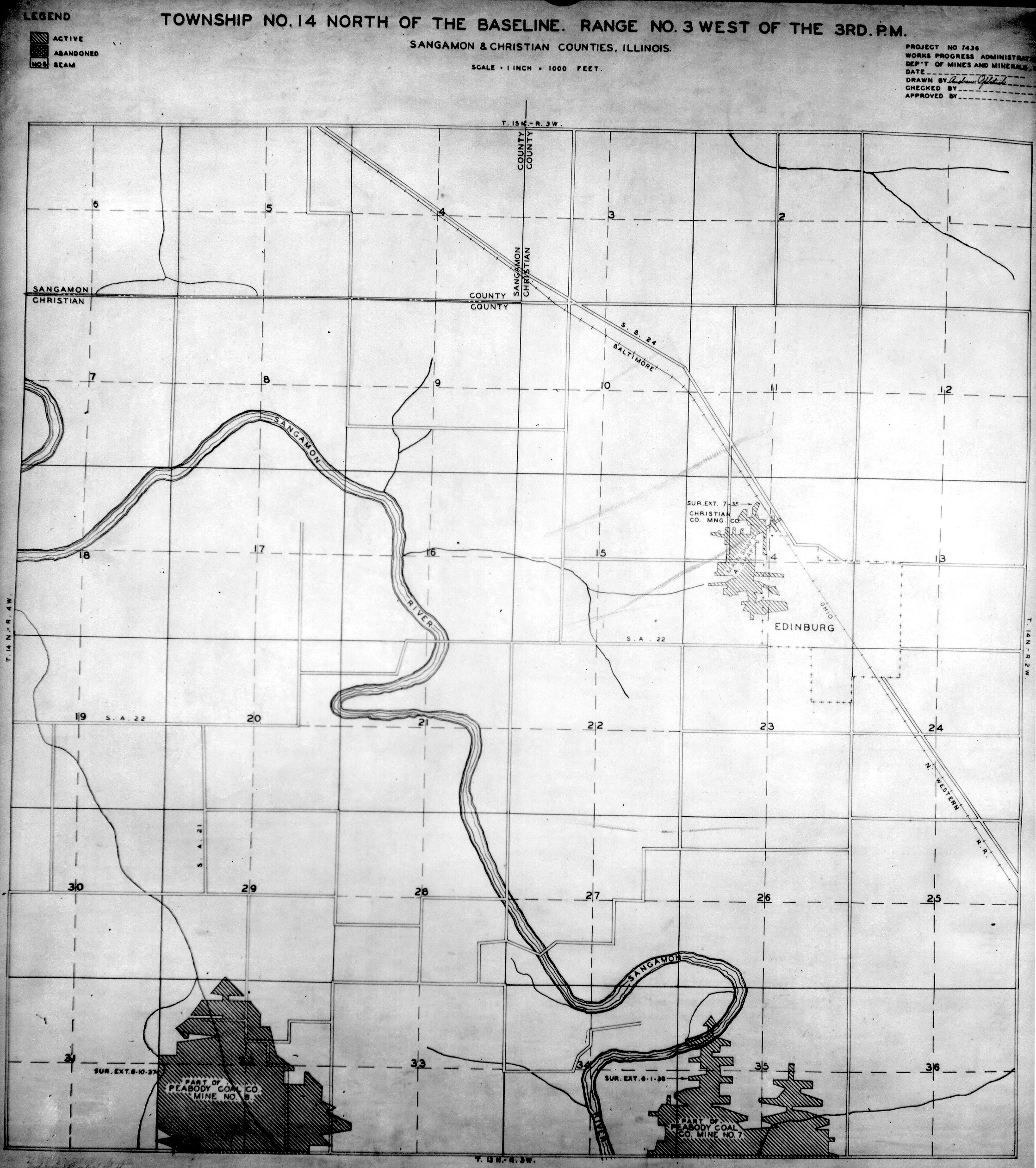
 | Sangamon, T14N-R3W | Sangamon | T14N-R3W | WPA SANGAMON 14N3W.jpg |
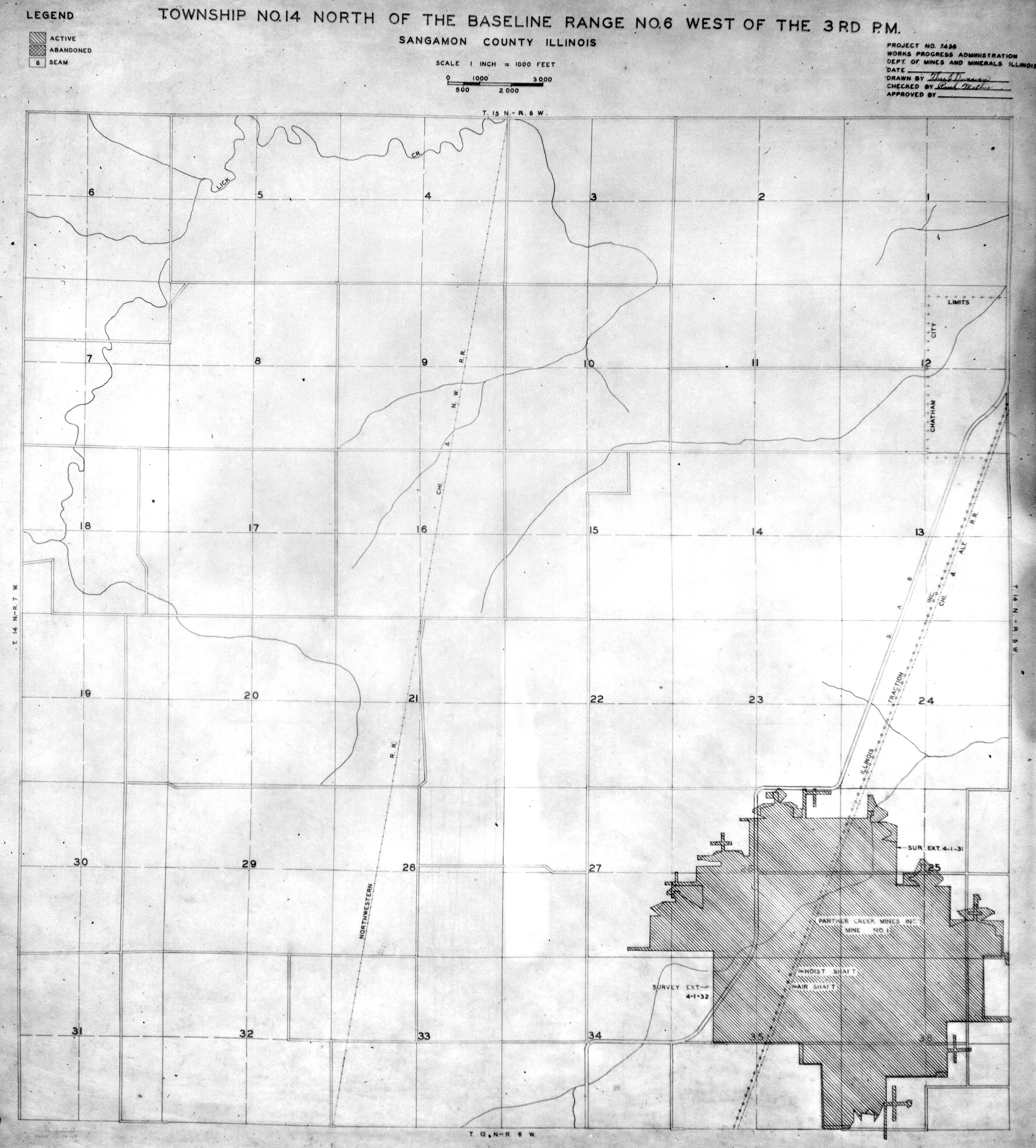
 | Sangamon, T14N-R6W No.1 | Sangamon | T14N-R6W | WPA SANGAMON 14N6W NO 1.jpg |
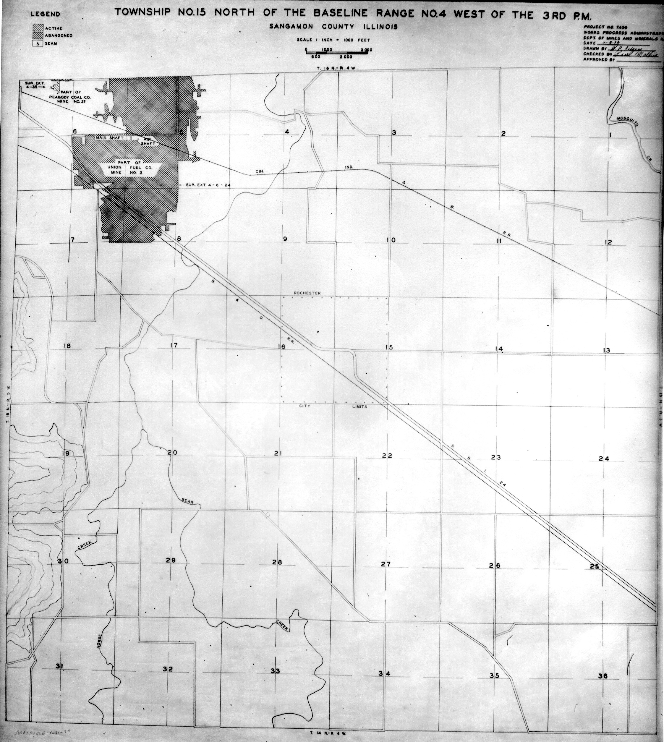
 | Sangamon, T15N-R4W | Sangamon | T15N-R4W | WPA SANGAMON 15N4W.jpg |
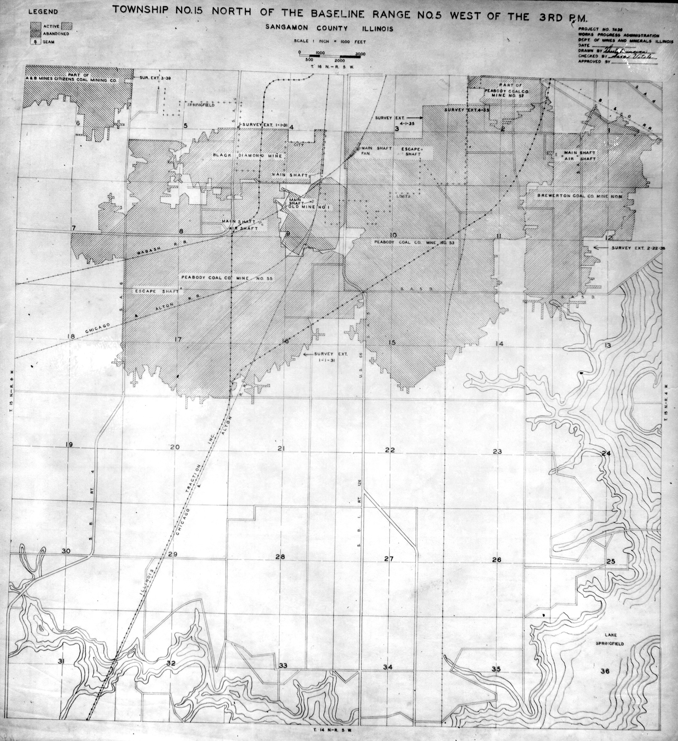
 | Sangamon, T15N-R5W | Sangamon | T15N-R5W | WPA SANGAMON 15N5W.jpg |
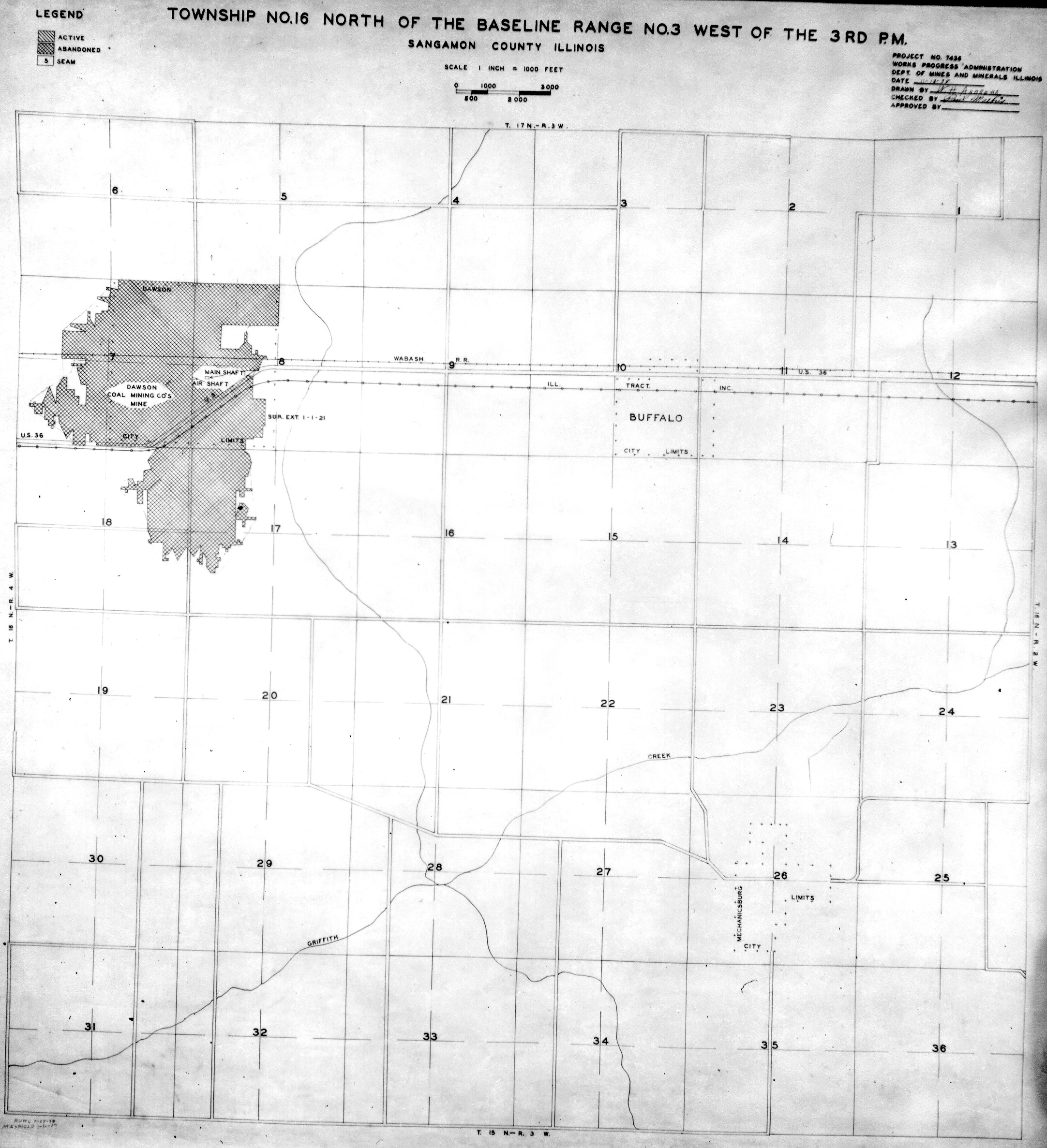
 | Sangamon, T16N-R3W | Sangamon | T16N-R3W | WPA SANGAMON 16N3W.jpg |
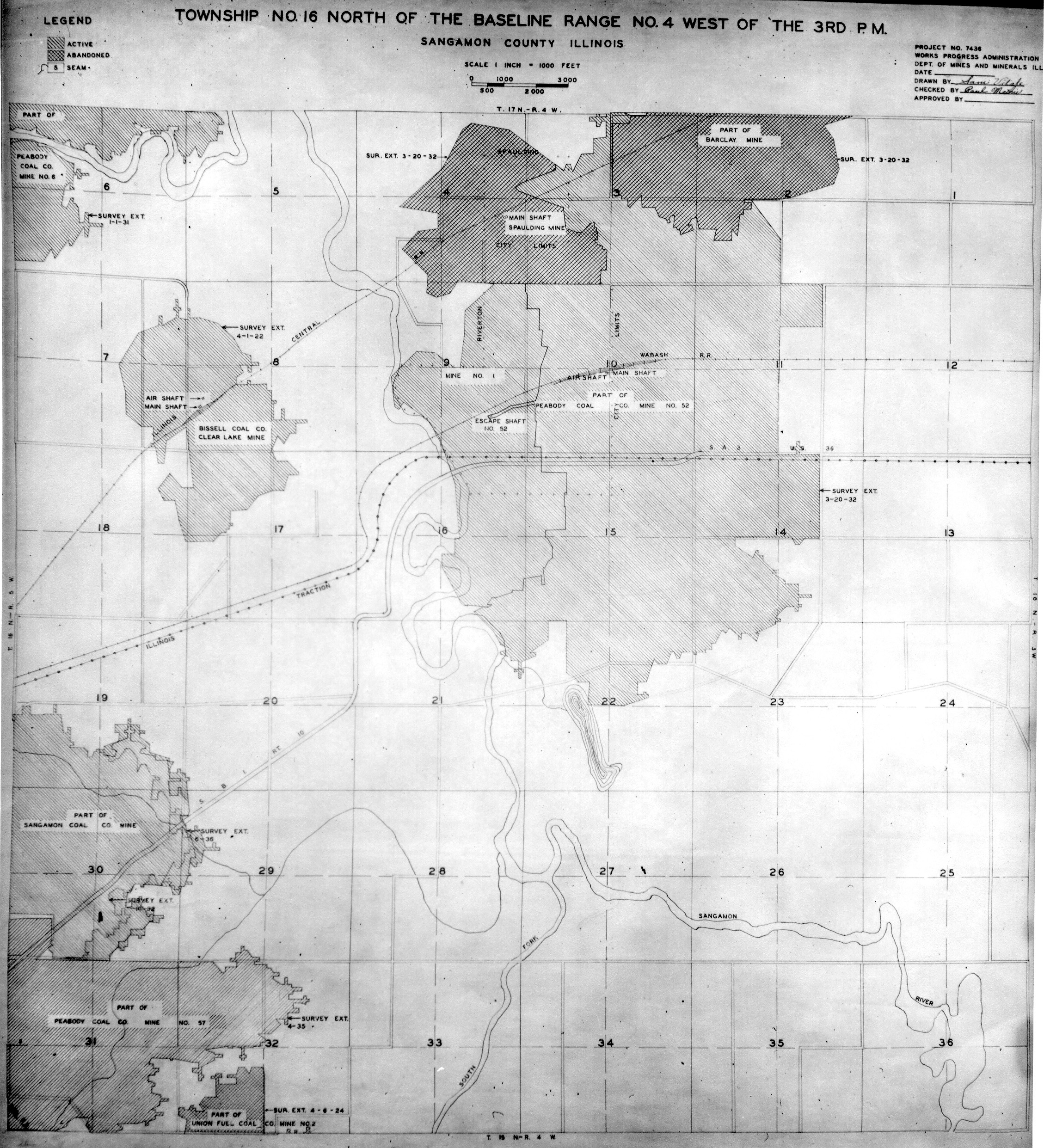
 | Sangamon, T16N-R4W | Sangamon | T16N-R4W | WPA SANGAMON 16N4W.jpg |
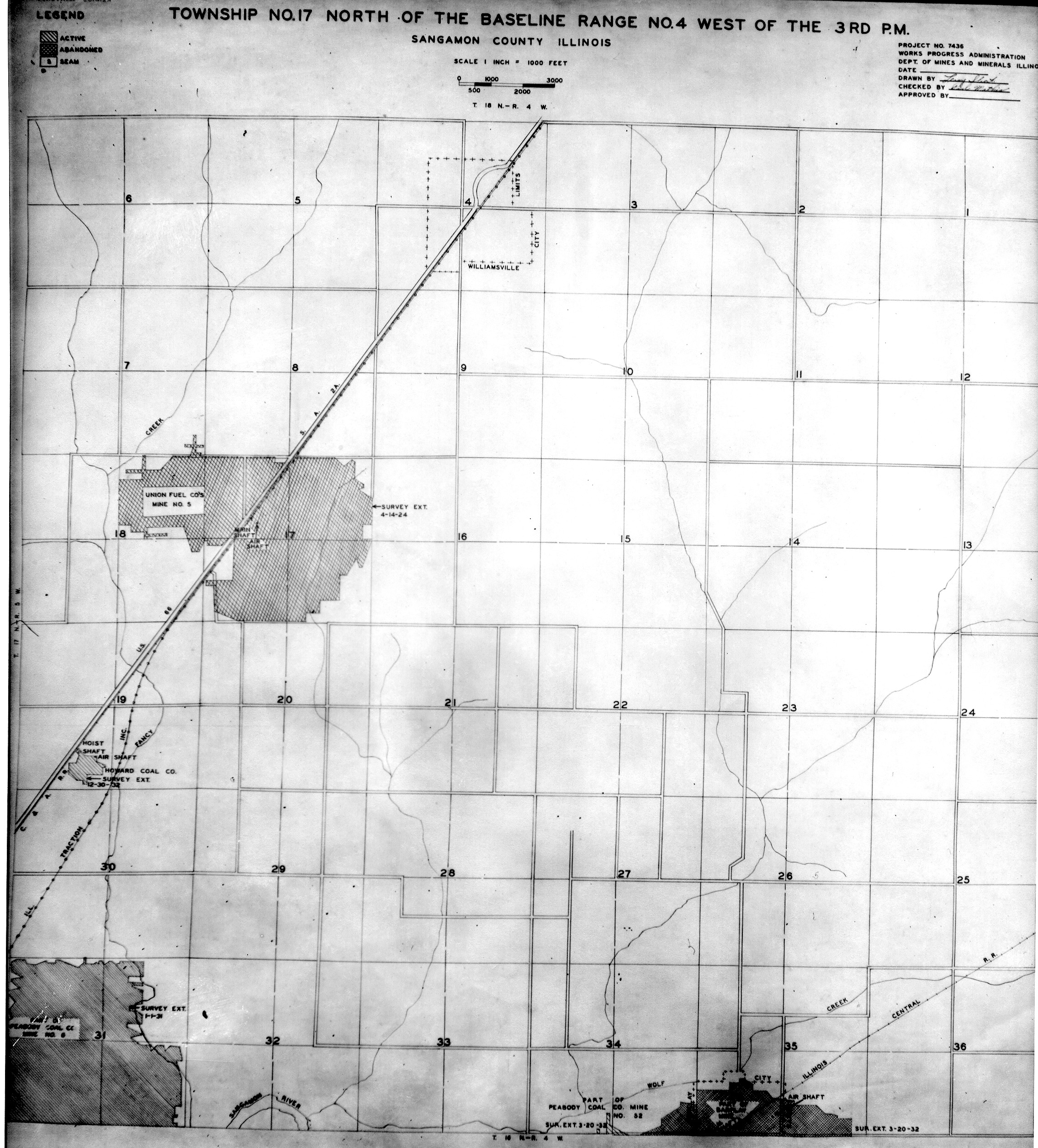
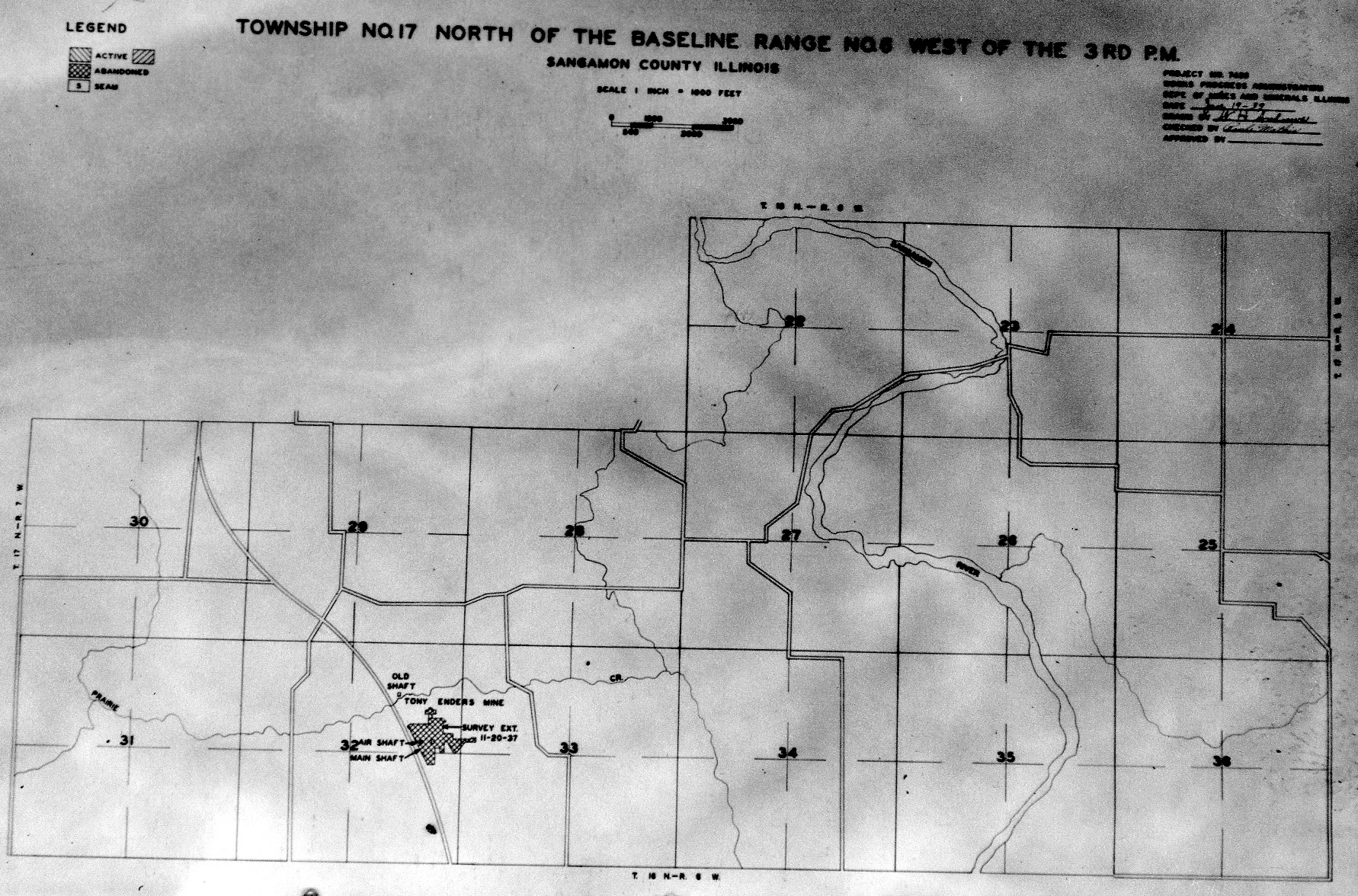
 | Sangamon, T17N-R4W | Sangamon | T17N-R4W | WPA SANGAMON 17N4W.jpg |
 | Sangamon, T17N-R6W | Sangamon | T17N-R6W | WPA SANGAMON 17N6W.jpg |
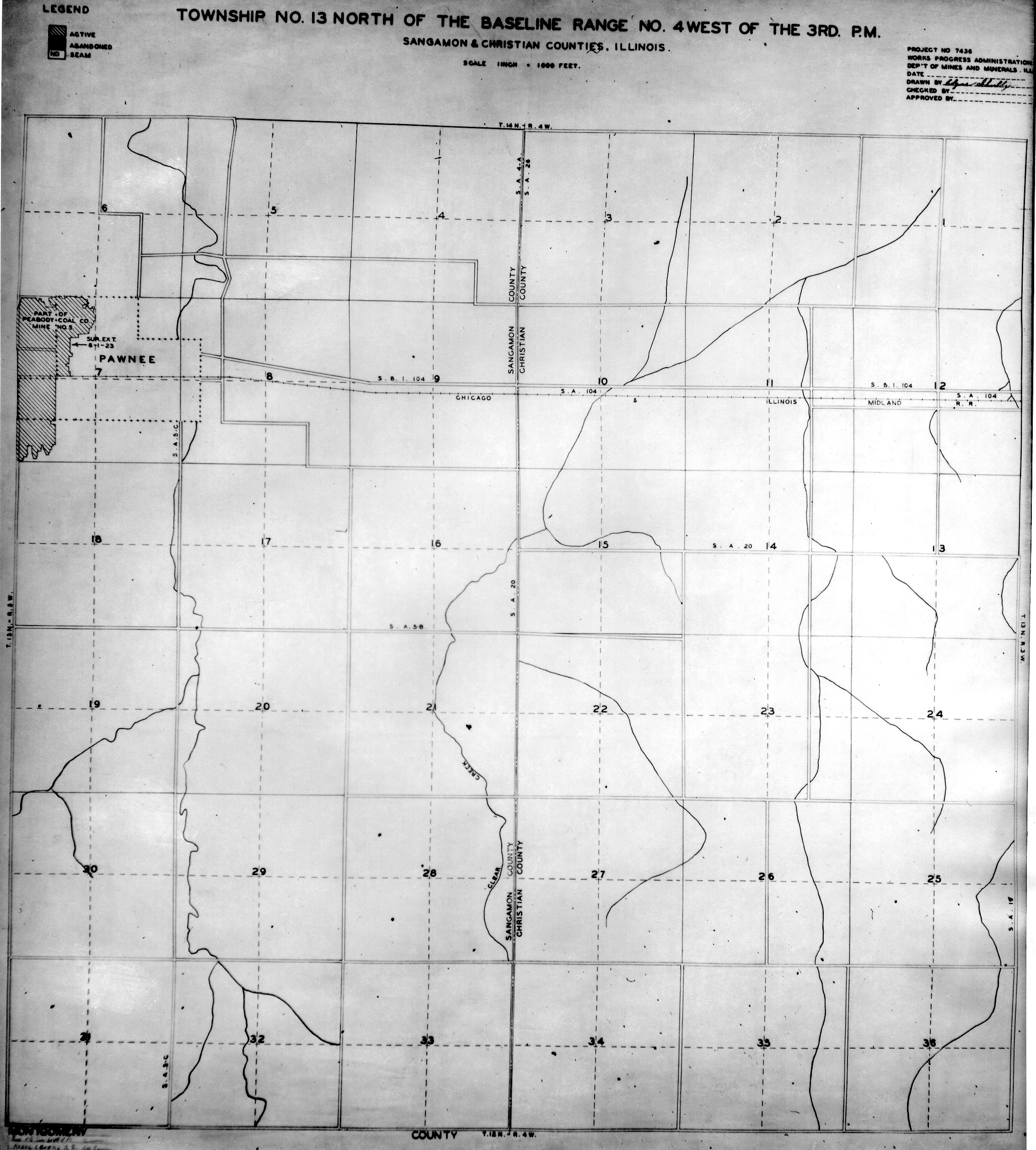
 | Sangamon & Christian, T13N-R14W | Sangamon Christian | T13N-R14W | WPA SANGAMON CHRISTIAN 13N4W.jpg |
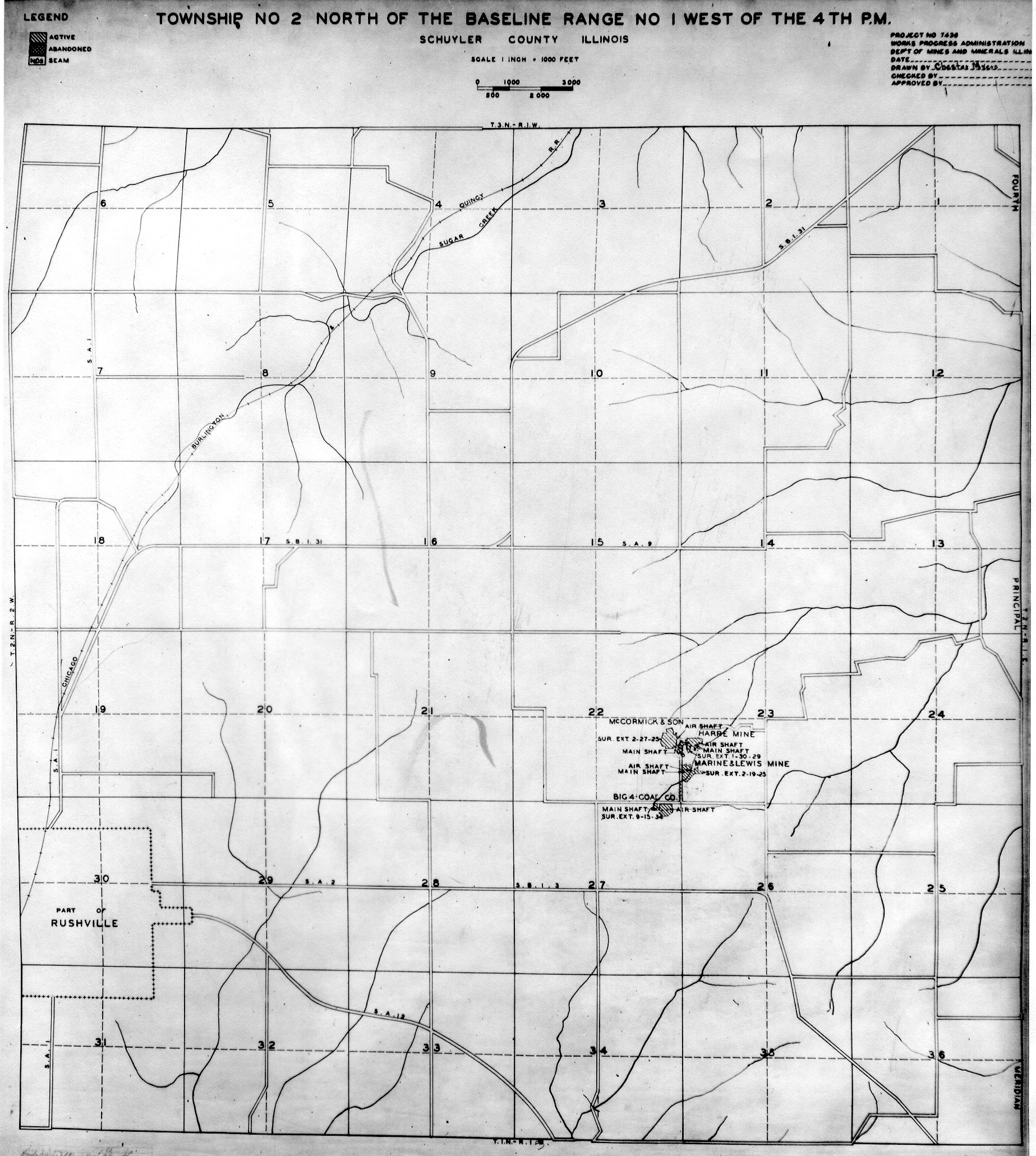
 | Schuyler, T2N-R1W | Schuyler | T2N-R1W | WPA SCHUYLER 2N1W.jpg |
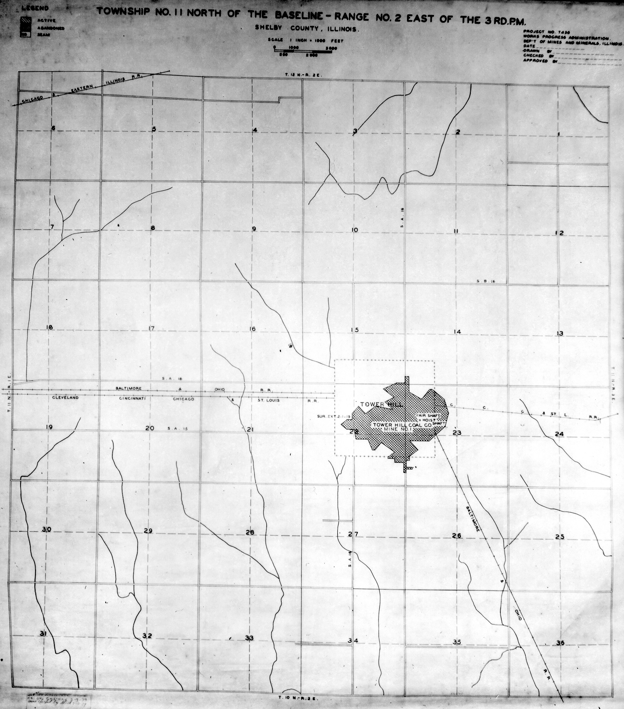
 | Shelby, T11N-R2E | Shelby | T11N-R2E | WPA SHELBY 11N2E.jpg |
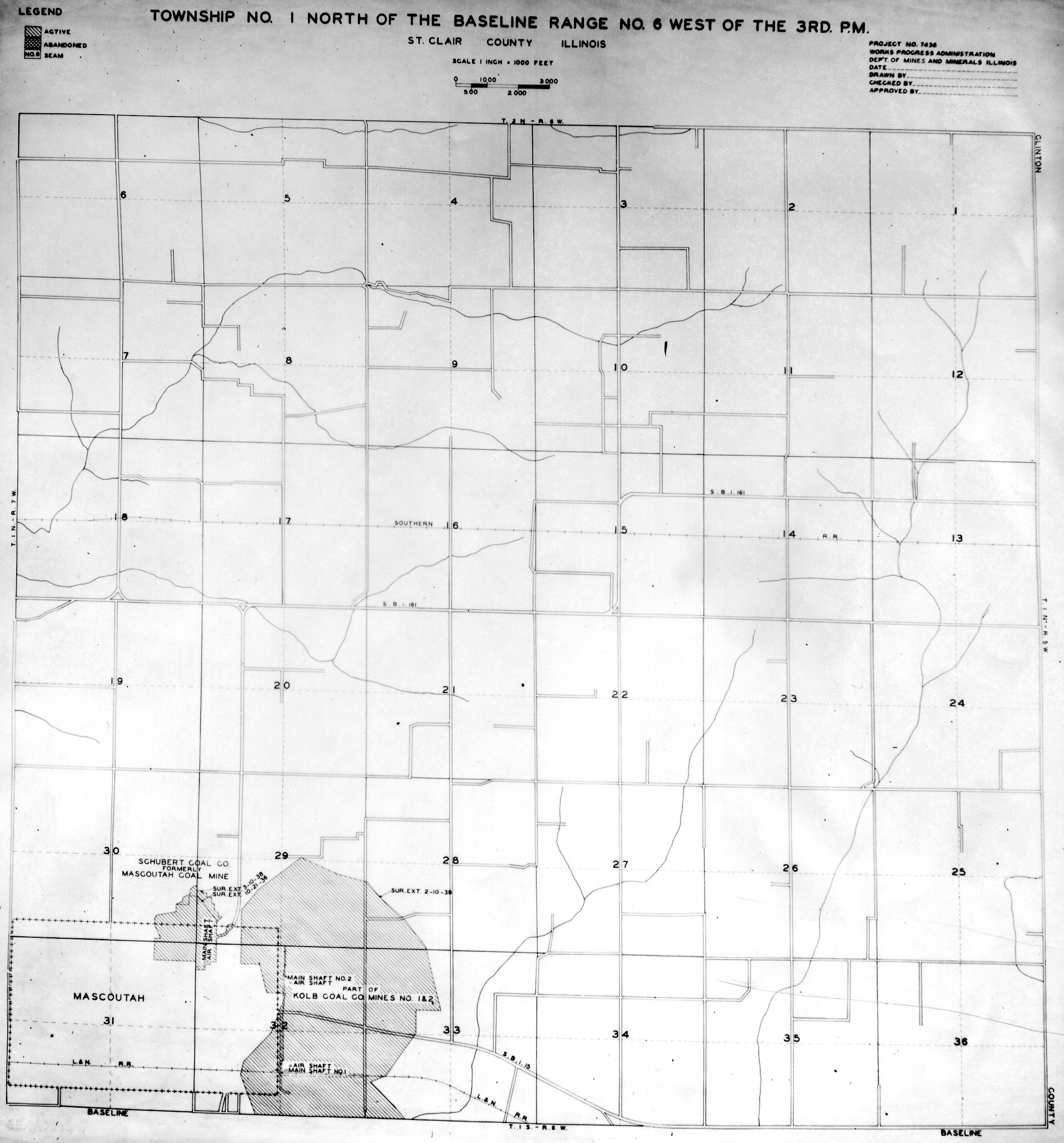
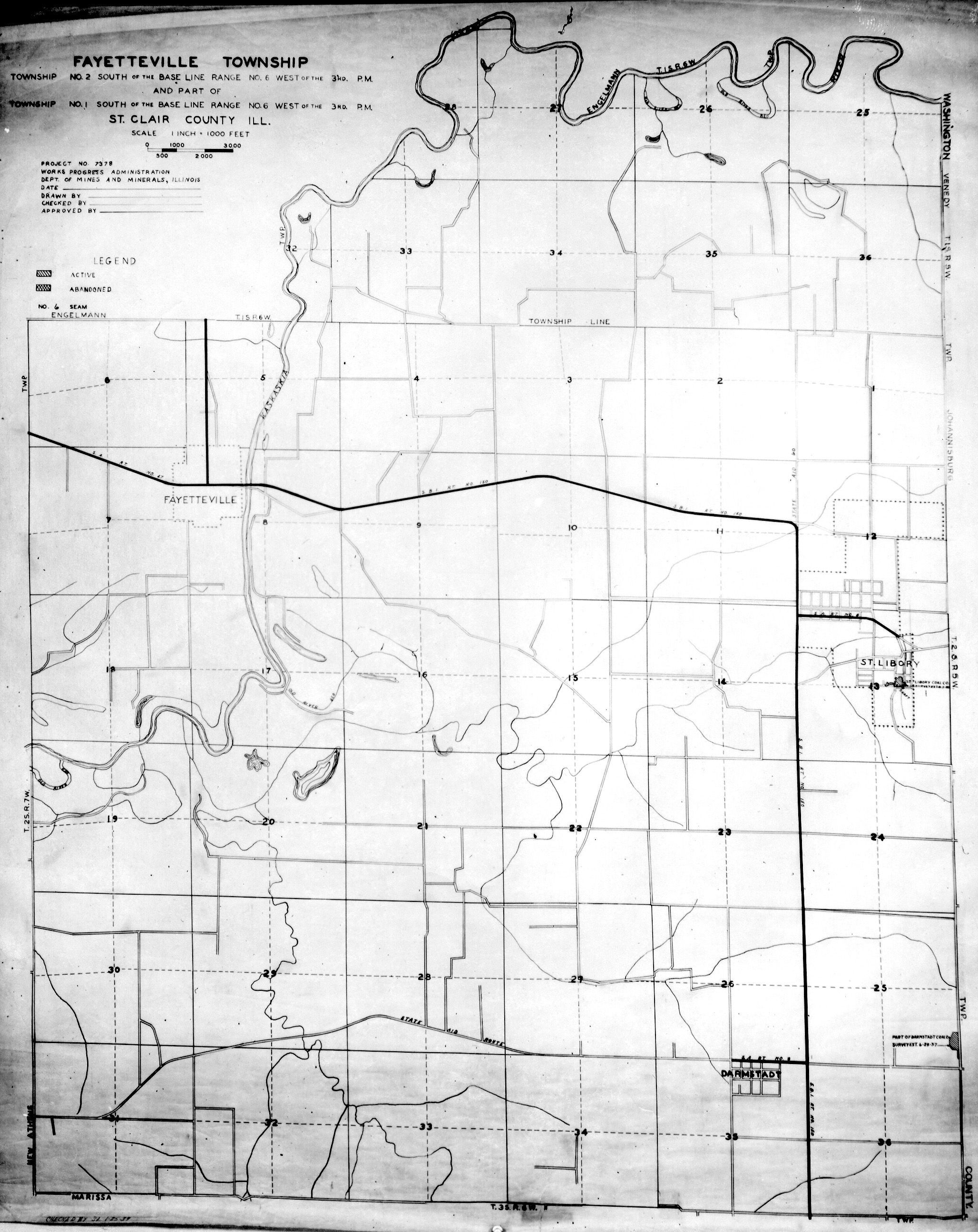
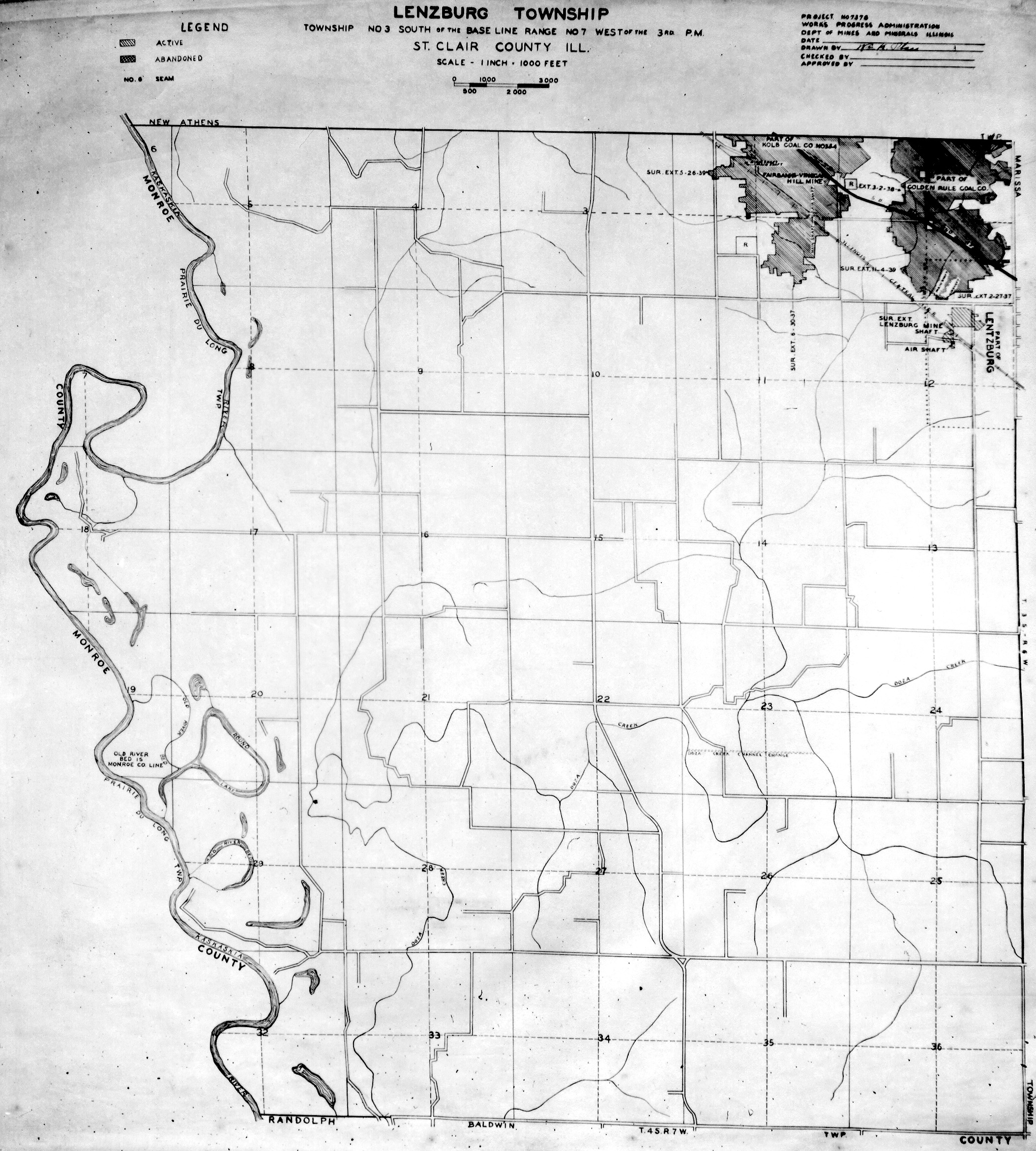
 | St. Clair, T1N-R6W | St. Clair | T1N-R6W | WPA ST CLAIR 1N6W.jpg |
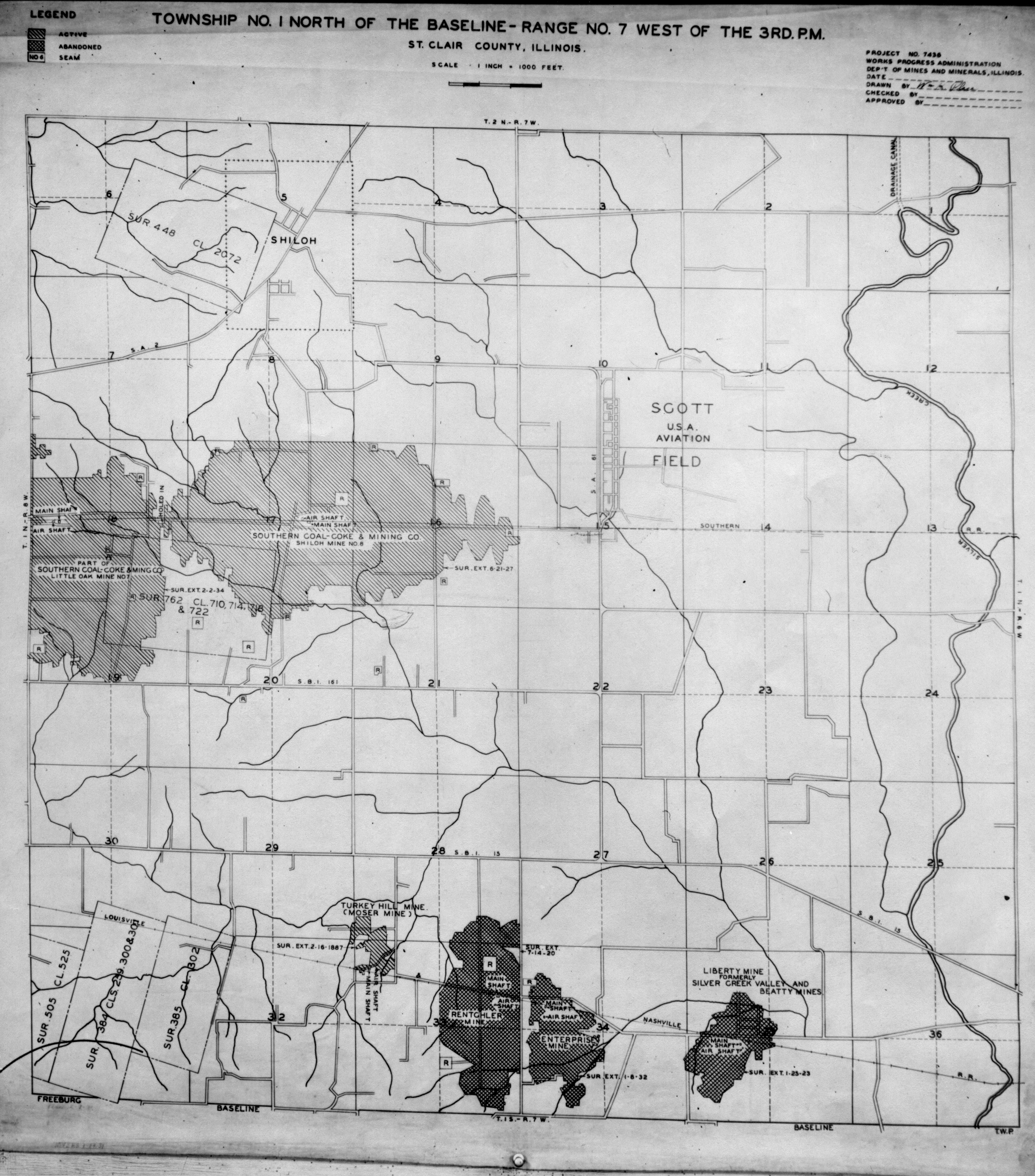
 | St. Clair, T1N-R7W | St. Clair | T1N-R7W | WPA ST CLAIR 1N7W.jpg |
 | St. Clair, T1N-R8W | St. Clair | T1N-R8W | WPA ST CLAIR 1N8W.jpg |
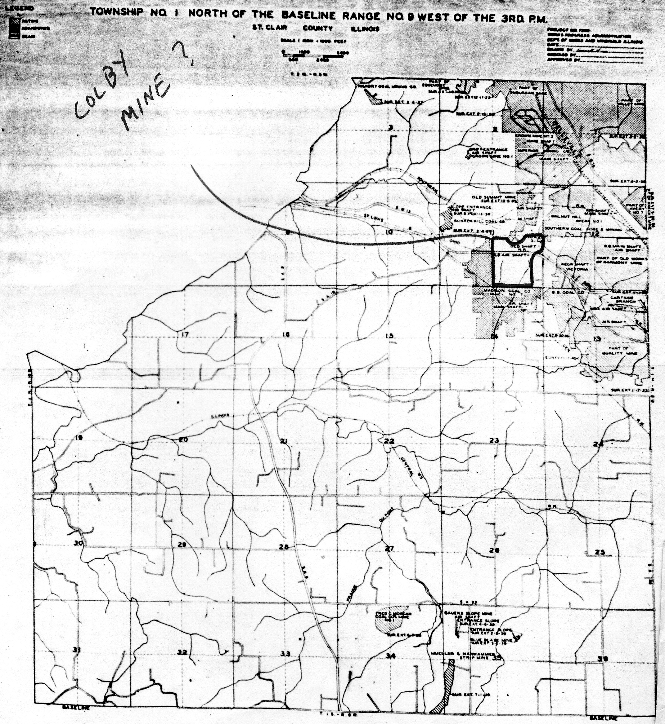
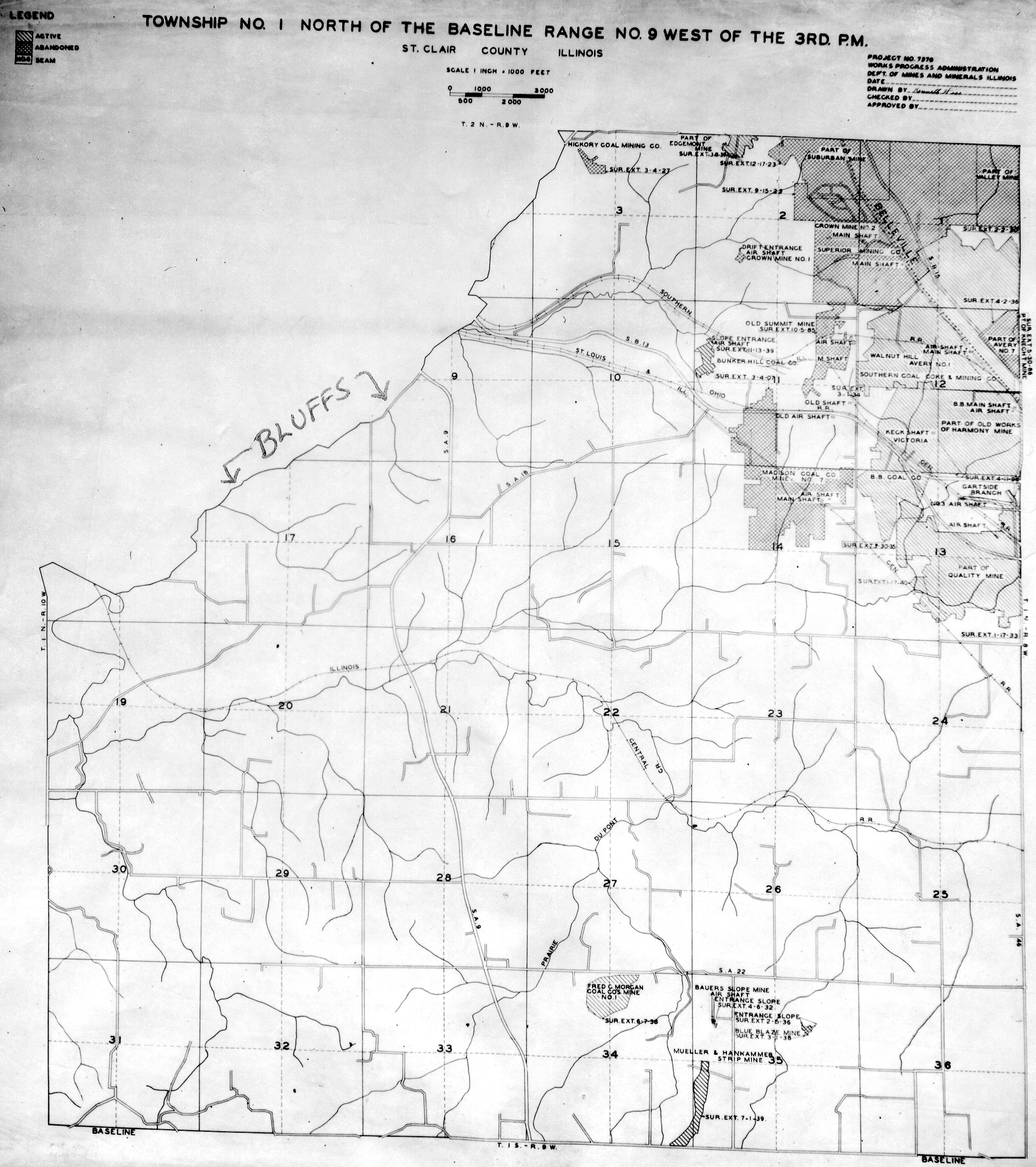
 | St. Clair, T1N-R9W Colby Mine | St. Clair | T1N-R9W | WPA ST CLAIR 1N9W COLBY MINE.jpg |
 | St. Clair, T1N-R9W | St. Clair | T1N-R9W | WPA ST CLAIR 1N9W.jpg |
 | St. Clair, T1S-R6W | St. Clair | T1S-R6W | WPA ST CLAIR 1S6W.jpg |
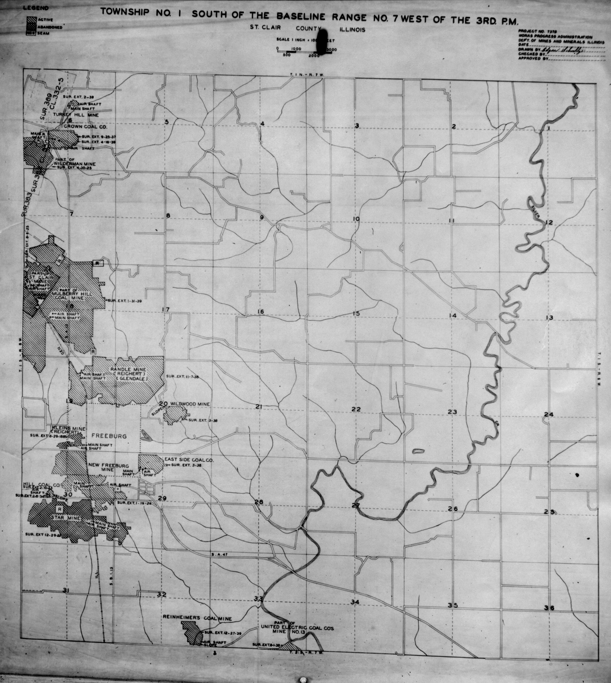
 | St. Clair, T1S-R7W | St. Clair | T1S-R7W | WPA ST CLAIR 1S7W.jpg |
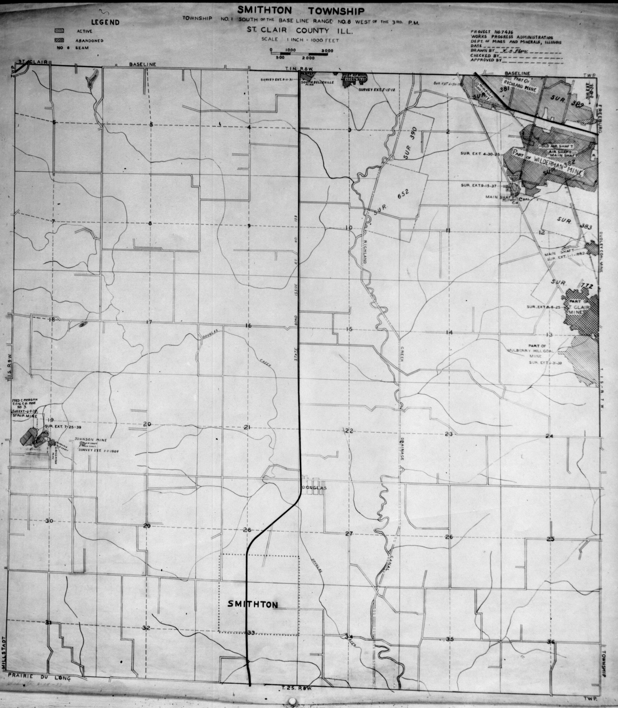
 | St. Clair, T1S-R8W | St. Clair | T1S-R8W | WPA ST CLAIR 1S8W.jpg |
 | St. Clair, T1S-R9W | St. Clair | T1S-R9W | WPA ST CLAIR 1S9W.jpg |
 | St. Clair, T2N-R6W | St. Clair | T2N-R6W | WPA ST CLAIR 2N6W.jpg |
 | St. Clair, T2N-R7W | St. Clair | T2N-R7W | WPA ST CLAIR 2N7W.jpg |
 | St. Clair, T2N-R8W | St. Clair | T2N-R8W | WPA ST CLAIR 2N8W.jpg |
 | St. Clair, T2N-R9W | St. Clair | T2N-R9W | WPA ST CLAIR 2N9W.jpg |
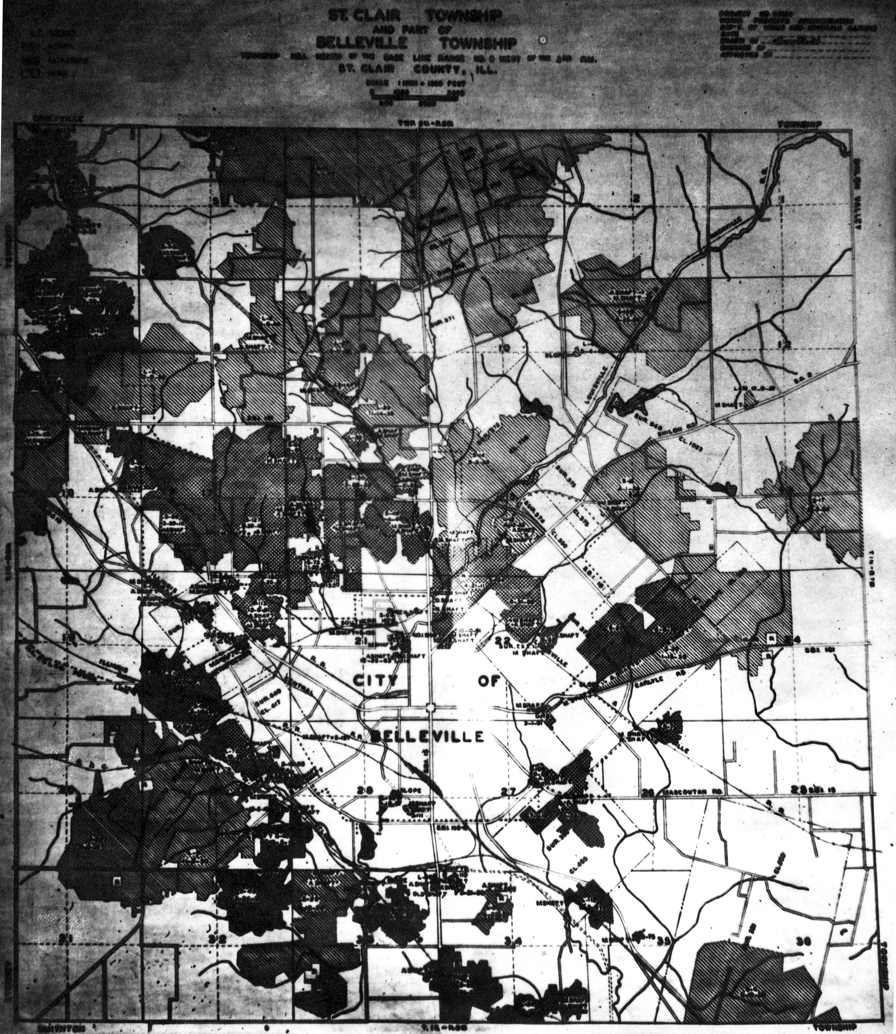
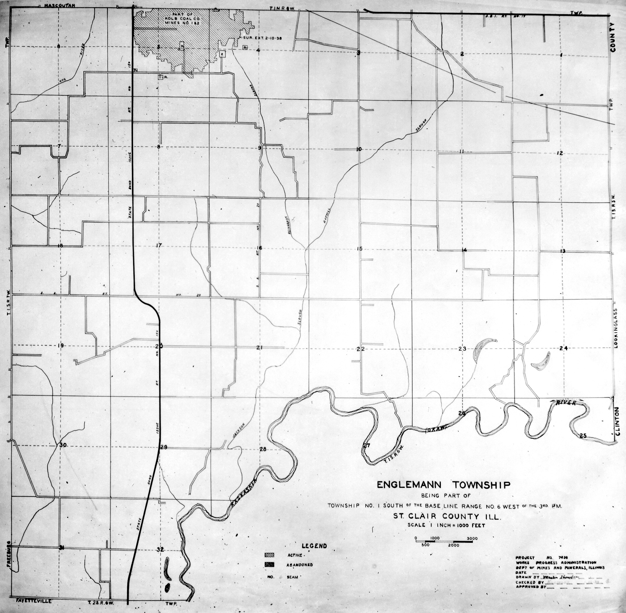
 | St. Clair, T2S-R6W & T1S-R6W | St. Clair | T1S-R6W T2S-R6W | WPA ST CLAIR 2S6W-1S6W.jpg |
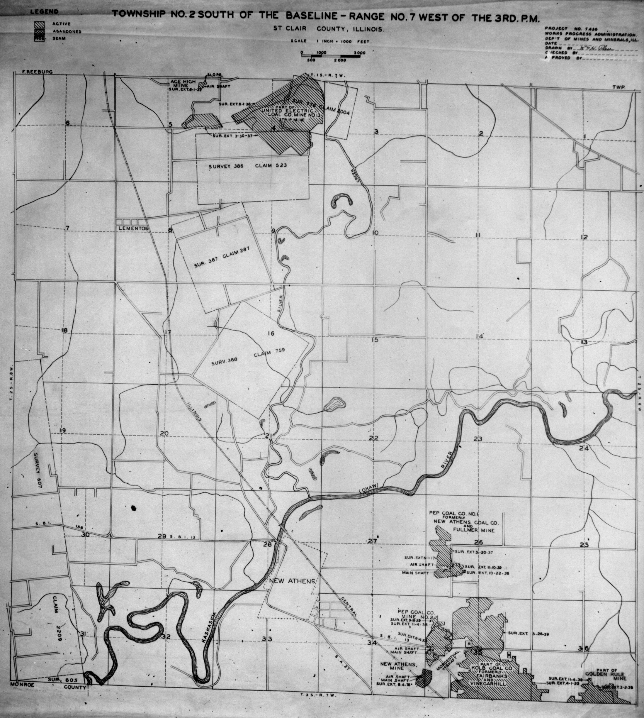
 | St. Clair, T2S-R7W | St. Clair | T2S-R7W | WPA ST CLAIR 2S7W.jpg |
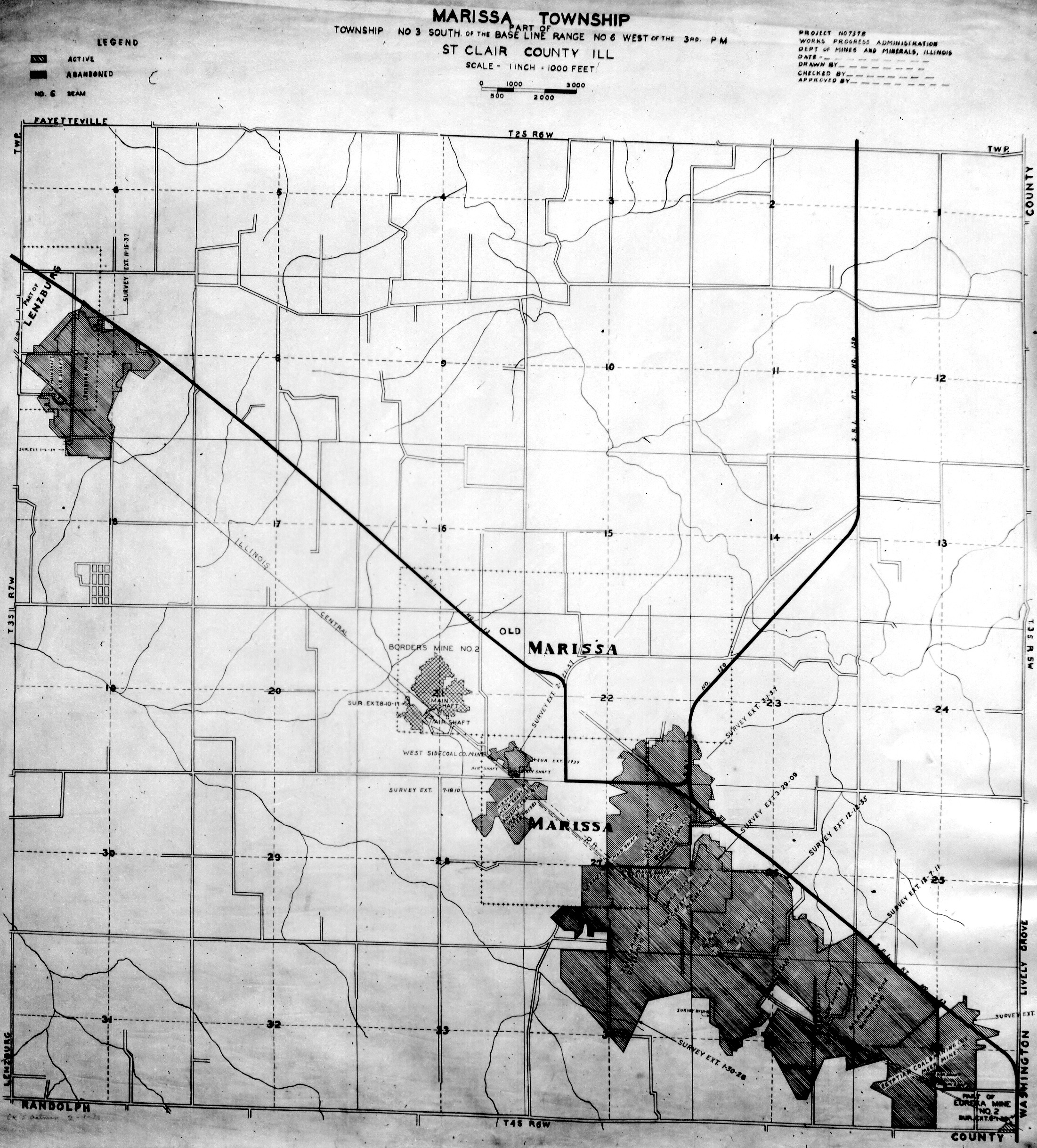
 | St. Clair, T3S-R6W | St. Clair | T3S-R6W | WPA ST CLAIR 3S6W.jpg |
 | St. Clair, T3S-R7W | St. Clair | T3S-R7W | WPA ST CLAIR 3S7W.jpg |
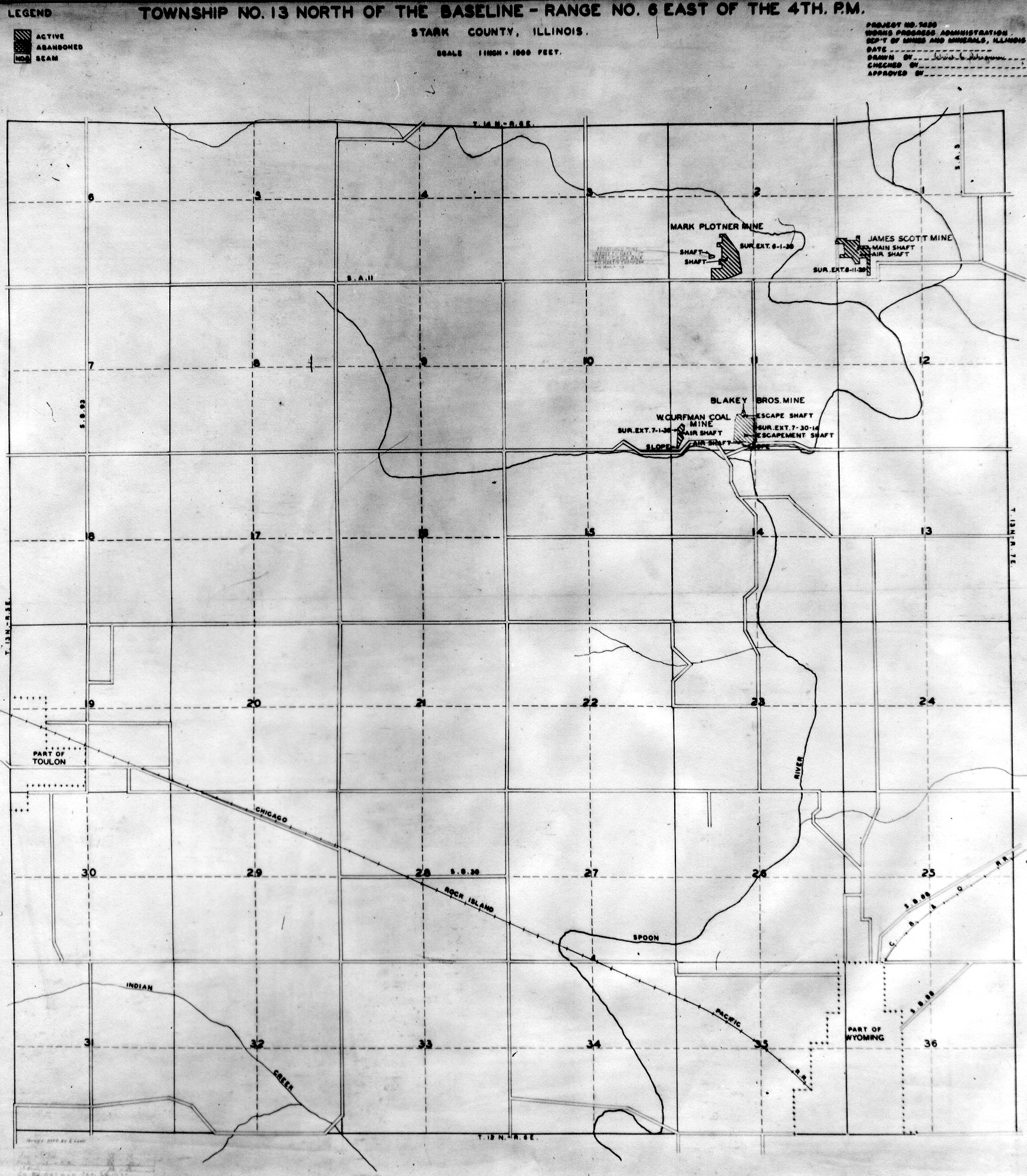
 | Stark, T13N-R6E | Stark | T13N-R6E | WPA STARK 13N6E.jpg |
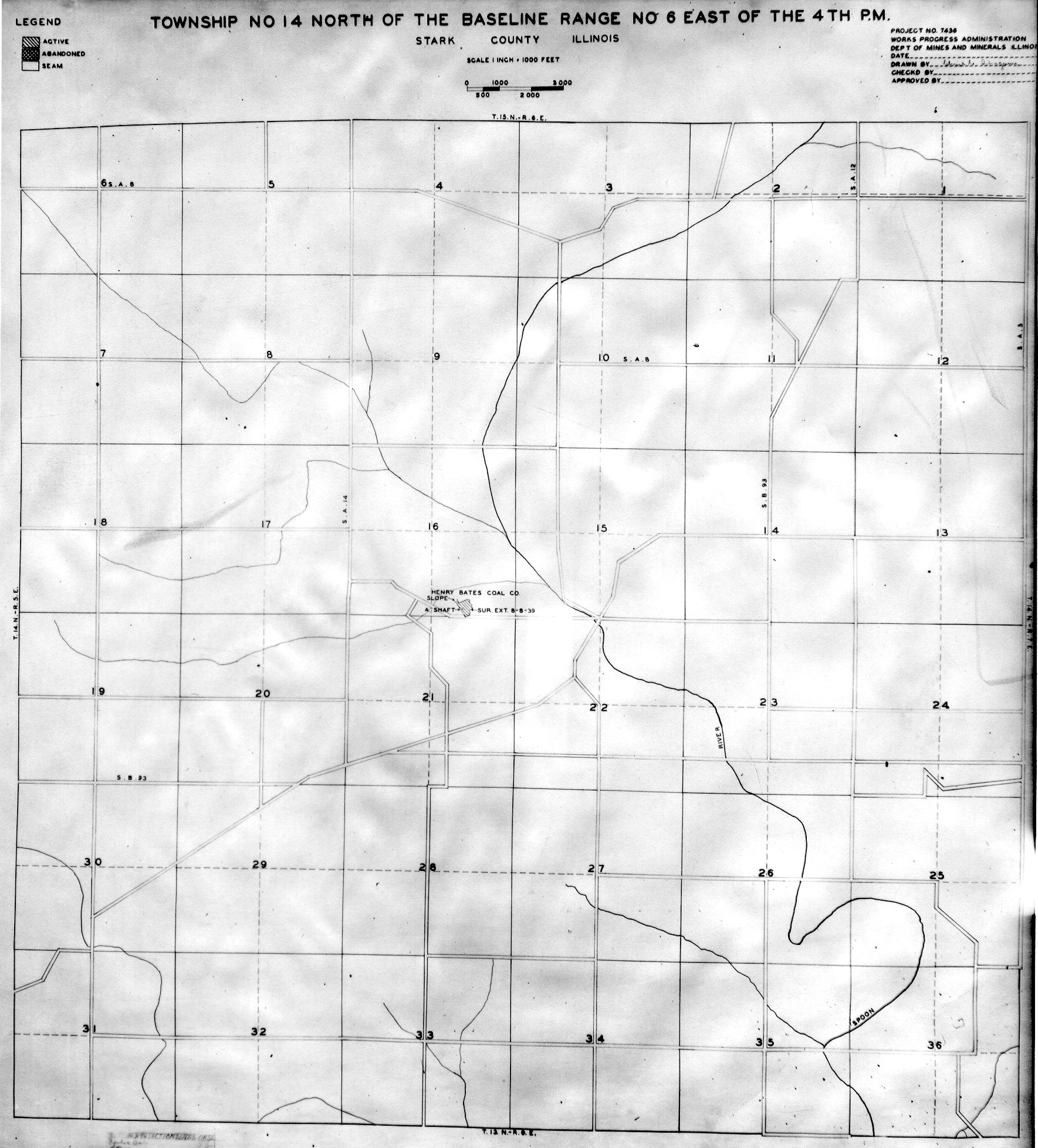
 | Stark, T14N-R6E | Stark | T14N-R6E | WPA STARK 14N6E.jpg |
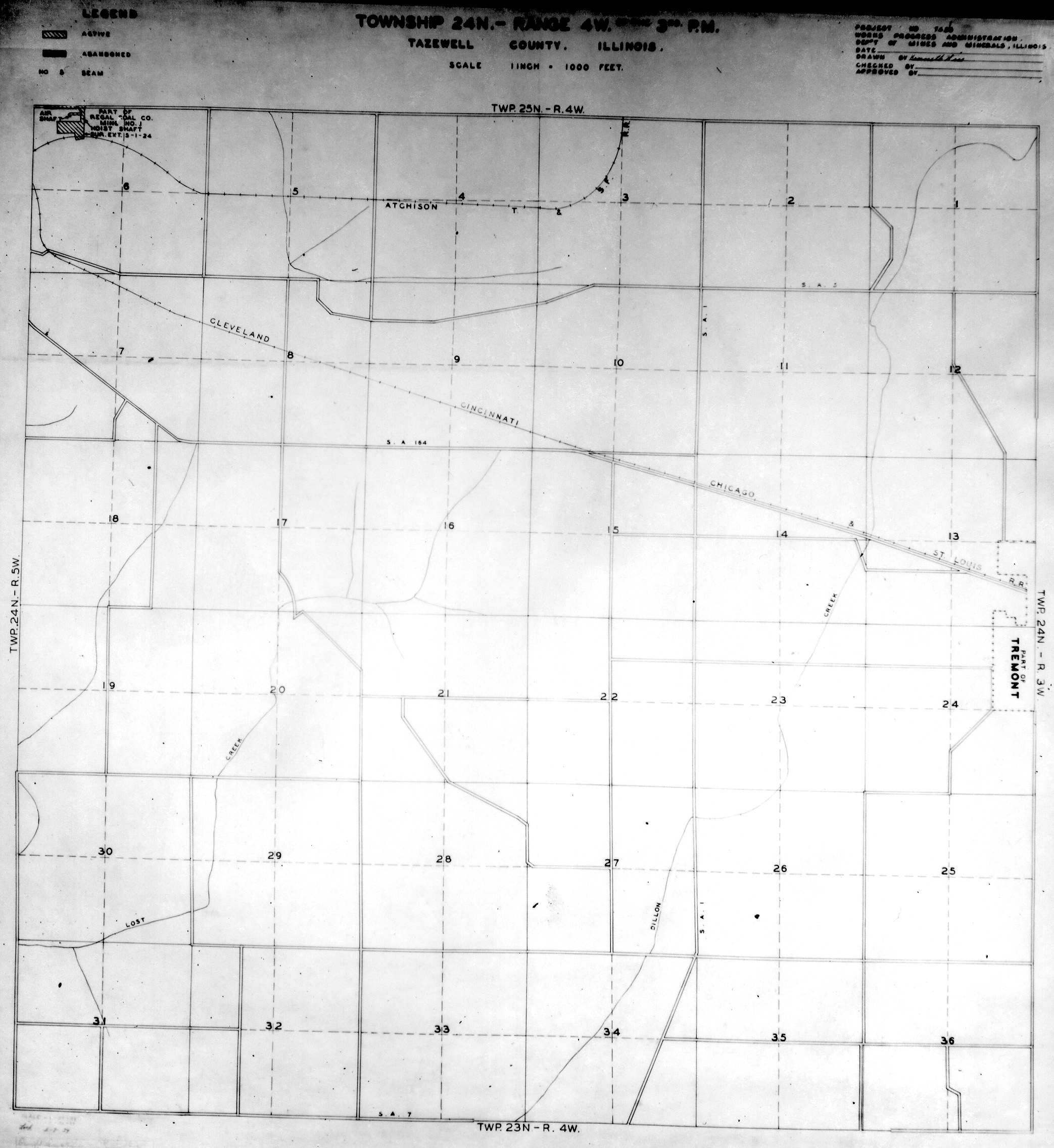
 | Tazewell, T24N-R4W | Tazewell | T24N-R4W | WPA TAZEWELL 24N4W.jpg |
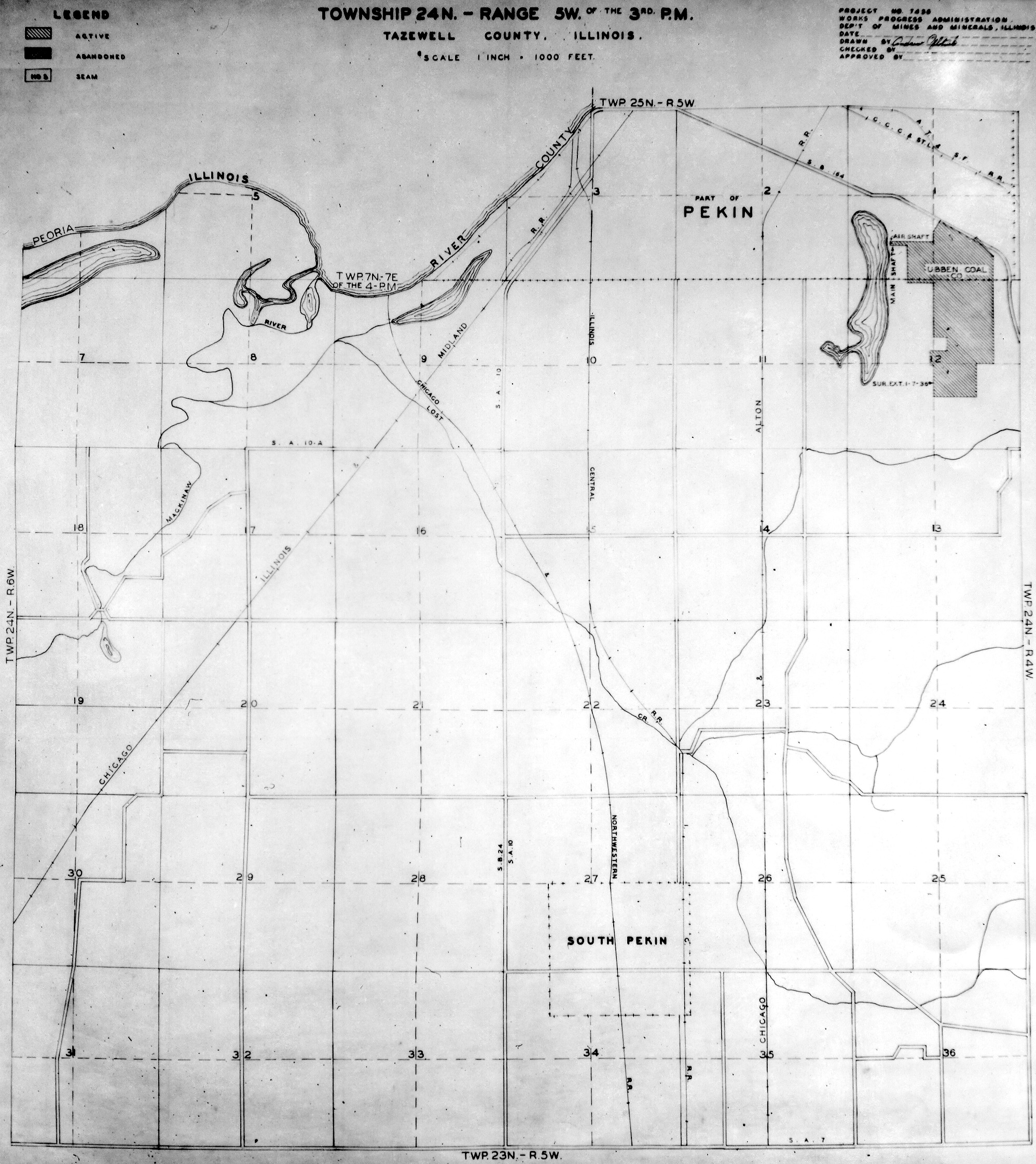
 | Tazewell, T24N-R5W | Tazewell | T24N-R5W | WPA TAZEWELL 24N5W.jpg |
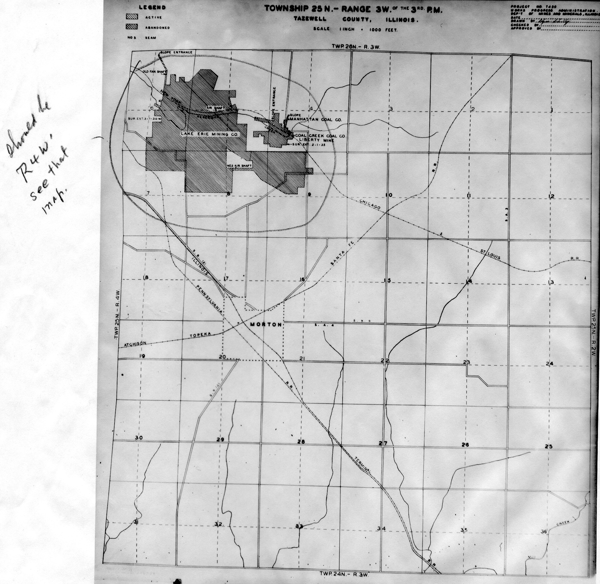
 | Tazewell, T25N-R3W | Tazewell | T25N-R3W | WPA TAZEWELL 25N3W.jpg |
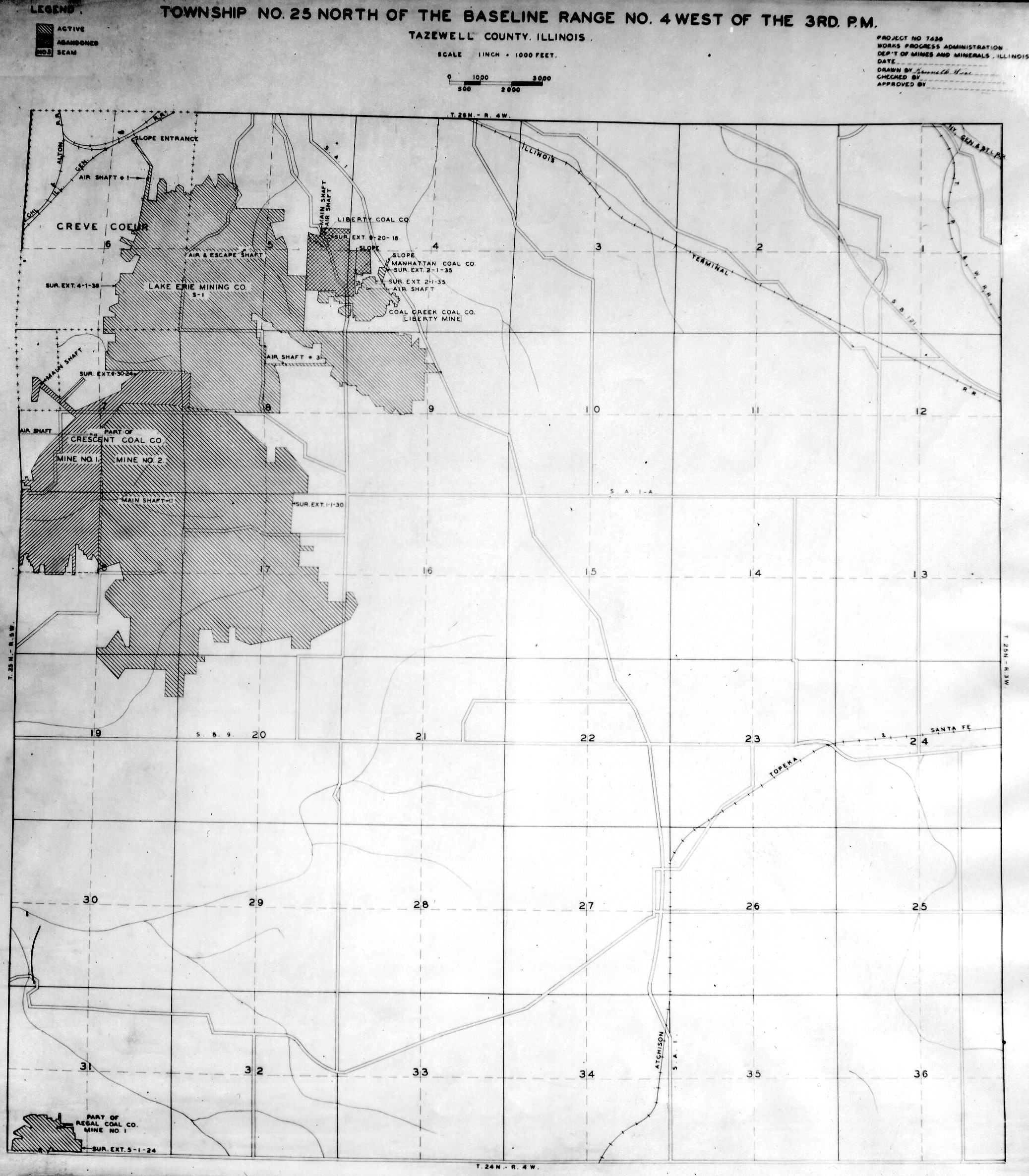
 | Tazewell, T25N-R4W | Tazewell | T25N-R4W | WPA TAZEWELL 25N4W.jpg |
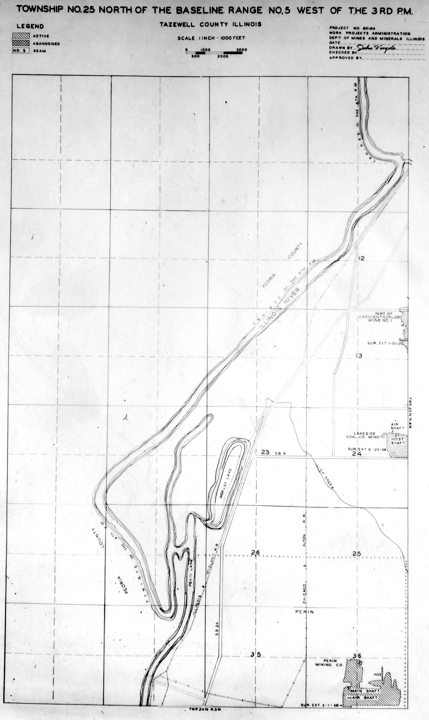
 | Tazewell, T25N-R5W | Tazewell | T25N-R5W | WPA TAZEWELL 25N5W.jpg |
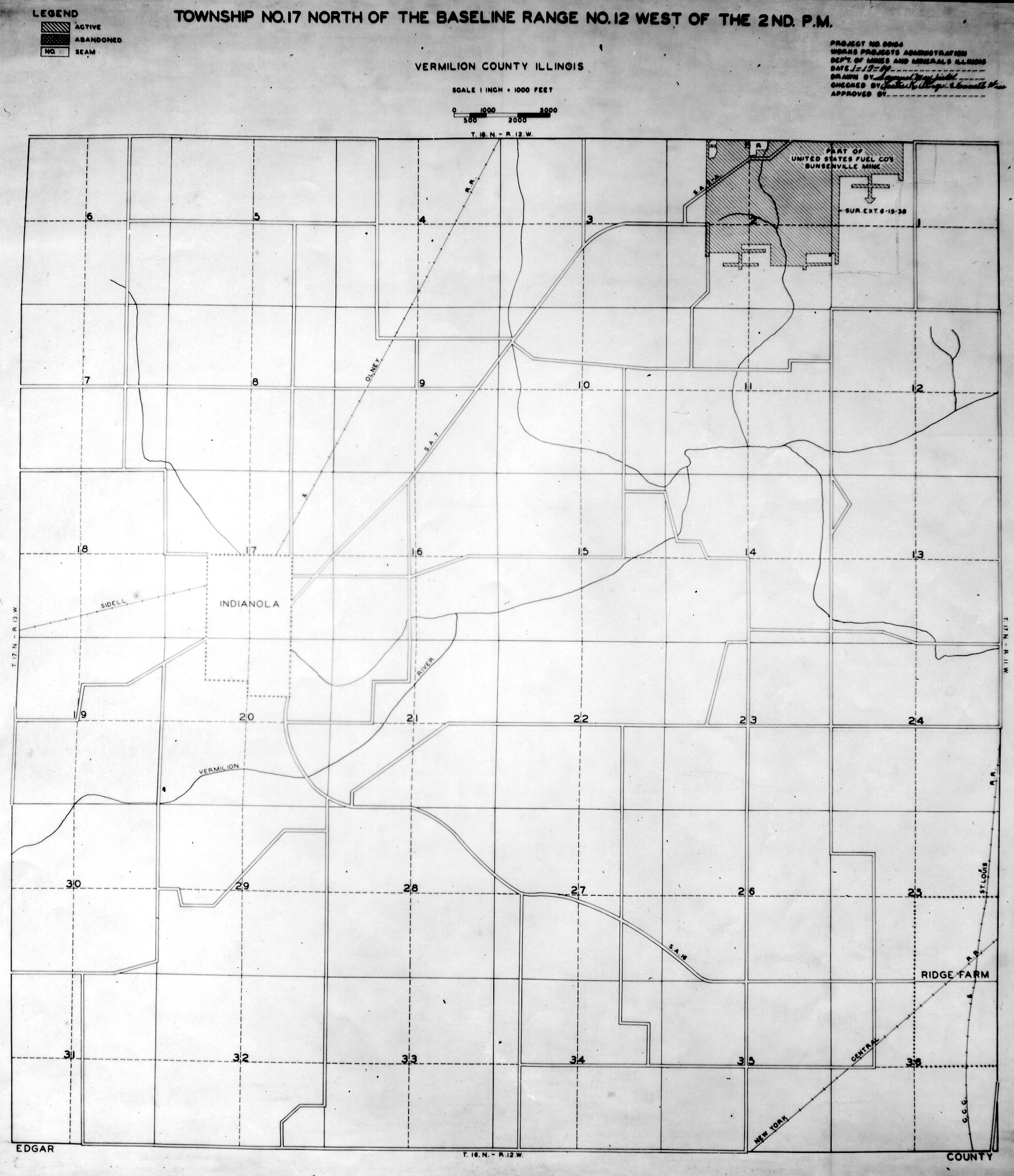
 | Vermilion, T17N-R2W | Vermilion | T17N-R2W | WPA VERMILION 17N12W.jpg |
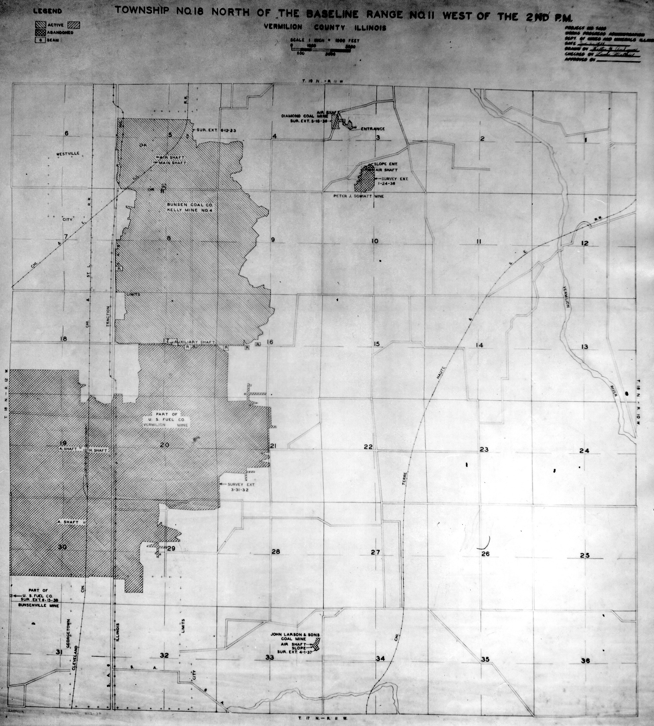
 | Vermilion, T18N-R11W | Vermilion | T18N-R11W | WPA VERMILION 18N11W.jpg |
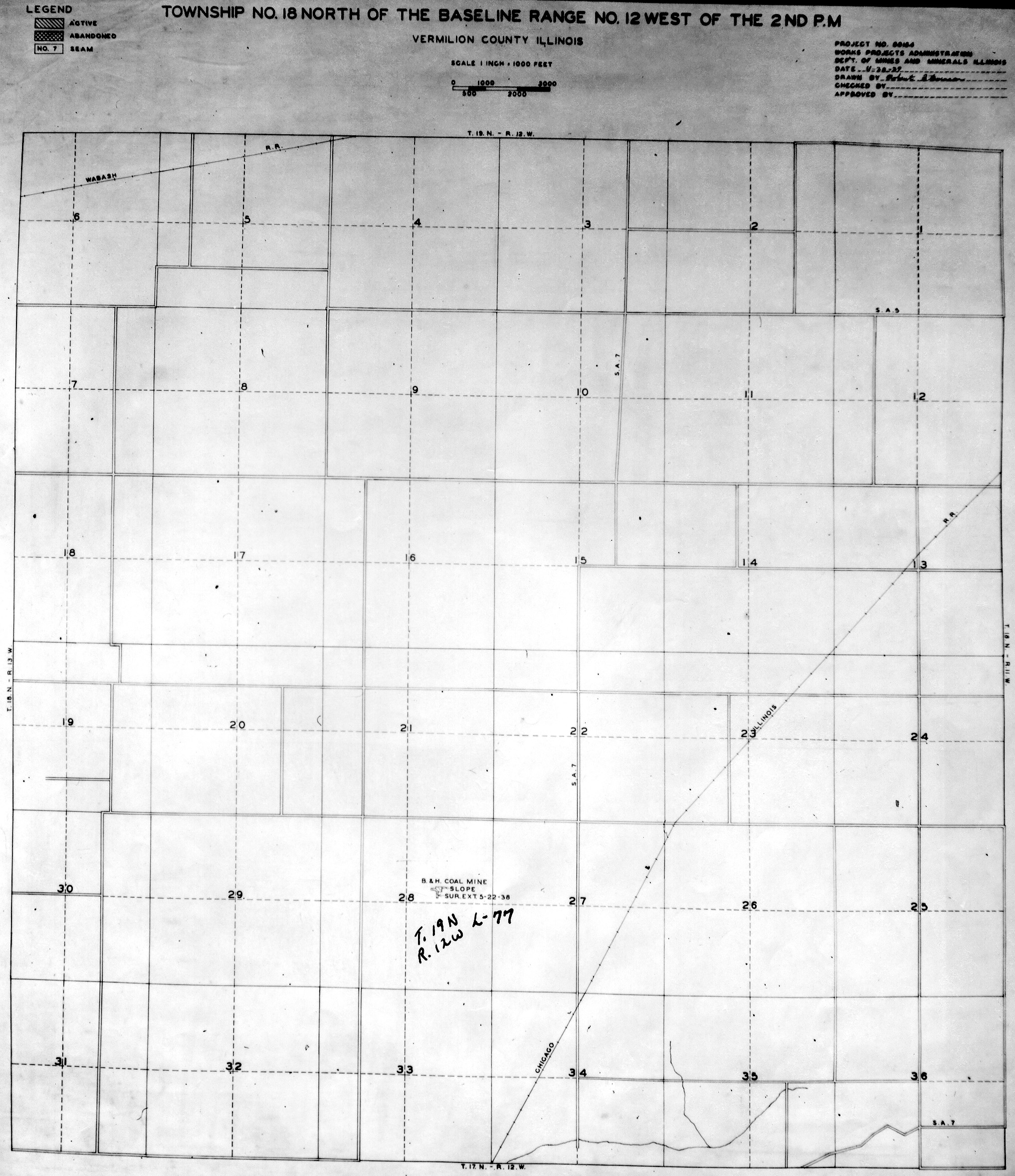
 | Vermilion, T18N-R12W No.1 | Vermilion | T18N-R12W | WPA VERMILION 18N12W NO 1.jpg |
 | Vermilion, T18N-R12W No.2 | Vermilion | T18N-R12W | WPA VERMILION 18N12W NO 2.jpg |
 | Vermilion, T18N-R13W | Vermilion | T18N-R13W | WPA VERMILION 18N13W.jpg |
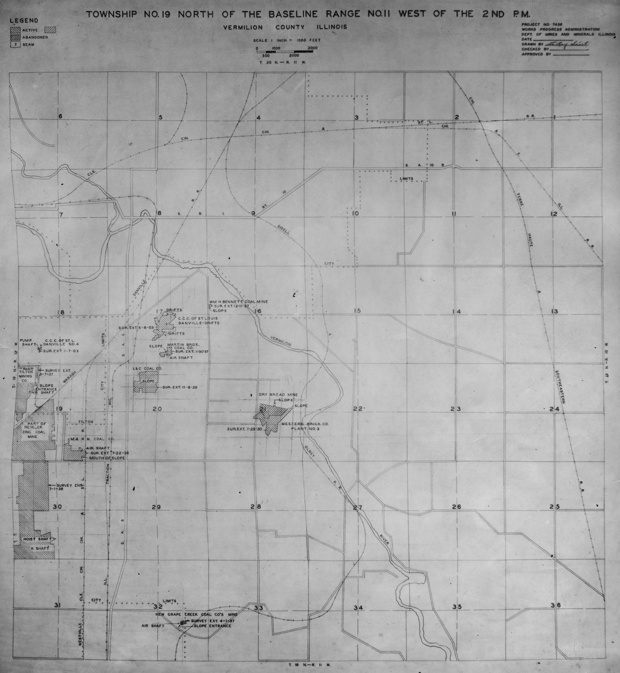
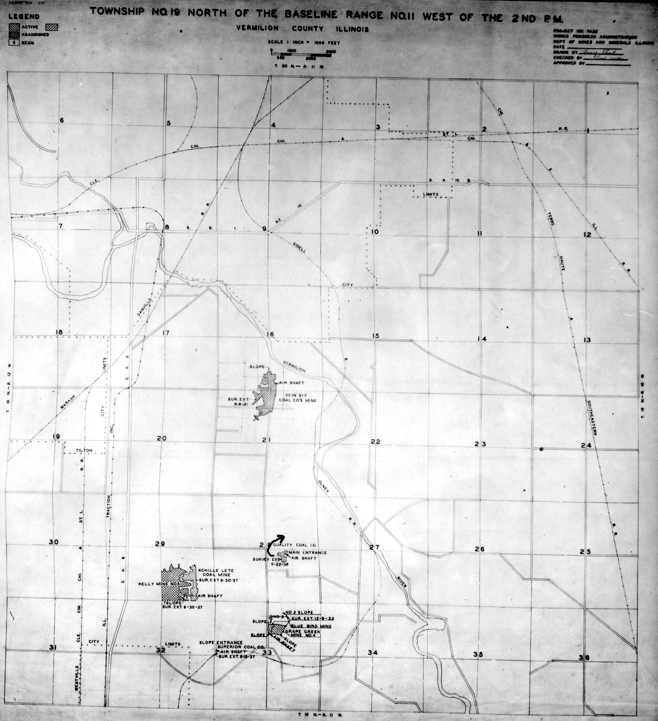
 | Vermilion, T19N-R11W No.1 | Vermilion | T19N-R11W | WPA VERMILION 19N11W NO 1.jpg |
 | Vermilion, T19N-R11W No.2 | Vermilion | T19N-R11W | WPA VERMILION 19N11W NO 2.jpg |
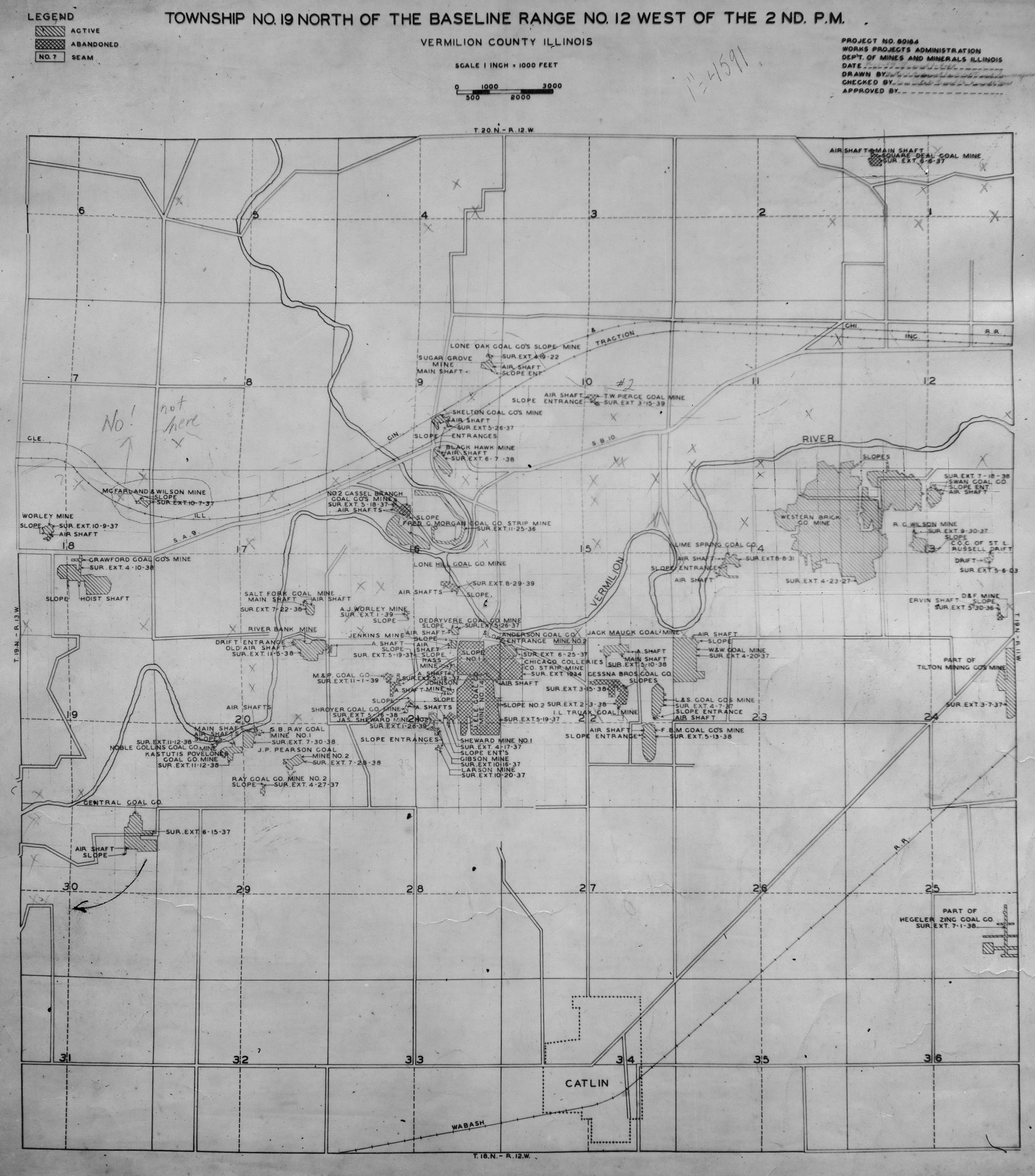
 | Vermilion, T19N-R12W No.1 | Vermilion | T19N-R12W | WPA VERMILION 19N12W NO 1.jpg |
 | Vermilion, T19N-R12W No.2 | Vermilion | T19N-R12W | WPA VERMILION 19N12W NO 2.jpg |
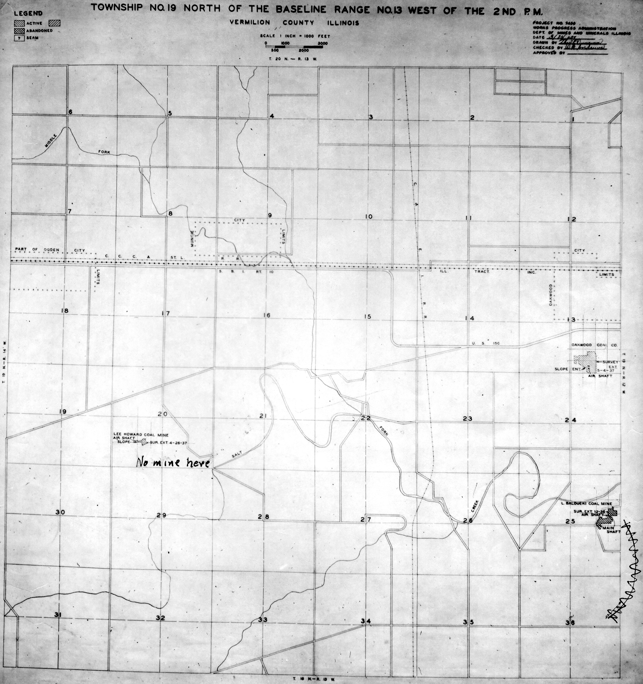
 | Vermilion, T19N-R13W | Vermilion | T19N-R13W | WPA VERMILION 19N13W.jpg |
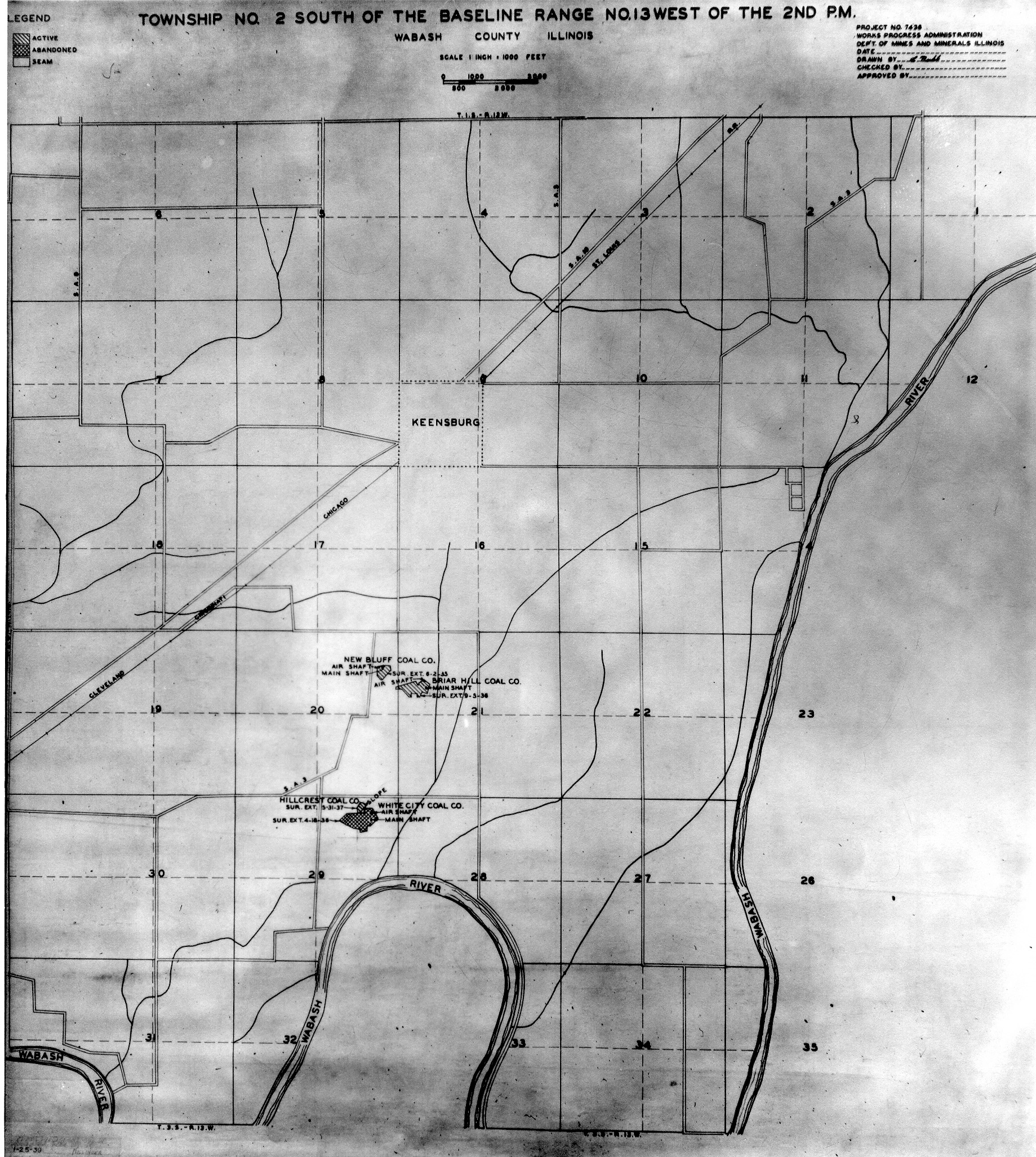
 | Wabash, T2S-R13W | Wabash | T2S-R13W | WPA WABASH 2S13W.jpg |
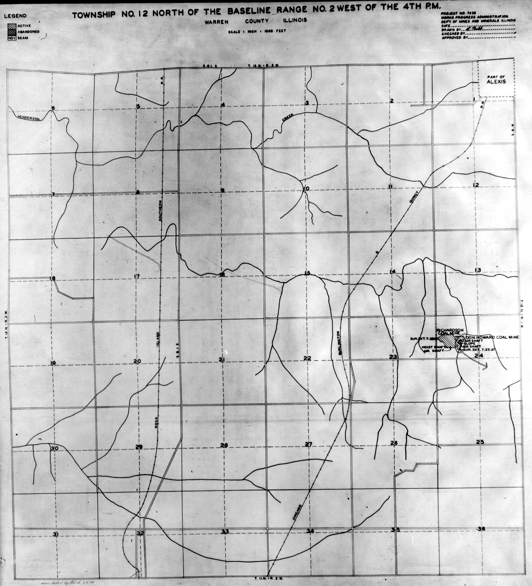
 | Warren, T12N-R2W | Warren | T12N-R2W | WPA WARREN 12N2W.jpg |
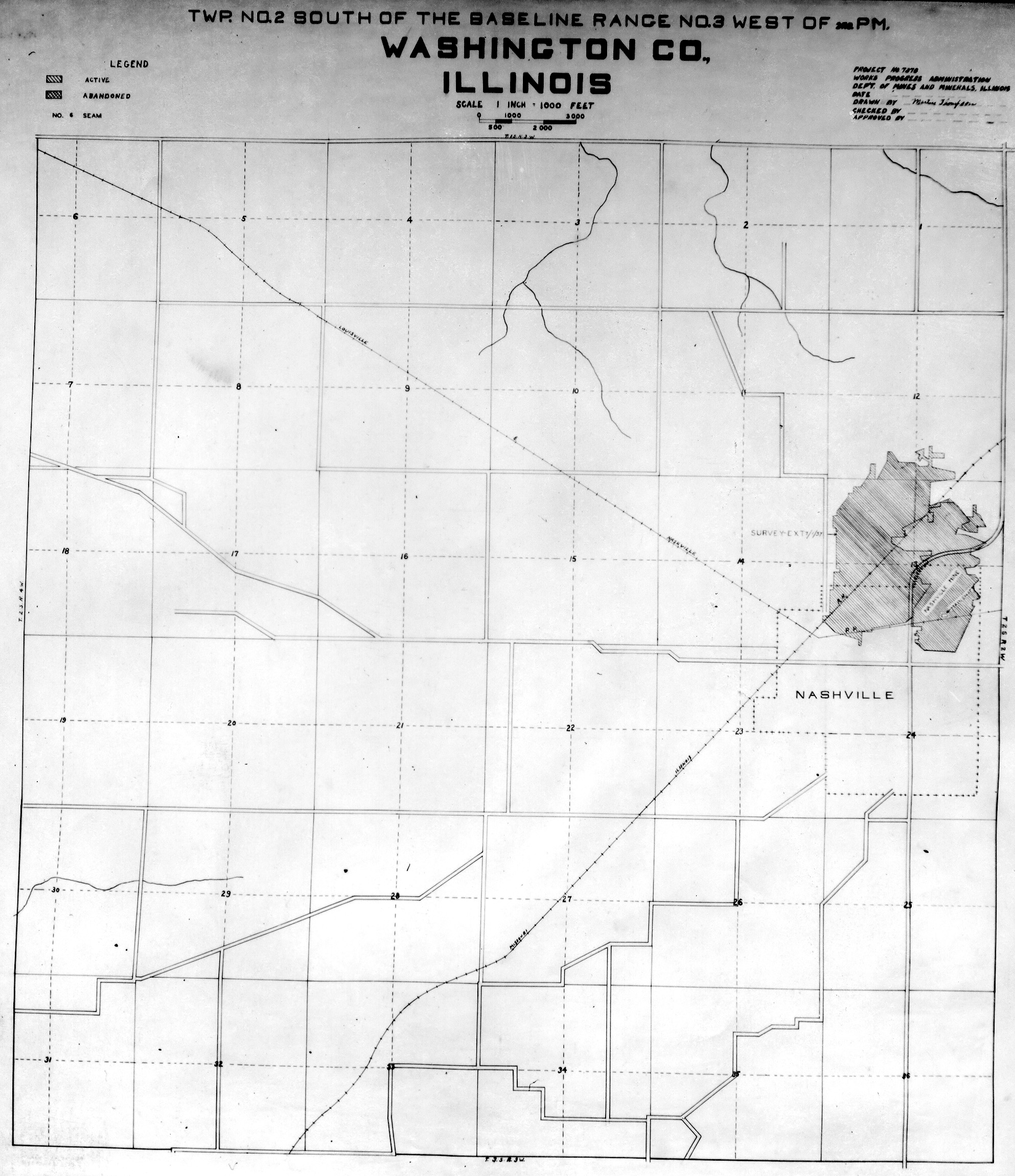
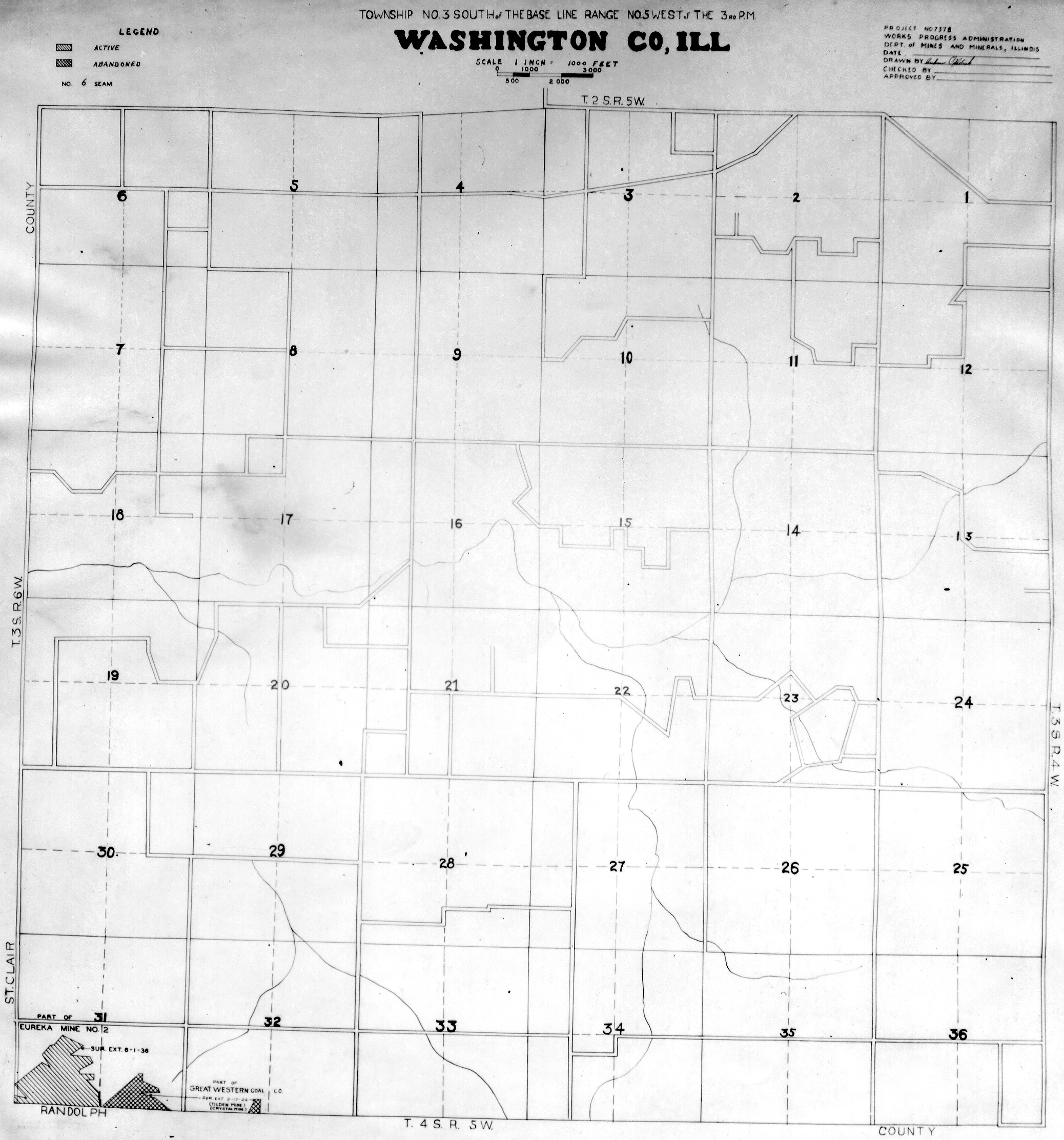
 | Washington, T2S-R3W | Washington | T2S-R3W | WPA WASHINGTON 2S3W.jpg |
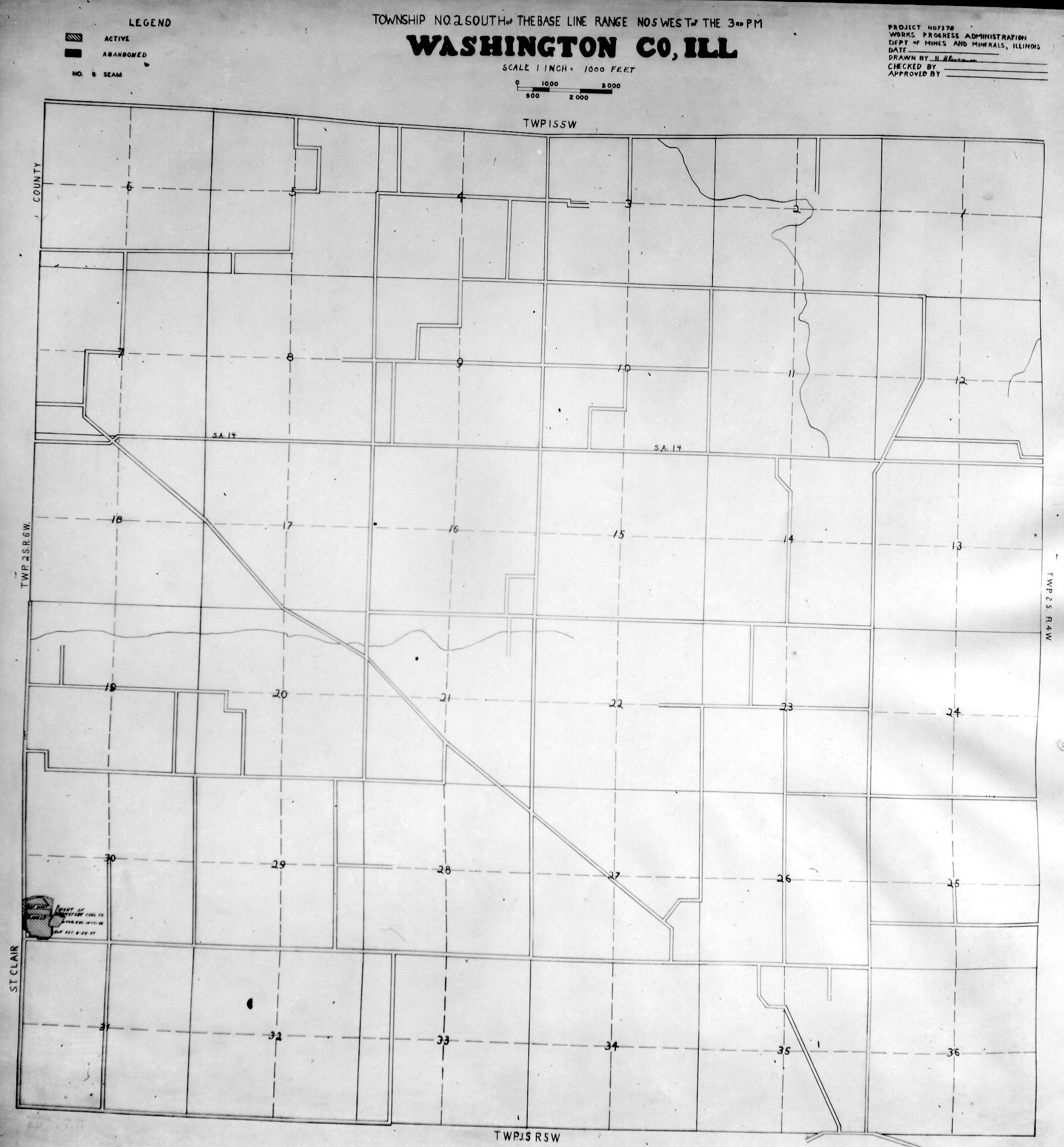
 | Washington, T2S-R5W | Washington | T2S-R5W | WPA WASHINGTON 2S5W.jpg |
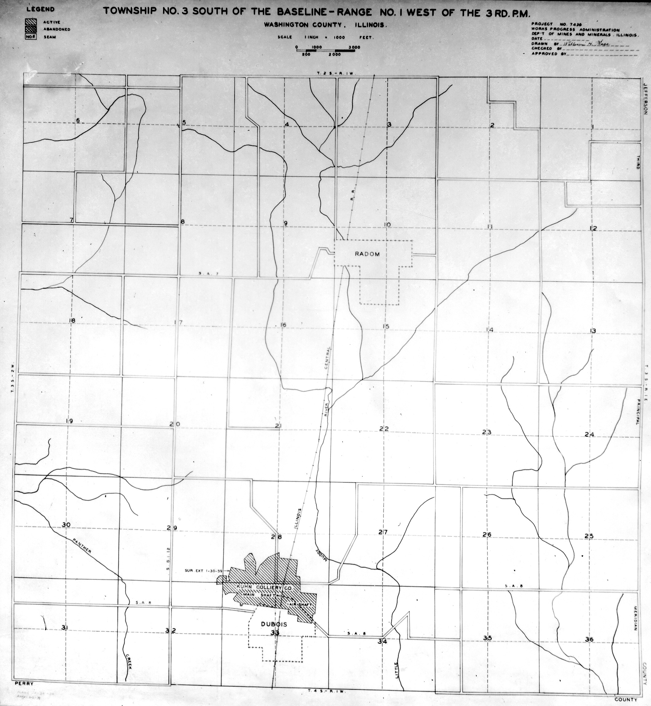
 | Washington, T3S-R1W | Washington | T3S-R1W | WPA WASHINGTON 3S1W.jpg |
 | Washington, T3S-R5W | Washington | T3S-R5W | WPA WASHINGTON 3S5W.jpg |
 | White, T6S-R8E | White | T6S-R8E | WPA WHITE 6S8E.jpg |
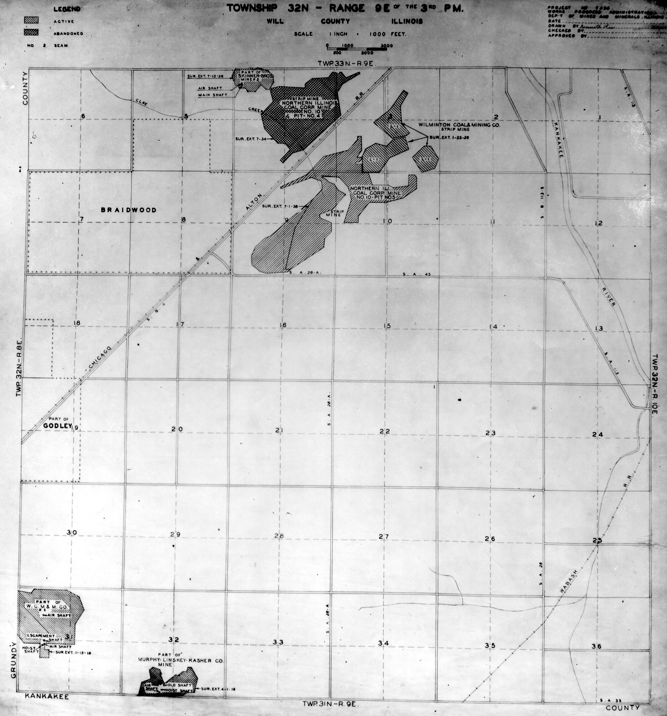
 | Will, T32N-R9E | Will | T32N-R9E | WPA WILL 32N9E.jpg |
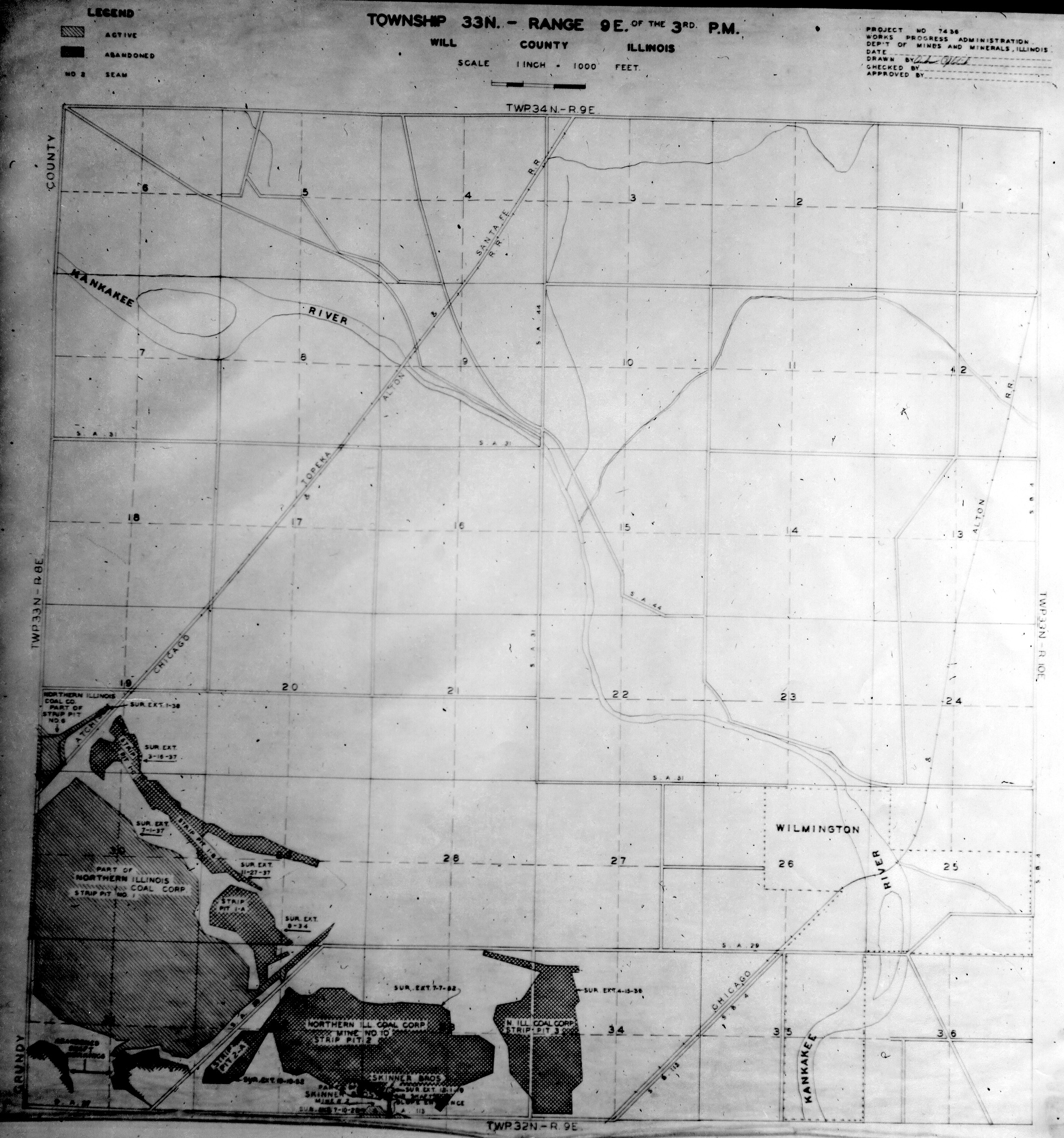
 | Will, T33N-R9E | Will | T33N-R9E | WPA WILL 33N9E.jpg |
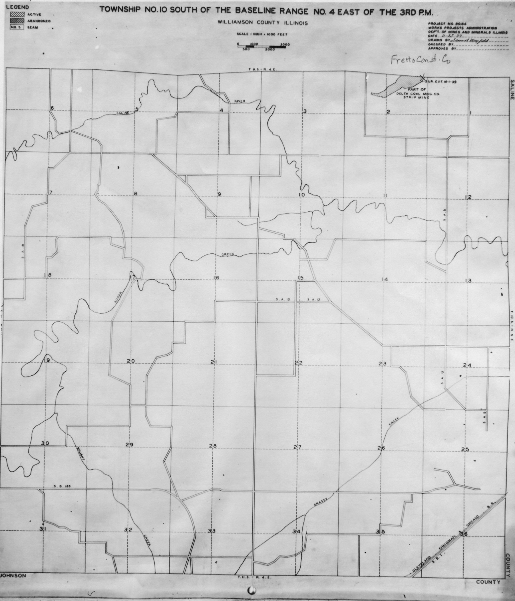
 | Williamson, T10S-R4E | Williamson | T10S-R4E | WPA WILLIAMSON 10S4E.jpg |
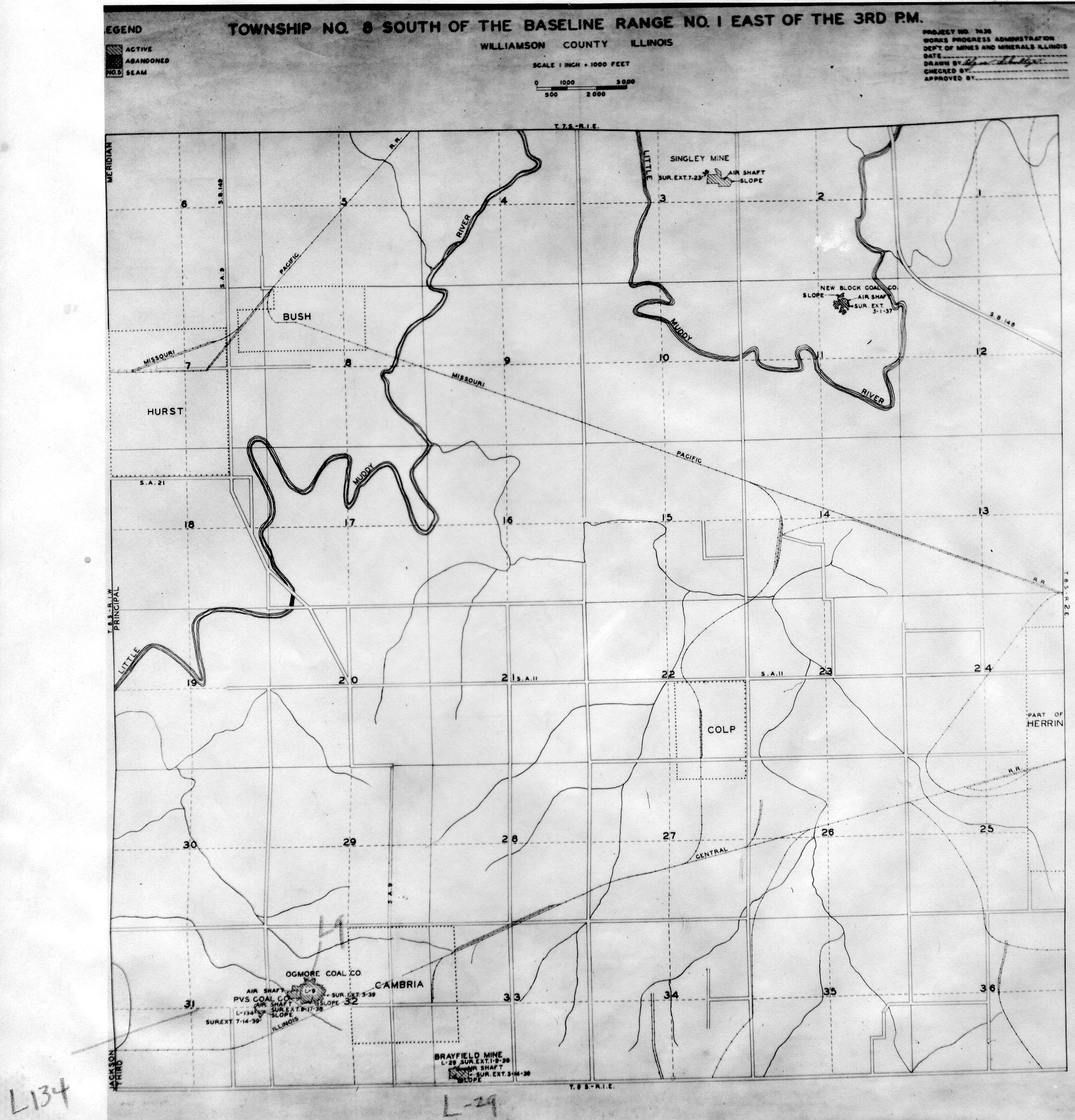
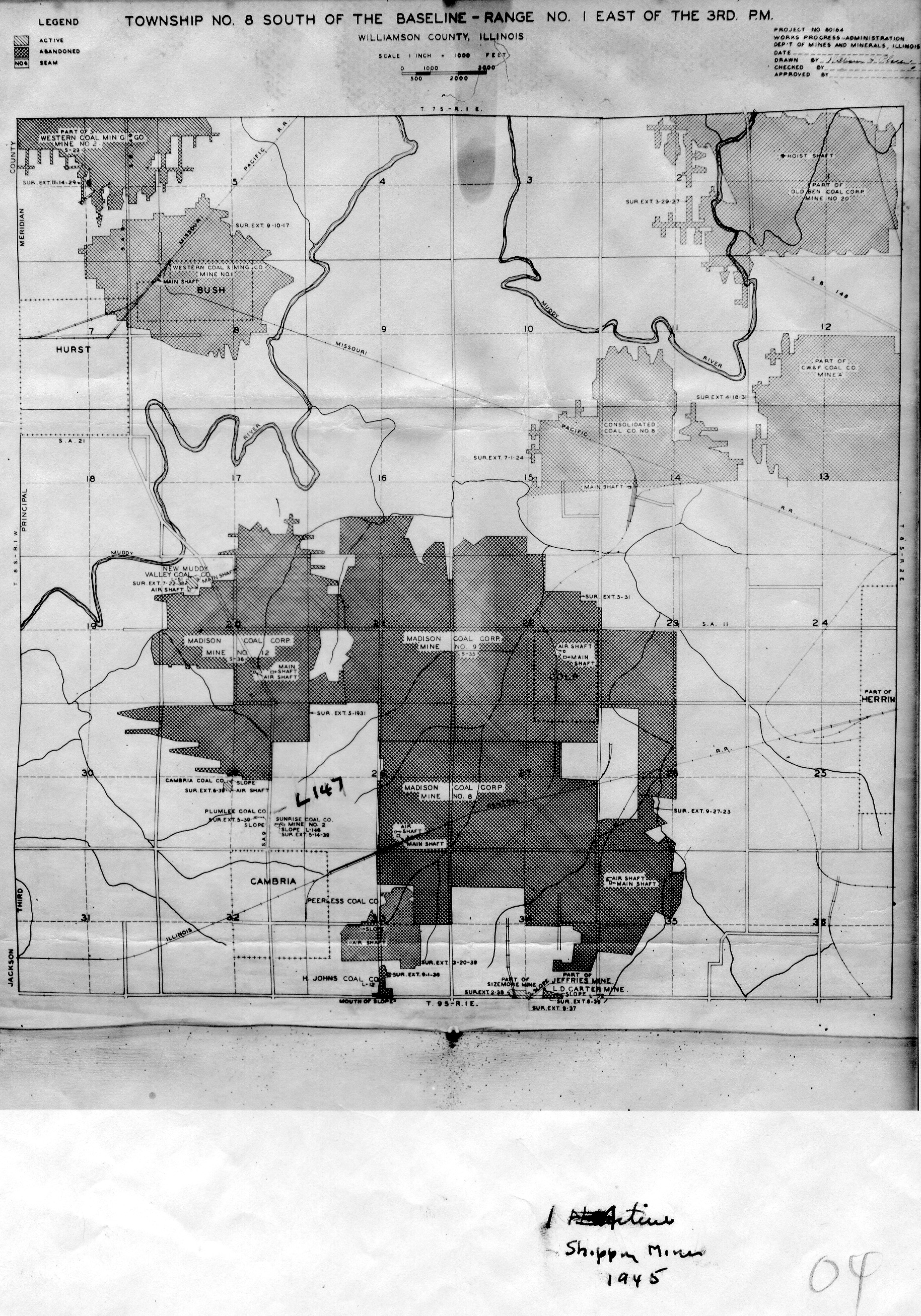
 | Williamson, T8S-R1E No.1 | Williamson | T8S-R1E | WPA WILLIAMSON 8S1E NO 1.jpg |
 | Williamson, T8S-R1E No.2 | Williamson | T8S-R1E | WPA WILLIAMSON 8S1E NO 2.jpg |
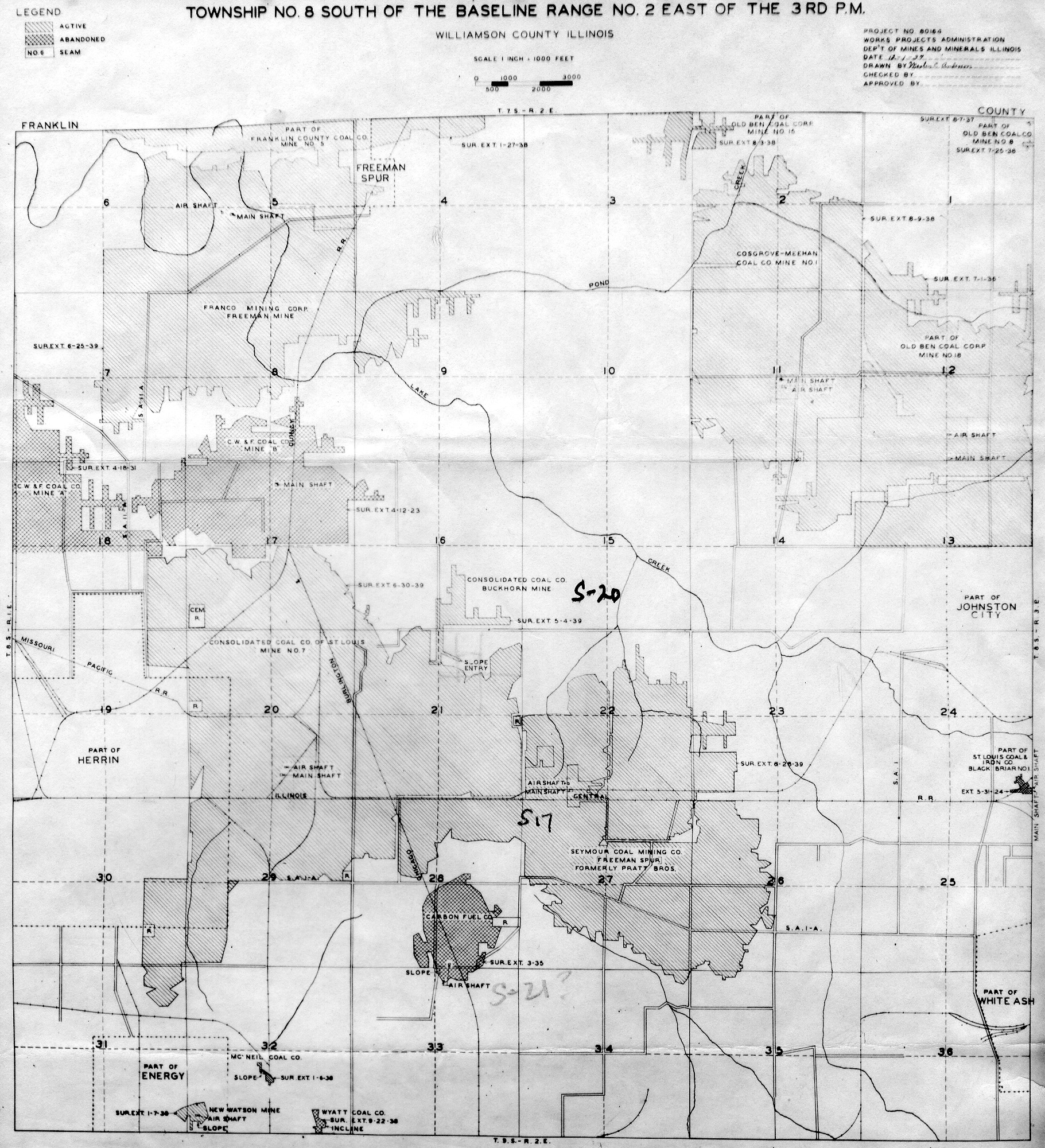
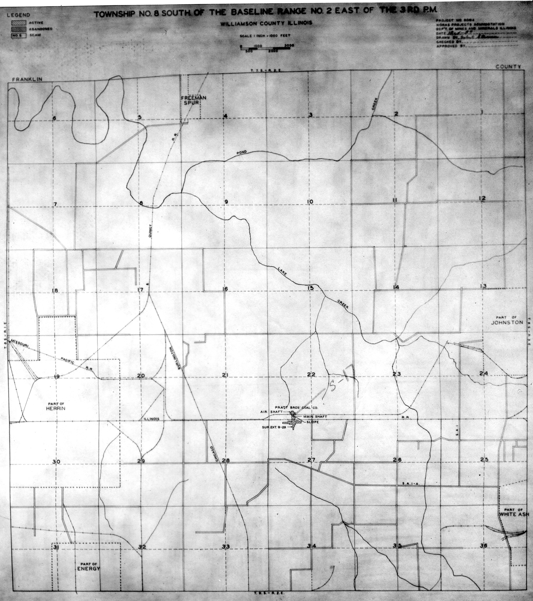
 | Williamson, T8S-R2E No.1 | Williamson | T8S-R2E | WPA WILLIAMSON 8S2E NO 1.jpg |
 | Williamson, T8S-R2E No.2 | Williamson | T8S-R2E | WPA WILLIAMSON 8S2E NO 2.jpg |
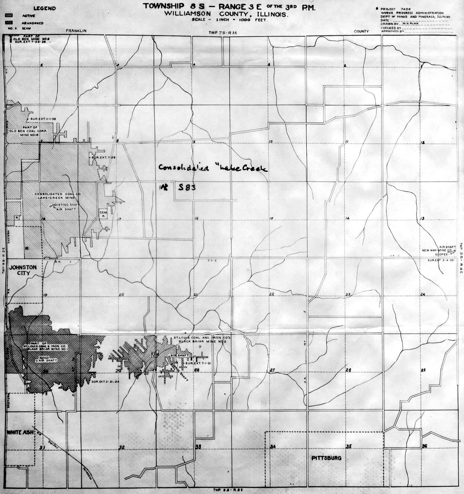
 | Williamson, T8S-R3E | Williamson | T8S-R3E | WPA WILLIAMSON 8S3E.jpg |
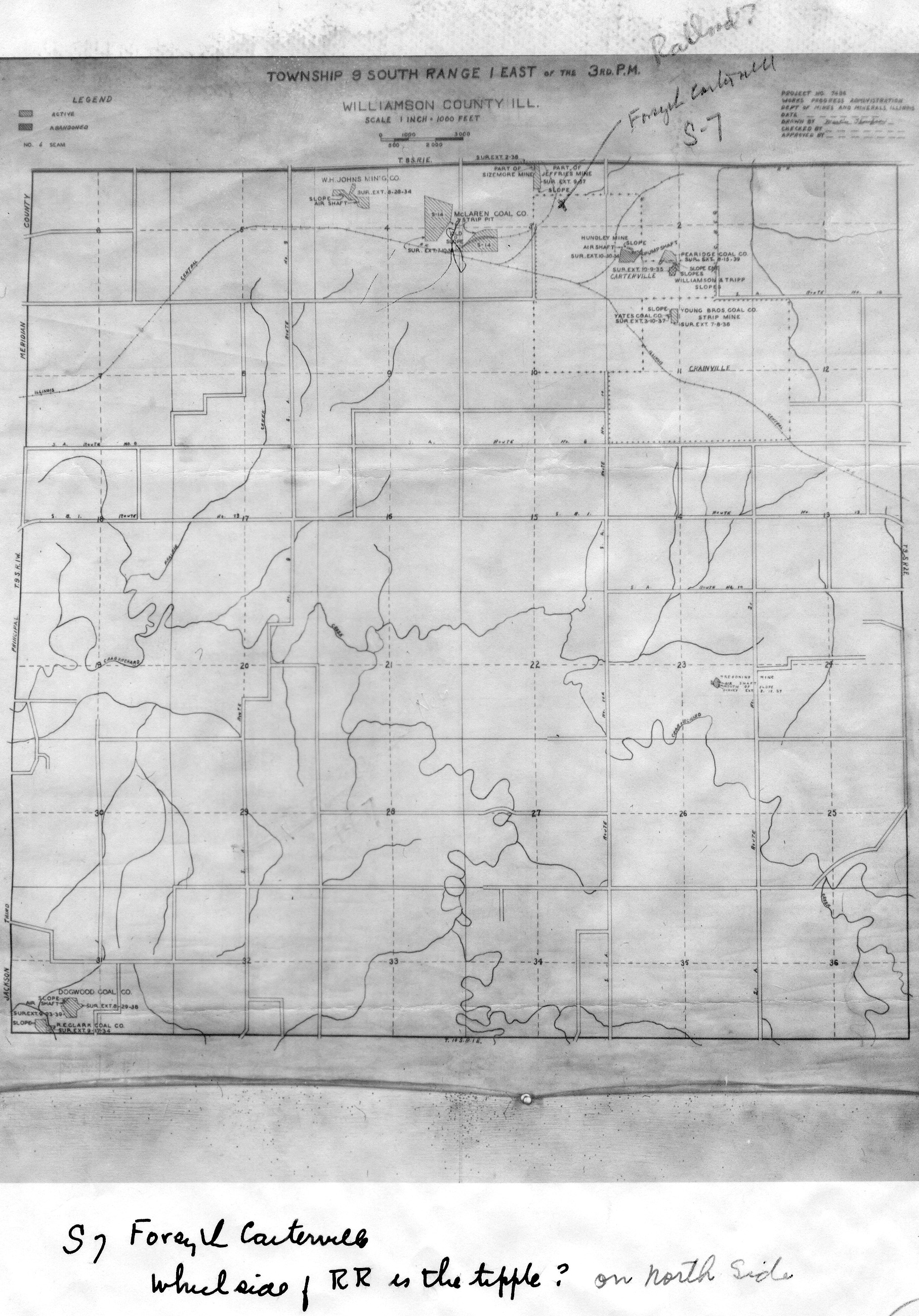
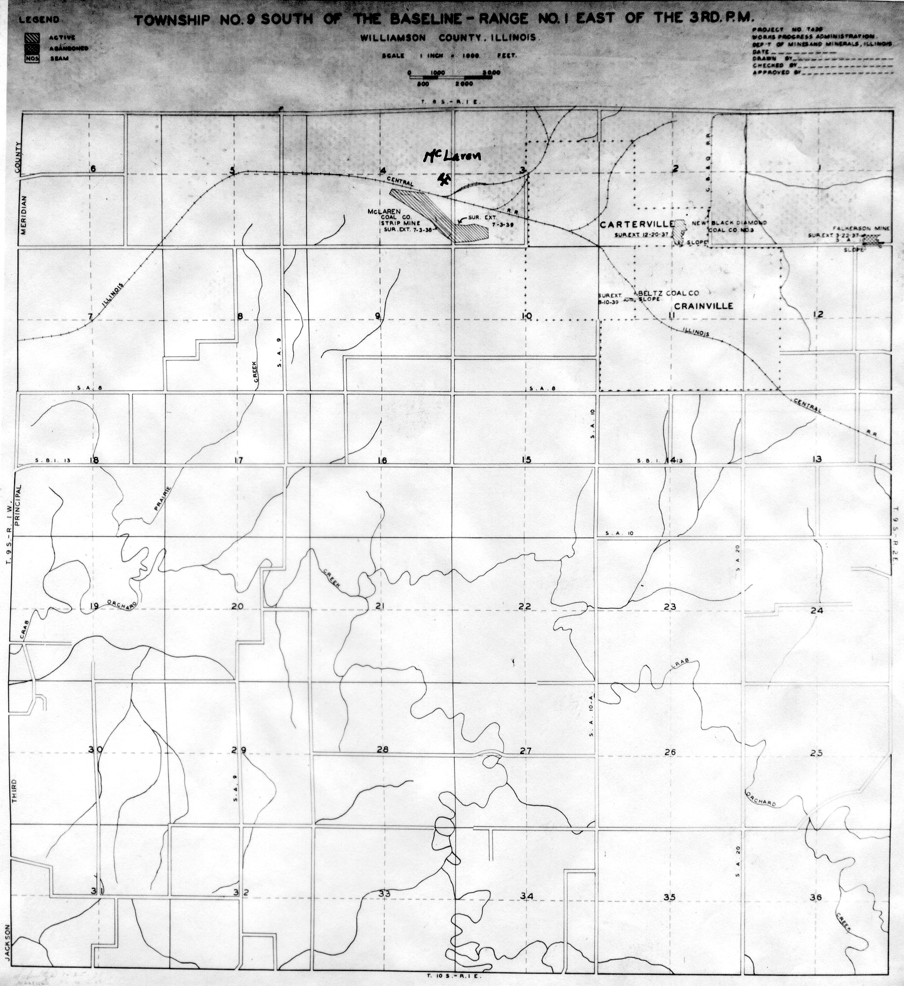
 | Williamson, T9S-R1E No.1 | Williamson | T9S-R1E | WPA WILLIAMSON 9S1E NO 1.jpg |
 | Williamson, T9S-R1E No.2 | Williamson | T9S-R1E | WPA WILLIAMSON 9S1E NO 2.jpg |
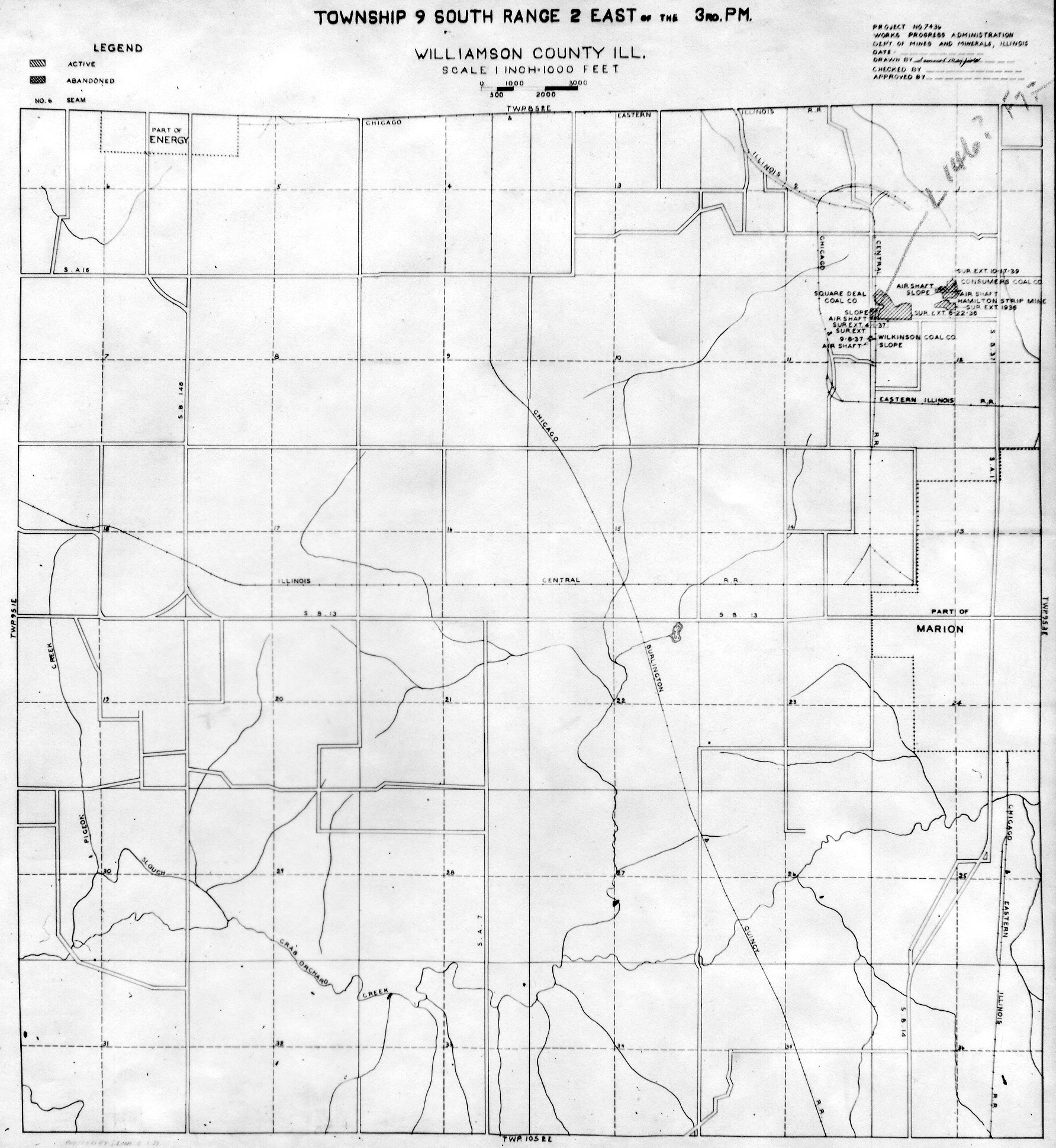
 | Williamson, T9S-R2E No.1 | Williamson | T9S-R2E | WPA WILLIAMSON 9S2E NO 1.jpg |
 | Williamson, T9S-R2E No.2 | Williamson | T9S-R2E | WPA WILLIAMSON 9S2E NO 2.jpg |
 | Williamson, T9S-R3E No.1 | Williamson | T9S-R3E | WPA WILLIAMSON 9S3E NO 1.jpg |
 | Williamson, T9S-R3E No.2 | Williamson | T9S-R3E | WPA WILLIAMSON 9S3E NO 2.jpg |
 | Williamson, T9S-R4E No.1 | Williamson | T9S-R4E | WPA WILLIAMSON 9S4E NO 1.jpg |
 | Williamson, T9S-R4E No.2 | Williamson | T9S-R4E | WPA WILLIAMSON 9S4E NO 2.jpg |
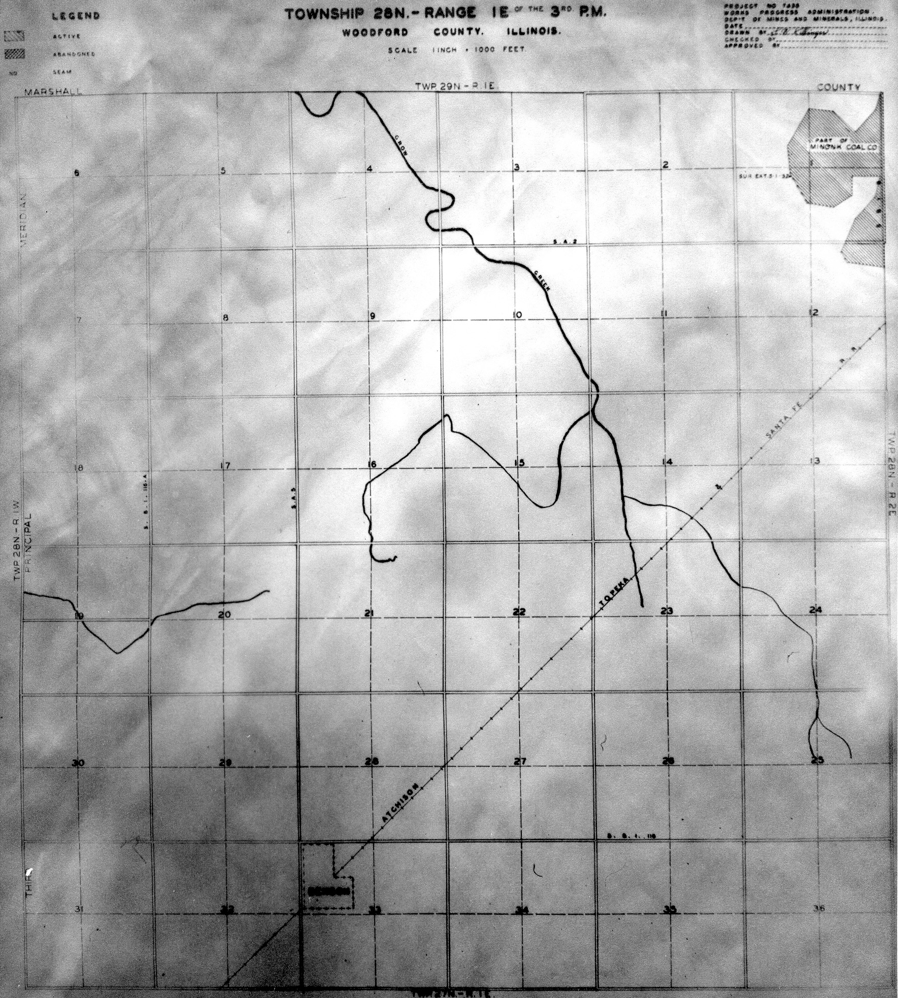
 | Woodford, T28N-R1E | Woodford | T28N-R1E | WPA WOODFORD 28N1E.jpg |
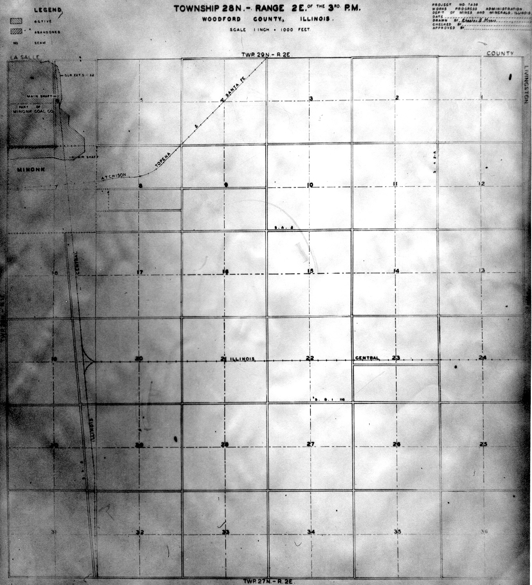
 | Woodford, T28N-R2E | Woodford | T28N-R2E | WPA WOODFORD 28N2E.jpg |
 | Bond & Montgomery T7N-R4W | Bond Montgomery | T4N-R4W | Wpa bond montgomery 7n4w.jpg |
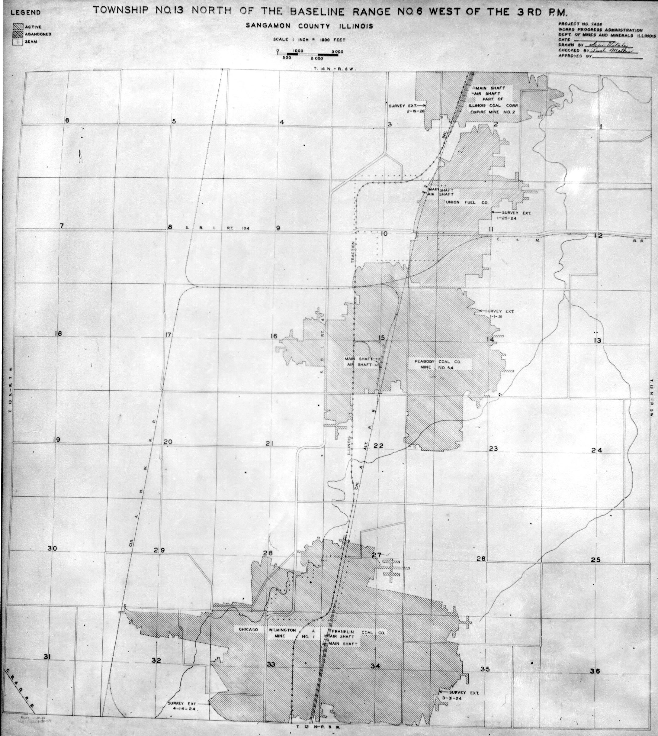
 | Sangamon, T13N-R6W | Sangamon | T13N-R6W | Wpa sangamon 13n6w.jpg |
 | Sangamon, T14N-R6W No.2 | Sangamon | T14N-R6W | Wpa sangamon 14n6w v2.jpg |
 | Sangamon, T15N-R6W | Sangamon | T15N-R6W | Wpa sangamon 15n6w.jpg |
 | Sangamon, T16N-R5W | Sangamon | T16N-R5W | Wpa sangamon 16n5w.jpg |
 | Sangamon, T16N-R6W | Sangamon | T16N-R6W | Wpa sangamon 16n6w.jpg |
Retrieved from "https://ilmineswiki.web.illinois.edu/index.php?title=WPA&oldid=20614"