|
|
| (59 intermediate revisions by the same user not shown) |
| Line 1: |
Line 1: |
| __NOTOC__
| | ==Coal Mines== |
| <div class="nomobile"><center> | | <center> |
| {{#widget:Iframe
| | <gallery widths=310px heights=210px perrow=3 mode=nolines> |
| |url=https://prairie-research.maps.arcgis.com/apps/webappviewer/index.html?id=fd4ef8c2f67e48fcbc661512ffcb5e84 | | File:Directory.png|link=Coal_Mines/Directory_of_Coal_Mines|[[Coal_Mines/Directory_of_Coal_Mines|Directory of Coal Mines]] |
| |width=100% | | File:Ilminesviewer.png|link=ILMINES|[[ILMINES|Coal Mine Viewer (ILMINES)]] |
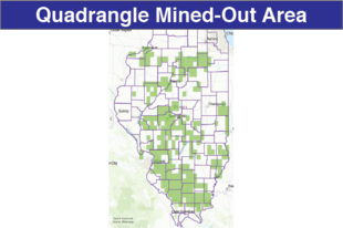
| |height=900 | | File:Moa quad.png|link=Quadrangle_Mined-Out_Area_Maps|[[Quadrangle_Mined-Out_Area_Maps|Quadrangle Mine-Out Quadrangle Map Downloads]] |
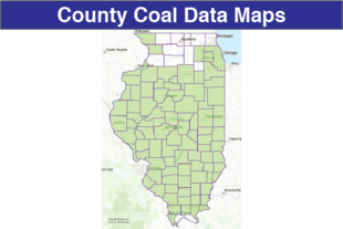
| |border=0 | | File:County coal.png|link=County_Coal_Data|[[County_Coal_Data|County Coal Data Downloads]] |
| }}
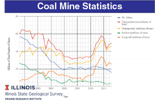
| | File:Coal Mine Statistics.png|link=Coal Mines/Mine_Statistics|[[Coal Mines/Mine_Statistics|Coal mine production in Illinois]] |
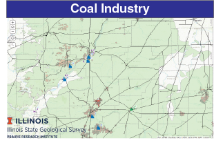
| </center></div> | | File:Coal_industry.png|link=https://go.illinois.edu/Coalindustry_gis |
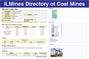
| ==DIRECTORY OF COAL MINES IN ILLINOIS==
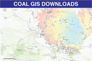
| | File:Coalgis.png|link=https://go.illinois.edu/coal_gis |
| Coal has been mined in 76 counties of Illinois. More than 7,400 coal mines have operated since commercial mining began in Illinois about 1810; fewer than 30 are currently active. To detail the extent and location of coal mining in Illinois, the Illinois State Geological Survey (ISGS) has compiled this known coal mines.
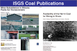
| | File:Coal pubs.png|link=https://go.illinois.edu/CoalPubs |
| | File:Mire.png|link=https://go.illinois.edu/MazonCreekFossils |
| | </gallery> |
| | </center> |
|
| |
|
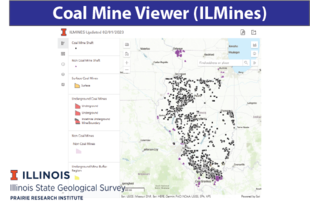
| This map show the approximate positions of mines in relation to surface features such as roads and water bodies, and indicate the mining method used and the accuracy of the mine boundaries. The maps are useful for locating mine boundaries relative to specific properties and for assessing the potential for subsidence in an area. Mine boundaries compiled from final mine surveys are generally shown within 200 feet of their true position. As a result of poor cartographic quality and inaccuracies in the original mine surveys, boundaries of some older mines may be mislocated on the map by 500 feet or more. Original mine maps should be consulted in situations that require precise delineation of mine boundaries or internal workings of mined areas.
| | ==Non-Fuel Mines== |
| | | <center> |
| This directory serves as a key to the accompanying mine map and provides basic information on the coal mines in Illinois.
| | <gallery widths=310px heights=210px perrow=3 mode=nolines> |
| | | File:Non-fuel.png|link=Non-Fuel|[[Non-Fuel|Non-Fuel Mine Data]] |
| | | </gallery> |
| ==Status== | | </center> |
| At this time there is a limited number of mines are entered into this system (shown in redboxes on the above map).
| | {{DISPLAYTITLE:ILMINES WIKI}} |
| ===Quadrangles=== | |
| {{#ask:[[Has query::~*-Quadrangle]]
| |
| |format=category|limit=500|link=all|order=ascending|headers=show|searchlabel=... further results|columns=3}}
| |
| | |
| ===Counties===
| |
| {{#ask:[[Has query::~*-County]] | |
| |format=category|limit=500|link=all|order=ascending|headers=show|searchlabel=... further results|columns=3}}
| |