Quade: Difference between revisions
Alan.Myers (talk | contribs) (Created page with "__NOTOC__ These maps were constructed as part of the nationwide Works Projects Administration (WPA), generally between 1934 and 1937 with some later updates or revisions, ==...") |
Alan.Myers (talk | contribs) No edit summary |
||
| Line 15: | Line 15: | ||
|?TR=Township-Range | |?TR=Township-Range | ||
|?Filename = Image Download | |?Filename = Image Download | ||
|?Quade Report= Quade Report | |||
|format=table | |format=table | ||
|limit=500 | |limit=500 | ||
Revision as of 10:41, July 4, 2020
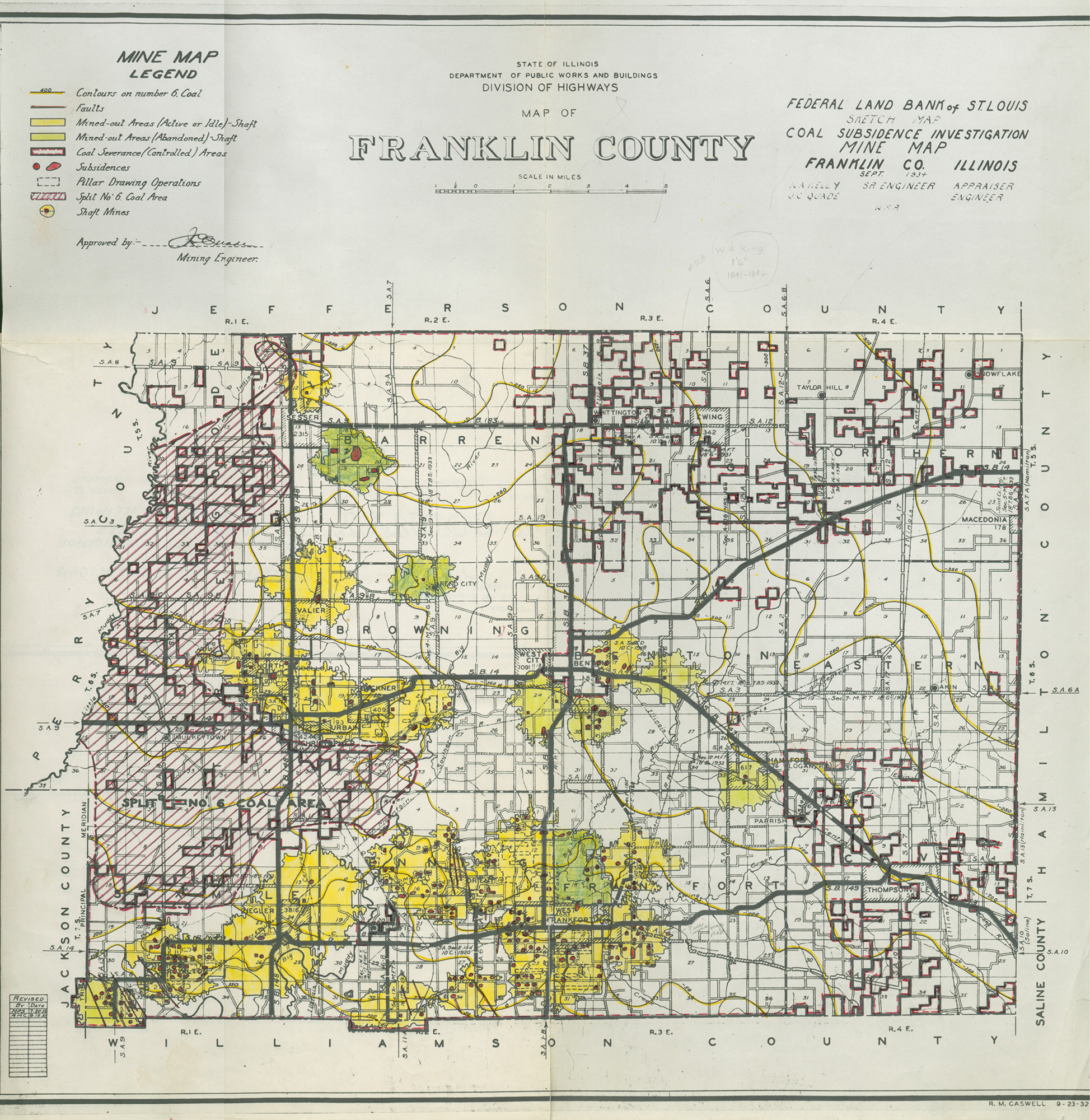
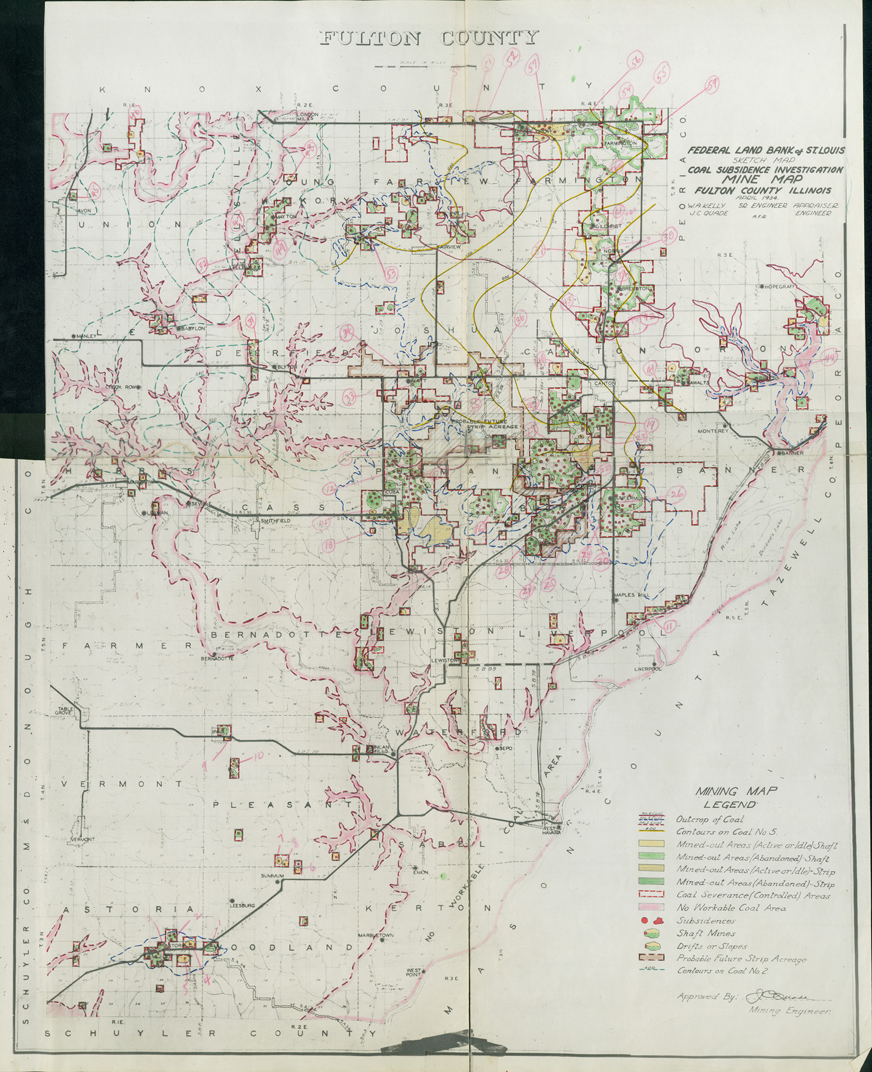
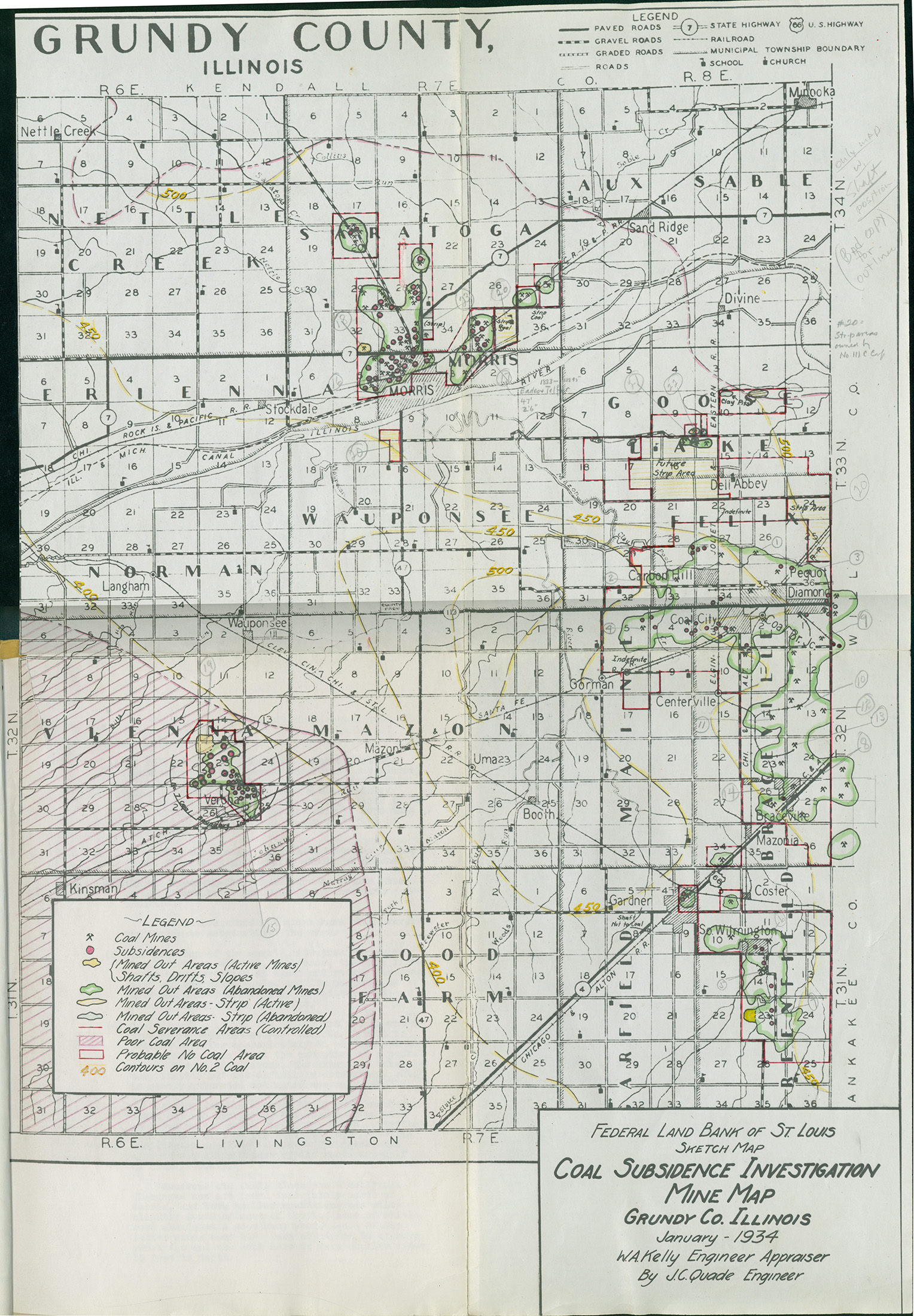
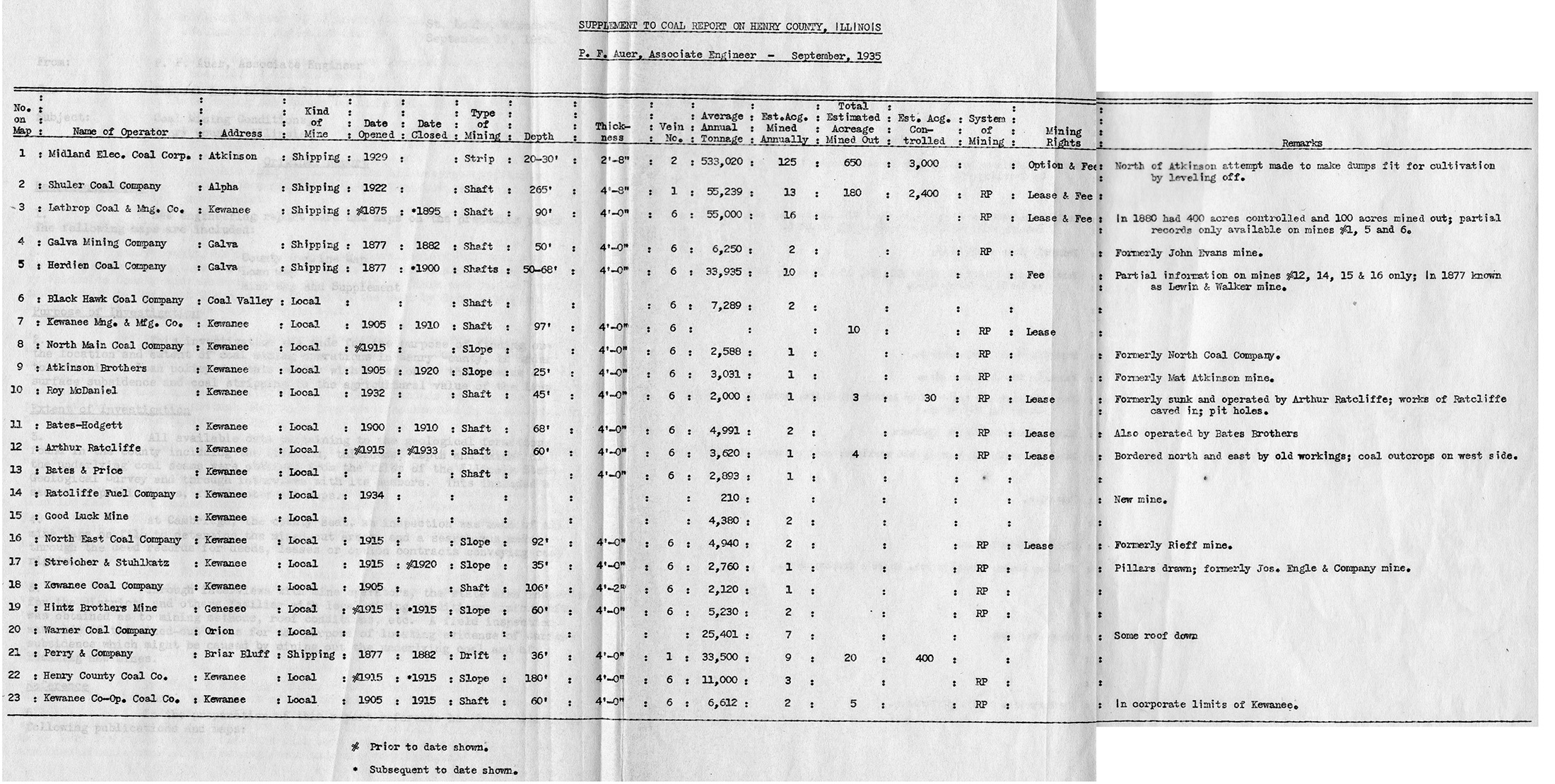
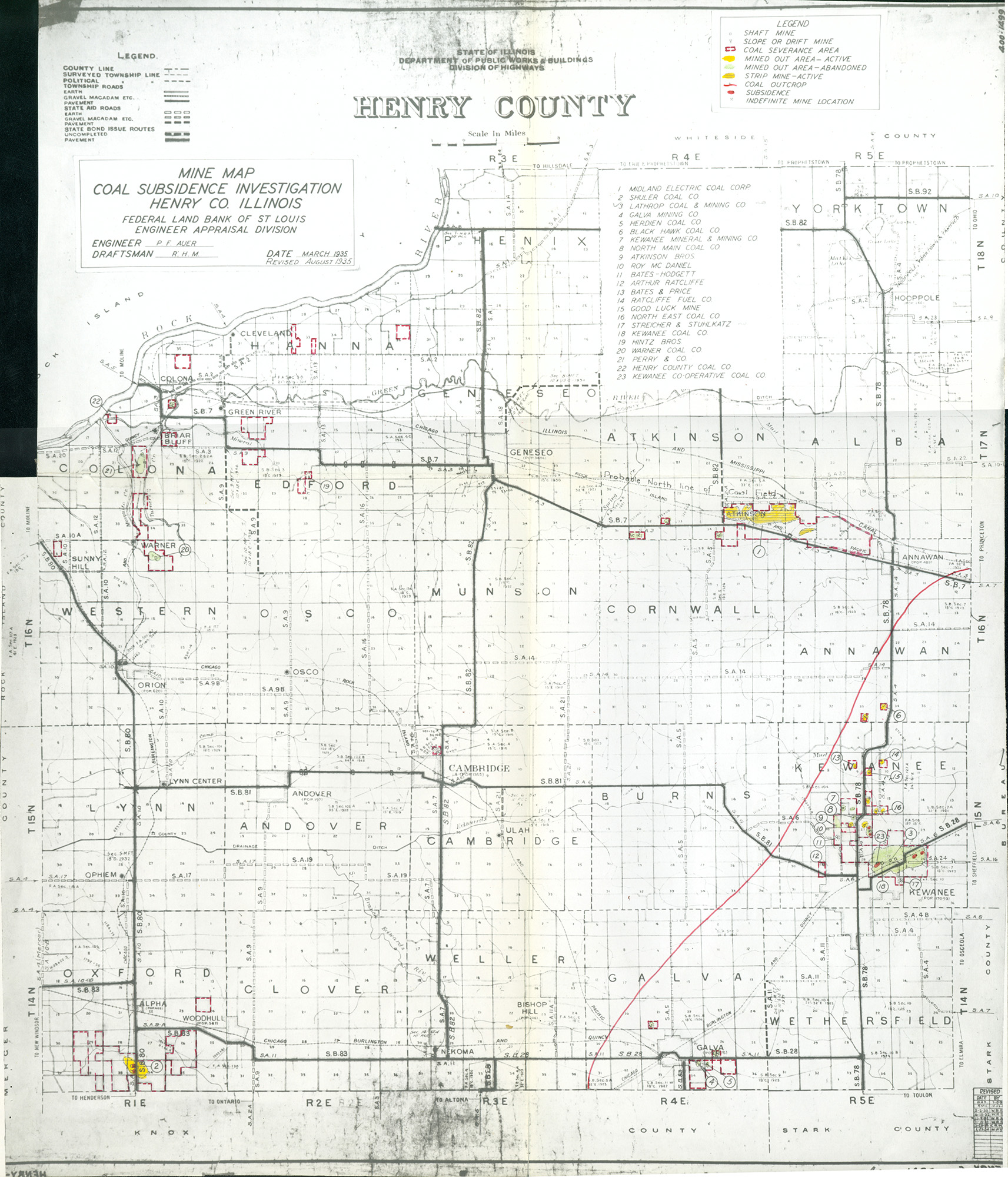
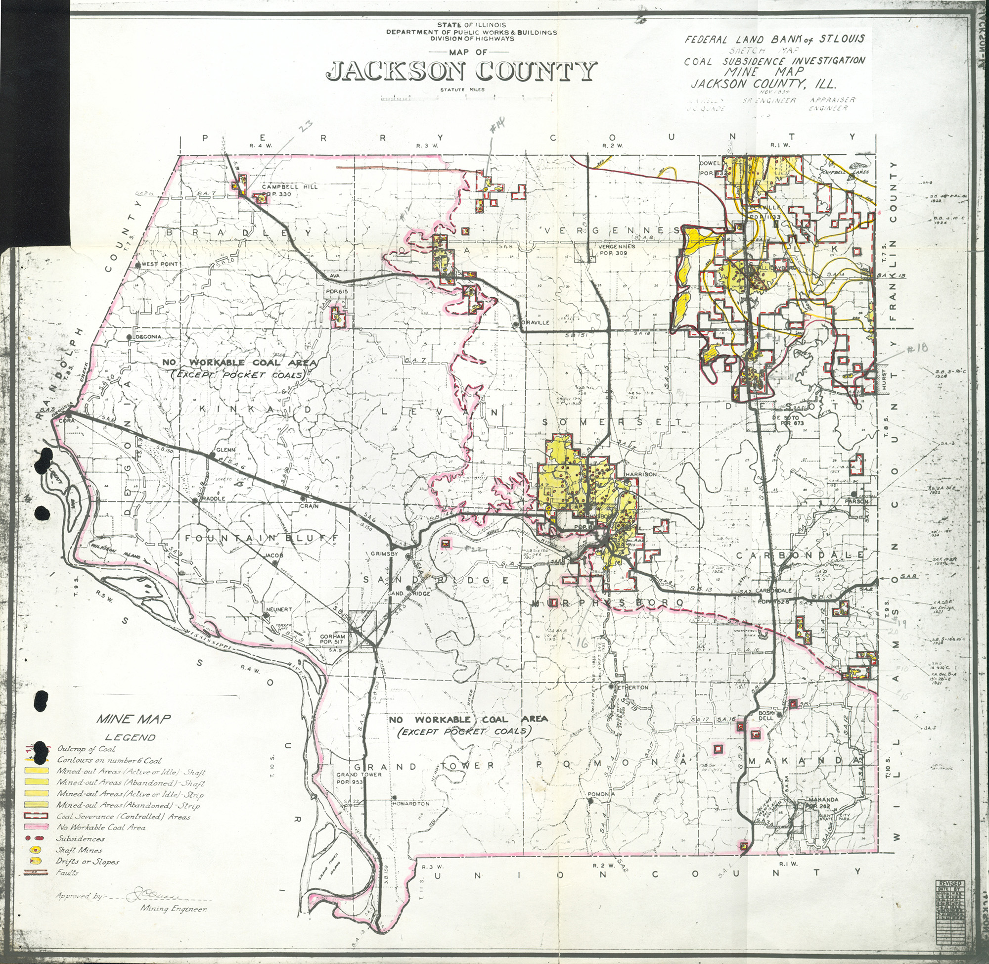
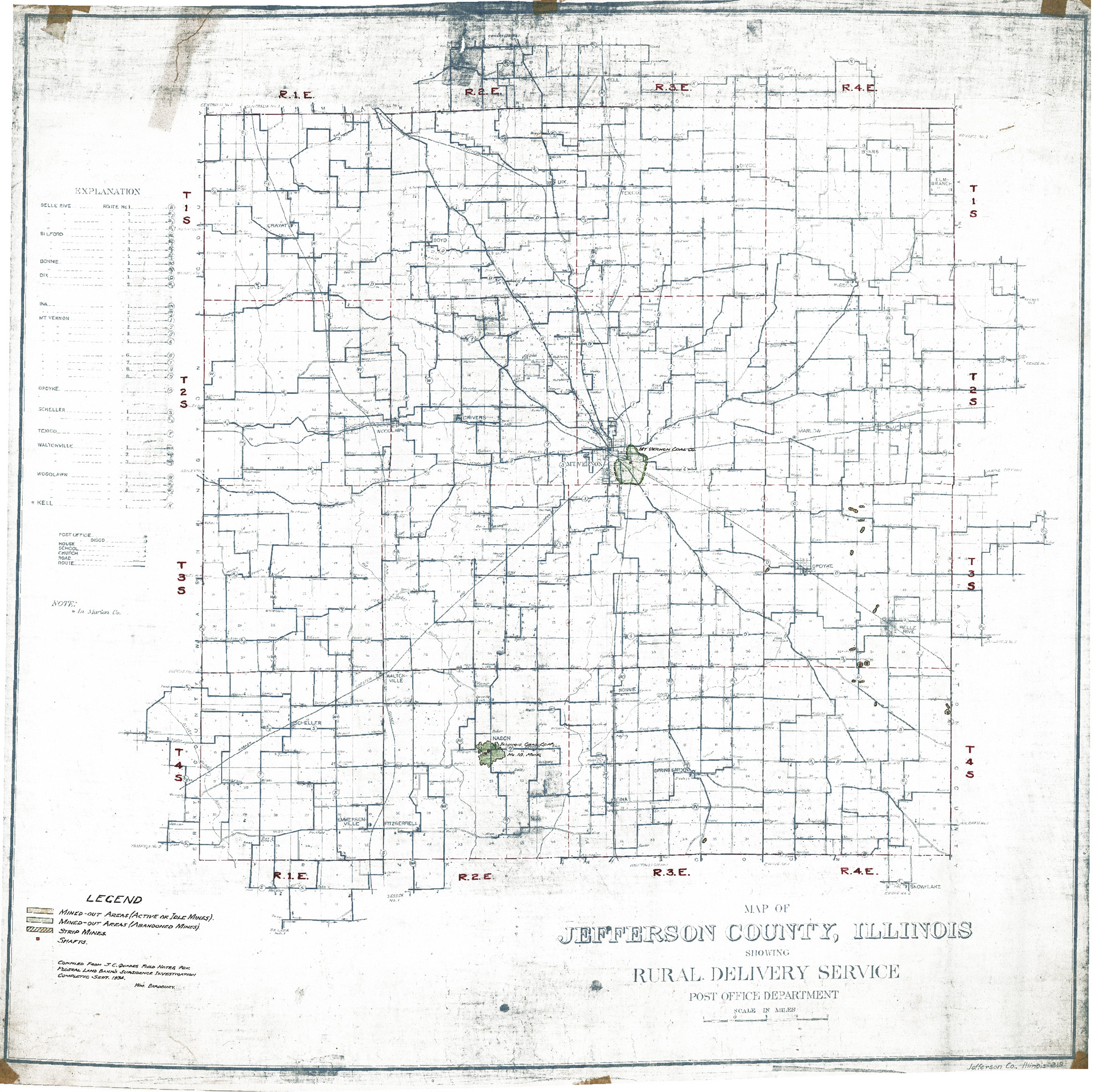
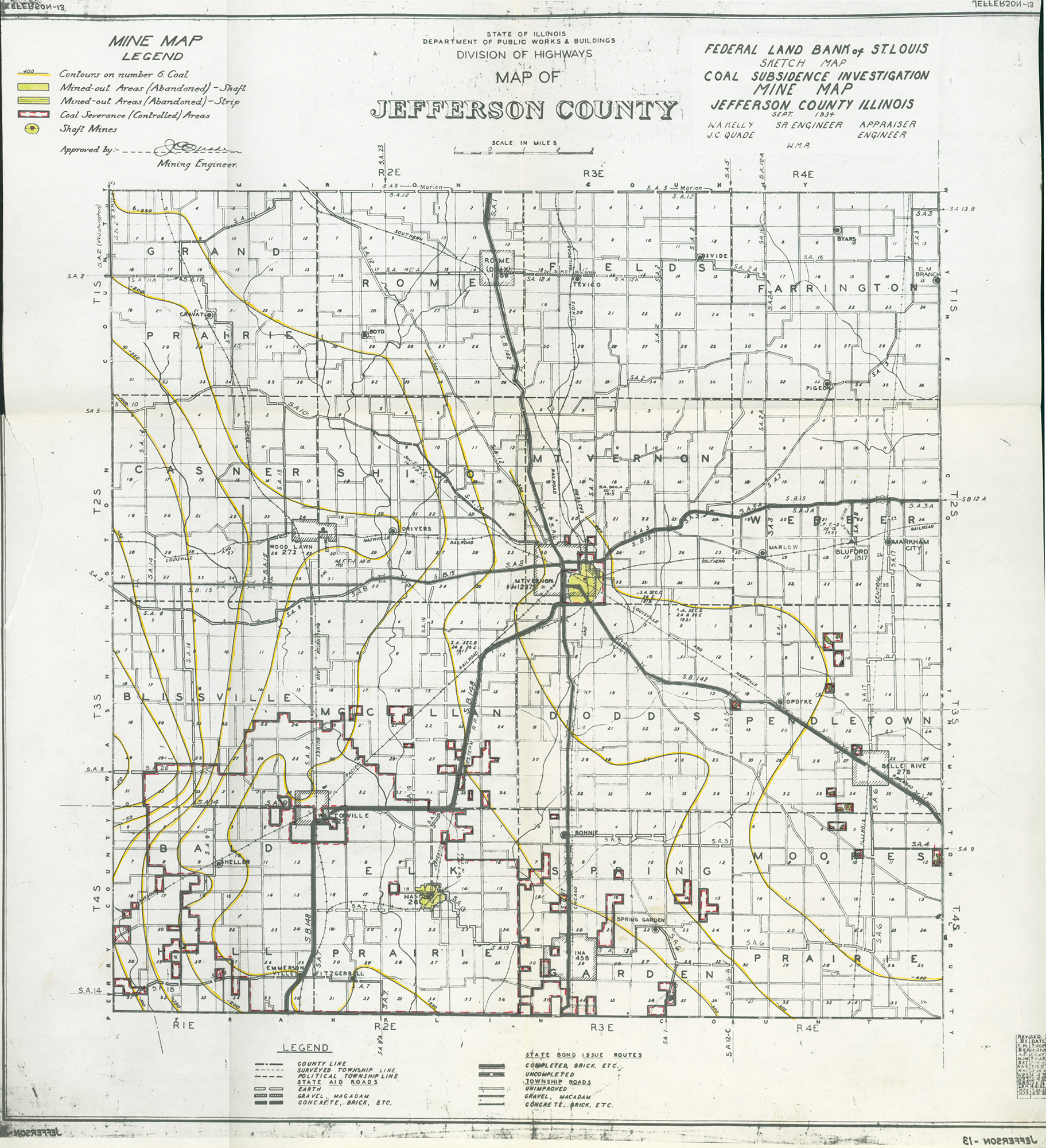
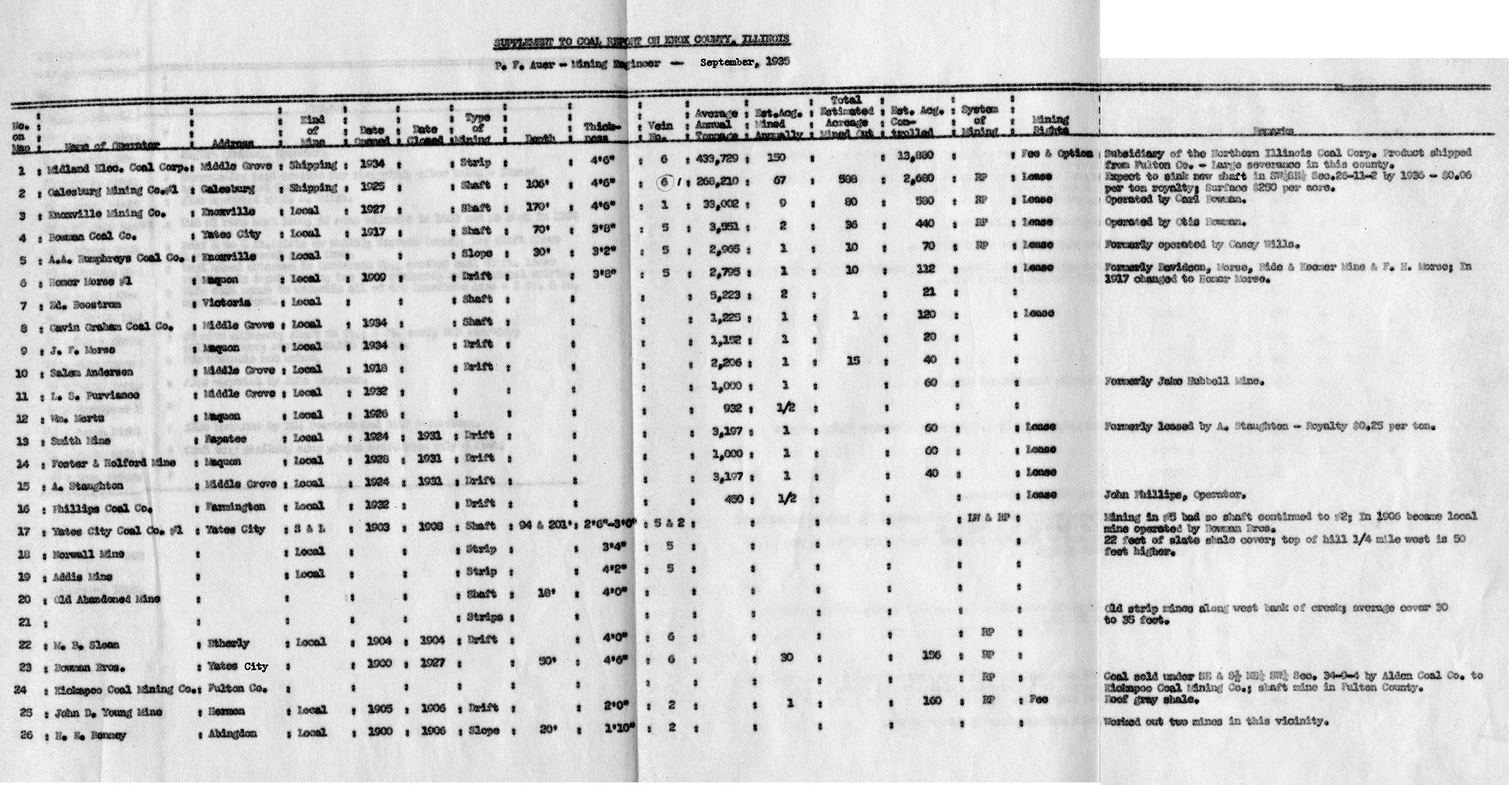
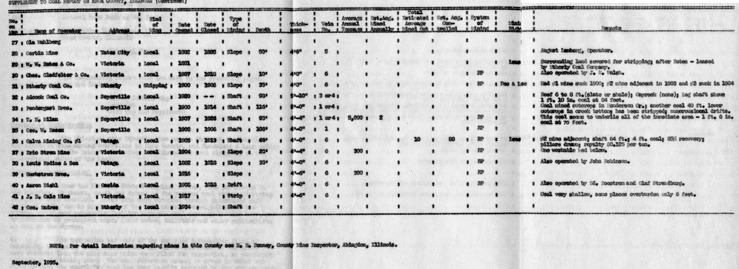
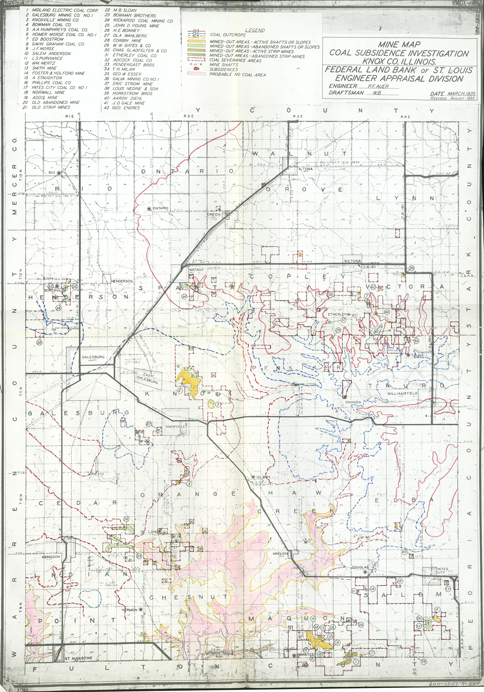
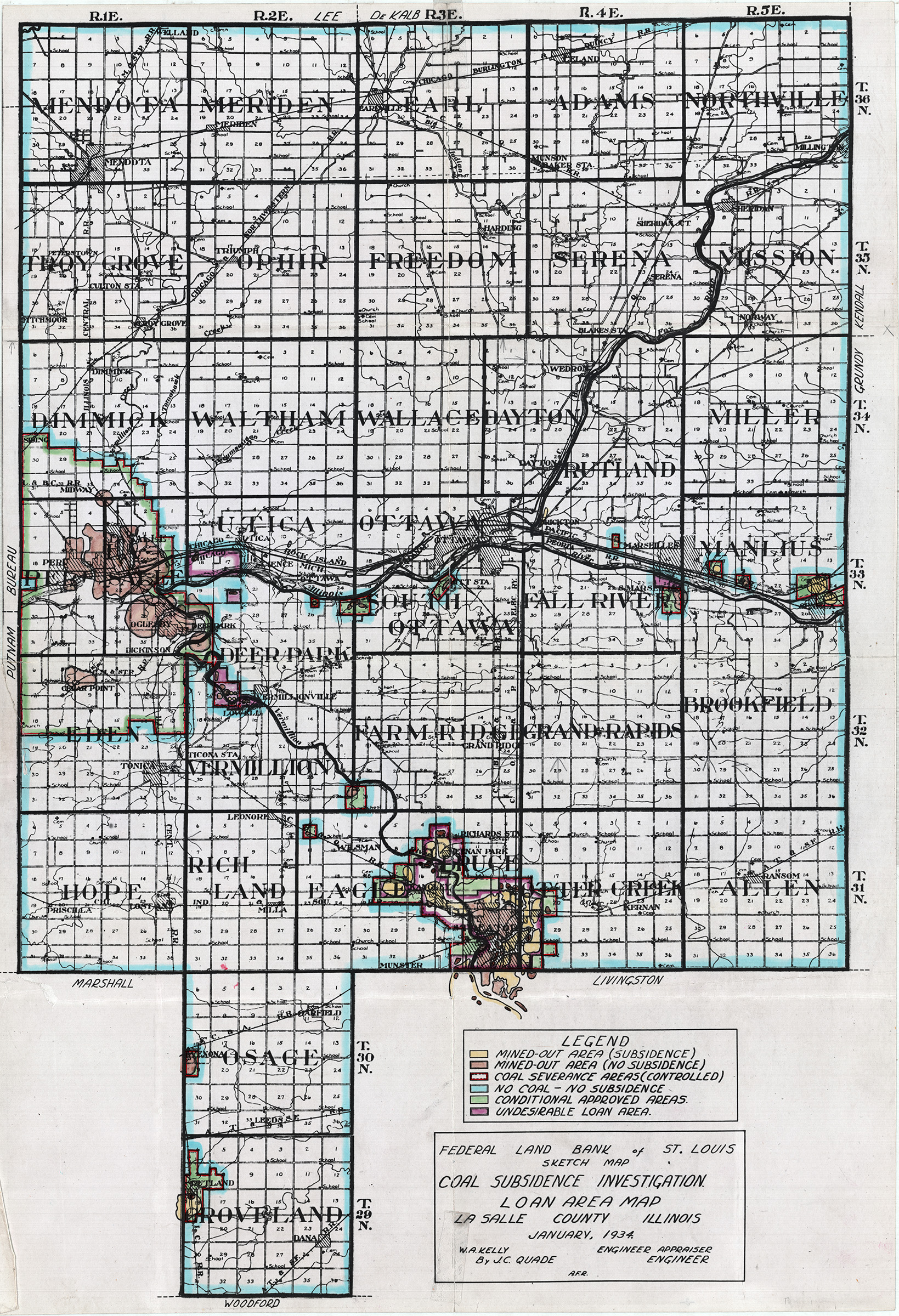
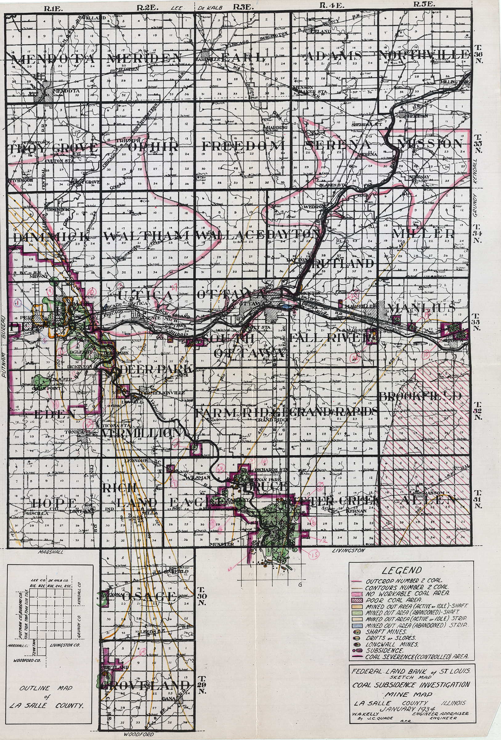
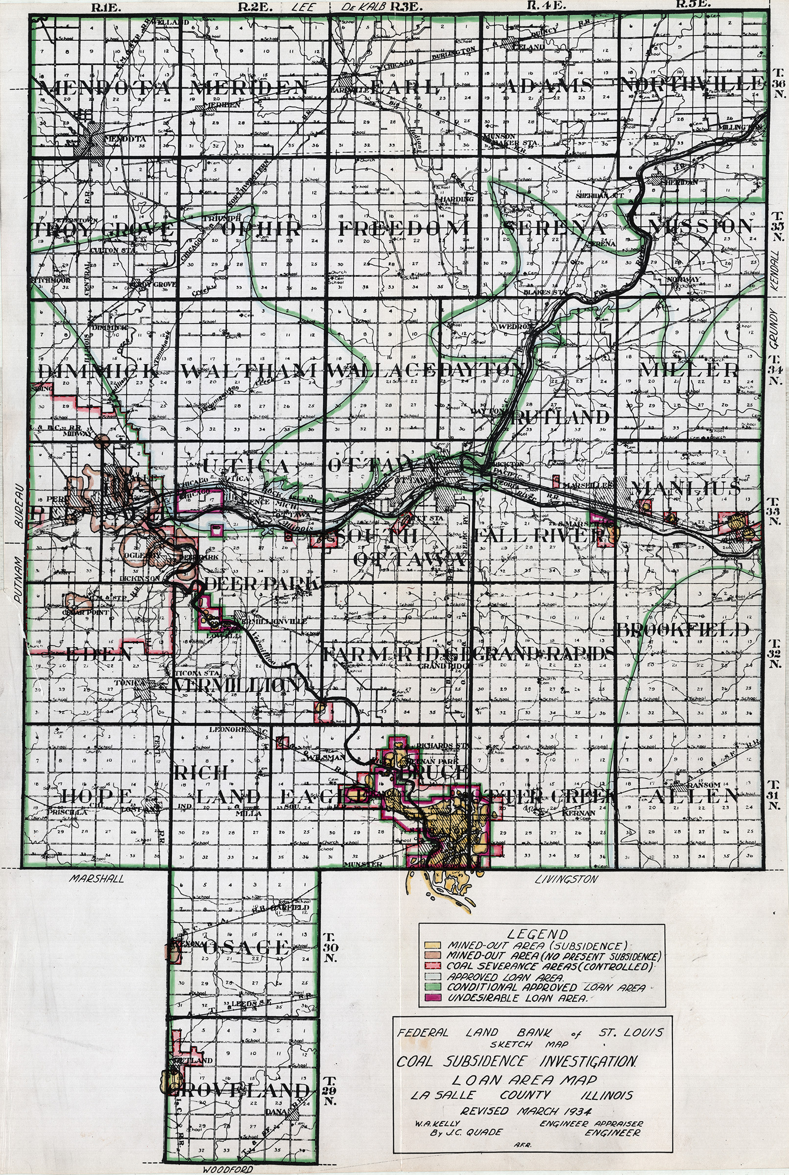
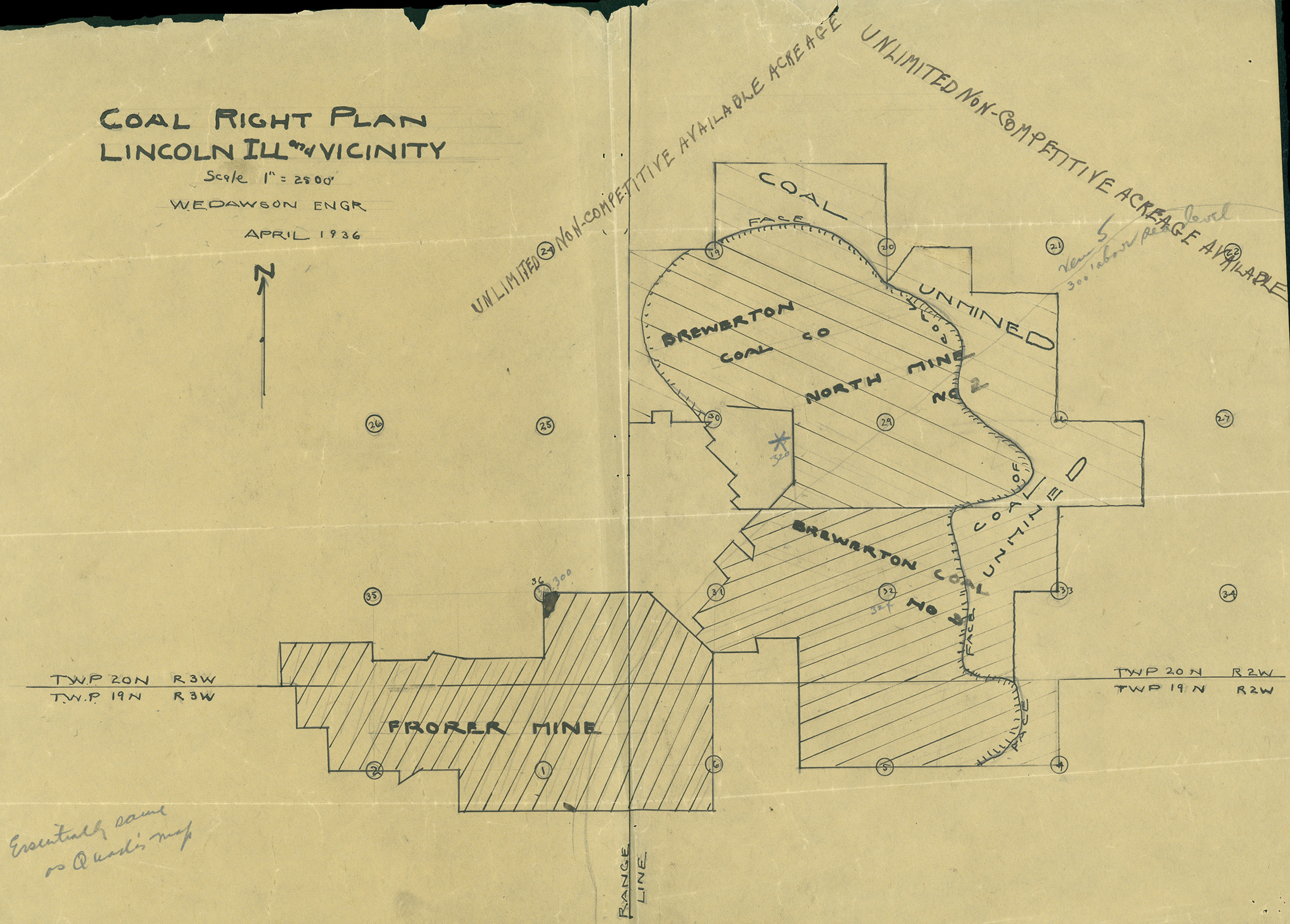
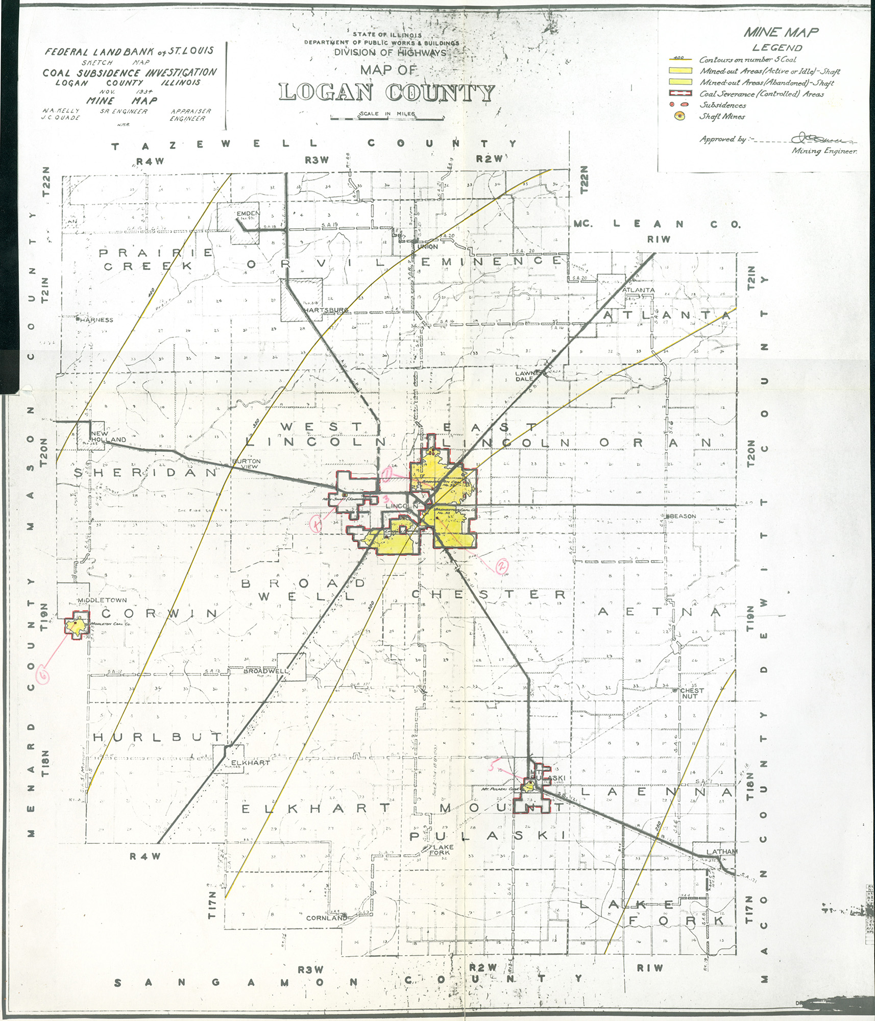
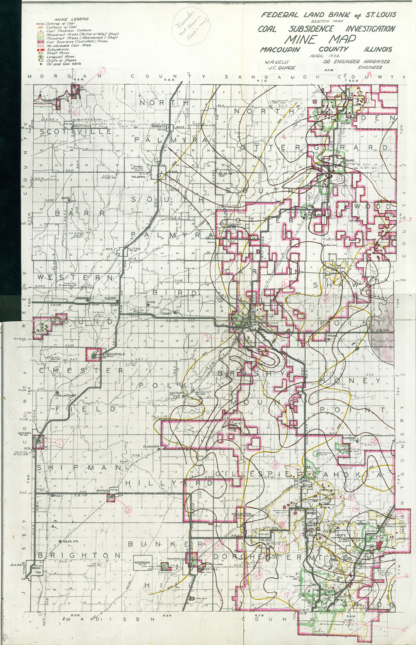
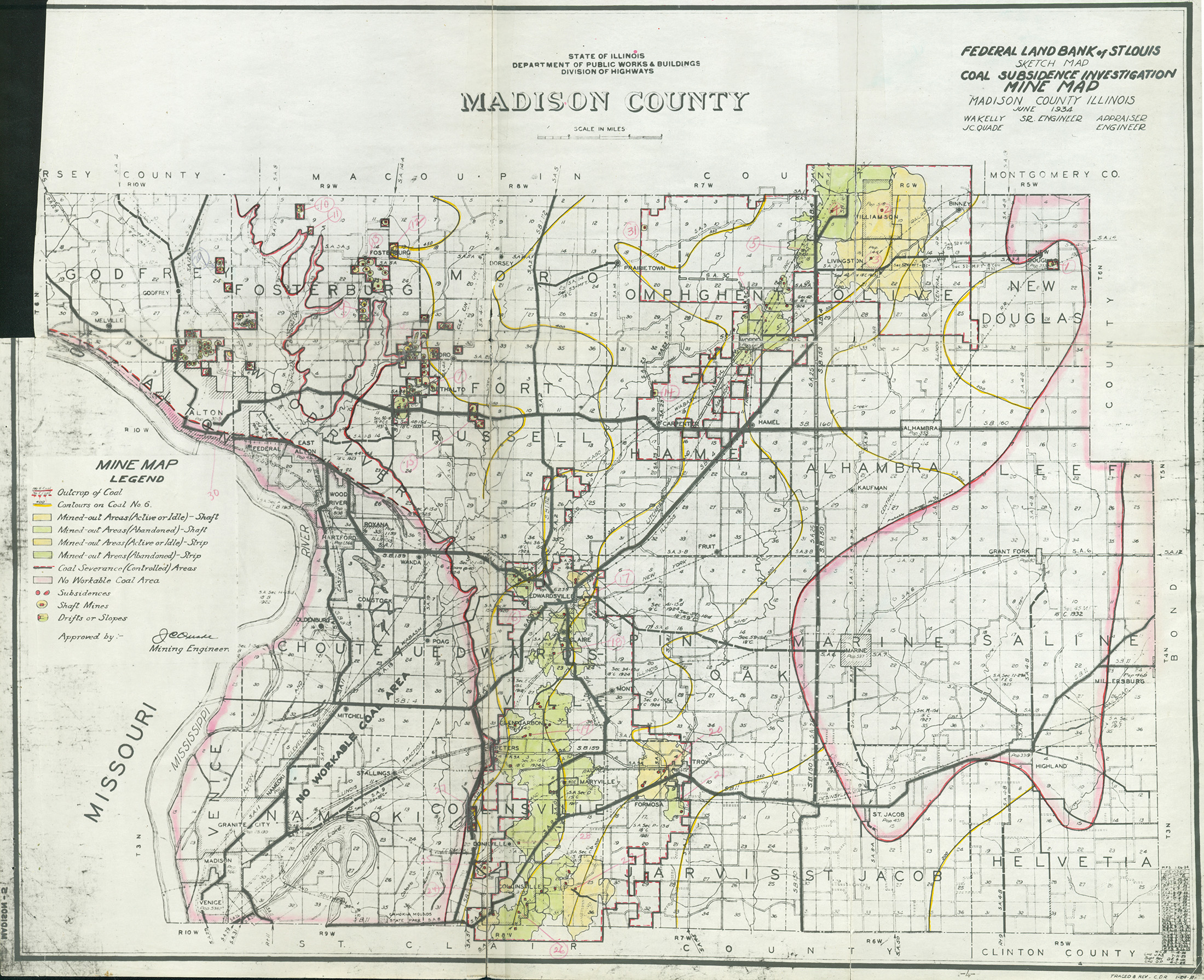
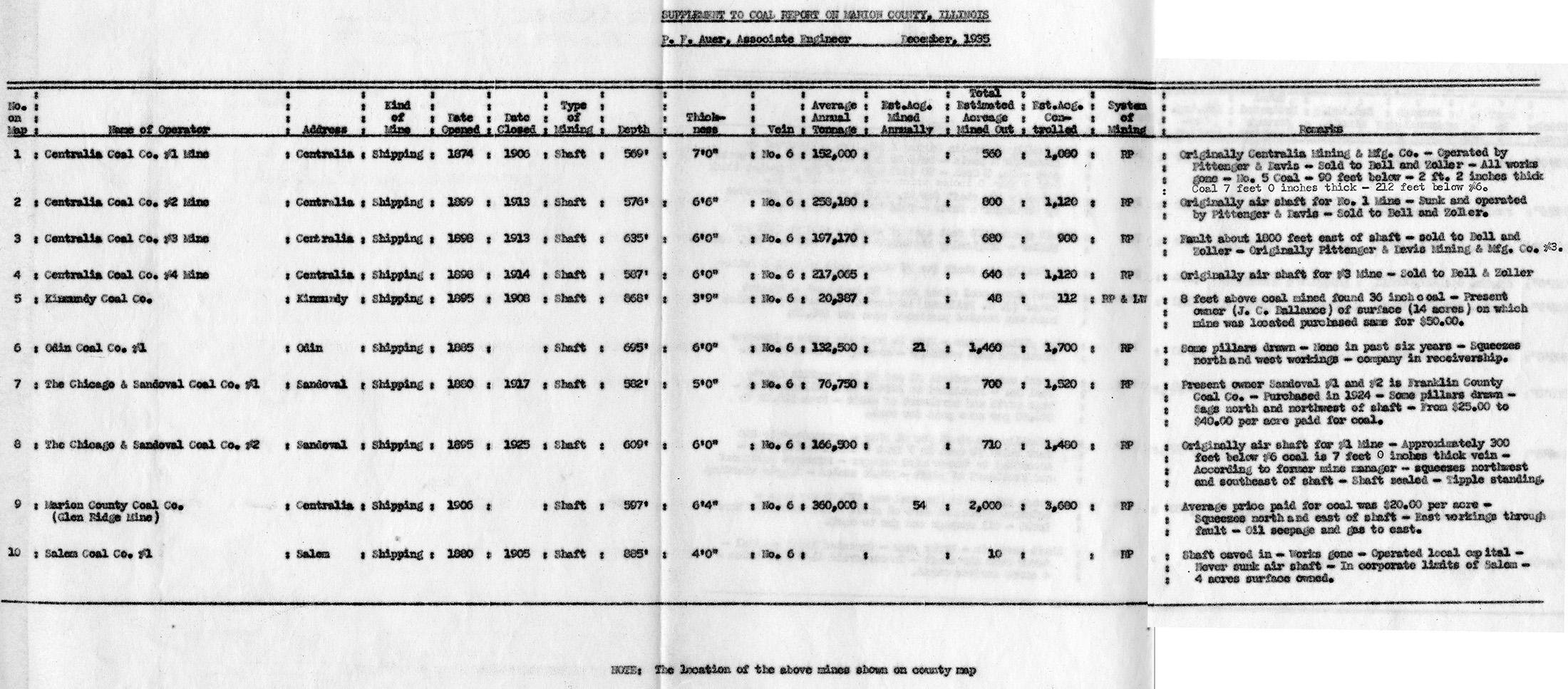
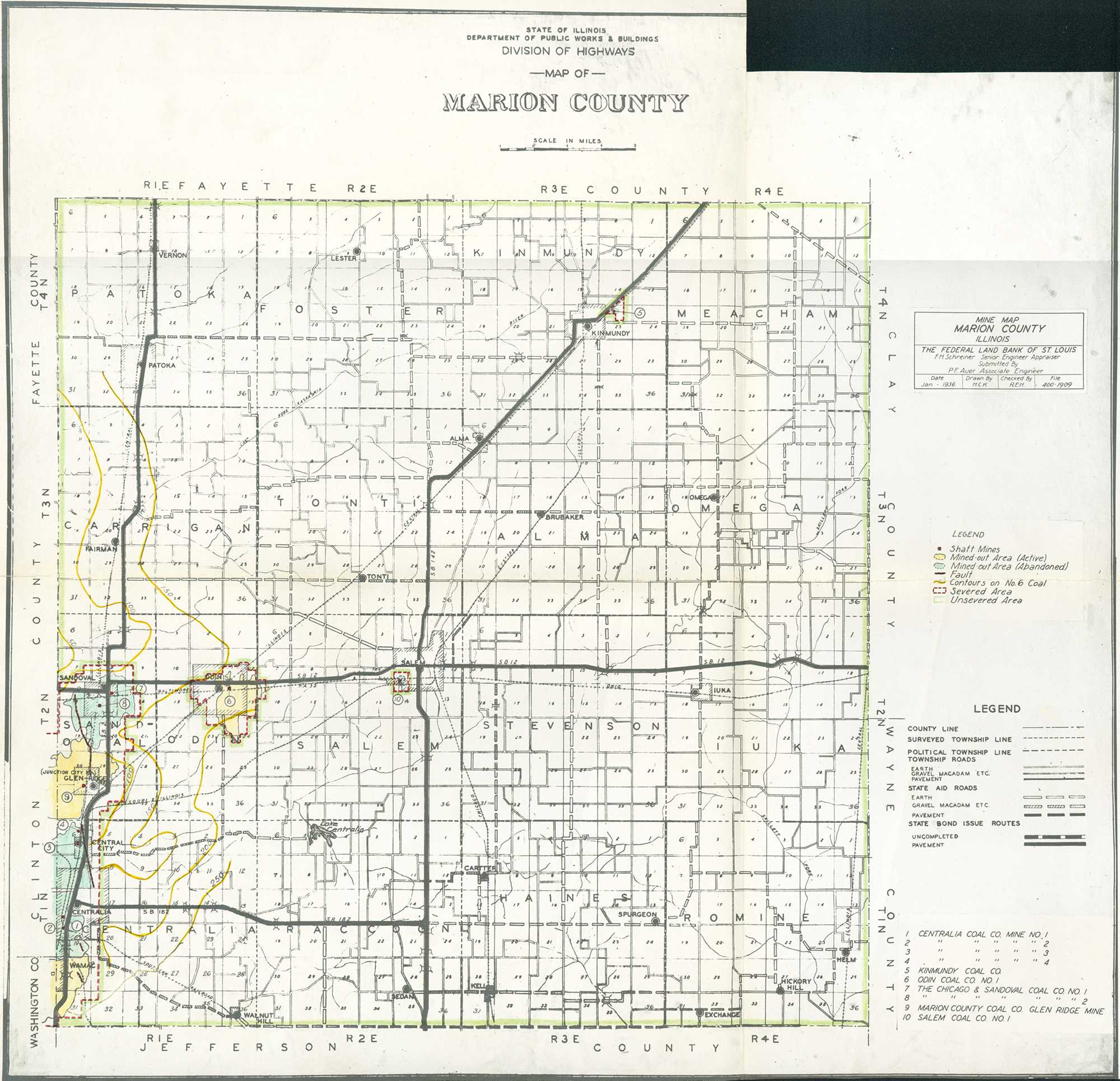
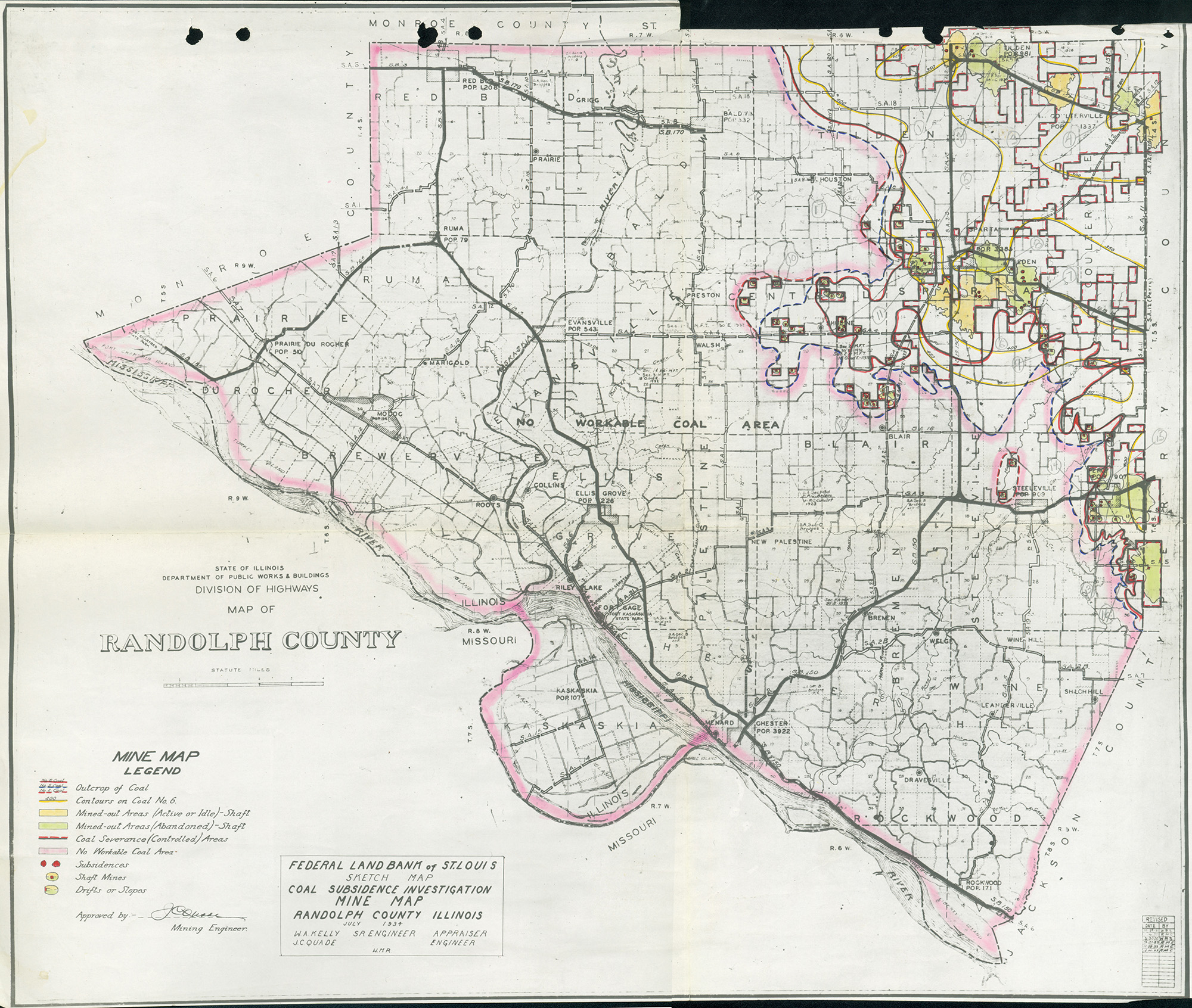
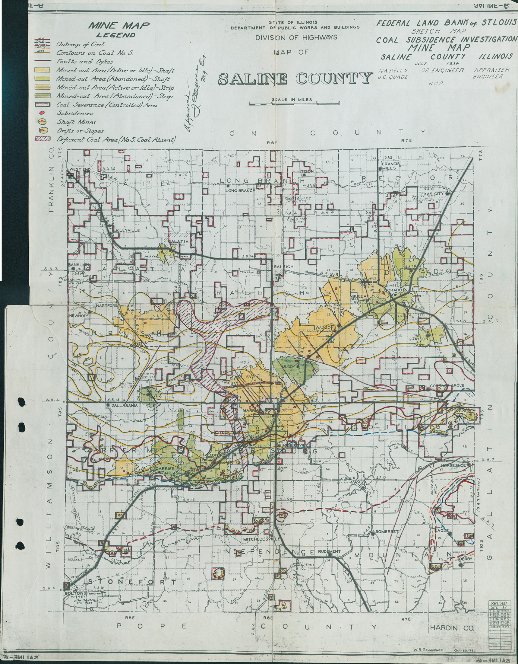
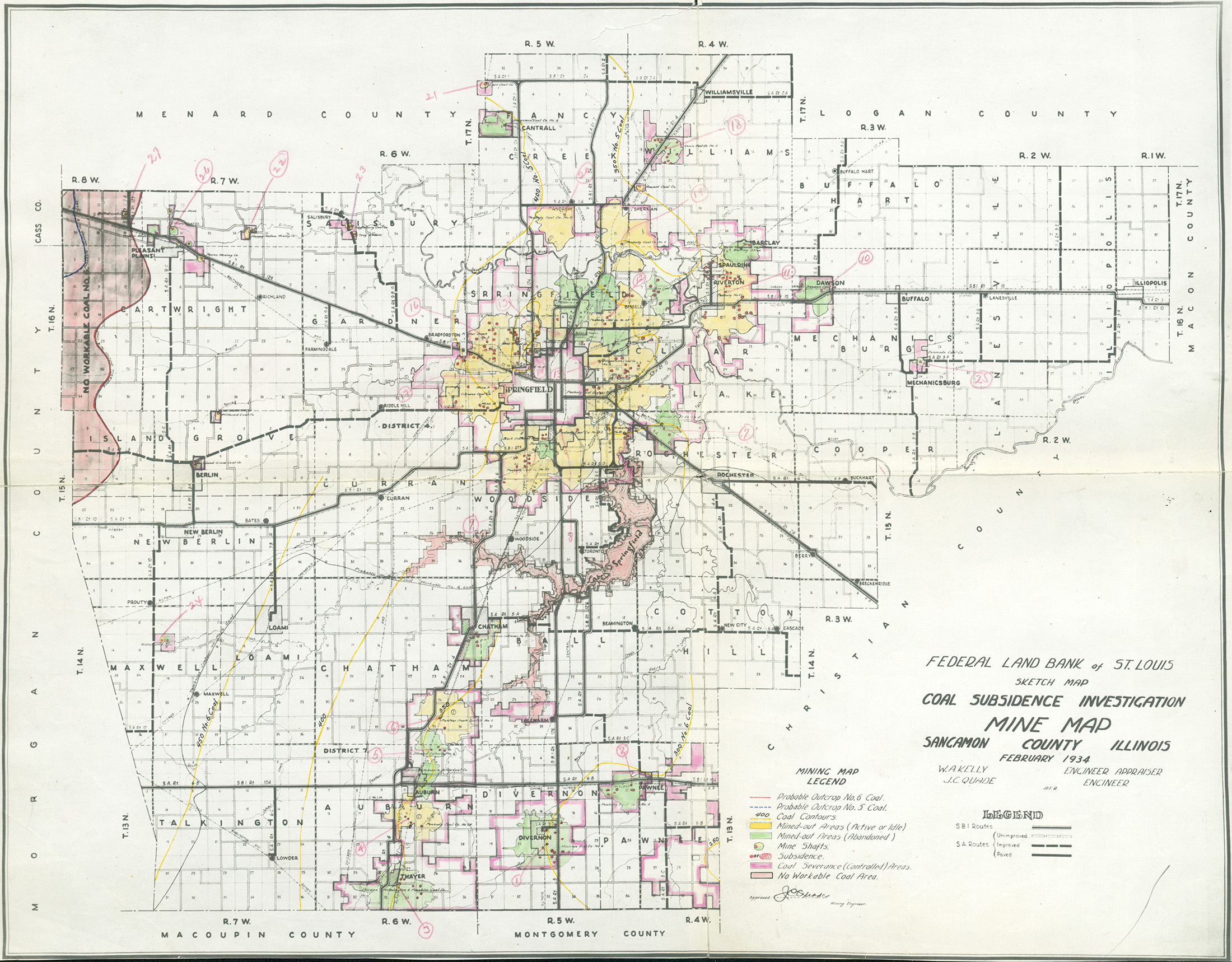
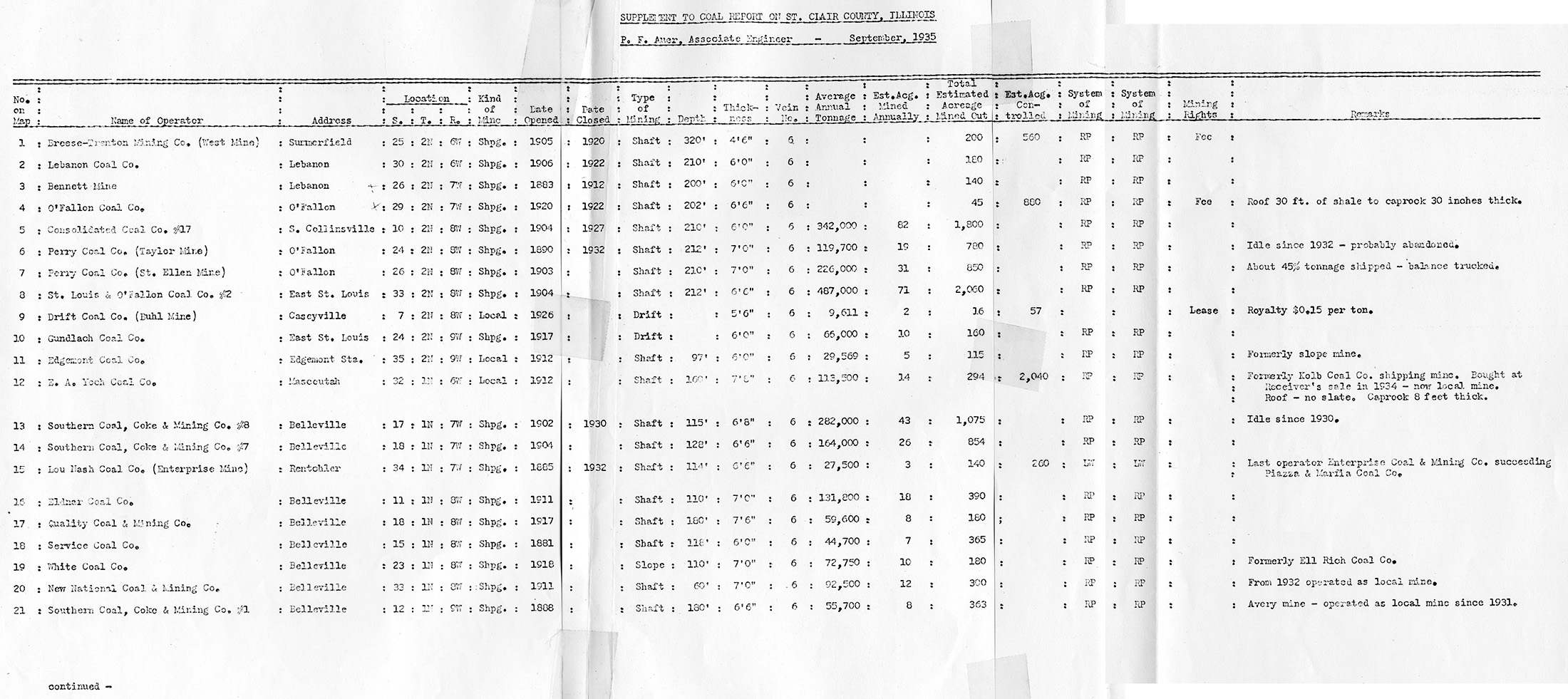
These maps were constructed as part of the nationwide Works Projects Administration (WPA), generally between 1934 and 1937 with some later updates or revisions,
Disclaimer
Maps for some locations might have multiple versions/seams, please inspected these areas closely for differences.
Notes and corrections were made by ISGS staff.
These maps are reproductions from microfilm, they may be of poor quality with text difficult to read.
Maps
Use the search box below to filter the list below, by county name or Township-Range (use T##N/S-R##E/W format i.e. T4N-R4W)
The export tab just exports the queried list not the actual images, click the image or link (on the left) to download.


