Federal Land Bank of St. Louis, Preliminary Reports on Subsidence Investigations
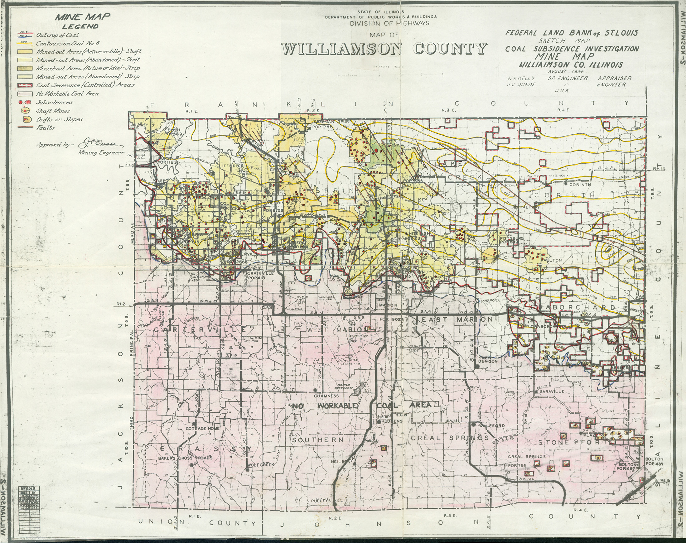
Mining engineers working for the Federal Land Bank of St. Louis mapped areas of subsidence due to coal mining in the early 1930s. These reports often include county maps of mine properties with mined-out areas including shaft locations, as well as subsidence areas.
Disclaimer
Maps for some locations might have multiple versions/seams, please inspected these areas closely for differences.
These maps are accompanied by a report, please download and inspect this document.
Notes and corrections were made by ISGS staff.
These maps are reproductions from microfilm, they may be of poor quality with text difficult to read.
Maps
Use the search box below to filter the list below, by county name or Township-Range (use T##N/S-R##E/W format i.e. T4N-R4W)
The export tab just exports the queried list not the actual images, click the image or link (on the left) to download.
| | Map ID | County name | Township-Range | Image Download | Quade Report |
|---|
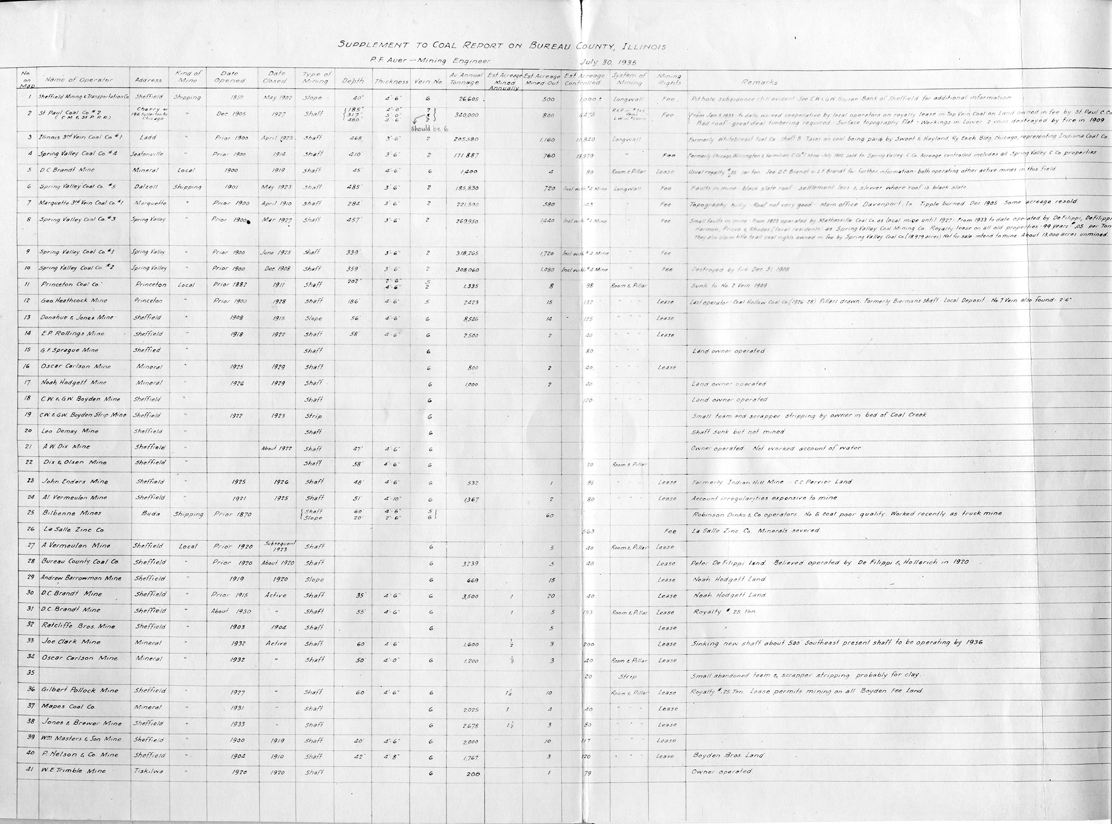
 | Bureau, Quade - Table | Bureau | | QUADE BUREAU TABLE.jpg | https://wikiimage.isgs.illinois.edu/ilmines/quade/reports/quade_report_bureau.pdf |
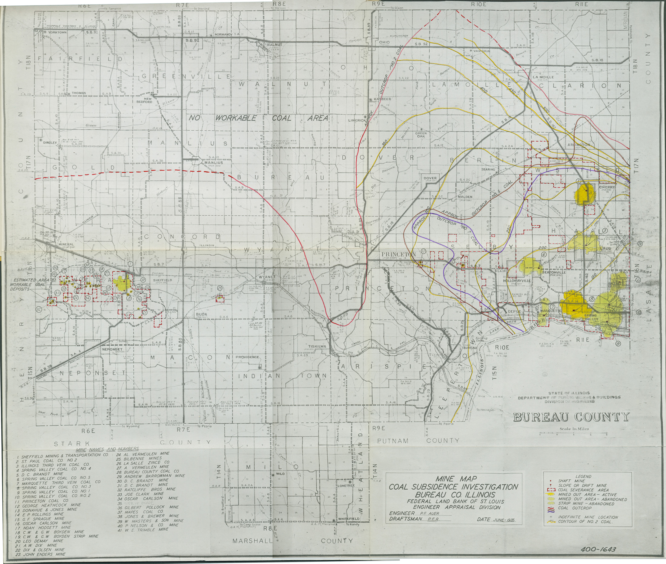
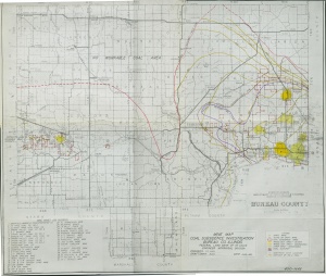 | Bureau, Quade - map | Bureau | | QUADE BUREAU.jpg | https://wikiimage.isgs.illinois.edu/ilmines/quade/reports/quade_report_bureau.pdf |
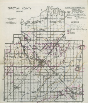
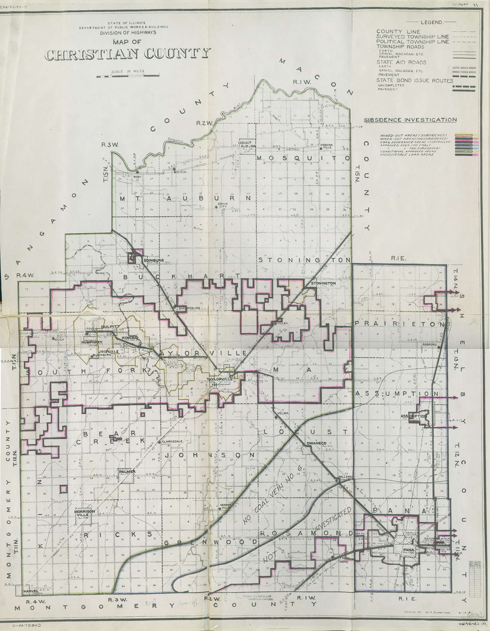
 | Christian, Quade - Map | Christian | | QUADE CHRISTIAN MINE MAP.jpg | https://wikiimage.isgs.illinois.edu/ilmines/quade/reports/quade_report_christian.pdf |
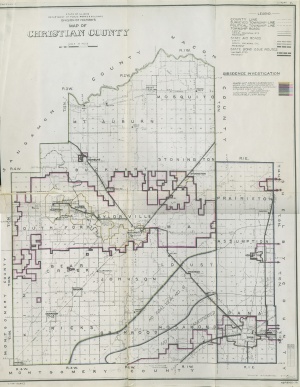
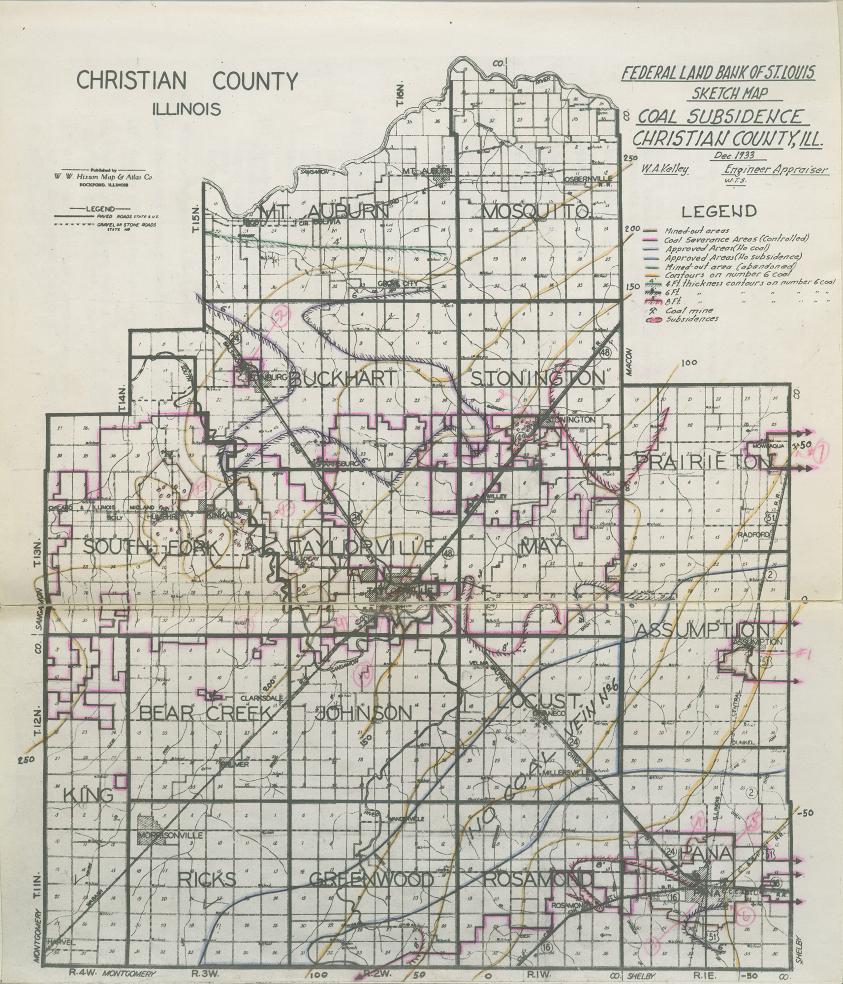
 | Christian, Quade - Sketch Map | Christian | | QUADE CHRISTIAN SKETCH MAP.jpg | https://wikiimage.isgs.illinois.edu/ilmines/quade/reports/quade_report_christian.pdf |
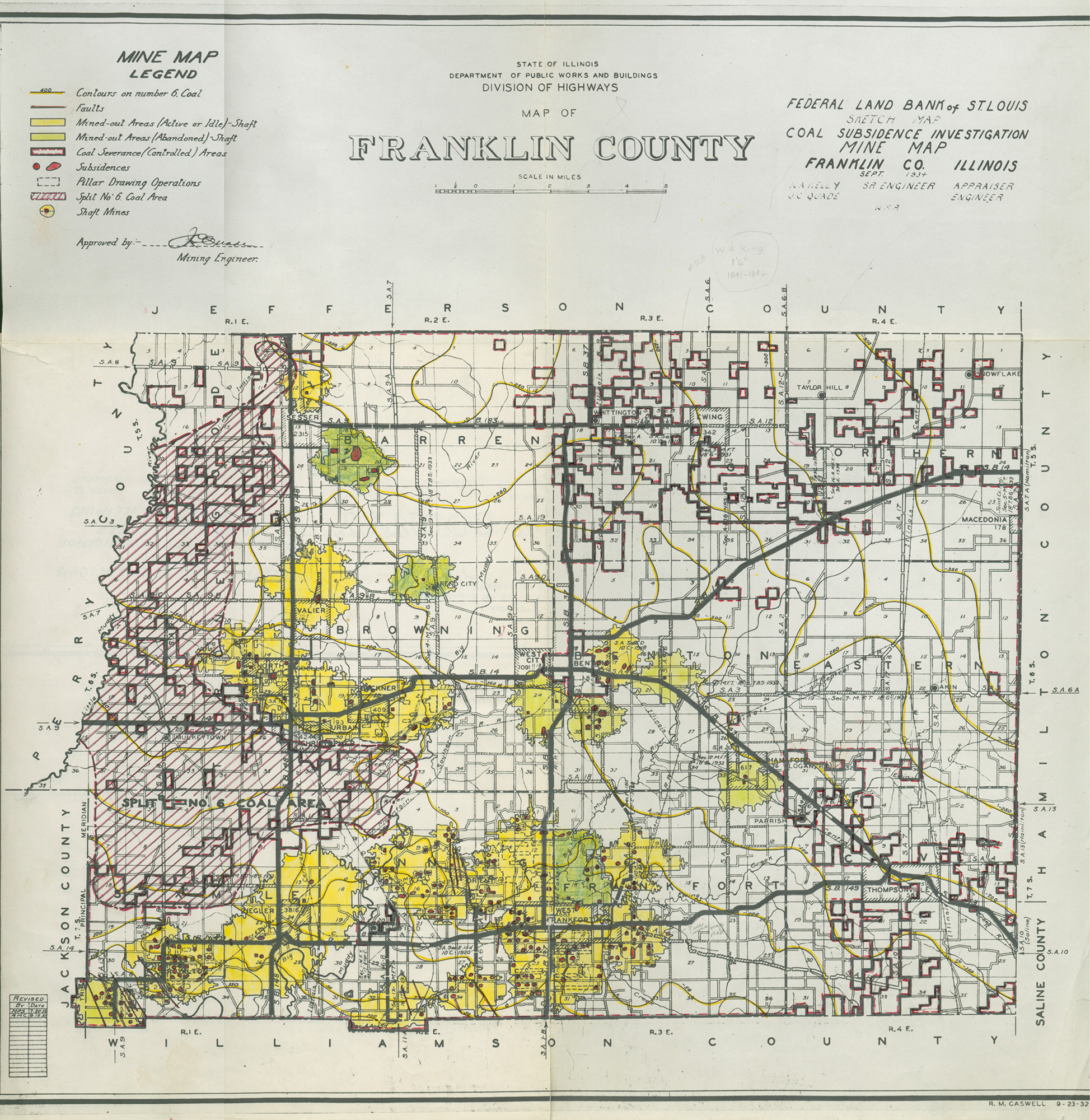
 | Franklin, Quade | Franklin | | QUADE FRANKLIN.jpg | https://wikiimage.isgs.illinois.edu/ilmines/quade/reports/quade_report_franklin.pdf |
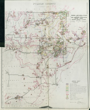 | Fulton, Quade | Fulton | | QUADE FULTON.jpg | https://wikiimage.isgs.illinois.edu/ilmines/quade/reports/quade_report_fulton.pdf |
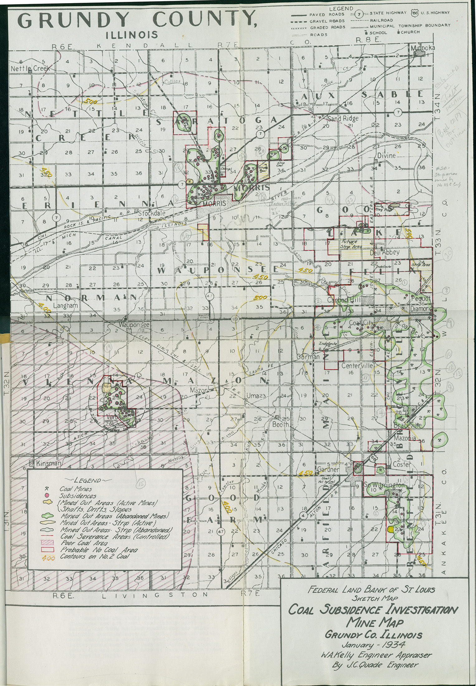
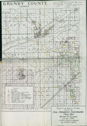 | Grundy, Quade | Grundy | | QUADE GRUNDY.jpg | https://wikiimage.isgs.illinois.edu/ilmines/quade/reports/quade_report_grundy.pdf |
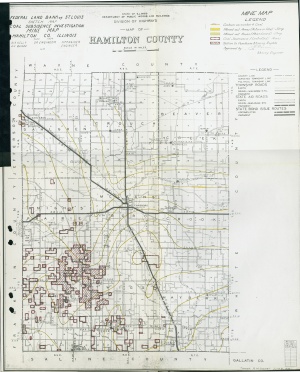 | Hamilton, Quade | Hamilton | | QUADE HAMILTON.jpg | https://wikiimage.isgs.illinois.edu/ilmines/quade/reports/quade_report_hamilton.pdf |
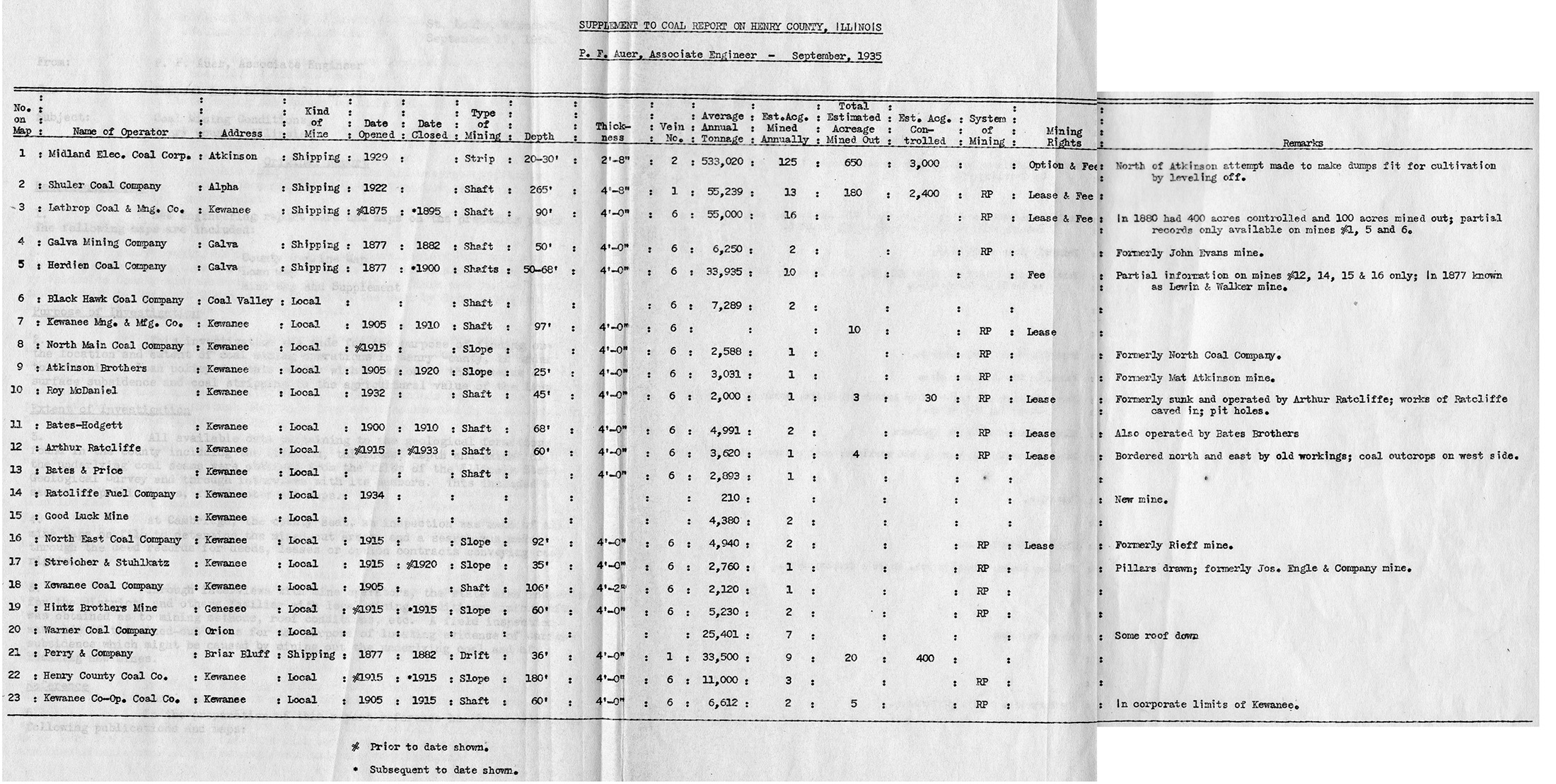
 | Henry, Quade - Table | Henry | | QUADE HENRY TABLE.jpg | https://wikiimage.isgs.illinois.edu/ilmines/quade/reports/quade_report_henry.pdf |
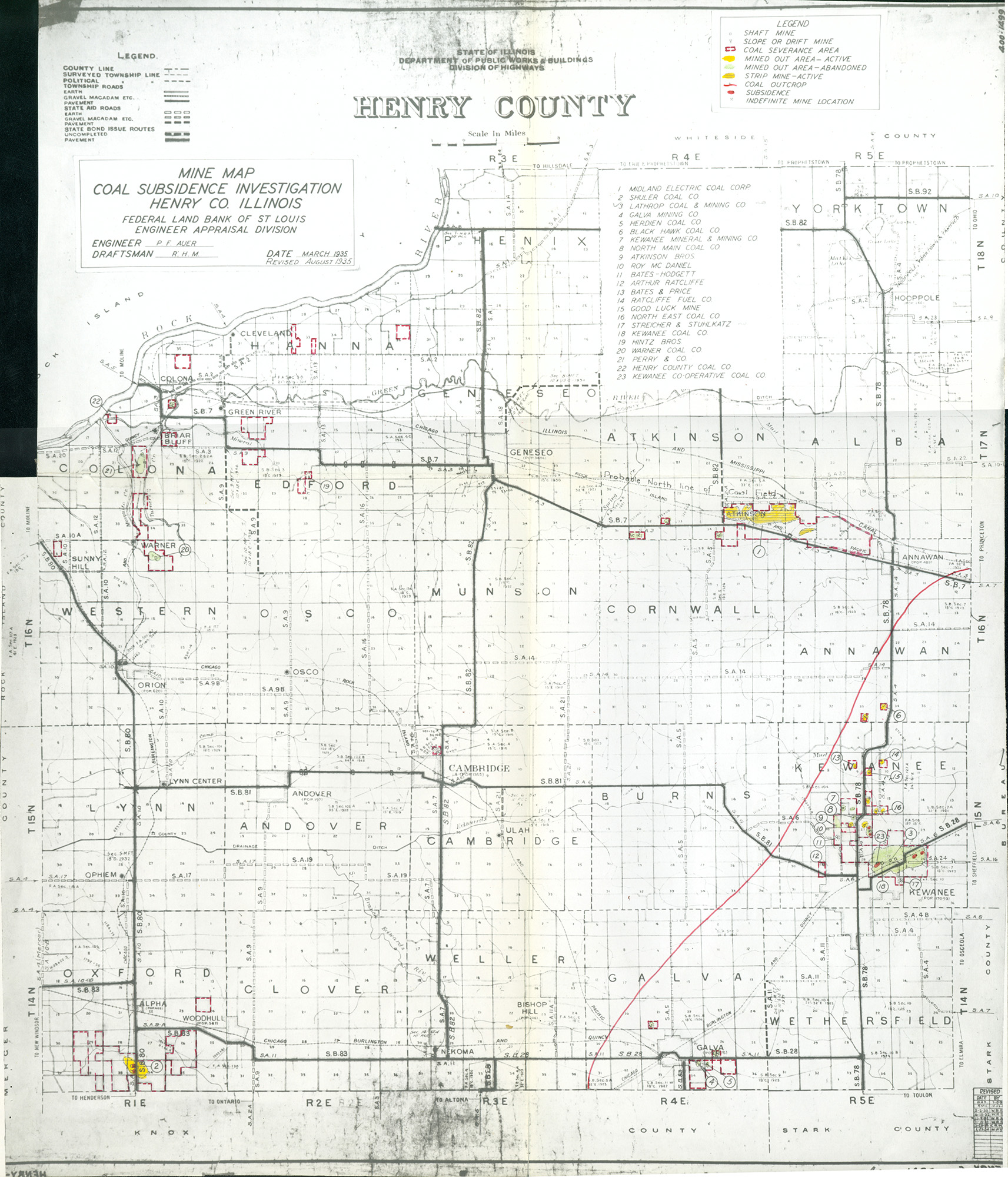
 | Henry, Quade | Henry | | QUADE HENRY.jpg | https://wikiimage.isgs.illinois.edu/ilmines/quade/reports/quade_report_henry.pdf |
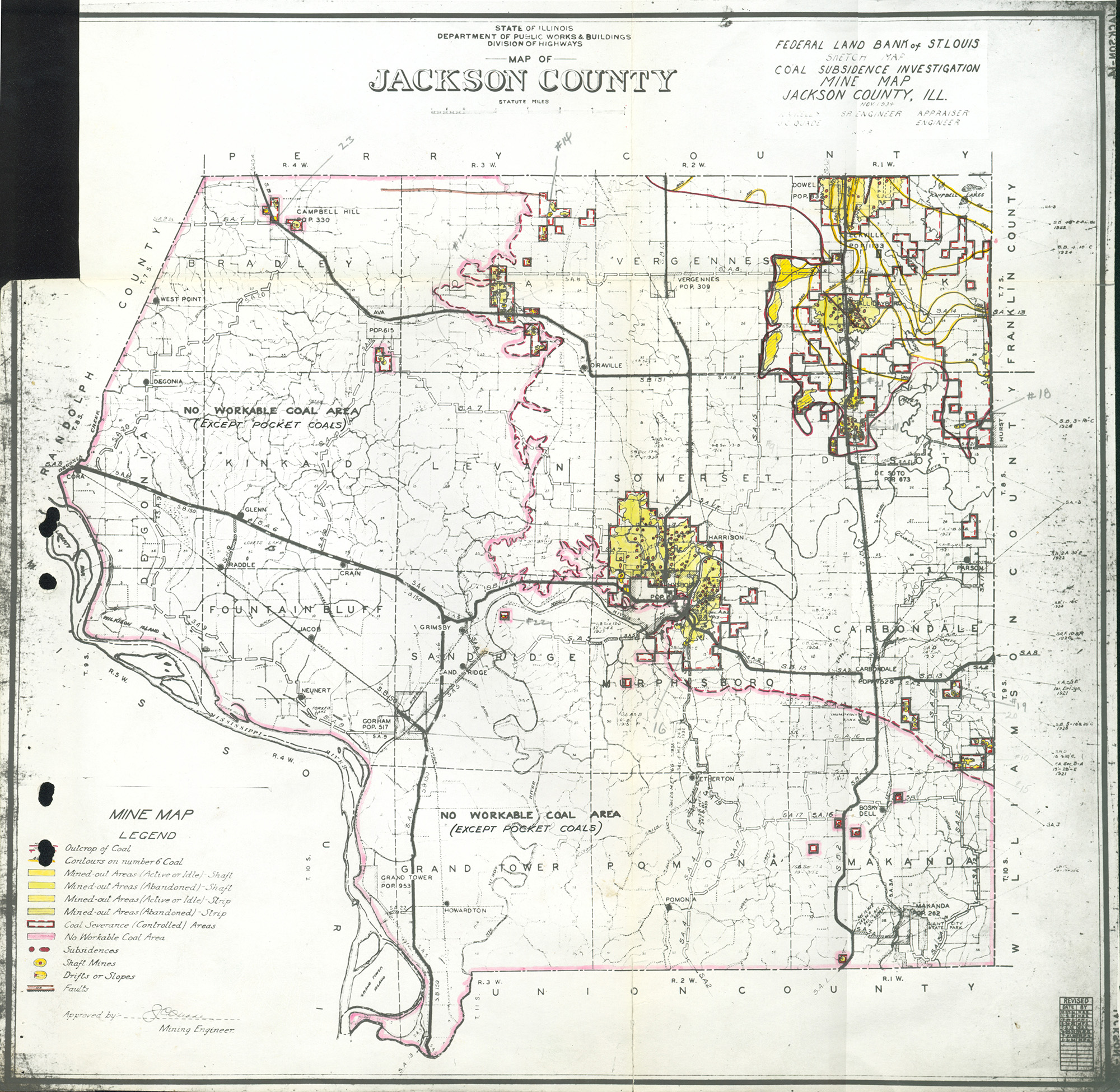
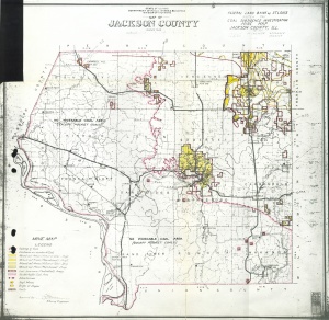 | Jackson, Quade | Jackson | | QUADE JACKSON.jpg | https://wikiimage.isgs.illinois.edu/ilmines/quade/reports/quade_report_jackson.pdf |
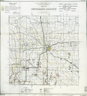
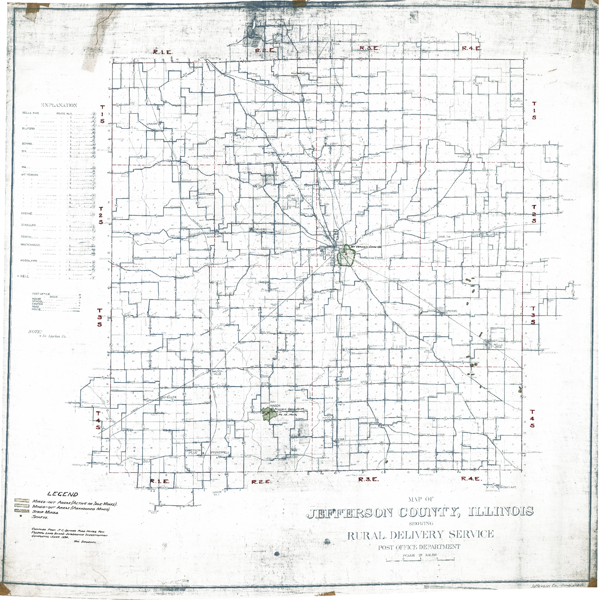
 | Jeffersion, Quade - Version 2 | Jefferson | | QUADE JEFFERSON COUNTY QUADE.jpg | https://wikiimage.isgs.illinois.edu/ilmines/quade/reports/quade_report_jefferson.pdf |
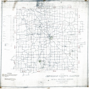
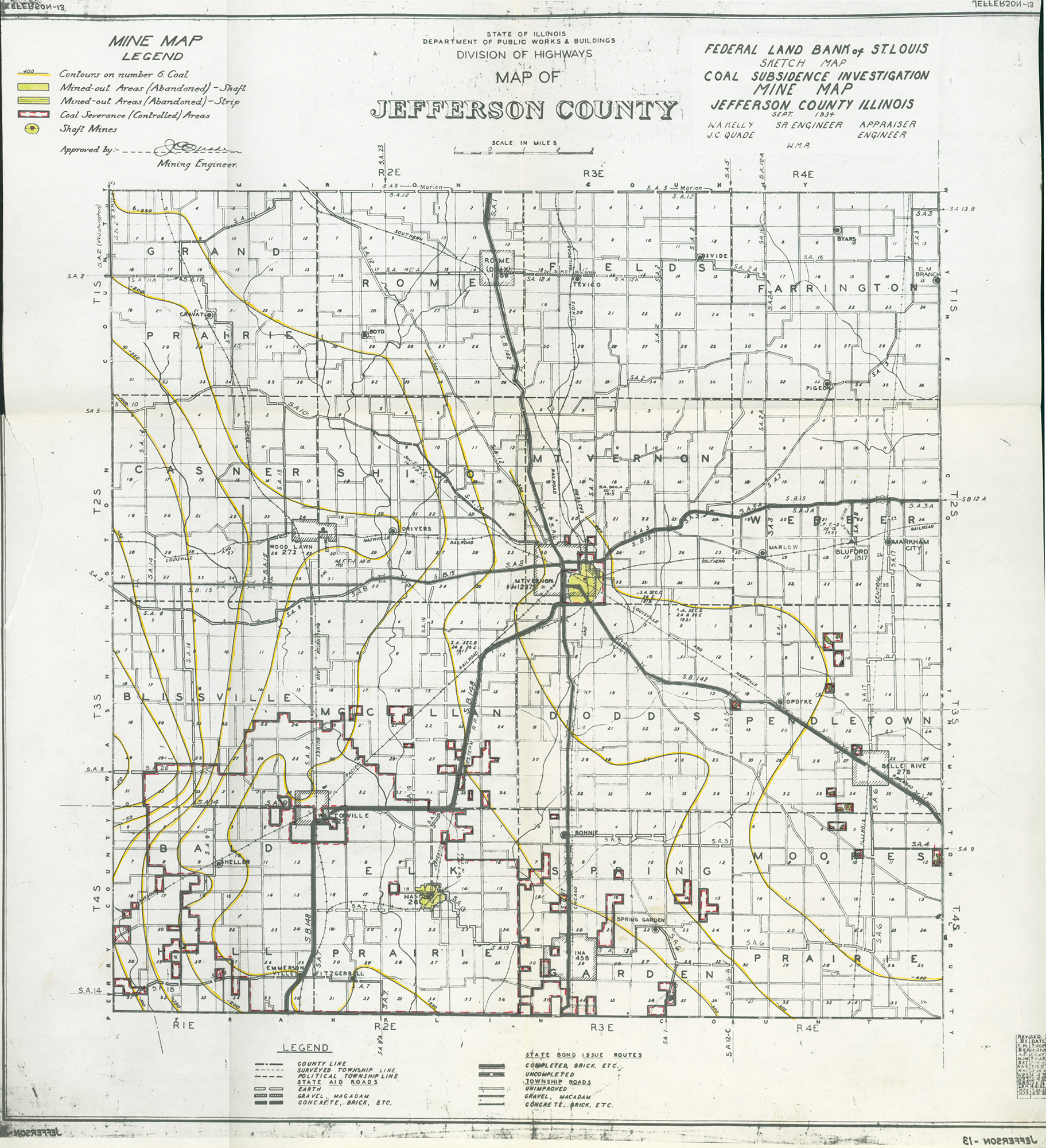
 | Jefferson, Quad - Version 1 | Jefferson | | QUADE JEFFERSON.jpg | https://wikiimage.isgs.illinois.edu/ilmines/quade/reports/quade_report_jefferson.pdf |
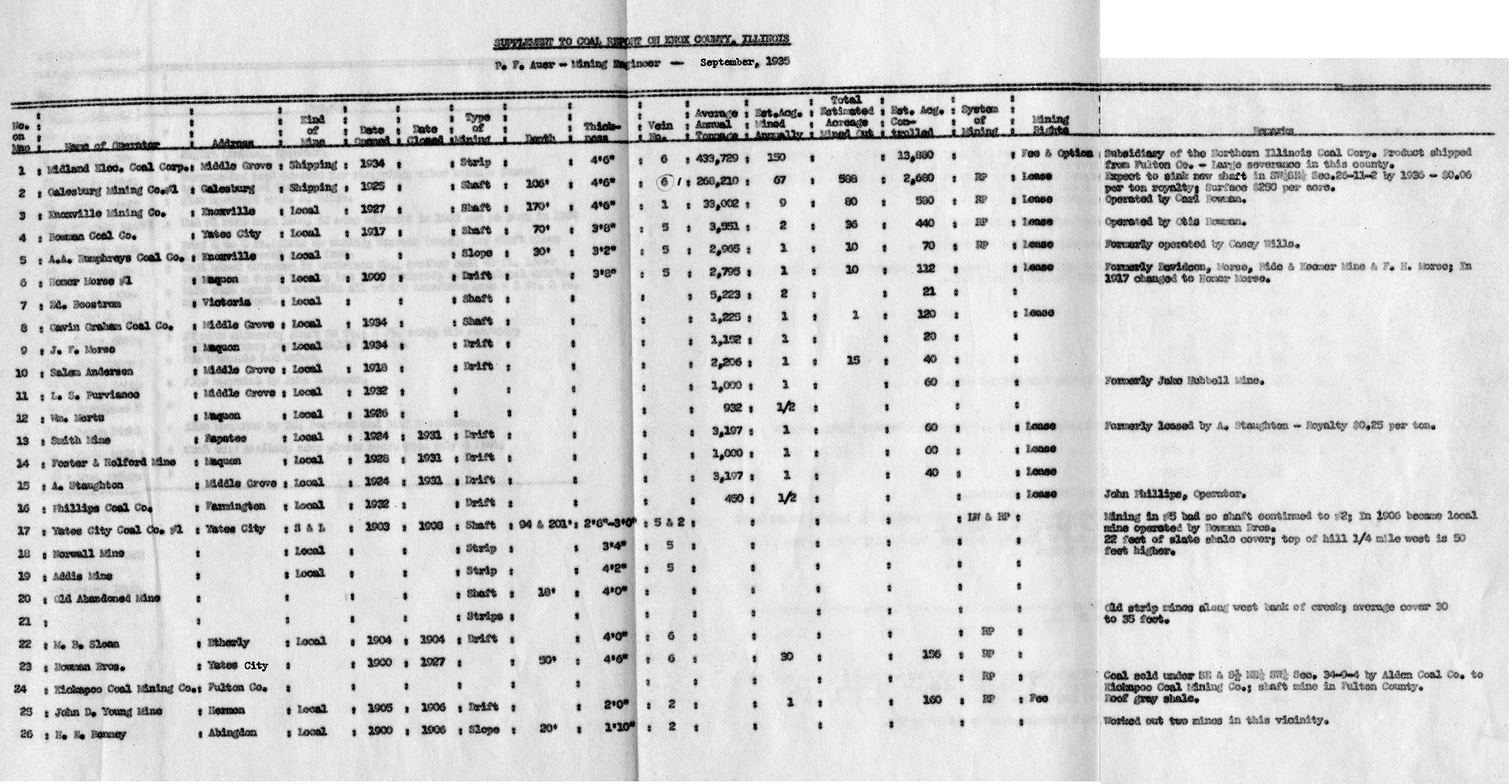
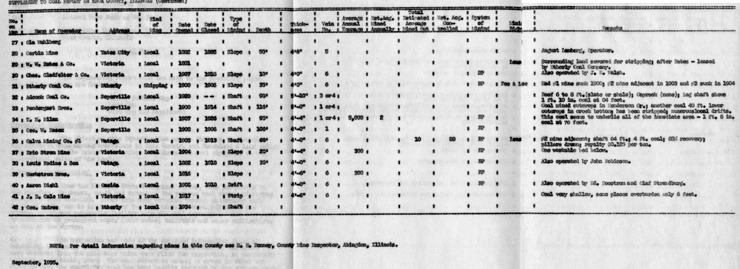
 | Knox, Quade - Table 1 | Knox | | QUADE KNOX TABLE1.jpg | https://wikiimage.isgs.illinois.edu/ilmines/quade/reports/quade_report_knox.pdf |
 | Knox, Quade - Table 2 | Knox | | QUADE KNOX TABLE2.jpg | https://wikiimage.isgs.illinois.edu/ilmines/quade/reports/quade_report_knox.pdf |
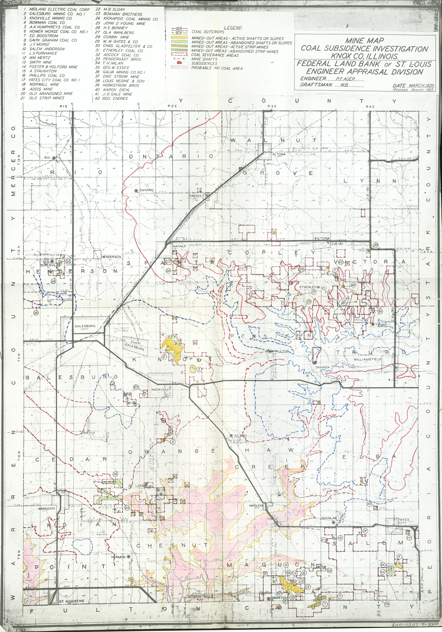
 | Knox, Quade - Map | Knox | | QUADE KNOX.jpg | https://wikiimage.isgs.illinois.edu/ilmines/quade/reports/quade_report_knox.pdf |
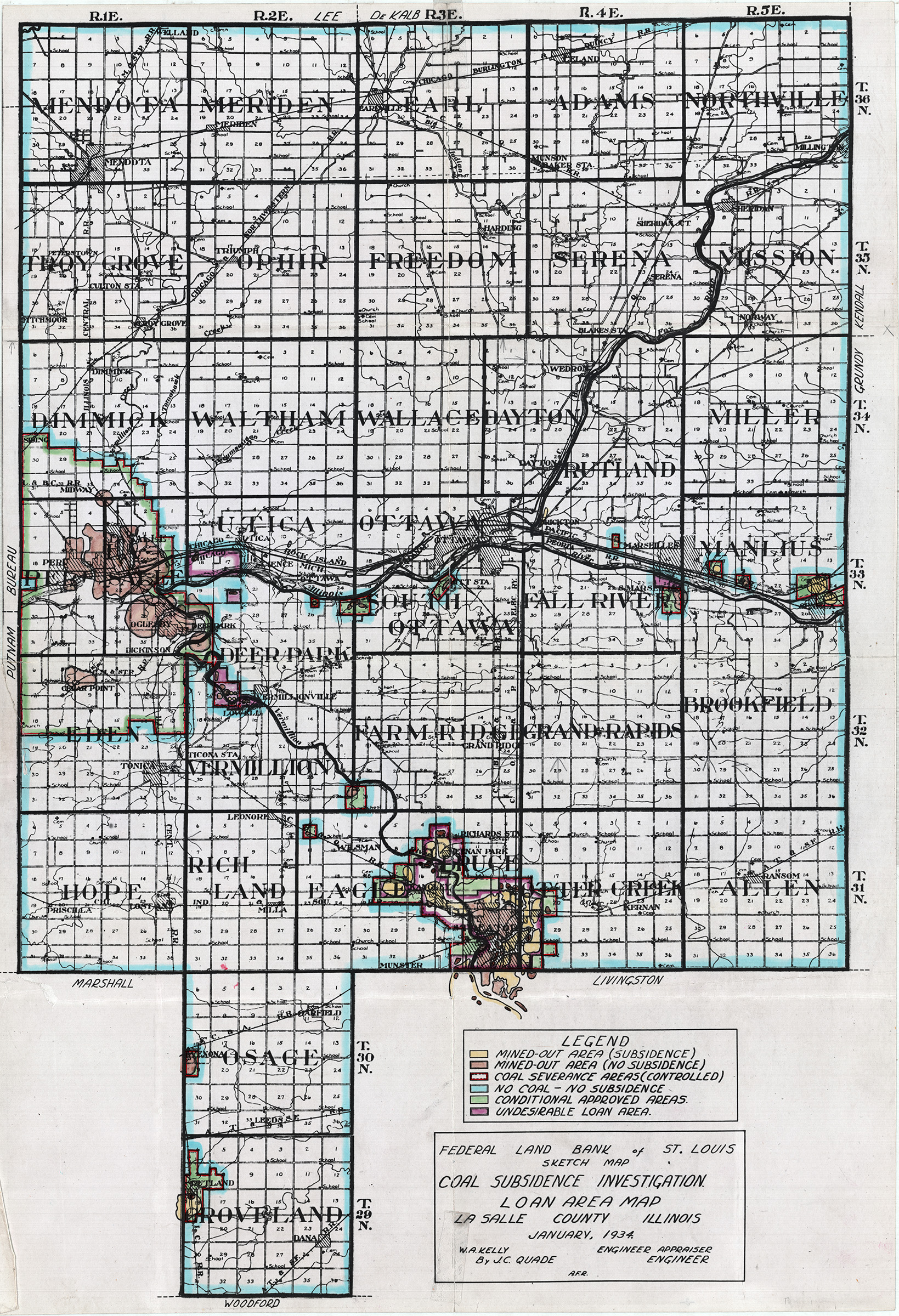
 | LaSalle, Quad - January 1934 Version 2 | La Salle | | QUADE LASALLE QUADE JAN 1934 V2.jpg | https://wikiimage.isgs.illinois.edu/ilmines/quade/reports/quade_report_lasalle_revised.pdf
https://wikiimage.isgs.illinois.edu/ilmines/quade/reports/quade_report_lasalle.pdf |
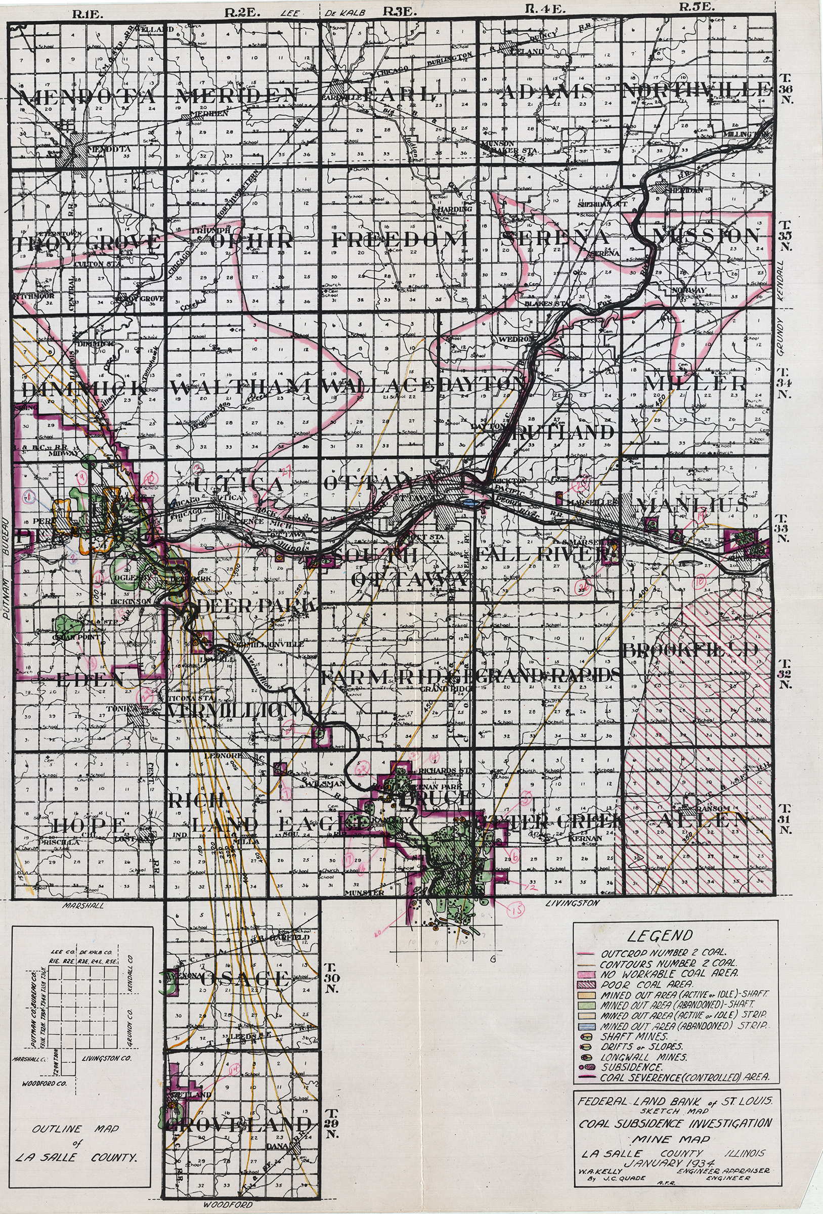
 | LaSalle, Quad - January 1934 | La Salle | | QUADE LASALLE QUADE JAN 1934.jpg | https://wikiimage.isgs.illinois.edu/ilmines/quade/reports/quade_report_lasalle_revised.pdf
https://wikiimage.isgs.illinois.edu/ilmines/quade/reports/quade_report_lasalle.pdf |
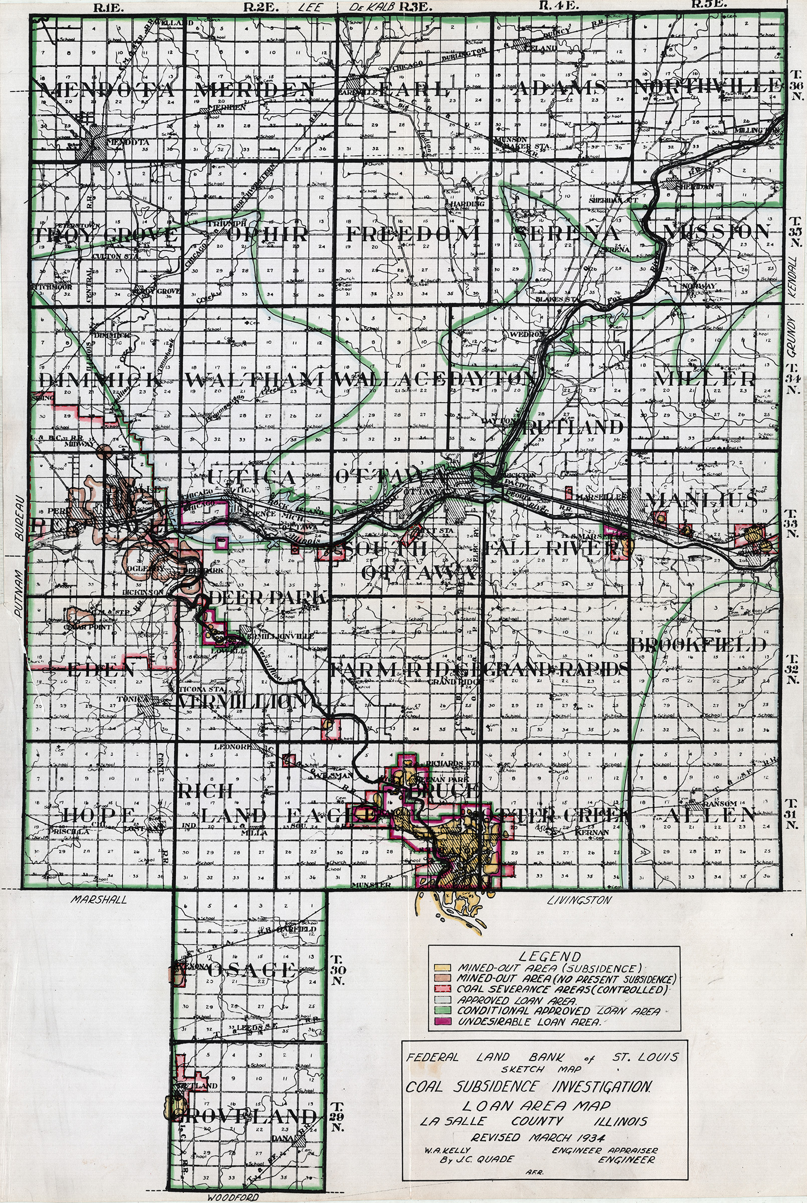
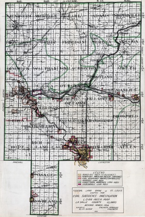 | LaSalle, Quad - Revised March 1934 | La Salle | | QUADE LASALLE QUADE REV MARCH 1934.jpg | https://wikiimage.isgs.illinois.edu/ilmines/quade/reports/quade_report_lasalle_revised.pdf
https://wikiimage.isgs.illinois.edu/ilmines/quade/reports/quade_report_lasalle.pdf |
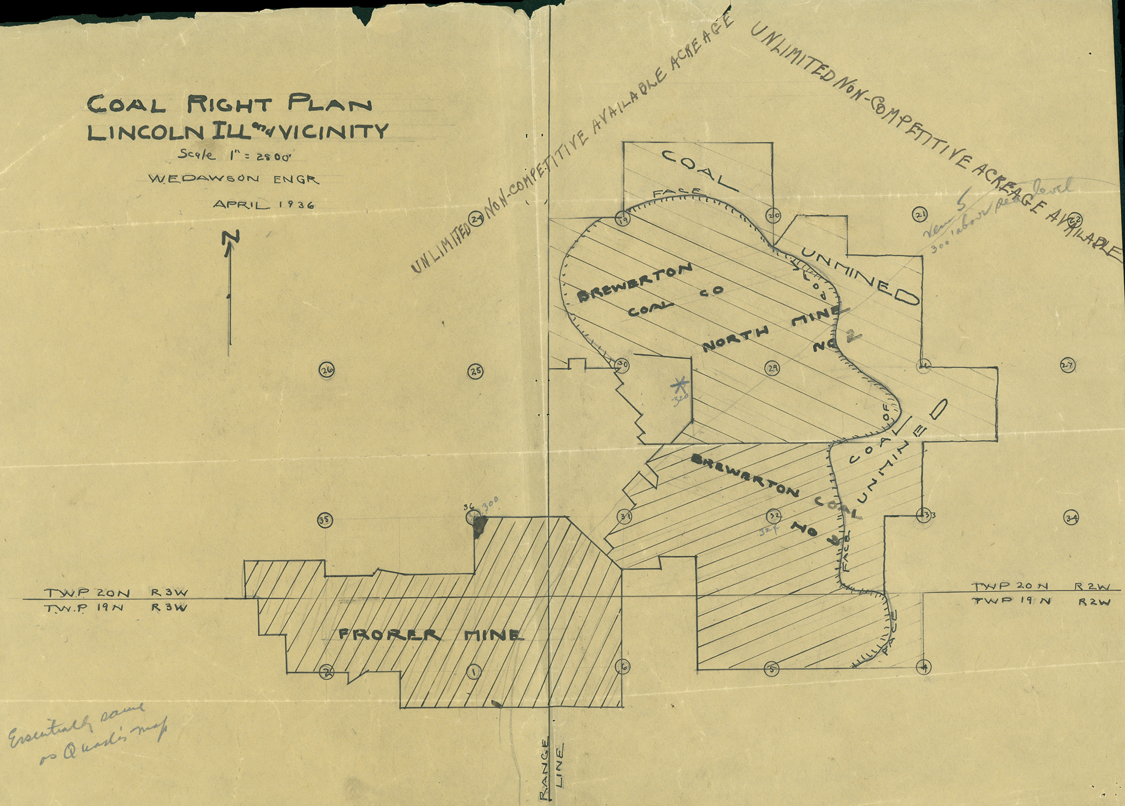
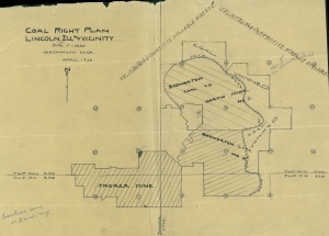 | Logan, Quade - Coal Right Plan Map | Logan | | QUADE LOGAN COAL RIGHT PLAN MAP.jpg | https://wikiimage.isgs.illinois.edu/ilmines/quade/reports/quade_report_logan.pdf |
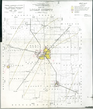 | Logan, Quade | Logan | | QUADE LOGAN MINE MAP.jpg | https://wikiimage.isgs.illinois.edu/ilmines/quade/reports/quade_report_logan.pdf |
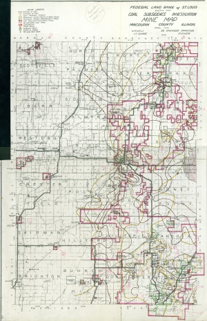 | Macoupin, Quade | Macoupin | | QUADE MACOUPIN.jpg | https://wikiimage.isgs.illinois.edu/ilmines/quade/reports/quade_report_macoupin.pdf |
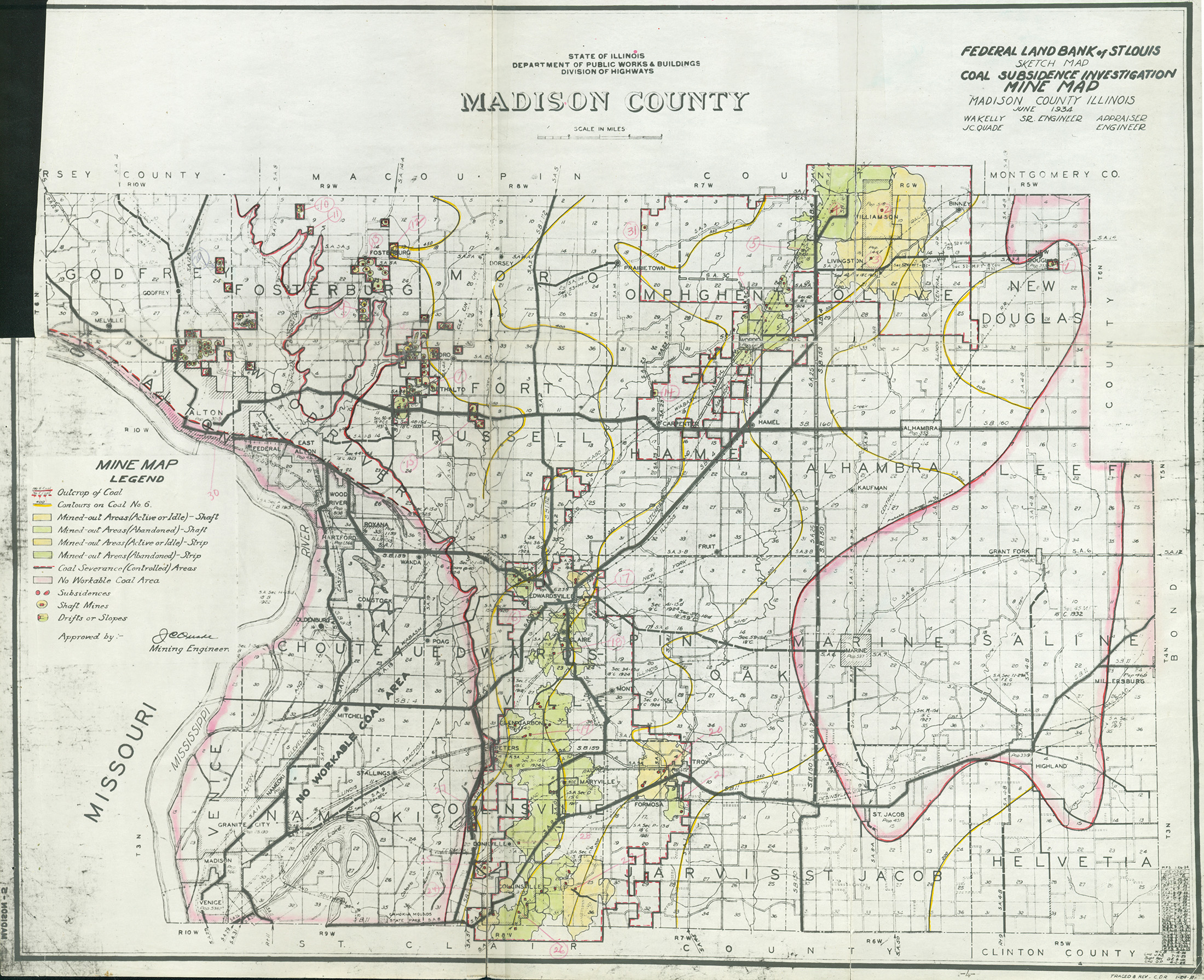
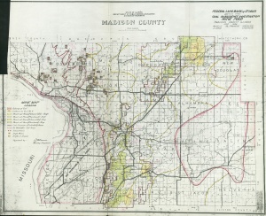 | Madison, Quade | Madison | | QUADE MADISON.jpg | https://wikiimage.isgs.illinois.edu/ilmines/quade/reports/quade_report_madison.pdf |
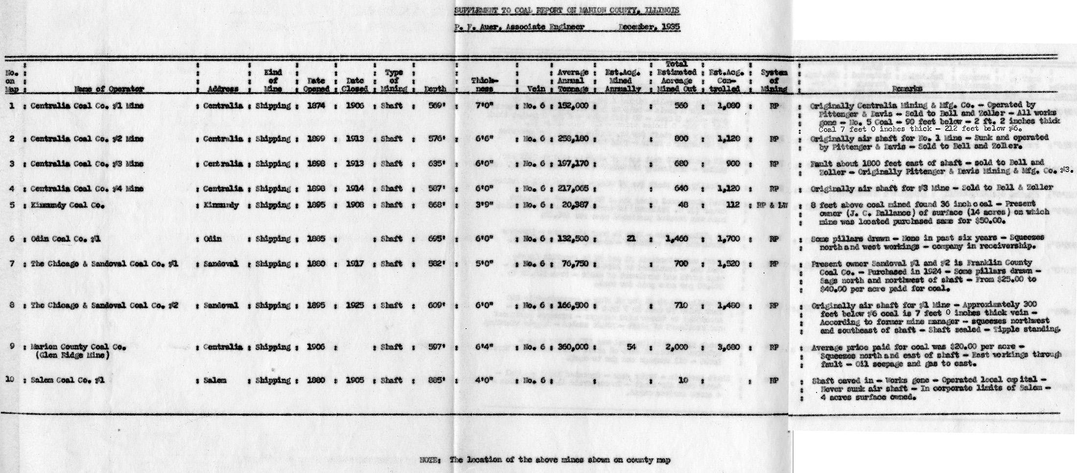
 | Marion, Quade - Table | Marion | | QUADE MARION TABLE.jpg | https://wikiimage.isgs.illinois.edu/ilmines/quade/reports/quade_report_marion.pdf |
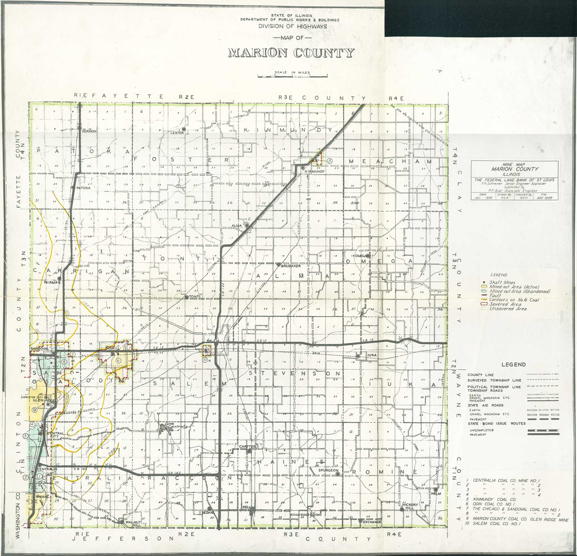
 | Marion, Quade | Marion | | QUADE MARION.jpg | https://wikiimage.isgs.illinois.edu/ilmines/quade/reports/quade_report_marion.pdf |
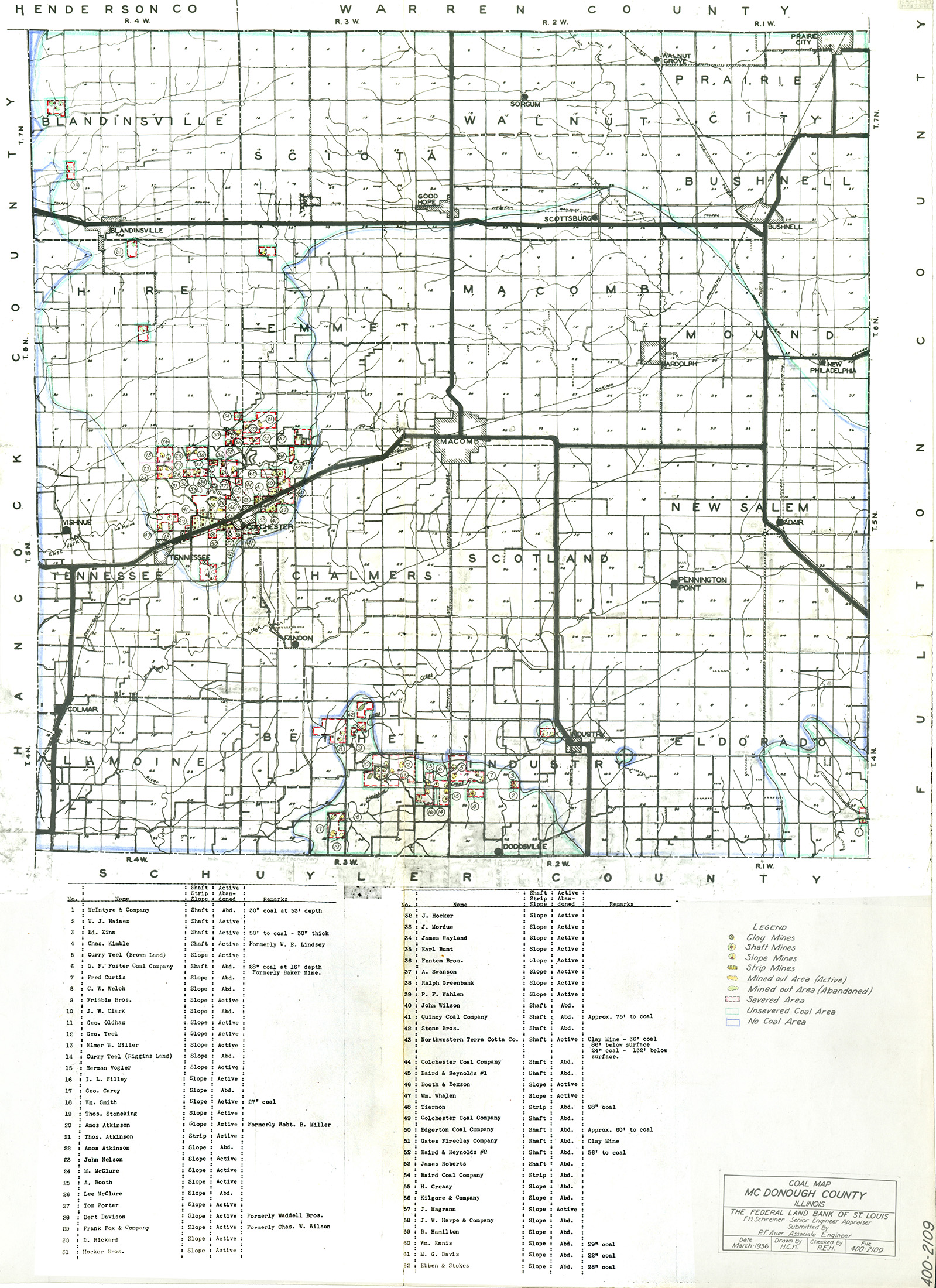
 | McDonough, Quade | McDonough | | QUADE MCDONOUGH.jpg | https://wikiimage.isgs.illinois.edu/ilmines/quade/reports/quade_report_mcdonough.pdf |
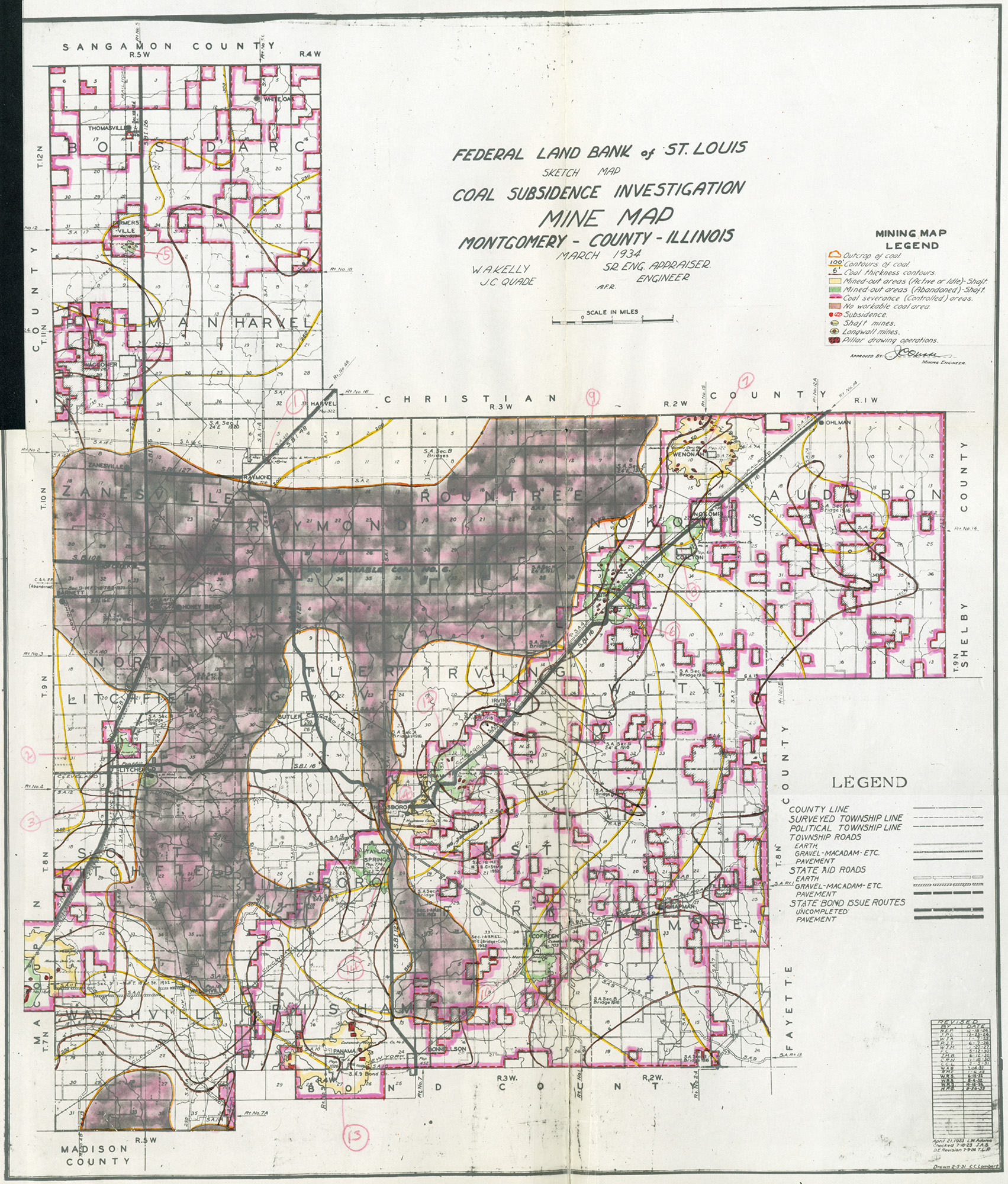
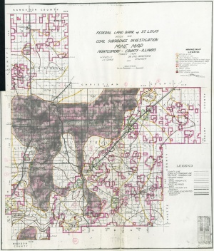 | Montgomery, Quade | Montgomery | | QUADE MONTGOMERY.jpg | https://wikiimage.isgs.illinois.edu/ilmines/quade/reports/quade_report_montgomery.pdf |
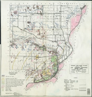 | Peoria, Quade | Peoria | | QUADE PEORIA.jpg | https://wikiimage.isgs.illinois.edu/ilmines/quade/reports/quade_report_peoria.pdf |
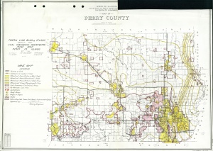 | Perry, Quade | Perry | | QUADE PERRY.jpg | https://wikiimage.isgs.illinois.edu/ilmines/quade/reports/quade_report_perry.pdf |
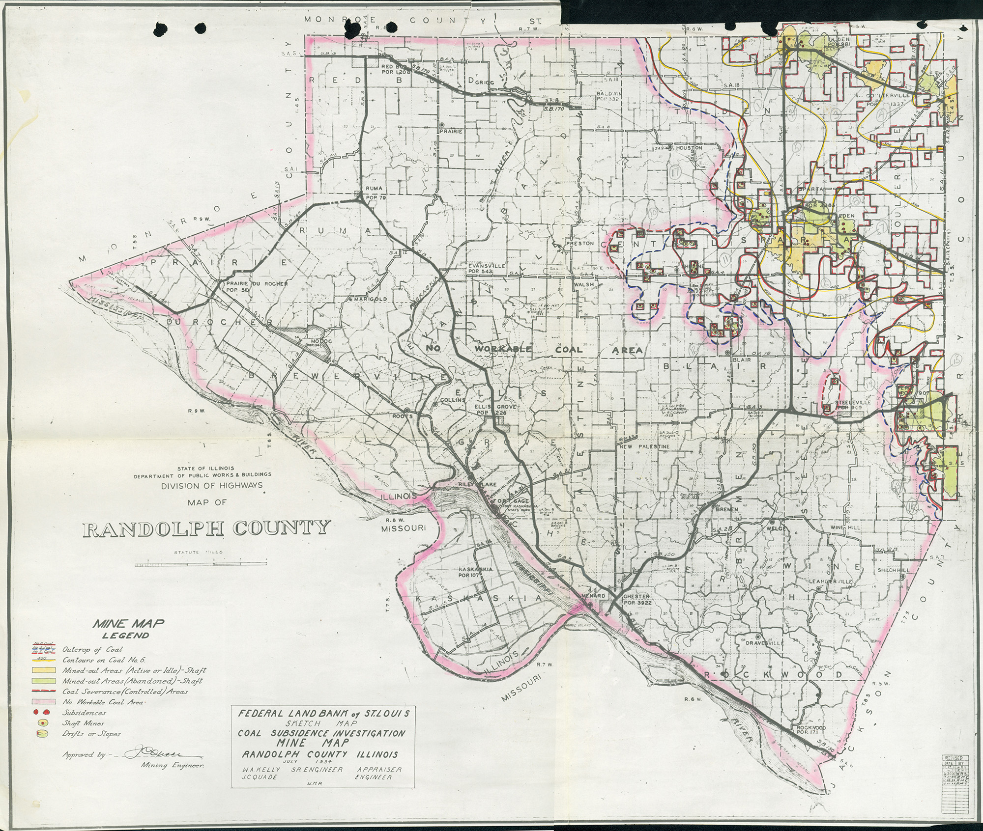
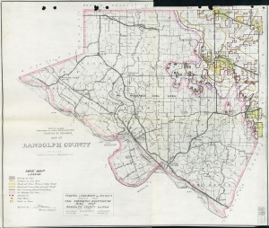 | Randolph, Quade | Randolph | | QUADE RANDOLPH.jpg | https://wikiimage.isgs.illinois.edu/ilmines/quade/reports/quade_report_randolph.pdf |
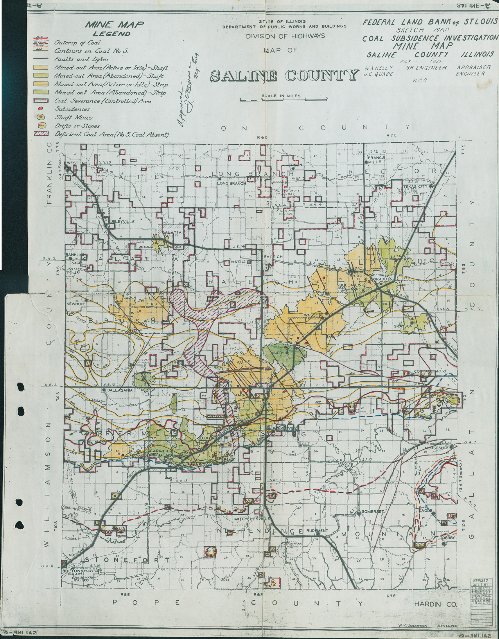
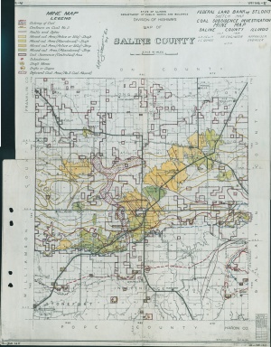 | Saline Quade | Saline | | QUADE SALINE.jpg | https://wikiimage.isgs.illinois.edu/ilmines/quade/reports/quade_report_saline.pdf |
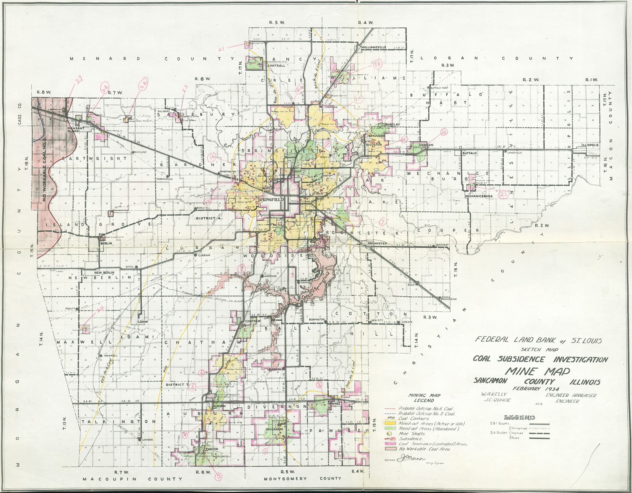
 | Sangamon, Quade | Sangamon | | QUADE SANGAMON.jpg | https://wikiimage.isgs.illinois.edu/ilmines/quade/reports/quade_report_sangamon.pdf |
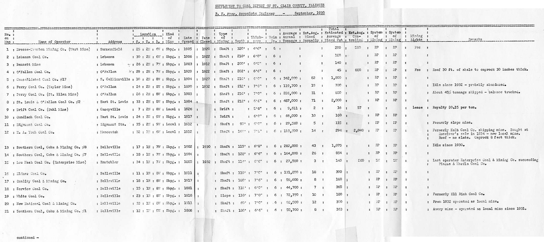
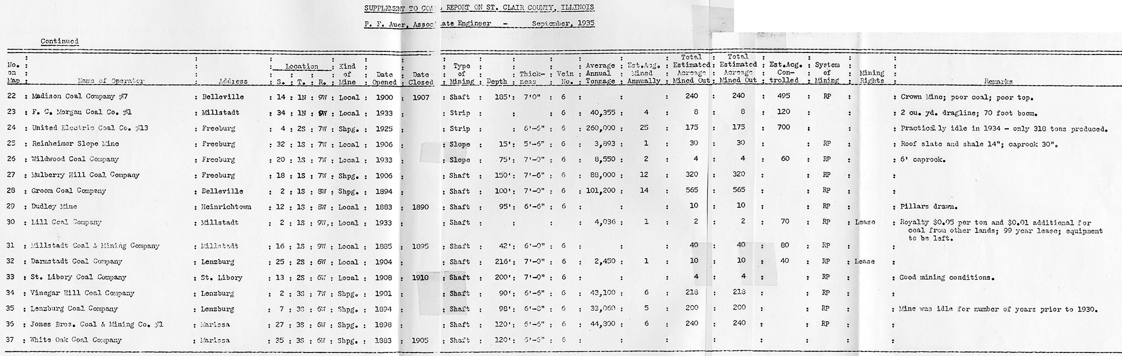
 | St. Clair, Quade - Table 1 | St. Clair | | QUADE ST CLAIR TABLE1.jpg | https://wikiimage.isgs.illinois.edu/ilmines/quade/reports/quade_report_stclair.pdf |
 | St. Clair, Quade - Table 2 | St. Clair | | QUADE ST CLAIR TABLE2.jpg | https://wikiimage.isgs.illinois.edu/ilmines/quade/reports/quade_report_stclair.pdf |
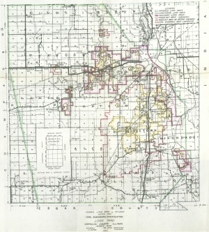
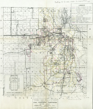
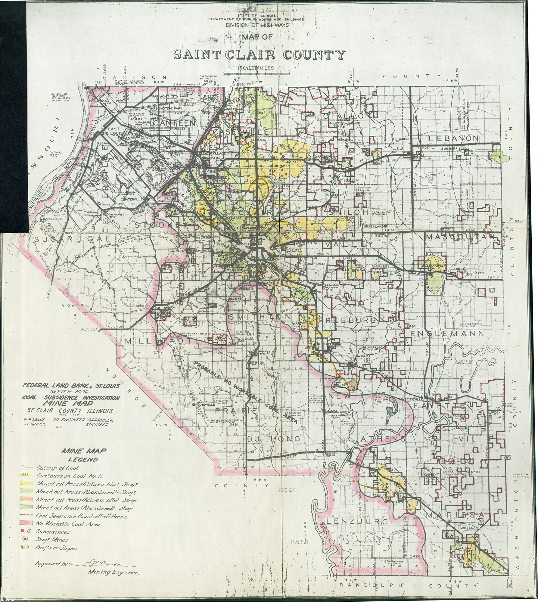
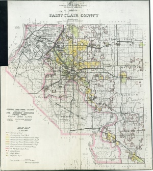 | St. Clair, Quade | St. Clair | | QUADE ST CLAIR.jpg | https://wikiimage.isgs.illinois.edu/ilmines/quade/reports/quade_report_stclair.pdf |
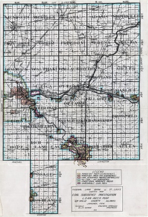
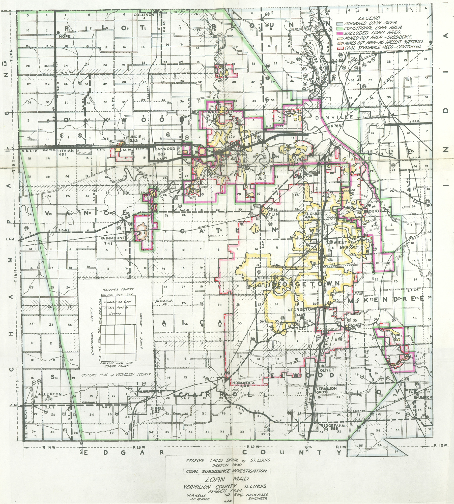
 | Vermilion, Quade - Loan Area Map | Vermilion | | QUADE VERMILION LOAN AREA MAP.jpg | https://wikiimage.isgs.illinois.edu/ilmines/quade/reports/quade_report_vermilion.pdf |
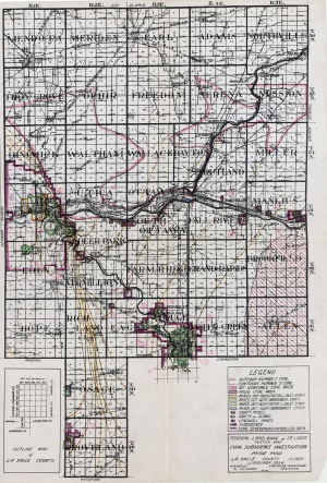
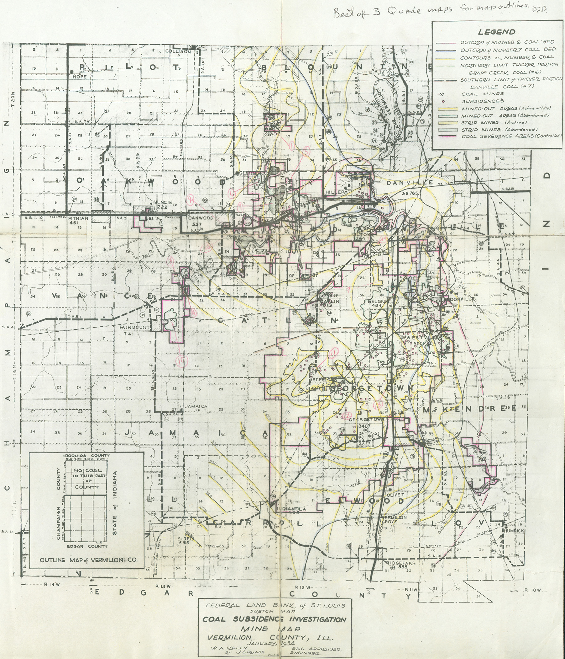
 | Vermilion, Quade | Vermilion | | QUADE VERMILION MINE MAP.jpg | https://wikiimage.isgs.illinois.edu/ilmines/quade/reports/quade_report_vermilion.pdf |
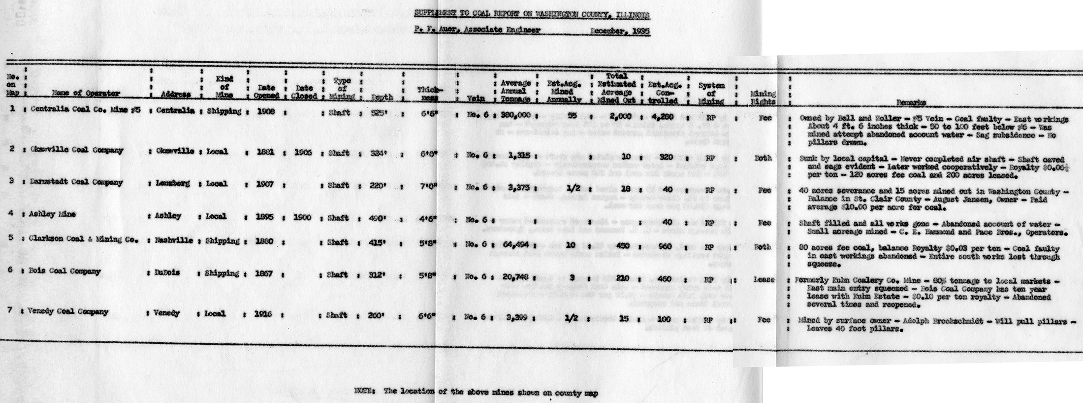
 | Washington, Quade - Table | Washington | | QUADE WASHINGTON TABLE.jpg | https://wikiimage.isgs.illinois.edu/ilmines/quade/reports/quade_report_washington.pdf |
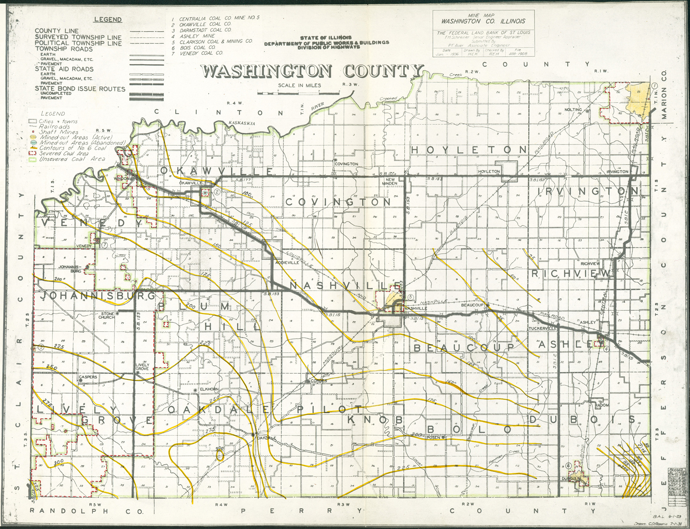
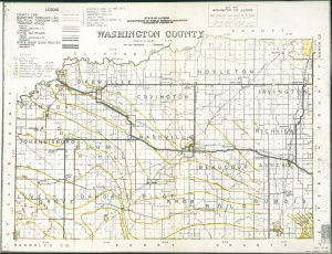 | Washington, Quade | Washington | | QUADE WASHINGTON.jpg | https://wikiimage.isgs.illinois.edu/ilmines/quade/reports/quade_report_washington.pdf |
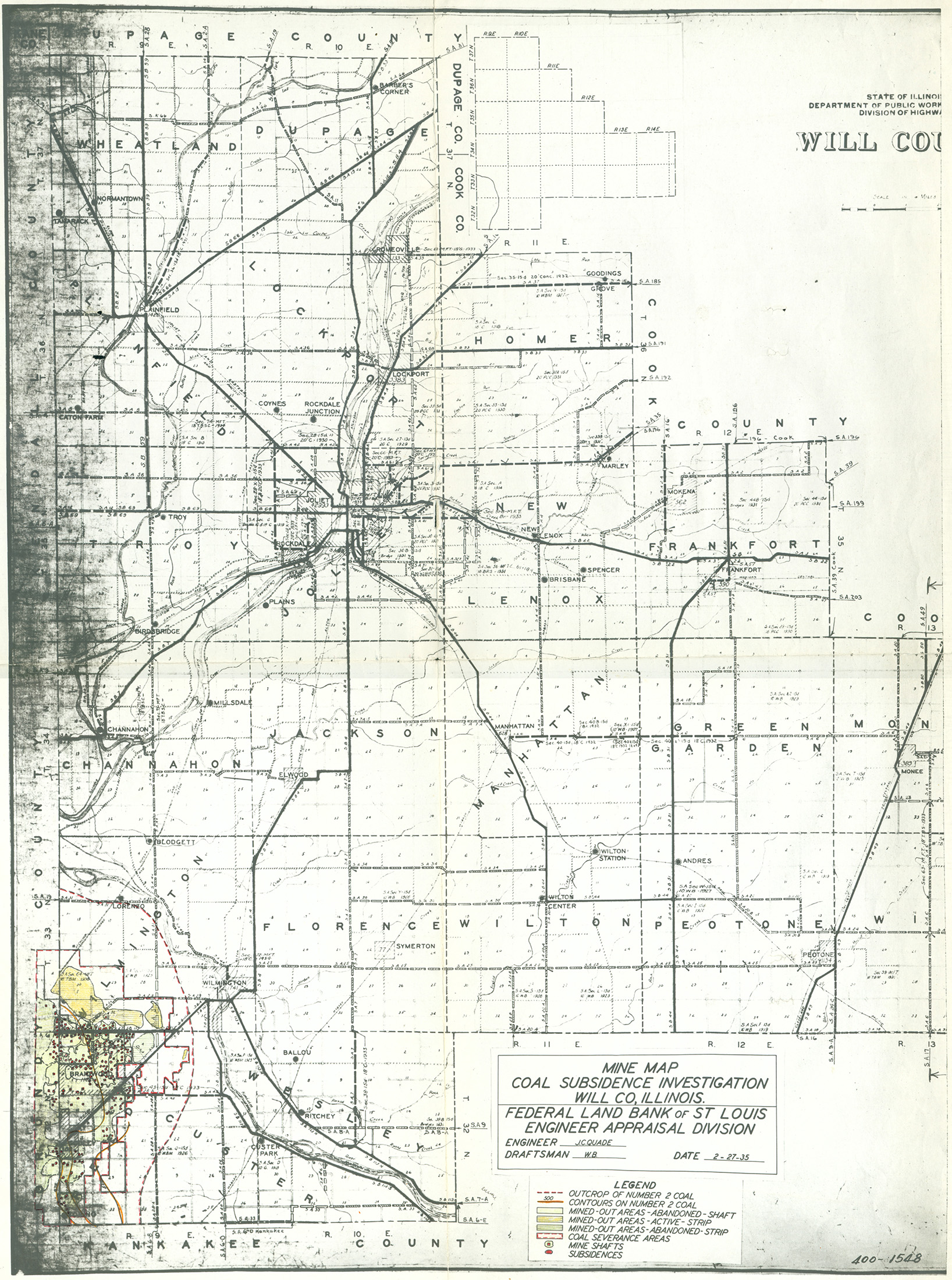
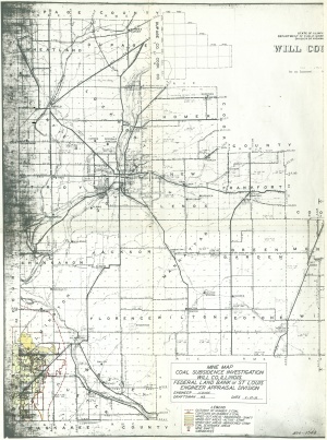 | Will, Quade | Will | | QUADE WILL.jpg | https://wikiimage.isgs.illinois.edu/ilmines/quade/reports/quade_report_will.pdf |
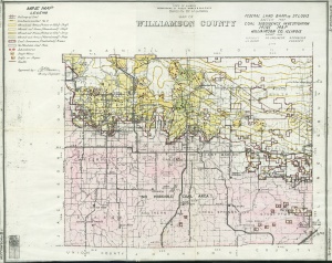 | Williamson, Quade | Williamson | | QUADE WILLIAMSON.jpg | https://wikiimage.isgs.illinois.edu/ilmines/quade/reports/quade_report_williamson.pdf |


