File:M0781.jpg
Size of this preview: 348 × 599 pixels. Other resolution: 1,971 × 3,390 pixels.
Original file (1,971 × 3,390 pixels, file size: 2.85 MB, MIME type: image/jpeg)
CLICK HERE TO DOWNLOAD THE HIGH RESOLUTION IMAGE. FILE SIZE MAY BE LARGE(Note:this file is usually better quality than "original file" linked above)
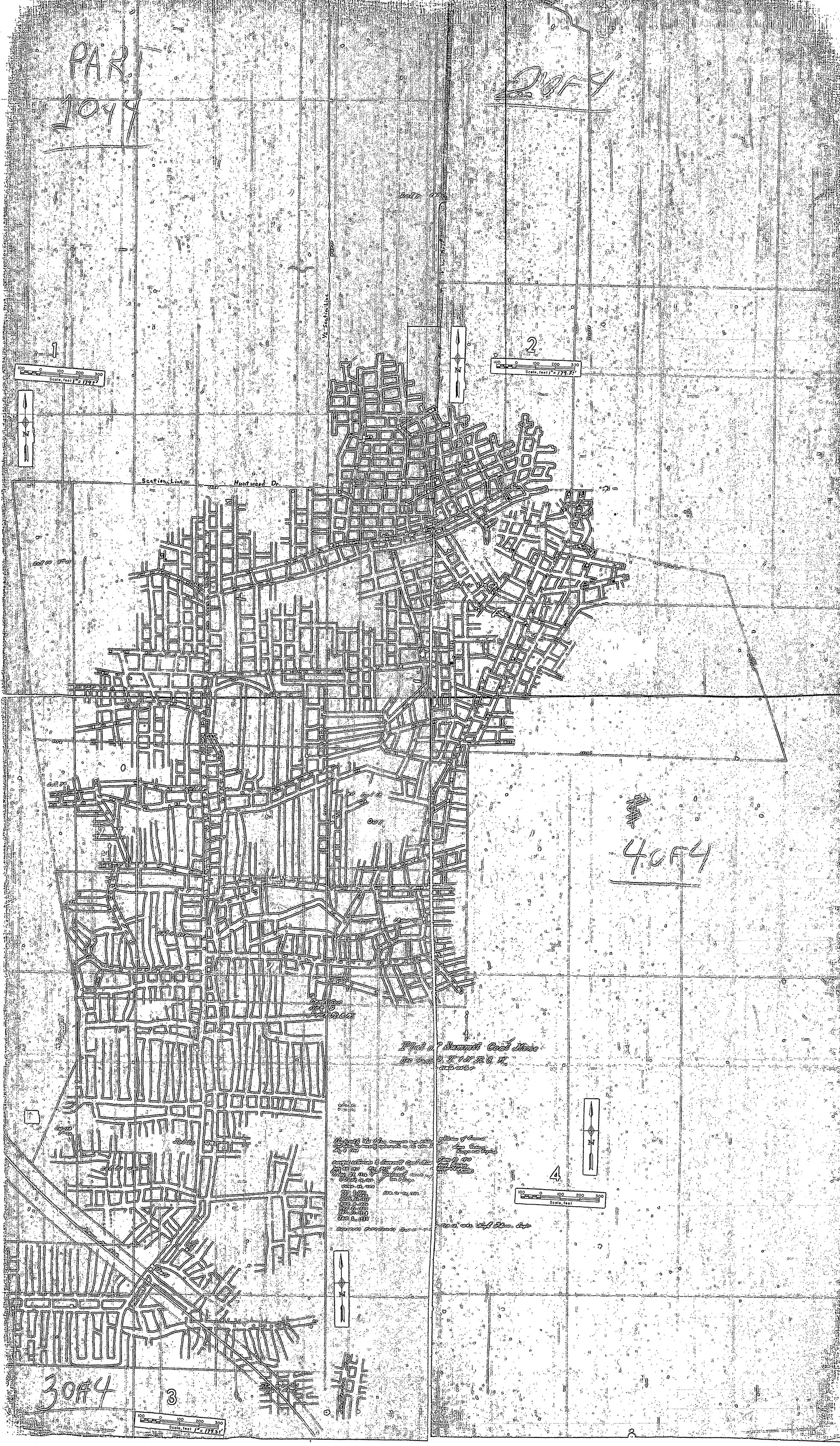
| Mine Index(s): | 0781 |
| Mine Company: | Summit Coal and Mining Company |
| Mine Name | Summit |
| Map Date | 2-12-1942 |
| Map Scale | 1:2152 |
| Map Type microfilm/company/wpa/quade | Microfilm |
| Map Status final,not final, secondary | Final |
| ID Number | 351042 |
| Used For | Shaft locations, mine outline, mining method |
| Notes | microfilm map, document 351042, reel 03134, frames 133-136 |
| Image Credit | |
| Hi-Res Download | Click to download |
File history
Click on a date/time to view the file as it appeared at that time.
| Date/Time | Thumbnail | Dimensions | User | Comment | |
|---|---|---|---|---|---|
| current | 10:55, October 13, 2020 | | 1,971 × 3,390 (2.85 MB) | Cheri (talk | contribs) |
You cannot overwrite this file.
File usage
The following page uses this file: