0201: Difference between revisions
Alan.Myers (talk | contribs) No edit summary |
Alan.Myers (talk | contribs) m (Text replacement - "OFallon" to "O'Fallon") |
||
| Line 10: | Line 10: | ||
|county1=St. Clair | |county1=St. Clair | ||
|quad1=Collinsville | |quad1=Collinsville | ||
|quad2= | |quad2=O'Fallon | ||
|year-start=1905 | |year-start=1905 | ||
|year-end=1927 | |year-end=1927 | ||
Revision as of 12:00, June 19, 2020
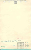
Mine Index Number: 0201
| Company Name: | Consolidated Coal Company | ||
|---|---|---|---|
| Mine Name: | Consolidated No. 17 Mine | ||
| Start Date: | 1905 | End Date: | 1927 |
| Type of Mine: | Underground | ||
| Total acres shown: | 1,343 | ||
| Acres after map date: | General Area of mining acres shown: | ||
Shaft, Slope, Drift or Tipple Location(s)
| Type | County | Township-Range | Section | Part Section |
|---|
| Main shaft | St. Clair | 2N 8W | 10 | 2340 FNL, 2140 FWL |
| Air shaft | St. Clair | 2N 8W | 10 | SE SE NW |
Geology
| Thickness (ft) | |||||
|---|---|---|---|---|---|
| Seam | Depth (ft) | Min | Max | Ave | Mining Method |
| Herrin | 210-228 | 6.5 | 8.0 | 6.5 | RPP |
Geological Problems Reported
The black shale roof (½ inch to 4 feet thick) required timbering, but was thin in the northern part of the mine. Some slips were present in some areas in the coal, making it unminable. The floor clay heaved badly in one location, but generally gave no problem.
Production
| Company | Mine Name | Date | Production (tons) |
| Consolidated Coal Company | Consolidated No. 17 | 1905-1927 Idle July 1924 to November 1926 | 7,571,121 |
Production Notes
Coal Report production (if available)
Sources of Data
| Source Map | Map Date | Original Scale | Digitized Scale | Map Type |
| Company | 1927 | 1:2400 | 1:2400 | Final |
Annotated Bibliography (Data source - brief description of information)
| Coal Reports - Production, ownership, years of operation. |
| Directory of Illinois Coal Mines (St. Clair County) - Mine names, mine index, ownership, years of operation. |
| ENR Document 85/01 - Mining method. |
| Company map - Shaft locations, mine outline, mining method. |
| Mine notes (St. Clair County) - Thickness, depth, seam, mine type, shaft locations, geologic problems. |
| Federal Land Bank Report (St. Clair County) - Depth. |
Mine Notes
Mine Images
![[[:Consolidated No. 17|Consolidated No. 17]]](https://wikiimage.isgs.illinois.edu/ilmines/st_clair/thumbnails/m0201mrg_th.jpg)
Photographs