File:M3685.jpg: Difference between revisions
No edit summary |
Alan.Myers (talk | contribs) m (Text replacement - "Danville SE" to "Danville Southeast") |
||
| Line 10: | Line 10: | ||
|Map ID=4103.v4 i5.1-63 | |Map ID=4103.v4 i5.1-63 | ||
|county1=Vermilion | |county1=Vermilion | ||
|quad1=Danville | |quad1=Danville Southeast | ||
|Image Notes=Company map, ISGS map library, 4103.v4 i5.1-63 | |Image Notes=Company map, ISGS map library, 4103.v4 i5.1-63 | ||
|Image Used For=Slope and shaft locations, mine outline, mining method | |Image Used For=Slope and shaft locations, mine outline, mining method | ||
}} | }} | ||
Revision as of 12:50, June 19, 2020
| Mine Index(s): | 3685 |
| Mine Company: | Schafer Brothers Coal Company |
| Mine Name | Schafer No. 7 Mine |
| Map Date | 6-19-1941 |
| Map Scale | 1:1200 |
| Map Type microfilm/company/wpa/quade | Company map |
| Map Status final,not final, secondary | Not final |
| ID Number | 4103.v4 i5.1-63 |
| Used For | Slope and shaft locations, mine outline, mining method |
| Notes | Company map, ISGS map library, 4103.v4 i5.1-63 |
| Image Credit | |
File history
Click on a date/time to view the file as it appeared at that time.
| Date/Time | Thumbnail | Dimensions | User | Comment | |
|---|---|---|---|---|---|
| current | 12:16, February 28, 2020 | 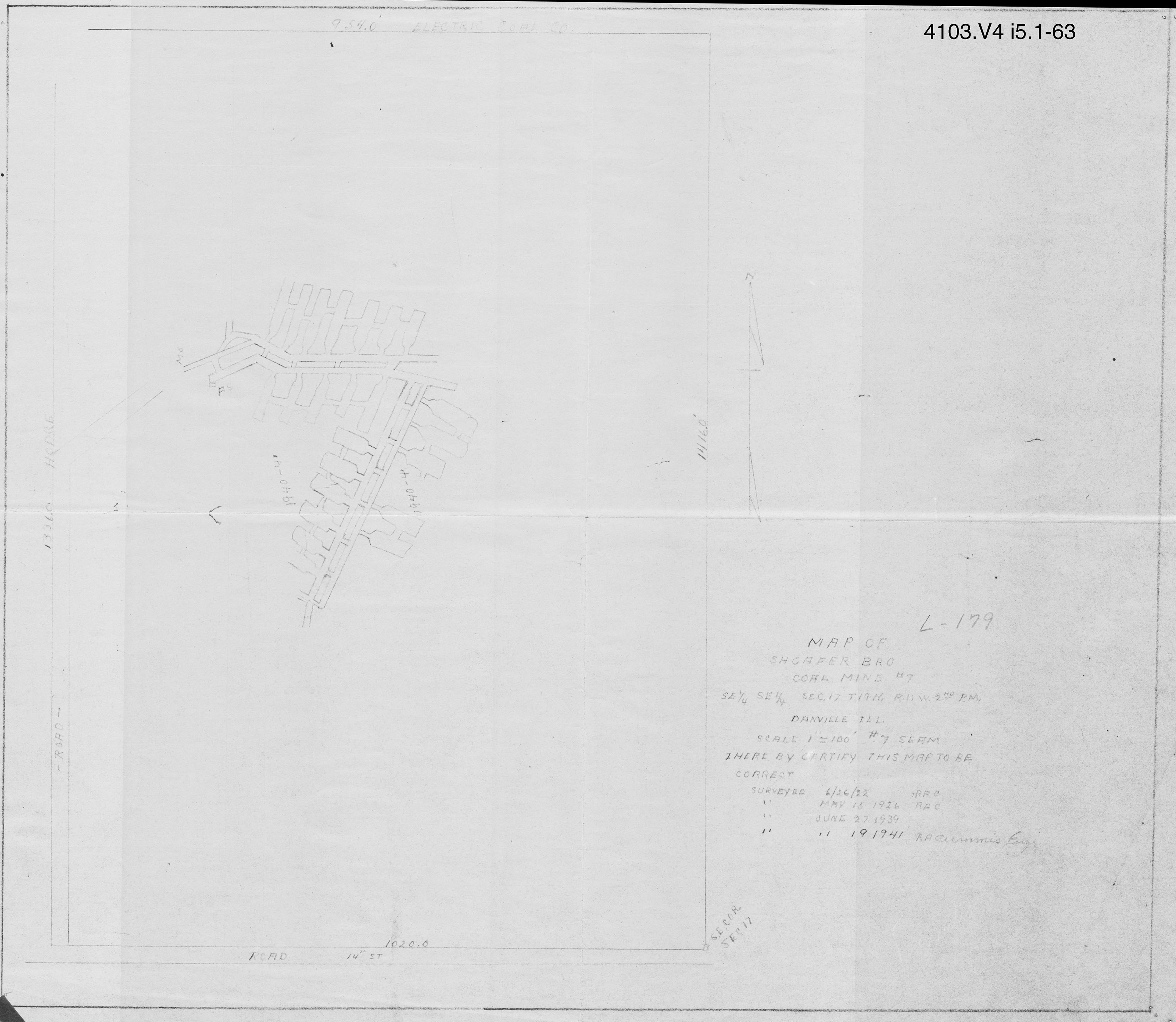 | 3,390 × 2,945 (817 KB) | Cheri (talk | contribs) |
You cannot overwrite this file.
File usage
The following page uses this file: