Category:Vermilion-County
County Coal Data
Mines that Appear in Vermilion-County
- 9998 & 9999 = Unknown dates
Unlocated Mines in Vermilion-County
Mine that have known coal production but no known location
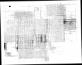
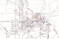
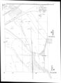
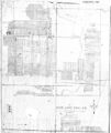
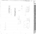
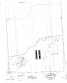
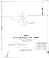
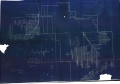
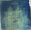
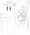
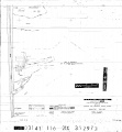
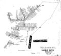
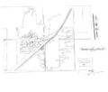
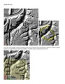
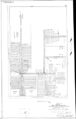
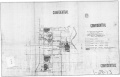
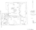
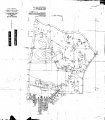
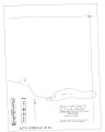
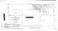
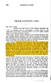
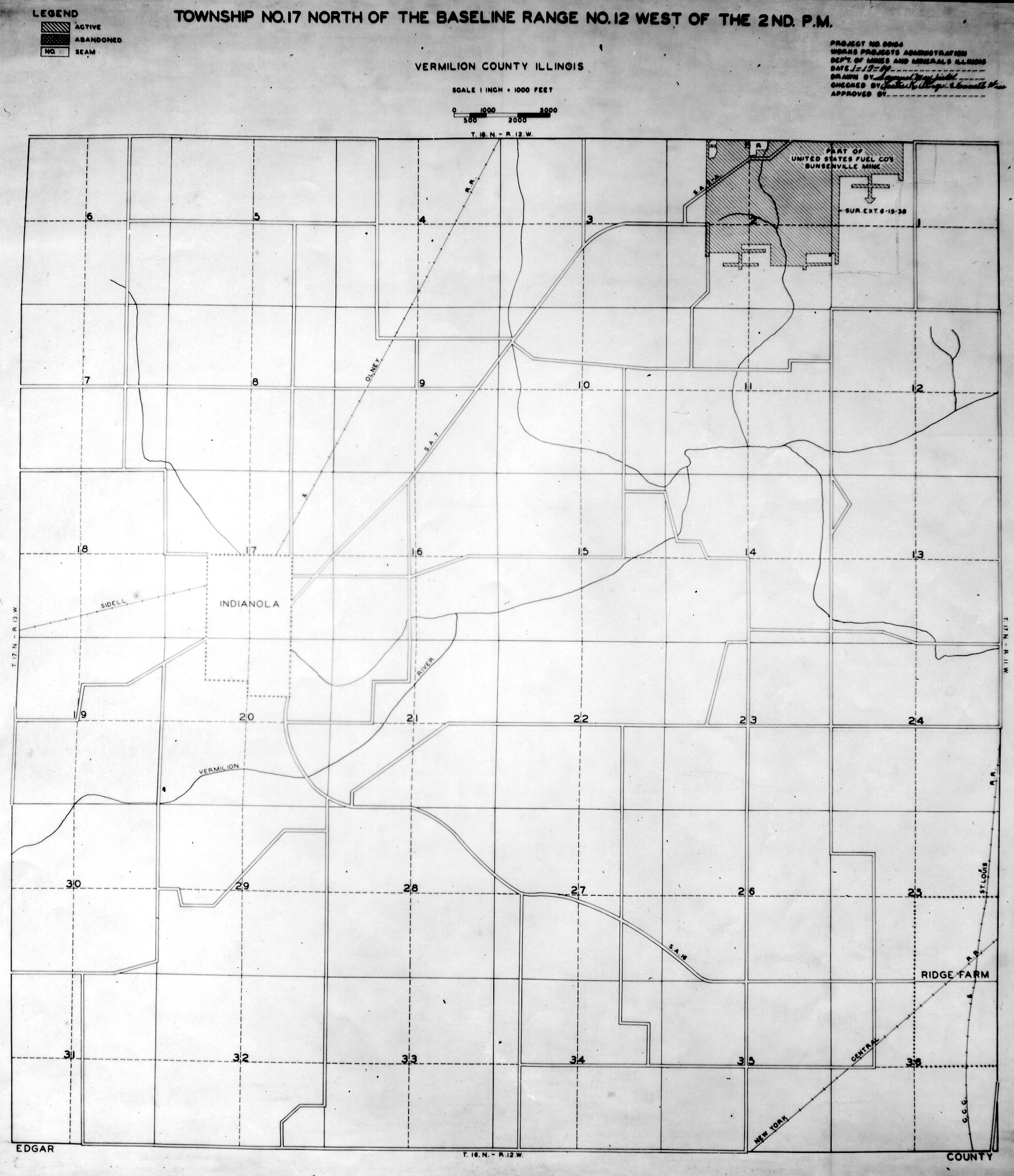
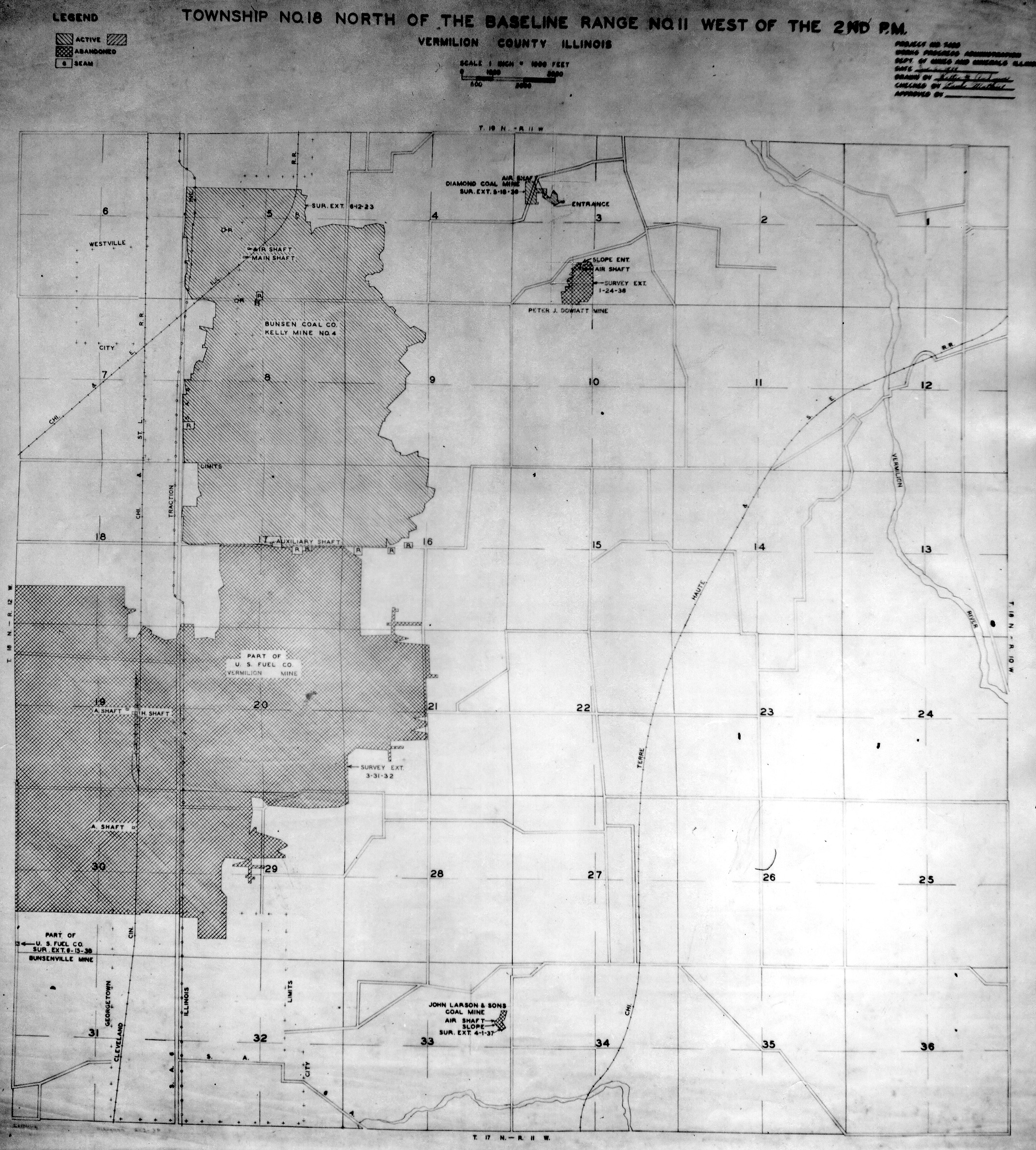
Historical Mined Out Area Maps
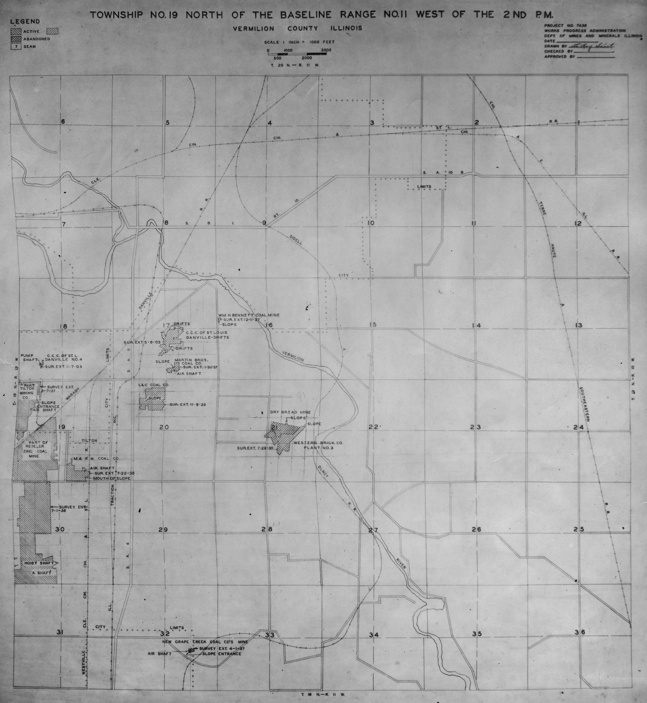
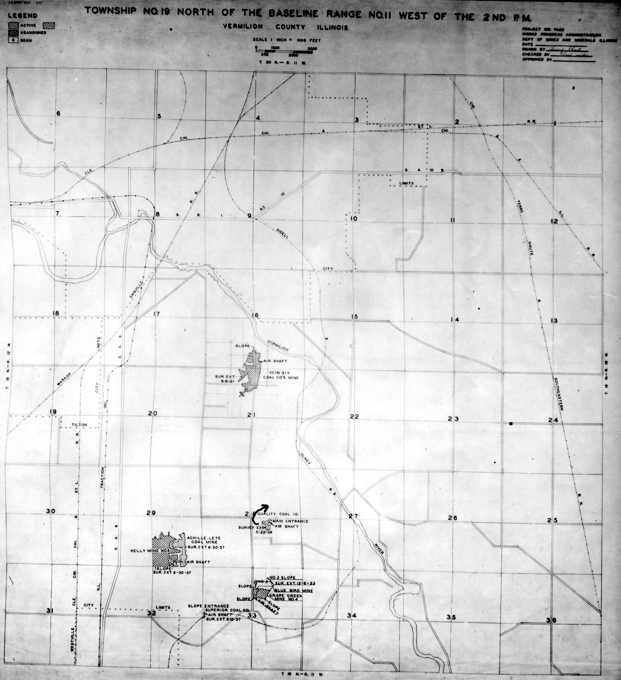
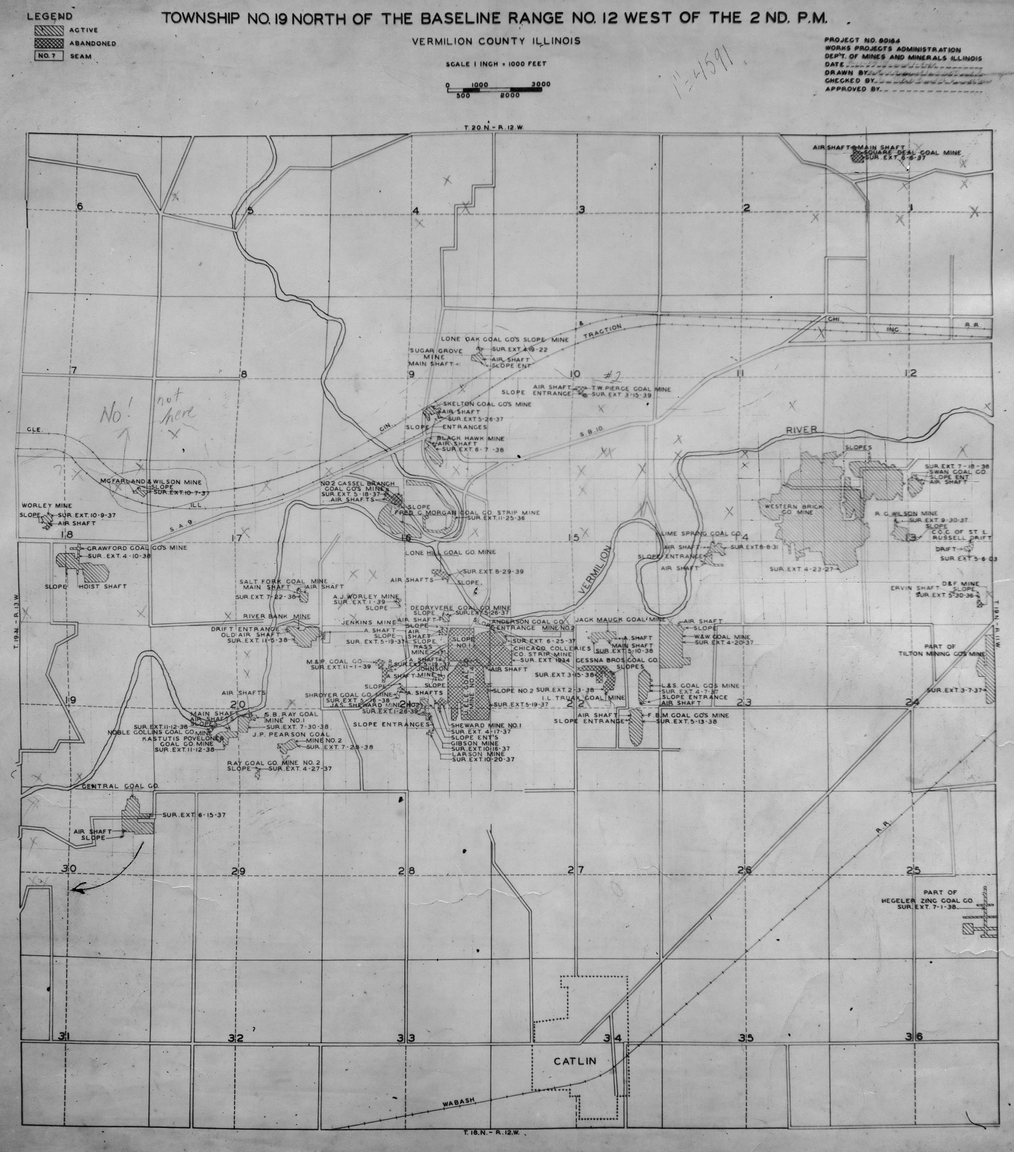
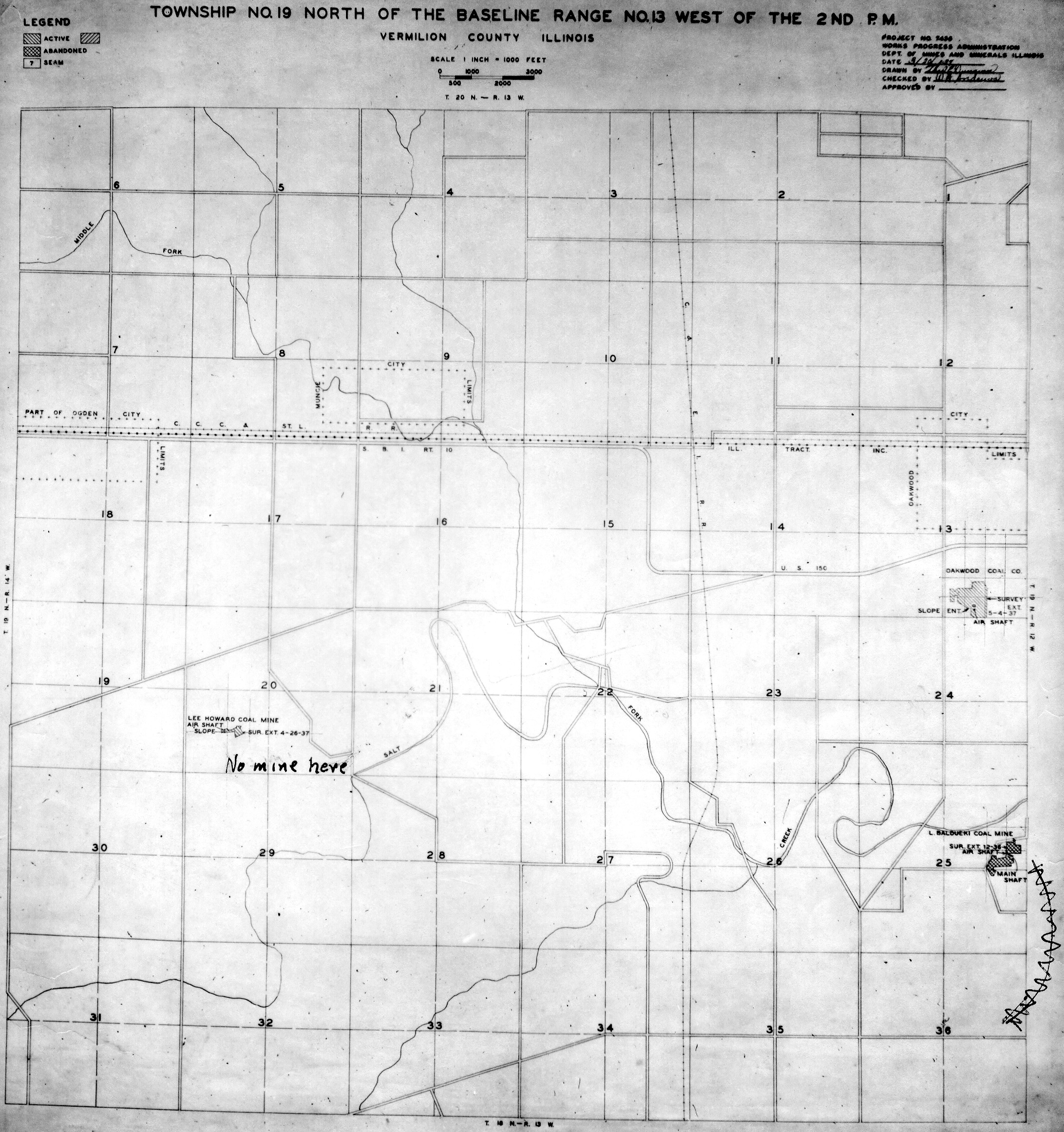
WPA
These maps were constructed as part of the nationwide Works Projects Administration (WPA), generally between 1934 and 1937 with some later updates or revisions,
Disclaimer
Maps for some locations might have multiple versions/seams, please inspected these areas closely for differences.
Notes and corrections were made by ISGS staff.
These maps are reproductions from microfilm, they may be of poor quality with text difficult to read.


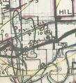
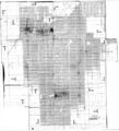
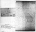
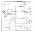
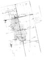
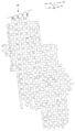
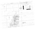
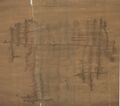
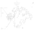
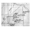
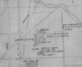
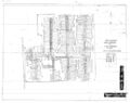
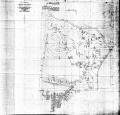
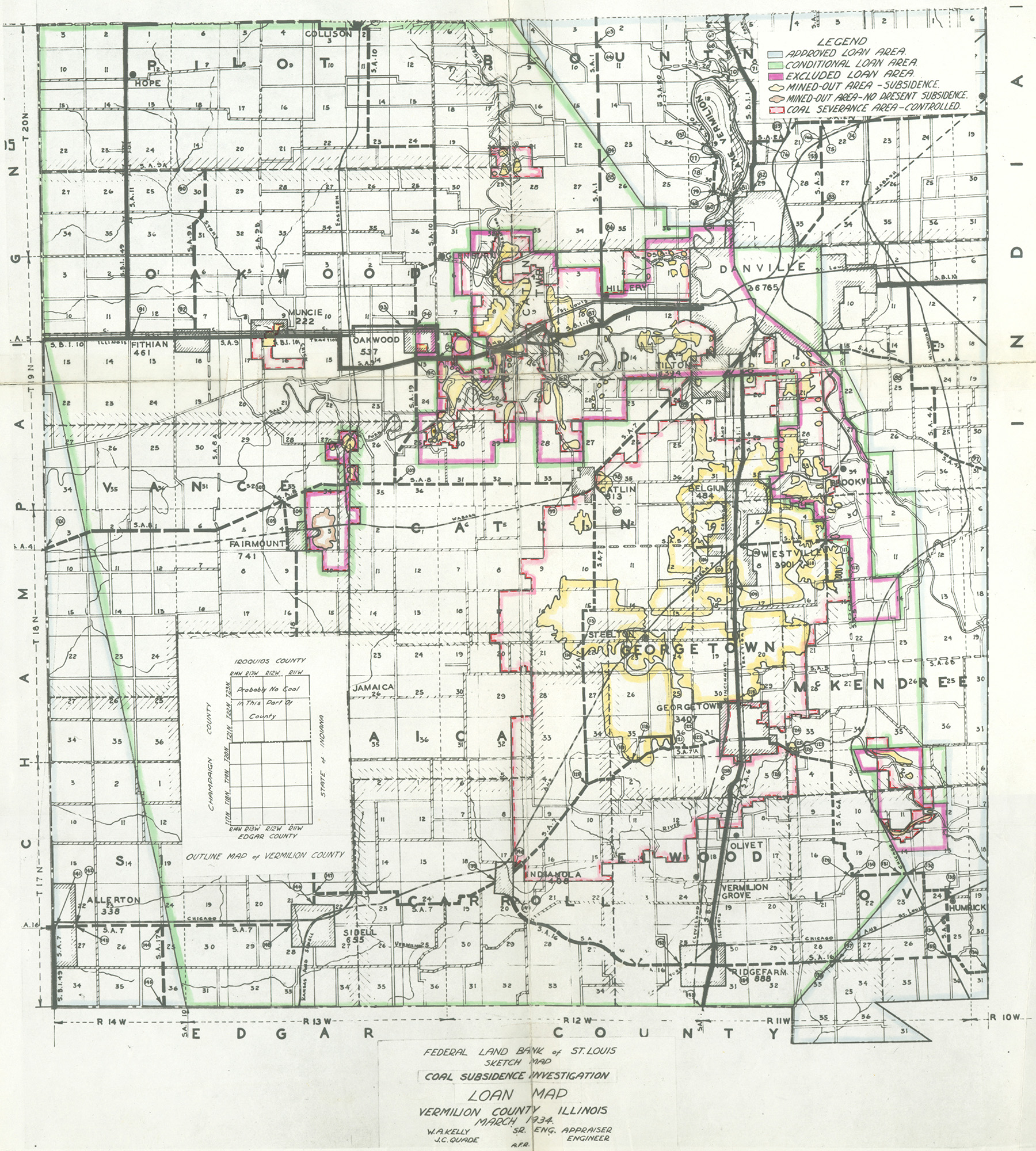
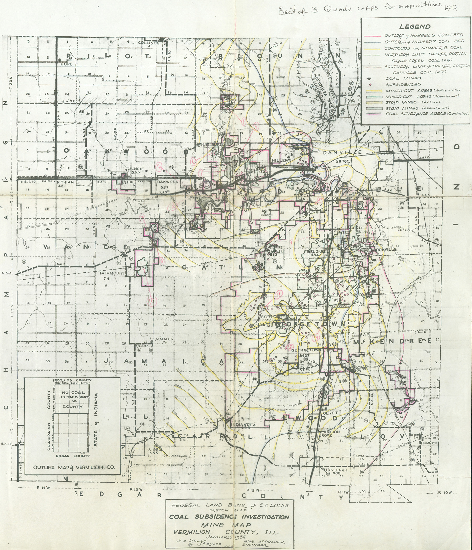
Federal Land Bank of St. Louis, Preliminary Reports on Subsidence Investigations
Federal Land Bank of St. Louis, Preliminary Reports on Subsidence Investigations (refered by Coal Section Staff as "Quade Maps")
Mining engineers working for the Federal Land Bank of St. Louis mapped areas of subsidence due to coal mining in the early 1930s. These reports often include county maps of mine properties with mined-out areas including shaft locations, as well as subsidence areas.
Disclaimer
Maps for some locations might have multiple versions/seams, please inspected these areas closely for differences.
These maps are accompanied by a report, please download and inspect this document.
Notes and corrections were made by ISGS staff.


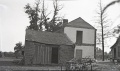
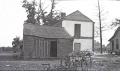
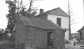
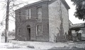
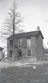
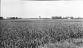
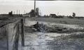
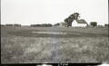
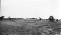
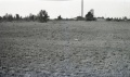
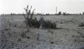
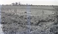
Photographs


Pages in category "Vermilion-County"
The following 200 pages are in this category, out of 996 total.
(previous page) (next page)0
1
- 1006
- 1018
- 1026
- 1830001
- 1830002
- 1830004a
- 1830004b
- 1830005
- 1830006
- 1830007
- 1830008
- 1830009
- 1830010
- 1830011
- 1830012
- 1830013
- 1830014
- 1830016a
- 1830016b
- 1830016c
- 1830017
- 1830018
- 1830019
- 1830021
- 1830022
- 1830023
- 1830024
- 1830025
- 1830026a
- 1830026b
- 1830027a
- 1830027b
- 1830028
- 1830029a
- 1830029b
- 1830029c
- 1830032
- 1830033
- 1830034
- 1830036
- 1830038
- 1830039a
- 1830039b
- 1830040
- 1830041a
- 1830041b
- 1830041c
- 1830042a
- 1830042b
- 1830042c
- 1830043a
- 1830043b
- 1830044
- 1830045a
- 1830045b
- 1830046
- 1830047a
- 1830047b
- 1830048
- 1830049
- 1830050
- 1830051
- 1830052
- 1830053
- 1830054
- 1830055
- 1830056
- 1830057
- 1830058
- 1830059
- 1830060
- 1830061
- 1830062
- 1830063
- 1830064
- 1830065
- 1830066
- 1830067a
- 1830067b
- 1830067c
- 1830068
- 1830069
- 1830070
- 1830071
- 1830072
- 1830074
- 1830076
- 1830077
- 1830079
- 1830080
- 1830081
- 1830082
- 1830083
- 1830084
- 1830085
- 1830086
- 1830087
- 1830088
- 1830089
- 1830090
- 1830091
- 1830092
- 1830093
- 1830094
- 1830095
- 1830096
- 1830098
- 1830099
- 1830100
- 1830101
- 1830102
- 1830103
- 1830104
- 1830105
- 1830106
- 1830107
- 1830108
- 1830109
- 1830110
- 1830112
- 1830113
- 1830114
- 1830115
- 1830116a
- 1830116b
- 1830116c
- 1830117
- 1830118
- 1830119
- 1830120
- 1830121
- 1830122
- 1830123
- 1830124
- 1830126
- 1830126a
- 1830128
- 1830129
- 1830130
- 1830131
- 1830132
- 1830133
- 1830134
- 1830135
- 1830136
- 1830137
- 1830138
- 1830140
- 1830141
- 1830142
- 1830143
- 1830144
- 1830145
- 1830145b
- 1830147
- 1830148
- 1830149
- 1830150
- 1830151
- 1830152
- 1830153
- 1830154b
- 1830155
- 1830156
- 1830157
- 1830159
- 1830160
- 1830162
- 1830162a
- 1830164
- 1830164a
- 1830165a
- 1830165b
- 1830165c
- 1830166a
Media in category "Vermilion-County"
The following 200 files are in this category, out of 478 total.
(previous page) (next page) 0401 bunsen.jpg 3,390 × 2,267; 334 KB
 Dantwp1895 Copy1.jpg 3,390 × 2,754; 1.52 MB
 Folio67b.jpg 1,919 × 1,256; 1.05 MB
 Folio67d.jpg 1,511 × 1,273; 806 KB
 Folio67d2.jpg 1,511 × 1,273; 806 KB
 M-1007 Kelly No 5 Danville District Coop 17 Fig 42 6ft coal 200ft deep.jpg 2,500 × 1,484; 431 KB
 M-1008 Kelly No 5 Danville 6ft coal 200ft deep-ps.jpg 2,500 × 1,480; 545 KB
 M-1009 Kelly No 5 Danville District 6ft coal 200ft deep.jpg 2,500 × 1,461; 500 KB
 M-1010 Kelly No 5 Danville District 6ft coal 200ft deep.jpg 2,500 × 1,478; 573 KB
 M-1011 Kelly No 5 Danville District 6ft coal 200ft deep.jpg 1,454 × 2,500; 438 KB
 M-821 Coop 17 Fig 31 Dering Coal Co Danville District.jpg 4,388 × 2,577; 1.22 MB
 M-822 Copp 17 Fig 35 Pit s of Electric Mine Danville District see M-934.jpg 2,500 × 1,469; 579 KB
 M-929 Subsidence Kelly No 5 Mine.jpg 4,408 × 2,666; 1.18 MB
 M-932 Kellyville No 3 near Electric mine Danville District.jpg 4,388 × 2,555; 1.38 MB
 M-933 Kellyville No 3 S of shalft 3ft deep Electric mine Danville District.jpg 2,500 × 1,477; 802 KB
 M-934 Kellyville No 3 near Electric mine Danville District 8ft dia 3ft deep.jpg 2,500 × 1,464; 719 KB
 M-939 Kellyville No 3 near Electric mine Danville District.jpg 2,500 × 1,465; 731 KB
 M0091 minenotes.pdf 739 × 1,193, 40 pages; 10.72 MB
 M0091.jpg 3,390 × 2,535; 2.57 MB
 M0093 coalreport1912 p273.pdf 1,643 × 1,241, 2 pages; 692 KB
 M0093 minenotes.pdf 739 × 1,193, 34 pages; 8.03 MB
 M0093mrg.jpg 3,390 × 2,674; 3.14 MB
 M0094 coalreport1903 p231.pdf 1,547 × 1,231; 284 KB
 M0094 minenotes.pdf 739 × 1,193, 19 pages; 5.06 MB
 M0094 quade.jpg 402 × 441; 61 KB
 M0095 minenotes.pdf 739 × 1,193, 14 pages; 3.47 MB
 M0211 coalreport1903 p231.pdf 1,547 × 1,231; 283 KB
 M0211 coalreport1910 p328.pdf 583 × 943; 86 KB
 M0211 minenotes.pdf 737 × 1,193, 11 pages; 2.5 MB
 M0212 minenotes.pdf 739 × 1,193, 16 pages; 4.53 MB
 M0212 quade.jpg 878 × 877; 182 KB
 M0212.jpg 3,390 × 2,787; 312 KB
 M0400 minenotes.pdf 739 × 1,193, 55 pages; 13.73 MB
 M0400 no7thick.jpg 3,390 × 2,233; 1.08 MB
 M0401 coalreport1914 p171.pdf 1,752 × 1,327; 233 KB
 M0401 minenotes.pdf 739 × 1,193, 20 pages; 5.46 MB
 M0401mrg.jpg 3,076 × 3,390; 3.17 MB
 M0507 minenotes.pdf 739 × 1,193, 13 pages; 3.95 MB
 M0507a.jpg 3,390 × 2,619; 916 KB
 M0507b.jpg 3,390 × 1,433; 305 KB
 M0603 minenotes.pdf 739 × 1,193, 13 pages; 3.55 MB
 M0603.jpg 3,390 × 3,266; 1.35 MB
 M0656 minenotes.pdf 737 × 1,193, 5 pages; 1.42 MB
 M0656.jpg 3,346 × 3,390; 1,023 KB
 M0656b.jpg 3,390 × 1,934; 619 KB
 M0663 minenotes.pdf 737 × 1,193, 6 pages; 1.66 MB
 M0663b ml4103V4 i51-9.jpg 3,390 × 3,028; 1.22 MB
 M0663wrp.jpg 2,495 × 3,390; 723 KB
 M0673 minenotes.pdf 739 × 1,193, 43 pages; 11.23 MB
 M0673.jpg 3,390 × 1,982; 1.26 MB
 M0694 minenotes.pdf 739 × 1,193, 59 pages; 36.11 MB
 M0694 new.jpg 2,342 × 3,390; 1.61 MB
 M0811 minenotes.pdf 739 × 1,189, 22 pages; 5.34 MB
 M0811.jpg 2,862 × 3,390; 1.74 MB
 M0851 minenotes.pdf 739 × 1,189; 332 KB
 M0851.jpg 3,390 × 3,335; 1.49 MB
 M0852 minenotes.pdf 739 × 1,193, 4 pages; 1.12 MB
 M0852.jpg 3,191 × 3,390; 778 KB
 M0853 minenotes.pdf 739 × 1,193, 4 pages; 1.08 MB
 M0889 minenotes.pdf 737 × 1,193, 6 pages; 1.36 MB
 M0924 minenotes.pdf 739 × 1,193, 4 pages; 1.05 MB
 M0924.jpg 3,390 × 3,189; 729 KB
 M0994 minenotes.pdf 737 × 1,193, 78 pages; 46.76 MB
 M0994.jpg 2,514 × 3,390; 741 KB
 M0994a.jpg 1,939 × 3,390; 509 KB
 M1018 minenotes.pdf 800 × 1,183, 91 pages; 18.48 MB
 M1026 minenotes.pdf 768 × 1,191, 26 pages; 8.11 MB
 M1830024 coalreport1885 p71.pdf 1,652 × 1,293; 924 KB
 M1830099 coalreport1889 p36.pdf 1,647 × 1,304; 923 KB
 M1830118 coalreport1899 p80.pdf 1,481 × 1,216; 355 KB
 M1830118 coalreport1900 p139.pdf 1,556 × 1,191; 353 KB
 M1830121 coalreport1889 p34.pdf 1,639 × 1,291; 915 KB
 M1830121 coalreport1891 p102.pdf 793 × 1,275, 2 pages; 2.19 MB
 M2290 minenotes.pdf 739 × 1,189, 4 pages; 1.09 MB
 M3194 minenotes.pdf 737 × 1,193, 3 pages; 701 KB
 M3641 minenotes.pdf 739 × 1,193, 3 pages; 824 KB
 M3641.jpg 3,390 × 2,942; 752 KB
 M3650 minenotes.pdf 737 × 1,193, 4 pages; 1.11 MB
 M3650.jpg 2,714 × 3,390; 589 KB
 M3651 minenotes.pdf 737 × 1,193, 4 pages; 1.04 MB
 M3652 minenotes.pdf 737 × 1,193, 6 pages; 1.46 MB
 M3652.jpg 3,390 × 2,814; 968 KB
 M3653 minenotes.pdf 737 × 1,193, 8 pages; 2.19 MB
 M3653.jpg 2,853 × 3,390; 418 KB
 M3654 minenotes.pdf 737 × 1,193, 5 pages; 1.3 MB
 M3654.jpg 2,982 × 3,390; 732 KB
 M3655 minenotes.pdf 737 × 1,193, 11 pages; 2.82 MB
 M3655.jpg 2,884 × 3,390; 527 KB
 M3656 minenotes.pdf 737 × 1,193, 5 pages; 1.34 MB
 M3657 minenotes.pdf 737 × 1,193, 6 pages; 1.61 MB
 M3657.jpg 1,755 × 1,275; 512 KB
 M3658.jpg 3,390 × 2,512; 324 KB
 M3659 minenotes.pdf 737 × 1,193, 5 pages; 1.37 MB
 M3659.jpg 2,598 × 3,390; 607 KB
 M3660 coalreport1910.pdf 583 × 943, 4 pages; 291 KB
 M3660 minenotes.pdf 737 × 1,193, 11 pages; 2.84 MB
 M3661 coalreport1896 p107.pdf 1,610 × 1,210; 300 KB
 M3661 minenotes.pdf 737 × 1,193, 4 pages; 1.11 MB
 M3661 msha1168.jpg 3,390 × 2,370; 1.13 MB
 M3662 coalreport1895 p55.pdf 750 × 1,185; 128 KB
 M3662 minenotes.pdf 739 × 1,193, 5 pages; 1.39 MB
 M3662 pb363.jpg 3,390 × 2,999; 1.77 MB
 M3663 coalreport1895 p55.pdf 750 × 1,185; 123 KB
 M3663 coalreport1910.pdf 583 × 943, 4 pages; 302 KB
 M3663 minenotes.pdf 737 × 1,193, 10 pages; 2.66 MB
 M3664 coalreport1897 p79.pdf 839 × 1,185; 1.1 MB
 M3664 coalreport1898 p154.pdf 1,614 × 1,177; 321 KB
 M3664 minenotes.pdf 737 × 1,193, 8 pages; 2.09 MB
 M3664.jpg 3,390 × 2,154; 689 KB
 M3666 minenotes.pdf 739 × 1,193, 4 pages; 1.13 MB
 M3667 minenotes.pdf 737 × 1,193, 6 pages; 1.6 MB
 M3667.jpg 3,153 × 3,390; 770 KB
 M3668 coalreport1903 p231.pdf 1,547 × 1,231; 283 KB
 M3668 minenotes.pdf 739 × 1,193, 13 pages; 3.28 MB
 M3668 msha775.jpg 3,390 × 3,297; 3.66 MB
 M3670 coalreport1905 p268.pdf 633 × 977; 126 KB
 M3670 minenotes.pdf 739 × 1,193, 6 pages; 1.64 MB
 M3670.jpg 3,390 × 2,901; 476 KB
 M3673 minenotes.pdf 739 × 1,193, 6 pages; 1.53 MB
 M3673 wpa.jpg 3,390 × 3,125; 1,024 KB
 M3673.jpg 3,112 × 3,390; 766 KB
 M3674 minenotes.pdf 739 × 1,193, 4 pages; 1.16 MB
 M3675 minenotes.pdf 739 × 1,193, 4 pages; 1.06 MB
 M3681 minenotes.pdf 739 × 1,193, 6 pages; 1.63 MB
 M3681.jpg 2,890 × 3,390; 991 KB
 M3682 minenotes.pdf 739 × 1,193, 4 pages; 1.07 MB
 M3683 minenotes.pdf 739 × 1,193, 5 pages; 1.39 MB
 M3683.jpg 3,134 × 3,390; 736 KB
 M3684 minenotes.pdf 739 × 1,193, 4 pages; 1.1 MB
 M3685 minenotes.pdf 739 × 1,193, 6 pages; 1.6 MB
 M3685.jpg 3,390 × 2,945; 817 KB
 M3686 minenotes.pdf 739 × 1,193, 5 pages; 1.25 MB
 M3686a.jpg 3,390 × 2,812; 764 KB
 M3687 minenotes.pdf 739 × 1,193, 3 pages; 832 KB
 M3688 coalreport1885 p69.pdf 1,656 × 1,300; 904 KB
 M3688 minenotes.pdf 739 × 1,193, 4 pages; 1.08 MB
 M3689 minenotes.pdf 739 × 1,193, 6 pages; 1.6 MB
 M3690 minenotes.pdf 745 × 1,145, 8 pages; 2.85 MB
 M3691 coalreport1884 p508.pdf 1,641 × 1,279; 368 KB
 M3691 coalreport1885 p69.pdf 1,656 × 1,300; 903 KB
 M3691 minenotes.pdf 739 × 1,193, 3 pages; 807 KB
 M3692 mf352930.jpg 3,136 × 2,912; 994 KB
 M3692 wpa 17 19n11w.jpg 540 × 441; 59 KB
 M3694 coalreport1885 p70.pdf 1,656 × 1,300, 2 pages; 1.77 MB
 M3694 coalreport1898 p154.pdf 1,614 × 1,177; 326 KB
 M3694 minenotes.pdf 739 × 1,193, 6 pages; 1.45 MB
 M3694.jpg 3,390 × 2,886; 631 KB
 M3695 lidar.pdf 1,275 × 1,650, 2 pages; 603 KB
 M3695 minenotes.pdf 739 × 1,193, 4 pages; 1.18 MB
 M3696 minenotes.pdf 739 × 1,193, 10 pages; 2.33 MB
 M3698 minenotes.pdf 739 × 1,193, 5 pages; 1.33 MB
 M3699 minenotes.pdf 739 × 1,193, 5 pages; 1.31 MB
 M3700 minenotes.pdf 739 × 1,193, 17 pages; 4.1 MB
 M3701 minenotes.pdf 739 × 1,193, 4 pages; 1.06 MB
 M3702 minenotes.pdf 739 × 1,193, 10 pages; 2.59 MB
 M3703 minenotes.pdf 739 × 1,193, 4 pages; 1.03 MB
 M3704 minenotes.pdf 739 × 1,193, 4 pages; 1.14 MB
 M3704.jpg 2,166 × 3,390; 687 KB
 M3705 fieldnotes.pdf 750 × 1,193; 218 KB
 M3705 minenotes.pdf 739 × 1,193, 8 pages; 2.22 MB
 M3705.jpg 3,390 × 2,845; 1.31 MB
 M3706 minenotes.pdf 739 × 1,193; 173 KB
 M3707 minenotes.pdf 739 × 1,193, 5 pages; 1.28 MB
 M3707.jpg 3,390 × 2,164; 1.07 MB
 M3708 minenotes.pdf 739 × 1,193, 2 pages; 574 KB
 M3709 minenotes.pdf 739 × 1,193, 4 pages; 1.11 MB
 M3709.jpg 3,390 × 2,676; 1.13 MB
 M3709b.jpg 3,390 × 2,870; 501 KB
 M3710.jpg 3,390 × 3,252; 3.91 MB
 M3710b.jpg 3,390 × 3,252; 3.91 MB
 M3711 minenotes.pdf 739 × 1,193, 6 pages; 1.57 MB
 M3712 minenotes.pdf 739 × 1,193, 5 pages; 2.05 MB
 M3712.jpg 3,390 × 3,252; 3.91 MB
 M3713 352876.jpg 2,968 × 3,390; 1.05 MB
 M3713 minenotes.pdf 739 × 1,193, 2 pages; 563 KB
 M3714 minenotes.pdf 739 × 1,193, 5 pages; 1.27 MB
 M3715 minenotes.pdf 739 × 1,193, 4 pages; 1.08 MB
 M3716 minenotes.pdf 739 × 1,193, 4 pages; 1.06 MB
 M3717 minenotes.pdf 739 × 1,193, 4 pages; 1.06 MB
 M3718 minenotes.pdf 739 × 1,193, 2 pages; 535 KB
 M3718.jpg 2,718 × 3,390; 351 KB
 M3719 coalreport1884 p499.pdf 1,595 × 1,264, 2 pages; 734 KB
 M3719 coalreport1885 p70.pdf 1,652 × 1,293; 919 KB
 M3719 minenotes.pdf 739 × 1,193, 4 pages; 1.02 MB
 M3720 minenotes.pdf 737 × 1,193, 8 pages; 2.23 MB
 M3720.jpg 3,390 × 1,794; 644 KB
 M3722 minenotes.pdf 739 × 1,193, 4 pages; 1.06 MB
 M3723 minenotes.pdf 739 × 1,193, 2 pages; 593 KB
 M3724 minenotes.pdf 739 × 1,193, 4 pages; 1.11 MB
 M3725 minenotes.pdf 739 × 1,193, 4 pages; 1.13 MB
 M3726 minenotes.pdf 739 × 1,193, 5 pages; 1.41 MB
 M3726.jpg 3,390 × 2,891; 1.13 MB
 M3726b.jpg 2,316 × 3,390; 2.35 MB
 M3727 minenotes.pdf 739 × 1,193, 4 pages; 1.1 MB
 M3728 minenotes.pdf 739 × 1,193, 9 pages; 2.68 MB
 M3728.jpg 1,336 × 3,390; 934 KB
 M3728b.jpg 3,390 × 2,419; 619 KB
 M3729 coalreport1891 p102.pdf 793 × 1,275; 113 KB


