Mine Index Number: 0400
| Company Name:
|
United Electric Coal Company
|
| Mine Name:
|
United Electric No. 1 Mine
|
| Start Date:
|
1910
|
End Date:
|
October 1933
|
| Type of Mine:
|
Surface
|
| Total acres shown:
|
479
|
| Acres after map date:
|
|
General Area of mining acres shown:
|
|
|
|
Shaft, Slope, Drift or Tipple Location(s)
| Type
|
County
|
Township-Range
|
Section
|
Part Section
|
| Tipple
|
Vermilion
|
19N 12W
|
8
|
SW NE SW
|
| Tipple
|
Vermilion
|
19N 12W
|
16
|
NW NW NW
|
Geology
| Danville
|
18-30
|
4.5
|
6.08
|
5.67
|
Surface
|
Geological Problems Reported
The roof was 30 feet of gray shale. The impurities in the seam were fairly abundant, and consisted of pyrite in lenses (2 inches by 8 inches maximum), sheets and balls, joint fillings and facings of calcite and gypsum up to 1/16th inch thick (apparently an important ash constituent of the bed), and a persistent clay band 8 to 10 inches above the floor. At least one horseback or roll was encountered.
Production
| Company
|
Mine Name
|
Date
|
Production (tons)
|
|
|
|
|
|
| Total Production: 5,171,033
|
Production Notes
Coal Report production (if available)
Sources of Data
| USGS topographic map
|
PR 1978
|
1:24000
|
1:24000
|
Secondary source
|
| ISGS composite map, Danville Coal
|
Undated
|
1:62500
|
1:62500
|
Secondary source
|
Annotated Bibliography (Data source - brief description of information)
| Coal Reports - Production, ownership, years of operation, depth.
|
| Directory of Illinois Coal Mines (Vermilion County) - Mine names, mine index, ownership, years of operation.
|
| Mine notes (Vermilion County) - Mine type, pit & tipple locations, seam, thickness, geologic problems.
|
| USGS topographic map, 1966, Photorevised 1978 - Mine outline, mining method.
|
| ISGS composite map, Coal Section files (1-24-31-i), thickness of the Danville Coal - Mine outline.
|
Mine Notes
Mine Images
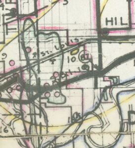
Federal Land Bank Report:
Map Date: 1-1934
Coal Co.: Electric Coal Company
Mine Name: Electric Mine
Full Res Download
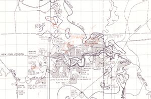
Coal Section composite: 1-24-31i
Map Date: Undated
Coal Co.: United Electric Coal Company
Mine Name: United Electric No. 1 Min
Photographs


