Mine Index Number: 0401
| Company Name:
|
United States Coal and Coke Company
|
| Mine Name:
|
Bunsen Mine
|
| Start Date:
|
1916
|
End Date:
|
April 1947
|
| Type of Mine:
|
Underground
|
| Total acres shown:
|
3,736
|
| Acres after map date:
|
|
General Area of mining acres shown:
|
|
|
|
Shaft, Slope, Drift or Tipple Location(s)
| Type
|
County
|
Township-Range
|
Section
|
Part Section
|
| Main shaft
|
Vermilion
|
18N 12W
|
26
|
NE NW SE
|
| Air shaft
|
Vermilion
|
18N 12W
|
26
|
NE NW SE
|
Geology
| Herrin
|
200-240
|
4.0
|
8.0
|
6.0
|
MRP, HERsome HER
|
Geological Problems Reported
The roof was 1 to 4 feet of draw slate. The chief impurity in the coal came from the numerous horsebacks in the upper part of the seam. A few pyrite concretions and nodules were noticed. The source maps show a sandstone channel in the southwest corner of the mine, faults in the eastern and northwestern areas, and “faulty sand rock” in the eastern part of the mine. Some of the areas labeled “faulty” may be erosional sandstone channels rather than geologic faults.
Production
| Company
|
Mine Name
|
Date
|
Production (tons)
|
|
|
|
|
|
| Total Production: 23,712,673
|
Production Notes
Coal Report production (if available)
Sources of Data
| Microfilm, document 353017
|
6-15-1940
|
1:1200
|
1:2731
|
Not final
|
| Company
|
1947
|
1:7200
|
1:7200
|
Final
|
Annotated Bibliography (Data source - brief description of information)
| Coal Reports - Production, ownership, years of operation.
|
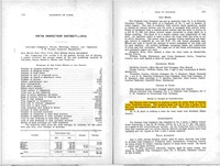
| Directory of Illinois Coal Mines (Vermilion County) - Mine names, mine index, ownership, years of operation.
|
| Mine notes (Vermilion County) - Mine type, shaft location, seam, depth, thickness, geologic problems.
|
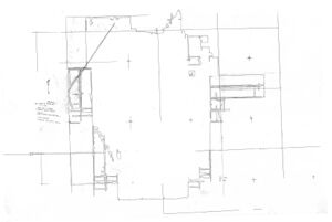
| Microfilm map, document 353017, reel 03141, frames 164-186 - Shaft locations, mine outline, geologic problems.
|
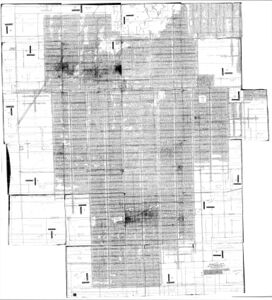
| Company map, loaned by Peabody Coal Company (traced, Coal Section files 6-307) - Mine outline, mining method.
|
Mine Notes
Mine Images
Coal Section files, traced: 6-307
Map Date: 1947
Coal Co.: United States Coal and Coke Company
Mine Name: Bunsenville Mine
Full Res Download
Microfilm: 353017
Map Date: 6-15-1940
Coal Co.: United States Coal and Coke Company
Mine Name: Bunsenville Mine
Full Res Download
Photographs


