Georgetown Quadrangle
(Redirected from Georgetown-Quadrangle)
Mining in the Georgetown Quadrangle
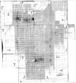
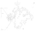
The Herrin Coal was mined in the Georgetown Quadrangle, generally averaging between 5.5 and 6.0 feet thick. The roof was most often the Energy Shale, a silty gray shale that had layers of siltstone, and required conscientious attention to keep up. Rolls and faults were present in most of the mines as well. Mining took place between 1904 and 1947, until the Riola Mine (mine index 1018) opened in 1996. Mining appears to have ceased in the area with the closing of Vermilion Grove Mine (mine index 1026).
Map and Directory PDF Download
Coal Mines In Illinois Georgetown Quadrangle
Mines that Appear on the Georgetown Quadrangle
Unlocated Mines
Vermilion County
Edgar County
Pages in category "Georgetown Quadrangle"
The following 22 pages are in this category, out of 22 total.
Media in category "Georgetown Quadrangle"
The following 9 files are in this category, out of 9 total.
- 0401 bunsen.jpg 3,390 × 2,267; 334 KB
- M0091.jpg 3,390 × 2,535; 2.57 MB
- M0093 coalreport1912 p273.pdf 1,643 × 1,241, 2 pages; 692 KB
- M0093 minenotes.pdf 739 × 1,193, 34 pages; 8.03 MB
- M0093mrg.jpg 3,390 × 2,674; 3.14 MB
- M0401mrg.jpg 3,076 × 3,390; 3.17 MB
- M1018 minenotes.pdf 800 × 1,183, 91 pages; 18.48 MB
- M1026 minenotes.pdf 768 × 1,191, 26 pages; 8.11 MB
- M3670.jpg 3,390 × 2,901; 476 KB


