Mine Index Number: 0093
| Company Name:
|
United States Fuel Company
|
| Mine Name:
|
Vermilion Mine
|
| Start Date:
|
1905
|
End Date:
|
March 1932
|
| Type of Mine:
|
Underground
|
| Total acres shown:
|
2,870
|
| Acres after map date:
|
|
General Area of mining acres shown:
|
|
|
Connected underground to Kelly No. 4 Mine (mine index 3660) near Kelly’s auxiliary shaft in 17-T18N-R11W; connection sealed in March 1930.
|
Shaft, Slope, Drift or Tipple Location(s)
| Type
|
County
|
Township-Range
|
Section
|
Part Section
|
| Main shaf
|
Vermilion
|
18N 11W
|
19
|
NE NW SE
|
| Air shaft
|
Vermilion
|
18N 11W
|
19
|
NE NW SE
|
| Air shaft
|
Vermilion
|
18N 11W
|
30
|
SE NW NE
|
Geology
| Herrin
|
180-194
|
0-5.5
|
9.5-12.0
|
6.0-7.5
|
MRP, HERFrom the mine notes, ca. 1912, “pillars were largely drawn”. It is not known how long this procedure continued.
|
Geological Problems Reported
The immediate roof was gray sandy shale that ranged from 11 to 50 feet thick and was interbedded with the top layers of the coal, and came down readily. Rolls from the roof were an important factor to mining. A small amount of sulfur and gypsum was present in cracks throughout most of the mine. The floor was clay up to 6 feet thick. The mine was dry, but the clay did swell readily upon becoming wet. Heaving was not a characteristic of this mine. Faults were noted on the company map in various parts of the mine, but particularly in sections 19 and 20 of T18N R11W. Some faults disturbed the mining pattern and made the coal difficult to get while others had no apparent affect. Some of these faults may have been channels or other erosional features. A 70-foot roof fall was noted southeast of the shaft.
Production
| Company
|
Mine Name
|
Date
|
Production (tons)
|
|
|
|
|
|
| Total Production: 18,613,168
|
Production Notes
Coal Report production (if available)
Sources of Data
| ISGS map library, 4103.V4 i5.1-125
|
4-1-1932
|
1:1200
|
1:1200
|
Final
|
Annotated Bibliography (Data source - brief description of information)
| Coal Reports - Production, ownership, years of operation, seam, depth.
|
| Mine notes (Vermilion County) - Mine type, shaft locations, seam, depth, thickness, geologic problems, mining method.
|
| ISGS map library, 4103.V4 i5.1-125 - Shaft locations, mine outline, mining method, geologic problems.
|
Mine Notes
Mine Images
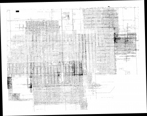
Company map: 4103.V4 i5.1-125
Map Date: 4-1-1932
Coal Co.: United States Fuel Company
Mine Name: Vermilion Mine
Full Res Download
Photographs


