Mine Index Number: 3660
| Company Name:
|
United States Fuel Company
|
| Mine Name:
|
Kelly No. 4 Mine
|
| Start Date:
|
1902
|
End Date:
|
May 1924
|
| Type of Mine:
|
Underground
|
| Total acres shown:
|
1,586
|
| Acres after map date:
|
|
General Area of mining acres shown:
|
|
|
The boundaries between the Kelly mines (No.s 1 through 5 and 46 and 47, mine index numbers 3731, 3729, 3663, 3660, 3740, 3664 and 3661) cannot be distinguished with any accuracy. The total area for these Kelly mines (5,300 acres) is in line with production of all the Kelly mines.
|
Shaft, Slope, Drift or Tipple Location(s)
| Type
|
County
|
Township-Range
|
Section
|
Part Section
|
| Main shaft
|
Vermilion
|
18N 11W
|
5
|
NW SE SW
|
| Air shaft
|
Vermilion
|
18N 11W
|
5
|
SE NE SW
|
| Auxiliary shaft
|
Vermilion
|
18N 11W
|
17
|
SW SW NE
|
Geology
| Herrin
|
90-164
|
|
|
6.0-7.0
|
MRP, HERThe 1911 Coal Report listed a death that occurred while the miner was pulling pillars. The extent of this practice is not known but is shown extensively in the southern and eastern portions of the mine on the source map.
|
Geological Problems Reported
The roof was a sandy gray shale that was described as treacherous. The source map shows a fault trending northeast-southwest in the northeast part of the mine, but this may be a depositional or compactional feature rather than tectonic. Another fault was shown in the northwestern portion of the mine.
Production
| Company
|
Mine Name
|
Date
|
Production (tons)
|
|
|
|
|
|
| Total Production: 9,411,256
|
Production Notes
Coal Report production (if available)
Sources of Data
| State Archive, MSHA_1168_01
|
1-1910
|
1:2400
|
1:2400
|
Not final
|
| Company, 4103.V4 i5.1-124 A final map is available at the Vermilion County Recorder’s Office (cabinet 03900, drawer 3). The map is too large to trace.
|
6-12-1923
|
1:1200
|
1:1200
|
Not final
|
Annotated Bibliography (Data source - brief description of information)
| Coal Reports - Production, ownership, years of operation, depth, thickness, mining method.
|
| Directory of Illinois Coal Mines (Vermilion County) - Mine names, mine index, ownership, years of operation.
|
| Mine notes (Vermilion County) - Mine type, shaft location, seam, depth, thickness, geologic problems.
|
| Company map, State Archive, MSHA_1168_01, courtesy of Robert Gibson, DNR - Mine outline (northern & northwestern), geologic problems.
|
| Company map, ISGS map library, 4103.V4 i5.1-124 - Shaft locations, mine outline, mining method, geologic problems.
|
Mine Notes
Mine Images
Company map: MSHA_1168
Map Date: 3-1907
Coal Co.: Kelly Coal Company
Mine Name: Kelly No. 47 Mine
Image Credit: Illinois Department of Natural Resources - Office of Mines and Minerals
Full Res Download
Map library: 4103.V4 i5.1-135
Map Date: 7-1-1947
Coal Co.: United States Fuel Company
Mine Name: Kelly No. 4 Mine
Full Res Download
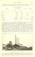
Photographs