Mine Index Number: 3740
| Company Name:
|
Bunsen Coal Company
|
| Mine Name:
|
Kelly No. 5 Mine
|
| Start Date:
|
1902
|
End Date:
|
May 1911
|
| Type of Mine:
|
Underground
|
| Total acres shown:
|
263
|
| Acres after map date:
|
|
General Area of mining acres shown:
|
|
|
The mine was later partially surface mined by Mary Moore No. 25 Mine (mine index 3707).
The boundaries between the Kelly mines (No.s 1 through 5 and 46 and 47, mine index numbers 3731, 3729, 3663, 3660, 3740, 3664 and 3661) cannot be distinguished with any accuracy. The total area for these Kelly mines (5,300 acres) is in line with production of all the Kelly mines.
|
Shaft, Slope, Drift or Tipple Location(s)
| Type
|
County
|
Township-Range
|
Section
|
Part Section
|
| Main shaft
|
Vermilion
|
19N 11W
|
32
|
NE SW NE
|
| Air shaft
|
Vermilion
|
19N 11W
|
32
|
SE NW NE
|
Geology
Geological Problems Reported
Production
| Company
|
Mine Name
|
Date
|
Production (tons)
|
| Kelly Coal Company
|
Kelly No. 45
|
1906-1909 Idle 1909. The title block for the 1909 source map indicates the mine was owned by Hammond Coal Company, and was known as the No. 45 Mine. A handwritten note on the map blueline print states the mine was operated by Brazil Block Coal Company. Production was not reported under either name.
|
308,135
|
|
|
|
|
|
|
|
| Total Production: 1,189,189
|
Production Notes
Coal Report production (if available)
Sources of Data
| ISGS map library, 4103.V4 i5.1-135 The map is incomplete in the northwestern part of the mine.
|
7-1-1947
|
1:42240
|
1:42240
|
Secondary source
|
| State Archive, MSHA_1050_01
|
4-11-1909
|
1:2400
|
1:2400
|
Not final
|
Annotated Bibliography (Data source - brief description of information)
| Coal Reports - Production, ownership, years of operation, depth, thickness.
|
| Directory of Illinois Coal Mines (Vermilion County) - Mine names, mine index, ownership, years of operation.
|
| Mine notes (Vermilion County) - Mine type, shaft location, seam, thickness.
|
| ISGS map library, 4103.V4 i5.1-135, property map of U.S. Coal & Coke - Mine location, mine outline.
|
| ISGS map library, 4103.V4 i5.1-124, map of Kelly No. 4 (mine index 3660) - Mine outline, mine location, mining method.
|
| Company map, State Archive, MSHA_1050_01, courtesy Robert Gibson, DNR - Mine outline, shaft locations, mining method.
|
Mine Notes
Mine Images
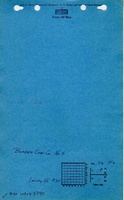
Company: MSHA_1050
Map Date: 4-11-1909
Coal Co.: Bunsen Coal Company
Mine Name: Kelly No. 5 Mine
Image Credit: Illinois Department of Natural Resources - Office of Mines and Minerals
Full Res Download
Photographs
Caption: Brick house near Danville abandoned on account of danger by room-and-pillar mining of a 6-foot coal at a depth of about 200 feet.
Credit: Illinois State Geological Survey
Date: Pre-1914
Publication: Fig. 42 Cooperative Bulletin 17 – Subsidence in Illinois
Library No.: M-1007
Caption: Brick house near Danville abandoned on account of danger by room-and-pillar mining of a 6-foot coal at a depth of about 200 feet.
Credit: Illinois State Geological Survey
Date: Pre-1914
Library No.: M-1008
Caption: Brick house near Danville abandoned on account of danger by room-and-pillar mining of a 6-foot coal at a depth of about 200 feet.
Credit: Illinois State Geological Survey
Date: Pre-1914
Library No.: M-1009
Caption: Brick house near Danville abandoned on account of danger by room-and-pillar mining of a 6-foot coal at a depth of about 200 feet.
Credit: Illinois State Geological Survey
Date: Pre-1914
Library No.: M-1010
Caption: Brick house near Danville abandoned on account of danger by room-and-pillar mining of a 6-foot coal at a depth of about 200 feet.
Credit: Illinois State Geological Survey
Date: Pre-1914
Library No.: M-1011
Caption: Subsidence Kelly No 5 Mine
(Mine Index:3740)
Credit: Illinois State Geological Survey
Date: Pre-1914
Library No.: M-929