Mine Index Number: 3731
| Company Name:
|
Kellyville Coal Company
|
| Mine Name:
|
Kellyville No. 1 Mine
|
| Start Date:
|
1878
|
End Date:
|
May 1, 1898
|
| Type of Mine:
|
Underground
|
| Total acres shown:
|
253
|
| Acres after map date:
|
|
General Area of mining acres shown:
|
|
|
The boundaries between the Kelly mines (No.s 1 through 5 and 46 and 47, mine index numbers 3731, 3729, 3663, 3660, 3740, 3664 and 3661) cannot be distinguished with any accuracy. The total area for these Kelly mines (5,300 acres) is in line with production of all the Kelly mines.
|
Shaft, Slope, Drift or Tipple Location(s)
| Type
|
County
|
Township-Range
|
Section
|
Part Section
|
| Main shaft
|
Vermilion
|
19N 11W
|
32
|
SE SW SE No air shafts were shown in this portion of the Kelly mines complex. Interconnection with other Kelly mines underground probably provided air and escapeways to satisfy regulations of the times.
|
Geology
Geological Problems Reported
Production
| Company
|
Mine Name
|
Date
|
Production (tons)
|
| Michael Kelly
|
Kelly No. 1
|
1878-1891 The mine reported in 1879 & the mine reported in 1882 may be different mines; 1882 was reputedly a surface mine. Production in 1881 and prior to 1878 is unknown.
|
568,220
|
|
|
|
|
|
|
|
| Total Production: 1,015,956
|
Production Notes
Coal Report production (if available)
Sources of Data
| State Archive, MSHA_1050_01
|
4-11-1909
|
1:2400
|
1:2400
|
Secondary source
|
| ISGS map library, 4103.V4 i5.1-135
|
7-1-1947
|
1:42240
|
1:42240
|
Secondary source
|
Annotated Bibliography (Data source - brief description of information)
| Coal Reports - Production, ownership, years of operation, depth, thickness, mining method.
|
| Directory of Illinois Coal Mines (Vermilion County) - Mine names, mine index, ownership, years of operation.
|
| Mine notes (Vermilion County) - Mine type, shaft location, seam.
|
| State Archive, MSHA_1050_01, map of Hammond No. 45 Mine (mine index 3740), courtesy Robert Gibson, DNR - Mine outline (northern).
|
| ISGS map library, 4103.V4 i5.1-135, property map of U.S. Coal & Coke Company - Shaft location, mine outline, mining method.
|
Mine Notes
Mine Images
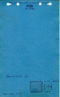
Company: MSHA_1050
Map Date: 4-11-1909
Coal Co.: Bunsen Coal Company
Mine Name: Kelly No. 5 Mine
Image Credit: Illinois Department of Natural Resources - Office of Mines and Minerals
Full Res Download
Photographs