Mine Index Number: 0656
| Company Name:
|
Kedas Coal Company
|
| Mine Name:
|
Kedas Mine
|
| Start Date:
|
1925
|
End Date:
|
April 1955
|
| Type of Mine:
|
Surface
|
| Total acres shown:
|
2
|
| Production Indicated Acres:
|
Production indicates that 3 to 4 acres were mined. The source map is poor and some difficulties with the map scale may have resulted with the polygon shown on the accompanying map being smaller than the predicted acreage. An earlier map also indicates that Kedas mined in other areas as well; the tonnage shown below may be from several locations.
|
General Area of mining acres shown:
|
|
|
|
Shaft, Slope, Drift or Tipple Location(s)
| Type
|
County
|
Township-Range
|
Section
|
Part Section
|
| Tipple
|
Vermilion
|
18N 11W
|
32
|
NW SE SE
|
Geology
| Danville
|
14
|
|
|
5.33-5.83
|
Surface
|
Geological Problems Reported
Production
| Company
|
Mine Name
|
Date
|
Production (tons)
|
| Alex Kedas
|
Kedas
|
1925-1934
|
1,010 Production not reported 1930-1933 for mines producing less than 1,000 tons per year
|
|
|
Production Notes
Coal Report production (if available)
Sources of Data
| Microfilm, document 353000
|
8-1-1955
|
|
1:5193 The source map had no scale, but shows sufficient area to determine the digitized map scale with a reasonable degree of certainty.
|
Final
|
| Company, 10-6-28
|
12-15-1952
|
1:1200
|
1:1200
|
Not final
|
Annotated Bibliography (Data source - brief description of information)
| Coal Reports - Production, ownership, years of operation.
|
| Directory of Illinois Coal Mines (Vermilion County) - Mine names, mine index, ownership, years of operation.
|
| Mine notes (Vermilion County) - Seam, depth, thickness.
|
| Microfilm map, document 353000, reel 03141, frame 145 - Mine outline, mining method.
|
| Company map, courtesy of Anita Kedas, copied, Coal Section files 10-6-28 - Mine outline (enlargement of pit for mine index 3754, Bunting Mine).
|
Mine Notes
Mine Images
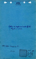
Microfilm: 353000
Map Date: 8-1-1955
Coal Co.: Kedas Coal Company
Mine Name: Kedas Mine
Full Res Download
Coal Section Files: 10-6-28
Map Date: 12-15-1952
Coal Co.: Kedas Coal Company
Mine Name: Kedas Mine
Full Res Download
Photographs