Mine Index Number: 0094
| Company Name:
|
Electric Coal Company
|
| Mine Name:
|
Electric Mine
|
| Start Date:
|
1903
|
End Date:
|
April 1914
|
| Type of Mine:
|
Underground
|
| Total acres shown:
|
None
|
| Acres after map date:
|
|
General Area of mining acres shown:
|
285
|
|
The mine may have been partially surface mined at a later date by Harmattan Mine (mine index 0673).
|
Shaft, Slope, Drift or Tipple Location(s)
| Type
|
County
|
Township-Range
|
Section
|
Part Section
|
| Main shaft
|
Vermilion
|
19N 12W
|
10
|
NE NW SW The mine notes indicate the air shaft is 3,000 feet south of the hoist shaft, which would place the air shaft in section 15-T19N-R12W.
|
Geology
| Danville
|
96-108
|
4.0-5.0
|
7.0
|
5.5-6.0
|
RP, HERAccording to the mine notes, some pillars were drawn where the roof permitted.
|
Geological Problems Reported
The roof was 0 to 3 feet of black shale that slaked readily on contact with air, and which was overlain by 40 to 50 feet of gray shale. A former stream channel cut down to within 10 feet of the coal. Where the rooms struck this roof, the roof fell and let in sand and a great deal of water. Gas was occasionally found in pockets in the coal. Numerous horsebacks, rolls, and sulfur balls were present in the roof. The seam contained a persistent clay band 6 to 10 inches above the floor. The clay band varied from a knife-edge to 2 inches thick, and contained considerable sulfur. The top 6 inches of underclay heaved considerably.
Production
| Company
|
Mine Name
|
Date
|
Production (tons)
|
|
|
|
|
|
| Total Production: 1,408,684
|
Production Notes
Coal Report production (if available)
Sources of Data
| Federal Land Bank Report
|
1-1934
|
1:105000
|
1:105000
|
Secondary source
|
| ISGS mine notes
|
Undated
|
(text only)
|
1:24000 Point plotted onto 1:24,000 USGS topographic map and digitized.
|
Secondary source
|
Annotated Bibliography (Data source - brief description of information)
| Coal Reports - Production, ownership, years of operation, mining method.
|
| Directory of Illinois Coal Mines (Vermilion County) - Mine names, mine index, ownership, years of operation.
|
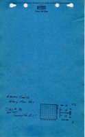
| Mine notes (Vermilion County) - Mine type, air shaft location, seam, depth, thickness, geologic problems, mining method.
|
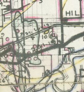
| Federal Land Bank Report (Vermilion County) - Mine outline, shaft location.
|
Mine Notes
Mine Images
Federal Land Bank Report:
Map Date: 1-1934
Coal Co.: Electric Coal Company
Mine Name: Electric Mine
Full Res Download
Photographs


