Mine Index Number: 0852
| Company Name:
|
Black Hawk Coal Company
|
| Mine Name:
|
Black Hawk Mine
|
| Start Date:
|
1934
|
End Date:
|
1942
|
| Type of Mine:
|
Underground
|
| Total acres shown:
|
7
|
| Acres after map date:
|
less than one
|
General Area of mining acres shown:
|
|
|
|
Shaft, Slope, Drift or Tipple Location(s)
| Type
|
County
|
Township-Range
|
Section
|
Part Section
|
| Main slope
|
Vermilion
|
19N 12W
|
9
|
NE SW SE
|
| Air shaft
|
Vermilion
|
19N 12W
|
9
|
SE SW SE
|
Geology
Geological Problems Reported
Production
| Company
|
Mine Name
|
Date
|
Production (tons)
|
Production Notes
Coal Report production (if available)
Sources of Data
| Microfilm, document 352947 A final map (dated 6-15-1943) is available at the Vermilion County Recorder’s Office (cabinet 03903, drawer 4). Since much less than an acre was mined after the map date, this map has not yet been copied.
|
6-27-1941
|
1:600
|
1:993
|
Not final
|
Annotated Bibliography (Data source - brief description of information)
| Coal Reports - Production, ownership, years of operation.
|
| Directory of Illinois Coal Mines (Vermilion County) - Mine names, mine index, ownership, years of operation.
|
| Mine notes (Vermilion County) - Mine type, slope and air shaft locations, seam, depth, thickness.
|
| Microfilm map, document 352947, reel 03141, frame 89 - Slope & shaft locations, mine outline, mining method.
|
Mine Notes
Mine Images
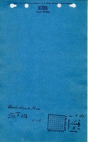
Microfilm: 352947
Map Date: 6-27-1941
Coal Co.: Black Hawk Coal Company
Mine Name: Black Hawk Mine
Full Res Download
Photographs