File:M0507a.jpg: Difference between revisions
No edit summary |
No edit summary |
||
| Line 1: | Line 1: | ||
{{Image | |||
|File name=M0507a.jpg | |||
|Mine-index=0507 | |||
|Coal_co=Grape Creek Mining Company | |||
|Mine_name=Grape Creek No. 7 Mine | |||
|Map Date=11-1-1941 | |||
|Map Type=Company | |||
|Map Scale=1:63360 | |||
|Map Status=Final | |||
|Map ID=4103.V4 i5.1-84 | |||
|county1=Vermilion | |||
|quad1=Danville SW | |||
|Image Notes=ISGS map library, 4103.V4 i5.1-84 | |||
|Image Used For=two southernmost pits, mine outline | |||
}} | |||
Revision as of 10:27, March 17, 2021
| Mine Index(s): | 0507 |
| Mine Company: | Grape Creek Mining Company |
| Mine Name | Grape Creek No. 7 Mine |
| Map Date | 11-1-1941 |
| Map Scale | 1:63360 |
| Map Type microfilm/company/wpa/quade | Company |
| Map Status final,not final, secondary | Final |
| ID Number | 4103.V4 i5.1-84 |
| Used For | two southernmost pits, mine outline |
| Notes | ISGS map library, 4103.V4 i5.1-84 |
| Image Credit | |
File history
Click on a date/time to view the file as it appeared at that time.
| Date/Time | Thumbnail | Dimensions | User | Comment | |
|---|---|---|---|---|---|
| current | 10:24, March 17, 2021 | 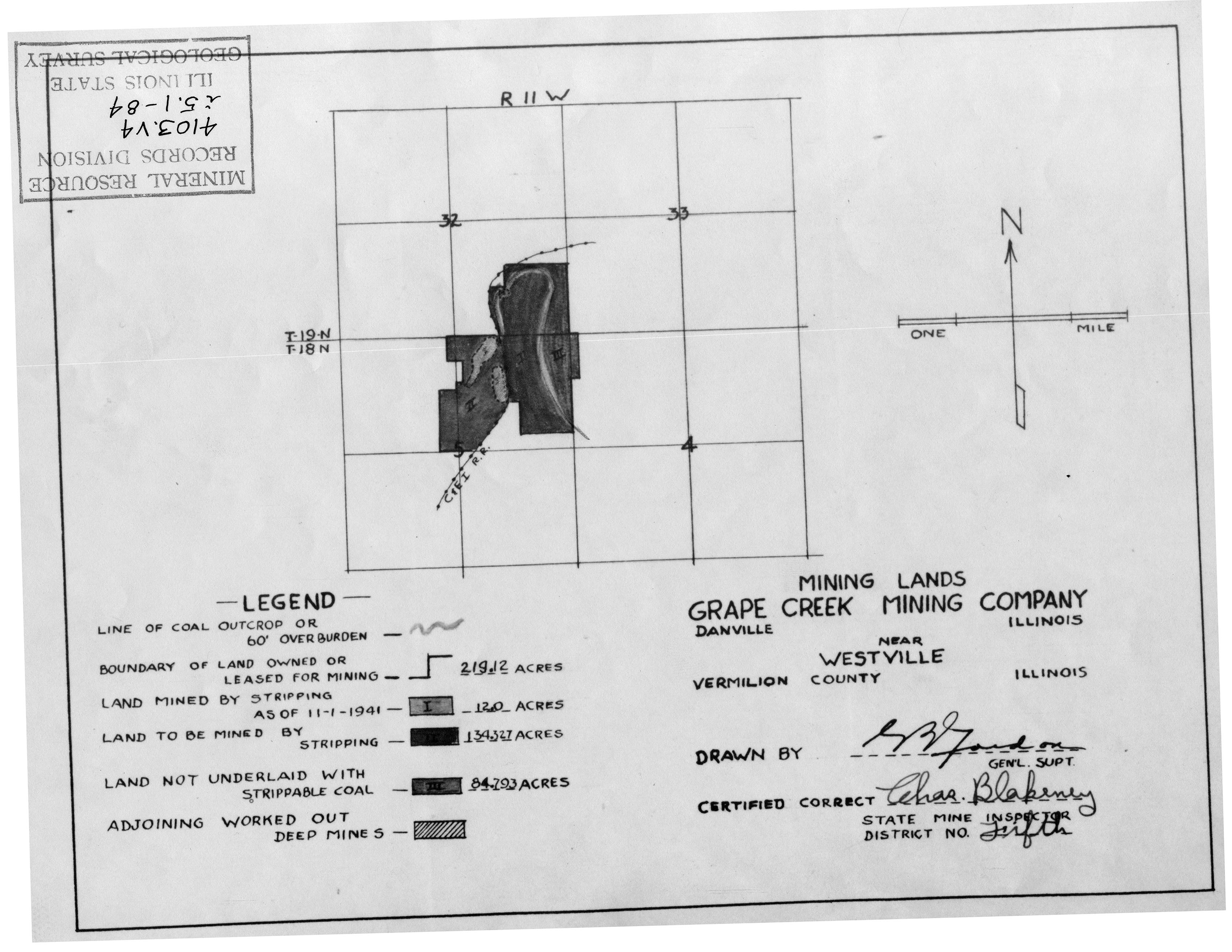 | 3,390 × 2,619 (916 KB) | Cheri (talk | contribs) |
You cannot overwrite this file.
File usage
The following page uses this file: