File:M3670.jpg: Difference between revisions
No edit summary |
No edit summary |
||
| Line 11: | Line 11: | ||
|county1=Vermilion | |county1=Vermilion | ||
|quad1=Danville SW | |quad1=Danville SW | ||
|quad2=Georgetown | |||
|Image Notes=Coal Section files, 10-7-15b, traced map in Vermilion County Recorder's Office, Cabinet 03900, Drawer 1, Folder 8 | |Image Notes=Coal Section files, 10-7-15b, traced map in Vermilion County Recorder's Office, Cabinet 03900, Drawer 1, Folder 8 | ||
|Image Used For=mine outline, shaft locations, mining method | |Image Used For=mine outline, shaft locations, mining method | ||
}} | }} | ||
Revision as of 15:31, March 24, 2021
| Mine Index(s): | 3670 |
| Mine Company: | Dering Coal Company |
| Mine Name | Dering No. 3 Mine |
| Map Date | 5-19-1913 |
| Map Scale | 1:2400 |
| Map Type microfilm/company/wpa/quade | Coal Section files |
| Map Status final,not final, secondary | Final |
| ID Number | 10-7-15b |
| Used For | mine outline, shaft locations, mining method |
| Notes | Coal Section files, 10-7-15b, traced map in Vermilion County Recorder's Office, Cabinet 03900, Drawer 1, Folder 8 |
| Image Credit | |
File history
Click on a date/time to view the file as it appeared at that time.
| Date/Time | Thumbnail | Dimensions | User | Comment | |
|---|---|---|---|---|---|
| current | 15:26, March 24, 2021 | 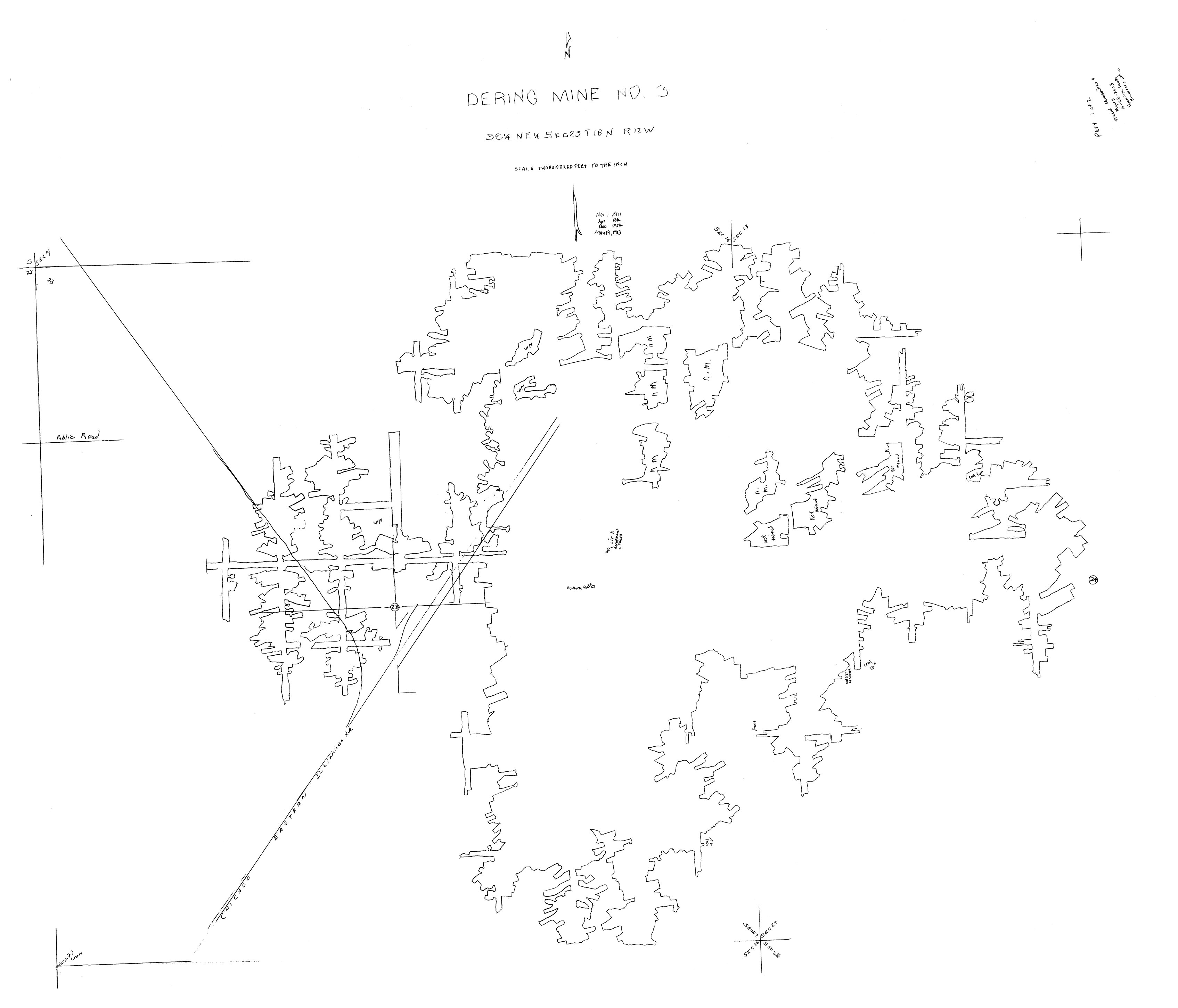 | 3,390 × 2,901 (476 KB) | Cheri (talk | contribs) |
You cannot overwrite this file.
File usage
The following page uses this file: