File:M0507b.jpg: Difference between revisions
No edit summary |
Alan.Myers (talk | contribs) No edit summary |
||
| Line 9: | Line 9: | ||
|Map Status=Not final | |Map Status=Not final | ||
|Map ID=4103.V4 i5.1-27 | |Map ID=4103.V4 i5.1-27 | ||
|Map hires=https://wikiimage.isgs.illinois.edu/ilmines/vermilion/m0507b.zip | |||
|county1=Vermilion | |county1=Vermilion | ||
|quad1=Danville SW | |quad1=Danville SW | ||
Latest revision as of 09:11, July 14, 2021
CLICK HERE TO DOWNLOAD THE HIGH RESOLUTION IMAGE. FILE SIZE MAY BE LARGE(Note:this file is usually better quality than "original file" linked above)
| Mine Index(s): | 0507 |
| Mine Company: | Grape Creek Mining Company |
| Mine Name | Grape Creek No. 7 Mine |
| Map Date | 2-20-1940 |
| Map Scale | 1:1200 |
| Map Type microfilm/company/wpa/quade | Company |
| Map Status final,not final, secondary | Not final |
| ID Number | 4103.V4 i5.1-27 |
| Used For | mine outline (northern pit), tipple location |
| Notes | Company map, ISGS map library, 4103.V4 i5.1-27 |
| Image Credit | |
| Hi-Res Download | Click to download |
File history
Click on a date/time to view the file as it appeared at that time.
| Date/Time | Thumbnail | Dimensions | User | Comment | |
|---|---|---|---|---|---|
| current | 10:28, March 17, 2021 | 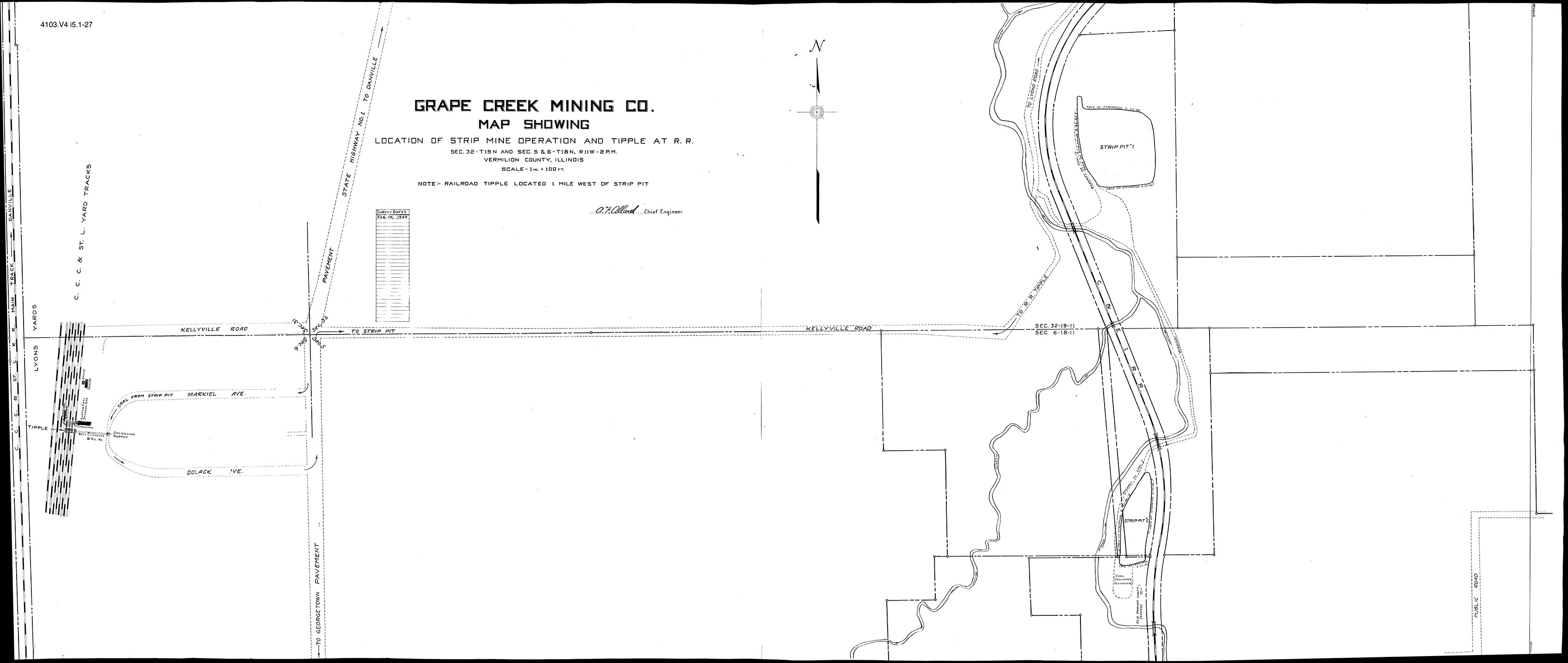 | 3,390 × 1,433 (305 KB) | Cheri (talk | contribs) |
You cannot overwrite this file.
File usage
The following page uses this file: