File:M1019.jpg: Difference between revisions
No edit summary |
Alan.Myers (talk | contribs) No edit summary |
||
| (One intermediate revision by one other user not shown) | |||
| Line 1: | Line 1: | ||
{{Image | |||
|File name=M1019.jpg | |||
|Mine-index=1019 | |||
|Coal_co=Cottonwood Coal Company | |||
|Mine_name=Cottonwood No. 1 Mine | |||
|Map Date=2003 | |||
|Map Type=Coal Section files | |||
|Map Scale=unknown | |||
|Map Status=Secondary source | |||
|Map ID=10-9-3 | |||
|Map hires=https://wikiimage.isgs.illinois.edu/ilmines/williamson/m1019.zip | |||
|county1=Williamson | |||
|quad1=Johnston City | |||
|Image Notes=aerial photograph enlargement and DMM permit outline, Coal Section files 10-9-3 | |||
|Image Used For=mine location | |||
}} | |||
Latest revision as of 11:21, June 2, 2022
CLICK HERE TO DOWNLOAD THE HIGH RESOLUTION IMAGE. FILE SIZE MAY BE LARGE(Note:this file is usually better quality than "original file" linked above)
| Mine Index(s): | 1019 |
| Mine Company: | Cottonwood Coal Company |
| Mine Name | Cottonwood No. 1 Mine |
| Map Date | 2003 |
| Map Scale | unknown |
| Map Type microfilm/company/wpa/quade | Coal Section files |
| Map Status final,not final, secondary | Secondary source |
| ID Number | 10-9-3 |
| Used For | mine location |
| Notes | aerial photograph enlargement and DMM permit outline, Coal Section files 10-9-3 |
| Image Credit | |
| Hi-Res Download | Click to download |
File history
Click on a date/time to view the file as it appeared at that time.
| Date/Time | Thumbnail | Dimensions | User | Comment | |
|---|---|---|---|---|---|
| current | 08:49, April 26, 2022 | 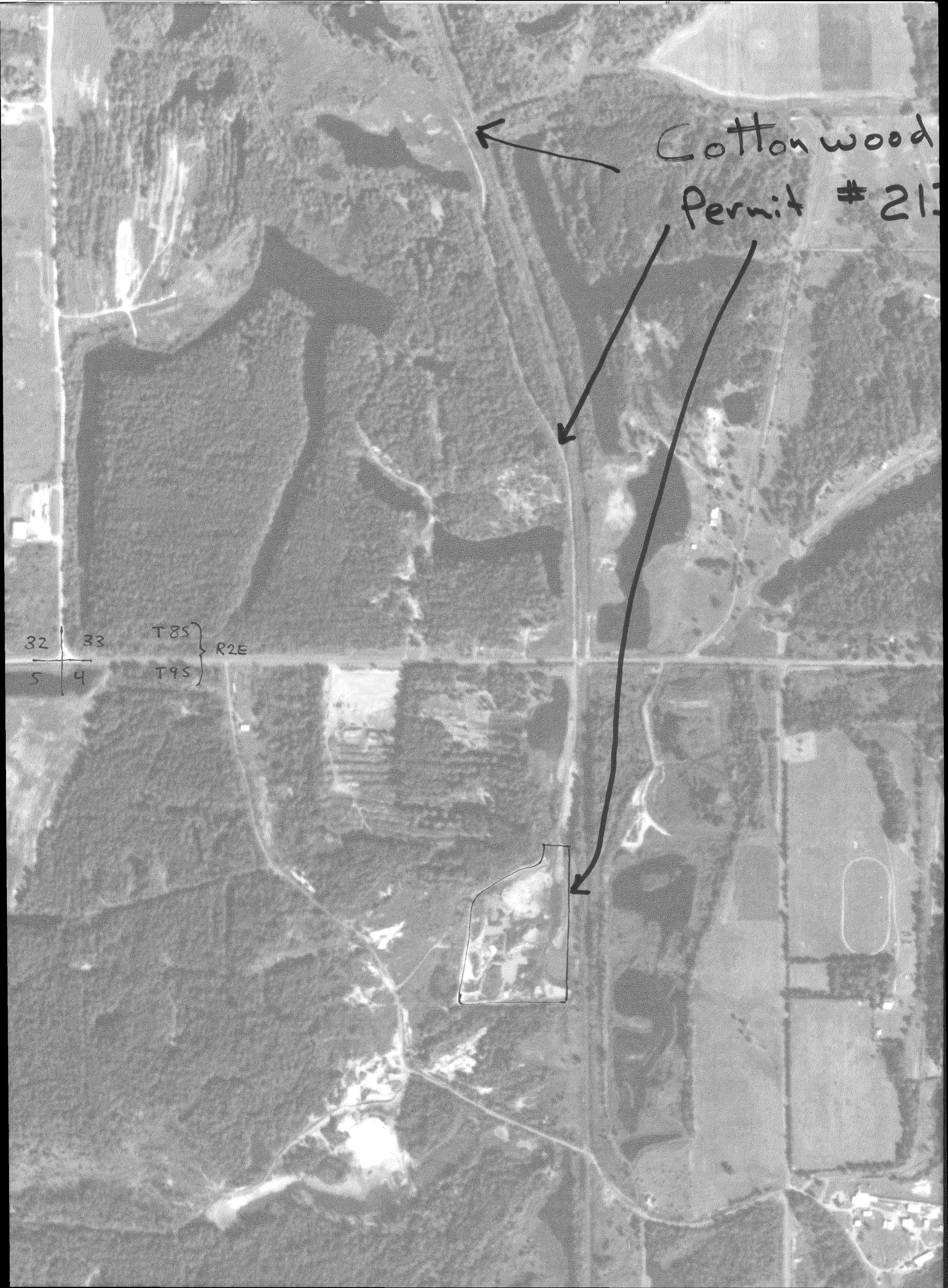 | 2,495 × 3,390 (3.7 MB) | Cheri (talk | contribs) |
You cannot overwrite this file.
File usage
The following page uses this file: