0439: Difference between revisions
Alan.Myers (talk | contribs) No edit summary |
No edit summary |
||
| (2 intermediate revisions by 2 users not shown) | |||
| Line 1: | Line 1: | ||
{{Sidebar Info Query}} | {{Sidebar Info Query}} | ||
{{Header | {{Header | ||
|checked=Checked OK | |||
|unlocated=No | |unlocated=No | ||
|shown_on_map=Yes | |shown_on_map=Yes | ||
| Line 8: | Line 9: | ||
|mine_type=Underground | |mine_type=Underground | ||
|mined-out-area=396 | |mined-out-area=396 | ||
|indicated=No | |||
|county1=Madison | |county1=Madison | ||
|quad1=Collinsville | |quad1=Collinsville | ||
|year-start=1903 | |year-start=1903 | ||
|year-end=1927 | |year-end=June 30, 1927 | ||
|Latitude=38.6754729530001 | |Latitude=38.6754729530001 | ||
|Longitude=-89.9596363639999 | |Longitude=-89.9596363639999 | ||
| Line 55: | Line 57: | ||
|Date=1903-1927 {{#info: Idle 1925|note}} | |Date=1903-1927 {{#info: Idle 1925|note}} | ||
|Production=2,330,988 | |Production=2,330,988 | ||
|Sum=Yes | |||
| | |||
}} | }} | ||
===Production Notes=== | ===Production Notes=== | ||
Latest revision as of 12:13, October 21, 2022
Mine Index Number: 0439
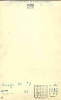
| Company Name: | Lumaghi Coal Company | ||
|---|---|---|---|
| Mine Name: | Cantine No. 3 Mine | ||
| Start Date: | 1903 | End Date: | June 30, 1927 |
| Type of Mine: | Underground | ||
| Total acres shown: | 396 | ||
| Acres after map date: | General Area of mining acres shown: | ||
Shaft, Slope, Drift or Tipple Location(s)
| Type | County | Township-Range | Section | Part Section |
|---|
| Main shaft | Madison | 3N 8W | 26 | NW SE SW |
| Air shaft | Madison | 3N 8W | 26 | NW SE SW |
Geology
| Thickness (ft) | |||||
|---|---|---|---|---|---|
| Seam | Depth (ft) | Min | Max | Ave | Mining Method |
| Herrin | 166-192 | 7.0 | 9.5 | 7.0 | MRP |
Geological Problems Reported
Occasional concretions occurred in the roof.
Production
| Company | Mine Name | Date | Production (tons) |
| Lumaghi Coal Company | Lumaghi No. 3 | 1903-1927 Idle 1925 | 2,330,988 |
| Total Production: 2,330,988 | |||
Production Notes
Coal Report production (if available)
Sources of Data
| Source Map | Map Date | Original Scale | Digitized Scale | Map Type |
| Microfilm, document 352370 | 7-1944 | 1:2400 | 1:5297 | Final |
Annotated Bibliography (Data source - brief description of information)
| Coal Reports - Production, ownership, years of operation. |
| Directory of Illinois Coal Mines (Madison County) - Mine names, mine index, ownership, years of operation. |
| Mine notes (Madison County) - Mine type, shaft location, seam, depth, thickness, geologic problems. |
| Microfilm map, document 352370, reel 03138, frames 492-493 - Shaft locations, mine outline, mining method. |
| Microfilm map, document 352369, reel 03138, frame 491 - Closing date. |
Mine Notes
Mine Images


Photographs