0103: Difference between revisions
Alan.Myers (talk | contribs) No edit summary |
No edit summary |
||
| (2 intermediate revisions by the same user not shown) | |||
| Line 1: | Line 1: | ||
{{Sidebar Info Query}} | {{Sidebar Info Query}} | ||
{{Header | {{Header | ||
|checked= | |checked=Checked OK | ||
|unlocated=No | |unlocated=No | ||
|shown_on_map=Yes | |shown_on_map=Yes | ||
| Line 9: | Line 9: | ||
|mine_type=Underground | |mine_type=Underground | ||
|mined-out-area=343 | |mined-out-area=343 | ||
|after_map=25{{#info: | |after_map=25 {{#info:The area mined in the Danville Coal is unknown. No map was found of workings in the Danville Coal, and the years of operation in that seam are uncertain. The Coal Reports indicate the earliest mining took place in the Danville Coal (1882 to 1885), and the mining from 1933 to 1936 was in the upper seam.|note}} | ||
|indicated=Yes | |||
|county1=La Salle | |county1=La Salle | ||
|county2=Marshall | |||
|quad1=Minonk | |quad1=Minonk | ||
|city1=Rutland | |||
|year-start=1881 | |year-start=1881 | ||
|year-end=1936 | |year-end=1936 | ||
|Latitude=40.97819878 | |Latitude=40.97819878 | ||
|Longitude=-89.04114113 | |Longitude=-89.04114113 | ||
|Zoom=15 | |Zoom=15 | ||
| Line 22: | Line 25: | ||
{{Shaft locations header}} | {{Shaft locations header}} | ||
{{Shaft locations | {{Shaft locations | ||
|shaft_type=Main shaft{{#Info:The main hoist shaft was sunk in 1894 and the original hoist shaft was then used for ventilation and escapement | |shaft_type=Main shaft {{#Info:The main hoist shaft was sunk in 1894 and the original hoist shaft was then used for ventilation and escapement.|note}} | ||
|County=La Salle | |County=La Salle | ||
|Town-Range=29N 2E | |Town-Range=29N 2E | ||
| Line 29: | Line 32: | ||
}} | }} | ||
{{Shaft locations | {{Shaft locations | ||
|shaft_type=Escape / air shaft{{#info:The main hoist shaft was sunk in 1894 and the original hoist shaft was then used for ventilation and escapement. The air shaft was also used to hoist coal from the Danville Coal from 1933 to 1936.|note}} | |shaft_type=Escape / air shaft {{#info:The main hoist shaft was sunk in 1894 and the original hoist shaft was then used for ventilation and escapement. The air shaft was also used to hoist coal from the Danville Coal from 1933 to 1936.|note}} | ||
|County=La Salle | |County=La Salle | ||
|Town-Range=29N 2E | |Town-Range=29N 2E | ||
| Line 51: | Line 54: | ||
|thick-ave=3.0 | |thick-ave=3.0 | ||
|mining-method=LW | |mining-method=LW | ||
|mining-method_note= (old longwall) | |||
}} | }} | ||
===Geological Problems Reported=== | ===Geological Problems Reported=== | ||
| Line 61: | Line 65: | ||
|Company=William Magher | |Company=William Magher | ||
|Mine-Name=Magher | |Mine-Name=Magher | ||
|Date=1881-1884{{#info:Idle 1884|note}} | |Date=1881-1884 {{#info:Idle 1884|note}} | ||
|Production=3,200 | |Production=3,200 | ||
|Sum=No | |Sum=No | ||
| Line 68: | Line 72: | ||
|Company=Emerson Hakes | |Company=Emerson Hakes | ||
|Mine-Name=Hakes | |Mine-Name=Hakes | ||
|Date=1884-1893{{#info:Idle 1886-1888|note}} | |Date=1884-1893 {{#info:Idle 1886-1888|note}} | ||
|Production=112,235 | |Production=112,235 | ||
|Sum=No | |Sum=No | ||
| Line 104: | Line 108: | ||
|Mine-Name=Rutland | |Mine-Name=Rutland | ||
|Date=1915-1915 | |Date=1915-1915 | ||
|Production=2,981{{#info:Production after map date, some in the Danville Coal|note}} | |Production=2,981 {{#info:Production after map date, some in the Danville Coal|note}} | ||
|Sum=No | |Sum=No | ||
}} | }} | ||
| Line 111: | Line 115: | ||
|Mine-Name=Rutland No. 2 | |Mine-Name=Rutland No. 2 | ||
|Date=1915-1916 | |Date=1915-1916 | ||
|Production=25,856{{#info:Production after map date, some in the Danville Coal|note}} | |Production=25,856 {{#info:Production after map date, some in the Danville Coal|note}} | ||
|Sum=No | |Sum=No | ||
}} | }} | ||
| Line 118: | Line 122: | ||
|Mine-Name=Rutland No. 2 | |Mine-Name=Rutland No. 2 | ||
|Date=1916-1917 | |Date=1916-1917 | ||
|Production=11,125{{#info:Production after map date, some in the Danville Coal|note}} | |Production=11,125 {{#info:Production after map date, some in the Danville Coal|note}} | ||
|Sum=No | |Sum=No | ||
}} | }} | ||
| Line 124: | Line 128: | ||
|Company=U. S. Coal and Coke Company | |Company=U. S. Coal and Coke Company | ||
|Mine-Name=Rutland No. 2 | |Mine-Name=Rutland No. 2 | ||
|Date=1917-1924{{#info:Idle 1922-1924|note}} | |Date=1917-1924 {{#info:Idle 1922-1924|note}} | ||
|Production=65,674{{#info:Production after map date, some in the Danville Coal|note}} | |Production=65,674 {{#info:Production after map date, some in the Danville Coal|note}} | ||
|Sum=No | |Sum=No | ||
}} | }} | ||
| Line 131: | Line 135: | ||
|Company=Rutland Coal Company | |Company=Rutland Coal Company | ||
|Mine-Name=Rutland No. 2 | |Mine-Name=Rutland No. 2 | ||
|Date=1924-1935{{#info:Idle 1927-1933|note}} | |Date=1924-1935 {{#info:Idle 1927-1933|note}} | ||
|Production=23,307{{#info:Production after map date, some in the Danville Coal|note}} | |Production=23,307 {{#info:Production after map date, some in the Danville Coal|note}} | ||
|Sum=No | |Sum=No | ||
}} | }} | ||
| Line 139: | Line 143: | ||
|Mine-Name=Rutland No. 1 | |Mine-Name=Rutland No. 1 | ||
|Date=1935-1935 | |Date=1935-1935 | ||
|Production=280{{#info:Production after map date, some in the Danville Coal|note}} | |Production=280 {{#info:Production after map date, some in the Danville Coal|note}} | ||
|Sum=No | |Sum=No | ||
}} | }} | ||
| Line 146: | Line 150: | ||
|Mine-Name=Rutland | |Mine-Name=Rutland | ||
|Date=1936-1936 | |Date=1936-1936 | ||
|Production=90{{#info:Production after map date, some in the Danville Coal|note}} | |Production=90 {{#info:Production after map date, some in the Danville Coal|note}} | ||
|Sum=No | |Sum=No | ||
}} | }} | ||
Latest revision as of 10:20, February 6, 2023
Mine Index Number: 0103
| Company Name: | Rutland Second Vein Company | ||
|---|---|---|---|
| Mine Name: | Rutland Mine | ||
| Start Date: | 1881 | End Date: | 1936 |
| Type of Mine: | Underground | ||
| Total acres shown: | 343 | ||
| Production Indicated Acres: | 25 The area mined in the Danville Coal is unknown. No map was found of workings in the Danville Coal, and the years of operation in that seam are uncertain. The Coal Reports indicate the earliest mining took place in the Danville Coal (1882 to 1885), and the mining from 1933 to 1936 was in the upper seam. | General Area of mining acres shown: | |
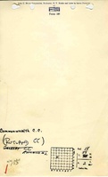
Shaft, Slope, Drift or Tipple Location(s)
| Type | County | Township-Range | Section | Part Section |
|---|
| Main shaft The main hoist shaft was sunk in 1894 and the original hoist shaft was then used for ventilation and escapement. | La Salle | 29N 2E | 18 | SW SE NW |
| Escape / air shaft The main hoist shaft was sunk in 1894 and the original hoist shaft was then used for ventilation and escapement. The air shaft was also used to hoist coal from the Danville Coal from 1933 to 1936. | La Salle | 29N 2E | 18 | SE NW NW |
Geology
| Thickness (ft) | |||||
|---|---|---|---|---|---|
| Seam | Depth (ft) | Min | Max | Ave | Mining Method |
| Danville | 285-295 | 3.5-4.5 | RP |
| Colchester | 517 | 2.0 | 4.5 | 3.0 | LW (old longwall) |
Geological Problems Reported
The Colchester Coal had some slips that were considerable in local spots. The seam had many cracks and fractures, some filled with calcite or gypsum and some pyrite.
Production
| Company | Mine Name | Date | Production (tons) |
| William Magher | Magher | 1881-1884 Idle 1884 | 3,200 |
| Emerson Hakes | Hakes | 1884-1893 Idle 1886-1888 | 112,235 |
| Northern Illinois Coal Corporation | Northern | 1893-1894 | 21,525 |
| Emerson Hakes | Hakes | 1894-1901 | 533,394 |
| Mrs. Emerson Hakes | Hakes | 1901-1910 | 596,436 |
| Rutland Coal Company | Rutland | 1910-1915 | 158,570 |
| Rutland Coal Company | Rutland | 1915-1915 | 2,981 Production after map date, some in the Danville Coal |
| Hakes-Lyon Coal Company | Rutland No. 2 | 1915-1916 | 25,856 Production after map date, some in the Danville Coal |
| Rutland Coal Company | Rutland No. 2 | 1916-1917 | 11,125 Production after map date, some in the Danville Coal |
| U. S. Coal and Coke Company | Rutland No. 2 | 1917-1924 Idle 1922-1924 | 65,674 Production after map date, some in the Danville Coal |
| Rutland Coal Company | Rutland No. 2 | 1924-1935 Idle 1927-1933 | 23,307 Production after map date, some in the Danville Coal |
| Rutland Mining Company | Rutland No. 1 | 1935-1935 | 280 Production after map date, some in the Danville Coal |
| Rutland Second Vein Company | Rutland | 1936-1936 | 90 Production after map date, some in the Danville Coal |
| Total Production: 1,551,692 | |||
Production Notes
Coal Report production (if available)
Sources of Data
| Source Map | Map Date | Original Scale | Digitized Scale | Map Type |
| Microfilm, document 352415 | 3-1915 | 1:1200 | 1:2566 | Not final |
Annotated Bibliography (Data source - brief description of information)
| Coal Reports - Production, ownership, years of operation, seam, depth, thickness, mining methods. |
| Directory of Illinois Coal Mines (La Salle County) - Mine names, mine index, ownership, years of operation. |
| Mine notes (La Salle County) - Mine type, shaft location, seam, depth, thickness, geologic problems. |
| Microfilm map, document 352415, reel 03139, frame 86 - Shaft locations, mine outline, mining method. |
Mine Notes
Mine Images
Photographs