0929: Difference between revisions
Alan.Myers (talk | contribs) No edit summary |
No edit summary |
||
| (One intermediate revision by one other user not shown) | |||
| Line 1: | Line 1: | ||
{{Sidebar Info Query}} | {{Sidebar Info Query}} | ||
{{Header | {{Header | ||
|checked=Checked OK | |||
|unlocated=No | |unlocated=No | ||
|shown_on_map=Yes | |shown_on_map=Yes | ||
| Line 8: | Line 9: | ||
|mine_type=Underground | |mine_type=Underground | ||
|mined-out-area=449 | |mined-out-area=449 | ||
|indicated=No | |||
|county1=St. Clair | |county1=St. Clair | ||
|quad1=O'Fallon | |quad1=O'Fallon | ||
| Line 52: | Line 54: | ||
|Date=1938-1970 {{#info: The 1874 Atlas of St. Clair County shows a mine at this location, indicating that mining may have taken place here in the early 1870s.|note}} | |Date=1938-1970 {{#info: The 1874 Atlas of St. Clair County shows a mine at this location, indicating that mining may have taken place here in the early 1870s.|note}} | ||
|Production=2,255,655 | |Production=2,255,655 | ||
|Sum=Yes | |||
| | |||
}} | }} | ||
===Production Notes=== | ===Production Notes=== | ||
Latest revision as of 15:52, July 18, 2023
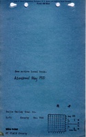
Mine Index Number: 0929
| Company Name: | Belle Valley Coal Company, Inc. | ||
|---|---|---|---|
| Mine Name: | Belle Valley Mine | ||
| Start Date: | 1938 | End Date: | May 1970 |
| Type of Mine: | Underground | ||
| Total acres shown: | 449 | ||
| Acres after map date: | General Area of mining acres shown: | ||
Shaft, Slope, Drift or Tipple Location(s)
| Type | County | Township-Range | Section | Part Section |
|---|
| Main slope | St. Clair | 1N 8W | 26 | SE SE NE |
| Air shaft | St. Clair | 1N 8W | 26 | NW SE NE |
Geology
| Thickness (ft) | |||||
|---|---|---|---|---|---|
| Seam | Depth (ft) | Min | Max | Ave | Mining Method |
| Herrin | 69 | 6.0-7.0 | MRP |
Geological Problems Reported
Production
| Company | Mine Name | Date | Production (tons) |
| Belle Valley Coal Company, Inc. | Belle Valley | 1938-1970 The 1874 Atlas of St. Clair County shows a mine at this location, indicating that mining may have taken place here in the early 1870s. | 2,255,655 |
| Total Production: 2,255,655 | |||
Production Notes
Coal Report production (if available)
Sources of Data
| Source Map | Map Date | Original Scale | Digitized Scale | Map Type |
| ISGS map library, 4103.S31 i5.1-57 | 6-1-1970 | 1:2400 | 1:4966 | Final |
Annotated Bibliography (Data source - brief description of information)
| Coal Reports - Production, ownership, years of operation, thickness. |
| Directory of Illinois Coal Mines (St. Clair County) - Mine names, mine index, ownership, years of operation. |
| Mine notes (St. Clair County) - Mine type, seam, depth, thickness. |
| ISGS map library, 4103.S31 i5.1-57 - Slope and shaft locations, mine outline, mining method. |
Mine Notes
Mine Images

Photographs