Vermilion
< Historical MOA Maps | Quade
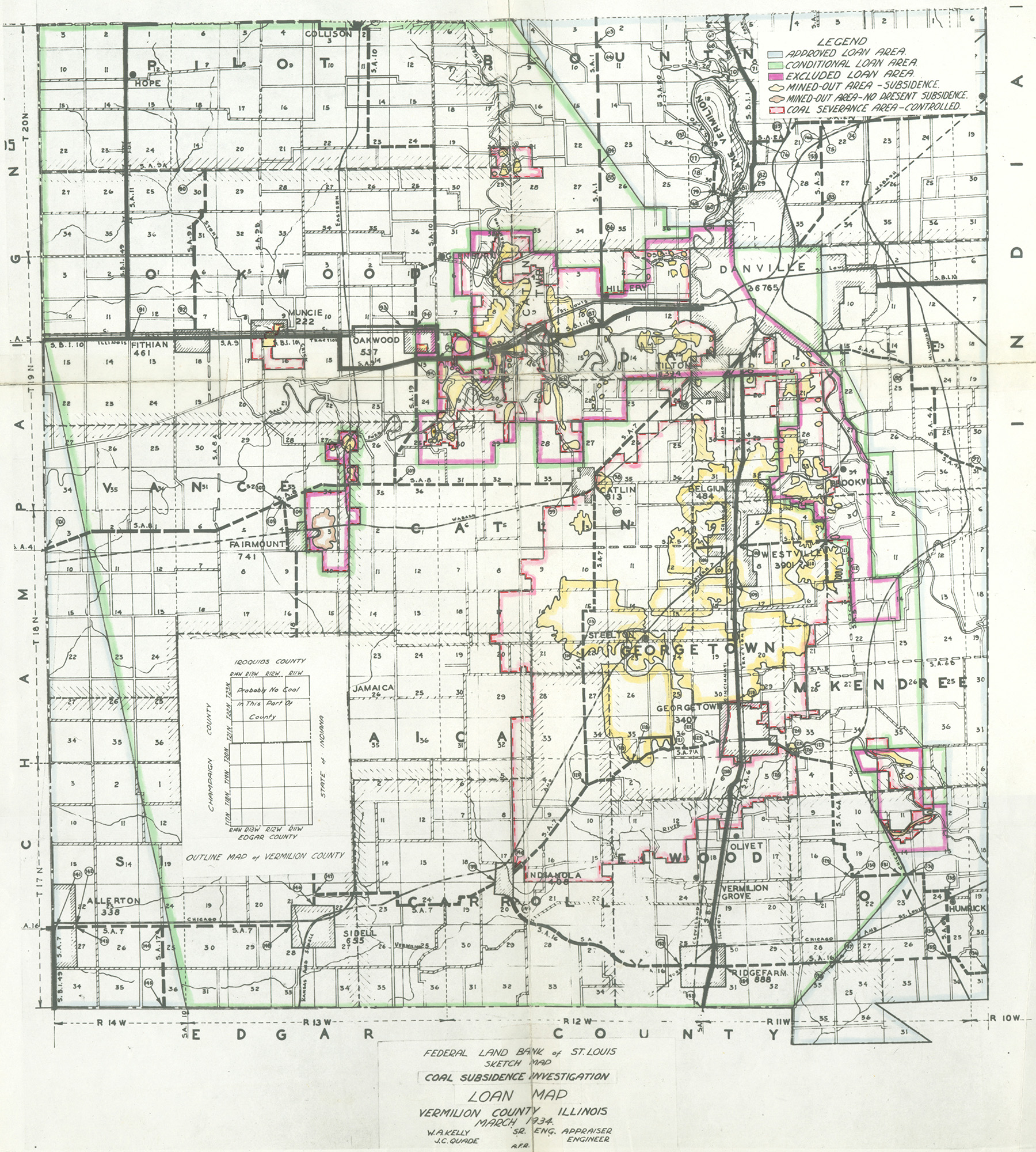
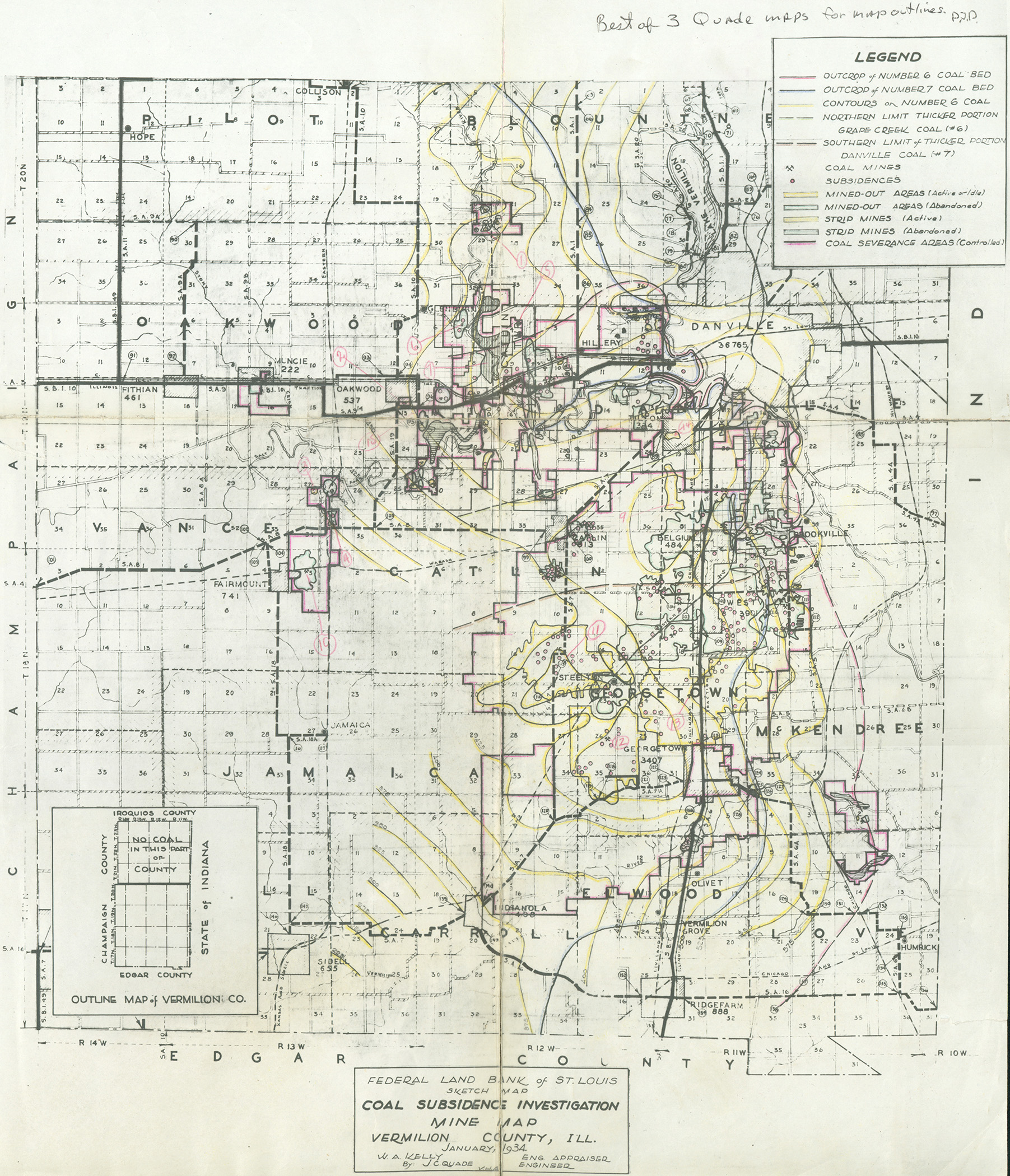
Federal Land Bank of St. Louis, Preliminary Reports on Subsidence Investigations (refered by Coal Section Staff as "Quade Maps")
Mining engineers working for the Federal Land Bank of St. Louis mapped areas of subsidence due to coal mining in the early 1930s. These reports often include county maps of mine properties with mined-out areas including shaft locations, as well as subsidence areas.
Disclaimer
Maps for some locations might have multiple versions/seams, please inspected these areas closely for differences.
These maps are accompanied by a report, please download and inspect this document.
Notes and corrections were made by ISGS staff.

