| | Map ID | County name | Township-Range | Image Download | Quade Report | Full Resolution Download |
|---|
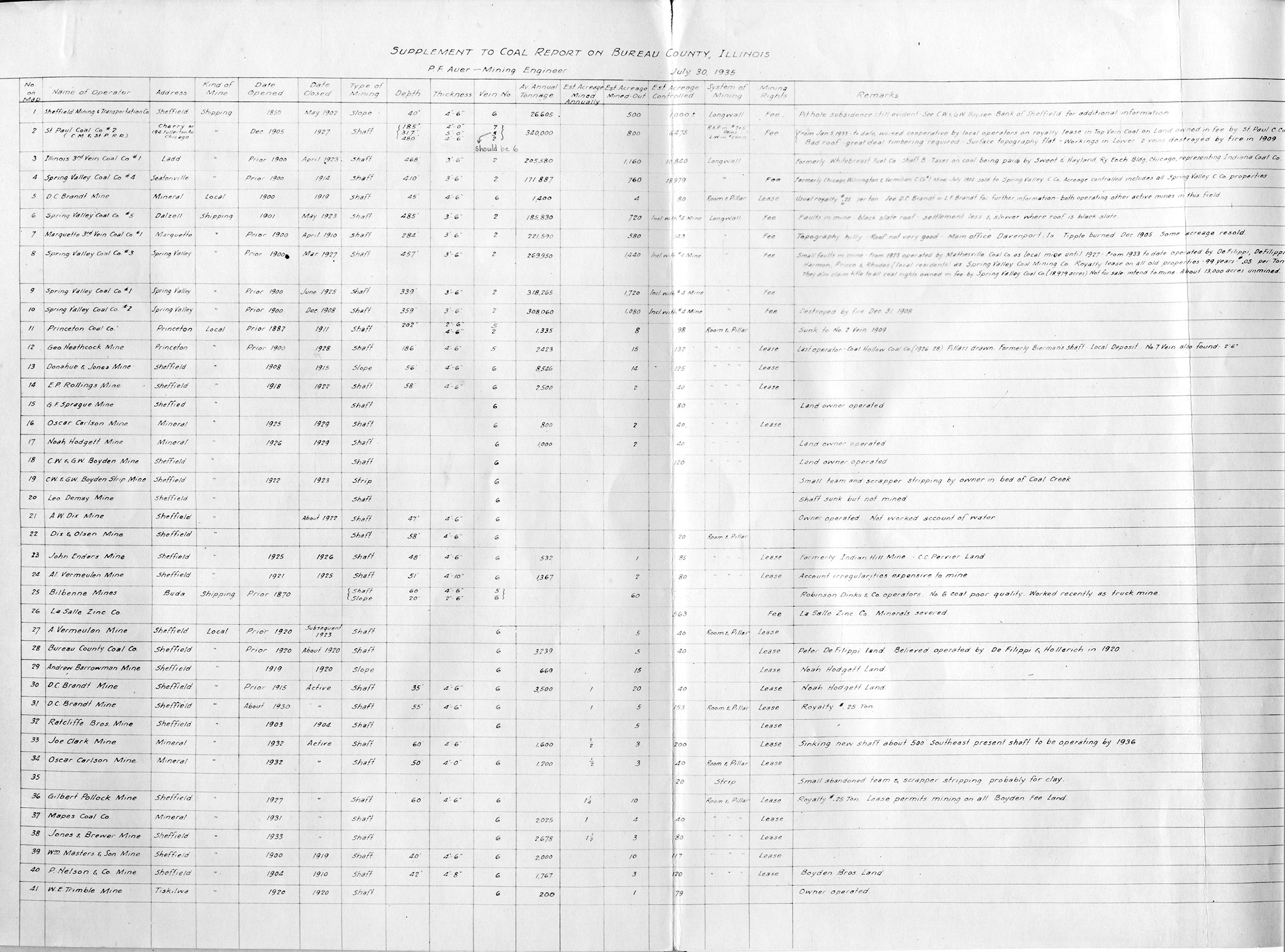
 | Bureau, Quade - Table | Bureau | | QUADE BUREAU TABLE.jpg | https://wikiimage.isgs.illinois.edu/ilmines/quade/reports/quade_report_bureau.pdf | https://wikiimage.isgs.illinois.edu/ilmines/quade/QUADE BUREAU TABLE.tif |
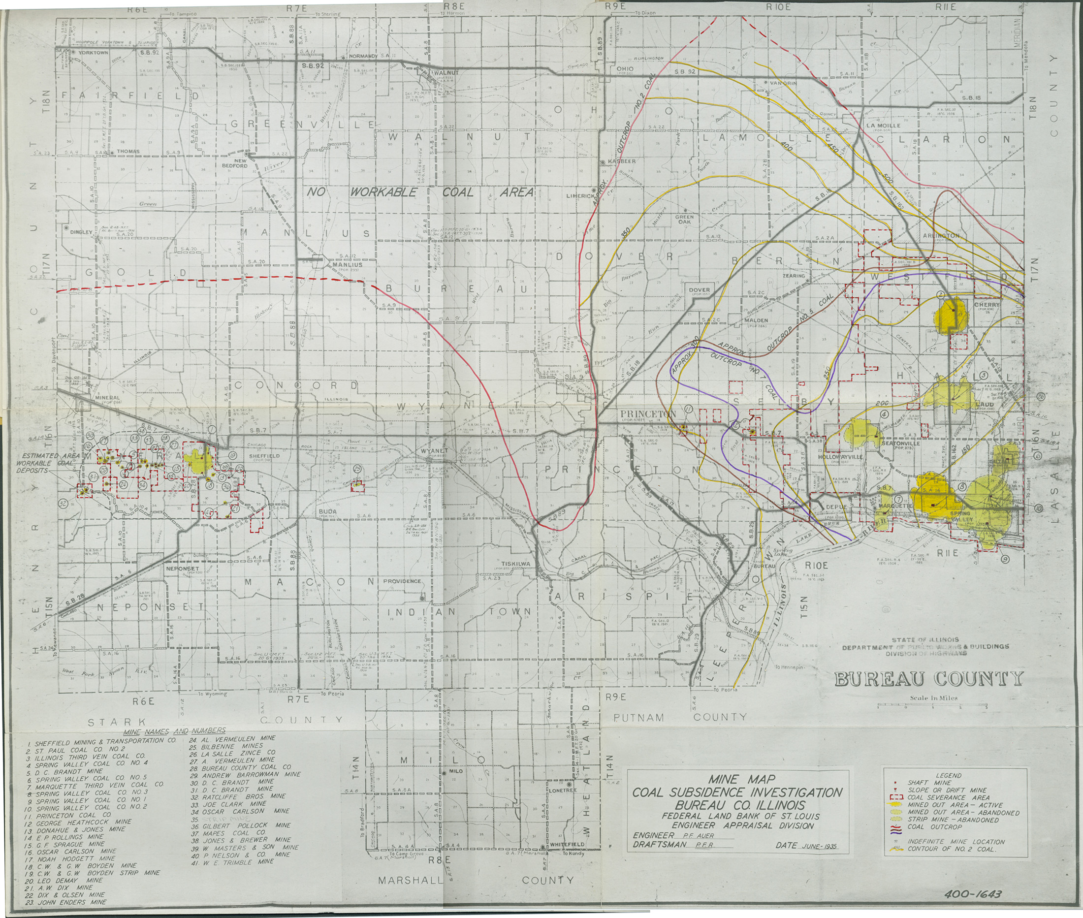
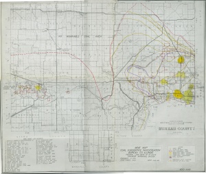 | Bureau, Quade - map | Bureau | | QUADE BUREAU.jpg | https://wikiimage.isgs.illinois.edu/ilmines/quade/reports/quade_report_bureau.pdf | https://wikiimage.isgs.illinois.edu/ilmines/quade/QUADE BUREAU.tif |
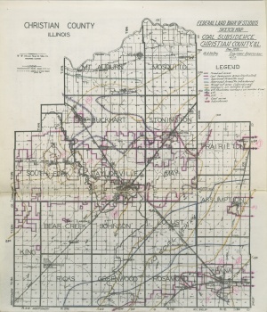
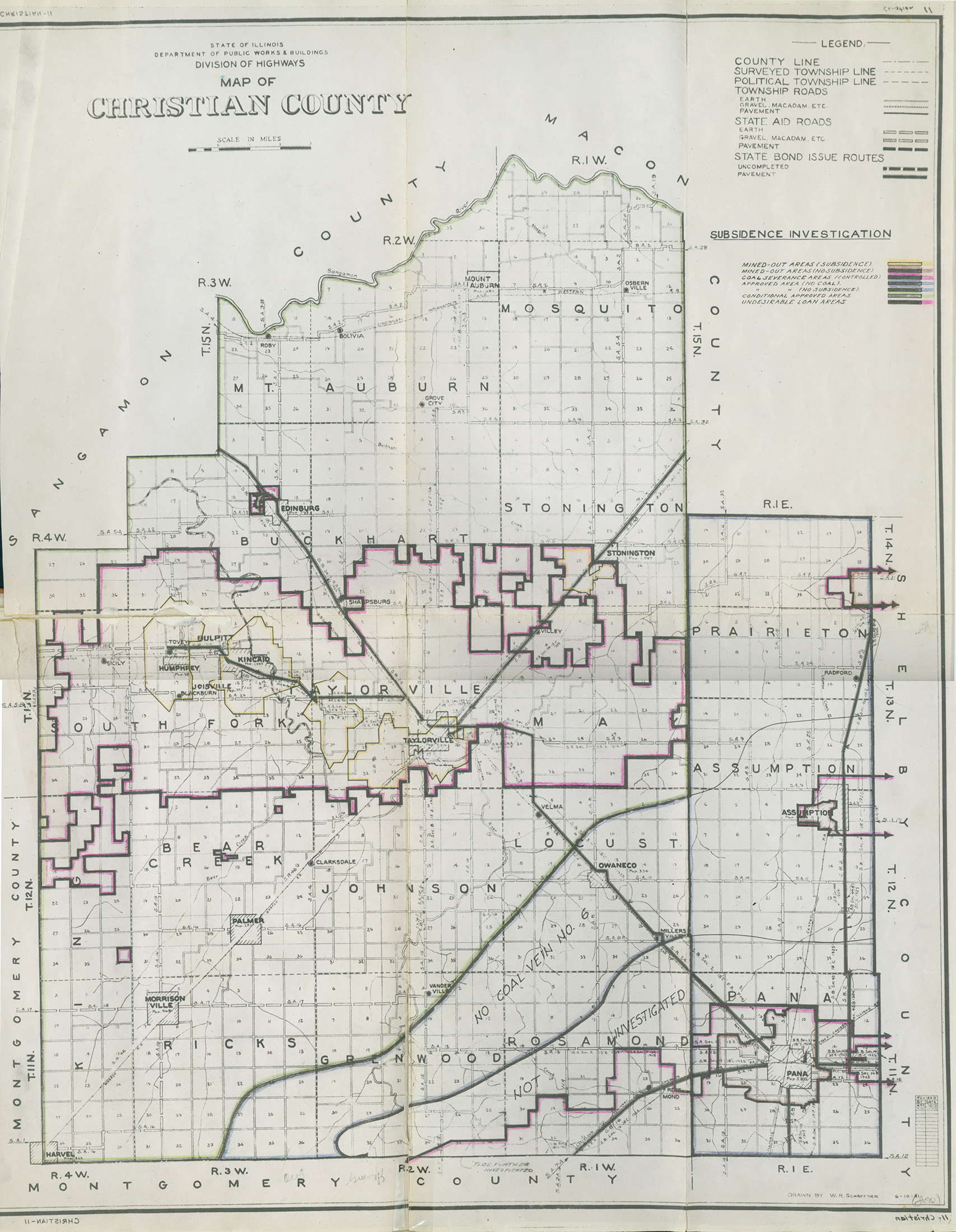
 | Christian, Quade - Map | Christian | | QUADE CHRISTIAN MINE MAP.jpg | https://wikiimage.isgs.illinois.edu/ilmines/quade/reports/quade_report_christian.pdf | https://wikiimage.isgs.illinois.edu/ilmines/quade/QUADE CHRISTIAN MINE MAP.TIF |
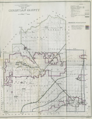
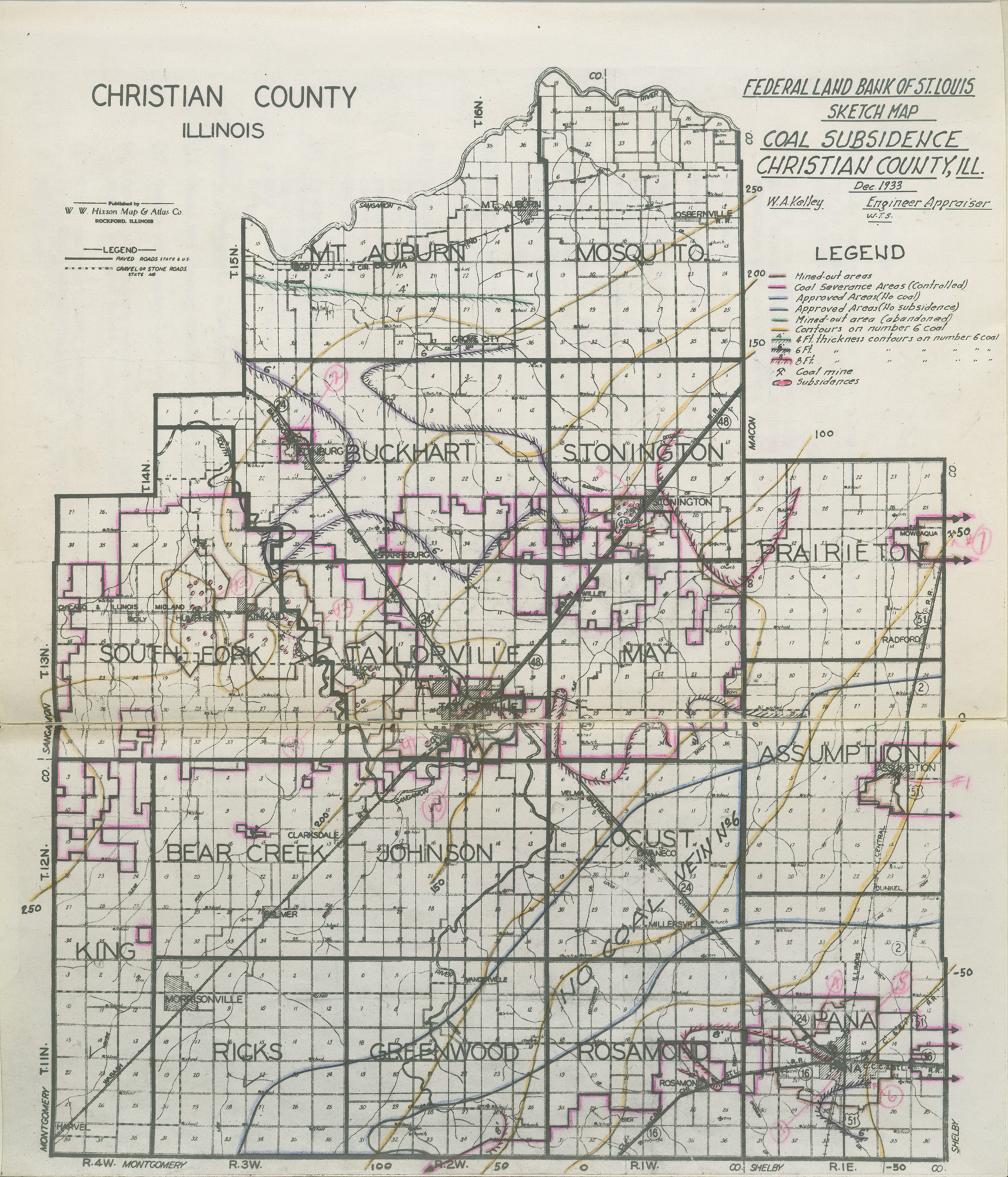
 | Christian, Quade - Sketch Map | Christian | | QUADE CHRISTIAN SKETCH MAP.jpg | https://wikiimage.isgs.illinois.edu/ilmines/quade/reports/quade_report_christian.pdf | https://wikiimage.isgs.illinois.edu/ilmines/quade/QUADE CHRISTIAN SKETCH MAP.TIF |
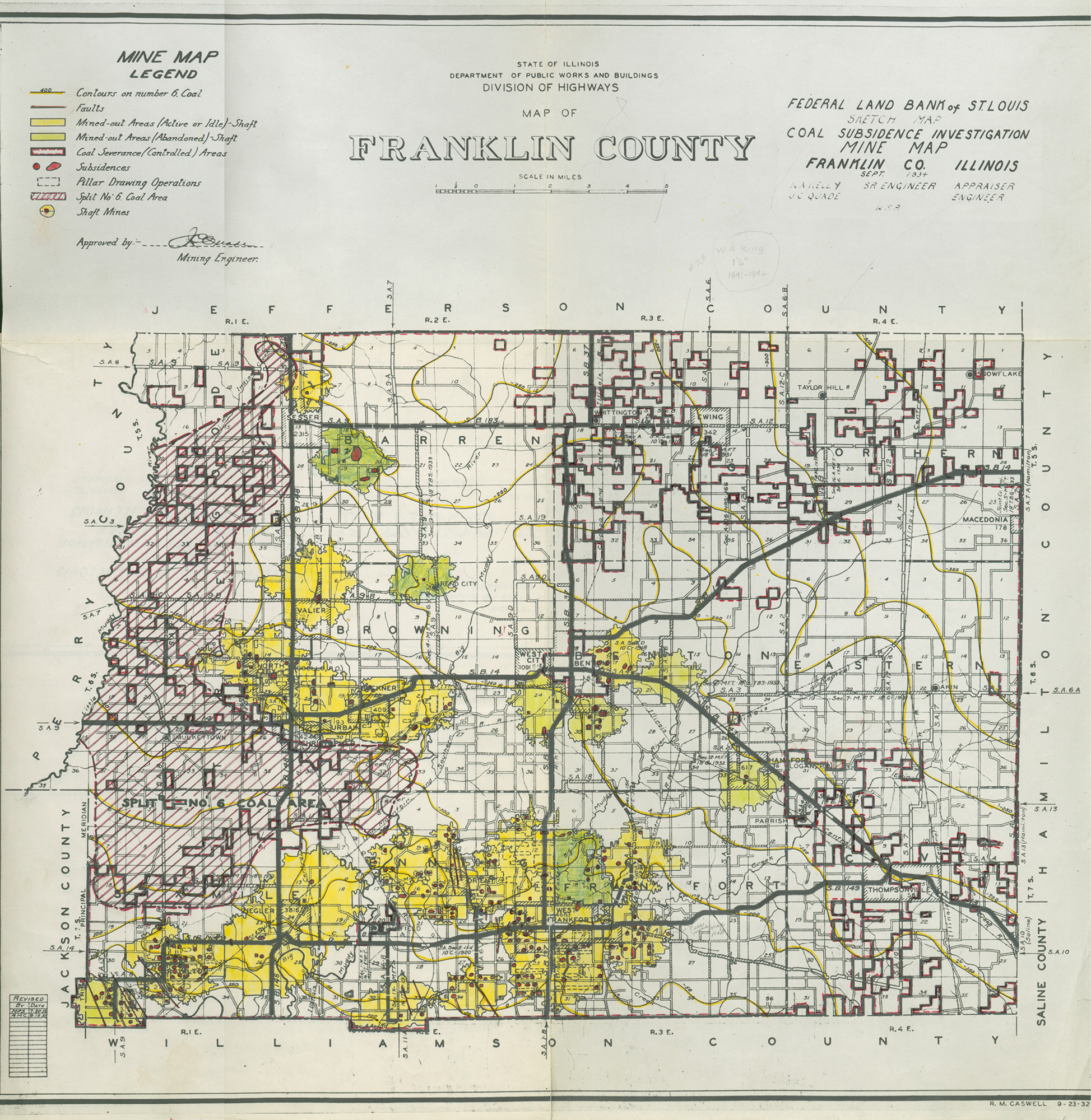
 | Franklin, Quade | Franklin | | QUADE FRANKLIN.jpg | https://wikiimage.isgs.illinois.edu/ilmines/quade/reports/quade_report_franklin.pdf | https://wikiimage.isgs.illinois.edu/ilmines/quade/QUADE FRANKLIN.tif |
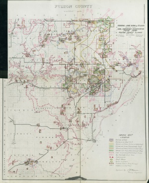 | Fulton, Quade | Fulton | | QUADE FULTON.jpg | https://wikiimage.isgs.illinois.edu/ilmines/quade/reports/quade_report_fulton.pdf | https://wikiimage.isgs.illinois.edu/ilmines/quade/QUADE FULTON.tif |
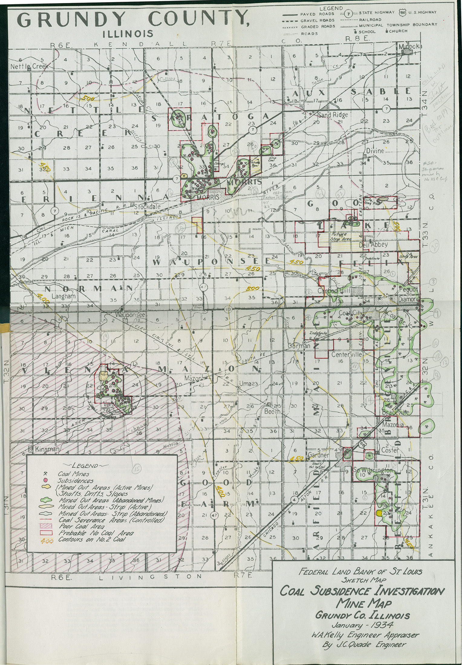
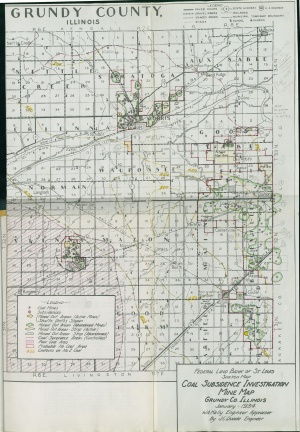 | Grundy, Quade | Grundy | | QUADE GRUNDY.jpg | https://wikiimage.isgs.illinois.edu/ilmines/quade/reports/quade_report_grundy.pdf | https://wikiimage.isgs.illinois.edu/ilmines/quade/QUADE GRUNDY.tif |
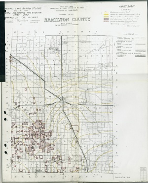 | Hamilton, Quade | Hamilton | | QUADE HAMILTON.jpg | https://wikiimage.isgs.illinois.edu/ilmines/quade/reports/quade_report_hamilton.pdf | https://wikiimage.isgs.illinois.edu/ilmines/quade/QUADE HAMILTON.tif |
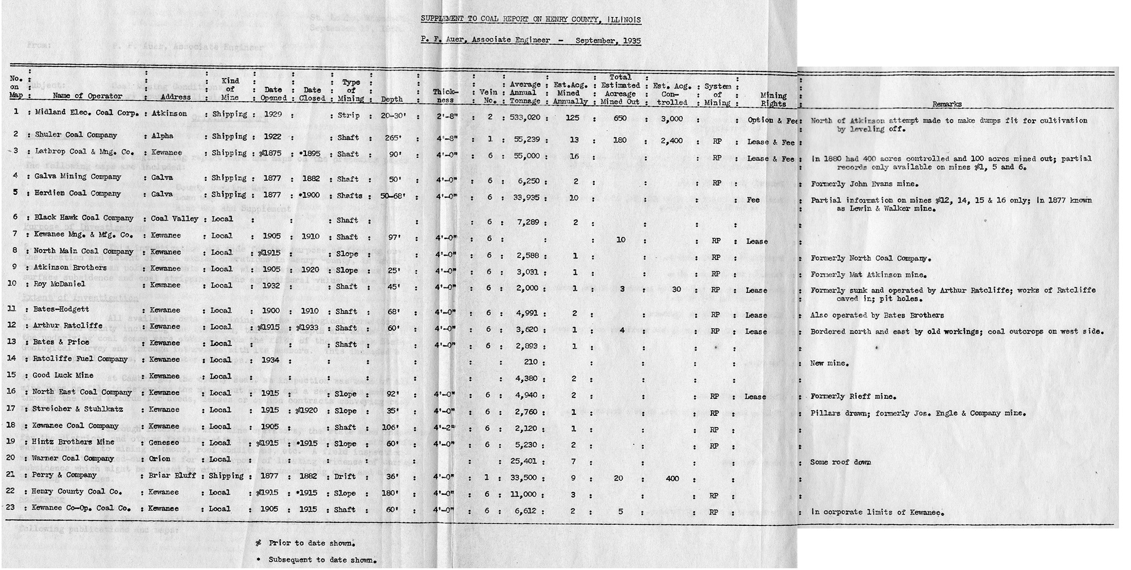
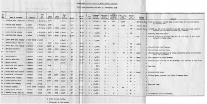 | Henry, Quade - Table | Henry | | QUADE HENRY TABLE.jpg | https://wikiimage.isgs.illinois.edu/ilmines/quade/reports/quade_report_henry.pdf | https://wikiimage.isgs.illinois.edu/ilmines/quade/QUADE HENRY TABLE.tif |
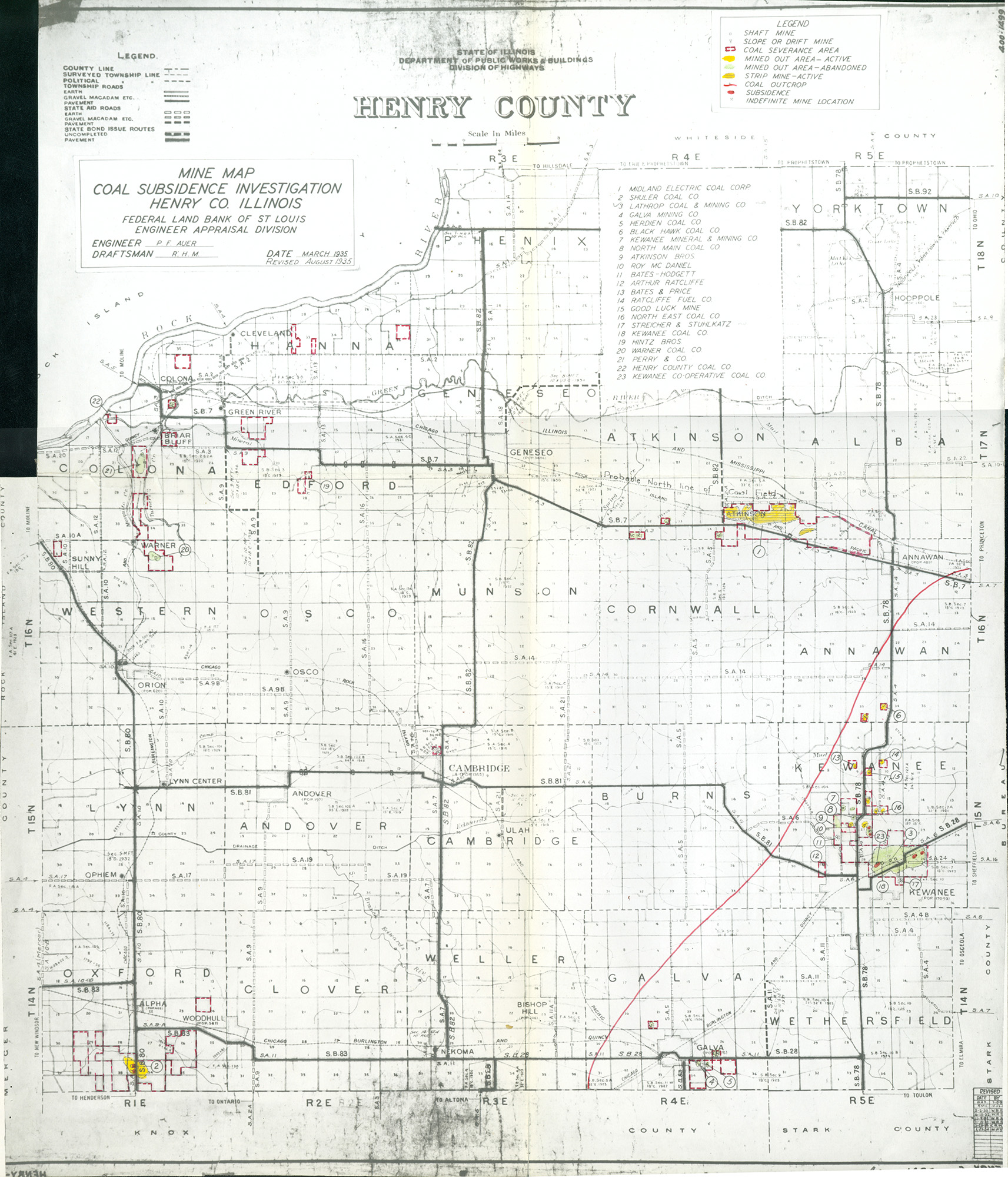
 | Henry, Quade | Henry | | QUADE HENRY.jpg | https://wikiimage.isgs.illinois.edu/ilmines/quade/reports/quade_report_henry.pdf | https://wikiimage.isgs.illinois.edu/ilmines/quade/QUADE HENRY.tif |
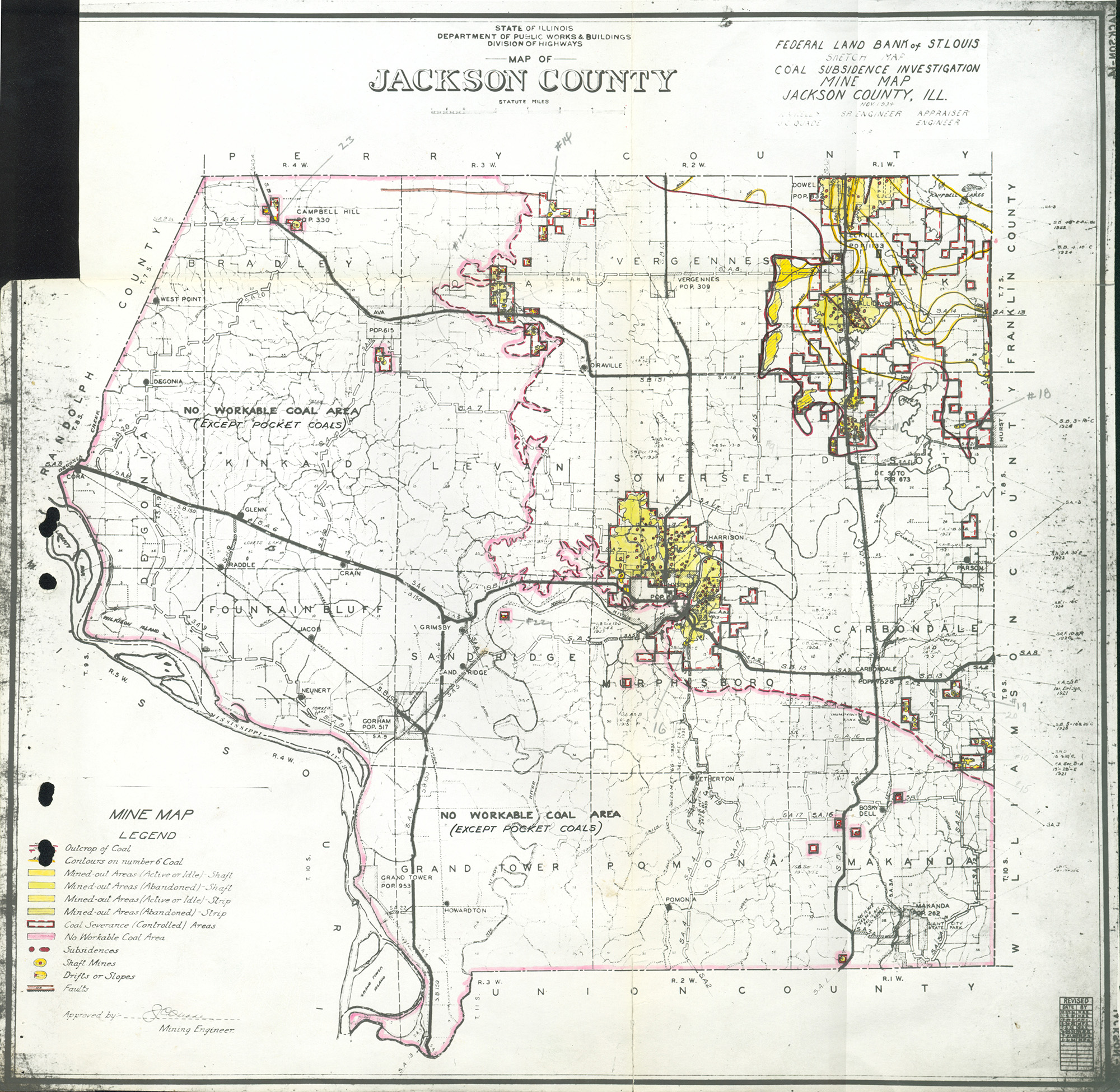
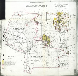 | Jackson, Quade | Jackson | | QUADE JACKSON.jpg | https://wikiimage.isgs.illinois.edu/ilmines/quade/reports/quade_report_jackson.pdf | https://wikiimage.isgs.illinois.edu/ilmines/quade/QUADE JACKSON.tif |
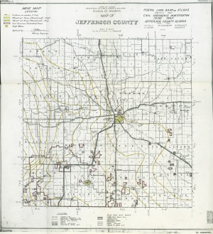
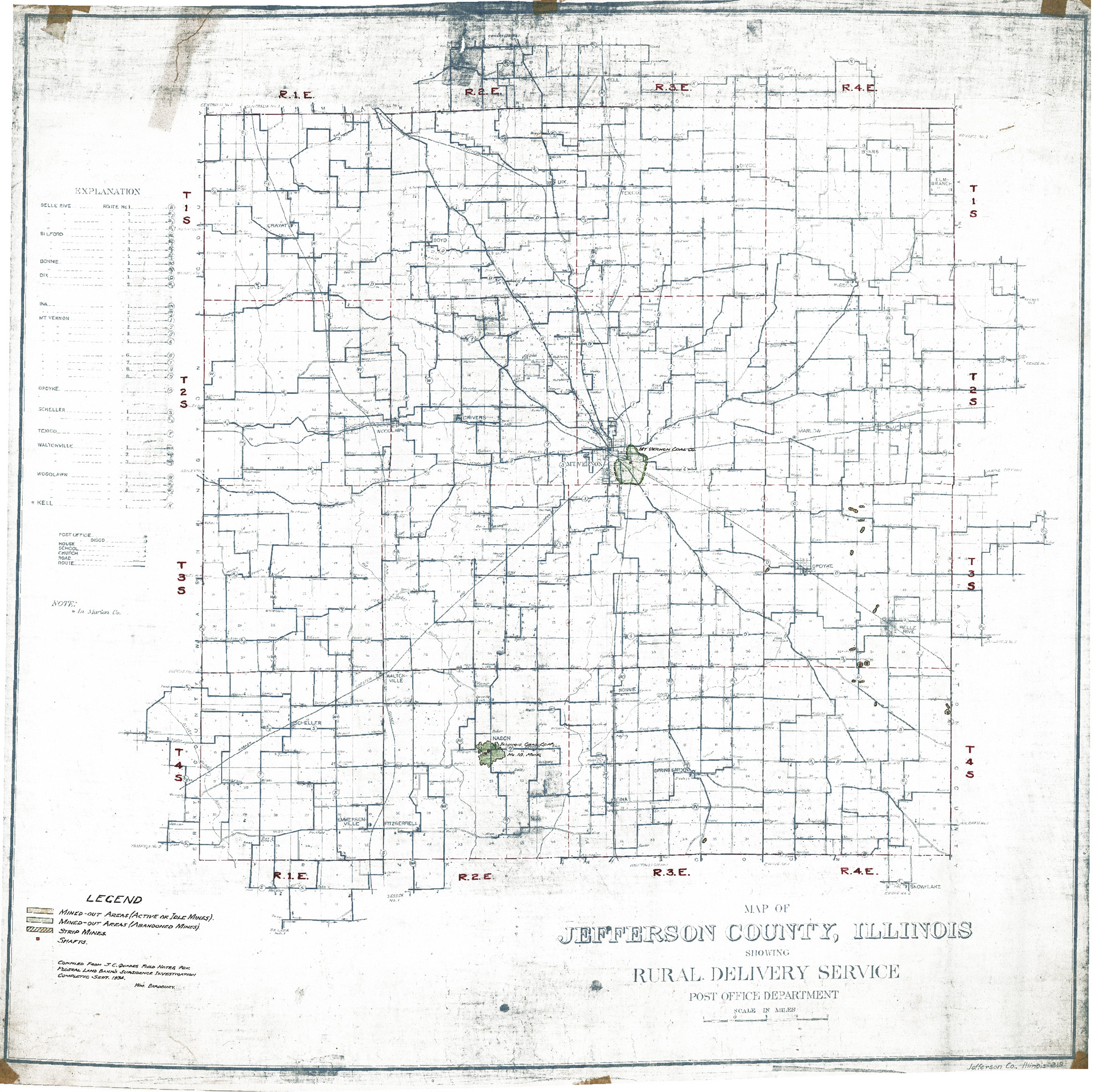
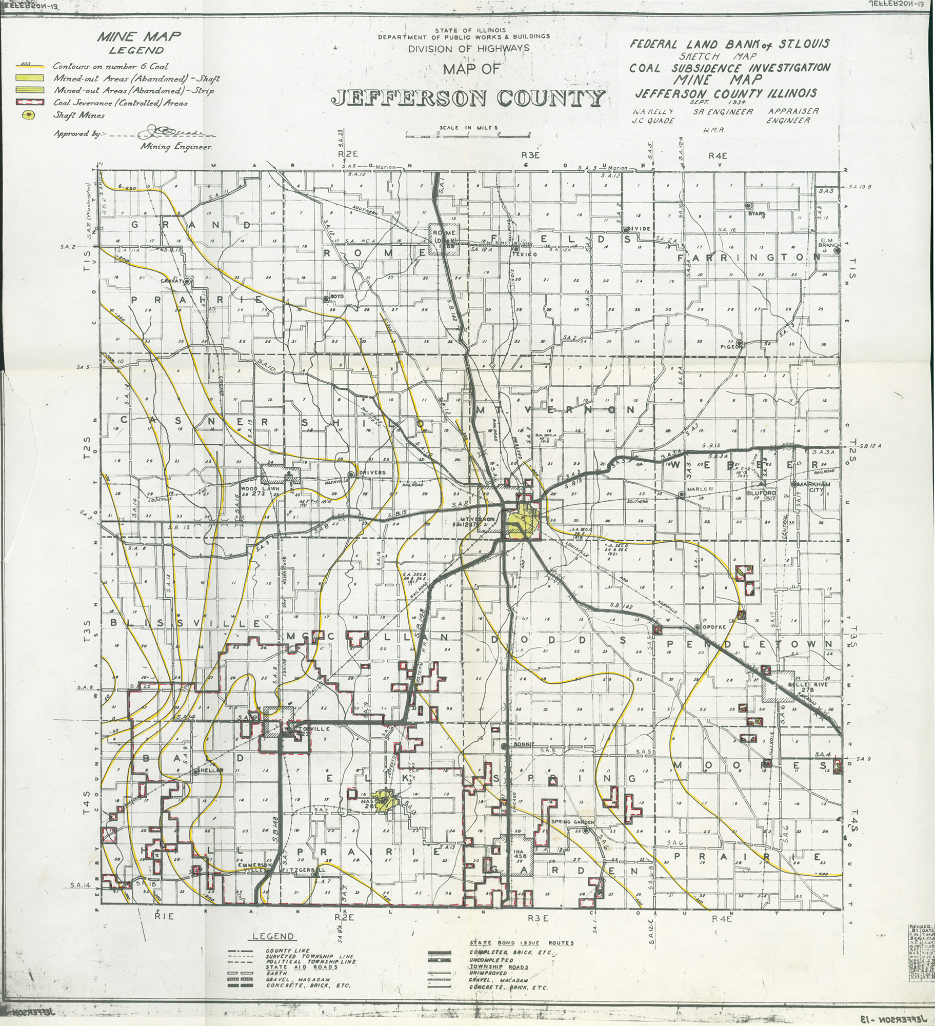
 | Jeffersion, Quade - Version 2 | Jefferson | | QUADE JEFFERSON COUNTY QUADE.jpg | https://wikiimage.isgs.illinois.edu/ilmines/quade/reports/quade_report_jefferson.pdf | https://wikiimage.isgs.illinois.edu/ilmines/quade/QUADE JEFFERSON COUNTY QUADE.tif |
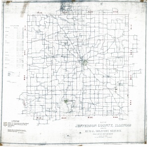
 | Jefferson, Quad - Version 1 | Jefferson | | QUADE JEFFERSON.jpg | https://wikiimage.isgs.illinois.edu/ilmines/quade/reports/quade_report_jefferson.pdf | https://wikiimage.isgs.illinois.edu/ilmines/quade/QUADE JEFFERSON.tif |
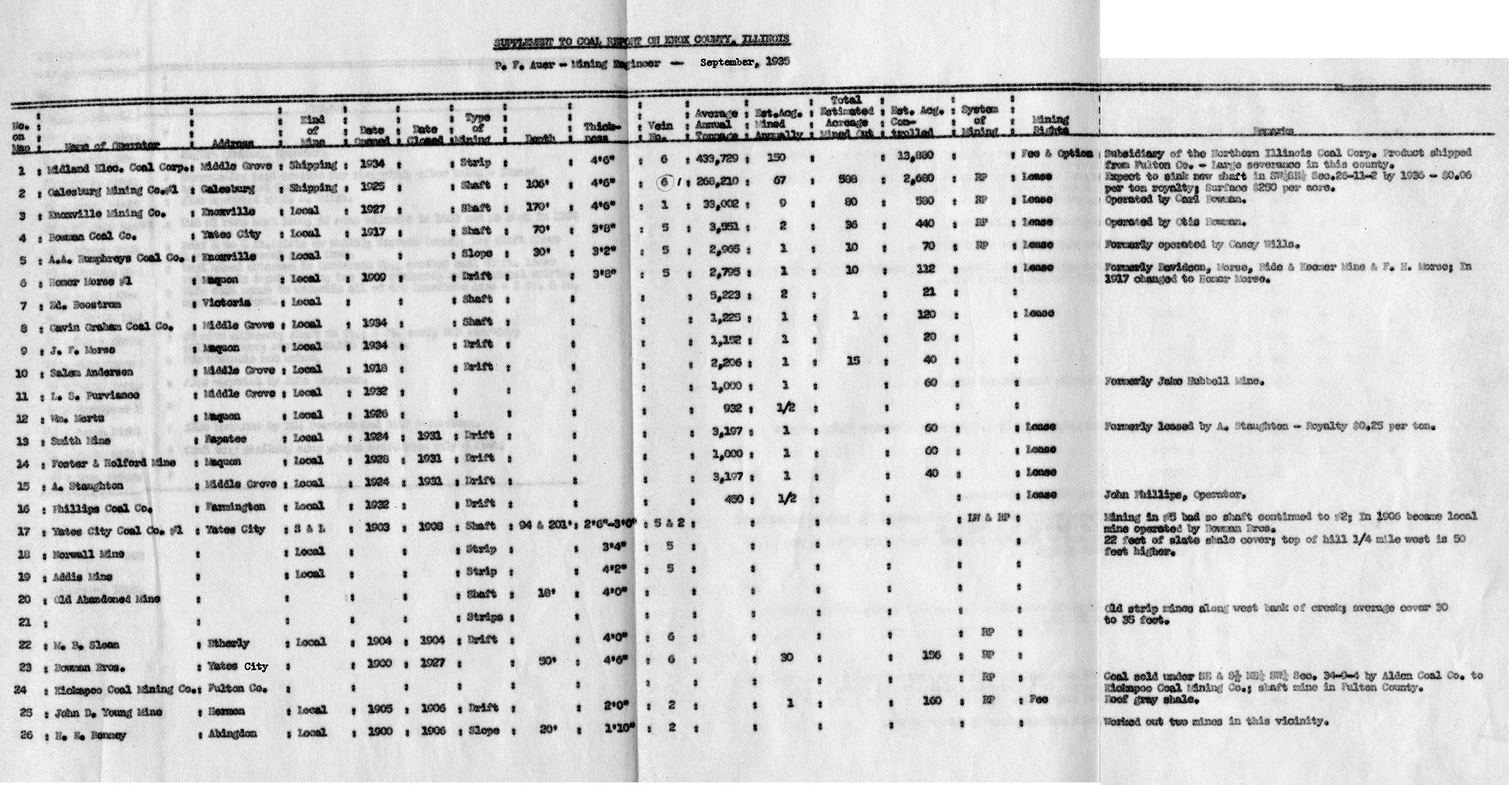
 | Knox, Quade - Table 1 | Knox | | QUADE KNOX TABLE1.jpg | https://wikiimage.isgs.illinois.edu/ilmines/quade/reports/quade_report_knox.pdf | https://wikiimage.isgs.illinois.edu/ilmines/quade/QUADE KNOX TABLE1.tif |
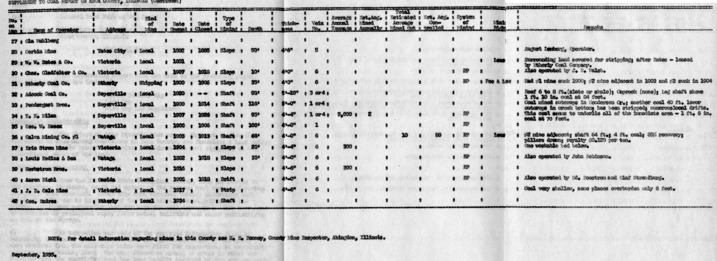
 | Knox, Quade - Table 2 | Knox | | QUADE KNOX TABLE2.jpg | https://wikiimage.isgs.illinois.edu/ilmines/quade/reports/quade_report_knox.pdf | https://wikiimage.isgs.illinois.edu/ilmines/quade/QUADE KNOX TABLE2.tif |
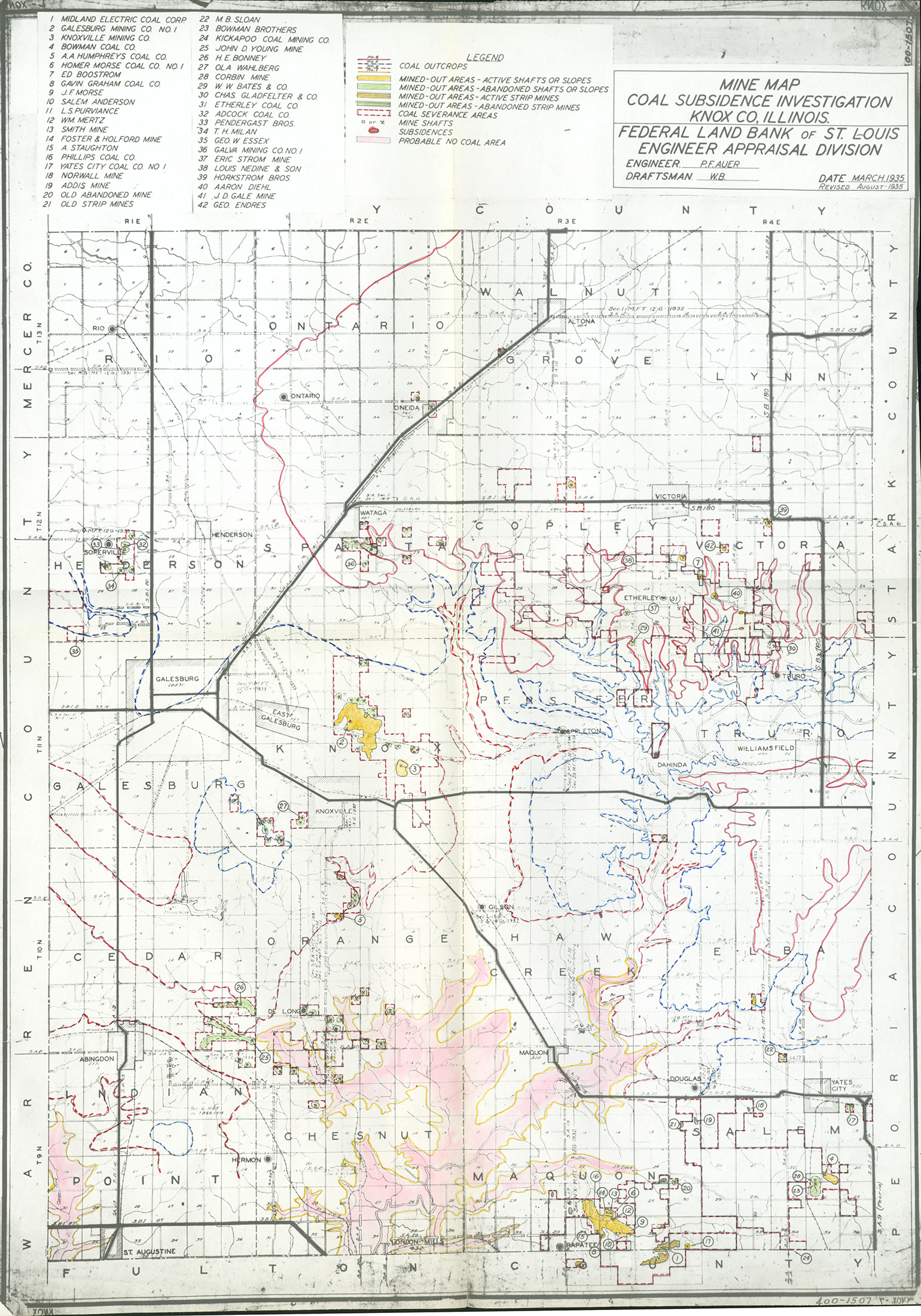
 | Knox, Quade - Map | Knox | | QUADE KNOX.jpg | https://wikiimage.isgs.illinois.edu/ilmines/quade/reports/quade_report_knox.pdf | https://wikiimage.isgs.illinois.edu/ilmines/quade/QUADE KNOX.tif |
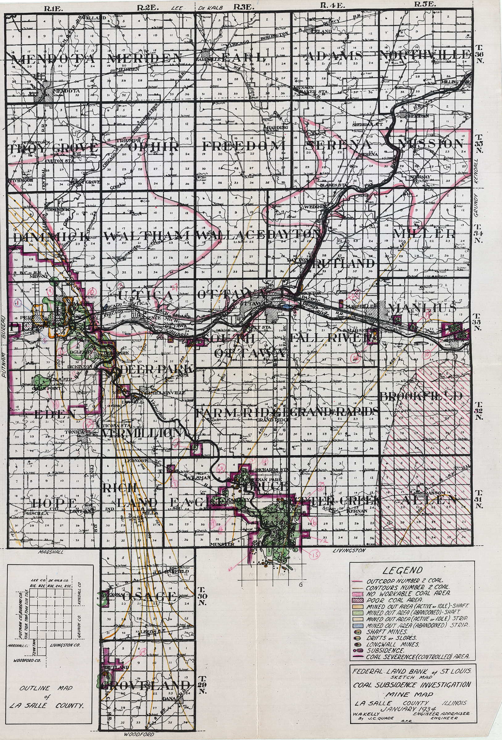
 | LaSalle, Quad - January 1934 Version 2 | La Salle | | QUADE LASALLE QUADE JAN 1934 V2.jpg | https://wikiimage.isgs.illinois.edu/ilmines/quade/reports/quade_report_lasalle_revised.pdf
https://wikiimage.isgs.illinois.edu/ilmines/quade/reports/quade_report_lasalle.pdf | https://wikiimage.isgs.illinois.edu/ilmines/quade/QUADE LASALLE QUADE JAN 1934 V2.tif |
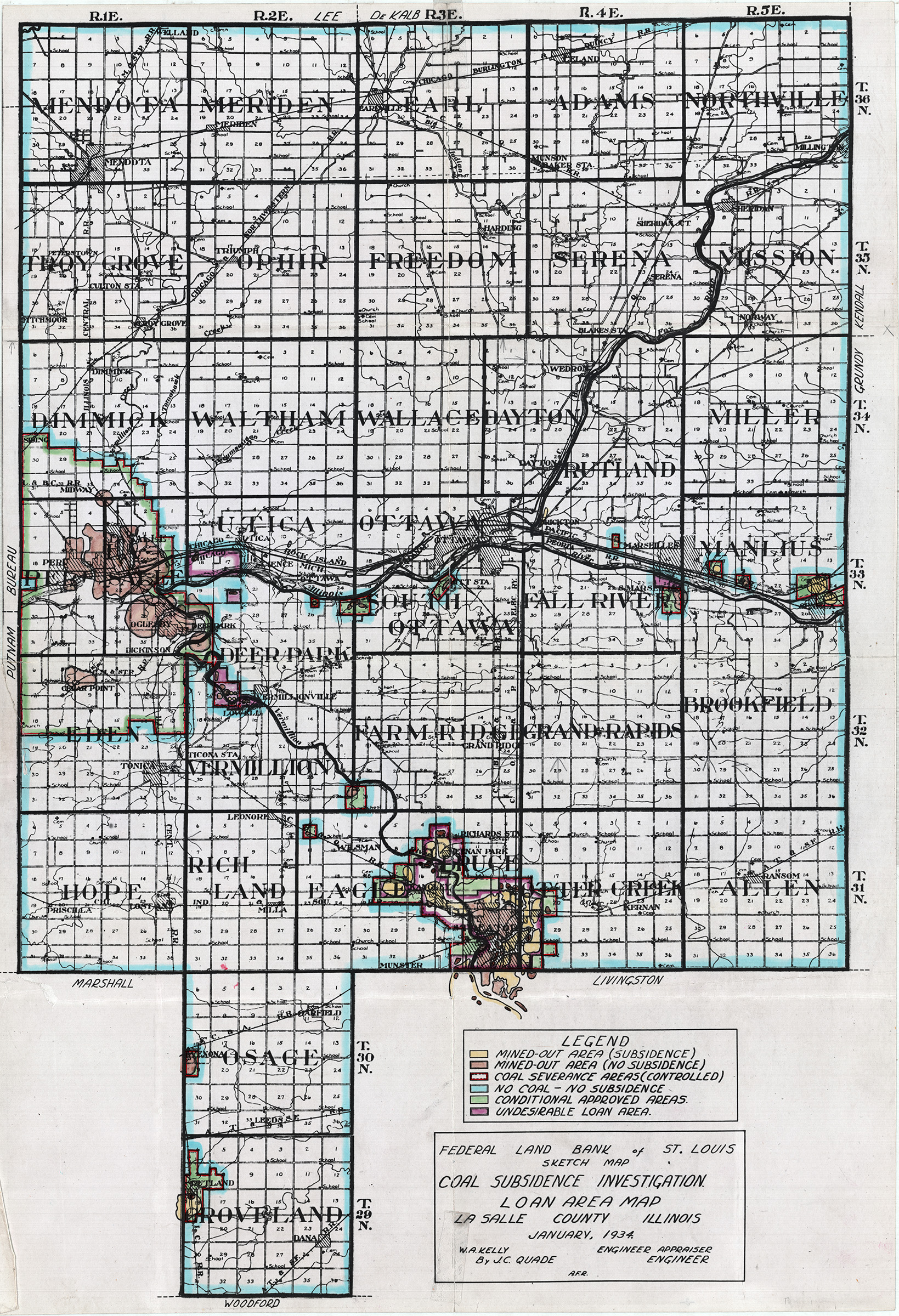
 | LaSalle, Quad - January 1934 | La Salle | | QUADE LASALLE QUADE JAN 1934.jpg | https://wikiimage.isgs.illinois.edu/ilmines/quade/reports/quade_report_lasalle_revised.pdf
https://wikiimage.isgs.illinois.edu/ilmines/quade/reports/quade_report_lasalle.pdf | https://wikiimage.isgs.illinois.edu/ilmines/quade/QUADE LASALLE QUADE JAN 1934.tif |
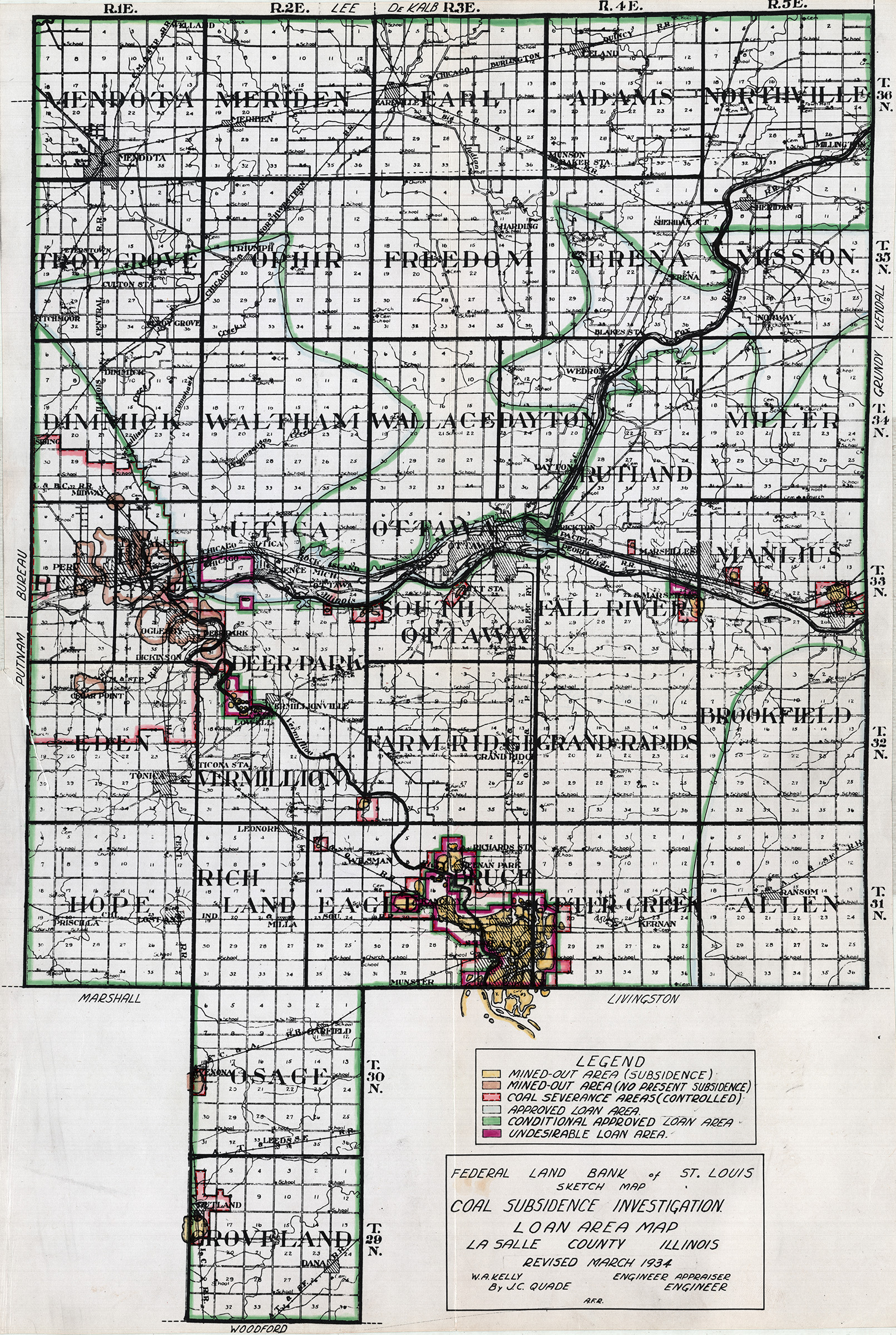
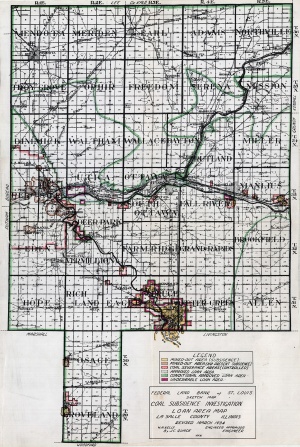 | LaSalle, Quad - Revised March 1934 | La Salle | | QUADE LASALLE QUADE REV MARCH 1934.jpg | https://wikiimage.isgs.illinois.edu/ilmines/quade/reports/quade_report_lasalle_revised.pdf
https://wikiimage.isgs.illinois.edu/ilmines/quade/reports/quade_report_lasalle.pdf | https://wikiimage.isgs.illinois.edu/ilmines/quade/QUADE LASALLE QUADE REV MARCH 1934.tif |
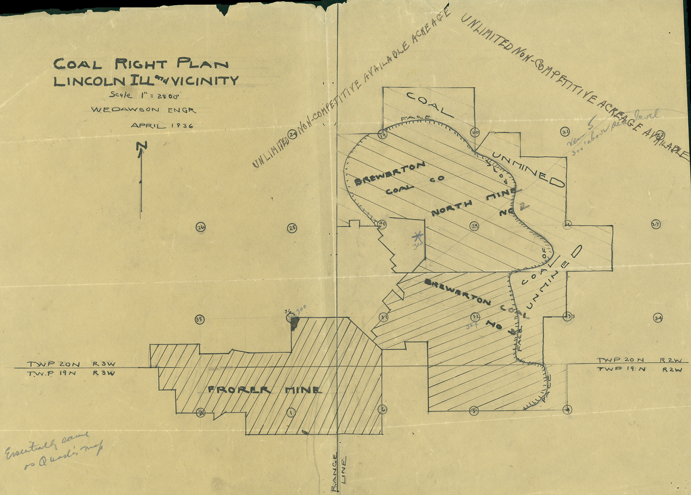
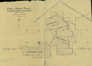 | Logan, Quade - Coal Right Plan Map | Logan | | QUADE LOGAN COAL RIGHT PLAN MAP.jpg | https://wikiimage.isgs.illinois.edu/ilmines/quade/reports/quade_report_logan.pdf | https://wikiimage.isgs.illinois.edu/ilmines/quade/QUADE LOGAN COAL RIGHT PLAN MAP.tif |
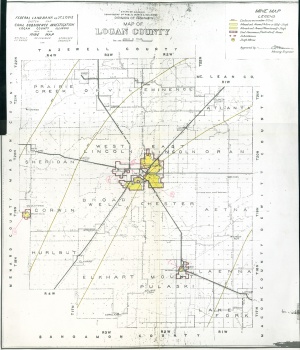 | Logan, Quade | Logan | | QUADE LOGAN MINE MAP.jpg | https://wikiimage.isgs.illinois.edu/ilmines/quade/reports/quade_report_logan.pdf | https://wikiimage.isgs.illinois.edu/ilmines/quade/QUADE LOGAN MINE MAP.tif |
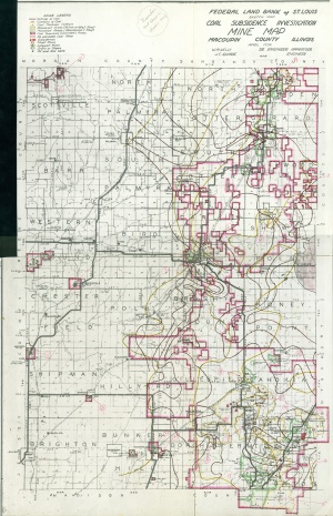 | Macoupin, Quade | Macoupin | | QUADE MACOUPIN.jpg | https://wikiimage.isgs.illinois.edu/ilmines/quade/reports/quade_report_macoupin.pdf | https://wikiimage.isgs.illinois.edu/ilmines/quade/QUADE MACOUPIN.tif |
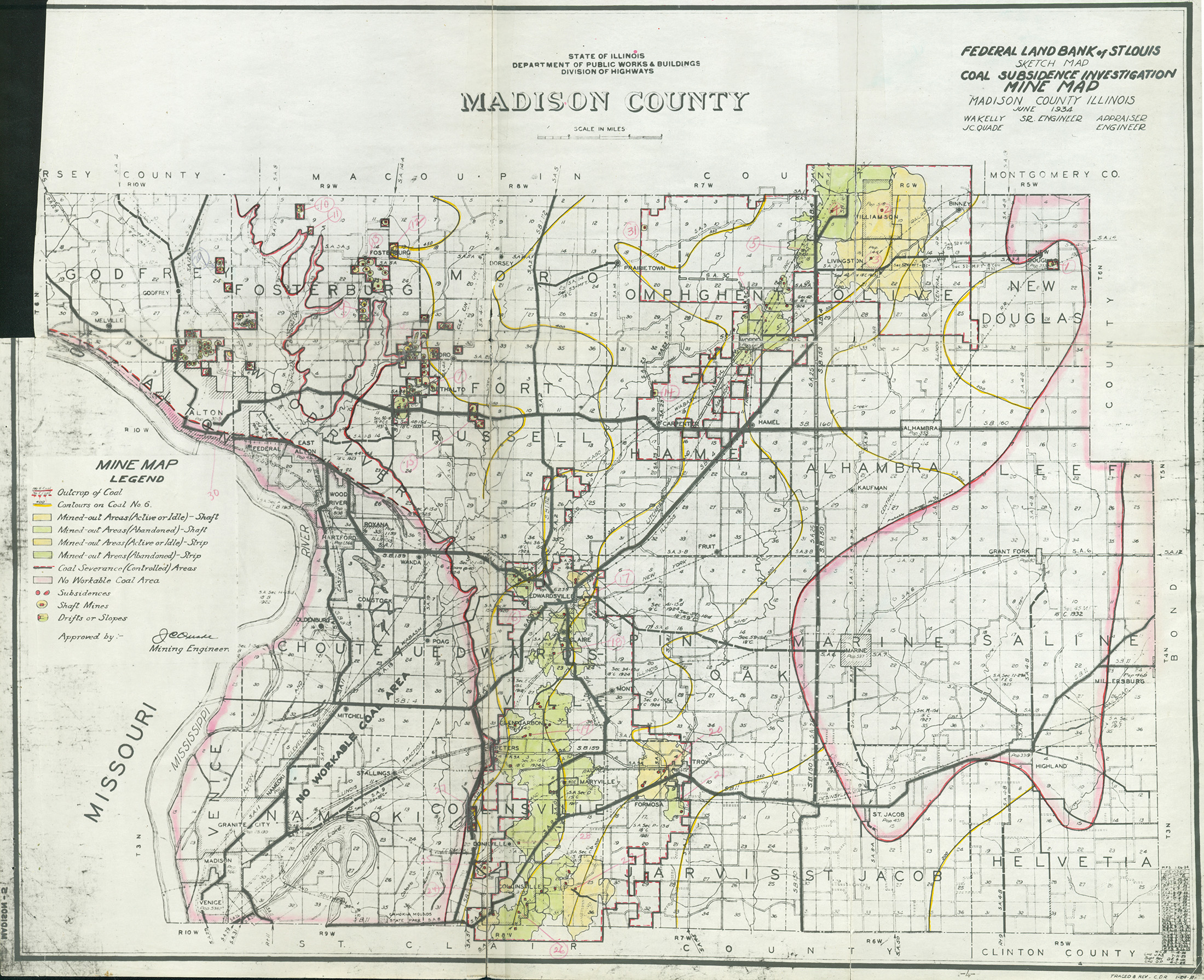
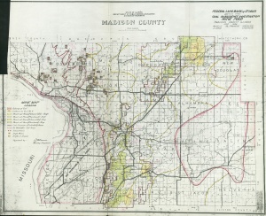 | Madison, Quade | Madison | | QUADE MADISON.jpg | https://wikiimage.isgs.illinois.edu/ilmines/quade/reports/quade_report_madison.pdf | https://wikiimage.isgs.illinois.edu/ilmines/quade/QUADE MADISON.tif |
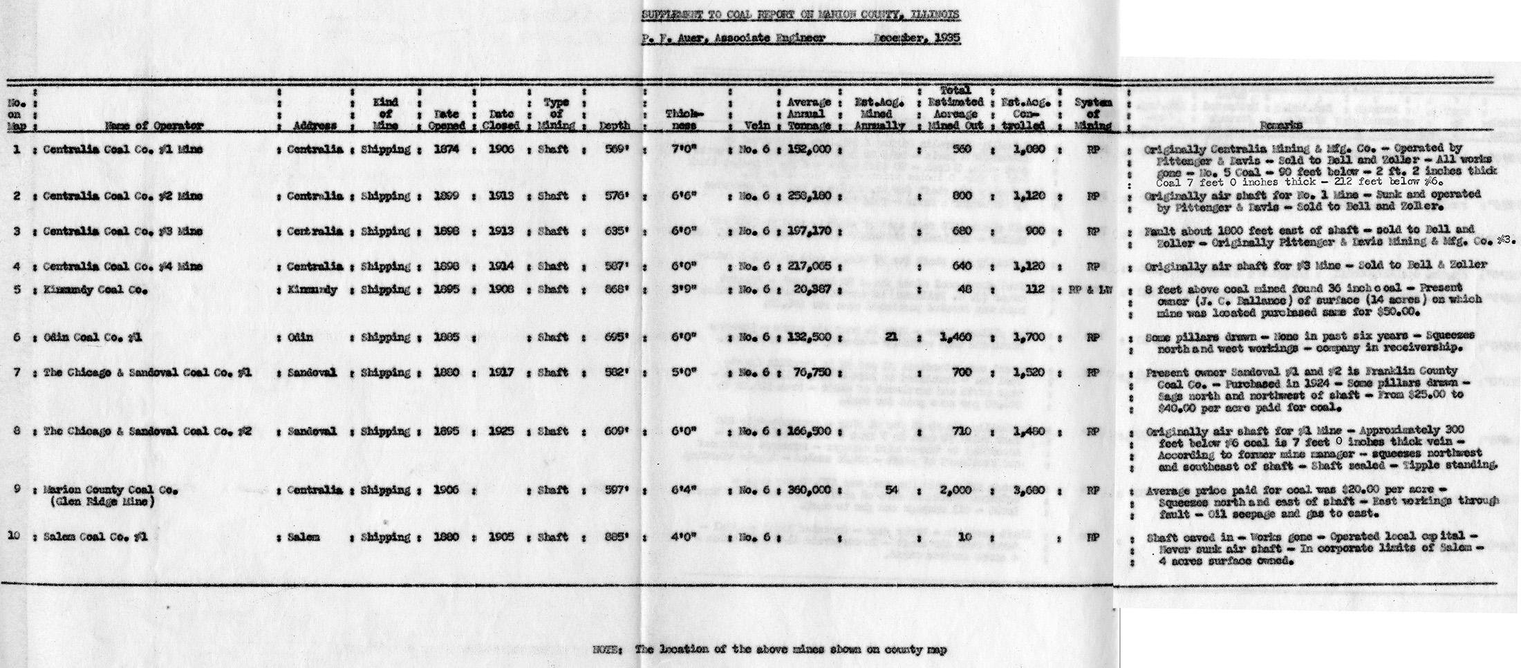
 | Marion, Quade - Table | Marion | | QUADE MARION TABLE.jpg | https://wikiimage.isgs.illinois.edu/ilmines/quade/reports/quade_report_marion.pdf | https://wikiimage.isgs.illinois.edu/ilmines/quade/QUADE MARION TABLE.tif |
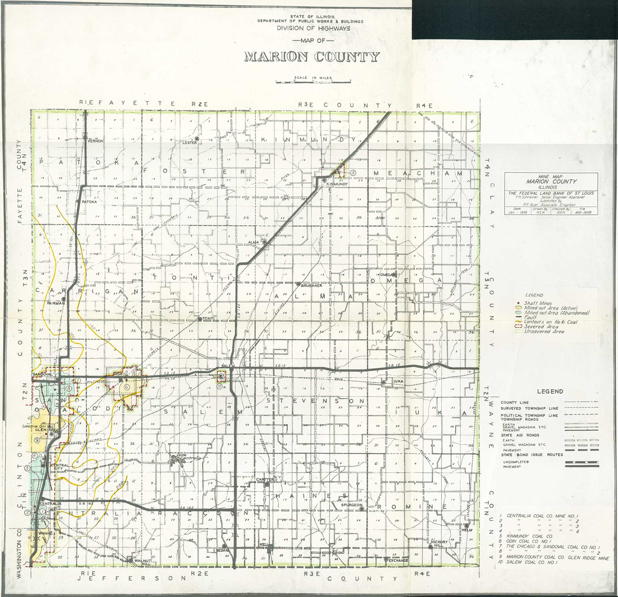
 | Marion, Quade | Marion | | QUADE MARION.jpg | https://wikiimage.isgs.illinois.edu/ilmines/quade/reports/quade_report_marion.pdf | https://wikiimage.isgs.illinois.edu/ilmines/quade/QUADE MARION.tif |
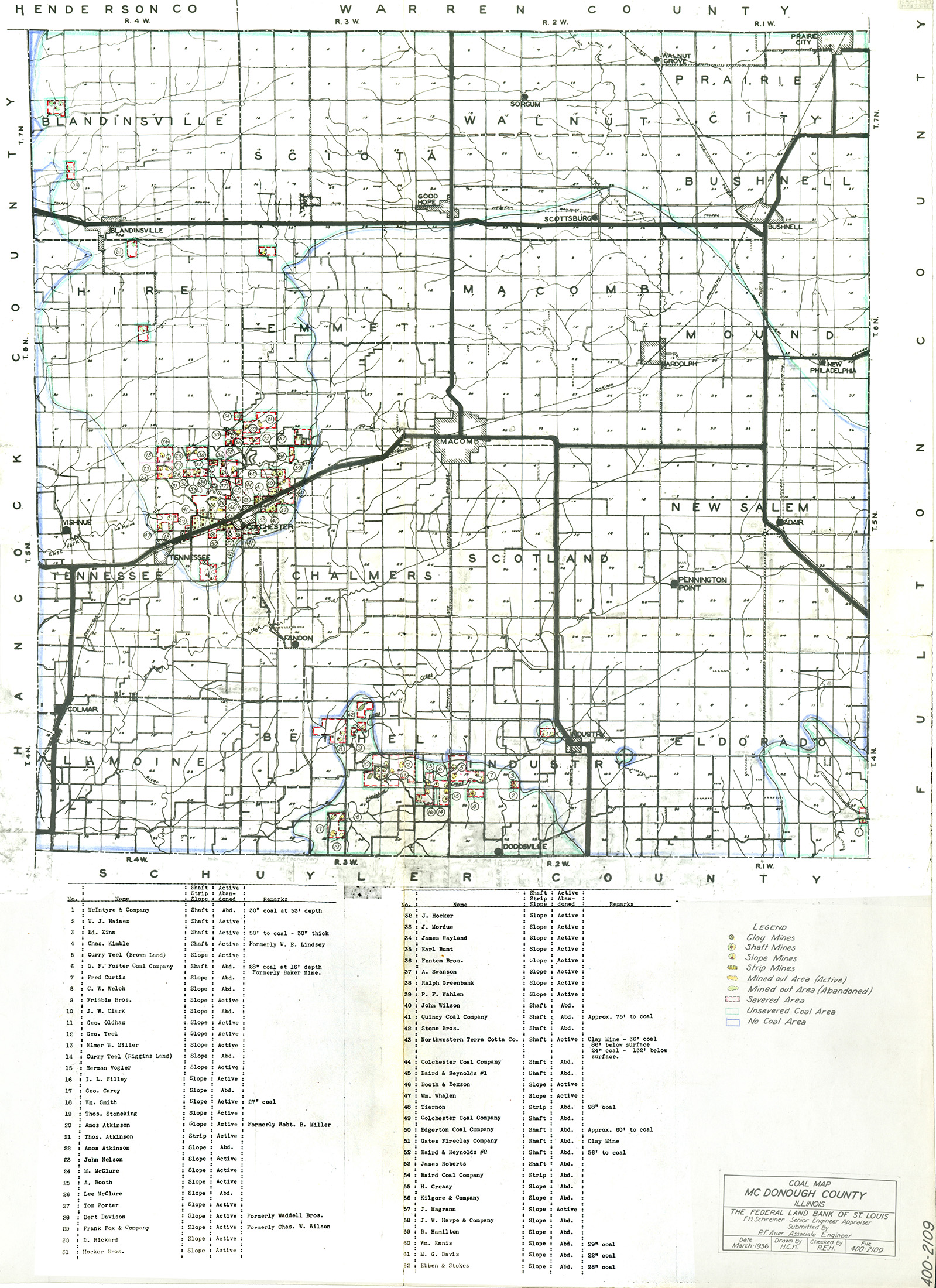
 | McDonough, Quade | McDonough | | QUADE MCDONOUGH.jpg | https://wikiimage.isgs.illinois.edu/ilmines/quade/reports/quade_report_mcdonough.pdf | https://wikiimage.isgs.illinois.edu/ilmines/quade/QUADE MCDONOUGH.tif |
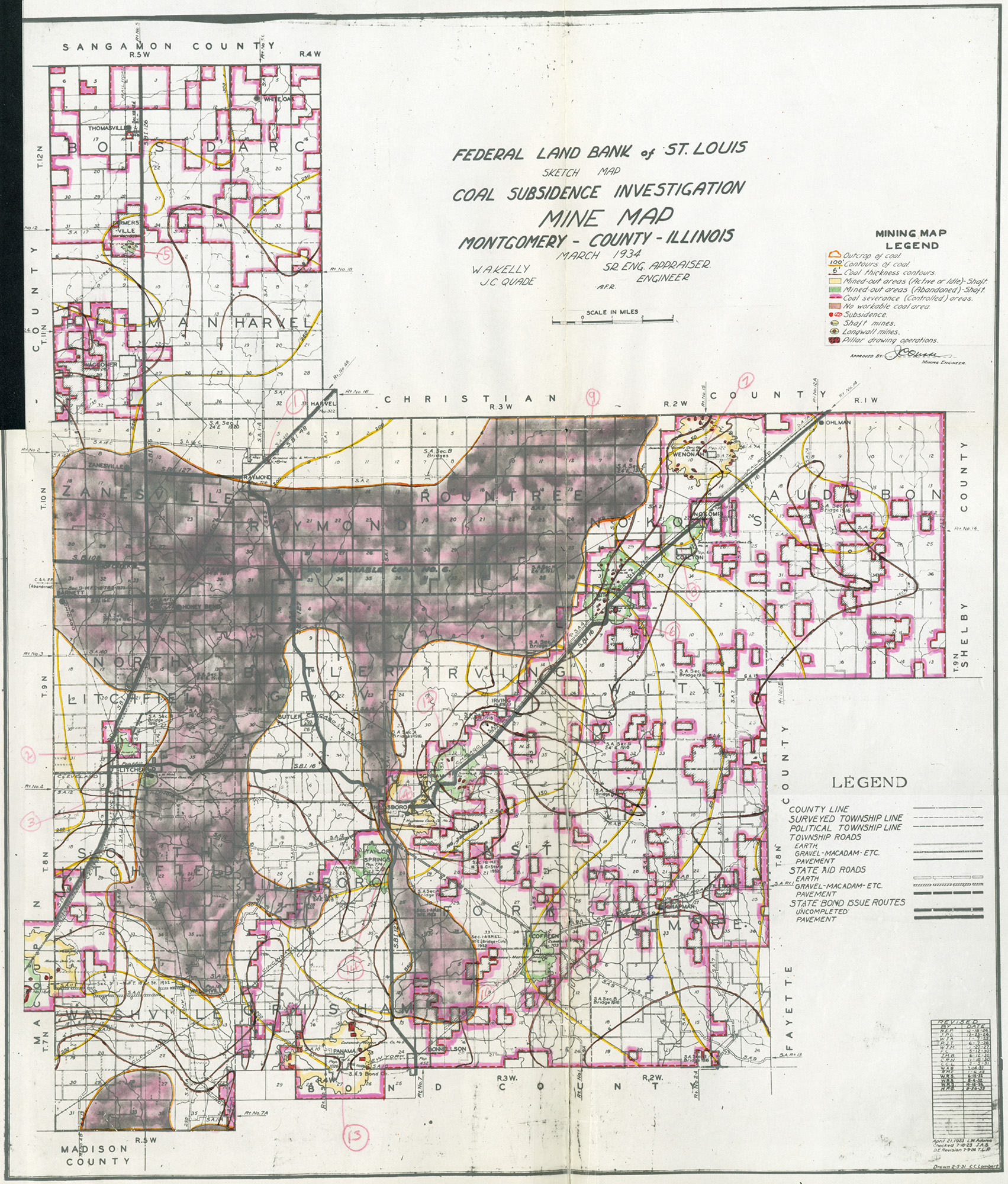
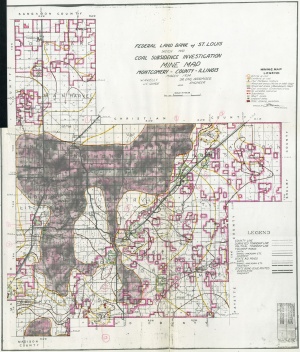 | Montgomery, Quade | Montgomery | | QUADE MONTGOMERY.jpg | https://wikiimage.isgs.illinois.edu/ilmines/quade/reports/quade_report_montgomery.pdf | https://wikiimage.isgs.illinois.edu/ilmines/quade/QUADE MONTGOMERY.tif |
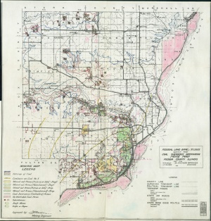 | Peoria, Quade | Peoria | | QUADE PEORIA.jpg | https://wikiimage.isgs.illinois.edu/ilmines/quade/reports/quade_report_peoria.pdf | https://wikiimage.isgs.illinois.edu/ilmines/quade/QUADE PEORIA.tif |
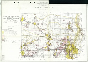 | Perry, Quade | Perry | | QUADE PERRY.jpg | https://wikiimage.isgs.illinois.edu/ilmines/quade/reports/quade_report_perry.pdf | https://wikiimage.isgs.illinois.edu/ilmines/quade/QUADE PERRY.tif |
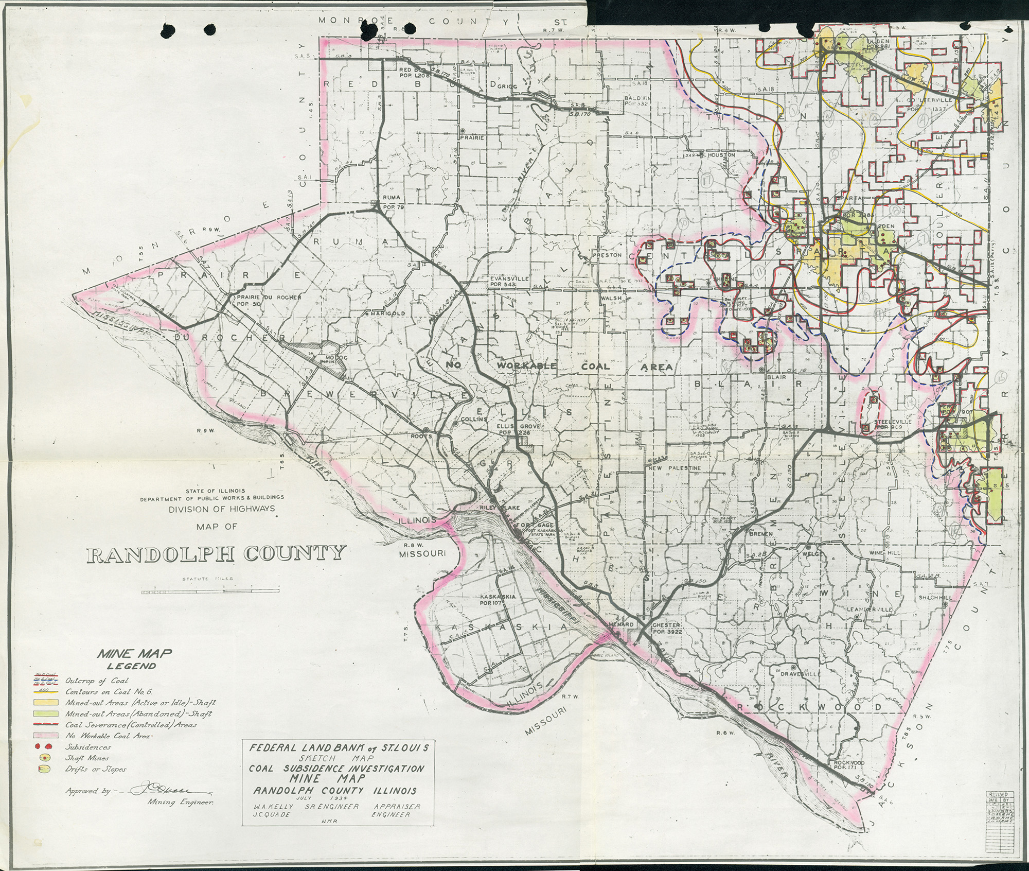
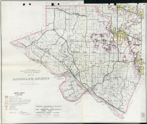 | Randolph, Quade | Randolph | | QUADE RANDOLPH.jpg | https://wikiimage.isgs.illinois.edu/ilmines/quade/reports/quade_report_randolph.pdf | https://wikiimage.isgs.illinois.edu/ilmines/quade/QUADE RANDOLPH.tif |
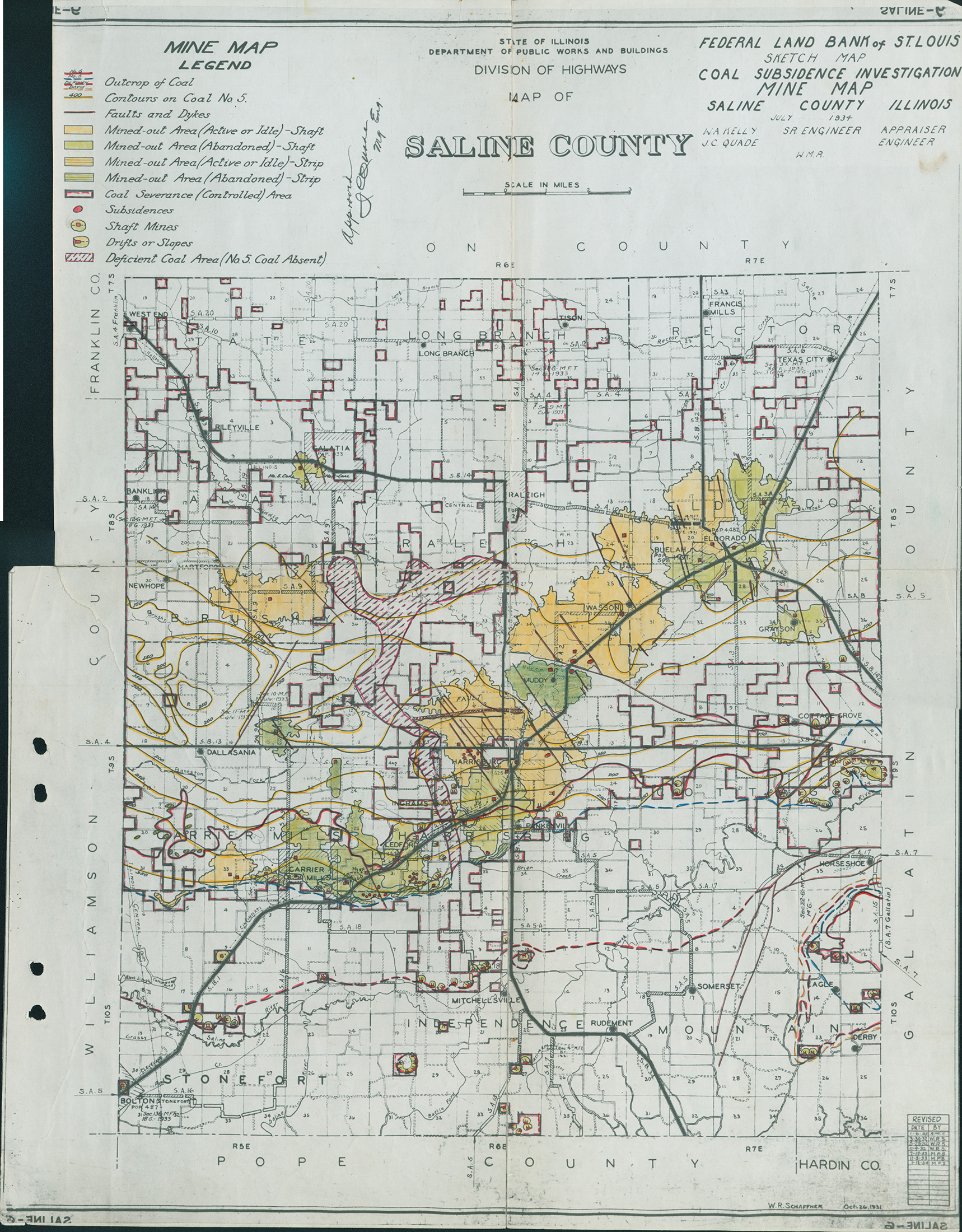
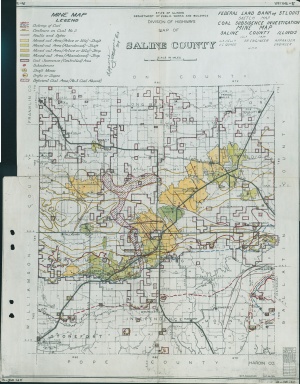 | Saline Quade | Saline | | QUADE SALINE.jpg | https://wikiimage.isgs.illinois.edu/ilmines/quade/reports/quade_report_saline.pdf | https://wikiimage.isgs.illinois.edu/ilmines/quade/QUADE SALINE.tif |
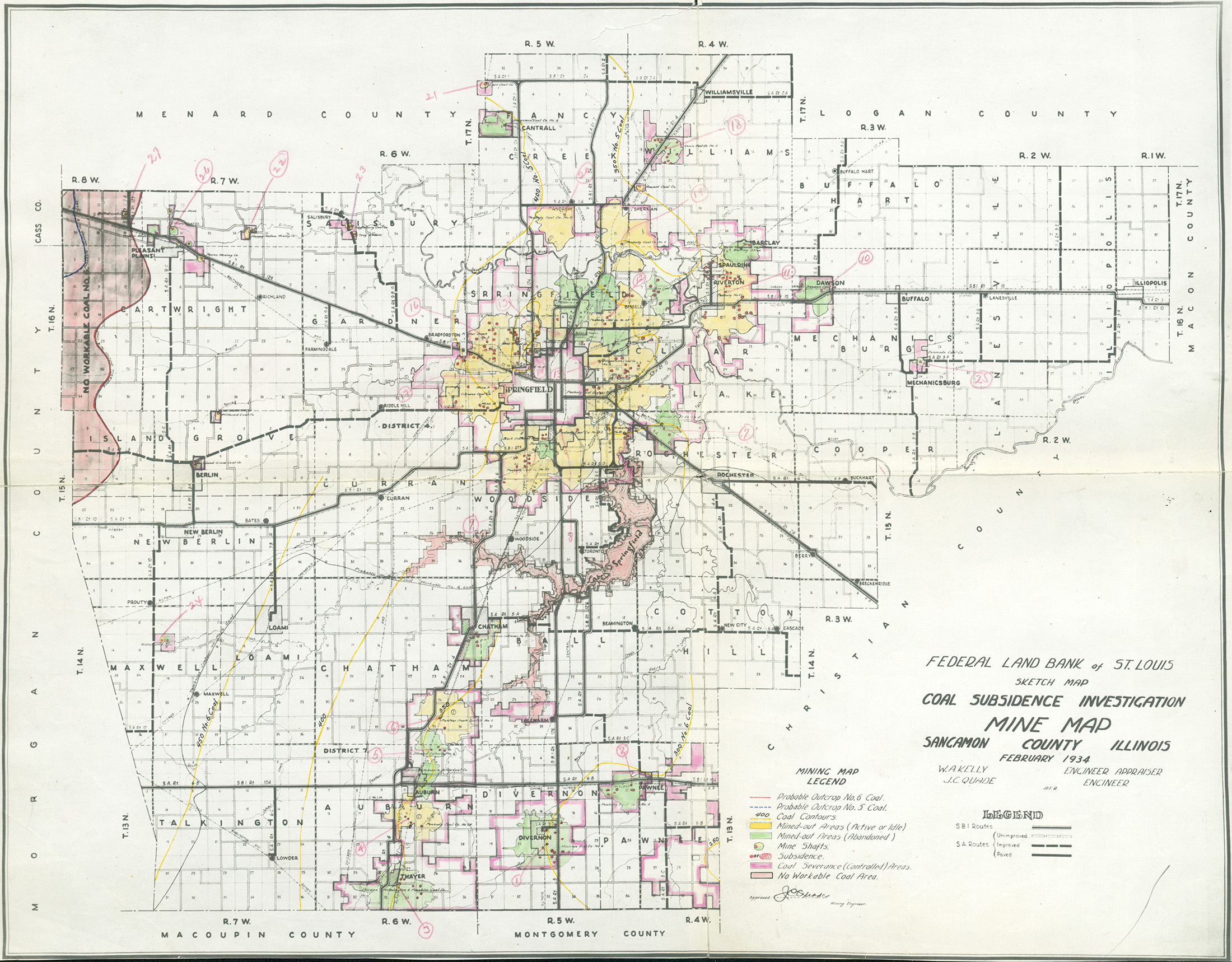
 | Sangamon, Quade | Sangamon | | QUADE SANGAMON.jpg | https://wikiimage.isgs.illinois.edu/ilmines/quade/reports/quade_report_sangamon.pdf | https://wikiimage.isgs.illinois.edu/ilmines/quade/QUADE SANGAMON.tif |
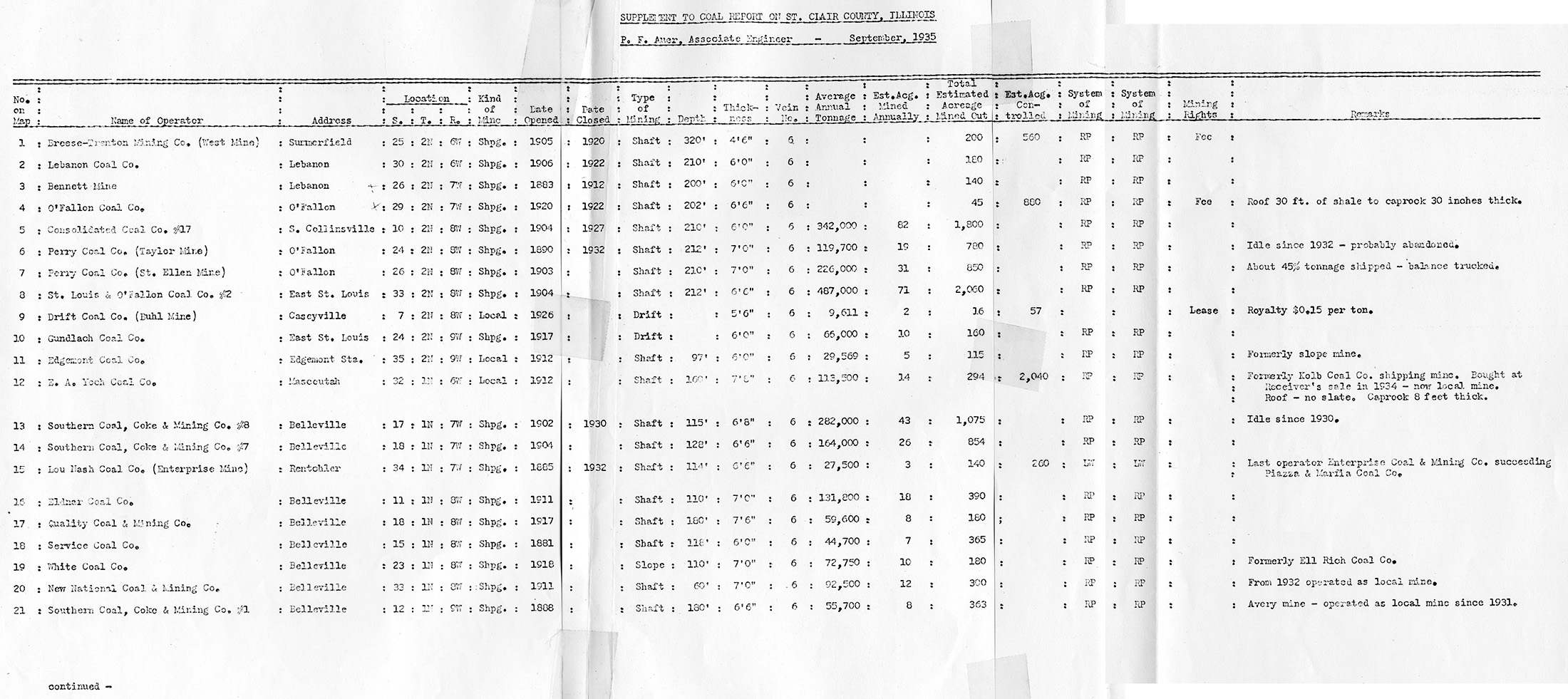
 | St. Clair, Quade - Table 1 | St. Clair | | QUADE ST CLAIR TABLE1.jpg | https://wikiimage.isgs.illinois.edu/ilmines/quade/reports/quade_report_stclair.pdf | https://wikiimage.isgs.illinois.edu/ilmines/quade/QUADE ST CLAIR TABLE1.tif |
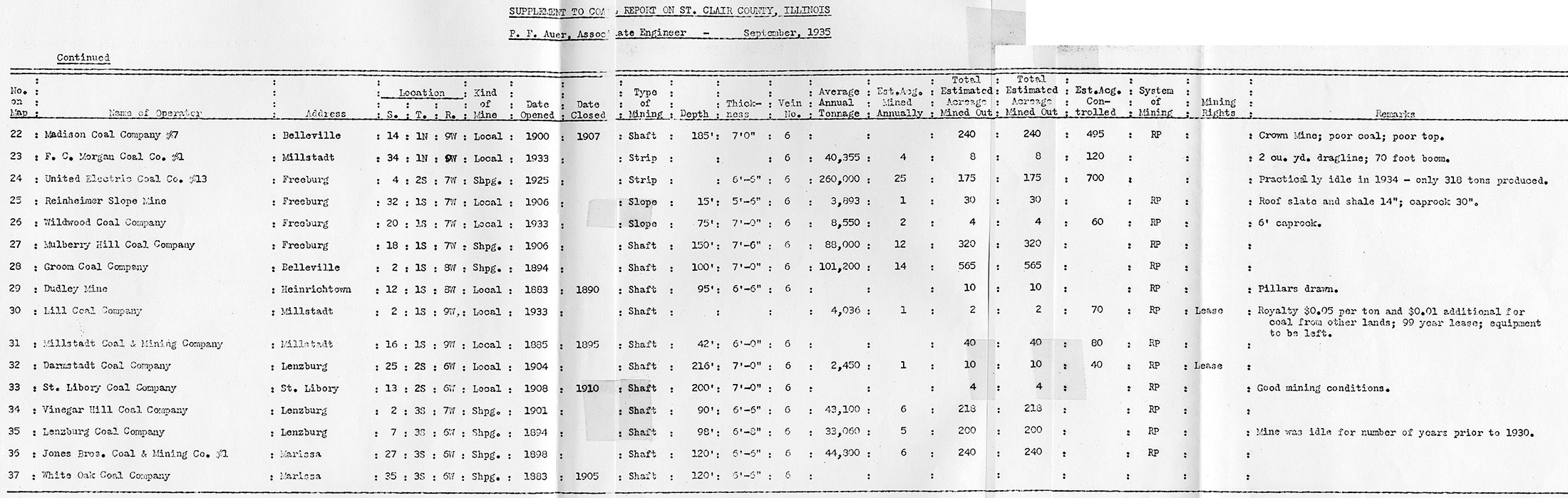
 | St. Clair, Quade - Table 2 | St. Clair | | QUADE ST CLAIR TABLE2.jpg | https://wikiimage.isgs.illinois.edu/ilmines/quade/reports/quade_report_stclair.pdf | https://wikiimage.isgs.illinois.edu/ilmines/quade/QUADE ST CLAIR TABLE2.tif |
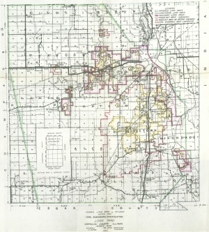
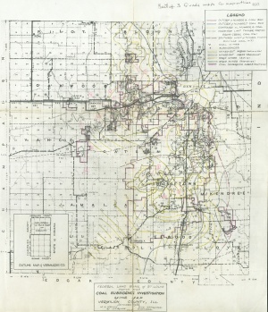
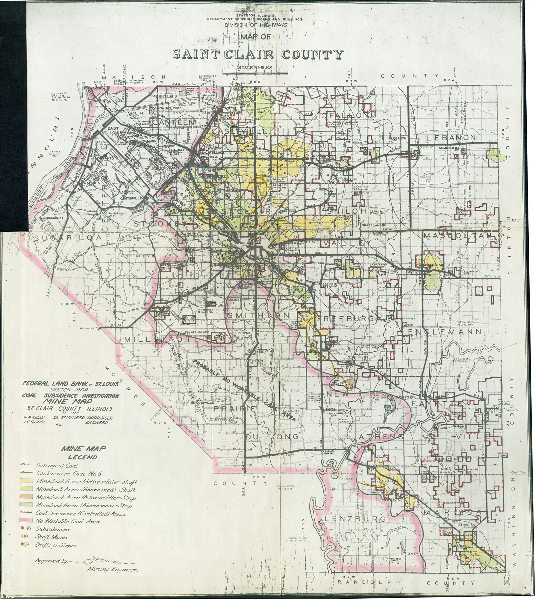
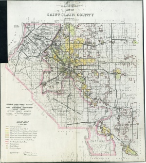 | St. Clair, Quade | St. Clair | | QUADE ST CLAIR.jpg | https://wikiimage.isgs.illinois.edu/ilmines/quade/reports/quade_report_stclair.pdf | https://wikiimage.isgs.illinois.edu/ilmines/quade/QUADE ST CLAIR.tif |
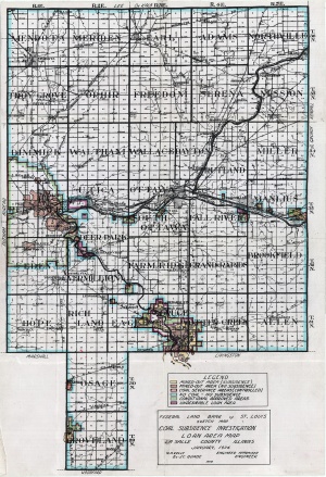
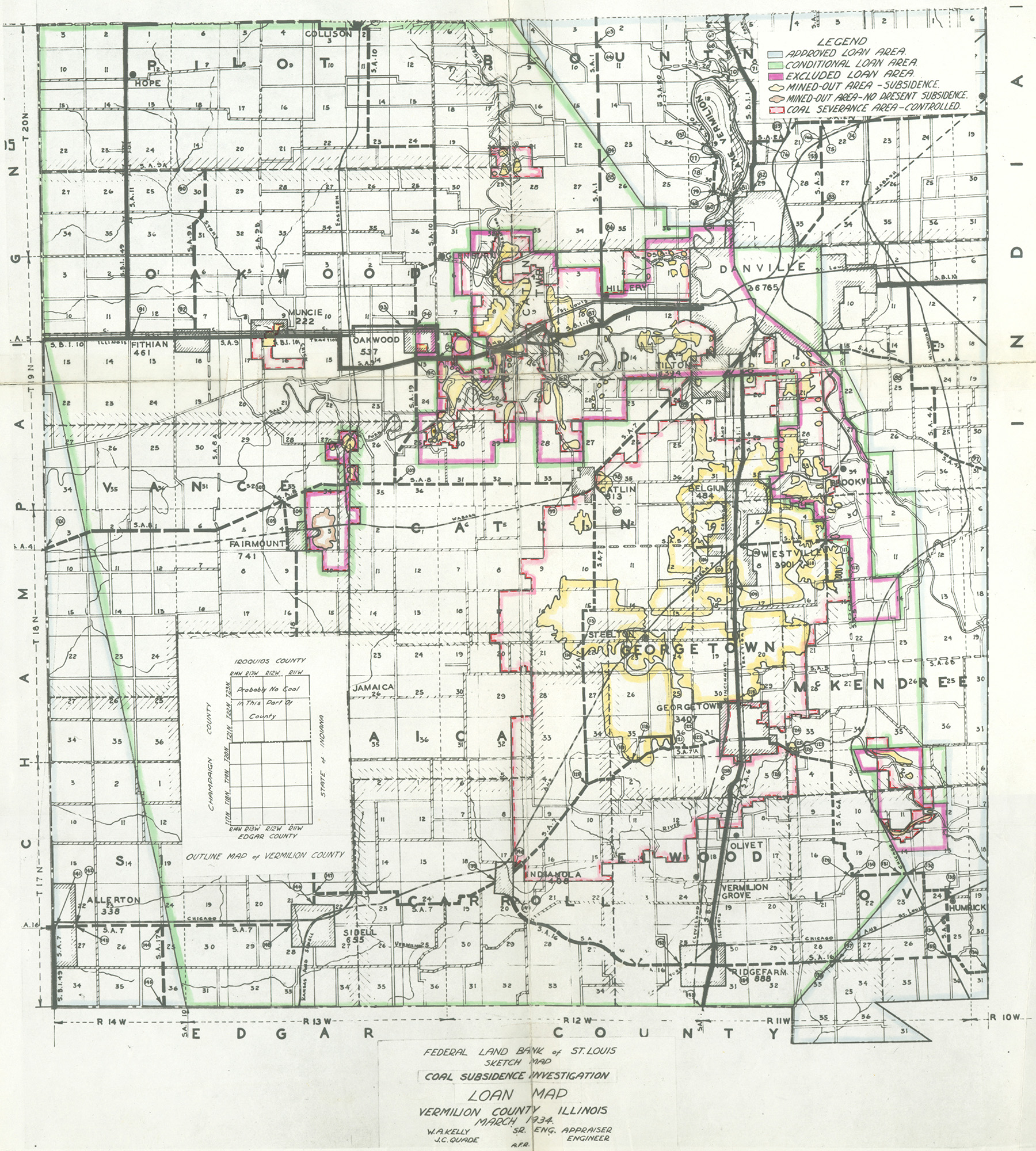
 | Vermilion, Quade - Loan Area Map | Vermilion | | QUADE VERMILION LOAN AREA MAP.jpg | https://wikiimage.isgs.illinois.edu/ilmines/quade/reports/quade_report_vermilion.pdf | https://wikiimage.isgs.illinois.edu/ilmines/quade/QUADE VERMILION LOAN AREA MAP.tif |
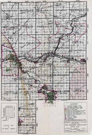
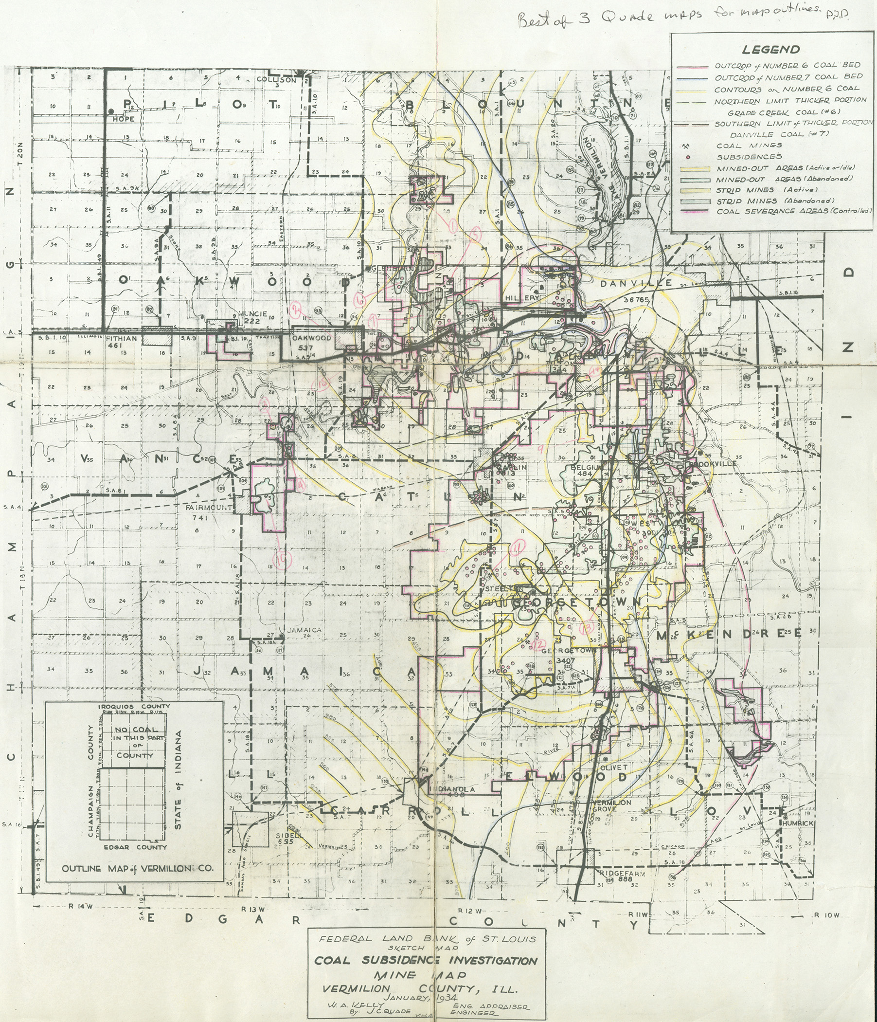
 | Vermilion, Quade | Vermilion | | QUADE VERMILION MINE MAP.jpg | https://wikiimage.isgs.illinois.edu/ilmines/quade/reports/quade_report_vermilion.pdf | https://wikiimage.isgs.illinois.edu/ilmines/quade/QUADE VERMILION MINE MAP.tif |
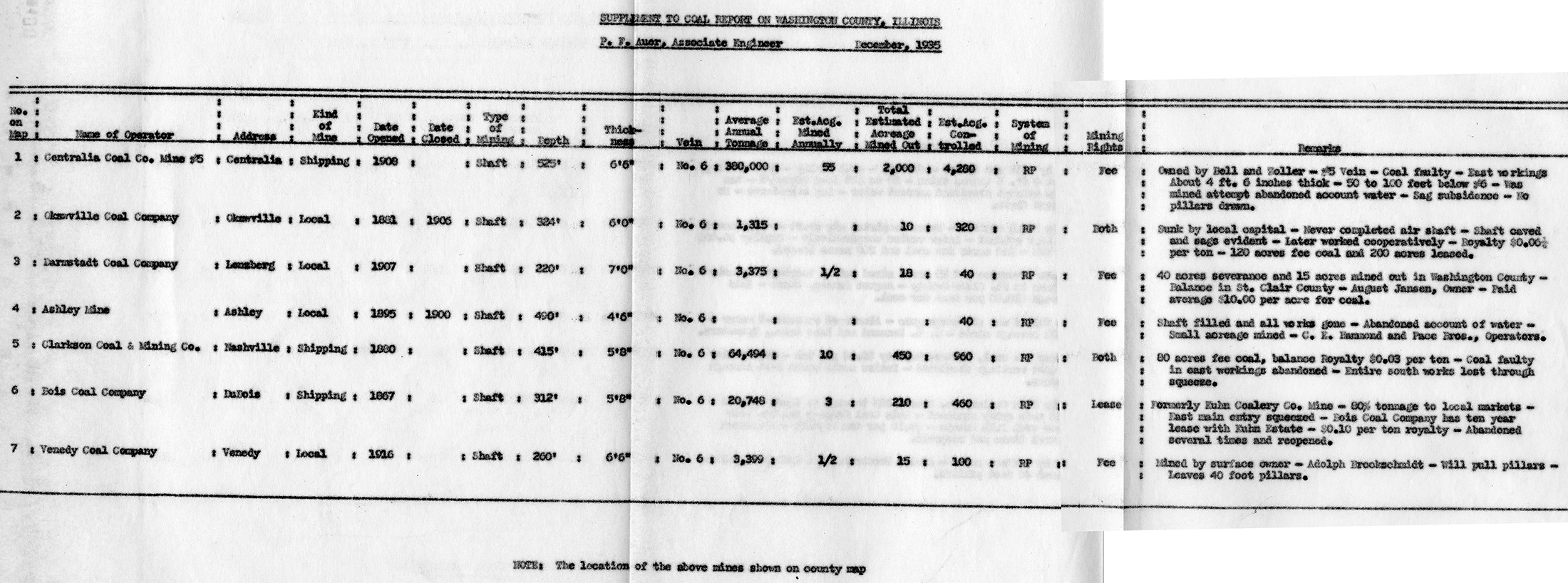
 | Washington, Quade - Table | Washington | | QUADE WASHINGTON TABLE.jpg | https://wikiimage.isgs.illinois.edu/ilmines/quade/reports/quade_report_washington.pdf | |
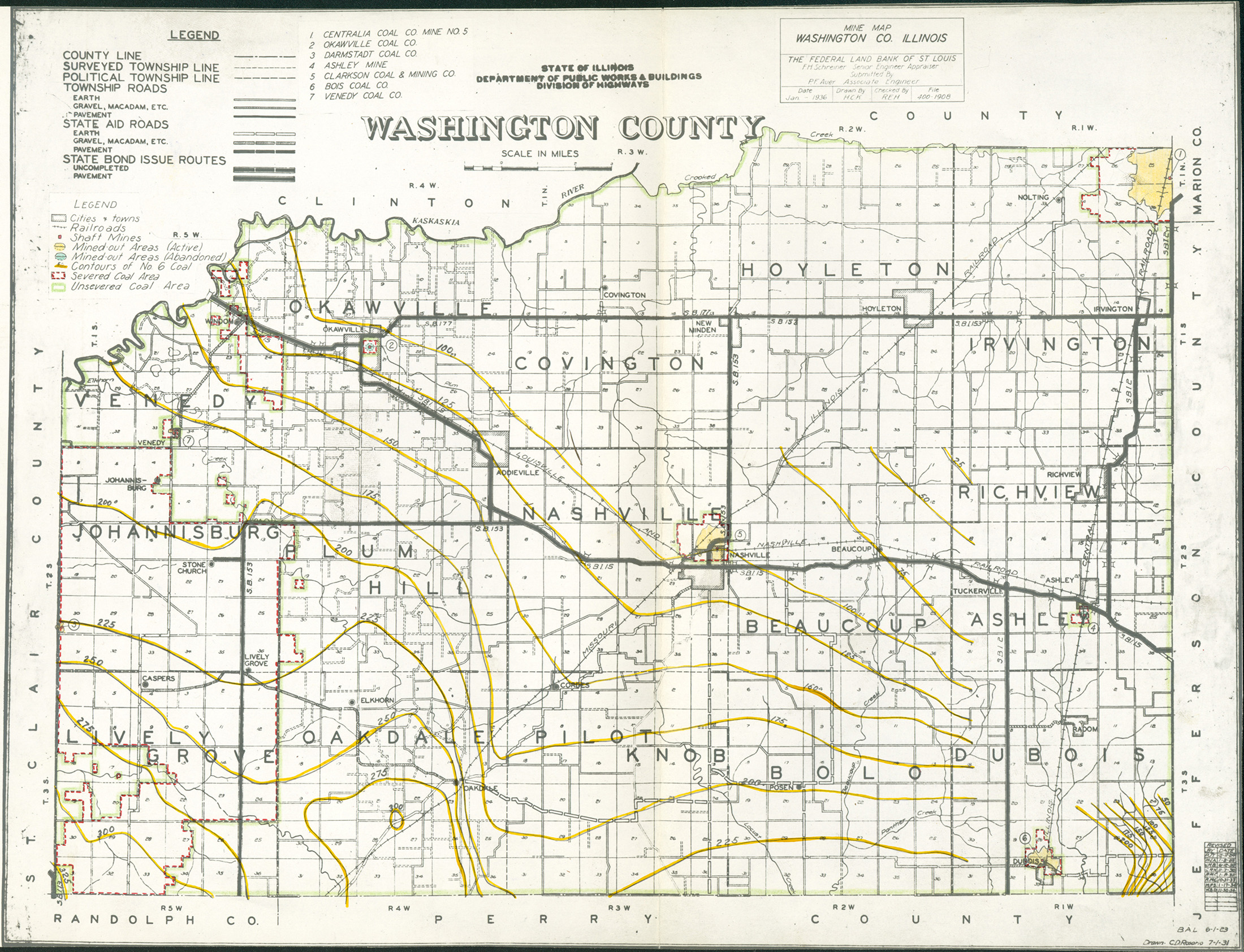
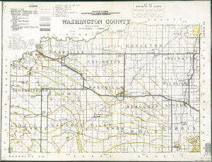 | Washington, Quade | Washington | | QUADE WASHINGTON.jpg | https://wikiimage.isgs.illinois.edu/ilmines/quade/reports/quade_report_washington.pdf | https://wikiimage.isgs.illinois.edu/ilmines/quade/QUADE WASHINGTON.tif |
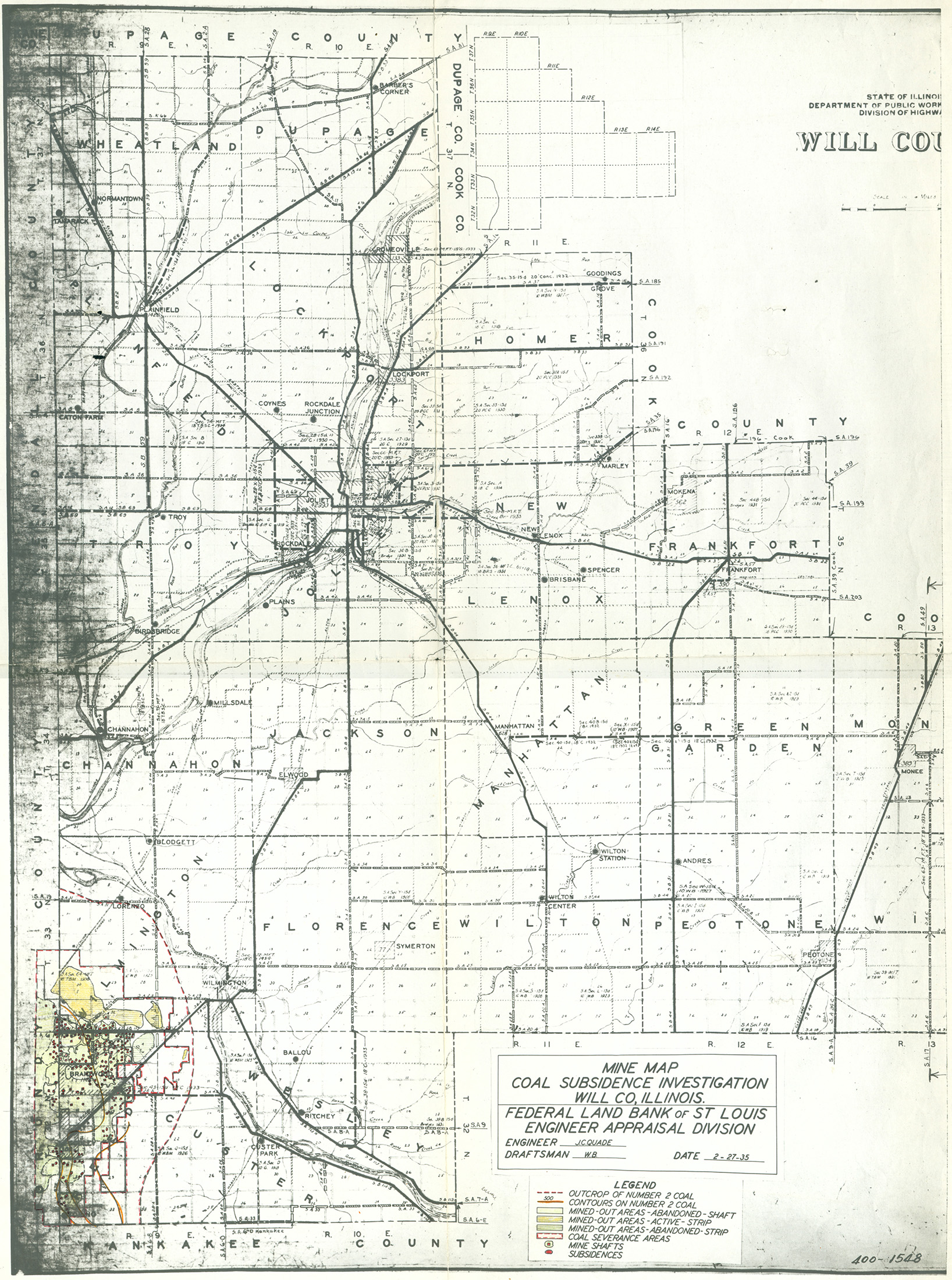
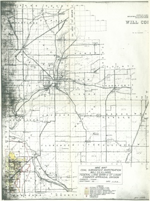 | Will, Quade | Will | | QUADE WILL.jpg | https://wikiimage.isgs.illinois.edu/ilmines/quade/reports/quade_report_will.pdf | https://wikiimage.isgs.illinois.edu/ilmines/quade/QUADE WILL.tif |
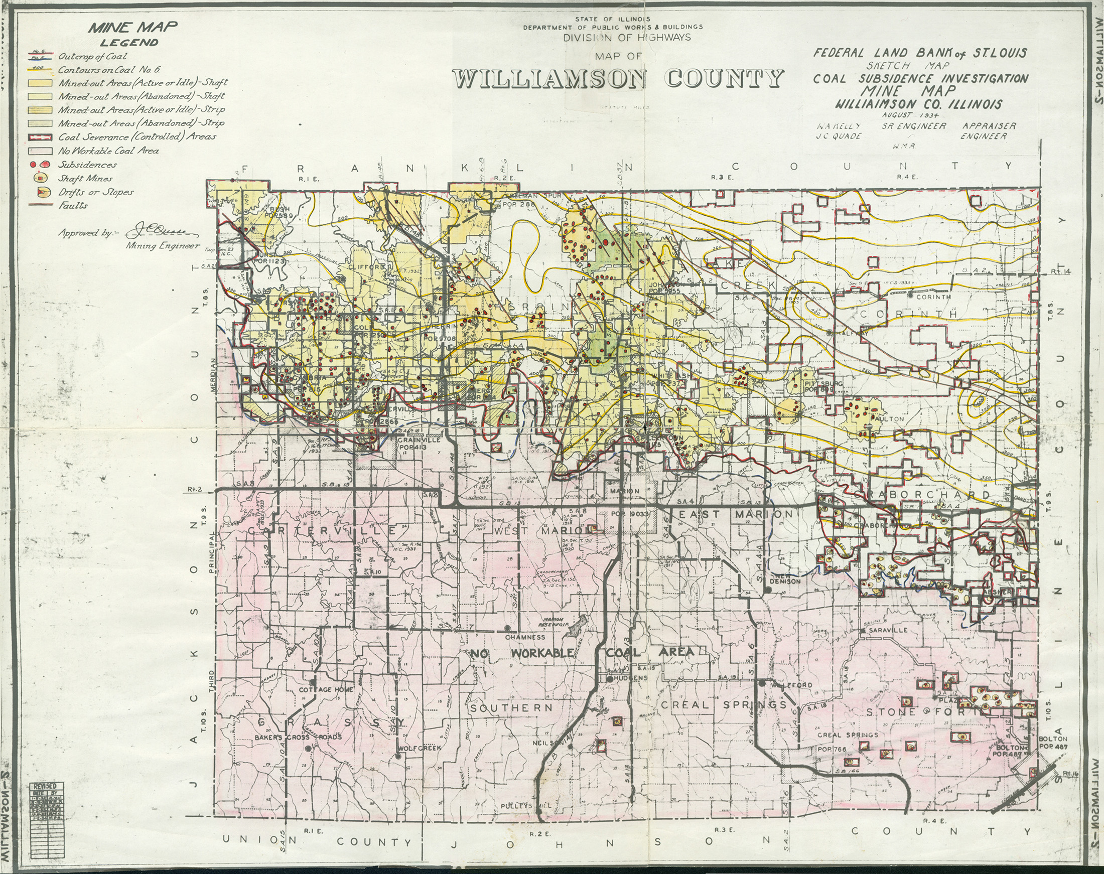
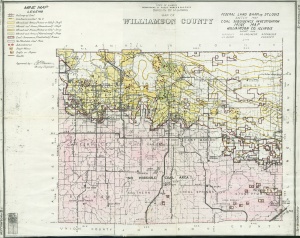 | Williamson, Quade | Williamson | | QUADE WILLIAMSON.jpg | https://wikiimage.isgs.illinois.edu/ilmines/quade/reports/quade_report_williamson.pdf | https://wikiimage.isgs.illinois.edu/ilmines/quade/QUADE WILLIAMSON.tif |


