FileList:M0667
Revision as of 12:16, February 6, 2023 by Alan.Myers (talk | contribs) (Created page with "{{FileList |checked=1st Entry |File name=m0667 |JPG_URL=https://wikiimage.isgs.illinois.edu/ilmines/tazewell/thumbnails/m0667_th.jpg |Mine-index=0667 |NC File TYPE=Map |Map Type=Microfilm |Map Status=Final |Map ID=352863 03140, 460, 18x |source_loc=Yes |minetype=Coal |Coal_co=Lakeside Coal Company |Mine_name=Lakeside |File Date=2-4-1957 |Map Scale=1:2400 |Map hires=https://wikiimage.isgs.illinois.edu/ilmines/tazewell/m0667.zip }} {{NC County |county=Tazewell }} {{NC Quad...")
|
These files may not be true to scale and are not georgistered. |
|---|
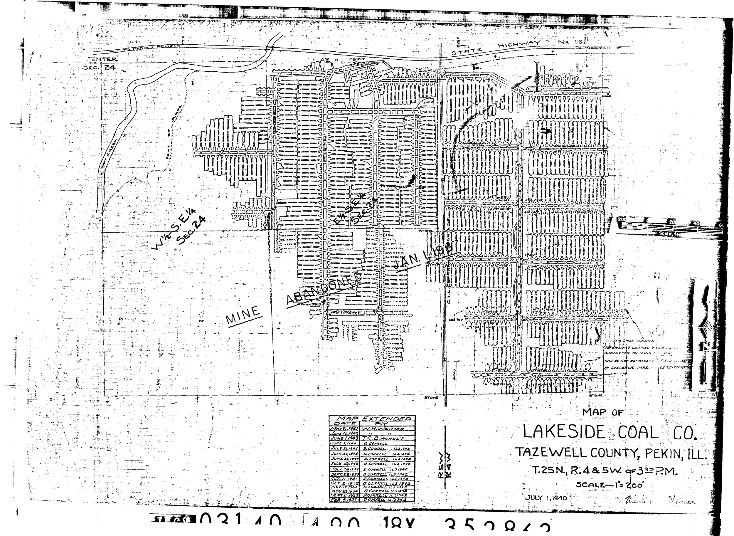
| Mine Index(s): | 0667 |
| ID Name/Number: | 352863 03140, 460, 18x |
| File Type: | Map |
| Mine Company: | Lakeside Coal Company |
| Mine Name | Lakeside |
| Date | 2-4-1957 |
| Map Type | Microfilm |
| Map Status | Final |
| Map Scale | 1:2400 |
| File Credit | |
| Caption | |
| Publication | |
| Note: | |
| Source of Location | Yes |
| DownloadThese files are true to scale and most are georegistered for gis software. | Click to download |