Category:Tazewell-County
County Coal Data
Mines that Appear in Tazewell-County
- 9998 & 9999 = Unknown dates
Unlocated Mines in Tazewell-County
Mine that have known coal production but no known location
Historical Mined Out Area Maps
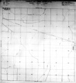
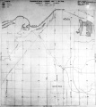
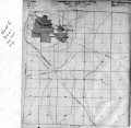
WPA
These maps were constructed as part of the nationwide Works Projects Administration (WPA), generally between 1934 and 1937 with some later updates or revisions,
Disclaimer
Maps for some locations might have multiple versions/seams, please inspected these areas closely for differences.
Notes and corrections were made by ISGS staff.
These maps are reproductions from microfilm, they may be of poor quality with text difficult to read.


Federal Land Bank of St. Louis, Preliminary Reports on Subsidence Investigations
Federal Land Bank of St. Louis, Preliminary Reports on Subsidence Investigations (refered by Coal Section Staff as "Quade Maps")
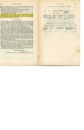
Mining engineers working for the Federal Land Bank of St. Louis mapped areas of subsidence due to coal mining in the early 1930s. These reports often include county maps of mine properties with mined-out areas including shaft locations, as well as subsidence areas.
Disclaimer
Maps for some locations might have multiple versions/seams, please inspected these areas closely for differences.
These maps are accompanied by a report, please download and inspect this document.
Notes and corrections were made by ISGS staff.
There are no Quade Maps for this county
Photographs
Pages in category "Tazewell-County"
The following 90 pages are in this category, out of 90 total.
6
9
- 91790001
- 91790002
- 91790003
- 91790004a
- 91790004b
- 91790005
- 91790007
- 91790010
- 91790011
- 91790013a
- 91790013b
- 91790014
- 91790015
- 91790016
- 91790017
- 91790018
- 91790019
- 91790020
- 91790021
- 91790022
- 91790023
- 91790026
- 91790027
- 91790028
- 91790028a
- 91790029
- 91790031
- 91790032
- 91790033
- 91790034
- 91790036
- 91790037a
- 91790037b
- 91790038
- 91790039
- 91790040
- 91790041
- 91790042
- 91790043
- 91790045
M
- FileList:M0027
- FileList:M0108 m0810 PB 902 03
- FileList:M0108 m810 MSHA 670 03
- FileList:M0667
- FileList:M3629
- FileList:M3630
- FileList:M3631
- FileList:M3635
- FileList:M3636 msha682 geo
- FileList:M3636a
- FileList:M3636b
- FileList:M3637
- FileList:M3637a
- FileList:M3640
- FileList:M7048
- FileList:M7391
- FileList:M7516 352852
- FileList:Mh sec1
Media in category "Tazewell-County"
The following 86 files are in this category, out of 86 total.
 M0027 coalreport1901 p167.pdf 1,331 × 1,170; 330 KB
 M0027 coalreport1906 p230.pdf 1,577 × 1,289; 298 KB
 M0027 fieldnotes.pdf 752 × 1,185; 207 KB
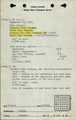
 M0027 minenotes.pdf 727 × 1,160, 24 pages; 7.52 MB
 M0108 coalreport1918.pdf 883 × 1,295; 168 KB
 M0108 fieldnotes.pdf 752 × 1,185; 156 KB
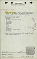
 M0108 minenotes.pdf 727 × 1,160, 22 pages; 4.11 MB
 M0667 minenotes.pdf 727 × 1,160, 12 pages; 2.33 MB
 M0810 coalreport1916.pdf 654 × 1,016; 62 KB
 M0810 fieldnotes.pdf 747 × 1,193; 203 KB
 M0810 minenotes.pdf 727 × 1,160, 17 pages; 5.88 MB
 M1790001 coalreport1882 p91.pdf 1,575 × 1,200; 276 KB
 M1790001 coalreport1884 p506.pdf 1,662 × 1,264; 337 KB
 M1790002 coalreport1882 p91.pdf 1,575 × 1,200; 275 KB
 M1790003 coalreport1882 p91.pdf 1,575 × 1,200; 275 KB
 M1790004a coalreport1882 p91.pdf 1,575 × 1,200; 275 KB
 M1790004a coalreport1884 p507.pdf 1,662 × 1,264; 338 KB
 M1790004a coalreport1885 p73.pdf 1,660 × 1,304; 871 KB
 M1790004b coalreport1898 p155.pdf 1,614 × 1,177; 320 KB
 M1790004b coalreport1899 p79.pdf 1,514 × 1,206; 359 KB
 M1790005 coalreport1882 p91.pdf 1,575 × 1,200; 275 KB
 M1790005 coalreport1884 p507.pdf 1,662 × 1,264; 337 KB
 M1790005 coalreport1885 p73.pdf 1,660 × 1,304; 871 KB
 M1790005 coalreport1899 p79.pdf 1,514 × 1,206; 358 KB
 M1790010 coalreport1882 p91.pdf 1,575 × 1,200; 275 KB
 M1790011 coalreport1884 p507.pdf 1,662 × 1,264; 337 KB
 M1790011 coalreport1885 p72.pdf 1,660 × 1,304; 873 KB
 M1790016 coalreport1895 3rd.pdf 750 × 1,185, 2 pages; 140 KB
 M1790016 coalreport1898 p154.pdf 1,614 × 1,177; 320 KB
 M1790016 coalreport1903 p200.pdf 1,627 × 1,233; 367 KB
 M1790016 History of Tazewell County 1905.pdf 1,475 × 2,029, 2 pages; 741 KB
 M1790022 coalreport1896 p107.pdf 1,610 × 1,210; 300 KB
 M1790022 coalreport1898 p154.pdf 1,614 × 1,177; 320 KB
 M1790023 coalreport1898 p154.pdf 1,614 × 1,177; 320 KB
 M1790023 coalreport1901.pdf 1,331 × 1,170, 2 pages; 620 KB
 M1790026 coalreport1897 p80.pdf 839 × 1,185; 142 KB
 M1790026 coalreport1898 p154.pdf 1,614 × 1,177; 320 KB
 M1790026 coalreport1901 p167.pdf 1,331 × 1,170; 329 KB
 M1790028 coalreport1902 p154.pdf 804 × 1,250; 110 KB
 M1790028a coalreport1899 p80.pdf 1,481 × 1,216; 351 KB
 M1790033 coalreport1902 p153.pdf 804 × 1,250; 99 KB
 M3629 fieldnotes.pdf 752 × 1,185; 211 KB
 M3629 minenotes.pdf 727 × 1,160, 16 pages; 2.8 MB
 M3630 coalreport1906.pdf 1,577 × 1,289; 299 KB
 M3630 fieldnotes.pdf 752 × 1,183; 190 KB
 M3630 minenotes.pdf 727 × 1,160, 7 pages; 1.3 MB
 M3631 coalreport1882.pdf 1,575 × 1,200; 283 KB
 M3631 coalreport1884.pdf 1,662 × 1,264; 339 KB
 M3631 coalreport1885.pdf 1,660 × 1,304; 873 KB
 M3631 minenotes.pdf 727 × 1,160, 4 pages; 676 KB
 M3633 minenotes.pdf 727 × 1,160, 3 pages; 503 KB
 M3634 minenotes.pdf 727 × 1,160, 5 pages; 898 KB
 M3635 coalreport1918.pdf 883 × 1,295; 115 KB
 M3635 fieldnotes.pdf 754 × 1,187; 211 KB
 M3635 minenotes.pdf 727 × 1,160, 3 pages; 523 KB
 M3636 coalreport1902.pdf 804 × 1,250; 96 KB
 M3636 fieldnotes.pdf 754 × 1,187; 238 KB
 M3636 minenotes.pdf 727 × 1,160, 9 pages; 1.66 MB
 M3637 fieldnotes.pdf 752 × 1,185; 216 KB
 M3637 minenotes.pdf 727 × 1,160, 10 pages; 1.9 MB
 M3638 coalreport1898 p154.pdf 1,614 × 1,177; 320 KB
 M3639 minenotes.pdf 727 × 1,160, 8 pages; 1.41 MB
 M3640 fieldnotes.pdf 752 × 1,185; 244 KB
 M3640 minenotes.pdf 727 × 1,160, 5 pages; 1,010 KB
 M6808 coalreport1882 p91.pdf 1,575 × 1,200; 281 KB
 M6808 coalreport1884 p507.pdf 1,662 × 1,264; 337 KB
 M6808 coalreport1885 p72.pdf 1,660 × 1,304; 873 KB
 M6808 coalreport1896 p107.pdf 1,610 × 1,210; 301 KB
 M6808 minenotes.pdf 727 × 1,160; 171 KB
 M7178 fieldnotes.pdf 752 × 1,185, 2 pages; 399 KB
 M7259 Tazewell.pdf 1,275 × 1,650, 2 pages; 155 KB
 M7387 coalreport1882 p91.pdf 1,575 × 1,200; 275 KB
 M7387 coalreport1884 p507.pdf 1,662 × 1,264; 337 KB
 M7387 coalreport1885 p72.pdf 1,660 × 1,304; 873 KB
 M7387 minenotes.pdf 727 × 1,160; 137 KB
 M7389 coalreport1882 p91.pdf 1,575 × 1,200; 275 KB
 M7389 coalreport1884 p507.pdf 1,662 × 1,264; 337 KB
 M7389 coalreport1885 p72.pdf 1,660 × 1,304; 871 KB
 M7389 minenotes.pdf 727 × 1,160; 119 KB
 M7390 fieldnotes.pdf 758 × 1,187, 3 pages; 665 KB
 M7542 fieldnotes.pdf 752 × 1,185, 2 pages; 400 KB
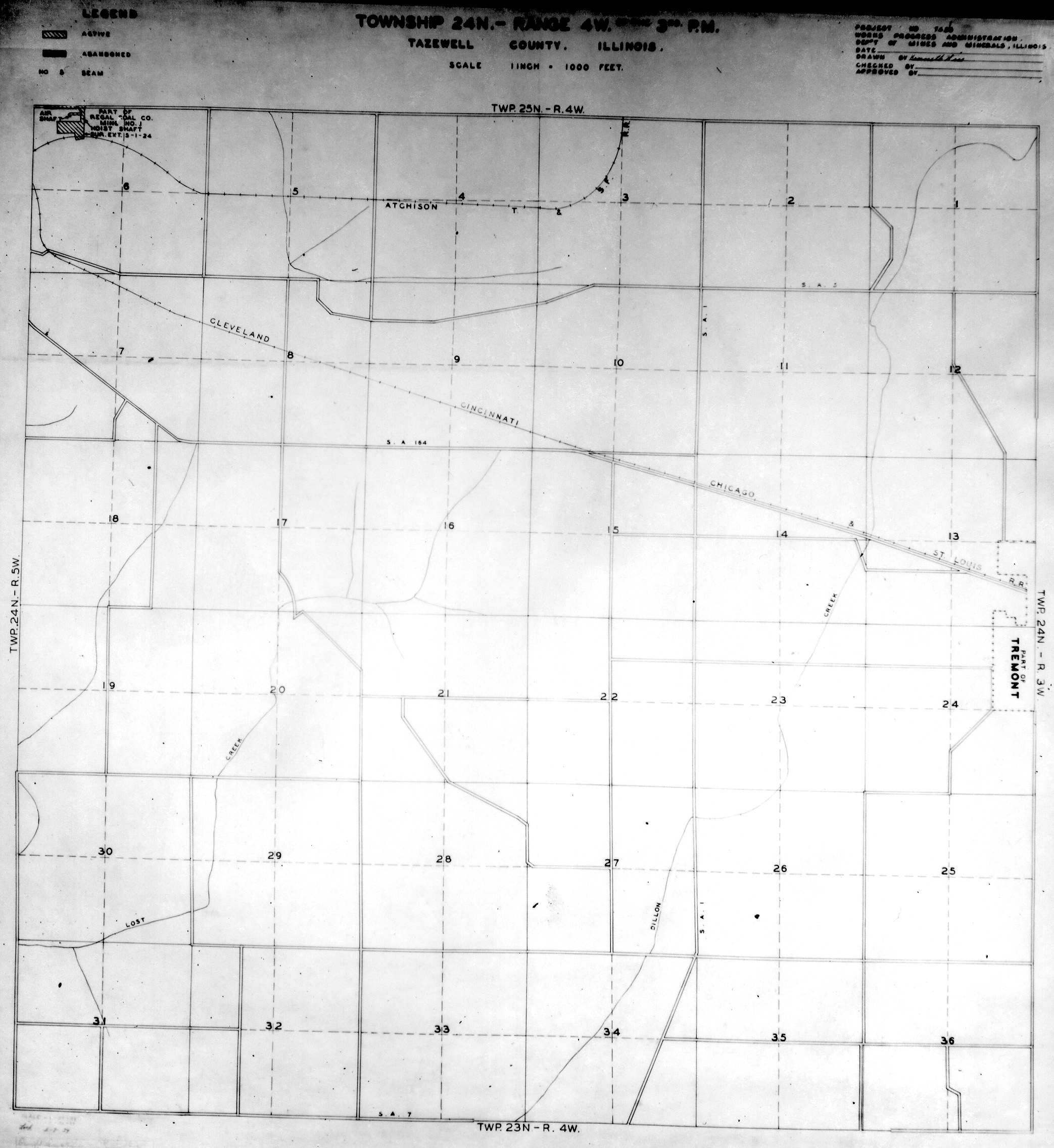
 WPA TAZEWELL 24N4W.jpg 2,086 × 2,271; 1,002 KB
 WPA TAZEWELL 24N5W.jpg 1,997 × 2,244; 1.11 MB
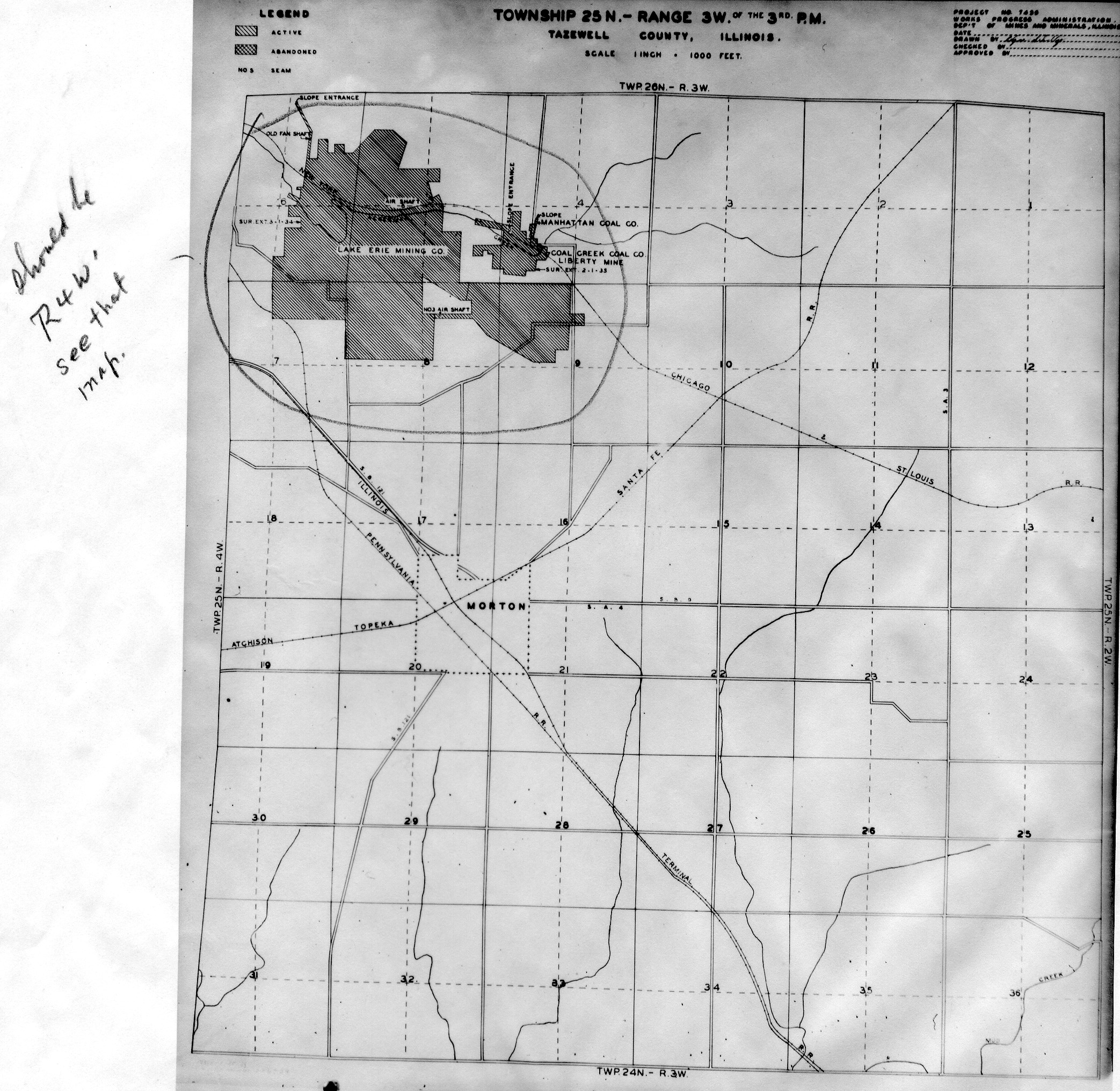
 WPA TAZEWELL 25N3W.jpg 2,086 × 2,032; 1.25 MB
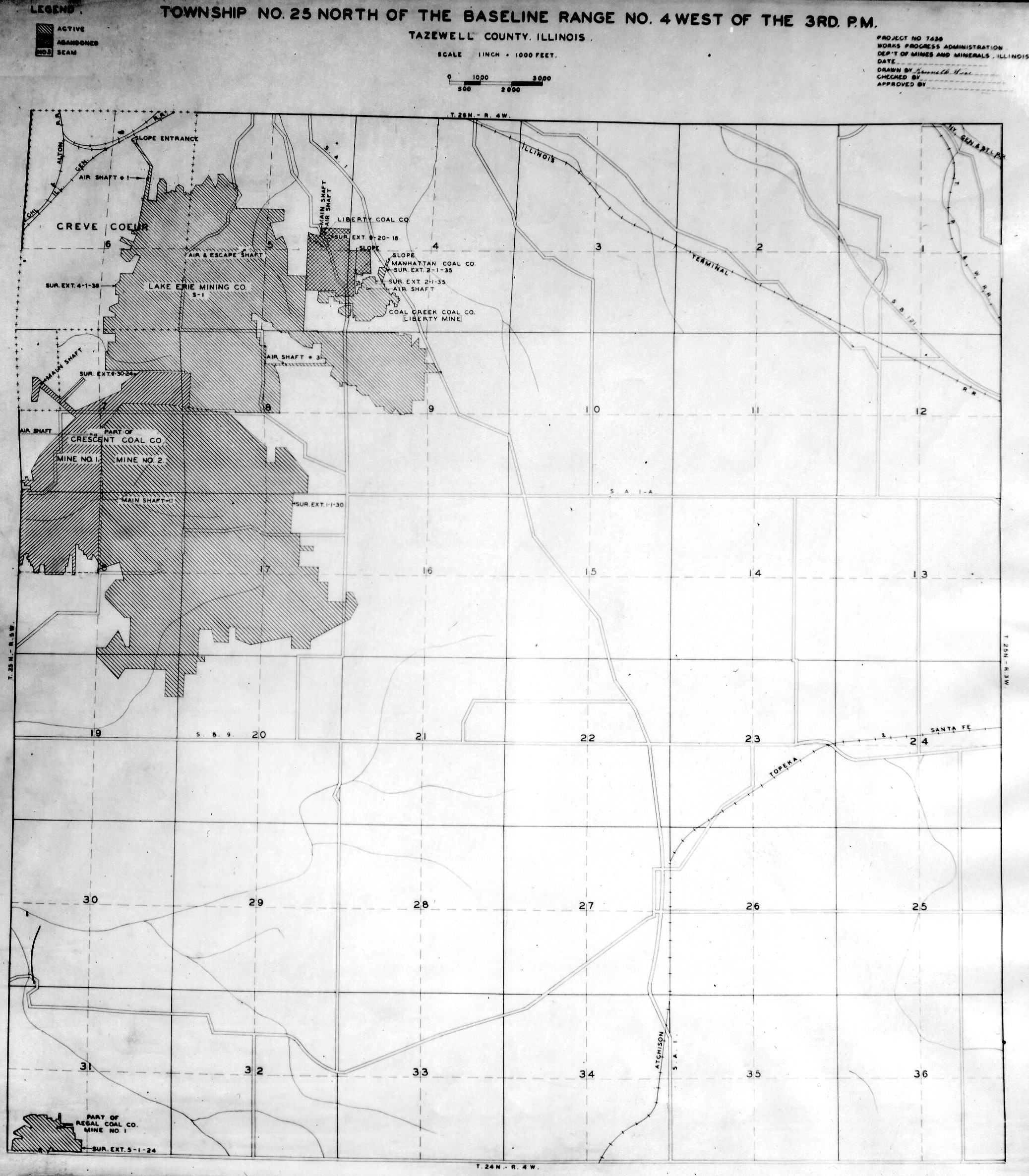
 WPA TAZEWELL 25N4W.jpg 2,075 × 2,372; 1.27 MB
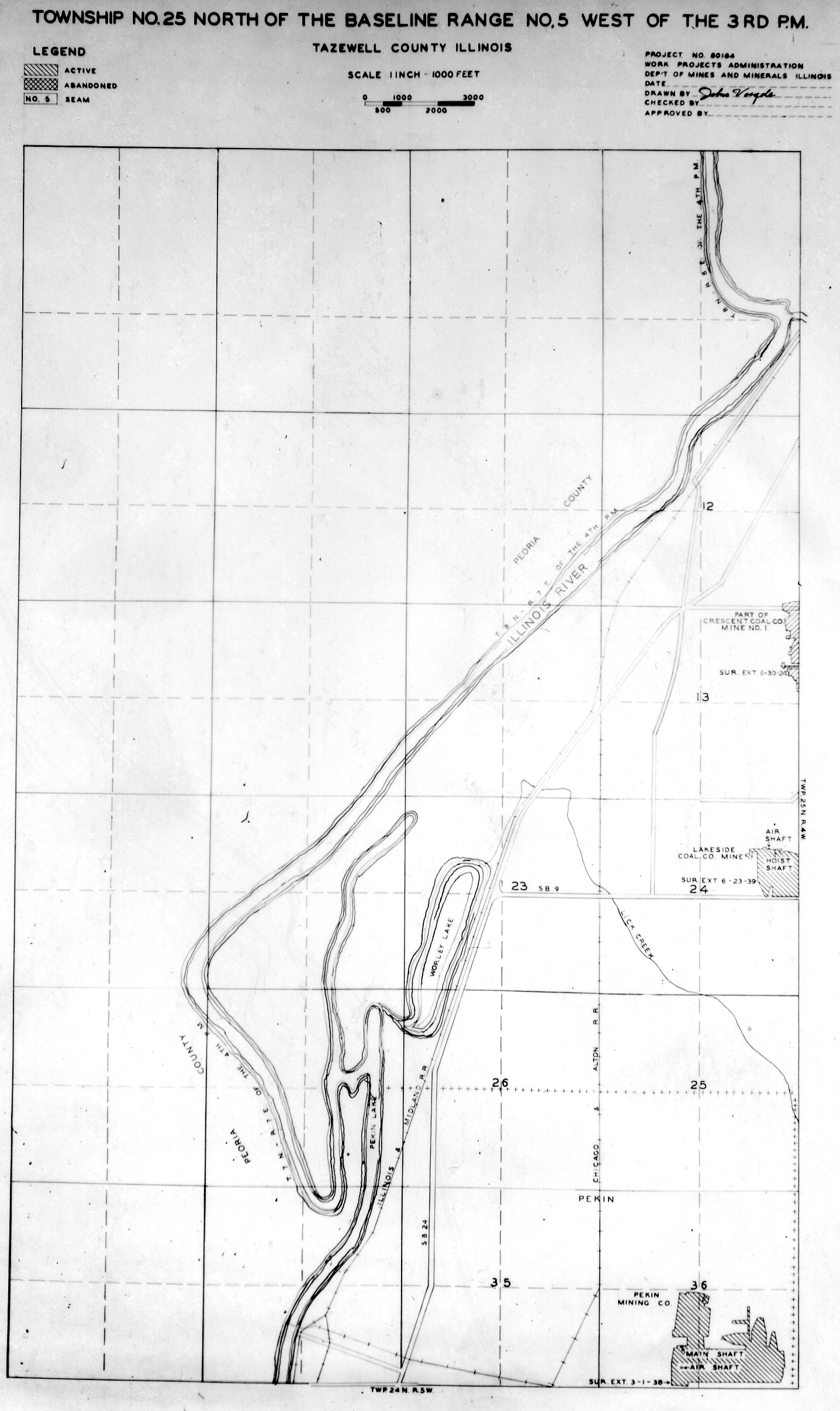
 WPA TAZEWELL 25N5W.jpg 1,437 × 2,412; 728 KB