Mine Index Number: 7389
| Company Name:
|
Bohlander Brothers
|
| Mine Name:
|
Bohlander Mine
|
| Start Date:
|
1873
|
End Date:
|
1907
|
| Type of Mine:
|
Underground
|
| Total acres shown:
|
None
|
| Acres after map date:
|
40
|
General Area of mining acres shown:
|
A general area of mining is shown on the accompanying map to indicate the approximate size, but although old works were labeled on the source map for the Ubben No. 1 Mine (mine index 3630), other mines may have operated in the vicinity (see the unlocated mines at the back of this report).
|
|
|
Shaft, Slope, Drift or Tipple Location(s)
| Type
|
County
|
Township-Range
|
Section
|
Part Section
|
| Main shaft
|
Tazewell
|
24N 5W
|
1
|
SW NW SE
|
Geology
| Springfield
|
120-135
|
|
|
4.0-5.0
|
RP
|
Geological Problems Reported
Production
| Company
|
Mine Name
|
Date
|
Production (tons)
|
| William Rundle
|
Rundle
|
1873-1879The shaft location was shown on the 1873 plat map. Years of operation before 1873 are not known, and production is not known before June 1878. The 1882 Coal Report indicated 6 acres were mined.
|
4,696The shaft location was shown on the 1873 plat map. Years of operation before 1873 are not known, and production is not known before June 1878. The 1882 Coal Report indicated 6 acres were mined.
|
|
|
|
|
|
|
|
| Total Production: 141,852
|
Production Notes
Coal Report production (if available)
Sources of Data
| Atlas Map of Tazewell County
|
1873
|
1:9457
|
1:9457
|
Secondary source
|
| Microfilm, document 352854
|
1-7-1936
|
1:2400
|
1:4634
|
Secondary source
|
Annotated Bibliography (Data source - brief description of information)
| Coal Reports - Production, ownership, years of operation, mine type, seam, depth, thickness, mining method.
|
| Directory of Illinois Coal Mines (Tazewell County) - Mine names, mine index, ownership, years of operation.
|
| Andreas, A. T., 1873, Atlas Map of Tazewell County, Illinois: Davenport, Iowa, Andreas, Lyter & Co., 165p. - Shaft location.
|
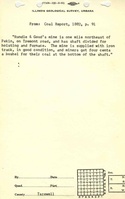
| Microfilm map, document 352854, reel 03140, frame 471, map of Ubben No. 1 Mine (mine index 3630) - General area of mining.
|
Mine Notes
Mine Images
 These files may not be true to scale and are not georgistered. These files may not be true to scale and are not georgistered.
|
Map Type:
|
Atlas
|
| Map ID:
|
1873 Atlas of Tazewell County
|
| Company:
|
|
| Mine Name:
|
|
| Caption:
|
|
| Map Date:
|
1873
|
| Map Status:
|
Secondary
|
| Image Credit:
|
|
| Note:
|
|
| More Info:
|
Mh sec1
|
| Full Res Download:These files are true to scale and most are georegistered for gis software. These files may be a very large (>1GB) download!
|
https://wikiimage.isgs.illinois.edu/ilmines/tazewell/mh sec1.zip
|
Photographs