Mine Index Number: 3637
| Company Name:
|
Lake Erie Mining Company
|
| Mine Name:
|
Lake Erie Mine
|
| Start Date:
|
1899
|
End Date:
|
February 1939
|
| Type of Mine:
|
Underground
|
| Total acres shown:
|
980
|
| Acres after map date:
|
|
General Area of mining acres shown:
|
|
|
|
Shaft, Slope, Drift or Tipple Location(s)
| Type
|
County
|
Township-Range
|
Section
|
Part Section
|
| Old slope
|
Tazewell
|
25N 4W
|
6
|
NW NEThe top row of sections in T25N-R4W is about 2,000 feet longer in the north-south direction than a regular one-mile section. Traditionally, the points are oriented from the southeast corner of the section (see page 6). This slope is outside the square mile grid. Its approximate location (generated from the accompanying map) is 1100 FNL, 2000 FEL.
|
| Air shaft
|
Tazewell
|
25N 4W
|
6
|
NE NW NE
|
| Air shaft
|
Tazewell
|
25N 4W
|
5
|
SW SE NW
|
| Air shaft
|
Tazewell
|
25N 4W
|
8
|
SW NW NE
|
Geology
Geological Problems Reported
Production
| Company
|
Mine Name
|
Date
|
Production (tons)
|
| Carters Coal and Mining Company The title block for the 1908-1911 microfilm map, document 352868, reel 03140, frames 495 & 496, states “Rushce Mine (New Carters) Coal Mine”. The unlocated mines at the back of this report (East Peoria group) includes a Rushce Mine that operated 1878-1889. The 10-year gap between the opening date above and the closing date of Rusche is the major factor that prevents combining the two production histories.
|
Carters
|
1905-1906
|
14,532
|
|
|
|
|
|
|
|
| Total Production: 3,443,128
|
Production Notes
Coal Report production (if available)
Sources of Data
| Microfilm, document 352860
|
2-19-1939
|
1:2400
|
1:4634
|
Final
|
| Microfilm, document 352748
|
7-20-1915
|
1:2400
|
1:3972
|
Not final
|
Annotated Bibliography (Data source - brief description of information)
| Coal Reports - Production, ownership, years of operation.
|
| Directory of Illinois Coal Mines (Tazewell County) - Mine names, mine index, ownership, years of operation.
|
| Mine notes (Tazewell County) - Mine type, slope location, seam, depth, thickness.
|
| Microfilm map, document 352860, reel 03140, frames 484-487 - Slope/shaft locations, mine outline, mining method.
|
| Microfilm map, document 352849, reel 03140, frame 466 - Mine outline (northern, western).
|
Mine Notes
Mine Images
![[[:Carters|Carters]]](https://wikiimage.isgs.illinois.edu/ilmines/tazewell/thumbnails/m3637a_th.jpg) These files may not be true to scale and are not georgistered. These files may not be true to scale and are not georgistered.
|
Map Type:
|
Microfilm
|
| Map ID:
|
352849 3140 466 24x
|
| Company:
|
Carters Coal and Mining Company
|
| Mine Name:
|
Carters
|
| Caption:
|
|
| Map Date:
|
7-20-1915
|
| Map Status:
|
Not Final
|
| Image Credit:
|
|
| Note:
|
|
| More Info:
|
M3637a
|
| Full Res Download:These files are true to scale and most are georegistered for gis software. These files may be a very large (>1GB) download!
|
https://wikiimage.isgs.illinois.edu/ilmines/tazewell/m3637a.zip
|
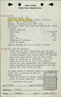
![[[:Lake Erie|Lake Erie]]](https://wikiimage.isgs.illinois.edu/ilmines/tazewell/thumbnails/m3637_th.jpg) These files may not be true to scale and are not georgistered. These files may not be true to scale and are not georgistered.
|
Map Type:
|
Microfilm
|
| Map ID:
|
352860 3140 484-487, 28x
|
| Company:
|
Lake Erie Mining Company
|
| Mine Name:
|
Lake Erie
|
| Caption:
|
|
| Map Date:
|
02/19/1939
|
| Map Status:
|
Final
|
| Image Credit:
|
|
| Note:
|
|
| More Info:
|
M3637
|
| Full Res Download:These files are true to scale and most are georegistered for gis software. These files may be a very large (>1GB) download!
|
https://wikiimage.isgs.illinois.edu/ilmines/tazewell/m3637.zip
|
Photographs