Peoria East Quadrangle
Mining in the Peoria East Quadrangle
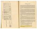
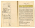
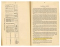
James Whittaker mined coal near Wesley City in 1852, and that mine operated until 1890. Little is known of the early mining in this county, and many unlocated mines (see the back of this report) had high production. Because of this lack of old mine maps, a large general area of mining was added to the accompanying map along the bluffs near Wesley City. Those bluffs closest to Wesley City would have been the most likely site for early mining.
The Springfield Coal was mined in the southern half of the Peoria East Quadrangle, where it was generally over 4 feet thick. The roof was quite poor in some areas, with a combination of massive shale, thin and incompetent limestone, and water-bearing sandstone. The Groveland No. 1 Mine (mine index 0810) had clay slips and horsebacks. In spite of these disadvantages, the mines managed to operate for many years. The Manhattan Mine (mine index [[[3636]]) operated from 1900 to 1939, and the Lake Erie Mine operated from 1899 to 1939. These were the last coal mines in the quadrangle, and it is probably not a coincidence that the mines closed just as machine mining was required for competitive product pricing.
Map and Directory PDF Download
Coal Mines In Illinois Peoria East Quadrangle
Mines that Appear on the Peoria East Quadrangle
Unlocated Mines
Peoria County
Tazewell County
Pages in category "Peoria East Quadrangle"
The following 56 pages are in this category, out of 56 total.
9
Media in category "Peoria East Quadrangle"
The following 44 files are in this category, out of 44 total.
 M0108 coalreport1918.pdf 883 × 1,295; 168 KB
 M0108 fieldnotes.pdf 752 × 1,185; 156 KB
 M0108 minenotes.pdf 727 × 1,160, 22 pages; 4.11 MB
 M0810 coalreport1916.pdf 654 × 1,016; 62 KB
 M0810 fieldnotes.pdf 747 × 1,193; 203 KB
 M0810 minenotes.pdf 727 × 1,160, 17 pages; 5.88 MB
 M1790001 coalreport1882 p91.pdf 1,575 × 1,200; 276 KB
 M1790001 coalreport1884 p506.pdf 1,662 × 1,264; 337 KB
 M1790002 coalreport1882 p91.pdf 1,575 × 1,200; 275 KB
 M1790003 coalreport1882 p91.pdf 1,575 × 1,200; 275 KB
 M1790004a coalreport1882 p91.pdf 1,575 × 1,200; 275 KB
 M1790004a coalreport1884 p507.pdf 1,662 × 1,264; 338 KB
 M1790004a coalreport1885 p73.pdf 1,660 × 1,304; 871 KB
 M1790004b coalreport1898 p155.pdf 1,614 × 1,177; 320 KB
 M1790004b coalreport1899 p79.pdf 1,514 × 1,206; 359 KB
 M1790005 coalreport1882 p91.pdf 1,575 × 1,200; 275 KB
 M1790005 coalreport1884 p507.pdf 1,662 × 1,264; 337 KB
 M1790005 coalreport1885 p73.pdf 1,660 × 1,304; 871 KB
 M1790005 coalreport1899 p79.pdf 1,514 × 1,206; 358 KB
 M1790016 coalreport1895 3rd.pdf 750 × 1,185, 2 pages; 140 KB
 M1790016 coalreport1898 p154.pdf 1,614 × 1,177; 320 KB
 M1790016 coalreport1903 p200.pdf 1,627 × 1,233; 367 KB
 M1790016 History of Tazewell County 1905.pdf 1,475 × 2,029, 2 pages; 741 KB
 M1790022 coalreport1896 p107.pdf 1,610 × 1,210; 300 KB
 M1790022 coalreport1898 p154.pdf 1,614 × 1,177; 320 KB
 M1790023 coalreport1898 p154.pdf 1,614 × 1,177; 320 KB
 M1790023 coalreport1901.pdf 1,331 × 1,170, 2 pages; 620 KB
 M1790028 coalreport1902 p154.pdf 804 × 1,250; 110 KB
 M1790028a coalreport1899 p80.pdf 1,481 × 1,216; 351 KB
 M1790033 coalreport1902 p153.pdf 804 × 1,250; 99 KB
 M3633 minenotes.pdf 727 × 1,160, 3 pages; 503 KB
 M3634 minenotes.pdf 727 × 1,160, 5 pages; 898 KB
 M3635 coalreport1918.pdf 883 × 1,295; 115 KB
 M3635 fieldnotes.pdf 754 × 1,187; 211 KB
 M3635 minenotes.pdf 727 × 1,160, 3 pages; 523 KB
 M3636 coalreport1902.pdf 804 × 1,250; 96 KB
 M3636 fieldnotes.pdf 754 × 1,187; 238 KB
 M3636 minenotes.pdf 727 × 1,160, 9 pages; 1.66 MB
 M3637 fieldnotes.pdf 752 × 1,185; 216 KB
 M3637 minenotes.pdf 727 × 1,160, 10 pages; 1.9 MB
 M3638 coalreport1898 p154.pdf 1,614 × 1,177; 320 KB
 M7178 fieldnotes.pdf 752 × 1,185, 2 pages; 399 KB
 M7259 Tazewell.pdf 1,275 × 1,650, 2 pages; 155 KB
 M7542 fieldnotes.pdf 752 × 1,185, 2 pages; 400 KB