Mine Index Number: 3629
| Company Name:
|
Regal Coal Company
|
| Mine Name:
|
Regal Mine
|
| Start Date:
|
1904
|
End Date:
|
March 1924
|
| Type of Mine:
|
Underground
|
| Total acres shown:
|
51
|
| Acres after map date:
|
|
General Area of mining acres shown:
|
|
|
|
Shaft, Slope, Drift or Tipple Location(s)
| Type
|
County
|
Township-Range
|
Section
|
Part Section
|
| Main shaft
|
Tazewell
|
24N 4W
|
6
|
NE NW NW
|
| Air shaft
|
Tazewell
|
24N 4W
|
6
|
NE NW NW
|
Geology
Geological Problems Reported
Above the coal was 1 foot of black shale, then 1 foot of clod (a massive dark gray shale), then 6 to 8 inches of limestone that was not persistent. Numerous horsebacks were present in the seam. Bands of soft “brown sulphur” were common near the horsebacks.
Production
| Company
|
Mine Name
|
Date
|
Production (tons)
|
|
|
|
|
|
| Total Production: 242,484
|
Production Notes
Coal Report production (if available)
Sources of Data
| Microfilm, document 352856
|
5-1-1924
|
1:2400
|
1:2979
|
Final
|
Annotated Bibliography (Data source - brief description of information)
| Coal Reports - Production, ownership, years of operation, mine type.
|
| Directory of Illinois Coal Mines (Tazewell County) - Mine names, mine index, ownership, years of operation.
|
| Mine notes (Tazewell County) - Shaft location, seam, depth, thickness, geologic problems.
|
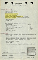
| Microfilm map, document 352856, reel 03134, frame 474 - Shaft locations, mine outline, mining method.
|
Mine Notes
Mine Images
![[[:Regal|Regal]]](https://wikiimage.isgs.illinois.edu/ilmines/tazewell/thumbnails/m3629_th.jpg) These files may not be true to scale and are not georgistered. These files may not be true to scale and are not georgistered.
|
Map Type:
|
Microfilm
|
| Map ID:
|
352856 03134, 474, 18x
|
| Company:
|
Regal Coal Company
|
| Mine Name:
|
Regal
|
| Caption:
|
|
| Map Date:
|
5-1-1924
|
| Map Status:
|
Final
|
| Image Credit:
|
|
| Note:
|
|
| More Info:
|
M3629
|
| Full Res Download:These files are true to scale and most are georegistered for gis software. These files may be a very large (>1GB) download!
|
https://wikiimage.isgs.illinois.edu/ilmines/tazewell/m3629.zip
|
Photographs