Mine Index Number: 7390
| Company Name:
|
Unknown
|
| Mine Name:
|
Unknown Mine
|
| Start Date:
|
Before 1891
|
End Date:
|
Unknown
|
| Type of Mine:
|
Underground
|
| Total acres shown:
|
|
| Acres after map date:
|
|
General Area of mining acres shown:
|
|
|
|
Shaft, Slope, Drift or Tipple Location(s)
| Type
|
County
|
Township-Range
|
Section
|
Part Section
|
| Drift
|
Tazewell
|
25N 4W
|
19
|
SW SW NW
|
Geology
Geological Problems Reported
Production
| Company
|
Mine Name
|
Date
|
Production (tons)
|
Production Notes
Coal Report production (if available)
Sources of Data
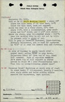
| ISGS field notes (T. B. Root, H. R. Wanless, 1931)
|
9-22-1931 and 10-17-1931
|
1:62500
|
1:24000
|
Secondary source
|
| Plat Book of Tazewell County
|
1891
|
1:31680
|
1:31680
|
Secondary source
|
Annotated Bibliography (Data source - brief description of information)
| ISGS field notes (Tazewell County) - Mine type, depth, thickness.
|
| George A. Ogle & Co., 1891, Plat Book of Tazewell County, Chicago, Illinois – Mine location.
|
Mine Notes
Mine Images
Photographs