1022: Difference between revisions
Alan.Myers (talk | contribs) No edit summary |
No edit summary |
||
| Line 3: | Line 3: | ||
|checked=Checked OK | |checked=Checked OK | ||
|unlocated=No | |unlocated=No | ||
|shown_on_map= | |shown_on_map=Yes | ||
|Mine-index=1022 | |Mine-index=1022 | ||
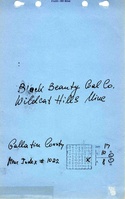
|Coal_co=Black Beauty Mining Company | |Coal_co=Black Beauty Mining Company | ||
| Line 16: | Line 15: | ||
|year-start=1998 | |year-start=1998 | ||
|year-end=2007 | |year-end=2007 | ||
|Latitude=37.67174066 | |Latitude=37.67174066 | ||
|Longitude=-88.34360319 | |Longitude=-88.34360319 | ||
|Zoom=15 | |Zoom=15 | ||
Latest revision as of 17:16, January 31, 2024
Mine Index Number: 1022
| Company Name: | Black Beauty Mining Company | ||
|---|---|---|---|
| Mine Name: | Wildcat Hills Eagle Valley Mine | ||
| Start Date: | 1998 | End Date: | 2007 |
| Type of Mine: | Surface | ||
| Total acres shown: | 942 | ||
| Acres after map date: | General Area of mining acres shown: | ||
Shaft, Slope, Drift or Tipple Location(s)
| Type | County | Township-Range | Section | Part Section |
|---|
| Tipple | Gallatin | 10S 8E | 17 | NE SW |
| Pit | Gallatin | 10S 8E | 5 |
| Pit | Gallatin | 10S 8E | 6 |
Geology
| Thickness (ft) | |||||
|---|---|---|---|---|---|
| Seam | Depth (ft) | Min | Max | Ave | Mining Method |
| Herrin | 65-85 | 3.8-4.0 | Surface |
| Springfield | 35 | Surface |
Geological Problems Reported
Production
| Company | Mine Name | Date | Production (tons) |
| Black Beauty Mining Company | Wildcat Hills | 1998-2001 | 5,988,417Production from 2000-2005 also includes Wildcat Hills Cottage Grove Mine (mine index 1044). |
| Arclar Company | Wildcat Hills | 2002-2004 | 7,855,678Production from 2000-2005 also includes Wildcat Hills Cottage Grove Mine (mine index 1044). |
| Black Beauty Mining Company | Wildcat Hills Eagle Valley | 2005-2007 | 6,586,992Production from 2000-2005 also includes Wildcat Hills Cottage Grove Mine (mine index 1044). |
| Total Production: 20,431,087 | |||
Production Notes
Coal Report production (if available)
Sources of Data
| Source Map | Map Date | Original Scale | Digitized Scale | Map Type |
| Company, Coal Section digital files | 2008 | unknown | 1:24000 | Final |
Annotated Bibliography (Data source - brief description of information)
| Coal Reports - Production, ownership, years of operation, seam, depth, thickness. |
| Directory of Illinois Coal Mines (Gallatin County) - Mine names, mine index, ownership, years of operation. |
| Mine notes (Gallatin County) - Mine type, mine location, seam, depth, mining method. |
| Company digital map, Coal Section files - Mine outline, mining method. |
Mine Notes
Mine Images
Photographs