Coffeen Quadrangle
Revision as of 12:19, February 18, 2022 by Alan.Myers (talk | contribs)
Mining in the Coffeen Quadrangle
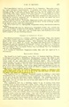
Mining near Coffeen took place in the Herrin Coal, which ranged from 5.8 to 8 feet thick. The coal was deep, being 450 feet or more below the surface. The depth contributed to roof difficulties.
Mining began in the Coffeen Quadrangle in 1889, when Clover Leaf No. 1 Mine (mine index 3001) opened. After Clover Leaf No. 4 Mine (mine index 442) closed in 1924, a hiatus in mining activity continued until the Hillsboro Mine (mine index 871) opened in 1964. The Hillsboro Mine closed in 1983, leaving a great deal of coal remaining for future activity.
Map and Directory PDF Download
Coal Mines In Illinois Coffeen Quadrangle
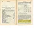
Mines that Appear on the Coffeen Quadrangle
Unlocated Mines
Montgomery County
Bond County
Pages in category "Coffeen Quadrangle"
The following 8 pages are in this category, out of 8 total.
Media in category "Coffeen Quadrangle"
The following 12 files are in this category, out of 12 total.
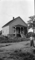 M-1033 Taylor Springs Peabody no 15 Plaster and foundation cracked.jpg 2,509 × 4,327; 1.21 MB
 M0077 coalreport1908.pdf 629 × 970; 78 KB
 M0077 coalreport1913.pdf 793 × 1,187, 2 pages; 134 KB
 M0077 minenotes.pdf 733 × 1,193, 9 pages; 2.2 MB
 M0442 coalreport1905.pdf 633 × 977; 99 KB
 M0442 coalreport1906.pdf 1,679 × 1,283; 382 KB
 M0442 coalreport1913.pdf 793 × 1,187; 99 KB
 M0442 minenotes.pdf 733 × 1,193, 11 pages; 2.91 MB
 M0871 minenotes pt1.pdf 733 × 1,193, 100 pages; 24.23 MB
 M0871 minenotes pt2.pdf 745 × 1,195, 100 pages; 28.01 MB
 M0871 minenotes pt3.pdf 737 × 1,183, 121 pages; 40.5 MB
 M3001 minenotes.pdf 733 × 1,193, 5 pages; 1.14 MB
