Goreville Quadrangle
Revision as of 16:12, October 26, 2022 by Alan.Myers (talk | contribs) (→Mines that Appear on the Goreville Quadrangle)
Mining in the Goreville Quadrangle
The coal in the Goreville Quadrangle varied considerably in thickness but was characteristically broken by numerous clay shale partings. Immediately above the coal was an erosional conglomerate composed of sandstone pebbles that sometimes channeled into the seam for as much as 6 inches. Few mines are found in this thin, poor quality coal. These mines are poorly located, with no company maps found for any of these mines.
Map and Directory PDF Download
Coal Mines In Illinois Goreville Quadrangle
Mines that Appear on the Goreville Quadrangle
Unlocated Mines
Johnson County
Williamson County
Pages in category "Goreville Quadrangle"
The following 8 pages are in this category, out of 8 total.
Media in category "Goreville Quadrangle"
The following 5 files are in this category, out of 5 total.
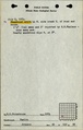 M4850 fieldnotes.pdf 756 × 1,187, 4 pages; 699 KB
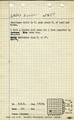 M4850 minenotes.pdf 733 × 1,193; 253 KB
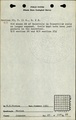 M7278 fieldnotes.pdf 752 × 1,187; 187 KB
 M7279 fieldnotes.pdf 750 × 1,187, 2 pages; 434 KB
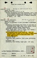
 M7279 minenotes.pdf 733 × 1,193; 242 KB