Seneca Quadrangle
Revision as of 10:41, October 28, 2022 by Alan.Myers (talk | contribs)
Mining in the Seneca Quadrangle
Mining in this quadrangle occurred primarily around the town of Seneca. The Colchester Coal was the primary seam mined, at a depth of 100 to 125 feet. This area lies within what has historically been known as the Longwall District. As the name implies, mining in this area was typically done using the longwall method of mining. The earliest mining began some time in the 1870s, and mining continued in Seneca until 1922, when the Seneca Coal Company mine closed (mine index 2706).
Map and Directory PDF Download
Coal Mines In Illinois Seneca Quadrangle
Mines that Appear on the Seneca Quadrangle
Unlocated Mines
La Salle County
Grundy County
Pages in category "Seneca Quadrangle"
The following 4 pages are in this category, out of 4 total.
Media in category "Seneca Quadrangle"
The following 11 files are in this category, out of 11 total.
- M2706 fieldnotes.pdf 754 × 1,185; 218 KB
- M2706 minenotes.pdf 731 × 1,202, 4 pages; 795 KB
- M2707 email 03112020.pdf 1,275 × 1,650, 3 pages; 815 KB
- M2707 minenotes.pdf 731 × 1,202, 2 pages; 372 KB
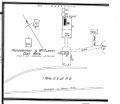
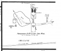
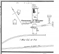
- M2707 Seneca Feb. 1898.jpg 830 × 717; 103 KB
- M2707 Seneca Mar. 1907.jpg 838 × 706; 110 KB
- M2707 Seneca Sept. 1892.jpg 790 × 715; 104 KB
- M2707 shaft down.jpg 2,543 × 3,390; 1.72 MB
- M2707 shaft.jpg 3,390 × 2,543; 1.92 MB
- M2708 minenotes.pdf 731 × 1,202, 2 pages; 378 KB
- M2709 minenotes.pdf 731 × 1,202, 2 pages; 354 KB


