Mine Index Number: 2707
| Company Name:
|
Standard Coal Company
|
| Mine Name:
|
Standard Mine
|
| Start Date:
|
Before 1875
|
End Date:
|
1902
|
| Type of Mine:
|
Underground
|
| Total acres shown:
|
|
| Production Indicated Acres:
|
27
|
General Area of mining acres shown:
|
|
|
|
Shaft, Slope, Drift or Tipple Location(s)
| Type
|
County
|
Township-Range
|
Section
|
Part Section
|
| Shaft
|
LaSalle
|
33N 5E
|
24
|
SE SW SE
|
| Air shaft
|
LaSalle
|
33N 5E
|
24
|
SE SW SE
|
Geology
| Colchester
|
102-110
|
|
|
2.75-3.0
|
LW (old longwall)
|
Geological Problems Reported
Production
| Company
|
Mine Name
|
Date
|
Production (tons)
|
| Hugh Henry None of these owners were listed in the Coal Reports. Henry, Letsom and Tatterson were listed in the Coal Section mine notes. The dates of operation were not corroborated by other sources, and the source of that information is unknown. No mines were shown at this location in old plats or atlas maps. Prendergast & McCleary were shown on the Sanborn-Perris Map Company fire insurance maps, although the mine was labeled “not in operation” on the 1907 map.
|
Henry
|
|
|
|
|
| Abe Letsom None of these owners were listed in the Coal Reports. Henry, Letsom and Tatterson were listed in the Coal Section mine notes. The dates of operation were not corroborated by other sources, and the source of that information is unknown. No mines were shown at this location in old plats or atlas maps. Prendergast & McCleary were shown on the Sanborn-Perris Map Company fire insurance maps, although the mine was labeled “not in operation” on the 1907 map.
|
Letsom
|
|
|
|
|
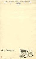
| George Tatterson None of these owners were listed in the Coal Reports. Henry, Letsom and Tatterson were listed in the Coal Section mine notes. The dates of operation were not corroborated by other sources, and the source of that information is unknown. No mines were shown at this location in old plats or atlas maps. Prendergast & McCleary were shown on the Sanborn-Perris Map Company fire insurance maps, although the mine was labeled “not in operation” on the 1907 map.
|
Tatterson
|
circa 1875
|
|
|
|
| Prendergast and McCleary None of these owners were listed in the Coal Reports. Henry, Letsom and Tatterson were listed in the Coal Section mine notes. The dates of operation were not corroborated by other sources, and the source of that information is unknown. No mines were shown at this location in old plats or atlas maps. Prendergast & McCleary were shown on the Sanborn-Perris Map Company fire insurance maps, although the mine was labeled “not in operation” on the 1907 map.
|
Prendergast and McCleary
|
ca. 1892 - ca. 1907
|
|
|
|
| Standard Coal Company Standard Coal Company was listed in the Coal Reports. The years of operation concur with the years of operation of Prendergast & McCleary as shown in the Sanborn-Perris fire insurance maps. Standard Coal Company was previously listed in the ISGS mine database with North Wilmington Coal Company (mine index 2708). The Coal Reports clearly indicate Standard and North Wilmington are separate mines, by the 1902 Coal Report (p. 103) reporting the sinking of the North Wilmington shaft, and 1903 (p. 144) reporting the opening of North Wilmington while also reporting the abandonment of Standard Mine (1903 Coal Report, p. 145). The assumption that Prendergast & McCleary were the owners or operators of Standard Coal Company may not be correct, but it fits the little data we have.
|
Standard
|
1892-1902
|
100,936
|
|
|
|
|
|
|
|
| Total Production: 100,936
|
Production Notes
Coal Report production (if available)
Sources of Data
| USGS topographic map
|
1916
|
1:62500
|
1:62500
|
Secondary source
|
Annotated Bibliography (Data source - brief description of information)
| Coal Reports - Production, ownership, years of operation, depth, thickness, mining method.
|
| Directory of Illinois Coal Mines (La Salle County) - Mine names, mine index, ownership, years of operation.
|
| Mine notes (La Salle County) - Mine location, years of operation, mine name.
|
| USGS 15-minute topographic map, Marseilles Quadrangle, 1916 - Mine location.
|
| Sanborn-Perris Map Company, 1892, 1898, 1907 - Ownership, years of operation, shaft location, depth.
|
Mine Notes
Mine Images
Sanborn Fire Insurance map:
Map Date: 1898
Coal Co.: Prendergast and McCleary
Mine Name: Prendergast and McCleary
Sanborn Fire Insurance map:
Map Date: 1907
Coal Co.: Prendergast and McCleary
Mine Name: Prendergast and McCleary
Sanborn Fire Insurance map:
Map Date: 1892
Coal Co.: Prendergast and McCleary
Mine Name: Prendergast and McCleary
Photographs
Caption: The covering of the old shaft (abandoned 1902) has failed, resulting in subsidence below the shed entrance. Photo courtesy of David Kimmerle, P. E., Division of Abandoned Mined Land Reclamation
Credit: Illinois Department of Natural Resources - Office of Mines and Minerals
Date: 3-2020
Caption: The covering of the old shaft (abandoned 1902) has failed, resulting in subsidence below the shed entrance. Photo courtesy of David Kimmerle, P. E., Division of Abandoned Mined Land Reclamation
Credit: Illinois Department of Natural Resources - Office of Mines and Minerals
Date: 3-2020