Quade
Alan.Myers (talk | contribs) No edit summary Tag: Manual revert |
Alan.Myers (talk | contribs) No edit summary |
||
| (3 intermediate revisions by the same user not shown) | |||
| Line 1: | Line 1: | ||
==Federal Land Bank of St. Louis, Preliminary Reports on Subsidence Investigations== | |||
Select County or use the filtered table below<br> | Select County or use the filtered table below<br> | ||
[[Historical MOA Maps/Quade/Bureau|Bureau]] | | [[Historical MOA Maps/Quade/Bureau|Bureau]] | | ||
| Line 27: | Line 28: | ||
[[Historical MOA Maps/Quade/Will|Will]] | | [[Historical MOA Maps/Quade/Will|Will]] | | ||
[[Historical MOA Maps/Quade/Williamson|Williamson]] <br> | [[Historical MOA Maps/Quade/Williamson|Williamson]] <br> | ||
{{DISPLAYTITLE:Federal Land Bank of St. Louis, Preliminary Reports on Subsidence Investigations}} | {{DISPLAYTITLE:Federal Land Bank of St. Louis, Preliminary Reports on Subsidence Investigations|noerror}} | ||
{{:Quade}}{{#css: | {{:Quade}}{{#css: | ||
#ca-key1 { display:none!important; } | #ca-key1 { display:none!important; } | ||
}} | }} | ||
Latest revision as of 15:27, July 24, 2023
Federal Land Bank of St. Louis, Preliminary Reports on Subsidence Investigations
Select County or use the filtered table below
Bureau |
Christian |
Franklin |
Fulton |
Grundy |
Hamilton |
Henry |
Jackson |
Jefferson |
Knox |
LaSalle |
Logan |
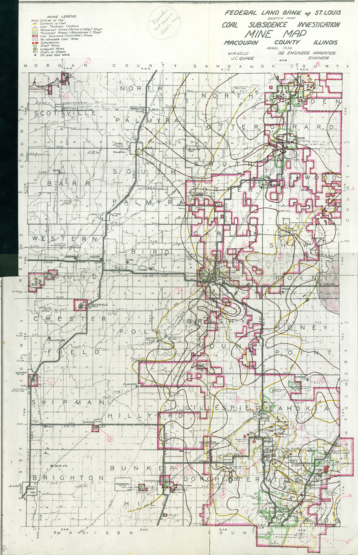
Macoupin |
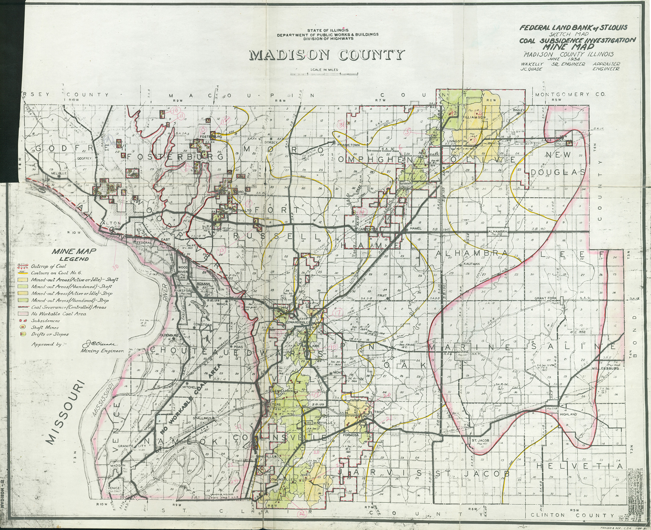
Madison |
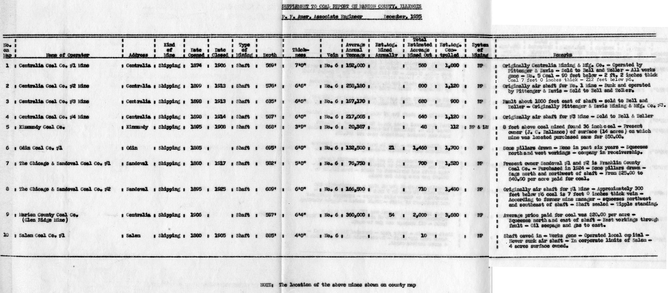
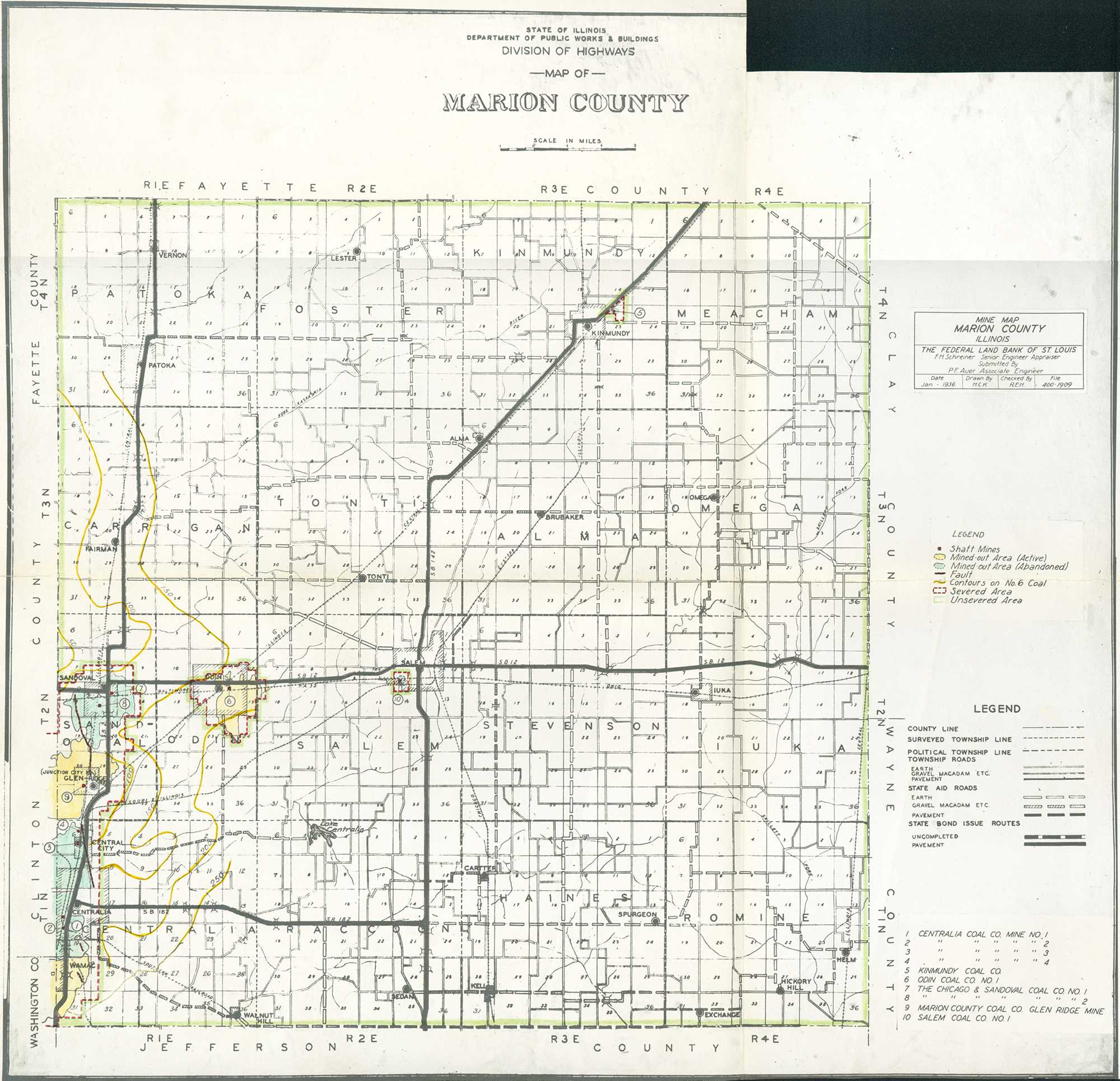
Marion |
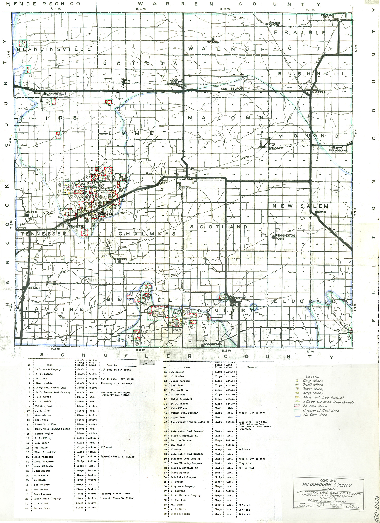
McDonough |
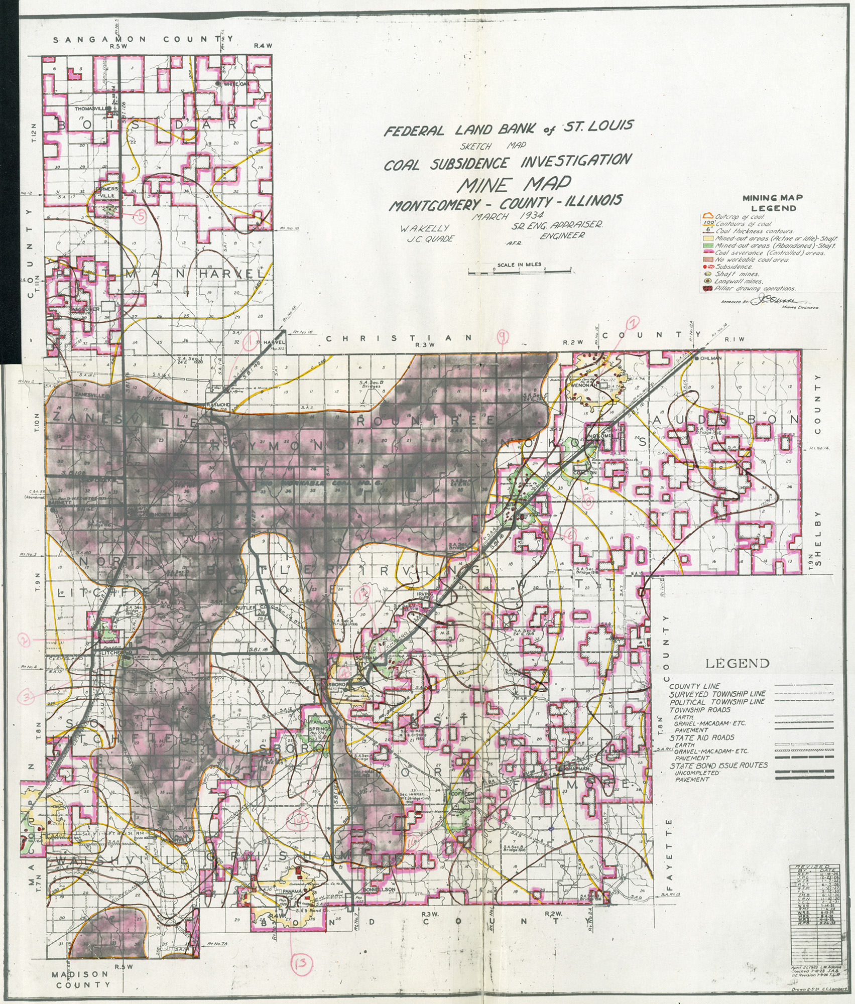
Montgomery |
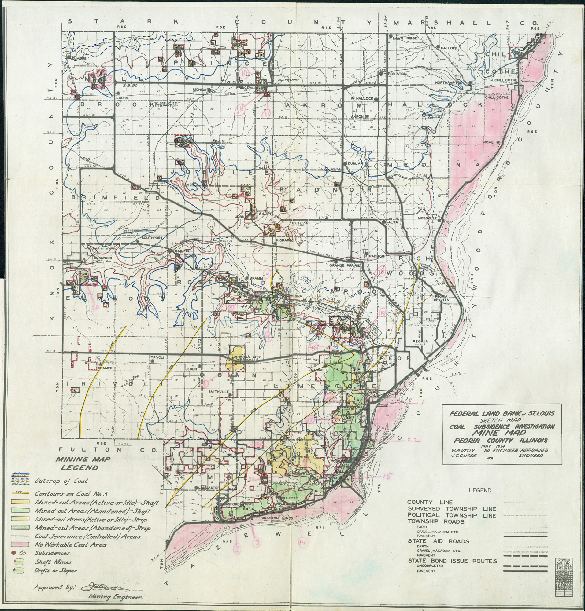
Peoria |
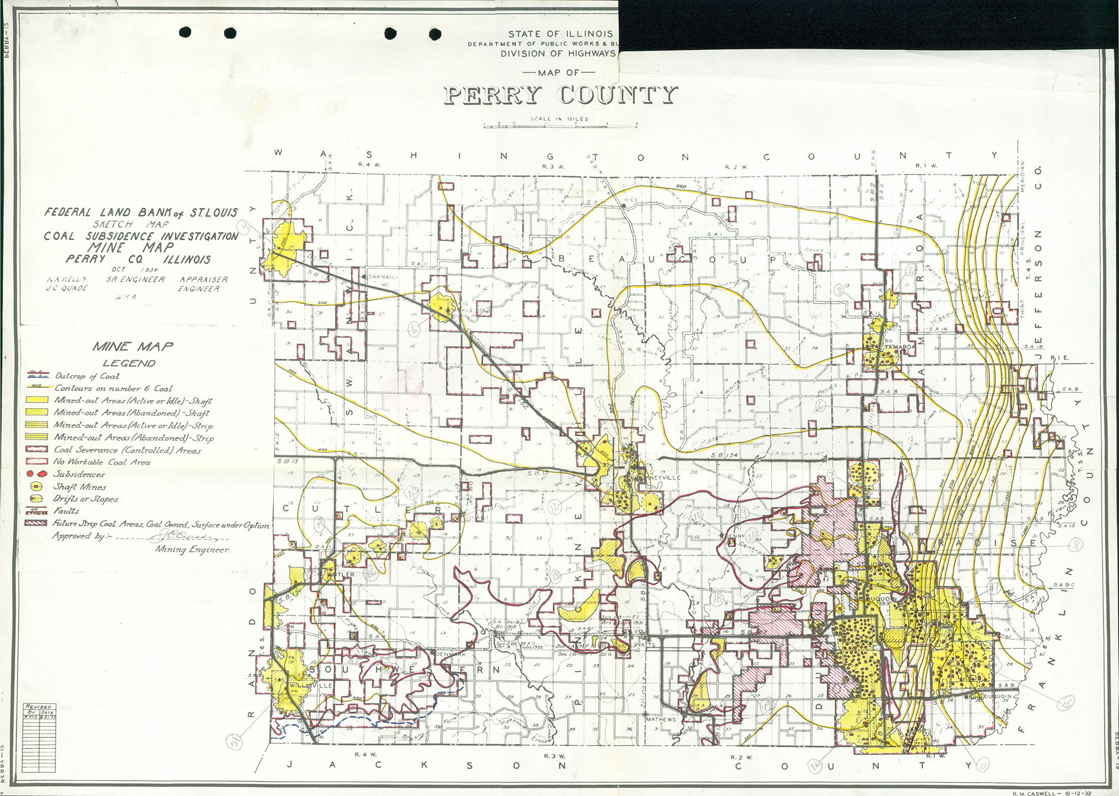
Perry |
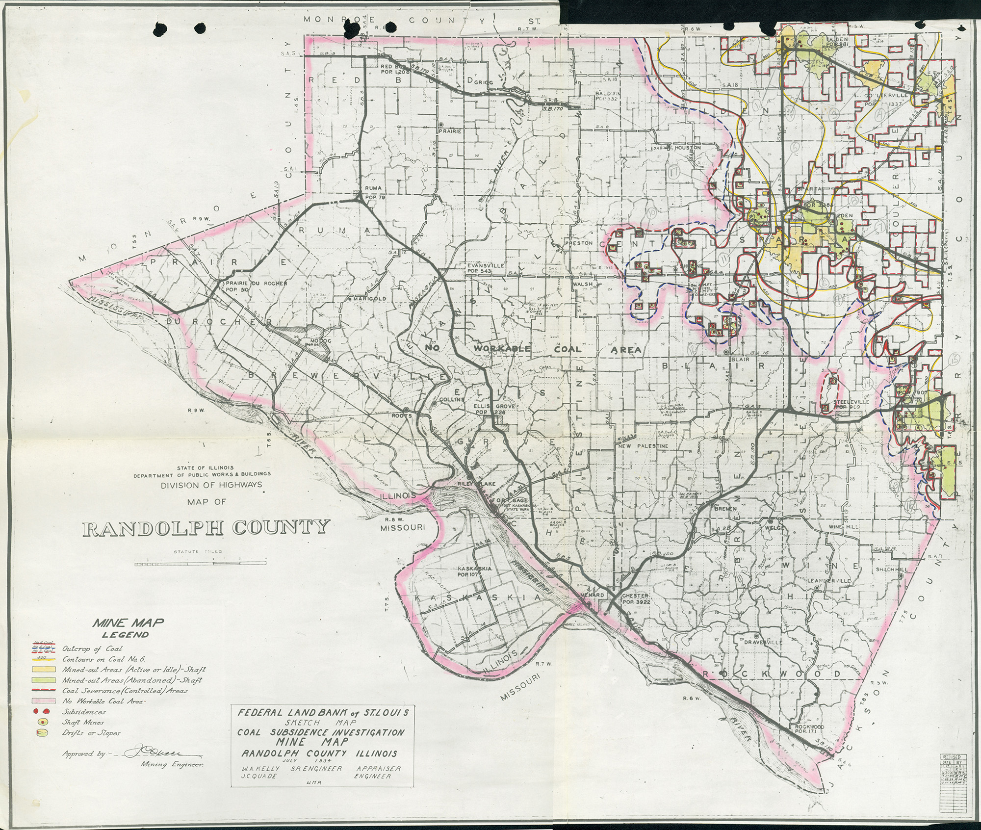
Randolph |
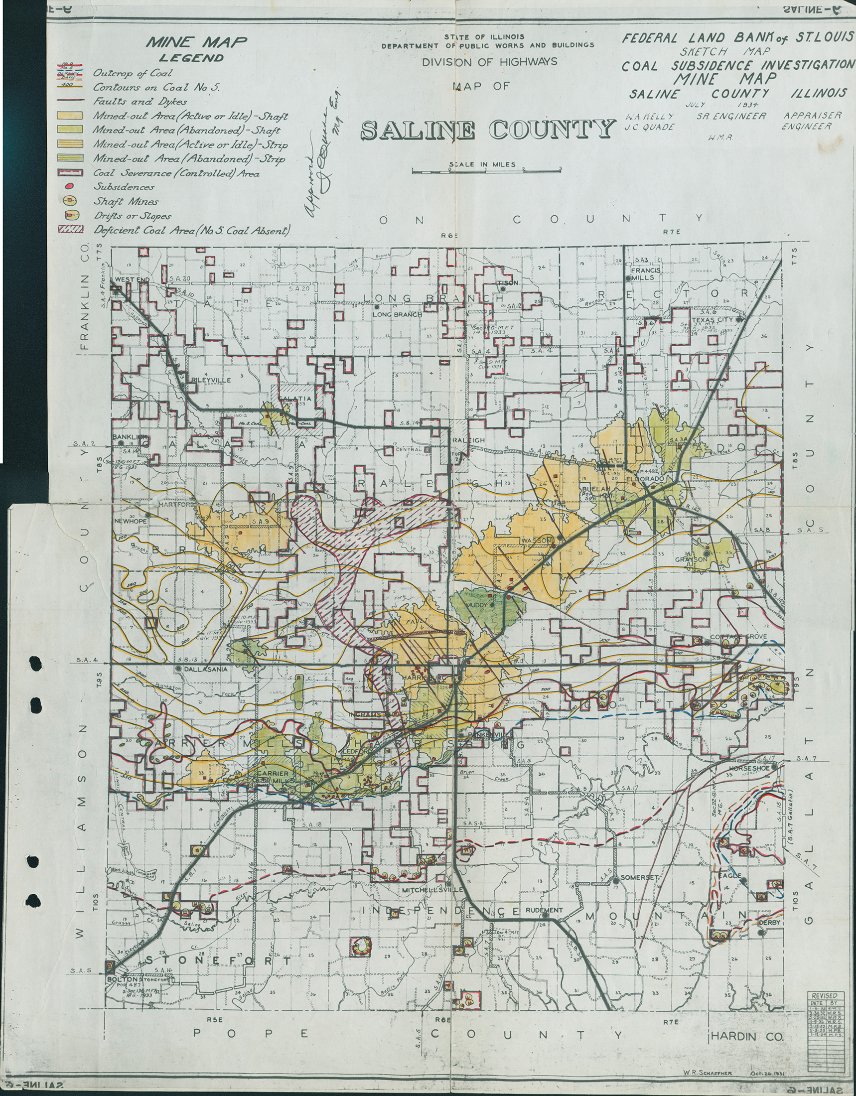
Saline |
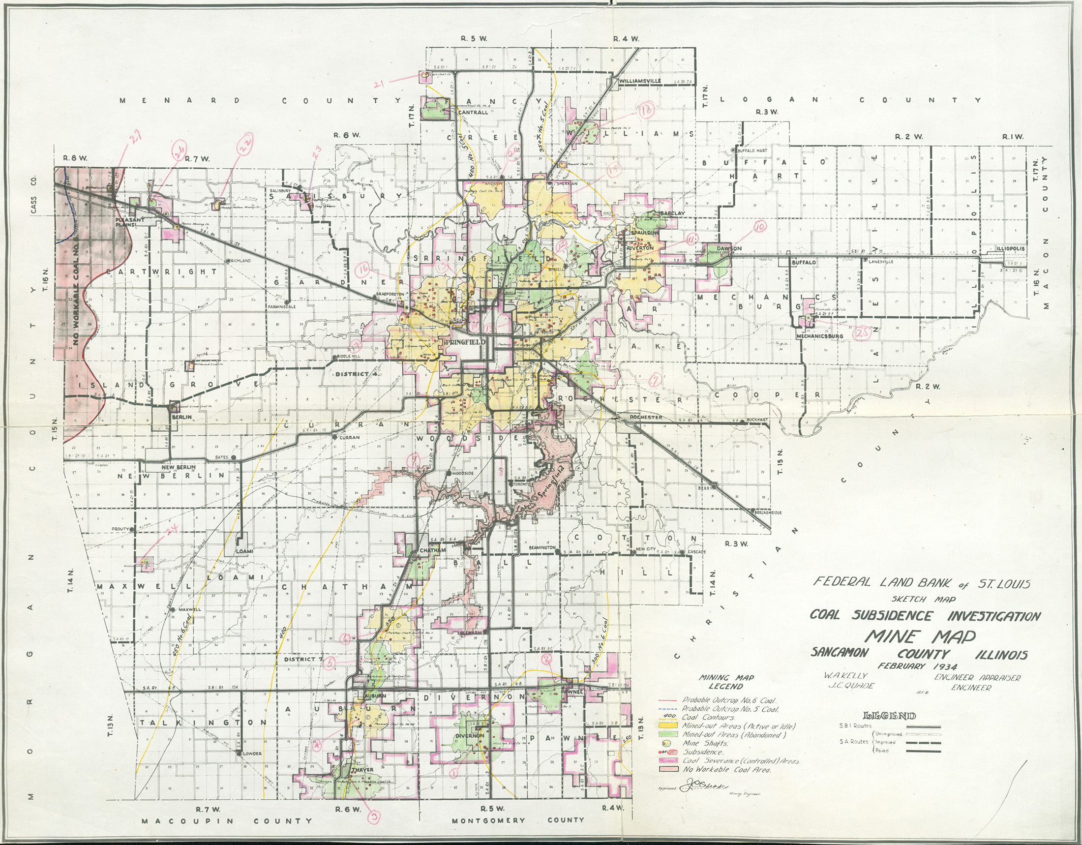
Sangamon |
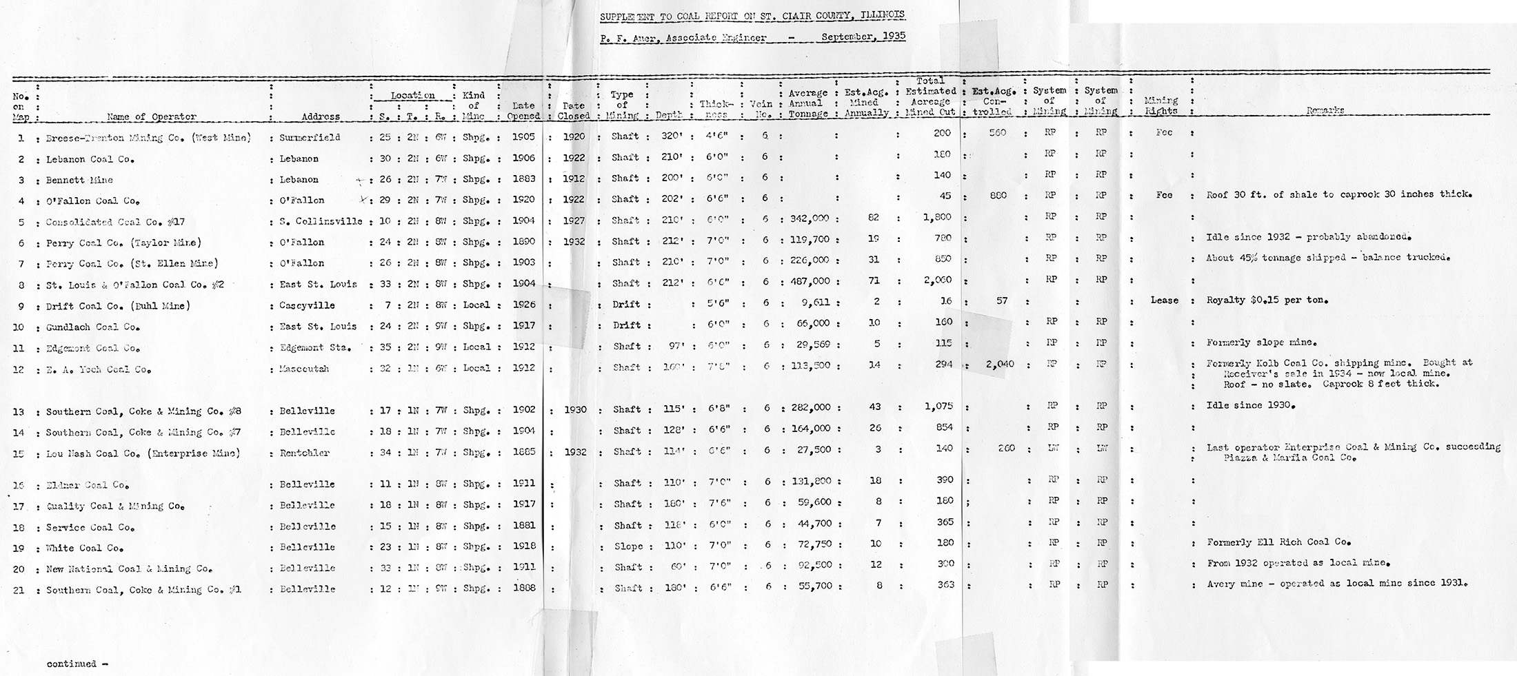
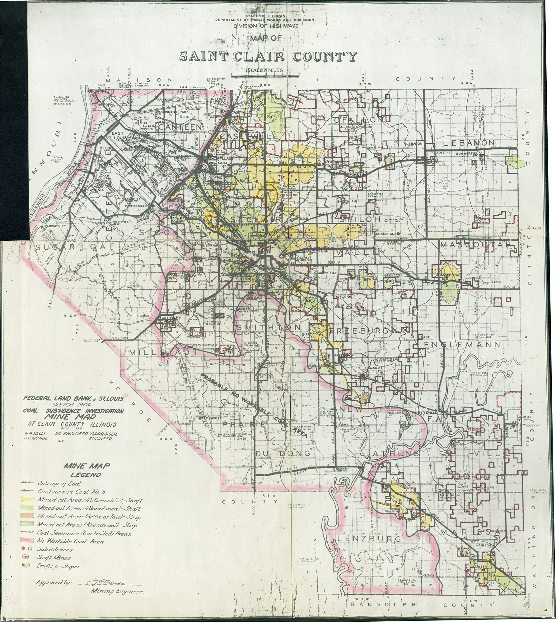
St. Clair |
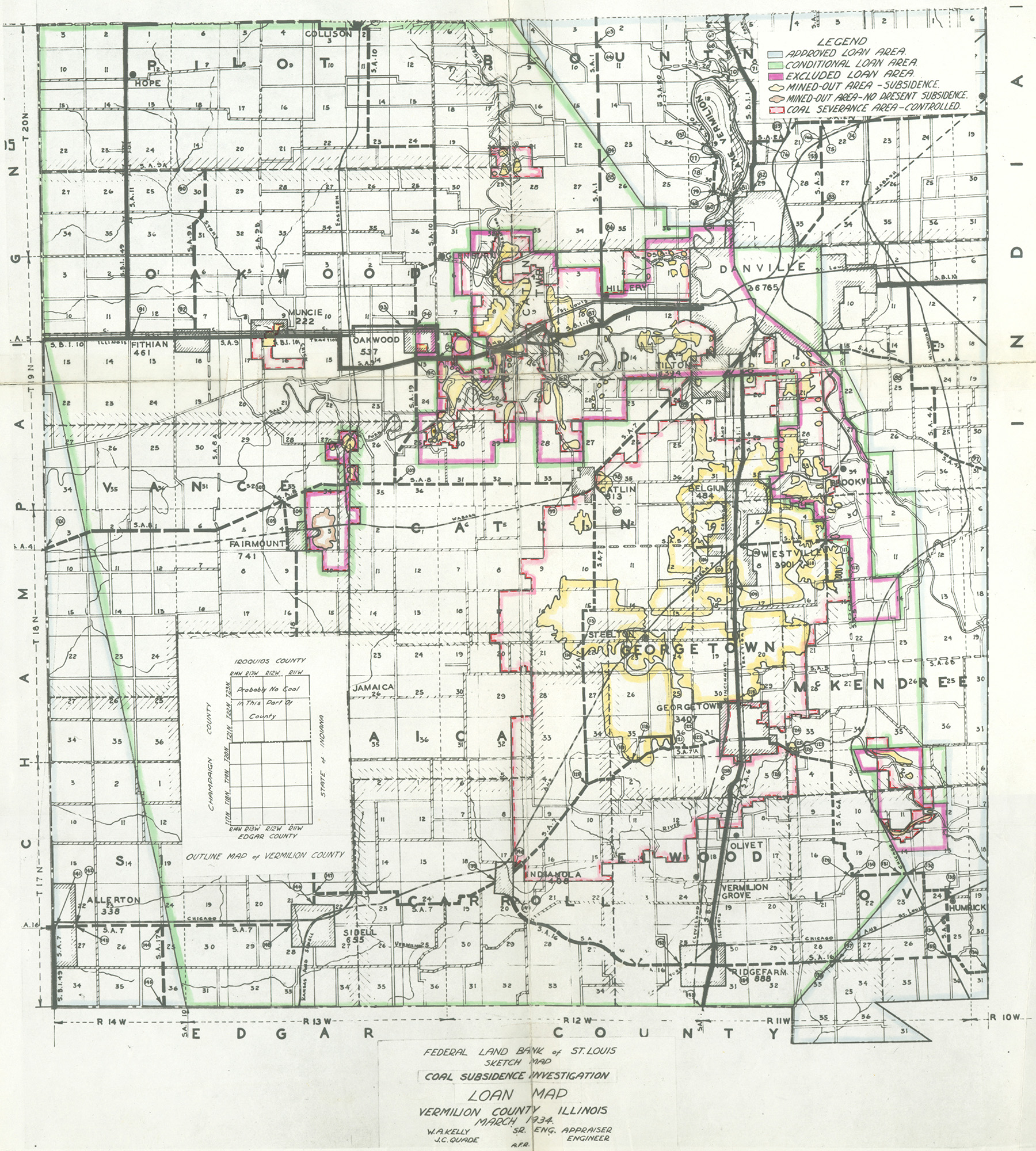
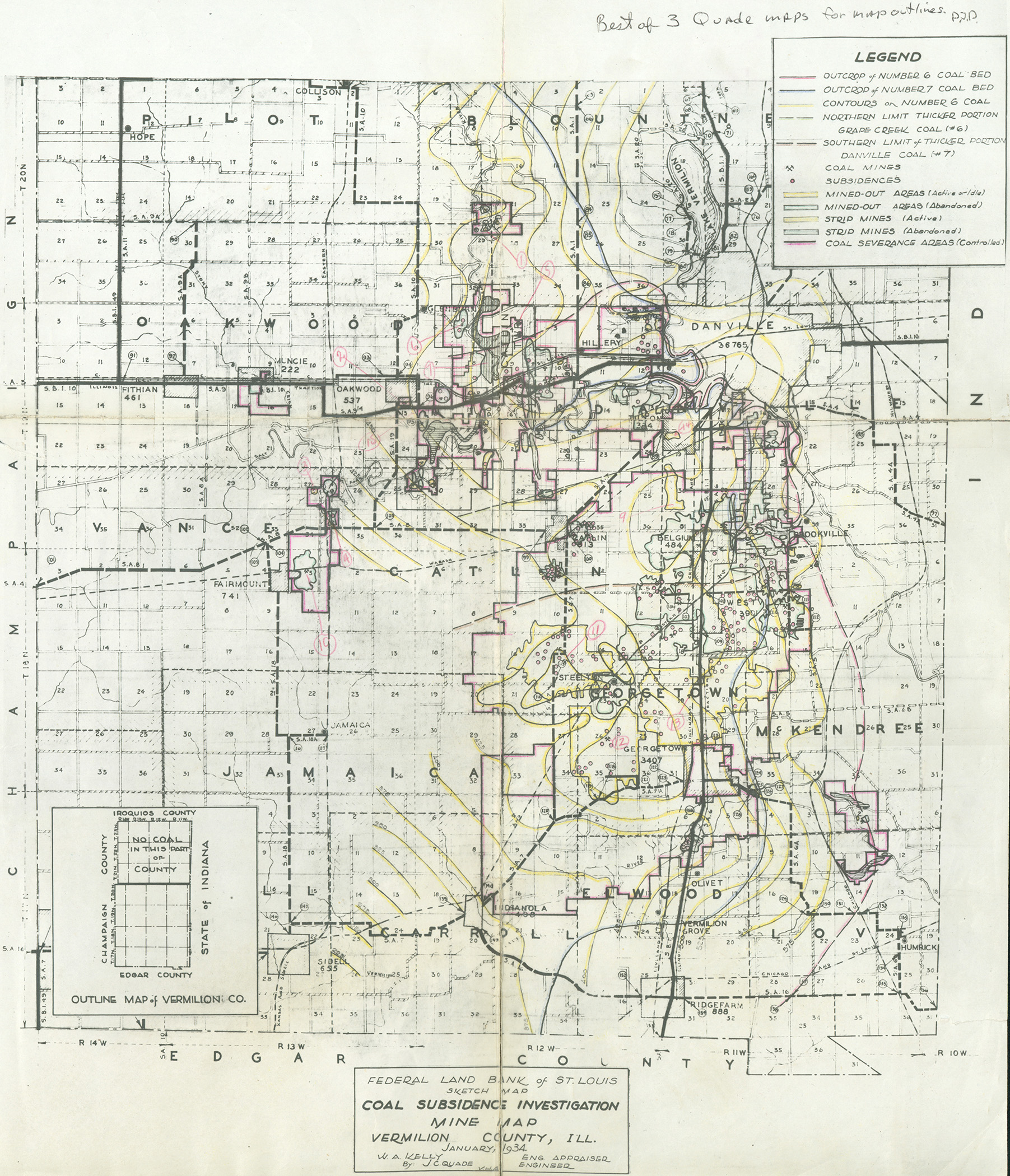
Vermilion |
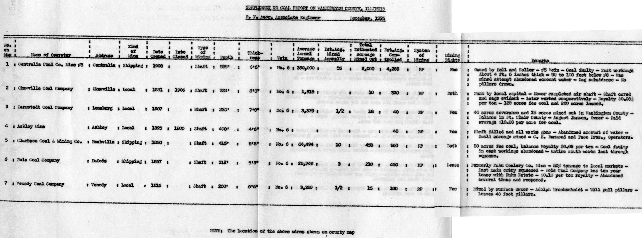
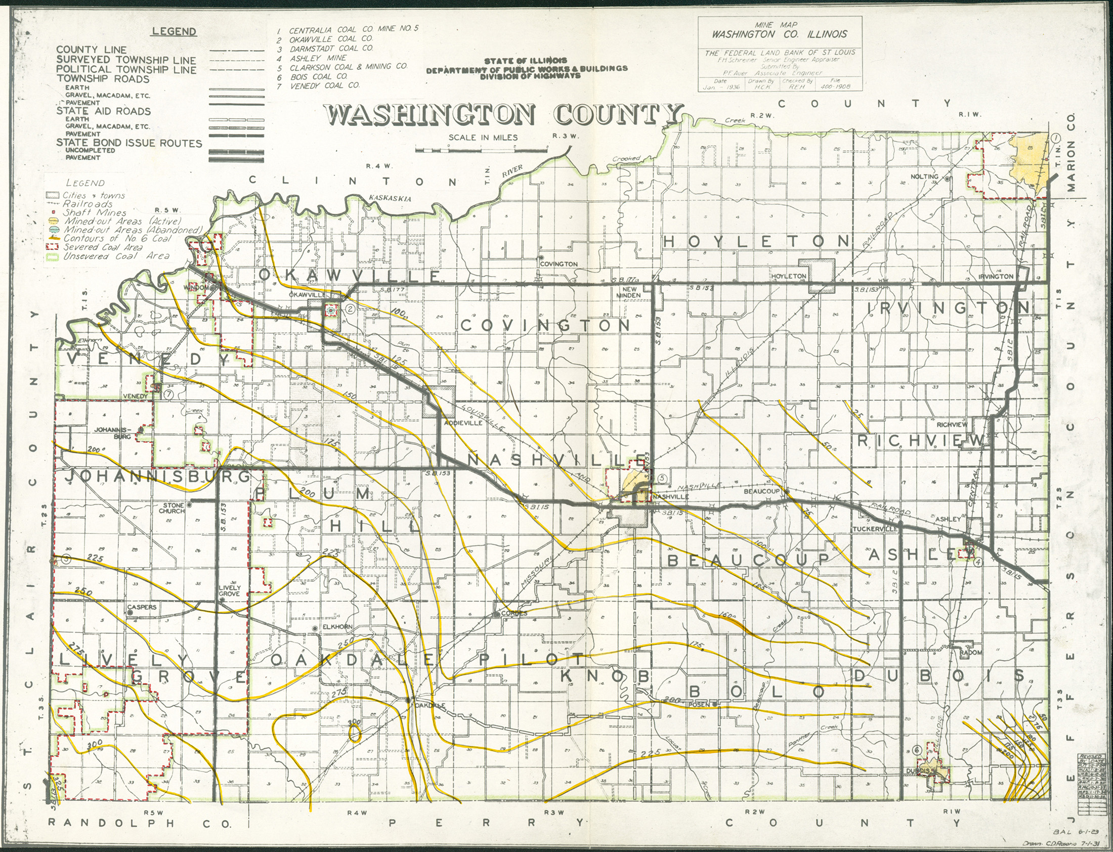
Washington |
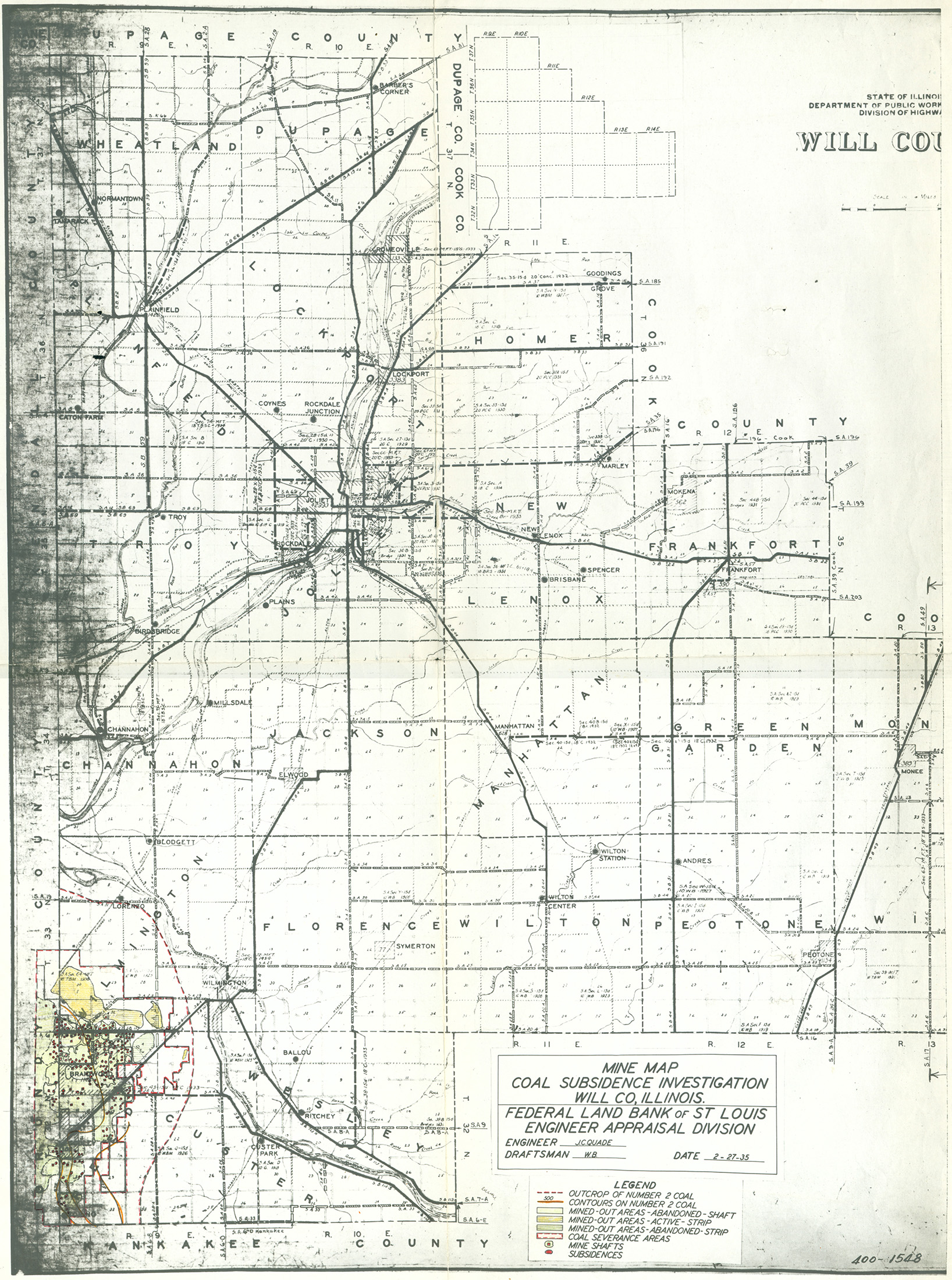
Will |
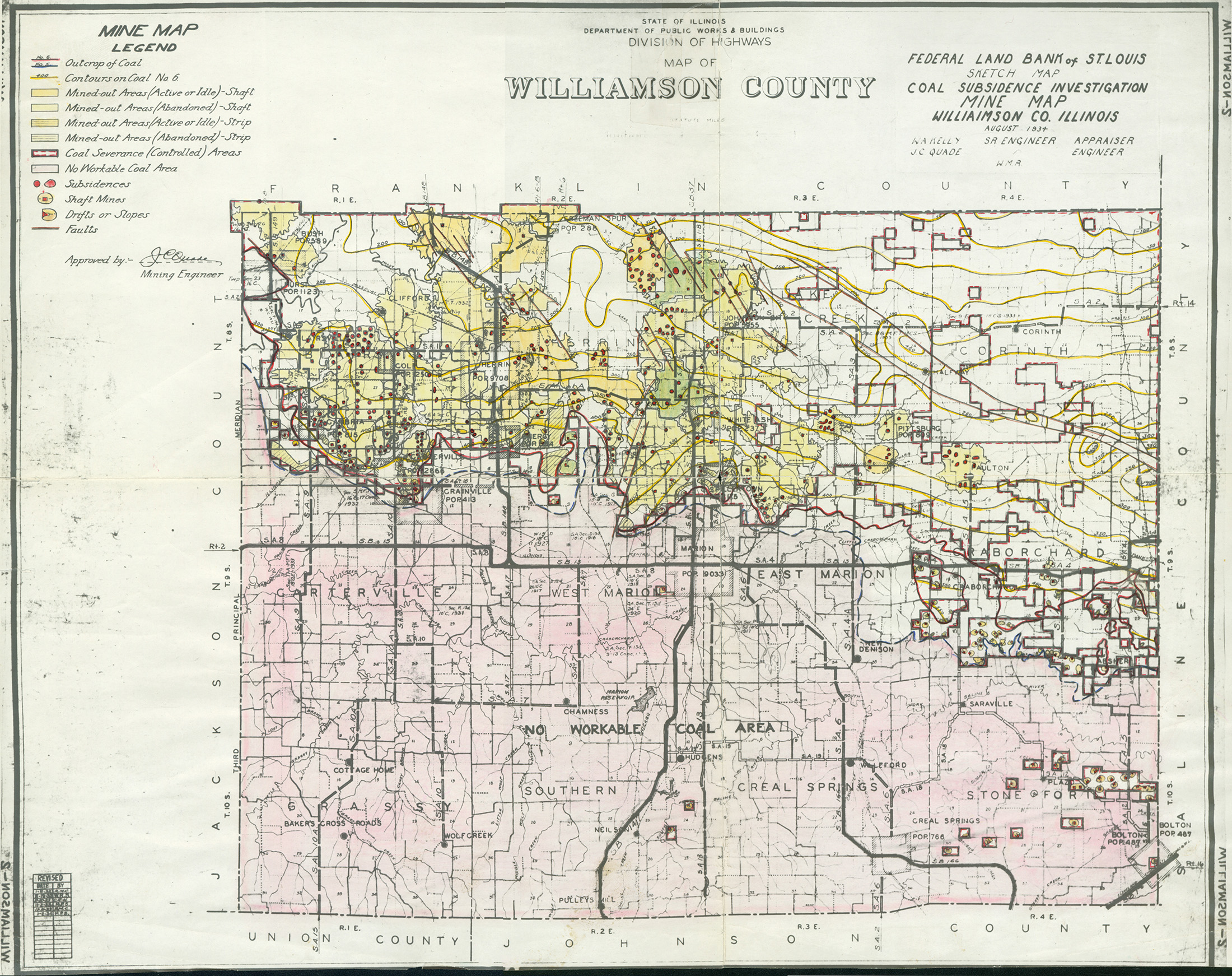
Williamson
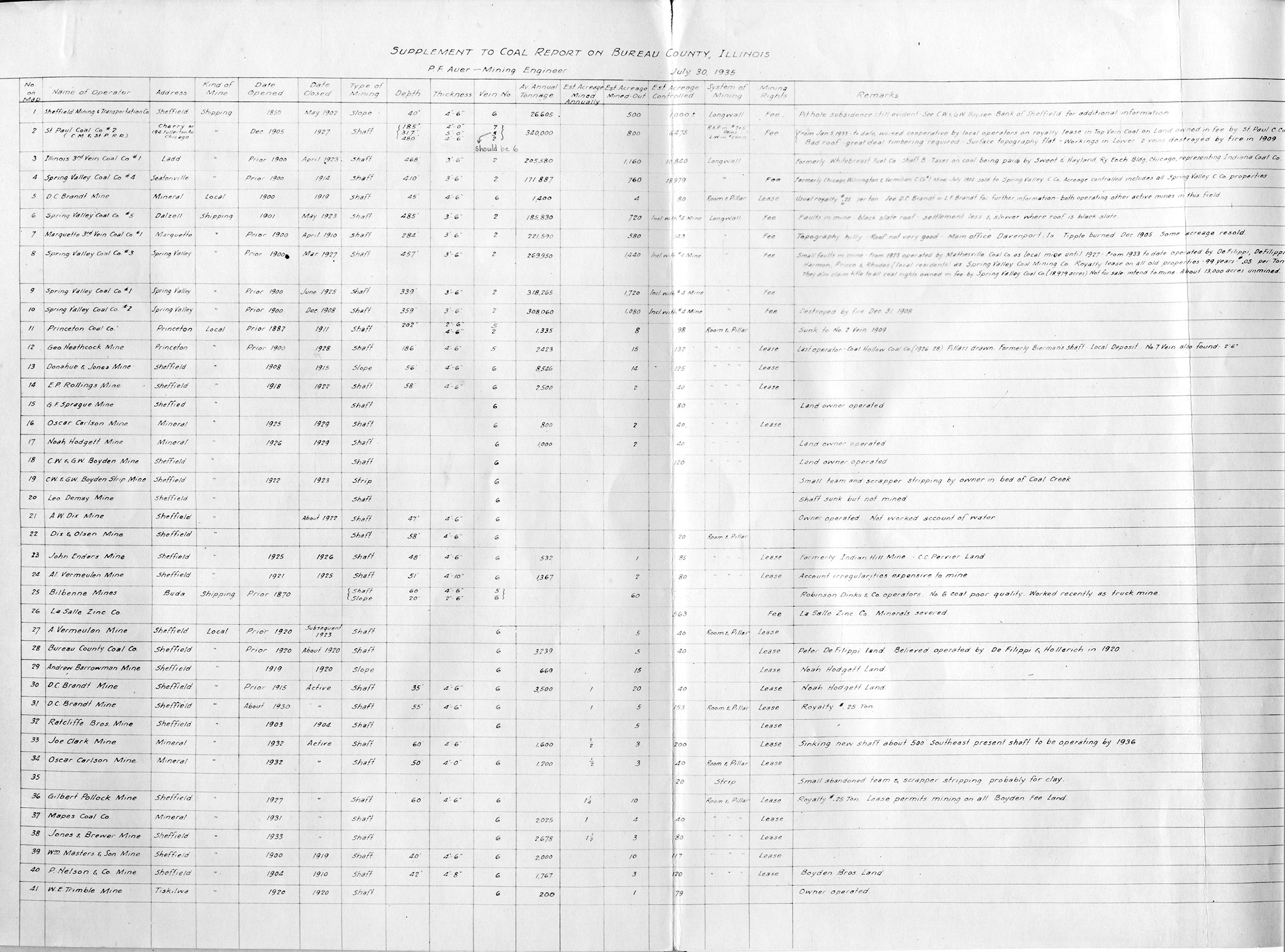
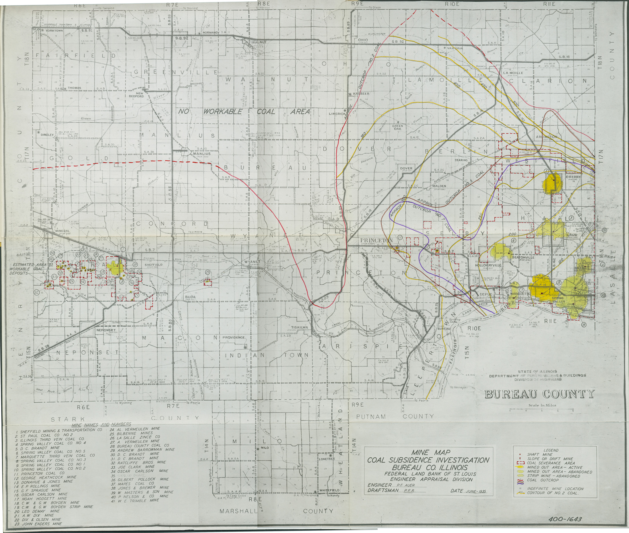
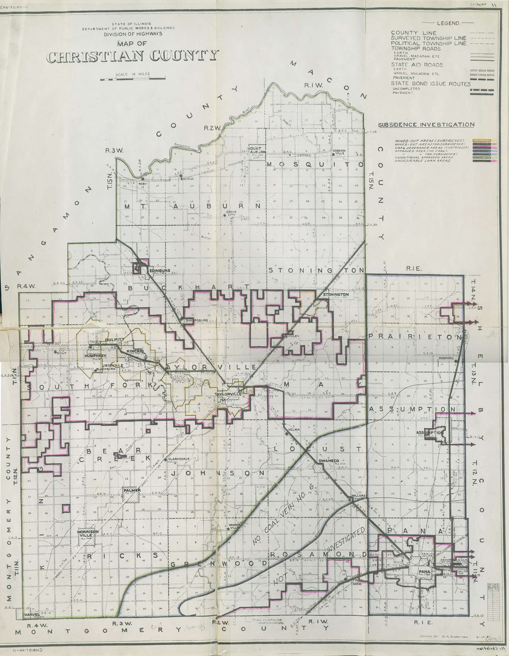
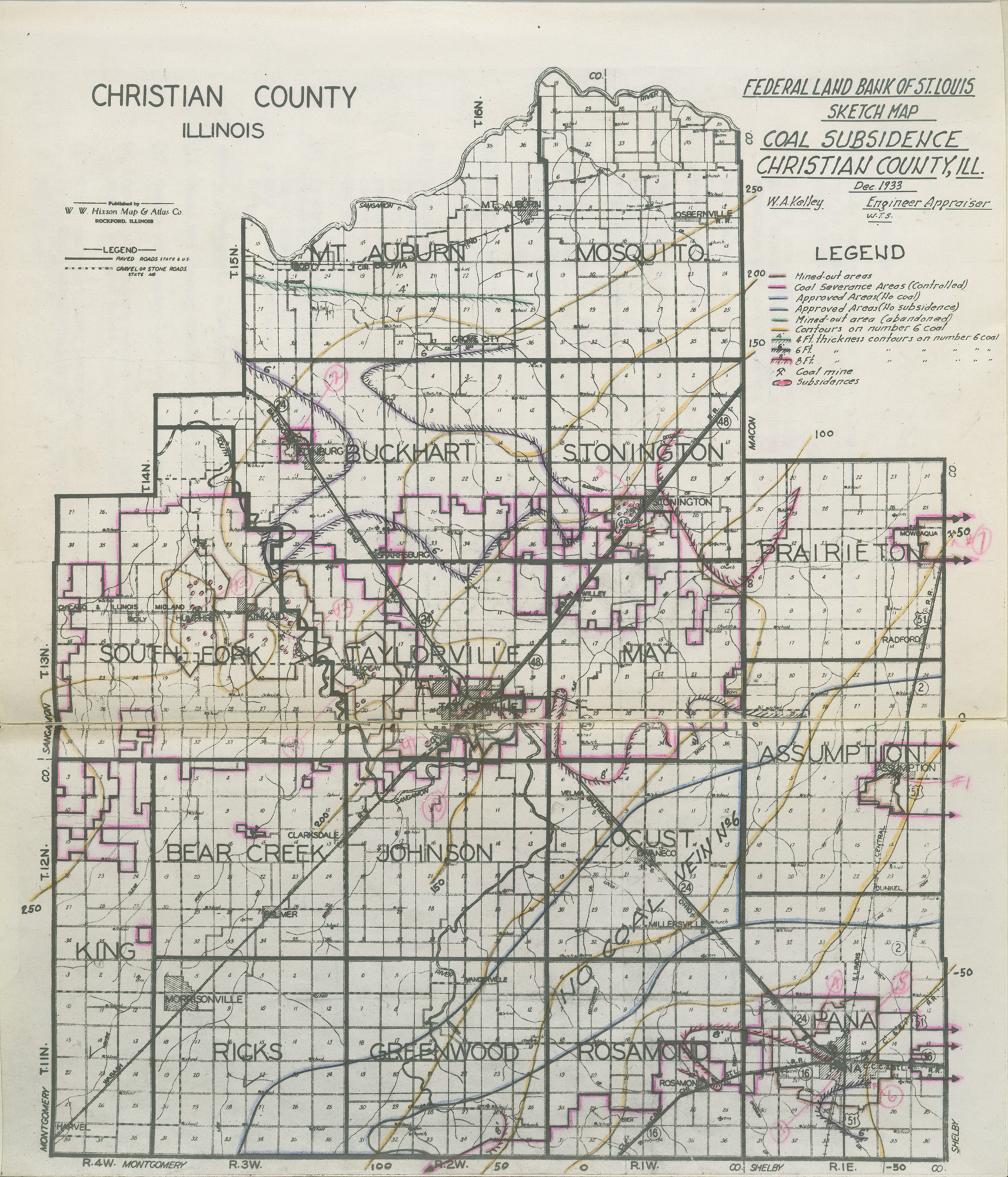
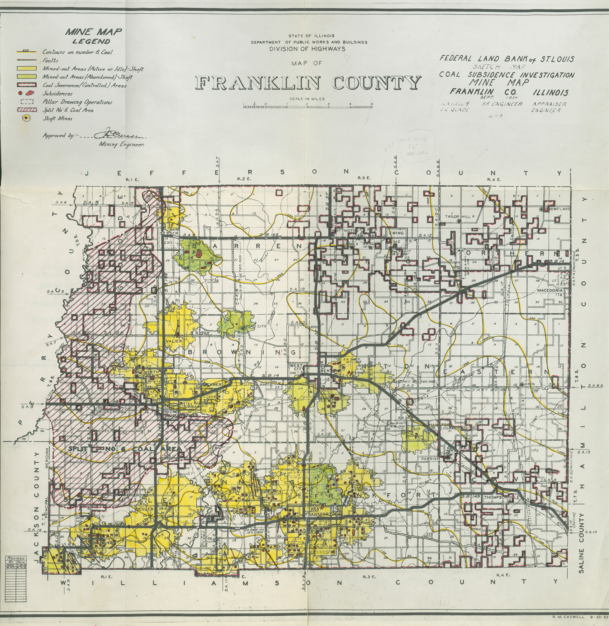
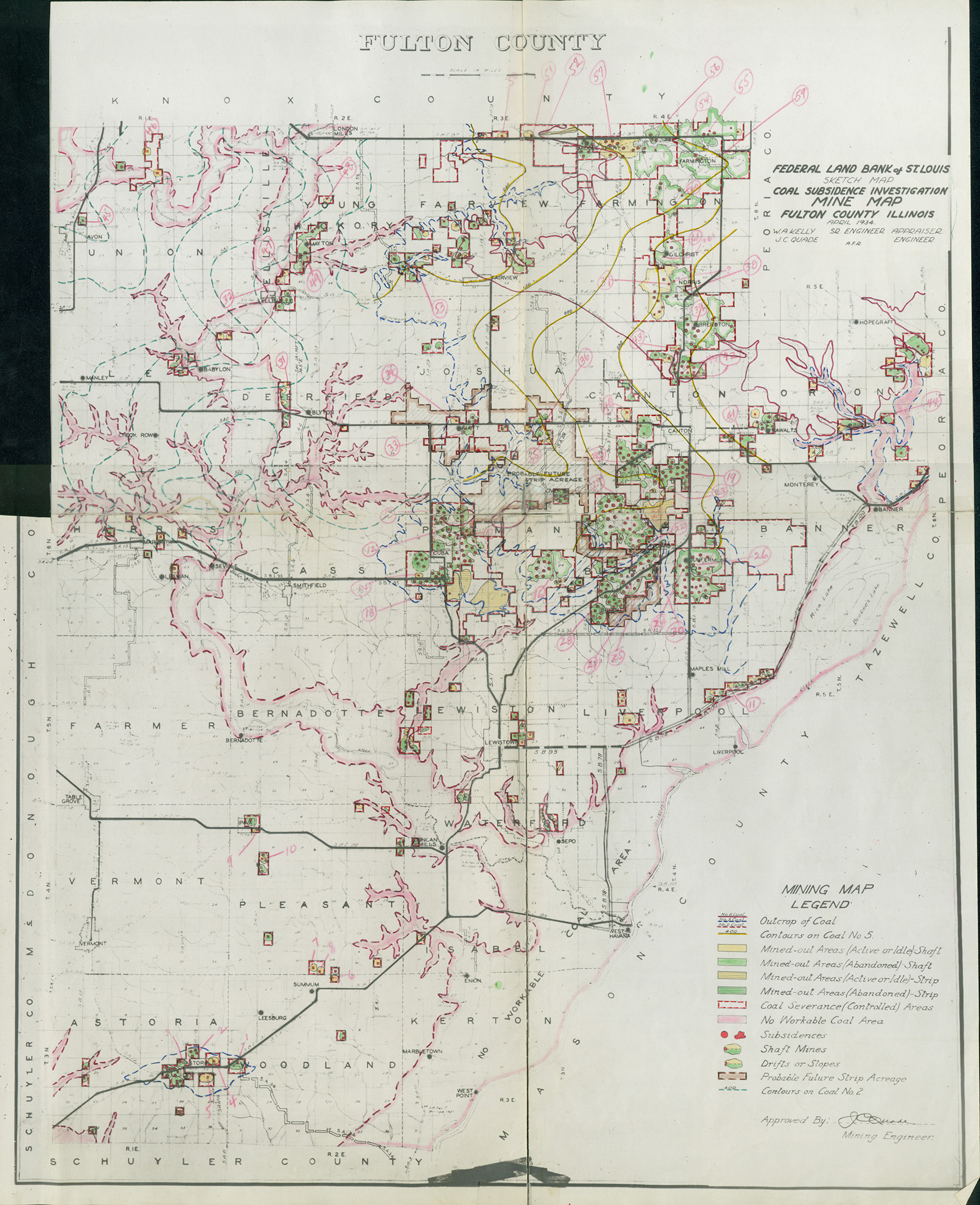
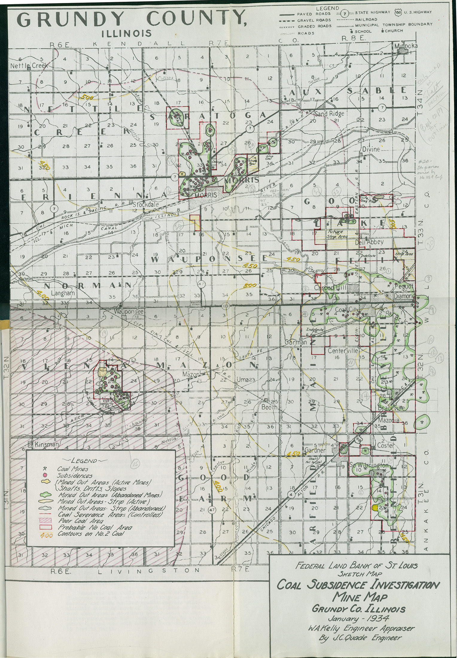
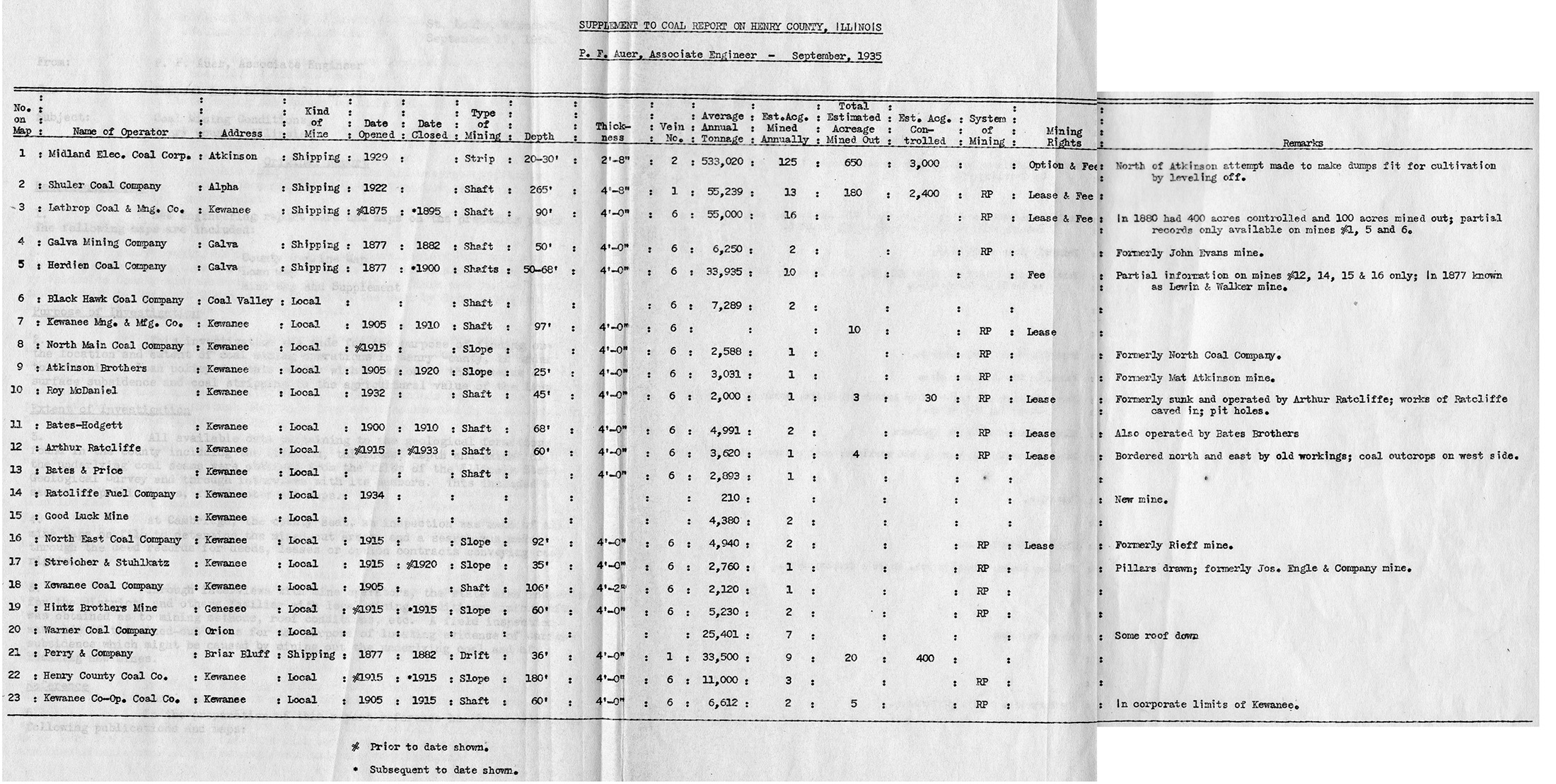
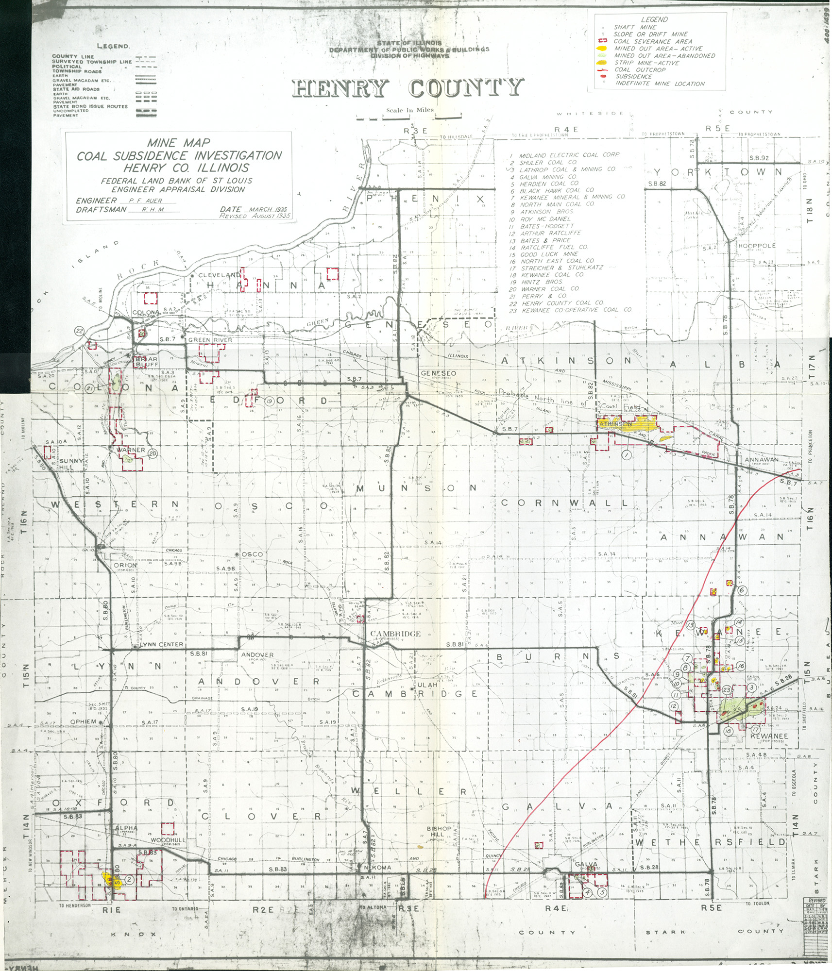
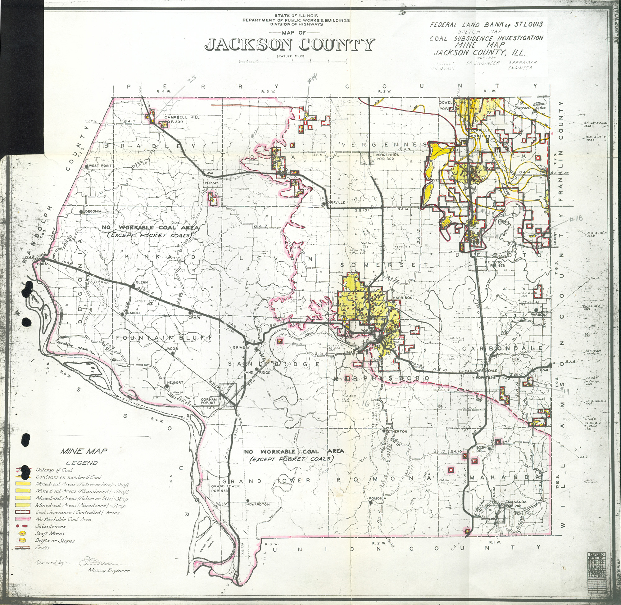
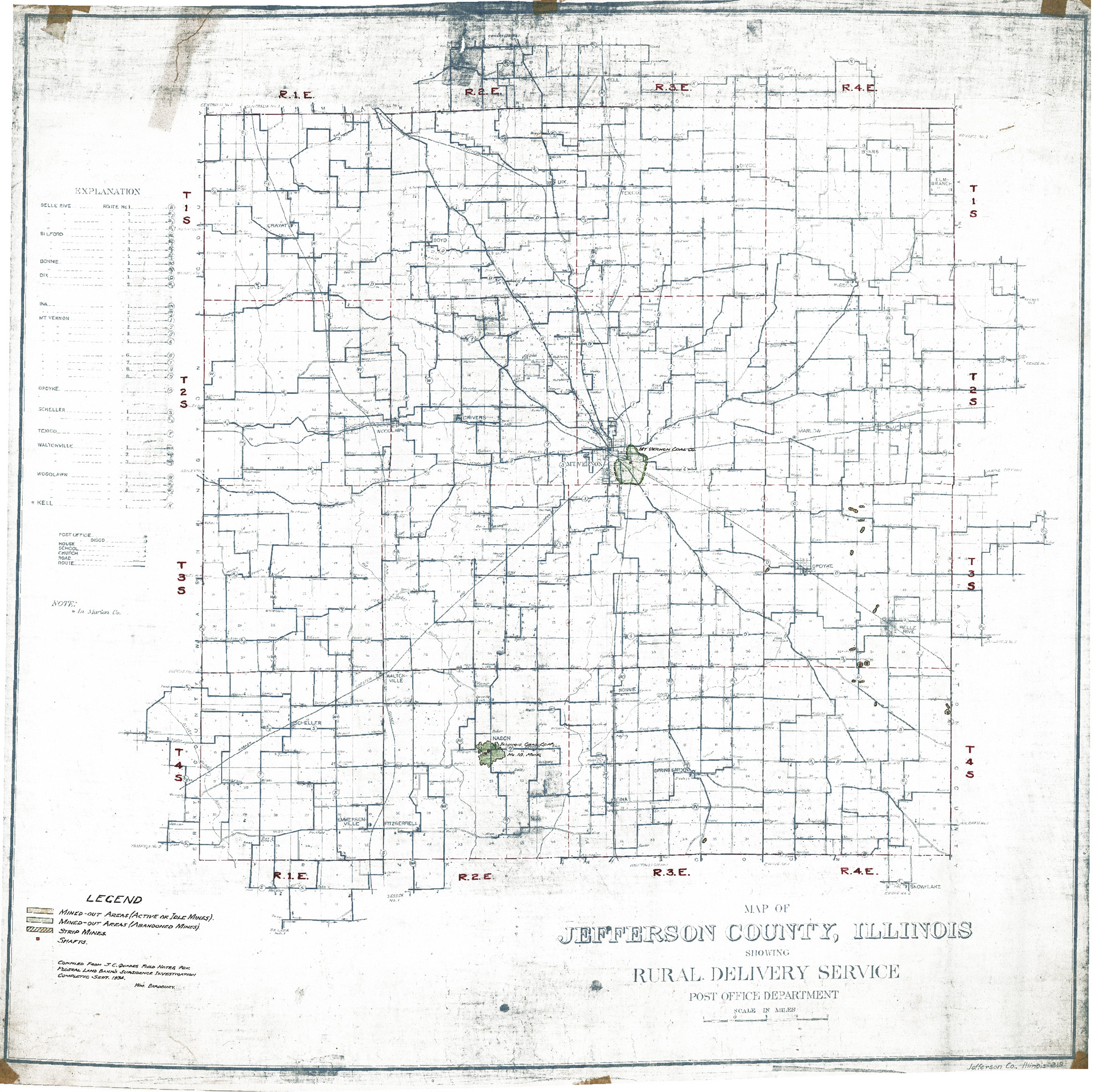
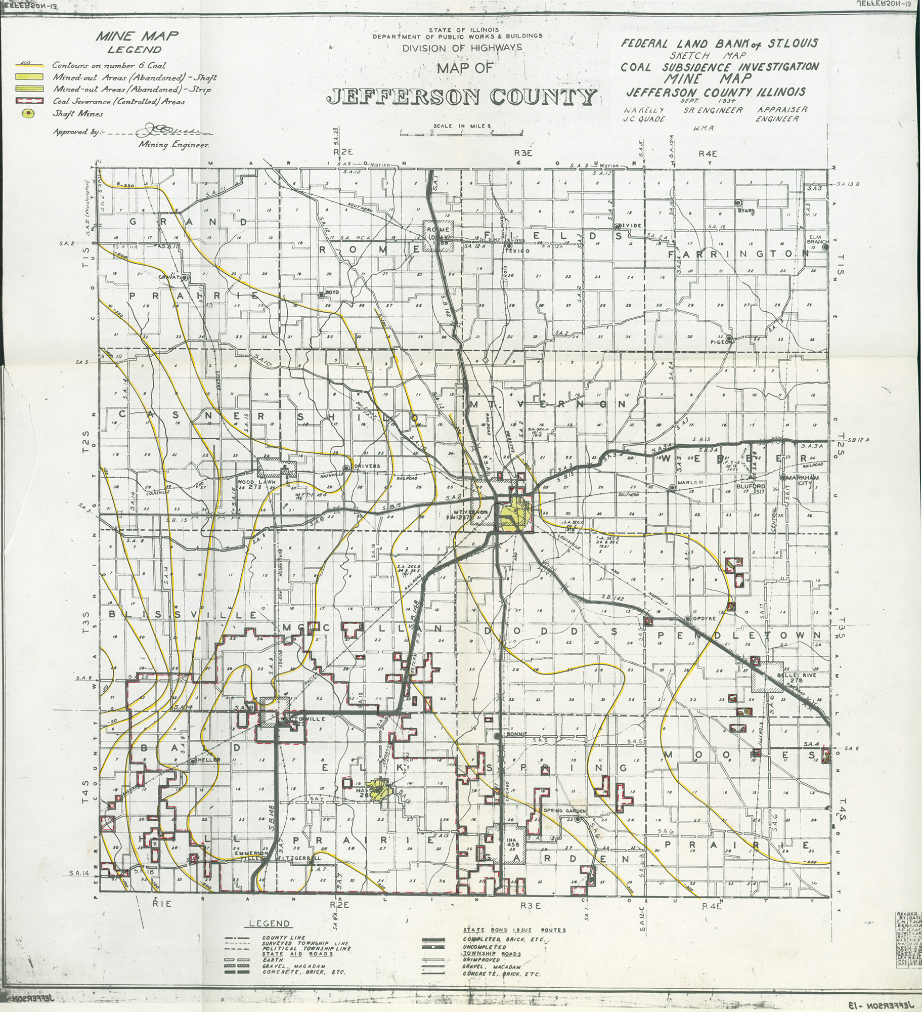
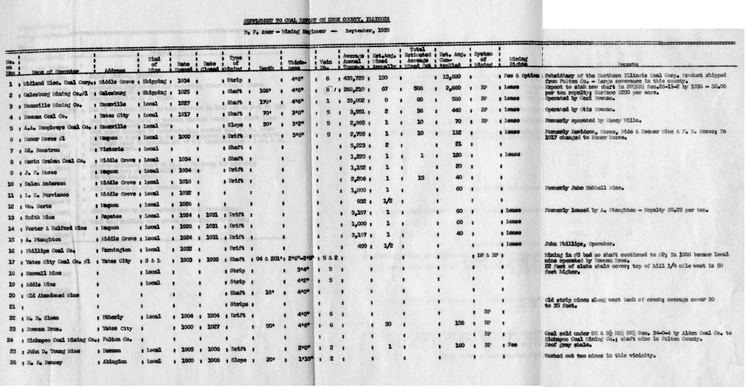
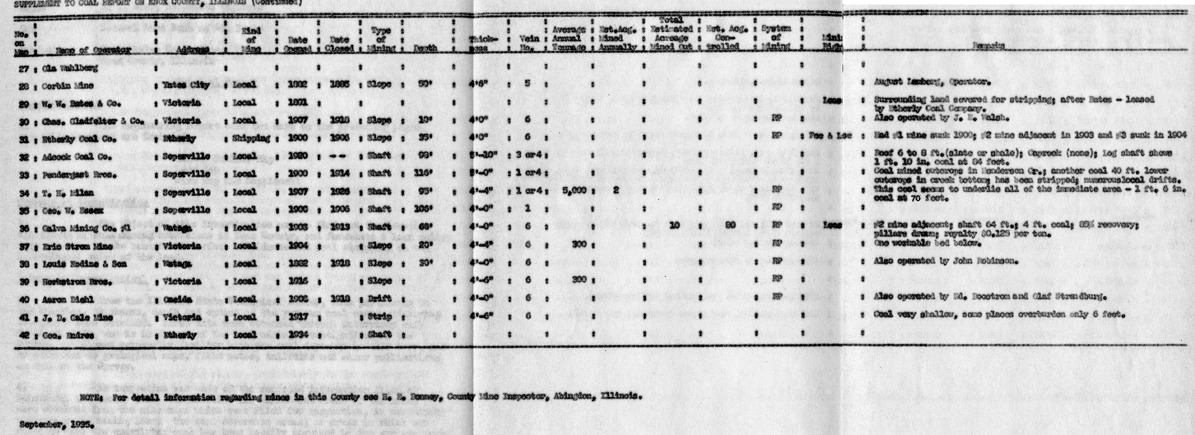
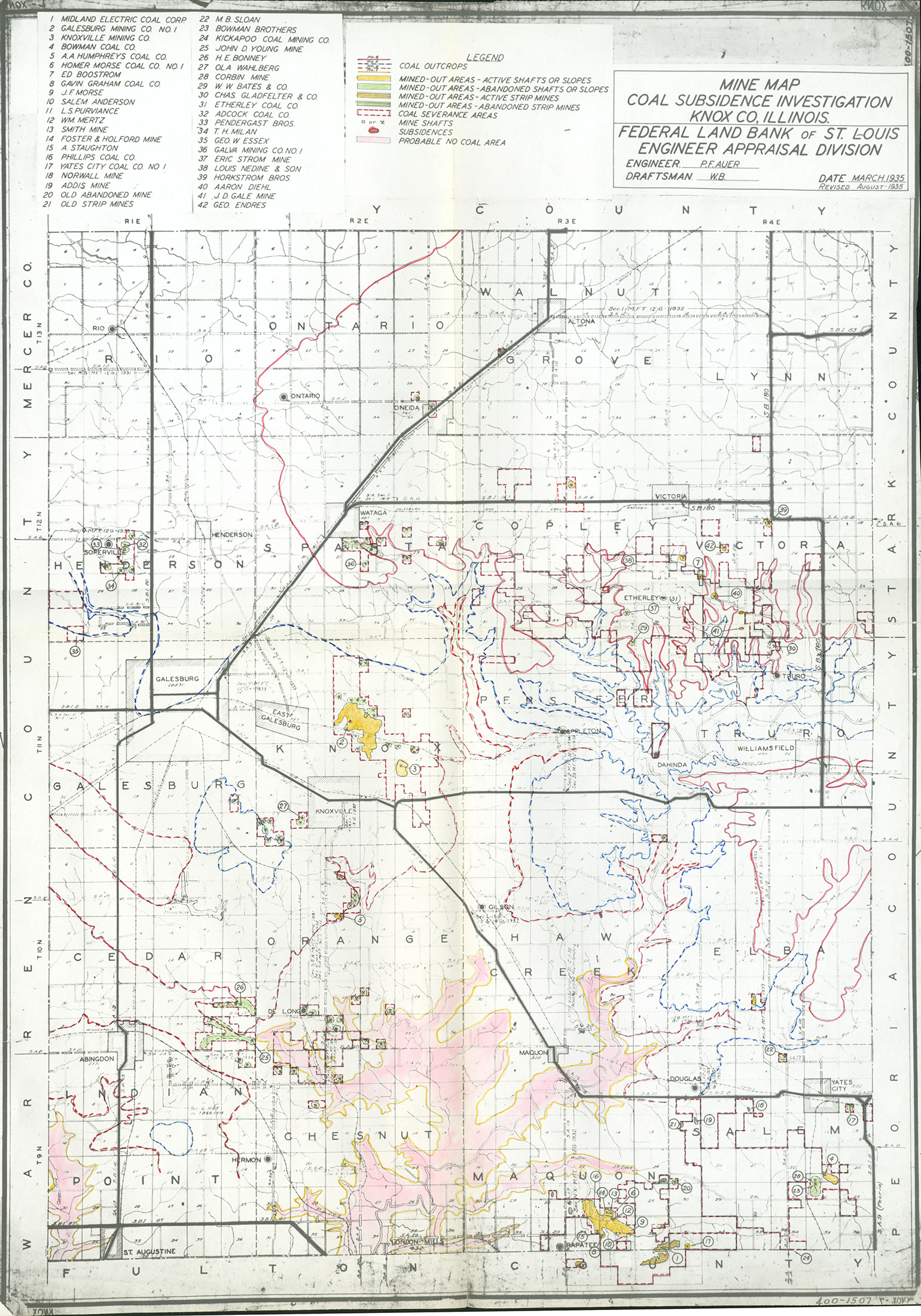
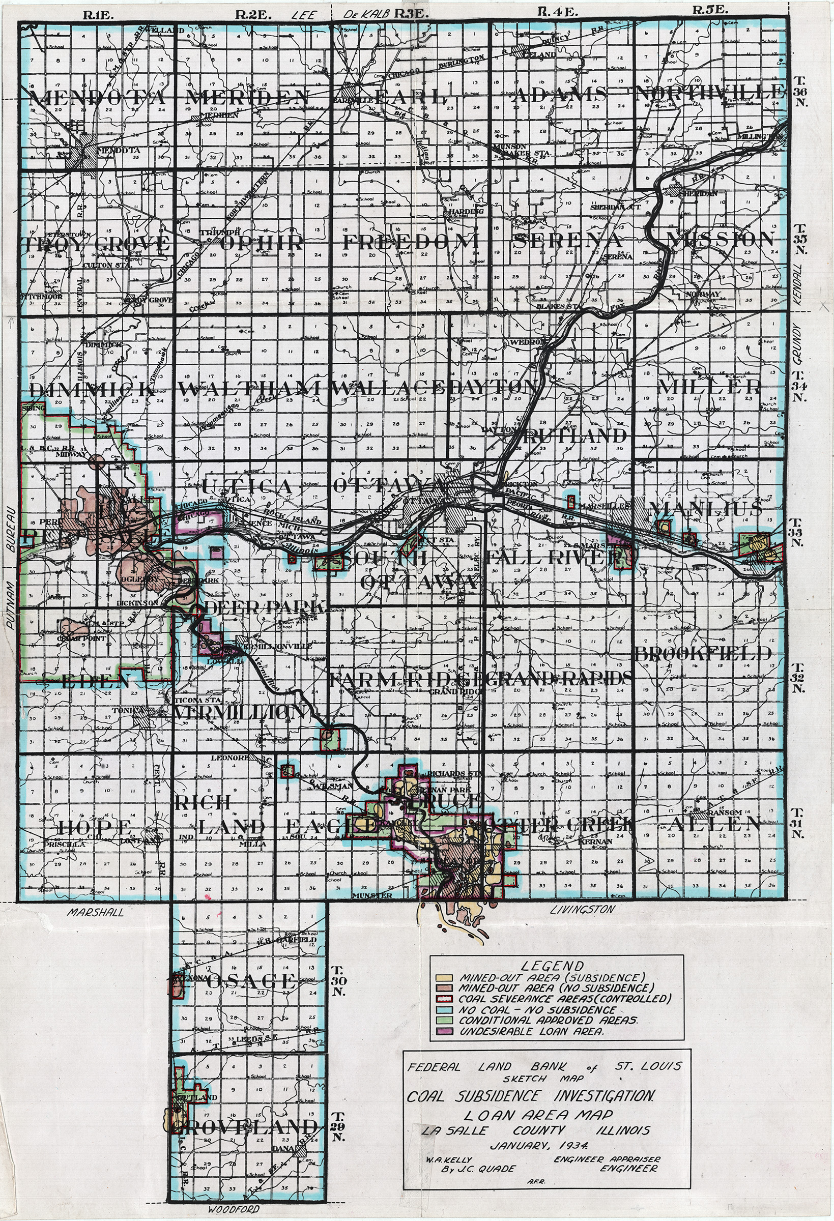
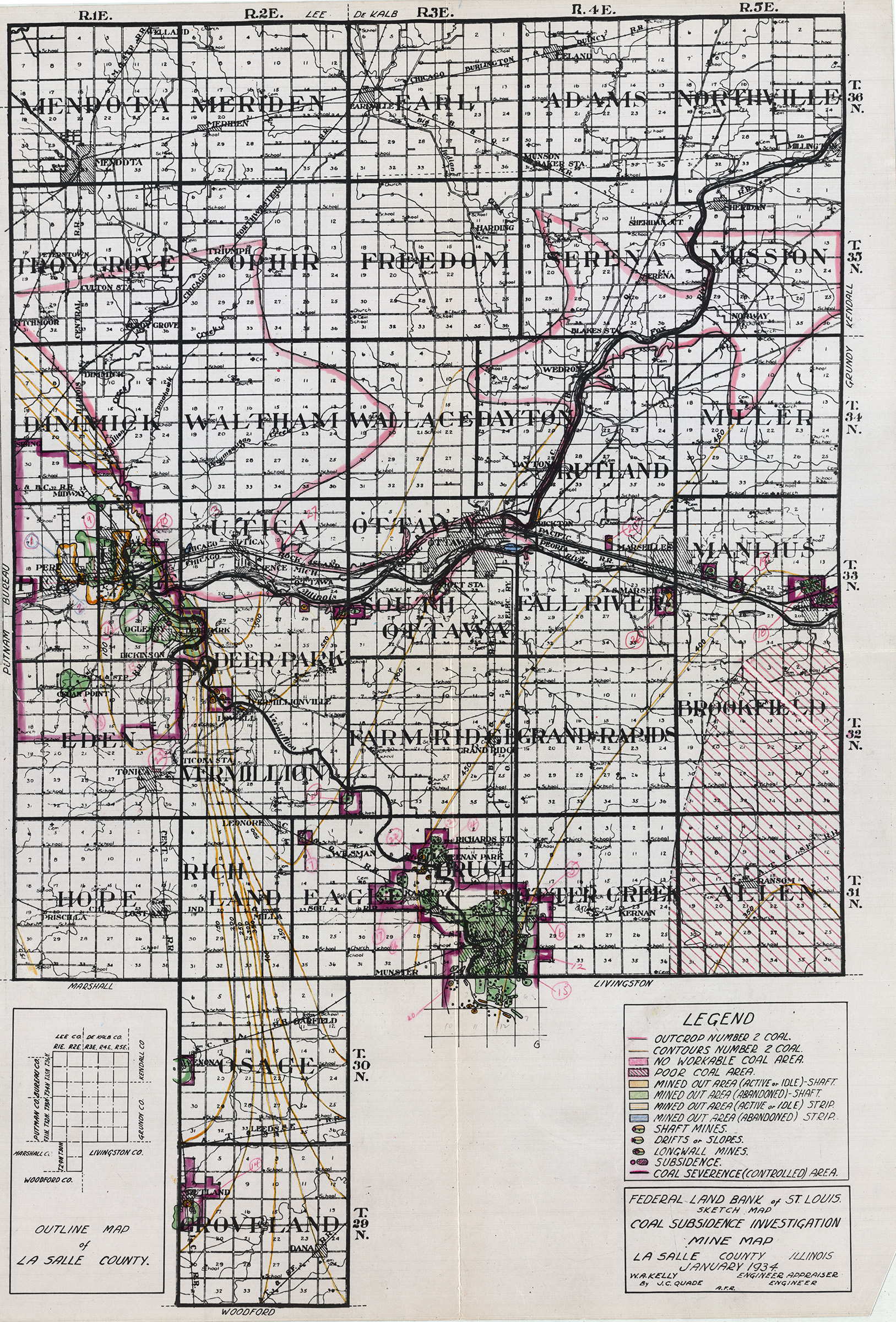
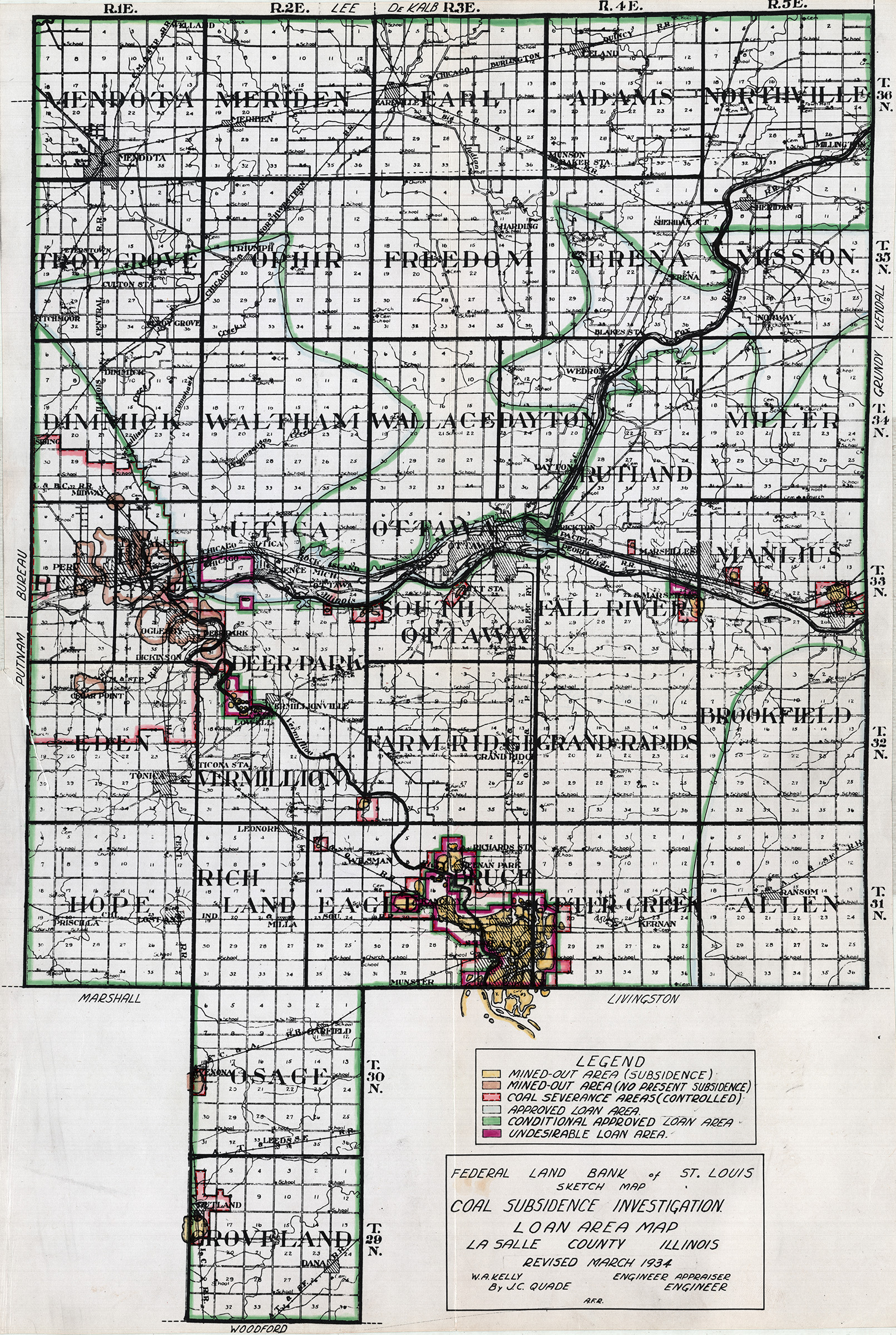
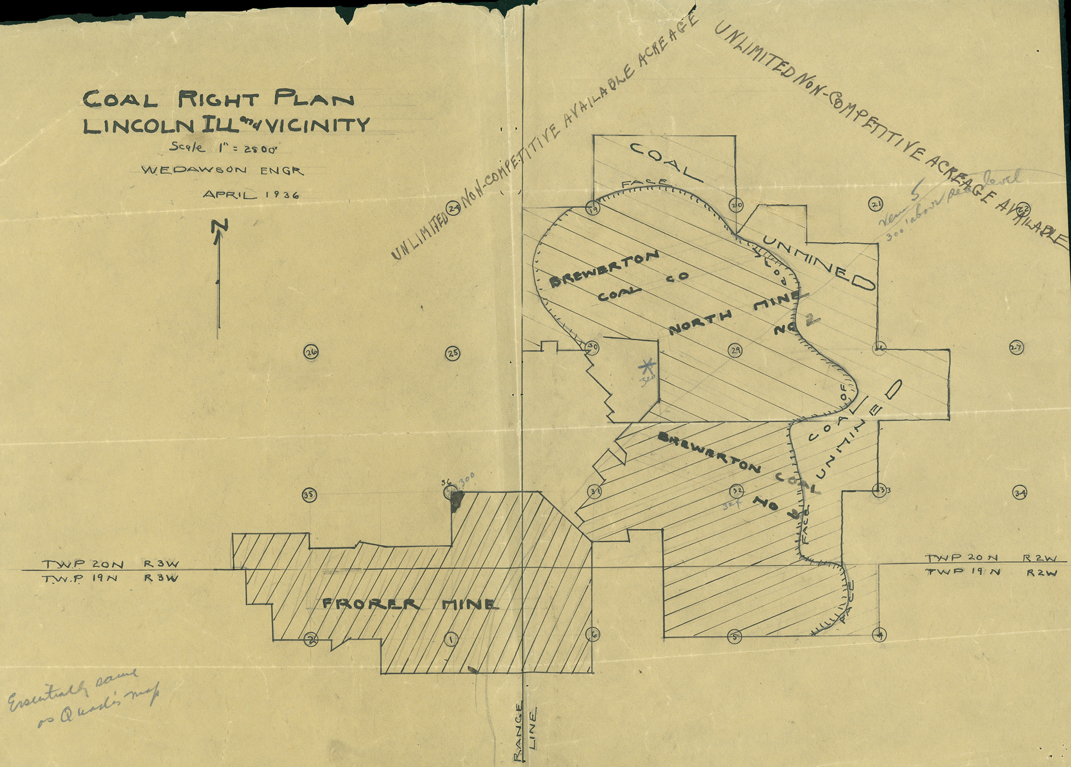
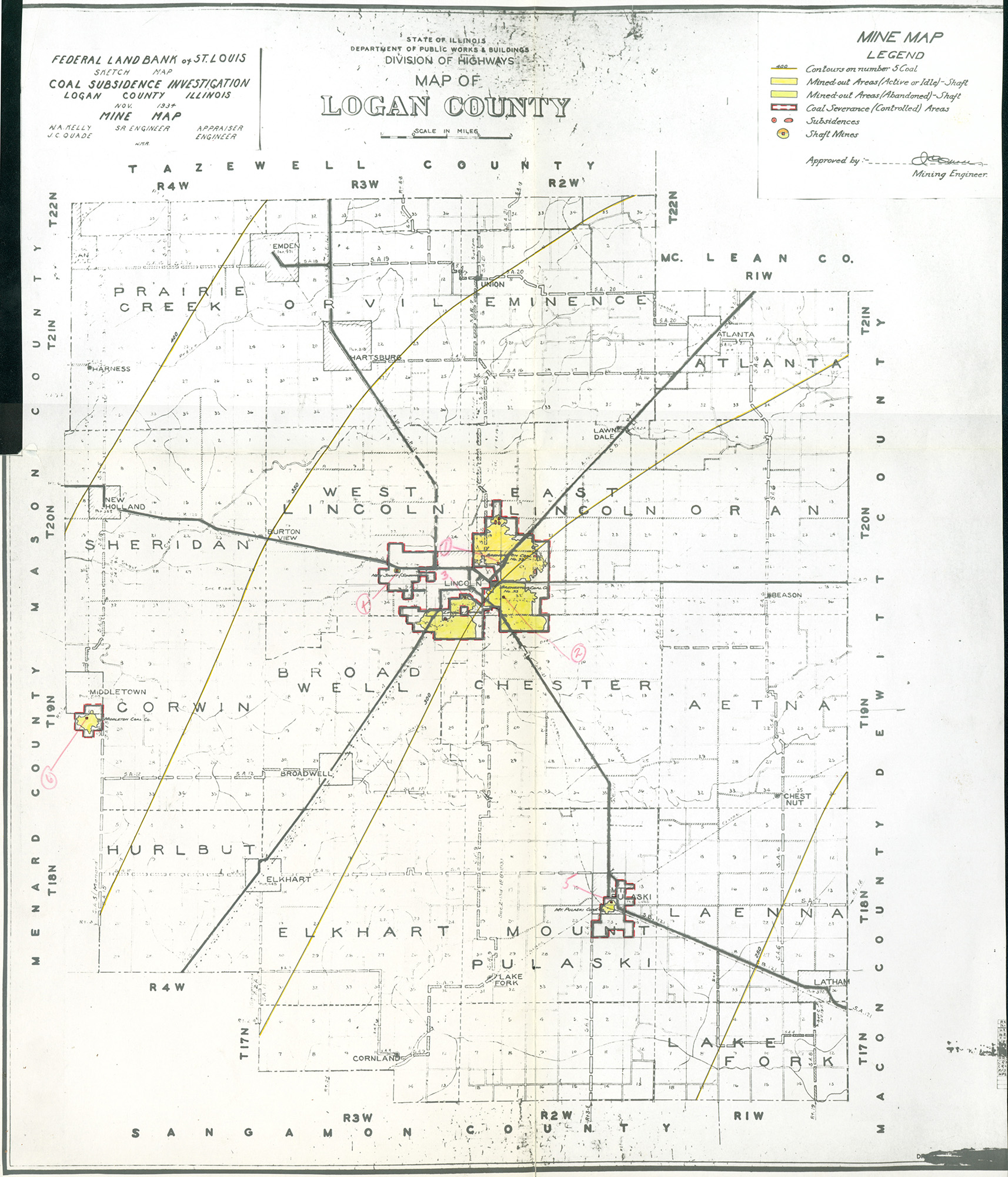
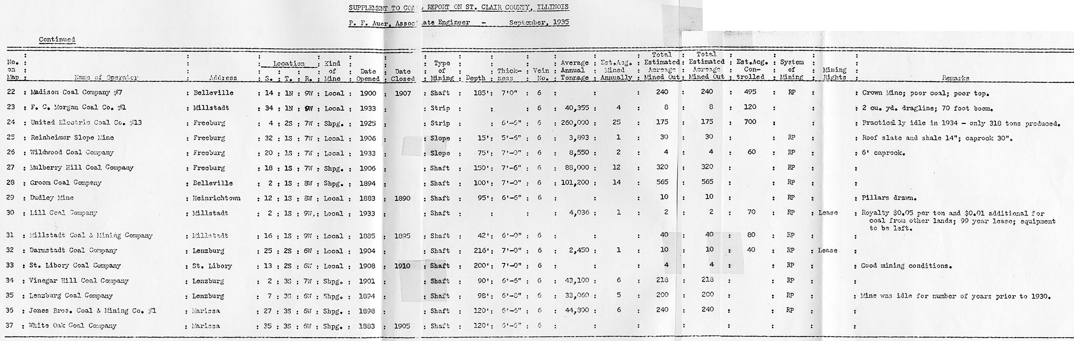
Federal Land Bank of St. Louis, Preliminary Reports on Subsidence Investigations (referred by Coal Section Staff as "Quade Maps")
Mining engineers working for the Federal Land Bank of St. Louis mapped areas of subsidence due to coal mining in the early 1930s. These reports often include county maps of mine properties with mined-out areas including shaft locations, as well as subsidence areas.
Disclaimer
Maps for some locations might have multiple versions, please inspected these areas closely for differences.
These maps are accompanied by a report, please download this report for more information.
Notes and corrections were made by ISGS staff.
Maps
Use the search box below to filter the list below, by county name
The export tab just exports the queried list not the actual images, click the image or link (on the left) to download.


