Mine Index 10082956 Ozark-Mahoning Company, Annabel Lee
| Disclaimer | ||
|---|---|---|
| S-T-R | 10(CENTER)-11S-9E | |
| County: | Hardin | |
| Quadrangle: | Saline Mines | |
| District: | Fluorspar District | |
| Subdistrict: | Harris Creek Subdistrict | |
Mine Index Number: 10082956
| ISGS ID: | MSHA ID: | ||
|---|---|---|---|
| MAS ID: | 170690162 | MRDS ID: | W062426 |
| Company Name: | Ozark-Mahoning Company | ||
| Mine/Site Name: | Annabel Lee | ||
| Active/Abandoned: | Abandoned | ||
| Start Date: | Unknown | End Date: | Unknown |
| Commodity Type: | Metallic, Non-Metallic | ||
| Commodity: | Barite(Barytes), Cadmium, Fluorspar, Lead, Silver, Zinc | ||
| Minerals Present: | Fluorite | ||
| Type of Mine: | Underground | ||
| District: | Fluorspar District | Subdistrict: | Harris Creek Subdistrict |
| County: | Hardin | ||
| Section/Township/Range: | 10(CENTER)-11S-9E | ||
| Latitude,Longitude: | 37.5833999999998,-88.2083599999999 | ||
| Unit(s) Mined: | Chesterian Series, Grove Church Shale, Tar Springs Sandstone | ||
| Feature(s) Mined: | |||
| MRDS Link: | https://mrdata.usgs.gov/mrds/show-mrds.php?dep id=10082956 | ||
| Mindat link: | |||
Primary source
Discussion
MINED BY THE ROOM AND PILLAR METHOD.
ECON.COM: PB, ZN, AND AG ARE BYPRODUCTS OF FLUORSPAR MINING.
Comments on reserve resource information: M1C1 RESERVES TAKEN FROM ADIT TABLES - JUNE 93. EVALUATED 1987 ORIGINAL EVAL WAS COPY OF DENTON. USES ROSICLARE MILL.
Mining method: Open Stope - Room and Pillar Milling method: Flotation
Mine Data/Information
 These files may not be true to scale and are not georgistered. These files may not be true to scale and are not georgistered.
|
Mine Index: | 10082956 |
|---|---|---|
| Company: | ||
| Mine Name: | ||
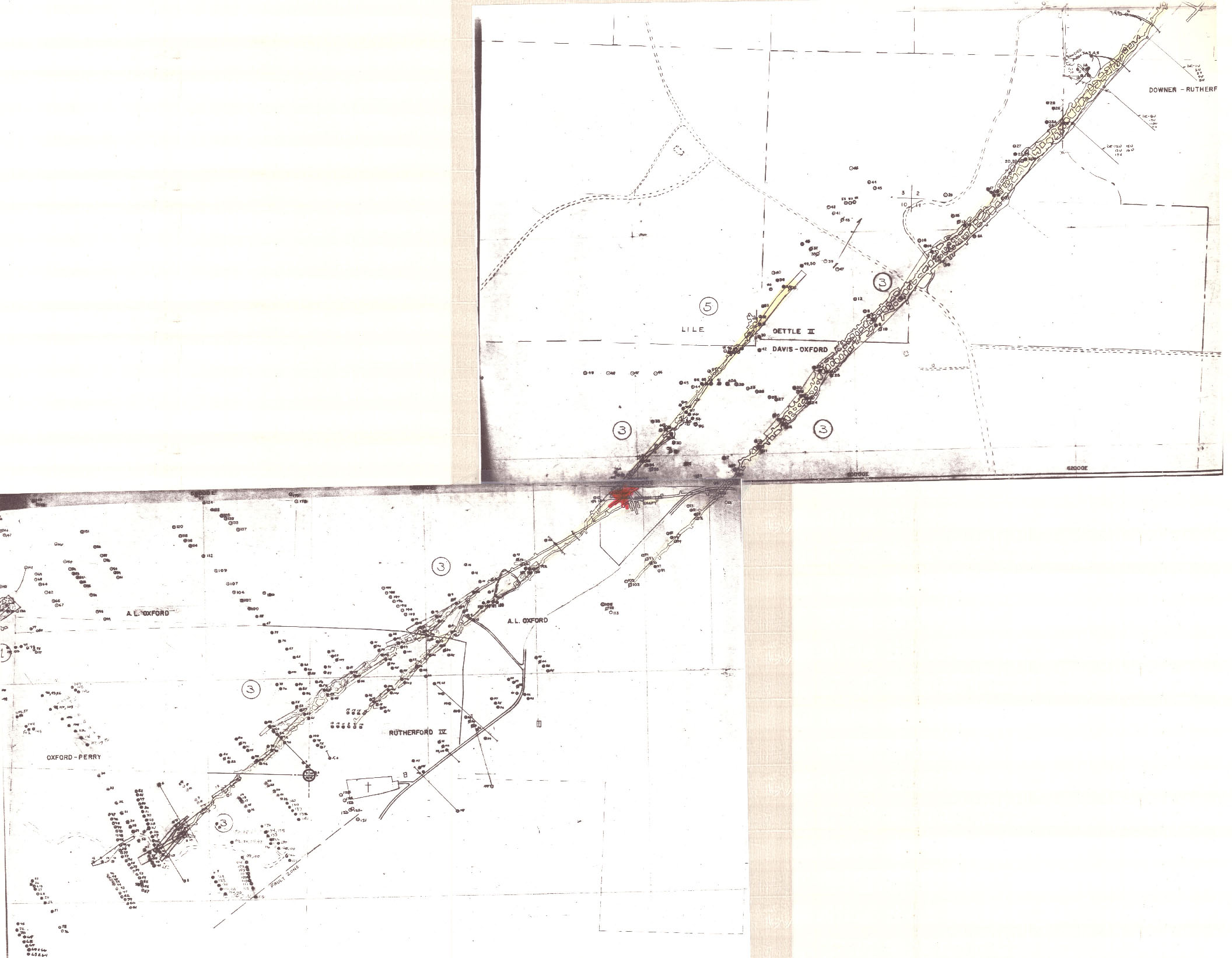
| More Info: | CaveInRock DavisOxford DrillPlan.jpg | |
| Click to download Full ResolutionThese files are true to scale and most are georegistered for gis software. File Type: Map Caption: Davis-Oxford Drill Plan | ||
 These files may not be true to scale and are not georgistered. These files may not be true to scale and are not georgistered.
|
Mine Index: | 10082956 |
|---|---|---|
| Company: | ||
| Mine Name: | ||
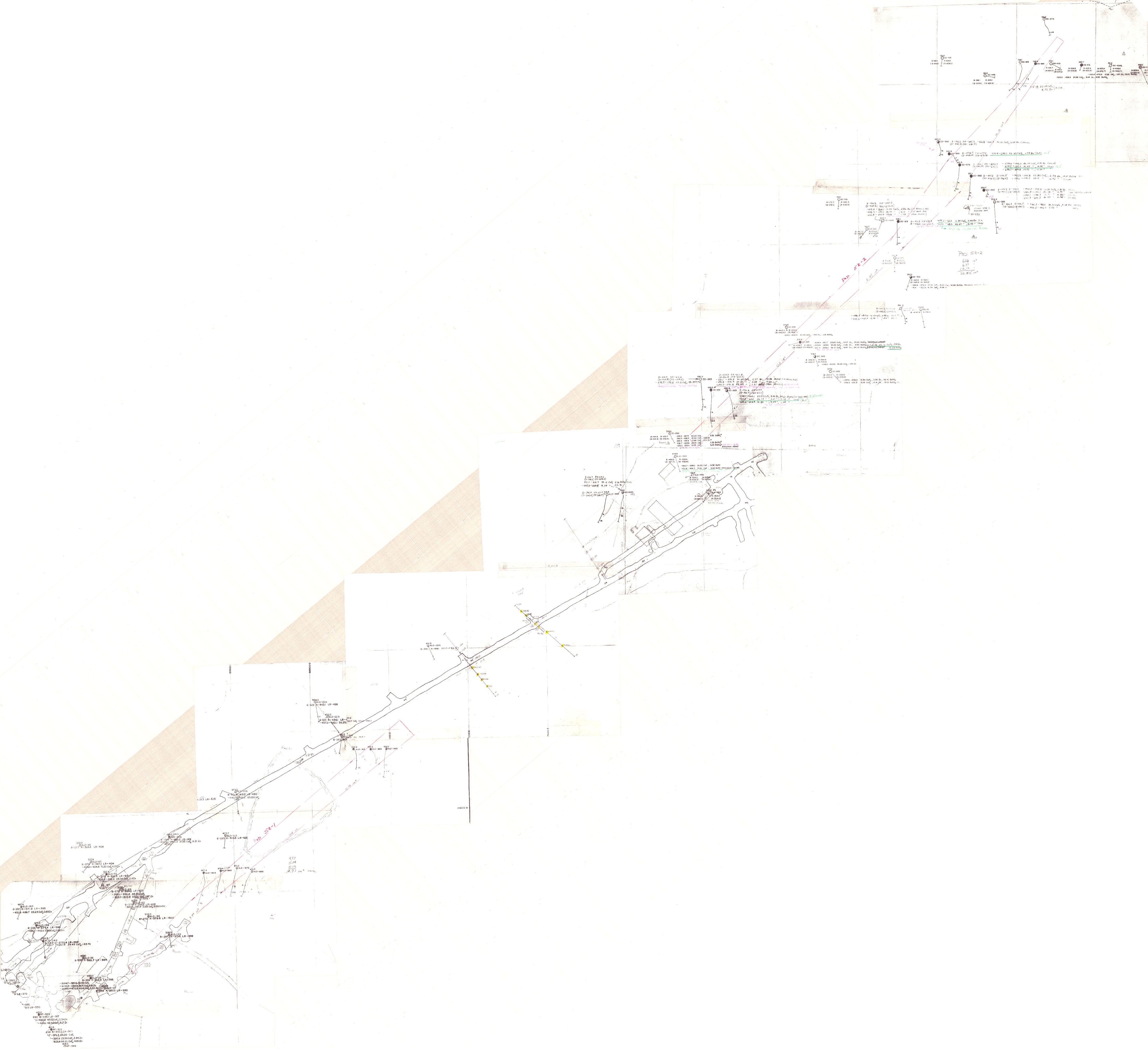
| More Info: | DentonPlanDrillA.jpg | |
| Click to download Full ResolutionThese files are true to scale and most are georegistered for gis software. File Type: Map | ||
 These files may not be true to scale and are not georgistered. These files may not be true to scale and are not georgistered.
|
Mine Index: | 10082956 |
|---|---|---|
| Company: | ||
| Mine Name: | ||
| More Info: | DentonPlanDrillB.jpg | |
| Click to download Full ResolutionThese files are true to scale and most are georegistered for gis software. File Type: Map | ||
References
|
|
External Links
Mineral Resources Data System (MRDS) USGS Link
https://mrdata.usgs.gov/mrds/show-mrds.php?dep id=10082956
Also referenced as 10241507