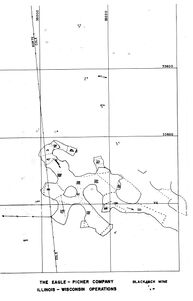
Mine Index 10106444 Tri-State Zinc Inc., Blackjack Mine, Black Jack Mine, Marsden Black Jack Mine, Marsden Lode, Peru Mine
| Disclaimer | ||
|---|---|---|
| S-T-R | 4(SWNW)-27N-1E, 33(SW)-28N-1E | |
| County: | Jo Daviess | |
| Quadrangle: | Bellevue | |
| District: | Upper Mississippi Valley | |
| Subdistrict: | ||
Mine Index Number: 10106444
| ISGS ID: | 9150 | MSHA ID: | |
|---|---|---|---|
| MAS ID: | 0170850050 | MRDS ID: | W062756 |
| Company Name: | Tri-State Zinc Inc. | ||
| Mine/Site Name: | Black Jack Mine, Marsden Black Jack Mine, Marsden Lode, Peru Mine, Blackjack Mine | ||
| Active/Abandoned: | Abandoned | ||
| Start Date: | 1854 | End Date: | 1952 |
| Commodity Type: | |||
| Commodity: | Lead, Zinc | ||
| Minerals Present: | Clay, Galena, Dolomite, Calcite, Sphalerite, Marcasite | ||
| Type of Mine: | Underground | ||
| District: | Upper Mississippi Valley | Subdistrict: | |
| County: | Jo Daviess | ||
| Section/Township/Range: | 4(SWNW)-27N-1E, 33(SW)-28N-1E | ||
| Latitude,Longitude: | 42.3663999999998,-90.4051099999998 | ||
| Unit(s) Mined: | Galena Group, Platteville Group, Decorah Subgroup, Spechts Ferry Formation | ||
| Feature(s) Mined: | Wisconsin_Arch | ||
| MRDS Link: | https://mrdata.usgs.gov/mrds/show-mrds.php?dep id=10106444 | ||
| Mindat link: | |||
Discussion
The Blackjack mine of the Mineral Point Zinc Company, now leased by TriState Zinc, Inc., is about three miles south of Galena. Nearly two million tons of ore are reported to have been taken from this mine since it was discovered in 1854. It was last operated in 1926. The deposit is a double pitch with heavy mineralization in the core-ground and rich lead ore deposits extending upward to the surface. Some stapes are reported to be over 100 feet high. A considerable tonnage of ore remains in the mine, principally in a block on the Martens property at the north end of the mine and at several places along the southwest pitch which is relatively high in iron. Much of this ore is a long distance from the hoisting shaft. There is a good possibility that the potentialities of the Glassrock and "Trenton" have not been adequately explored. Judging from the few drill-holes, the possibility of finding additional lateral extensions of ore, such as those already mined on the Wienen and Kipp properties, has not been investigated. These ore runs occur at places where the major ore body makes a sharp but small change in direction and at least one such locality appears to be unprospected. (WILLMAN, H.B., REYNOLDS, R.R., AND HERBERT, PAUL, JR., 1946)
The Overall Thickness is more than 120 ft.
This was one of the largest mines in the Wisconsin-Illinois-Iowa Zinc-Lead District
Geologic Structure
Southeast Of Wisconsin Dome And On The Gentle West Limb Of Wisconsin Arch. To The South Is Illinois Basin And To The West And Southwest Is Forest City Basin. A Few Minles South Of the Zinc-Lead District Is Westward-Trending Savanna-Sabula Anticline. Regional Strike Is N 85 W And The Dip Is South.
Additional Geologic Infomation
The mine trends Generally N40W. The orebody occurs in all the Decorah and Galena Strata from the top of the Prosser Cherty Member down to the Specths Ferry
Years of Productions
- 1854-1860 operated as a Lead Mine
- 1860-1883 operated as a Lead and Zinc Mine
- Reopened in 1907 but closed in 1908
- New Jersey Zinc Opened it in 1913 and operated it on a large scale until March 1, 1927
Owners
- Blackjack (Eagle-Picher Mining Co.):
- Cole (Blackjack)
- Felderman (Blackjack)
- Korte (Tri-State Drilling) / (Blackjack)
- Weinen (Tri-State Drilling)
- Beadle (Tri-State Drilling)
- Scharpf (Blackjack)
- Wullweber (Tri-State Drilling)
- Kipp
- Martens
- Blackjack
- Meana
- Fox
- Heer (Tri-State Drilling)
- Jack Gill (Blackjack)
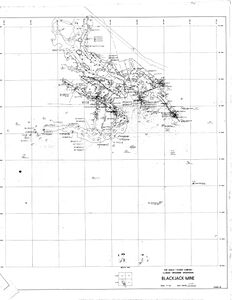
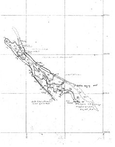
Mine Data/Information
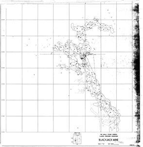
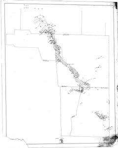
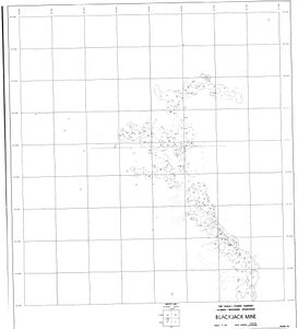
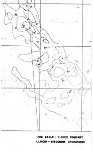
- Mine Map(s)
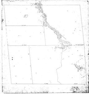
Source of Mine Location
Click to download Full Resolution
File Type: Map
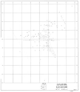
Source of Mine Location
Click to download Full Resolution
File Type: Map
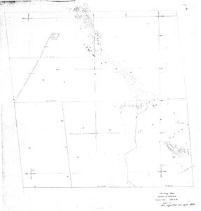
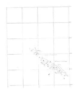
Source of Mine Location
Click to download Full Resolution
File Type: Map
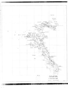
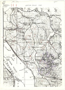
Caption: This is the south portion of a three map series
Date: 05/24/1971
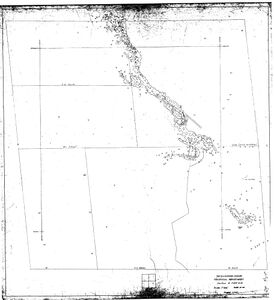
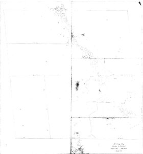
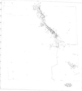
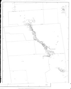
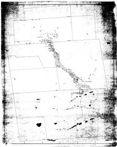
Source of Mine Location
Click to download Full Resolution
File Type: Map
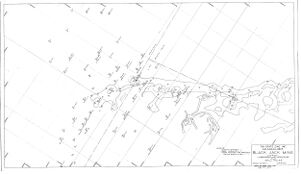
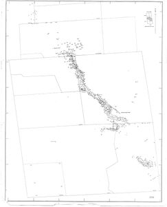
Caption: This is the middle portion of a three map series
Date: 05/24/1971
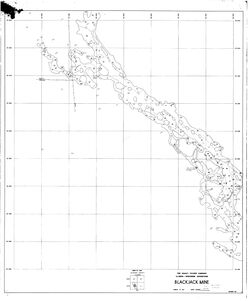
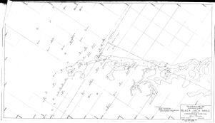
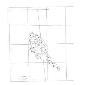
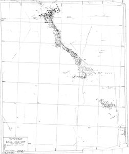
Source of Mine Location
Click to download Full Resolution
File Type: Map
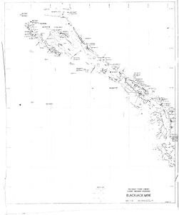
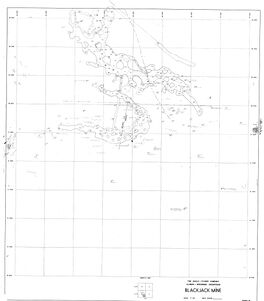
Caption: This is the north portion of a three map series
Date: 05/24/1971
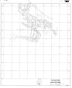
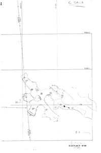
Source of Mine Location
Click to download Full Resolution
File Type: Map
Click to download Full Resolution
File Type: Map
Click to download Full Resolution
File Type: Map
Date: 1965
Click to download Full Resolution
File Type: Map
Click to download Full Resolution
File Type: Map
Click to download Full Resolution
File Type: Map
Date: 05/13/1950
Click to download Full Resolution
File Type: Map
Click to download Full Resolution
File Type: Map
Date: 05/02/1971
Click to download Full Resolution
File Type: Map
Date: 1965
Click to download Full Resolution
File Type: Map
Click to download Full Resolution
File Type: Map
Click to download Full Resolution
File Type: Map
Date: 05/02/1971
Click to download Full Resolution
File Type: Map
Date: 05/13/1950
Click to download Full Resolution
File Type: Map
Date: 1968
Click to download Full Resolution
File Type: Map
File Type: Map
Click to download Full Resolution
File Type: Map
Click to download Full Resolution
File Type: Map
Click to download Full Resolution
File Type: Map
Click to download Full Resolution
File Type: Map
Click to download Full Resolution
File Type: Map
Click to download Full Resolution
File Type: Map
Date: 05/13/1950

.jpg)
.jpg)
.jpg)
.jpg)


- Other Data Files
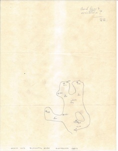
File Type: PDF Notes
Caption: Black Jack Mine Study
File Type: PDF Notes
Caption: Black Jack Area
References
|
|
|
|
|
|
External Links
Mineral Resources Data System (MRDS) USGS Link
https://mrdata.usgs.gov/mrds/show-mrds.php?dep_id=10106444
Also referenced as 10290576
Also referenced as 10086301